

Sweden · Marine
Haparanda Archipelago National Park
National park of 7,430 hectares in Sweden, established in 1995.
Overview
National park of 7,430 hectares in Sweden, established in 1995.
Haparanda Archipelago National Park is located in Sweden (Europe). It is a predominantly marine area. Established in 1995, it covers about 7,430 hectares. The site is managed by Norrbotten County Administrative Board.
Protections and designations
Natura 2000 · habitats (SAC)
- Haparanda skärgård SE0820108
Natura 2000 · birds (SPA)
- Haparanda skärgård SE0820108
Protected as a national park. International labels and designations: Natura 2000 network (1 site: “Haparanda skärgård”). Key dates: established in 1995, first Natura 2000 site under the Birds Directive in 1996 and first Natura 2000 site under the Habitats Directive in 2011.
In our collections
Timeline
-
1995
Established
-
1996
First Natura 2000 site under the Birds Directive
-
2011
First Natura 2000 site under the Habitats Directive
Sources: Wikidata (CC0) for establishment and international labels; EEA Natura 2000 database (CC-BY 4.0) for site designation dates.
Frequently asked questions
Where is Haparanda Archipelago National Park?
In Sweden (Europe). Representative point: 65.6049° N, 23.7696° E.
How large is Haparanda Archipelago National Park?
About 7,430 hectares (74 km²). It is the 13th largest of the 31 national parks in Sweden covered by Parkavela. About 6,700 ha are at sea.
When was Haparanda Archipelago National Park established?
In 1995.
What habitats and landscapes does Haparanda Archipelago National Park include?
A marine area, with coasts.
Which international labels apply to Haparanda Archipelago National Park?
Natura 2000 network (1 site: “Haparanda skärgård”).
When is the best time to visit Haparanda Archipelago National Park?
Best time to visit: from June to September, with average temperatures of 10 to 16 °C and moderate rainfall.
What is the nearest large city to Haparanda Archipelago National Park?
Nearest towns of over 50,000 people, as the crow flies: Oulu (98 km). Nearest airport: Luleå/Kallax (LLA), about 72 km away.
How can I reach Haparanda Archipelago National Park by train?
The nearest railway station is Haparanda, about 24 km from the site boundary.
Which species can be seen in Haparanda Archipelago National Park?
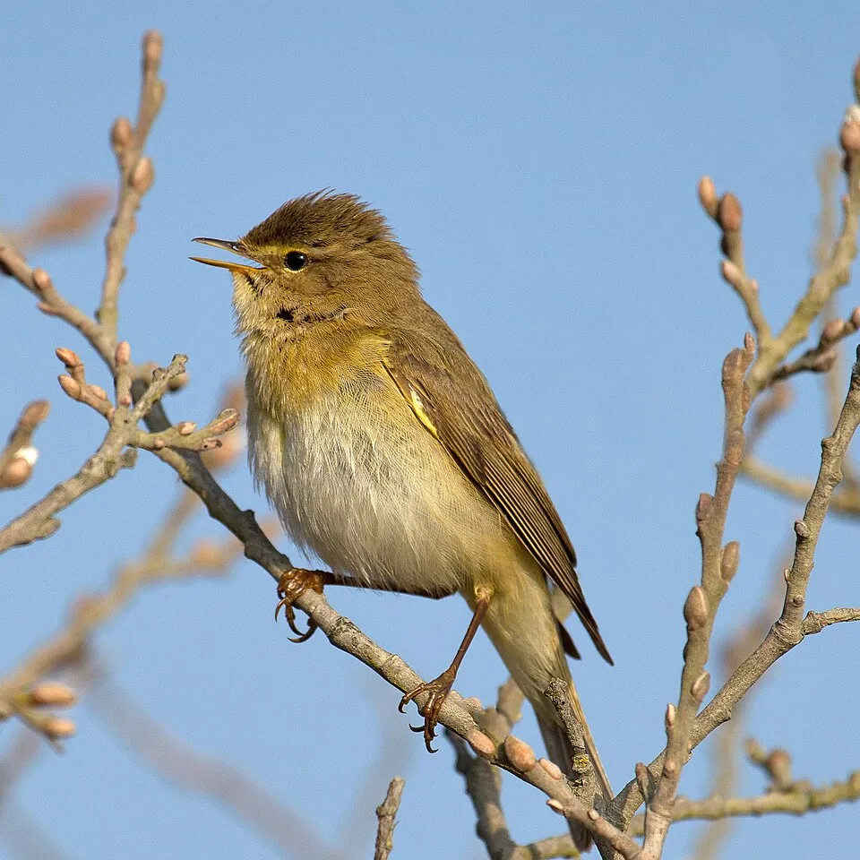
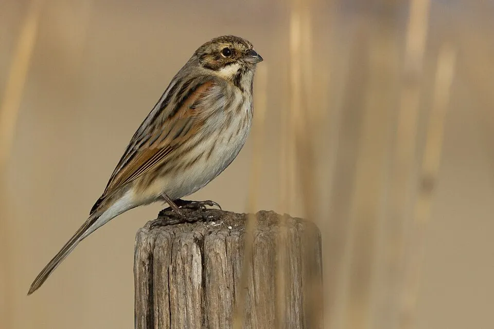
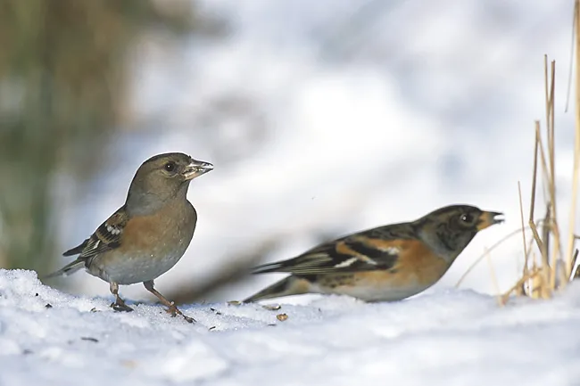
Among the species most often recorded on GBIF are Phylloscopus trochilus (Willow Warbler), Acanthis flammea (Redpoll), Emberiza schoeniclus (Reed Bunting) and Fringilla montifringilla (Brambling).
Who manages Haparanda Archipelago National Park?
Norrbotten County Administrative Board.
What is the official website of Haparanda Archipelago National Park?
nationalparksofsweden.se/choose-park---list/haparanda-skargard-national-park
© OpenStreetMap
Download the boundary: GeoJSON · GPX Boundary © OpenStreetMap contributors (ODbL).
Geography
Over the 1996–2025 period, the mean annual temperature is about 3.1 °C and total precipitation reaches roughly 702 mm per year. The warmest month is usually July, the coolest February, and the wettest August.
Area
- Area
- 7,430 ha
- Coordinates
- 65.6049, 23.7696
Climate
● Mean temperature (°C) · ▮ Precipitation (mm)
Source: Copernicus ERA5 (C3S, doi:10.24381/cds.f17050d7), monthly averages 1996–2025 interpolated to the representative point, temperatures adjusted for elevation.
Contains modified Copernicus Climate Change Service information 2026. Neither the European Commission nor ECMWF is responsible for any use that may be made of the Copernicus information or data it contains.
Natural habitats
The sea covers about 91% of the site. The seabed reaches about 28 m deep (median depth 10 m; GEBCO bathymetry). The Natura 2000 site overlapping the area lists 12 habitats of European interest (4 priority), the most extensive being sandbanks which are slightly covered by sea water all the time, reefs and western Taïga.
Biodiversity
Based on occurrences aggregated by GBIF, several species are regularly recorded within the site. Among the most frequent are Phylloscopus trochilus (Willow Warbler), Acanthis flammea (Redpoll), Emberiza schoeniclus (Reed Bunting) and Fringilla montifringilla (Brambling). The full list of documented taxa is shown below. The overlapping Natura 2000 site lists 40 species of European interest: 35 birds, 2 mammals and 3 plants.
Habitats of European interest
From the official form of the Natura 2000 site overlapping the area (areas reported for the whole site).
- Sandbanks which are slightly covered by sea water all the time 4,099 ha
- Reefs 342 ha
- Western Taïga priority 204 ha
- Mudflats and sandflats not covered by seawater at low tide 174 ha
- Natural forests of primary succession stages of landupheaval coast priority 124 ha
- Boreal Baltic coastal meadows priority 114 ha
- European dry heaths 54 ha
- Wooded dunes of the Atlantic, Continental and Boreal region 36 ha
and 4 more
Species of European interest
Birds · 35
Boreal Owl (Aegolius funereus) breeding, Greylag Goose (Anser anser) passage, Short-eared Owl (Asio flammeus) passage, Hazel Grouse (Bonasa bonasia) resident, Ruff (Calidris pugnax) passage, Common Ringed Plover (Charadrius hiaticula) breeding, Western Marsh Harrier (Circus aeruginosus) passage, Hen Harrier (Circus cyaneus) passage, Bluethroat (Cyanecula svecica) passage, Whooper Swan (Cygnus cygnus) passage, Ortolan Bunting (Emberiza hortulana) passage, Reed Bunting (Emberiza schoeniclus) breeding and 23 more
Plants · 3
Baltic Water-plantain (Alisma wahlenbergii), Artemisia campestris subsp. bottnica, Siberian primrose (Primula nutans)
Source: Natura 2000 standard data forms (EEA, CC-BY 4.0). Not exhaustive: sensitive species are not published.
Species to look out for

Observed species
Occurrences documented via GBIF; they are neither an exhaustive inventory nor proof of current presence.
- Willow Warbler · Phylloscopus trochilus · 34363
- Redpoll · Acanthis flammea · 15776
- Reed Bunting · Emberiza schoeniclus · 10088
- Brambling · Fringilla montifringilla · 7763
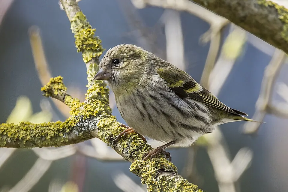
- Eurasian Siskin · Spinus spinus · 7232
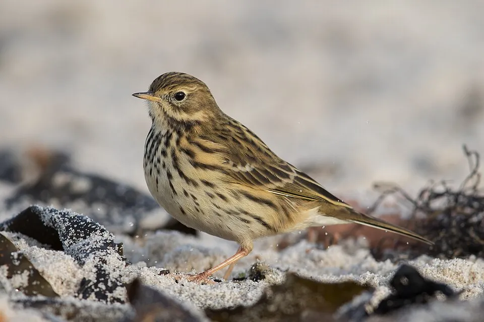
- Meadow Pipit · Anthus pratensis · 6271
- Great tit · Parus major · 5418
- Wood Sandpiper · Tringa glareola · 4601
- Eurasian Chaffinch · Fringilla coelebs · 4113
- Goldcrest · Regulus regulus · 3326
- European robin · Erithacus rubecula · 3252
- Common Redstart · Phoenicurus phoenicurus · 2999
+18 more species
- Sedge warbler · Acrocephalus schoenobaenus · 2823
- Lesser whitethroat · Sylvia curruca · 2794
- White Wagtail · Motacilla alba · 2790
- Great Spotted Woodpecker · Dendrocopos major · 2247
- Fieldfare · Turdus pilaris · 2146
- Eurasian blue tit · Cyanistes caeruleus · 2086
- Tree Pipit · Anthus trivialis · 1914
- Long-tailed Tit · Aegithalos caudatus · 1876
- Northern Wheatear · Oenanthe oenanthe · 1826
- Hooded Crow · Corvus cornix · 1689
- Common Ringed Plover · Charadrius hiaticula · 1671
- Bluethroat · Luscinia svecica · 1643
- Eurasian Bullfinch · Pyrrhula pyrrhula · 1565
- Common Gull · Larus canus · 1541
- European Herring Gull · Larus argentatus · 1518
- Dunnock · Prunella modularis · 1478
- Spotted Flycatcher · Muscicapa striata · 1404
- Redwing · Turdus iliacus · 1323
Records: GBIF.org (CC-BY). Names: Wikidata (CC0), GBIF. Photos: Wikimedia Commons.
Conservation challenges
The primary purpose of the site is to preserve its natural habitats and the biodiversity they support. The species recorded (Biodiversity tab) reflect its ecological value. The designations it holds frame its management and the control of land use.
According to CORINE Land Cover, land cover here remained almost unchanged between 2000 and 2018 (less than 0.5% of the area affected). According to the Natura 2000 forms, of 12 assessed habitats of European interest, 4 are in excellent condition and the rest in good condition. According to the Water Framework Directive assessment (2022 river basin management plans, data 2013–2018), water bodies assessed within the site: coastal waters, 2 of 2 in good ecological status or better. One invasive alien species has been recorded within the site since 2000 (GBIF observations), listed as of Union concern: Nyctereutes procyonoides (Raccoon Dog).
Pressure indicators
Land cover change
< 0.5%
of the area changed, 2000–2018 · CORINE
Rivers and lakes
Coastal waters: 2 of 2 good or better
assessments 2013–2018
Invasive alien species
1
incl. 1 of EU concern · since 2000
Sources: Global Forest Change (Hansen et al., University of Maryland, via Global Forest Watch, CC-BY 4.0); EFFIS, European Commission / Copernicus; NASA Black Marble 2016 (public domain); CORINE Land Cover 2018 (Copernicus) or MODIS.
CORINE Land Cover Change 2000–2018: generated using European Union's Copernicus Land Monitoring Service information (EEA), aggregated by Parkavela; DOI 10.2909/f30f1000-7cf8-43bb-872c-5eb093911b24.
Ecological status of water bodies: European Environment Agency, WISE – Water Framework Directive, 3rd river basin management plans (2022), CC BY 4.0. Official national classification, not comparable between countries.
Invasive alien species: Global Register of Introduced and Invasive Species (ISSG, CC BY 4.0); Union list, Regulation (EU) 1143/2014 (INBO, CC0); GBIF.org records (CC0 / CC BY 4.0), at least 2 per species.
Practical information
Cities and airport
- Oulu
98 km as the crow flies - Airport: Luleå/Kallax (LLA)
72 km as the crow flies
Data © OpenStreetMap contributors (ODbL) · Wikidata (CC0)
Access and visiting
The nearest railway station is Haparanda, about 24 km from the site boundary. Nearest towns of over 50,000 people, as the crow flies: Oulu (98 km). Nearest airport: Luleå/Kallax (LLA), about 72 km away. Fewer than 5,000 people live within 20 km of the site boundary, a very sparsely populated area (GHSL estimate, 2020). To plan a visit (access, opening periods, visitor rules), it is best to consult the official information from the managing body (Norrbotten County Administrative Board) and the official website listed in this page's sources.
Source: OpenStreetMap (ODbL), Wikidata (CC0), October 2026.
When to visit
Best time to visit: from June to September, with average temperatures of 10 to 16 °C and moderate rainfall. Average temperatures drop below 0 °C from December to April: expect snow and frost. Day length ranges from about 3 h 13 min in December to 22 h 49 min in June. Wildlife records published on GBIF peak for birds (August and September), plants (July and August), butterflies and moths (July and August) and mammals (April). These peaks also reflect when observers are most active.
Source: Copernicus ERA5 (C3S), monthly averages 1996–2025 at the representative point, temperatures adjusted for elevation.
Contains modified Copernicus Climate Change Service information 2026. Neither the European Commission nor ECMWF is responsible for any use that may be made of the Copernicus information or data it contains.
Wildlife records calendar
JFMAMJJASOND
Birds
Plants
Butterflies & moths
Mammals
Monthly records published on GBIF (CC-BY), relative to the busiest month; also reflects observer activity.
Gallery
© Birgitta Olsson · CC BY-SA 2.0
© Birgitta Olsson · CC BY-SA 2.0
© Hsskberra · CC BY-SA 4.0
© Birgitta Olsson · CC BY-SA 2.0
© Birgitta Olsson · CC BY-SA 2.0
© Birgitta Olsson · CC BY-SA 2.0
Sources and licences
- Wikidata: Q1891973
- OpenStreetMap: relation 7078156
- Official website: http://www.nationalparksofsweden.se/choose-park---list/haparanda-skargard-national-park/
- Wikipedia: en.wikipedia.org/wiki/Haparanda_Archipelago_National_Park
- WDPA: 106872
References
- cds.climate.copernicus.eu: climate · CC-BY-4.0
- registry.opendata.aws: elevation of the reference point · PD
- land.copernicus.eu: land cover, land cover change, sea share · COPERNICUS
- doi.org: population around the site · CC-BY-4.0
- wikidata.org: official area, establishment date, protected heritage, managing body, nearby cities and airport, access and peaks, places to see, official website · CC0-1.0
- eea.europa.eu: bathing water quality, ecological status of waters · CC-BY-4.0
- gebco.net: depths · PD
- opentopodata.org: elevations · CC-BY-4.0
- gbif.org: seasonality of sightings, invasive alien species, observed species · CC-BY-4.0
- natura2000.eea.europa.eu: Natura 2000 habitats and species · CC-BY-4.0
- openstreetmap.org: official name, access and peaks, trail difficulty · ODbL-1.0
- wikidata.org: Wikipedia article · CC-BY-SA-4.0
Data © OpenStreetMap contributors (ODbL), Wikidata (CC0) and the sources cited.
