Italy · Terrestrial
Julian Prealps Nature Park
Regional nature park of 9,402 hectares in Italy, established in 1996.
Overview
Regional nature park of 9,402 hectares in Italy, established in 1996.
Julian Prealps Nature Park is a regional nature park in Italy (Europe). It is a predominantly terrestrial area. Established in 1996, it covers about 9,402 hectares.
Protections and designations
Natura 2000 · habitats (SAC)
- Prealpi Giulie Settentrionali IT3320012
Natura 2000 · birds (SPA)
- Alpi Giulie IT3321002
Protected as a regional nature park. International labels and designations: Natura 2000 network (2 sites). Key dates: established in 1996, first Natura 2000 site under the Birds Directive in 2000 and first Natura 2000 site under the Habitats Directive in 2013.
In our collections
Timeline
-
1996
Established
-
2000
First Natura 2000 site under the Birds Directive
-
2013
First Natura 2000 site under the Habitats Directive
Sources: Wikidata (CC0) for establishment and international labels; EEA Natura 2000 database (CC-BY 4.0) for site designation dates.
Frequently asked questions
Where is Julian Prealps Nature Park?
In Italy (Europe). Representative point: 46.3380° N, 13.3180° E.
How large is Julian Prealps Nature Park?
About 9,402 hectares (94 km²). It is the 49th largest of the 128 regional parks in Italy covered by Parkavela.
When was Julian Prealps Nature Park established?
In 1996.
What habitats and landscapes does Julian Prealps Nature Park include?
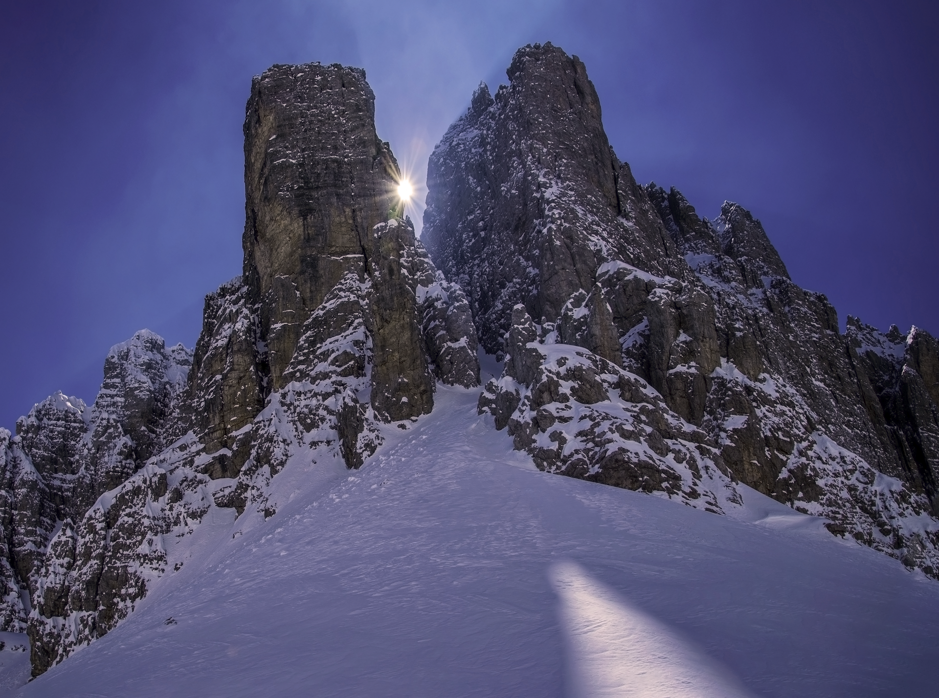
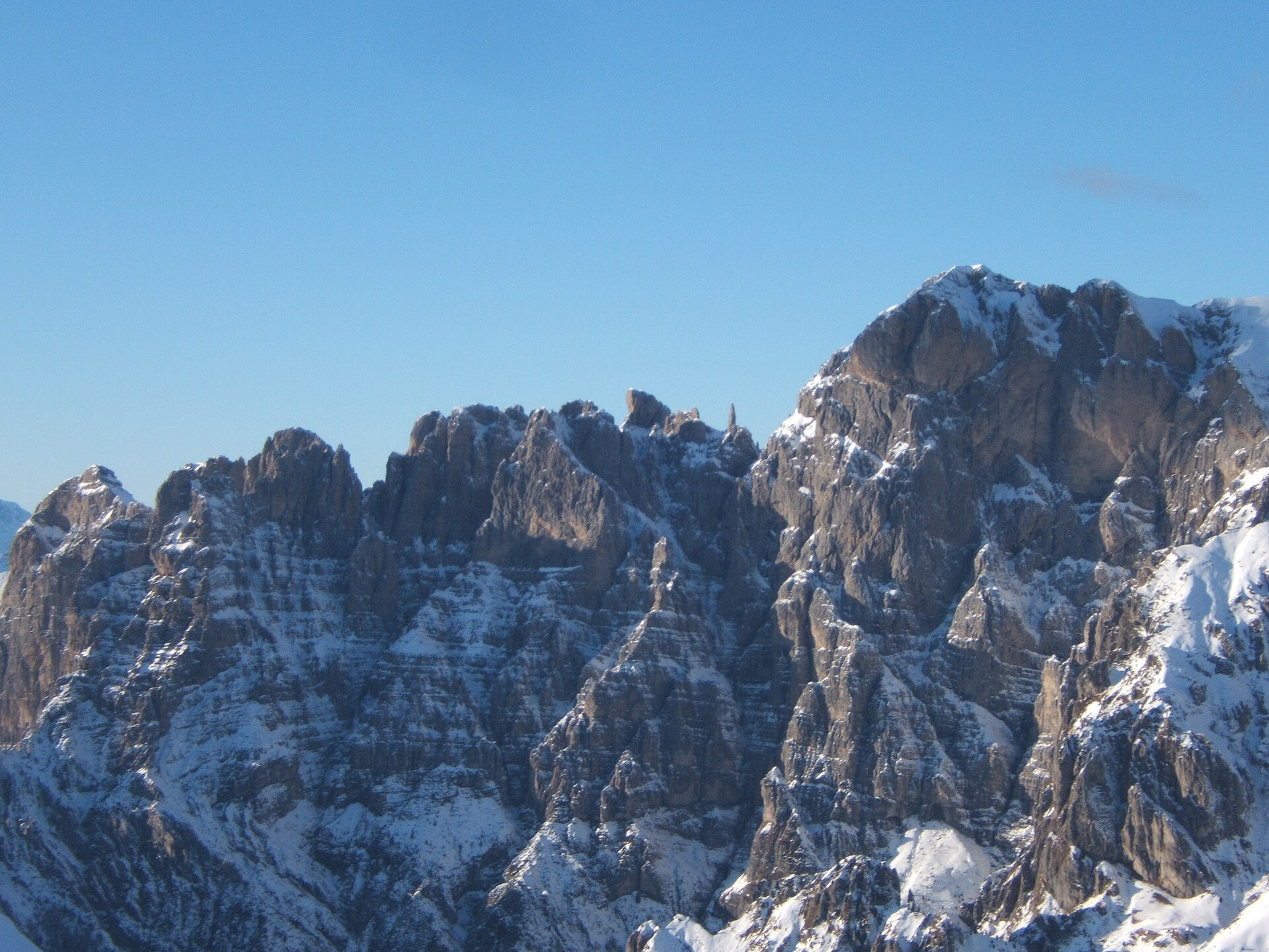
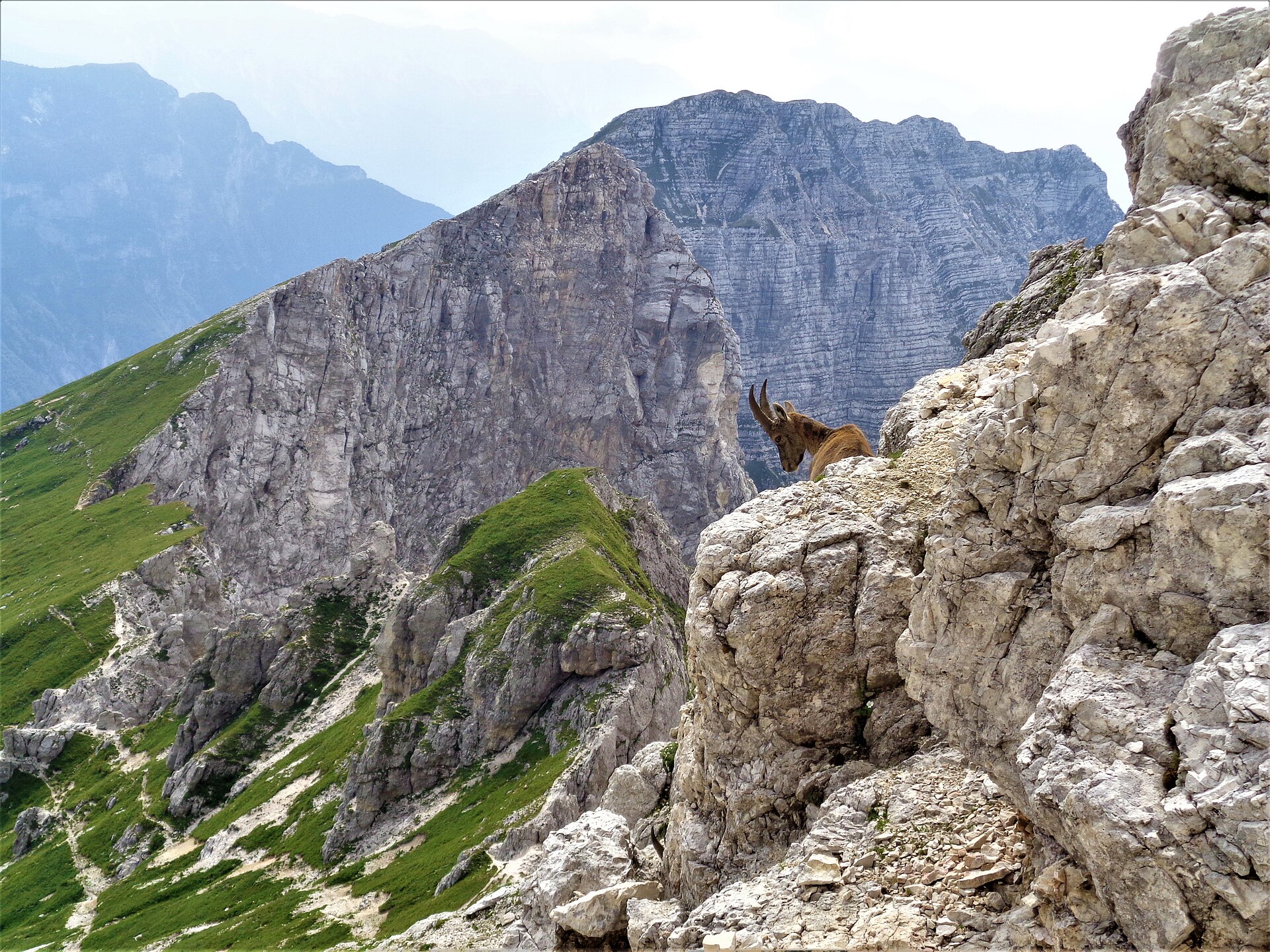
A terrestrial area, with forests and mountains.
What rocks lie beneath Julian Prealps Nature Park?
According to the European 1:1 million geological map (EGDI), the bedrock consists mainly of limestones (100% of sampled points). These are mostly sedimentary rocks. The geological units date mainly from the Triassic (80% of sampled points).
What is the highest point of Julian Prealps Nature Park?
Kanin / Canin, at 2,587 m (OpenStreetMap).
What are the main summits of Julian Prealps Nature Park?
Kanin / Canin (2,587 m), Monte Ursic / Vršič (2,541 m), Monte Forato / Prestreljenik (2,498 m), Cima Lunga / Hudi Vršič (2,471 m) and Cima Celso Gilberti / Peči (2,453 m) (OpenStreetMap).
Which international labels apply to Julian Prealps Nature Park?
Natura 2000 network (2 sites).
When is the best time to visit Julian Prealps Nature Park?
Best time to visit: from May to September, with average temperatures of 10 to 17 °C and moderate rainfall.
Is there snow in Julian Prealps Nature Park?
Yes. According to NASA's MODIS satellites (2015–2025 average), snow covers most of the site in December and January, and until April on higher ground, with about 75 snow-covered days a year on average.
What is there to see in Julian Prealps Nature Park?
2 viewpoints, 3 waterfalls, 42 caves and 3 glaciers, including Fontanone Barman, Bus de Bunny (2,013 m), Ghiacciaio del Canin and Abisso Emilio Comici (1,992 m) (OpenStreetMap).
Where can I stay in Julian Prealps Nature Park?
11 mountain huts and 1 campsite, including Rifugio Celso Gilberti (1,850 m), Rifugio Pian dei Ciclamini and Ricovero Casera Goriuda di sopra (1,405 m) (OpenStreetMap).
What is the nearest large city to Julian Prealps Nature Park?
Nearest towns of over 50,000 people, as the crow flies: Udine (27 km) and Villach (39 km). Nearest airport: Trieste – Friuli Venezia Giulia (TRS), about 54 km away.
How can I reach Julian Prealps Nature Park by train?
The nearest railway station is Tarvisio Boscoverde, about 18 km from the site boundary.
Where can I get visitor information on site?
Pro Loco.
Are there waymarked hiking trails in Julian Prealps Nature Park?
Yes. Waymarked hiking routes listed in OpenStreetMap: 70, including Via Alpina Yellow and Cammino Celeste Italia. The “JK17” route runs for about 12 km through the site, with some 450 m of ascent on its longest section.
Which species can be seen in Julian Prealps Nature Park?
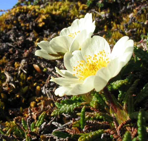
Among the species most often recorded on GBIF are Troglohyphantes fagei, Pretneria saulii, Dryas octopetala (Eightpetal mountain-avens) and Wormaldia copiosa.
What is the official website of Julian Prealps Nature Park?
© OpenStreetMap
Download the boundary: GeoJSON · GPX Boundary © OpenStreetMap contributors (ODbL).
Geography
The representative point of the site lies at around 1,116 m above sea level. Over the 1996–2025 period, the mean annual temperature is about 6.7 °C and total precipitation reaches roughly 1,830 mm per year. The warmest month is usually July, the coolest January, and the wettest November. According to the European 1:1 million geological map (EGDI), the bedrock consists mainly of limestones (100% of sampled points). These are mostly sedimentary rocks. The geological units date mainly from the Triassic (80% of sampled points). In 2017, 5 glaciers covered 8 ha within the site (Sentinel-2 glacier inventory of the Alps).
Area
- Area
- 9,402 ha
- Elevation
- 1,116 m
- Median elevation
- 1,250 m
- Mean slope
- 31°
- Snow cover
- ≈ 75 days a year
- Coordinates
- 46.338, 13.318
Terrain: Mapzen Terrain Tiles (SRTM, USGS)
Elevation bands
- below 500 m 1%
- 500–1,000 m 25%
- 1,000–1,500 m 46%
- 1,500–2,000 m 24%
- 2,000–2,500 m 5%
share of the site in each elevation band (smoothed terrain model: summits are rounded off) · Terrain: Mapzen Terrain Tiles (SRTM, USGS)
Bedrock
- Limestones 100 %
Sedimentary rocks 100 % · Main age: Triassic (80%)
Source: EGDI 1:1M geological map (EuroGeoSurveys and national geological surveys), CC BY 4.0 · 15 sampled points within the site.
Main summits
- Kanin / Canin2,587 m
- Monte Ursic / Vršič2,541 m
- Monte Forato / Prestreljenik2,498 m
- Cima Lunga / Hudi Vršič2,471 m
- Cima Celso Gilberti / Peči2,453 m
- Torre del Forato / Prestreljeniški stolp2,434 m
- Picco di Carnizza2,434 m
- Pod Kaninom2,429 m
- Črni Vogel / Cerni Vogu2,422 m
- Mali Dol2,374 m
Data © OpenStreetMap contributors (ODbL)
Climate
● Mean temperature (°C) · ▮ Precipitation (mm)
Source: Copernicus ERA5-Land (C3S, doi:10.24381/cds.68d2bb30), monthly averages 1996–2025 interpolated to the representative point, temperatures adjusted for elevation.
Contains modified Copernicus Climate Change Service information 2026. Neither the European Commission nor ECMWF is responsible for any use that may be made of the Copernicus information or data it contains.
Snow cover measured by satellite
J
F
M
A
M
J
J
A
S
O
N
D
average share of the site under snow · snowiest parts · ≈ 75 days a year
Snow cover: MODIS/Terra MOD10CM v61 (Hall & Riggs, 2021, NASA NSIDC DAAC, doi:10.5067/MODIS/MOD10CM.061), imagery from NASA GIBS (ESDIS); 2015–2025 average, grid of about 5 km.
Natural habitats
According to CORINE Land Cover (2018), the site is mainly made up of forests (54%), sparsely vegetated land (15%) and heath and scrub (13%). Woodland is mostly broadleaved. Elevation ranges from about 740 m to 2,587 m (highest point: Kanin / Canin). Median elevation is 1,250 m, and 29% of the site lies above 1,500 m (SRTM elevation model). The terrain is steep: 57% of slopes exceed 30° (mean slope 31°). The 2 Natura 2000 sites overlapping the area list 22 habitats of European interest (5 priority), the most extensive being Illyrian Fagus sylvatica forests (Aremonio-Fagion), calcareous rocky slopes with chasmophytic vegetation and bushes with Pinus mugo and Rhododendron hirsutum (Mugo-Rhododendretum hirsuti).
Biodiversity
Based on occurrences aggregated by GBIF, several species are regularly recorded within the site. Among the most frequent are Troglohyphantes fagei, Pretneria saulii, Dryas octopetala (Eightpetal mountain-avens) and Wormaldia copiosa. The full list of documented taxa is shown below. The overlapping Natura 2000 sites list 67 species of European interest: 21 birds, 11 mammals, 8 reptiles, 5 amphibians, 2 fish, 13 invertebrates and 7 plants.
Habitats of European interest
From the official forms of the 2 Natura 2000 sites overlapping the area (areas reported for each whole site).
- Illyrian Fagus sylvatica forests (Aremonio-Fagion) 3,482 ha
- Calcareous rocky slopes with chasmophytic vegetation 1,526 ha
- Bushes with Pinus mugo and Rhododendron hirsutum (Mugo-Rhododendretum hirsuti) priority 911 ha
- Alpine and subalpine calcareous grasslands 872 ha
- (Sub-) Mediterranean pine forests with endemic black pines priority 725 ha
- Alpine and Boreal heaths 433 ha
- Eastern sub-Mediterranean dry grasslands (Scorzoneratalia villosae) 217 ha
- Calcareous and calcshist screes of the montane to alpine levels (Thlaspietea rotundifolii) 203 ha
and 14 more
Species of European interest
Birds · 21
Boreal Owl (Aegolius funereus) resident, Rock Partridge (Alectoris graeca saxatilis) resident, Golden Eagle (Aquila chrysaetos) resident, Hazel Grouse (Bonasa bonasia) resident, Eurasian Eagle-owl (Bubo bubo) resident, European Nightjar (Caprimulgus europaeus) resident, Short-toed Snake Eagle (Circaetus gallicus) passage, Corn Crake (Crex crex) breeding, Black Woodpecker (Dryocopus martius) resident, Peregrine Falcon (Falco peregrinus) resident, Eurasian Pygmy Owlet (Glaucidium passerinum) wintering resident, Bearded vulture (Gypaetus barbatus) passage and 9 more
Mammals · 11
Alpine Ibex (Capra ibex), European wildcat (Felis silvestris), Mountain Hare (Lepus timidus), Eurasian Lynx (Lynx lynx), European pine marten (Martes martes), Hazel dormouse (Muscardinus avellanarius), Western Polecat (Mustela putorius), Greater Horseshoe Bat (Rhinolophus ferrumequinum), Lesser horseshoe bat (Rhinolophus hipposideros), Chamois (Rupicapra rupicapra), Brown bear (Ursus arctos)
Reptiles · 8
Smooth snake (Coronella austriaca), Western Whip Snake (Hierophis viridiflavus), Horvath's rock lizard (Iberolacerta horvathi), Green lizard (Lacerta viridis), Dice snake (Natrix tessellata), Common wall lizard (Podarcis muralis), Nose-horned Viper (Vipera ammodytes), Aesculapian Snake (Zamenis longissimus)
Amphibians · 5
Yellow-bellied toad (Bombina variegata), Green Toad (Bufotes viridis), Common tree frog (Hyla arborea), Common frog (Rana temporaria), Alpine salamander (Salamandra atra)
Invertebrates · 13
White-clawed Crayfish (Austropotamobius pallipes), Greater Capricorn Beetle (Cerambyx cerdo), Lorkovic’s Brassy Ringlet (Erebia calcaria), Marsh fritillary (Euphydryas aurinia), Jersey Tiger (Euplagia quadripunctaria), Roman Snail (Helix pomatia), Woodland brown (Lopinga achine), Stag beetle (Lucanus cervus), Large Blue (Maculinea arion), Apollo (Parnassius apollo), Clouded apollo (Parnassius mnemosyne), Willowherb Hawkmoth (Proserpinus proserpina) and 1 more
Plants · 7
Adenophora lilifolia, Mountain arnica (Arnica montana), Campanula zoysii, Alpine Sea Holly (Eryngium alpinum), Great Yellow Gentian (Gentiana lutea), Marsh gladiolus (Gladiolus palustris), Tufted horned rampion (Physoplexis comosa)
Source: Natura 2000 standard data forms (EEA, CC-BY 4.0). Not exhaustive: sensitive species are not published.
Species to look out for
Observed species
Occurrences documented via GBIF; they are neither an exhaustive inventory nor proof of current presence.
- Troglohyphantes fagei · 27
- Pretneria saulii · 8
- Eightpetal mountain-avens · Dryas octopetala · 6
- Wormaldia copiosa · 5
- Philopotamus ludificatus · 5
- Mughiphantes triglavensis · 5
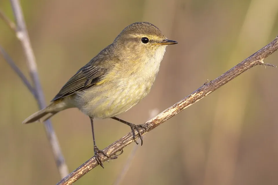
- Common Chiffchaff · Phylloscopus collybita · 5
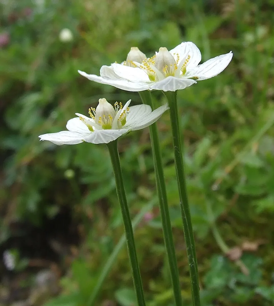
- Grass-of-Parnassus · Parnassia palustris · 5
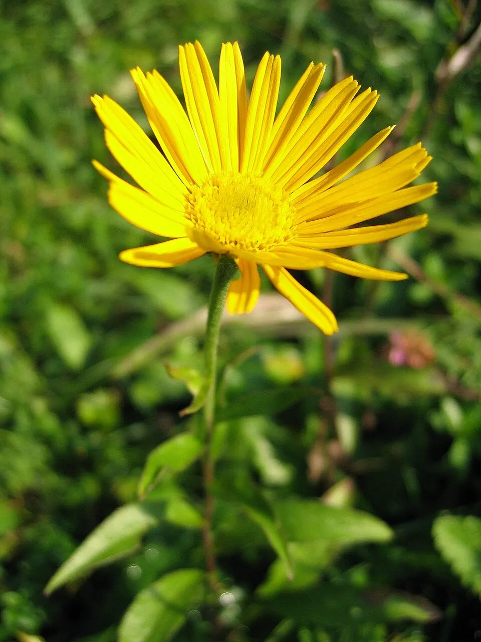
- Ox-eye · Buphthalmum salicifolium · 5
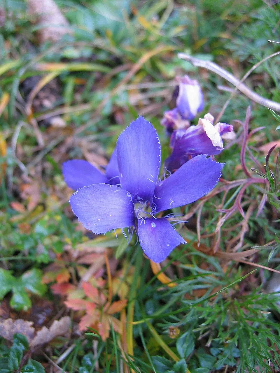
- Fringed gentian · Gentianopsis ciliata · 5
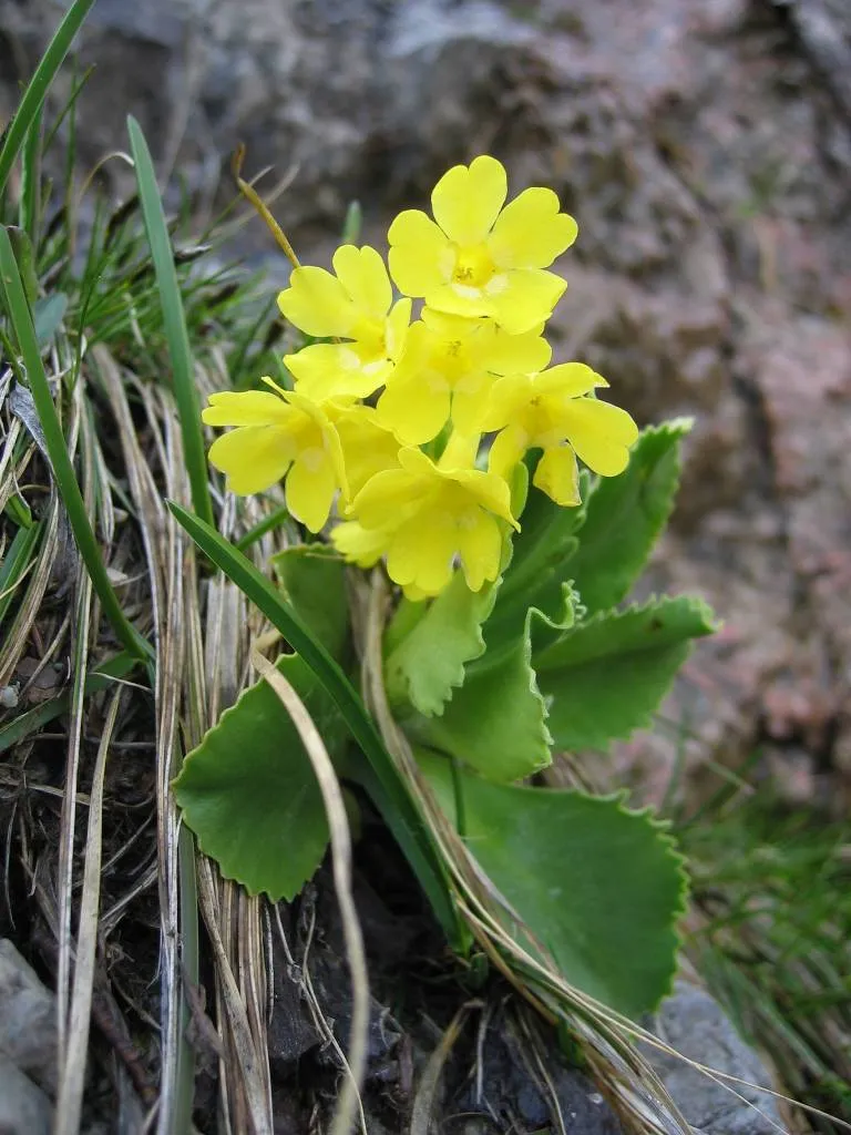
- Auricula · Primula auricula · 5
- Common Kestrel · Falco tinnunculus · 5
Records: GBIF.org (CC-BY). Names: Wikidata (CC0), GBIF. Photos: Wikimedia Commons.
Conservation challenges
The primary purpose of the site is to preserve its natural habitats and the biodiversity they support. The species recorded (Biodiversity tab) reflect its ecological value. The designations it holds frame its management and the control of land use.
According to Global Forest Change data (University of Maryland, Global Forest Watch), about 40 ha of tree cover were lost within the boundary between 2001 and 2023 (under 1% of its area), peaking in 2011 and 2018. These losses include logging, storms and fires, and do not account for regrowth. According to the European CORINE Land Cover inventory (Copernicus), land cover changed on about 233 ha of the site between 1990 and 2018 (2% of its area): forest grew by 233 ha, mostly at the expense of open natural land, while open natural land shrank by 233 ha, mostly giving way to forest. At night, the area gives off virtually no artificial light detectable from space (NASA VIIRS Black Marble composite, 2016). According to the Natura 2000 forms, of 18 assessed habitats of European interest, 12 are in excellent condition and 3 in average or reduced condition. According to the Water Framework Directive assessment (2022 river basin management plans, data 2009–2019), 100% of the 19 km of rivers assessed within the site are in good or high ecological status.
Pressure indicators
Tree cover lost
40 ha
2001–2023 · < 1% of the area
20012023
Fires since 2016
0
No large fire mapped (fires over about 30 ha)
Light at night
0%
of the area gives off artificial light visible from space
DarkLit
Land cover change
233 ha
changed cover, 1990–2018 · CORINE · 2% of the area
- +233 ha · forest
- −233 ha · open natural land
Rivers and lakes
100%
of the 19 km of assessed rivers in good or high ecological status · WFD 2022
assessments 2009–2019
Sources: Global Forest Change (Hansen et al., University of Maryland, via Global Forest Watch, CC-BY 4.0); EFFIS, European Commission / Copernicus; NASA Black Marble 2016 (public domain); CORINE Land Cover 2018 (Copernicus) or MODIS.
CORINE Land Cover Change 1990–2018: generated using European Union's Copernicus Land Monitoring Service information (EEA), aggregated by Parkavela; DOI 10.2909/f30f1000-7cf8-43bb-872c-5eb093911b24.
Ecological status of water bodies: European Environment Agency, WISE – Water Framework Directive, 3rd river basin management plans (2022), CC BY 4.0. Official national classification, not comparable between countries.
Practical information
Cities and airport
- Udine
27 km as the crow flies - Villach
39 km as the crow flies - Airport: Trieste – Friuli Venezia Giulia (TRS)
54 km as the crow flies
Visitor information
- Pro Loco
2 km from the site boundary
Things to see
2 viewpoints · 3 waterfalls · 42 caves · 3 glaciers
- Fontanone Barman
waterfall - Bus de Bunny
cave · 2,013 m - Ghiacciaio del Canin
glacier - Abisso Emilio Comici
cave · 1,992 m - Ghiacciaio orientale del Canin
glacier
Where to stay
11 mountain huts · 1 campsite
- Rifugio Celso Gilberti
Staffed hut · 1,850 m - Rifugio Pian dei Ciclamini
campsite - Ricovero Casera Goriuda di sopra
Unstaffed hut · 1,405 m · 4 beds - Ricovero casera Cjariguart
Unstaffed hut · 1,405 m · 16 beds - Ricovero Casera Caal
Unstaffed hut · 1,208 m · 10 beds
Hiking
70 waymarked routes listed, including:
Via Alpina YellowCammino Celeste Italia
Data © OpenStreetMap contributors (ODbL) · Wikidata (CC0)
Waymarked hiking routes
JK17
12.2 km within the site ↗ 453 m↘ 213 m 1,290–1,624 m
up to T2 · mountain hiking
JK16
8.3 km within the site ↗ 782 m↘ 545 m 842–1,605 m
up to T2 · mountain hiking
VA-B11 Via Alpina Yellow B11
1.6 km within the site ↗ 40 m↘ 70 m 716–773 m
up to T2 · mountain hiking
Cammino Celeste Italia - 7 Rifugio A.N.A. - Valle Torre - Prato di Resia
7.9 km within the site ↗ 511 m↘ 274 m 828–1,225 m
632 Unnamed route
4 km within the site ↗ 125 m↘ 355 m 1,839–2,076 m
up to T2 · mountain hiking
701 Unnamed route
5.6 km within the site ↗ 1,214 m↘ 220 m 676–1,875 m
up to T3 · demanding mountain hiking
Tracks © OpenStreetMap contributors (ODbL), clipped to the boundary; elevation gain and profiles computed on the longest section from Mapzen Terrain Tiles (≈ 30 m), indicative only. Indicative difficulty (SAC scale, OpenStreetMap, via Waymarked Trails): check with the park.
Access and visiting
The nearest railway station is Tarvisio Boscoverde, about 18 km from the site boundary. Nearest towns of over 50,000 people, as the crow flies: Udine (27 km) and Villach (39 km). Nearest airport: Trieste – Friuli Venezia Giulia (TRS), about 54 km away. About 120,000 people live within 20 km of the site boundary, 28,000 of them within 10 km; the site itself is virtually uninhabited (GHSL estimate, 2020). Visitor information on site: Pro Loco. Waymarked hiking routes listed in OpenStreetMap: 70, including Via Alpina Yellow and Cammino Celeste Italia. To see: 2 viewpoints, 3 waterfalls, 42 caves and 3 glaciers, including Fontanone Barman, Bus de Bunny (2,013 m), Ghiacciaio del Canin and Abisso Emilio Comici (1,992 m). Where to stay: 11 mountain huts and 1 campsite, including Rifugio Celso Gilberti (1,850 m), Rifugio Pian dei Ciclamini and Ricovero Casera Goriuda di sopra (1,405 m). To plan a visit (access, opening periods, visitor rules), it is best to consult the official information from the managing body and the official website listed in this page's sources.
Source: OpenStreetMap (ODbL), Wikidata (CC0), October 2026.
When to visit
Best time to visit: from May to September, with average temperatures of 10 to 17 °C and moderate rainfall. Average temperatures drop below 0 °C from December to February: frost is common. These averages apply to the site's representative point (1,116 m); higher up it is markedly cooler and snow lasts longer. According to NASA's MODIS satellites (2015–2025 average), snow covers most of the site in December and January, and until April on higher ground, with about 75 snow-covered days a year on average. Day length ranges from about 8 h 37 min in December to 15 h 47 min in June. Wildlife records published on GBIF peak for birds (December and January), plants (August) and butterflies and moths (July). These peaks also reflect when observers are most active.
Source: Copernicus ERA5-Land (C3S), monthly averages 1996–2025 at the representative point, temperatures adjusted for elevation.
Contains modified Copernicus Climate Change Service information 2026. Neither the European Commission nor ECMWF is responsible for any use that may be made of the Copernicus information or data it contains.
Wildlife records calendar
JFMAMJJASOND
Birds
Plants
Butterflies & moths
Monthly records published on GBIF (CC-BY), relative to the busiest month; also reflects observer activity.
Gallery
© Enrico Piciulin · CC BY-SA 4.0
© Klenje · CC BY-SA 3.0
© Naturpuur · CC BY 4.0
© Bibo993 · CC BY-SA 4.0
© Naturpuur · CC BY 4.0
© Stefano Zocca · CC BY-SA 4.0
Sources and licences
- Wikidata: Q3895650
- OpenStreetMap: relation 18148133
- Official website: http://www.parcoprealpigiulie.org
- Wikipedia: en.wikipedia.org/wiki/Julian_Prealps_Natural_Park
- WDPA: 178980
References
- cds.climate.copernicus.eu: climate · CC-BY-4.0
- registry.opendata.aws: elevation of the reference point, detailed relief · PD
- doi.org: glaciers, population around the site · CC-BY-4.0
- land.copernicus.eu: land cover, land cover change, sea share · COPERNICUS
- wikidata.org: official area, establishment date, protected heritage, official name, nearby cities and airport, access and peaks, lake depths, places to see, official website · CC0-1.0
- eea.europa.eu: bathing water quality, ecological status of waters · CC-BY-4.0
- en.eurovelo.com: EuroVelo cycle routes · ODbL-1.0
- cycling.waymarkedtrails.org: cycle routes · ODbL-1.0
- opentopodata.org: elevations · PD
- forest-fire.emergency.copernicus.eu: wildfires · COPERNICUS
- globalforestwatch.org: tree cover loss · CC-BY-4.0
- gbif.org: seasonality of sightings, invasive alien species, observed species · CC-BY-4.0
- europe-geology.eu: geology · CC-BY-4.0
- hydrosheds.org: lakes · CC-BY-4.0
- natura2000.eea.europa.eu: Natura 2000 habitats and species · CC-BY-4.0
- earthobservatory.nasa.gov: night light · PD
- openstreetmap.org: access and peaks, places to see · ODbL-1.0
- hiking.waymarkedtrails.org: route difficulty · ODbL-1.0
- nsidc.org: snow cover · PD
- wikidata.org: Wikipedia article · CC-BY-SA-4.0
Data © OpenStreetMap contributors (ODbL), Wikidata (CC0) and the sources cited.