Italy · Terrestrial
Maremma Regional Park
Regional nature park of 9,000 hectares in Italy, established in 1975.
Overview
Regional nature park of 9,000 hectares in Italy, established in 1975.
Maremma Regional Park is a regional nature park in Italy (Europe). It is a predominantly terrestrial area. Established in 1975, it covers about 9,000 hectares.
Protections and designations
Ramsar site
Natura 2000 · habitats (SAC) · 4 sites
- Dune costiere del Parco dell'Uccellina IT51A0015
- Monti dell'Uccellina IT51A0016
- Padule della Trappola, Bocca d'Ombrone IT51A0039
- Pineta Granducale dell'Uccellina IT51A0014
Natura 2000 · birds (SPA) · 5 sites
- Dune costiere del Parco dell'Uccellina IT51A0015
- Monti dell'Uccellina IT51A0016
- Padule della Trappola, Bocca d'Ombrone IT51A0013
- Pianure del Parco della Maremma IT51A0036
- Pineta Granducale dell'Uccellina IT51A0014
Protected as a regional nature park. International labels and designations: Ramsar site (“Trappola marshland”) and Natura 2000 network (6 sites). Key dates: established in 1975 and first Natura 2000 site under the Birds Directive in 1998.
In our collections
Timeline
-
1975
Established
-
1998
First Natura 2000 site under the Birds Directive 5 such sites designated up to 2003
Sources: Wikidata (CC0) for establishment and international labels; EEA Natura 2000 database (CC-BY 4.0) for site designation dates.
Frequently asked questions
Where is Maremma Regional Park?
In Italy (Europe). Representative point: 42.6330° N, 11.0920° E.
How large is Maremma Regional Park?
About 9,000 hectares (90 km²). It is the 50th largest of the 128 regional parks in Italy covered by Parkavela. About 600 ha are at sea.
When was Maremma Regional Park established?
In 1975.
What habitats and landscapes does Maremma Regional Park include?
A terrestrial area, with forests and coasts.
What rocks lie beneath Maremma Regional Park?
According to the European 1:1 million geological map (EGDI), the bedrock consists mainly of unconsolidated deposits (44% of sampled points), limestones (25%) and mudstones (25%). These are mostly sedimentary rocks. The geological units date mainly from the Quaternary (44% of sampled points).
What is the highest point of Maremma Regional Park?
Poggio Lecci, at 414 m (OpenStreetMap).
What are the main summits of Maremma Regional Park?
Poggio Lecci (414 m), Poggio Pian di Betto (397 m), Poggio Alto (391 m), Poggio dell'Uccellina (371 m) and Poggio alle Sugherine (292 m) (OpenStreetMap).
Which international labels apply to Maremma Regional Park?
Ramsar site (“Trappola marshland”) and Natura 2000 network (6 sites).
When is the best time to visit Maremma Regional Park?
Best time to visit: from April to September, with average temperatures of 12 to 24 °C and moderate rainfall.
What is there to see in Maremma Regional Park?
10 viewpoints and 29 caves, including Punta del Corvo (214 m), Buca dei cani sciolti, Semaforo and Buca del Mori (OpenStreetMap).
Where can I stay in Maremma Regional Park?
2 campsites, including Alberese Camper Park and Camping Village Talamone (OpenStreetMap).
Are there historic monuments in Maremma Regional Park?
Yes. According to Wikidata, 4 monuments protected as Italian national cultural heritage stand within the boundary. For example: “San Rabano” in Grosseto, “Torre della Bella Marsilia” in Magliano in Toscana and “Torre delle Cannelle” in Orbetello.
Can you swim in Maremma Regional Park?
14 monitored bathing sites lie in or within 1 km of the site; official 2025 classification: 12 excellent and 2 good (European Environment Agency). Swimming is only permitted at the sites and times authorised locally.
What is the nearest large city to Maremma Regional Park?
Nearest towns of over 50,000 people, as the crow flies: Grosseto (9 km) and Siena (72 km). Nearest airport: Pisa International Airport 'Galileo Galilei' (PSA), about 120 km away.
How can I reach Maremma Regional Park by train?
The nearest railway station is Talamone, less than 1 km from the site boundary.
Where can I get visitor information on site?
Centro Visite del Parco Naturale della Maremma, ProLoco Alborensis and Reception.
Are there waymarked hiking trails in Maremma Regional Park?
Yes. Waymarked hiking routes listed in OpenStreetMap: 14. The “A1 San Rabano e Torre Uccellina” route runs for about 13 km through the site, with some 380 m of ascent on its longest section.
Which species can be seen in Maremma Regional Park?
Among the species most often recorded on GBIF are Quercus ilex (Holm Oak), Larus michahellis (Yellow-legged Gull), Pica pica (Eurasian Magpie) and Corvus cornix (Hooded Crow).
What is the official website of Maremma Regional Park?
© OpenStreetMap
Download the boundary: GeoJSON · GPX Boundary © OpenStreetMap contributors (ODbL).
Geography
The representative point of the site lies at around 203 m above sea level. Over the 1996–2025 period, the mean annual temperature is about 15.3 °C and total precipitation reaches roughly 798 mm per year. The warmest month is usually August, the coolest January, and the wettest November. According to the European 1:1 million geological map (EGDI), the bedrock consists mainly of unconsolidated deposits (44% of sampled points), limestones (25%) and mudstones (25%). These are mostly sedimentary rocks. The geological units date mainly from the Quaternary (44% of sampled points).
Area
- Area
- 9,000 ha
- Elevation
- 203 m
- Mean slope
- 7°
- Coordinates
- 42.633, 11.092
Terrain: Mapzen Terrain Tiles (SRTM, USGS)
Bedrock
- Unconsolidated deposits 44 %
- Limestones 25 %
- Mudstones 25 %
- Dolomites 6 %
Sedimentary rocks 100 % · Main age: Quaternary (44%)
Source: EGDI 1:1M geological map (EuroGeoSurveys and national geological surveys), CC BY 4.0 · 16 sampled points within the site.
Main summits
- Poggio Lecci414 m
- Poggio Pian di Betto397 m
- Poggio Alto391 m
- Poggio dell'Uccellina371 m
- Poggio alle Sugherine292 m
- Poggio Raso280 m
- Poggio alle Querce275 m
- Poggio alle Pescine265 m
- Il Poggione256 m
- Cannucceto250 m
Data © OpenStreetMap contributors (ODbL)
Climate
● Mean temperature (°C) · ▮ Precipitation (mm)
Source: Copernicus ERA5-Land (C3S, doi:10.24381/cds.68d2bb30), monthly averages 1996–2025 interpolated to the representative point, temperatures adjusted for elevation.
Contains modified Copernicus Climate Change Service information 2026. Neither the European Commission nor ECMWF is responsible for any use that may be made of the Copernicus information or data it contains.
Natural habitats
According to CORINE Land Cover (2018), the site is mainly made up of farmland (37%), forests (35%) and Mediterranean scrub (13%). Woodland is mostly broadleaved. The site borders the coast. Elevation ranges from sea level to 414 m (highest point: Poggio Lecci). The 6 Natura 2000 sites overlapping the area list 28 habitats of European interest (6 priority), the most extensive being Quercus ilex and Quercus rotundifolia forests, wooded dunes with Pinus pinea and/or Pinus pinaster and coastal dunes with Juniperus spp.
Biodiversity
Based on occurrences aggregated by GBIF, several species are regularly recorded within the site. Among the most frequent are Quercus ilex (Holm Oak), Larus michahellis (Yellow-legged Gull), Pica pica (Eurasian Magpie) and Corvus cornix (Hooded Crow). The full list of documented taxa is shown below. The overlapping Natura 2000 sites list 166 species of European interest: 129 birds, 12 mammals, 11 reptiles, 5 amphibians, 4 fish and 5 invertebrates.
Habitats of European interest
From the official forms of the 6 Natura 2000 sites overlapping the area (areas reported for each whole site).
- Quercus ilex and Quercus rotundifolia forests 2,866 ha
- Wooded dunes with Pinus pinea and/or Pinus pinaster priority 573 ha
- Coastal dunes with Juniperus spp. priority 169 ha
- Mediterranean and thermo-Atlantic halophilous scrubs (Sarcocornetea fruticosi) 138 ha
- Cisto-Lavenduletalia dune sclerophyllous scrubs 128 ha
- Thermo-Mediterranean and pre-desert scrub 122 ha
- Mediterranean salt meadows (Juncetalia maritimi) 107 ha
- Quercus suber forests 101 ha
and 20 more
Species of European interest
Birds · 129
Eurasian Sparrowhawk (Accipiter nisus) resident passage, Moustached Warbler (Acrocephalus melanopogon) wintering passage, Common Kingfisher (Alcedo atthis) wintering passage breeding, Northern Pintail (Anas acuta) passage wintering, Eurasian Teal (Anas crecca) wintering passage, Mallard (Anas platyrhynchos) wintering passage breeding resident, Greylag Goose (Anser anser) passage wintering, Lesser white-fronted goose (Anser erythropus) passage wintering, Taiga bean goose (Anser fabalis) wintering, Tawny Pipit (Anthus campestris) passage breeding, Common Swift (Apus apus) passage breeding, Great Egret (Ardea alba) passage wintering and 117 more
Mammals · 12
Grey wolf (Canis lupus), European wildcat (Felis silvestris), Crested porcupine (Hystrix cristata), European pine marten (Martes martes), Common bent-wing bat (Miniopterus schreibersii), Hazel dormouse (Muscardinus avellanarius), Western Polecat (Mustela putorius), Geoffroy's bat (Myotis emarginatus), Greater mouse-eared bat (Myotis myotis), Mediterranean Horseshoe Bat (Rhinolophus euryale), Greater Horseshoe Bat (Rhinolophus ferrumequinum), Lesser horseshoe bat (Rhinolophus hipposideros)
Reptiles · 11
Loggerhead sea turtle (Caretta caretta), Smooth snake (Coronella austriaca), Four-lined snake (Elaphe quatuorlineata), European Pond Turtle (Emys orbicularis), European leaf-toed gecko (Euleptes europaea), Western Whip Snake (Hierophis viridiflavus), Dice snake (Natrix tessellata), Common wall lizard (Podarcis muralis), Italian wall lizard (Podarcis siculus), Hermann's tortoise (Testudo hermanni), Aesculapian Snake (Zamenis longissimus)
Amphibians · 5
Green Toad (Bufotes viridis complex), Agile frog (Rana dalmatina), Italian stream frog (Rana italica), Spectacled Salamander (Salamandrina terdigitata), Italian crested newt (Triturus carnifex)
Fish · 4
Twait shad (Alosa fallax), Mediterranean killifish (Aphanius fasciatus), European river lamprey (Lampetra fluviatilis), Sea lamprey (Petromyzon marinus)
Invertebrates · 5
Greater Capricorn Beetle (Cerambyx cerdo), Jersey Tiger (Euplagia quadripunctaria), Stag beetle (Lucanus cervus), Italian Marbled White (Melanargia arge), Southern Festoon (Zerynthia polyxena)
Source: Natura 2000 standard data forms (EEA, CC-BY 4.0). Not exhaustive: sensitive species are not published.
Species to look out for


Bird
Hooded Crow
Corvus cornix111 records © Ricardo Tulio Gandelman from Rio de Janeiro, Brazil · CC BY 2.0
Observed species
Occurrences documented via GBIF; they are neither an exhaustive inventory nor proof of current presence.
- Holm Oak · Quercus ilex · 490
- Yellow-legged Gull · Larus michahellis · 115
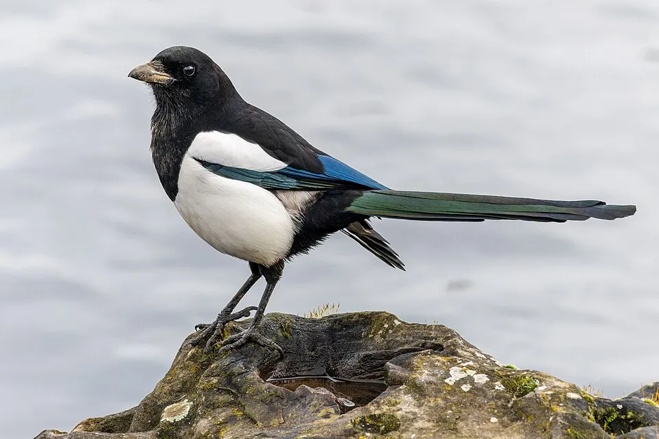
- Eurasian Magpie · Pica pica · 114
- Hooded Crow · Corvus cornix · 111
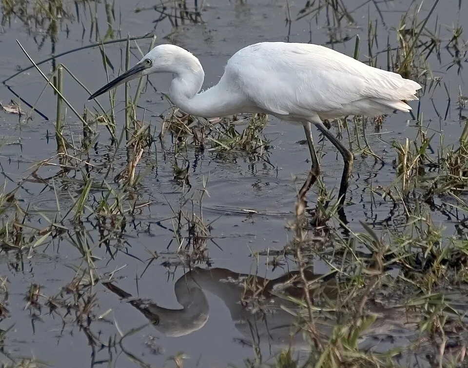
- Little Egret · Egretta garzetta · 106
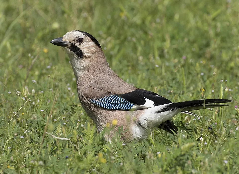
- Eurasian Jay · Garrulus glandarius · 92
- Mastic Tree · Pistacia lentiscus · 91
- Grey Heron · Ardea cinerea · 87
- Eurasian Collared Dove · Streptopelia decaocto · 76
- Mallard · Anas platyrhynchos · 74
- Western Cattle Egret · Bubulcus ibis · 70
- Common Wood Pigeon · Columba palumbus · 70
+18 more species
- Great Cormorant · Phalacrocorax carbo · 68
- European robin · Erithacus rubecula · 66
- European Goldfinch · Carduelis carduelis · 65
- Eurasian Curlew · Numenius arquata · 62
- Sardinian Warbler · Curruca melanocephala · 60
- Eurasian Chaffinch · Fringilla coelebs · 59
- Common Starling · Sturnus vulgaris · 59
- Common Kestrel · Falco tinnunculus · 55
- Great Egret · Ardea alba · 54
- Osprey · Pandion haliaetus · 50
- Common Buzzard · Buteo buteo · 49
- Common Blackbird · Turdus merula · 48
- Black-headed Gull · Chroicocephalus ridibundus · 47
- Italian Sparrow · Passer italiae · 44
- Common Pheasant · Phasianus colchicus · 43
- Common Crane · Grus grus · 41
- Common Sandpiper · Actitis hypoleucos · 41
- Common smilax · Smilax aspera · 40
Records: GBIF.org (CC-BY). Names: Wikidata (CC0), GBIF. Photos: Wikimedia Commons.
Conservation challenges
The primary purpose of the site is to preserve its natural habitats and the biodiversity they support. The species recorded (Biodiversity tab) reflect its ecological value. The designations it holds frame its management and the control of land use.
According to Global Forest Change data (University of Maryland, Global Forest Watch), about 820 ha of tree cover were lost within the boundary between 2001 and 2023 (9% of its area), peaking in 2017 and 2018. These losses include logging, storms and fires, and do not account for regrowth. According to the European CORINE Land Cover inventory (Copernicus), land cover changed on about 109 ha of the site between 1990 and 2018 (1% of its area): forest grew by 87 ha, mostly at the expense of open natural land, while open natural land shrank by 52 ha, mostly giving way to forest. Forest felling and regrowth add about 110 ha in total over the period. At night, 2% of the area gives off artificial light detectable from space (NASA VIIRS Black Marble composite, 2016). According to the Natura 2000 forms, of 26 assessed habitats of European interest, 3 are in excellent condition and 2 in average or reduced condition. According to the Water Framework Directive assessment (2022 river basin management plans, data 2016–2020), only 25% of the 33 km of rivers assessed within the site are in good or high ecological potential; the others mostly have poor ecological potential. Other assessed water bodies: lagoons and estuaries, 1 of 1 in good ecological status or better; coastal waters, 2 of 2 in good ecological status or better. Since 2000, 10 invasive alien species have been recorded within the site (GBIF observations), 3 of them listed as of Union concern under EU Regulation 1143/2014. Among them: Gambusia holbrooki (Eastern mosquitofish), Threskiornis aethiopicus (African Sacred Ibis) and Myocastor coypus (Coypu).
Pressure indicators
Tree cover lost
820 ha
2001–2023 · 9% of the area
20012023
Fires since 2016
0
No large fire mapped (fires over about 30 ha)
Light at night
2%
of the area gives off artificial light visible from space
DarkLit
Built-up land
< 1%
buildings, business areas, roads, quarries · farmland 37%
Land cover change
109 ha
changed cover, 1990–2018 · CORINE · 1% of the area
- +87 ha · forest
- −52 ha · open natural land
forest felling and regrowth: 110 ha in total
Rivers and lakes
25%
of the 33 km of assessed rivers at good or high ecological potential (mostly heavily modified water bodies) · WFD 2022
Lagoons and estuaries: 1 of 1 good or better
Coastal waters: 2 of 2 good or better
assessments 2016–2020
Invasive alien species
10
incl. 3 of EU concern · since 2000
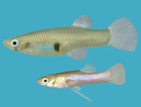 Eastern mosquitofishEU
 African Sacred IbisEU
 CoypuEU
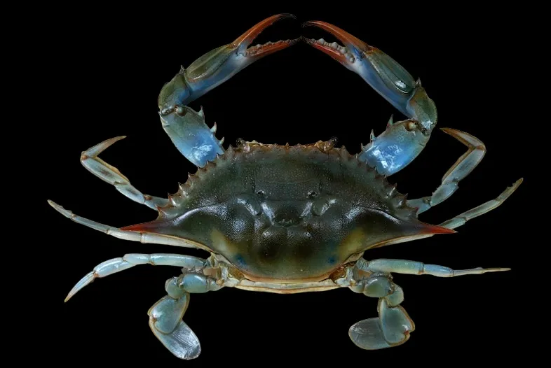 Blue Crab
 Mute Swan
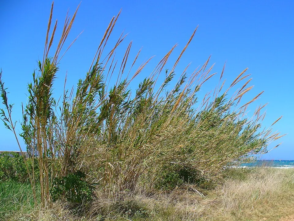 Giant Reed
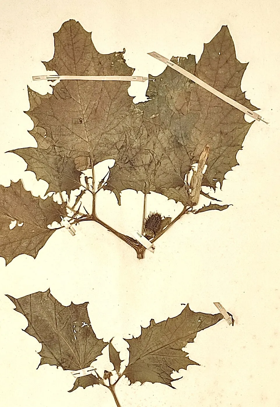 Jimsonweed
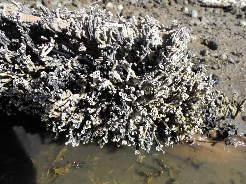 Australian tubeworm
Photos: Eastern mosquitofish © Osado · CC BY-SA 3.0; African Sacred Ibis © Steve Garvie from Dunfermline, Fife, Scotland · CC BY-SA 2.0; Coypu © Philippe Amelant · CC BY-SA 3.0; Blue Crab © The Children's Museum of Indianapolis · CC BY-SA 3.0; Mute Swan © Geni · CC BY-SA 4.0; Giant Reed © H. Zell · CC BY-SA 3.0; Jimsonweed © Giuseppe Frizzi · Public domain; Australian tubeworm © Etrusko25 · CC BY-SA 3.0
Sources: Global Forest Change (Hansen et al., University of Maryland, via Global Forest Watch, CC-BY 4.0); EFFIS, European Commission / Copernicus; NASA Black Marble 2016 (public domain); CORINE Land Cover 2018 (Copernicus) or MODIS.
CORINE Land Cover Change 1990–2018: generated using European Union's Copernicus Land Monitoring Service information (EEA), aggregated by Parkavela; DOI 10.2909/f30f1000-7cf8-43bb-872c-5eb093911b24.
Ecological status of water bodies: European Environment Agency, WISE – Water Framework Directive, 3rd river basin management plans (2022), CC BY 4.0. Official national classification, not comparable between countries.
Invasive alien species: Global Register of Introduced and Invasive Species (ISSG, CC BY 4.0); Union list, Regulation (EU) 1143/2014 (INBO, CC0); GBIF.org records (CC0 / CC BY 4.0), at least 2 per species.
Practical information
Cities and airport
- Grosseto
9 km as the crow flies - Siena
72 km as the crow flies - Airport: Pisa International Airport 'Galileo Galilei' (PSA)
120 km as the crow flies
Visitor information
- Centro Visite del Parco Naturale della Maremma
within the site - ProLoco Alborensis
within the site - Reception
1 km from the site boundary - Informazioni turistiche
3 km from the site boundary
Things to see
10 viewpoints · 29 caves
- Punta del Corvo
viewpoint · 214 m - Buca dei cani sciolti
cave - Semaforo
viewpoint - Buca del Mori
cave - Buca delle ossa
cave
Hiking
14 waymarked routes listed
By bike
BI-19 Ciclovia Tirrenica · 6 km
Signed cycle routes: this does not mean that cycling is allowed on footpaths.
Data © OpenStreetMap contributors (ODbL) · Wikidata (CC0)
Routes © OpenStreetMap contributors (ODbL), via Waymarked Trails
Waymarked hiking routes
Tracks © OpenStreetMap contributors (ODbL), clipped to the boundary; elevation gain and profiles computed on the longest section from Mapzen Terrain Tiles (≈ 30 m), indicative only.
Bathing
14 monitored bathing sites in or within 1 km of the site · 2025 classification
Excellent · 12
Good · 2
- Cala Cannelle · sea · Excellent
- Cala di Forno · sea · Excellent
- Collelungo Parco Dell'Uccellina · sea · Excellent
- Loc. la Trappola · sea · Excellent
- Marina di Alberese Nord · sea · Excellent
- Marina di Alberese Sud · sea · Excellent
- Molo Sipe - Nobel · sea · Excellent
- Talamone - Bagno Delle Donne · sea · Excellent
- Talamone - Diga Foranea · sea · Excellent
- Talamone - Loc. Poderino · sea · Excellent
and 4 more
Source: European Environment Agency, official bathing water classification (Directive 2006/7/EC, CC-BY 4.0). Swimming is only permitted at the sites and times authorised locally.
Access and visiting
The nearest railway station is Talamone, less than 1 km from the site boundary. Nearest towns of over 50,000 people, as the crow flies: Grosseto (9 km) and Siena (72 km). Nearest airport: Pisa International Airport 'Galileo Galilei' (PSA), about 120 km away. About 110,000 people live within 20 km of the site boundary, 69,000 of them within 10 km; some 820 people are estimated to live inside (GHSL estimate, 2020). Visitor information on site: Centro Visite del Parco Naturale della Maremma, ProLoco Alborensis and Reception. Waymarked hiking routes listed in OpenStreetMap: 14. A signed cycle route crosses the site: “BI-19 Ciclovia Tirrenica” (OpenStreetMap). To see: 10 viewpoints and 29 caves, including Punta del Corvo (214 m), Buca dei cani sciolti, Semaforo and Buca del Mori. Where to stay: 2 campsites, including Alberese Camper Park and Camping Village Talamone. To plan a visit (access, opening periods, visitor rules), it is best to consult the official information from the managing body and the official website listed in this page's sources.
Source: OpenStreetMap (ODbL), Wikidata (CC0), October 2026.
Built heritage
According to Wikidata, 4 monuments protected as Italian national cultural heritage stand within the boundary. Examples include “San Rabano” in Grosseto, “Torre della Bella Marsilia” in Magliano in Toscana and “Torre delle Cannelle” in Orbetello.
3 castles and fortifications1 religious building
-
San Rabano
Grosseto -
Torre della Bella Marsilia
Magliano in Toscana -
Torre delle Cannelle
Orbetello -
Torre di Capo d'Uomo
Orbetello
Source: Wikidata (CC0), monuments in each country’s official heritage protection registers, at national or regional level. Each item links to its Wikidata entry.
When to visit
Best time to visit: from April to September, with average temperatures of 12 to 24 °C and moderate rainfall. Precipitation peaks in October and November (up to 140 mm per month). Day length ranges from about 9 h 04 min in December to 15 h 18 min in June. Wildlife records published on GBIF peak for birds (January), plants (April and May), butterflies and moths (May) and mammals (January and February). These peaks also reflect when observers are most active.
Source: Copernicus ERA5-Land (C3S), monthly averages 1996–2025 at the representative point, temperatures adjusted for elevation.
Contains modified Copernicus Climate Change Service information 2026. Neither the European Commission nor ECMWF is responsible for any use that may be made of the Copernicus information or data it contains.
Wildlife records calendar
JFMAMJJASOND
Birds
Plants
Butterflies & moths
Mammals
Monthly records published on GBIF (CC-BY), relative to the busiest month; also reflects observer activity.
Gallery
© Francesco Mocellin · CC BY-SA 4.0
© Guglielmo Giambartolomei · CC BY-SA 4.0
© LigaDue · CC BY-SA 4.0
© Ulissevietato.9449 · CC BY-SA 4.0
© GDelhey · CC BY-SA 3.0
© trowel · Public domain
Sources and licences
- Wikidata: Q918575
- OpenStreetMap: relation 4279861
- Official website: http://www.parco-maremma.it/
- Wikipedia: en.wikipedia.org/wiki/Maremma_Regional_Park
- WDPA: 26609
References
- cds.climate.copernicus.eu: climate · CC-BY-4.0
- registry.opendata.aws: elevation of the reference point, detailed relief · PD
- land.copernicus.eu: land cover, land cover change, sea share · COPERNICUS
- doi.org: population around the site · CC-BY-4.0
- wikidata.org: official area, establishment date, protected heritage, official name, nearby cities and airport, access and peaks, lake depths, places to see, official website · CC0-1.0
- eea.europa.eu: bathing water quality, ecological status of waters · CC-BY-4.0
- en.eurovelo.com: EuroVelo cycle routes · ODbL-1.0
- cycling.waymarkedtrails.org: cycle routes · ODbL-1.0
- opentopodata.org: elevations · PD
- forest-fire.emergency.copernicus.eu: wildfires · COPERNICUS
- globalforestwatch.org: tree cover loss · CC-BY-4.0
- gbif.org: seasonality of sightings, invasive alien species, observed species · CC-BY-4.0
- europe-geology.eu: geology · CC-BY-4.0
- hydrosheds.org: lakes · CC-BY-4.0
- natura2000.eea.europa.eu: Natura 2000 habitats and species · CC-BY-4.0
- earthobservatory.nasa.gov: night light · PD
- openstreetmap.org: access and peaks, places to see · ODbL-1.0
- hiking.waymarkedtrails.org: route difficulty · ODbL-1.0
- nsidc.org: snow cover · PD
- wikidata.org: Wikipedia article · CC-BY-SA-4.0
Data © OpenStreetMap contributors (ODbL), Wikidata (CC0) and the sources cited.