Plant
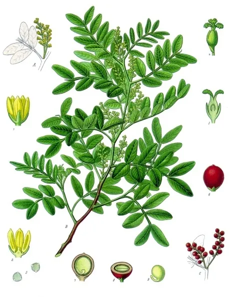
Mastic Tree
Pistacia lentiscus457 records © Franz Eugen Köhler, Köhler's Medizinal-Pflanzen · Public domain
Italy · Mixed
National park of 79,168 hectares in Italy, established in 1996.
National park of 79,168 hectares in Italy, established in 1996.
Arcipelago Toscano National Park is located in Italy (Europe). It covers both land and sea. Established in 1996, it covers about 79,168 hectares.
Protected as a national park. International labels and designations: Natura 2000 network (9 sites). Key dates: first Natura 2000 site under the Birds Directive in 1995 and established in 1996.
Sources: Wikidata (CC0) for establishment and international labels; EEA Natura 2000 database (CC-BY 4.0) for site designation dates.
In Italy (Europe). Representative point: 42.8249° N, 10.2687° E.
About 79,168 hectares (792 km²). It is the 7th largest of the 26 national parks in Italy covered by Parkavela. About 60,800 ha are at sea.
In 1996.
An area spanning land and sea, with coasts.
Monte Capanne, at 1,019 m (OpenStreetMap).
Monte Capanne (1,019 m), La Galera (969 m), Monte di Cote (950 m), Monte Corto (949 m) and La Tavola (936 m) (OpenStreetMap).
Natura 2000 network (9 sites).
Best time to visit: from April to September, with average temperatures of 14 to 26 °C and moderate rainfall.
55 viewpoints, 4 lakes and ponds and 74 caves, including Monte Serra (410 m), Stagnone della Capraia (321 m), Grotta La cattedrale and Capo Calvo (OpenStreetMap).
2 mountain huts and 12 campsites, including Acquaviva Village Camping, Agriturismo Agricampeggio BioElba and Area Sosta Ferrato (OpenStreetMap).
Yes. According to Wikidata, 16 monuments protected as Italian national cultural heritage stand within the boundary. For example: “San Niccolò” in Marciana, “Forte Focardo” in Capoliveri and “Museo” in Marciana.
63 monitored bathing sites lie in or within 1 km of the site; official 2025 classification: 63 excellent (European Environment Agency). Swimming is only permitted at the sites and times authorised locally.
Nearest towns of over 50,000 people, as the crow flies: Livorno (30 km) and Pisa (45 km). Nearest airport: Pisa International Airport 'Galileo Galilei' (PSA), about 43 km away.
The nearest railway station is Piombino, about 8 km from the site boundary.
Casotto dei Pescatori, Pro Loco and Info Park.
Yes. Waymarked hiking routes listed in OpenStreetMap: 173. The “Anello della Stella” route runs for about 9 km through the site, with some 360 m of ascent on its longest section.
Among the species most often recorded on GBIF are Pistacia lentiscus (Mastic Tree), Quercus ilex (Holm Oak), Larus michahellis (Yellow-legged Gull) and Curruca melanocephala (Sardinian Warbler).
© OpenStreetMap
Download the boundary: GeoJSON · GPX Boundary © OpenStreetMap contributors (ODbL).
The representative point of the site lies at around 8 m above sea level. Over the 1996–2025 period, the mean annual temperature is about 17.3 °C and total precipitation reaches roughly 679 mm per year. The warmest month is usually August, the coolest February, and the wettest November.
Data © OpenStreetMap contributors (ODbL)
● Mean temperature (°C) · ▮ Precipitation (mm)
Source: Copernicus ERA5-Land (C3S, doi:10.24381/cds.68d2bb30), monthly averages 1996–2025 interpolated to the representative point, temperatures adjusted for elevation.
Contains modified Copernicus Climate Change Service information 2026. Neither the European Commission nor ECMWF is responsible for any use that may be made of the Copernicus information or data it contains.
average share of the site under snow · snowiest parts · ≈ 10 days a year
Snow cover: MODIS/Terra MOD10CM v61 (Hall & Riggs, 2021, NASA NSIDC DAAC, doi:10.5067/MODIS/MOD10CM.061), imagery from NASA GIBS (ESDIS); 2015–2025 average, grid of about 5 km.
According to CORINE Land Cover (2018), the land area is mainly made up of Mediterranean scrub (61%), forests (26%) and farmland (5%). Woodland is mostly broadleaved. The sea covers about 77% of the site. The seabed reaches about 247 m deep (median depth 129 m; GEBCO bathymetry). Elevation ranges from sea level to 1,019 m (highest point: Monte Capanne). The 9 Natura 2000 sites overlapping the area list 29 habitats of European interest (5 priority), the most extensive being Posidonia beds (Posidonion oceanicae), Quercus ilex and Quercus rotundifolia forests and reefs.
Based on occurrences aggregated by GBIF, several species are regularly recorded within the site. Among the most frequent are Pistacia lentiscus (Mastic Tree), Quercus ilex (Holm Oak), Larus michahellis (Yellow-legged Gull) and Curruca melanocephala (Sardinian Warbler). The full list of documented taxa is shown below. The overlapping Natura 2000 sites list 183 species of European interest: 144 birds, 22 mammals, 6 reptiles, 4 amphibians, 6 invertebrates and 1 plant.
From the official forms of the 9 Natura 2000 sites overlapping the area (areas reported for each whole site).
and 21 more
Eurasian Goshawk (Accipiter gentilis) passage, Eurasian Sparrowhawk (Accipiter nisus) breeding passage, Great Reed Warbler (Acrocephalus arundinaceus) passage breeding, Moustached Warbler (Acrocephalus melanopogon) passage, Aquatic warbler (Acrocephalus paludicola) passage, Sedge warbler (Acrocephalus schoenobaenus) passage, Eurasian Reed Warbler (Acrocephalus scirpaceus) passage breeding, Common Sandpiper (Actitis hypoleucos) passage, Eurasian Skylark (Alauda arvensis) passage, Common Kingfisher (Alcedo atthis) wintering passage, Red-legged Partridge (Alectoris rufa) resident, Mallard (Anas platyrhynchos) passage breeding and 132 more
Fin whale (Balaenoptera physalus), Long-finned pilot whale (Globicephala melas), Risso's Dolphin (Grampus griseus), Savi's Pipistrelle (Hypsugo savii), European pine marten (Martes martes), Common bent-wing bat (Miniopterus schreibersii), Mediterranean Monk Seal (Monachus monachus), Greater noctule bat (Nyctalus lasiopterus), Common noctule (Nyctalus noctula), Sperm whale (Physeter macrocephalus), Kuhl's pipistrelle (Pipistrellus kuhlii), Nathusius's pipistrelle (Pipistrellus nathusii) and 10 more
Loggerhead sea turtle (Caretta caretta), Smooth snake (Coronella austriaca), European leaf-toed gecko (Euleptes europaea), Western Whip Snake (Hierophis viridiflavus), Common wall lizard (Podarcis muralis), Italian wall lizard (Podarcis siculus)
Green Toad (Bufotes viridis complex), Tyrrhenian painted frog (Discoglossus sardus), Sardinian tree frog (Hyla sarda), Edible frog (Pelophylax esculentus)
Greater Capricorn Beetle (Cerambyx cerdo), Red coral (Corallium rubrum), European date mussel (Lithophaga lithophaga), Ribbed Mediterranean limpet (Patella ferruginea), Fan Mussel (Pinna nobilis), Mediterranean Slipper Lobster (Scyllarides latus)
Source: Natura 2000 standard data forms (EEA, CC-BY 4.0). Not exhaustive: sensitive species are not published.
Plant
457 records © Franz Eugen Köhler, Köhler's Medizinal-Pflanzen · Public domain
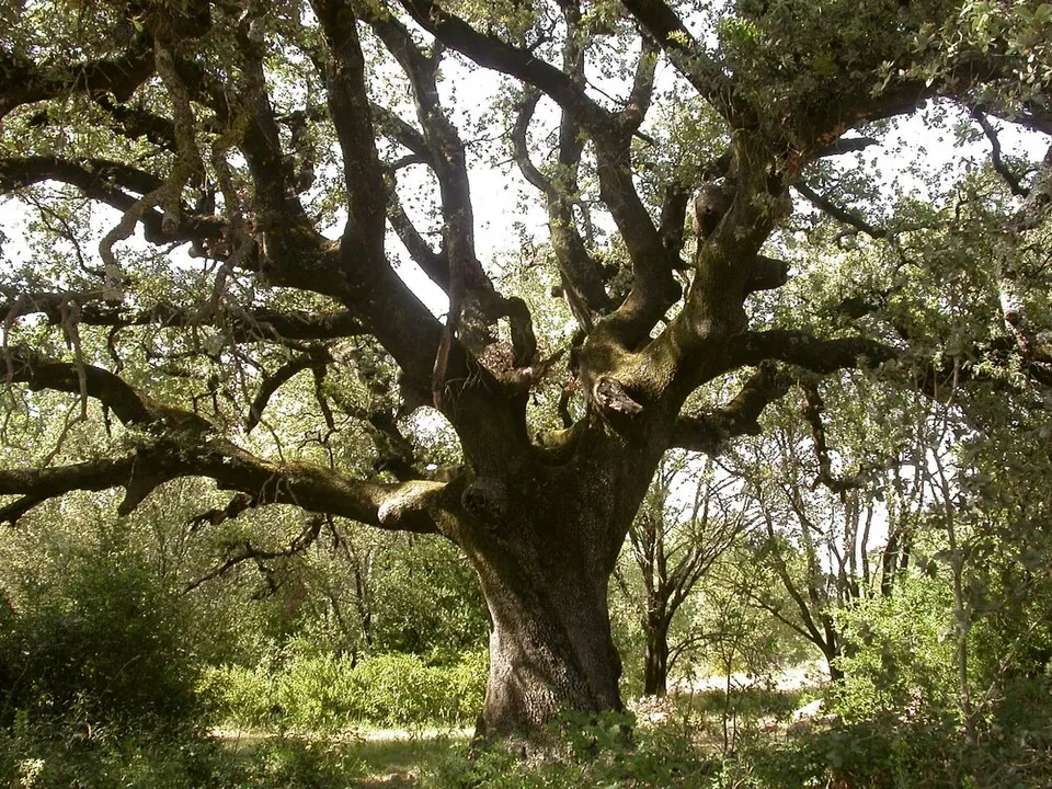


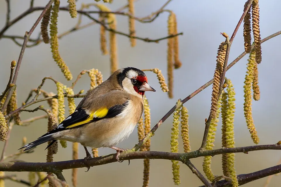
Occurrences documented via GBIF; they are neither an exhaustive inventory nor proof of current presence.
Records: GBIF.org (CC-BY). Names: Wikidata (CC0), GBIF. Photos: Wikimedia Commons.
The primary purpose of the site is to preserve its natural habitats and the biodiversity they support. The species recorded (Biodiversity tab) reflect its ecological value. The designations it holds frame its management and the control of land use.
According to Global Forest Change data (University of Maryland, Global Forest Watch), about 393 ha of tree cover were lost within the boundary between 2001 and 2023 (under 1% of its area), peaking in 2001 and 2023. These losses include logging, storms and fires, and do not account for regrowth. According to the European CORINE Land Cover inventory (Copernicus), land cover changed on about 1,050 ha of the site between 1990 and 2018 (6% of its area): farmland shrank by 393 ha, mostly giving way to built-up land, while built-up land grew by 381 ha, mostly at the expense of farmland. Since 2016, the European EFFIS system (Copernicus) has mapped 2 fires here, burning about 58 ha within the boundary; the largest, in August 2016 (near Marciana), covered 49 ha. At night, 3% of the area gives off artificial light detectable from space (NASA VIIRS Black Marble composite, 2016). According to the Natura 2000 forms, of 25 assessed habitats of European interest, 15 are in excellent condition and 2 in average or reduced condition. According to the Water Framework Directive assessment (2022 river basin management plans, data 2016–2020), water bodies assessed within the site: coastal waters, 2 of 2 in good ecological status or better. Since 2000, 11 invasive alien species have been recorded within the site (GBIF observations), 2 of them listed as of Union concern under EU Regulation 1143/2014. Among them: Ailanthus altissima (Tree-of-heaven), Broussonetia papyrifera (Paper mulberry) and Acacia dealbata (Silver Wattle).
393 ha
2001–2023 · < 1% of the area
58 ha
burned within the boundary (2 mapped fires)
3%
of the area gives off artificial light visible from space
< 1%
buildings, business areas, roads, quarries · farmland 1%
1,050 ha
changed cover, 1990–2018 · CORINE · 6% of the area
Coastal waters: 2 of 2 good or better
assessments 2016–2020
11
incl. 2 of EU concern · since 2000
 Tree-of-heavenEU
 Paper mulberryEU
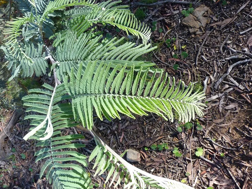 Silver Wattle
 Bermuda buttercup
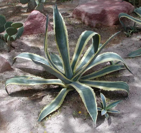 American century plant
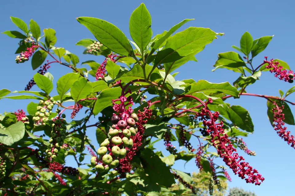 American pokeweed
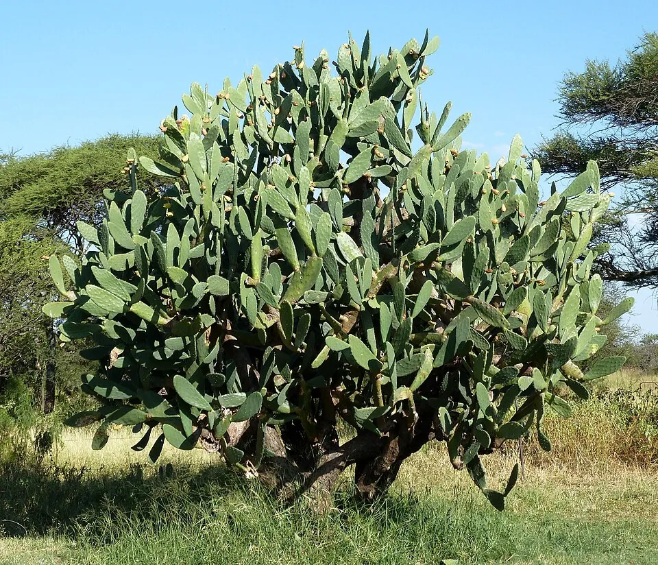 Tuna Cactus
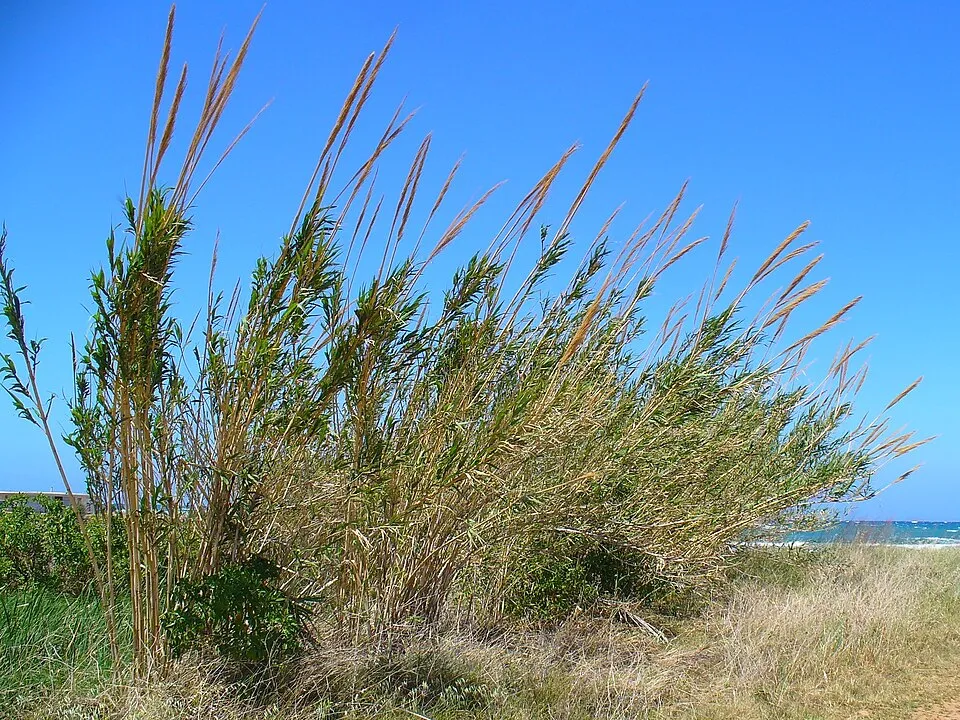 Giant Reed
Photos: Tree-of-heaven © Darkone · CC BY-SA 2.5; Paper mulberry © Didier Descouens · CC BY-SA 4.0; Silver Wattle © Donald Hobern from Copenhagen, Denmark · CC BY 2.0; Bermuda buttercup © MathKnight and Zachi Evenor אביר המתמטיקה וצחי אבנור · CC BY-SA 4.0; American century plant © Stan Shebs · CC BY-SA 3.0; American pokeweed © Huw Williams (Huwmanbeing) · Public domain; Tuna Cactus © JMK · CC BY-SA 3.0; Giant Reed © H. Zell · CC BY-SA 3.0
Sources: Global Forest Change (Hansen et al., University of Maryland, via Global Forest Watch, CC-BY 4.0); EFFIS, European Commission / Copernicus; NASA Black Marble 2016 (public domain); CORINE Land Cover 2018 (Copernicus) or MODIS.
CORINE Land Cover Change 1990–2018: generated using European Union's Copernicus Land Monitoring Service information (EEA), aggregated by Parkavela; DOI 10.2909/f30f1000-7cf8-43bb-872c-5eb093911b24.
Ecological status of water bodies: European Environment Agency, WISE – Water Framework Directive, 3rd river basin management plans (2022), CC BY 4.0. Official national classification, not comparable between countries.
Invasive alien species: Global Register of Introduced and Invasive Species (ISSG, CC BY 4.0); Union list, Regulation (EU) 1143/2014 (INBO, CC0); GBIF.org records (CC0 / CC BY 4.0), at least 2 per species.
82 public car parks listed within the site
55 viewpoints · 4 lakes and ponds · 74 caves
2 mountain huts · 12 campsites
173 waymarked routes listed
130 km graded out of 446 km of paths
SAC scale (T1–T6) © OpenStreetMap contributors (ODbL): indicative only, check with the park.
Data © OpenStreetMap contributors (ODbL) · Wikidata (CC0)
2.3 km within the site ↗ 0 m↘ 0 m 0–0 m
up to T3 · demanding mountain hiking faint path in places
Tracks © OpenStreetMap contributors (ODbL), clipped to the boundary; elevation gain and profiles computed on the longest section from Mapzen Terrain Tiles (≈ 30 m), indicative only. Indicative difficulty (SAC scale, OpenStreetMap, via Waymarked Trails): check with the park.
63 monitored bathing sites in or within 1 km of the site · 2025 classification
and 53 more
Source: European Environment Agency, official bathing water classification (Directive 2006/7/EC, CC-BY 4.0). Swimming is only permitted at the sites and times authorised locally.
The nearest railway station is Piombino, about 8 km from the site boundary. Nearest towns of over 50,000 people, as the crow flies: Livorno (30 km) and Pisa (45 km). Nearest airport: Pisa International Airport 'Galileo Galilei' (PSA), about 43 km away. About 80,000 people live within 20 km of the site boundary, 55,000 of them within 10 km; some 4,600 people are estimated to live inside (GHSL estimate, 2020). Visitor information on site: Casotto dei Pescatori, Pro Loco and Info Park. Public car parks listed within the site: 82, including Parcheggio Tortuga Beach Club, I Golfi and Il Pinone. Waymarked hiking routes listed in OpenStreetMap: 173. Of the roughly 130 km of paths with a difficulty grade in OpenStreetMap, 40% are easy hiking (T1), 45% mountain hiking (T2) and 10% demanding or alpine hiking (T3–T6). This is indicative only: check with the park. To see: 55 viewpoints, 4 lakes and ponds and 74 caves, including Monte Serra (410 m), Stagnone della Capraia (321 m), Grotta La cattedrale and Capo Calvo. Where to stay: 2 mountain huts and 12 campsites, including Acquaviva Village Camping, Agriturismo Agricampeggio BioElba and Area Sosta Ferrato. To plan a visit (access, opening periods, visitor rules), it is best to consult the official information from the managing body and the official website listed in this page's sources.
Source: OpenStreetMap (ODbL), Wikidata (CC0), October 2026.
According to Wikidata, 16 monuments protected as Italian national cultural heritage stand within the boundary. Among them are 9 castles and fortifications, 3 houses and civic buildings and 2 religious buildings. Examples include “San Niccolò” in Marciana, “Forte Focardo” in Capoliveri and “Museo” in Marciana.
and 8 more
Source: Wikidata (CC0), monuments in each country’s official heritage protection registers, at national or regional level. Each item links to its Wikidata entry.
Best time to visit: from April to September, with average temperatures of 14 to 26 °C and moderate rainfall. Precipitation peaks in November (up to 110 mm per month). Snow only makes brief appearances in winter (about 10 days a year on average, MODIS satellites 2015–2025). Day length ranges from about 9 h 02 min in December to 15 h 19 min in June. Wildlife records published on GBIF peak for birds (January), plants (May), butterflies and moths (from May to July), dragonflies (from July to September) and mammals (July and August). These peaks also reflect when observers are most active.
Source: Copernicus ERA5-Land (C3S), monthly averages 1996–2025 at the representative point, temperatures adjusted for elevation.
Contains modified Copernicus Climate Change Service information 2026. Neither the European Commission nor ECMWF is responsible for any use that may be made of the Copernicus information or data it contains.
Monthly records published on GBIF (CC-BY), relative to the busiest month; also reflects observer activity.
Data © OpenStreetMap contributors (ODbL), Wikidata (CC0) and the sources cited.