Fish
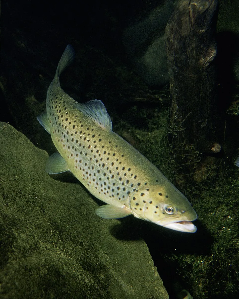
Brown Trout
Salmo trutta36,727 records © Eric Engbretson for U.S. Fish and Wildlife Service · Public domain
France · Terrestrial
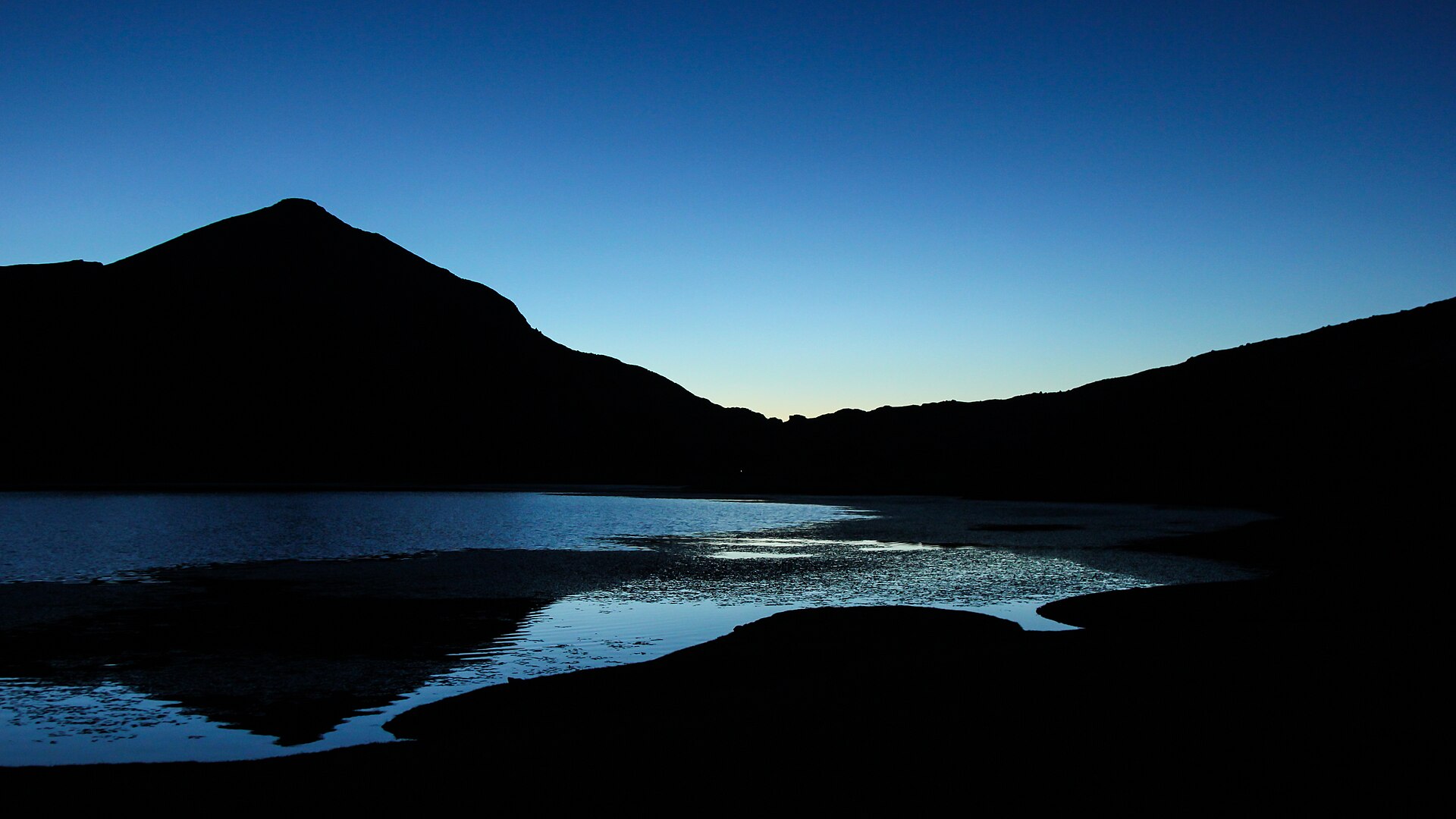
Regional nature park of 449,474 hectares in France, established in 1972.
Regional nature park of 449,474 hectares in France, established in 1972.
Corsica Regional Natural Park is a regional nature park in France (Europe). It is a predominantly terrestrial area. Established in 1972, it covers about 449,474 hectares. The site is managed by Office de l'environnement de la Corse.
Protected as a regional nature park. International labels and designations: UNESCO World Heritage (“Gulf of Porto: Calanche of Piana, Gulf of Girolata, Scandola Reserve”), Ramsar site (“tourbière de Moltifao”) and Natura 2000 network (31 sites). Key dates: established in 1972, World Heritage listing in 1983, first Natura 2000 site under the Birds Directive in 2003, first Natura 2000 site under the Habitats Directive in 2006 and Ramsar Site in 2011.
Sources: Wikidata (CC0) for establishment and international labels; EEA Natura 2000 database (CC-BY 4.0) for site designation dates.
In France (Europe). Representative point: 42.0394° N, 9.0130° E.
About 449,474 hectares (4,495 km²). It is the 2nd largest of the 59 regional parks in France covered by Parkavela.
In 1972.
A terrestrial area, with forests, mountains and coasts.
According to the BRGM's simplified lithological map, the bedrock consists mainly of granites (69% of sampled points) and basalts and rhyolites (13%). These are mostly igneous rocks.
Monte Cinto, at 2,706 m (OpenStreetMap).
Monte Cinto (2,706 m), Capu Ciuntrone (2,660 m), Monte Rotondo (2,622 m), Pointe des Éboulis (2,607 m) and Punta Mufrena (2,590 m) (OpenStreetMap).
UNESCO World Heritage (“Gulf of Porto: Calanche of Piana, Gulf of Girolata, Scandola Reserve”), Ramsar site (“tourbière de Moltifao”) and Natura 2000 network (31 sites).
Best time to visit: from May to October, with average temperatures of 10 to 19 °C and moderate rainfall.
179 viewpoints, 58 waterfalls, 53 lakes and ponds, 3 natural arches, 30 caves and 1 bird hide, including Monte Senino (618 m), Cascade d'Undella, Lac de Bastani (2,092 m) and Arche de Corte (OpenStreetMap).
49 mountain huts and 92 campsites, including Refuge d'Usciolu (1,750 m), AS Niolu and Bergerie de Tilarba (en ruine) (1,623 m) (OpenStreetMap).
Yes. According to the French Ministry of Culture's Mérimée database, 88 historic monuments stand within the boundary, 46 of them with the highest level of protection (classé). For example: “Cavités de Laninca” in Lano, “Chapelle Saint-Georges” in Valle-d'Orezza and “Monument torréen de Foce” in Argiusta-Moriccio.
58 monitored bathing sites lie in or within 1 km of the site; official 2025 classification: 25 excellent, 14 good, 5 sufficient and 13 poor (European Environment Agency). Swimming is only permitted at the sites and times authorised locally.
Nearest towns of over 50,000 people, as the crow flies: Ajaccio (14 km) and Olbia (76 km). Nearest airport: Calvi – Sainte-Catherine (CLY), less than 1 km away.
Carbuccia railway station lies within the site.
Office de Tourisme de l'Alta Rocca, Office de Tourisme de Piana and Sites archéologiques cucuruzzu capula san larenzu.
Yes. Waymarked hiking routes listed in OpenStreetMap: 165, including GR 20, Mare à Mare Nord Variante, Mare è Monti Nord Principal and Mare à Mare Nord Principal. The GR 20 Principale route runs for about 184 km through the site, with some 8,450 m of ascent on its longest section.
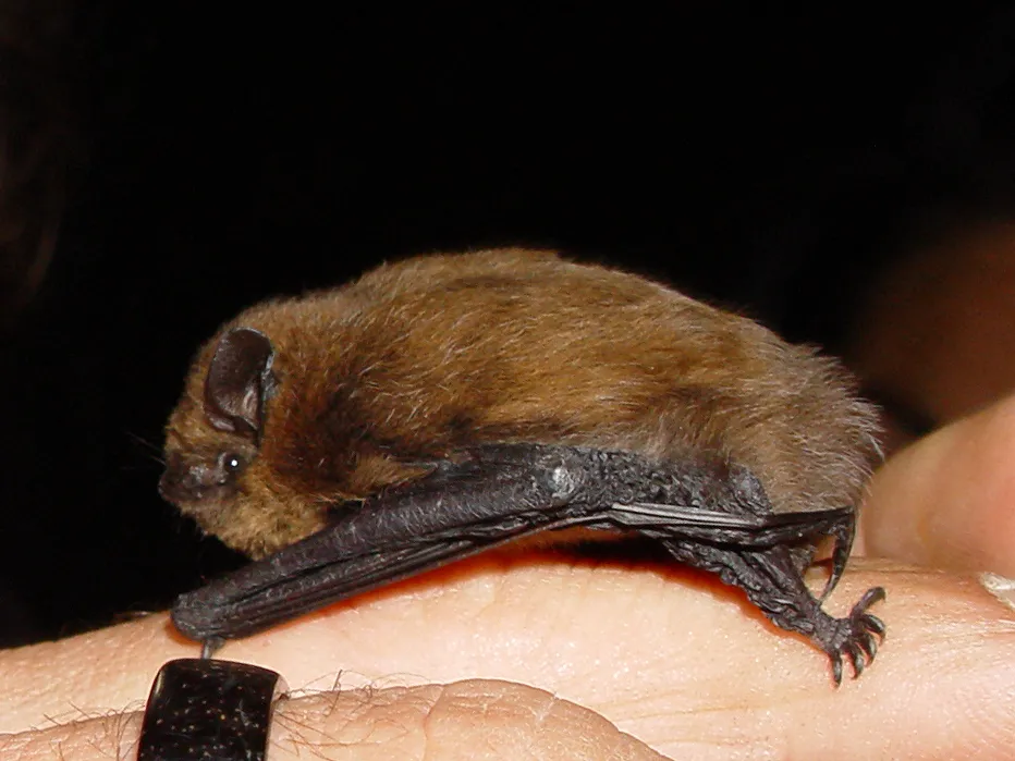
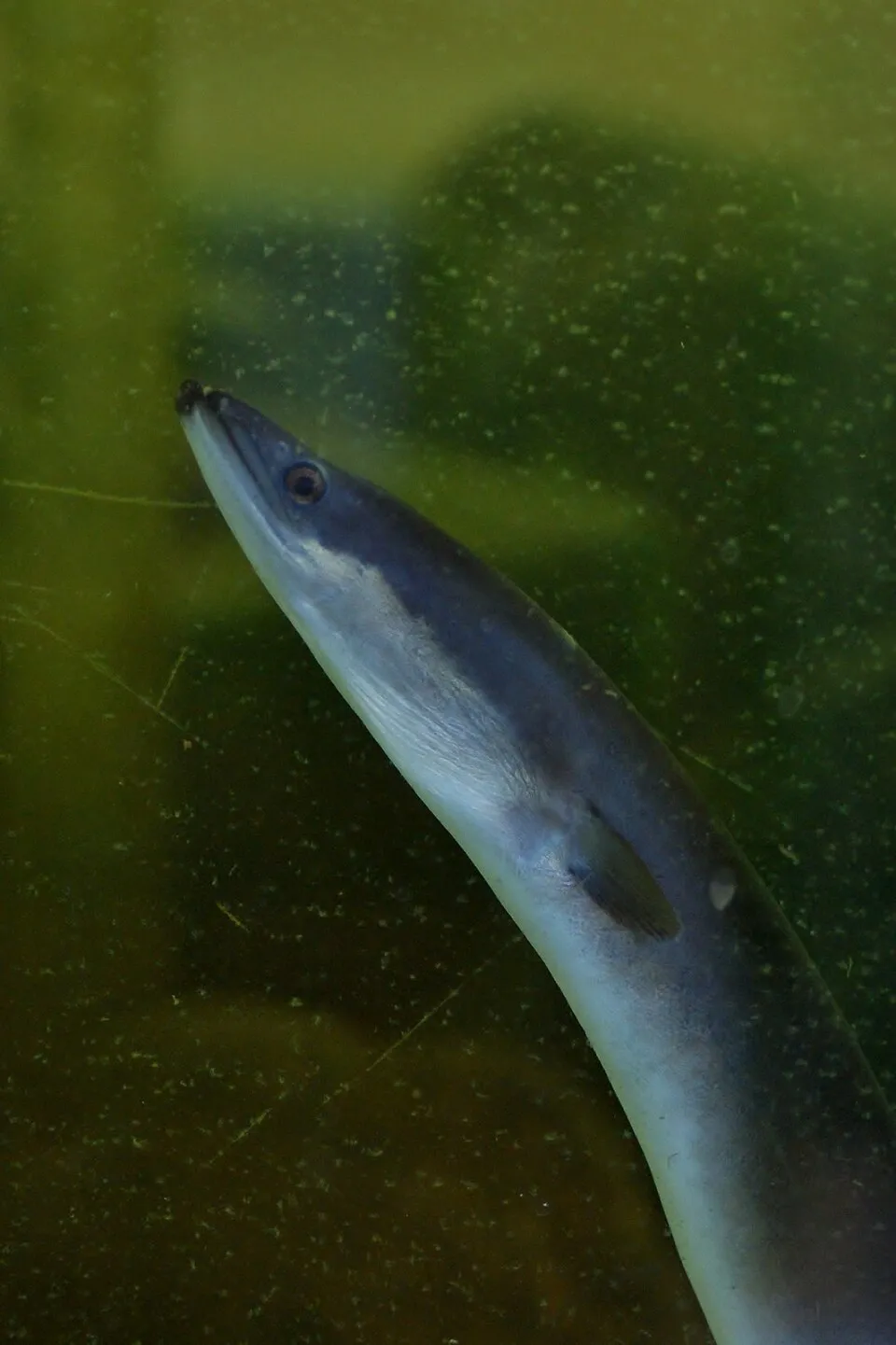
Among the species most often recorded on GBIF are Salmo trutta (Brown Trout), Pipistrellus pipistrellus (Common pipistrelle), Myotis capaccinii (Long-fingered bat) and Anguilla anguilla (European eel).
Office de l'environnement de la Corse.
© OpenStreetMap
Download the boundary: GeoJSON · GPX Boundary © OpenStreetMap contributors (ODbL).
The representative point of the site lies at around 1,370 m above sea level. Over the 1996–2025 period, the mean annual temperature is about 9.2 °C and total precipitation reaches roughly 926 mm per year. The warmest month is usually August, the coolest January, and the wettest November. According to the BRGM's simplified lithological map, the bedrock consists mainly of granites (69% of sampled points) and basalts and rhyolites (13%). These are mostly igneous rocks. The site contains 4 lakes larger than 10 ha, totalling 1.4 km² of water; the largest, lac de Calacuccia, covers 86 ha (HydroLAKES). lac de Capitello (5.5 ha) is 42 m deep (Wikidata).
Terrain: Mapzen Terrain Tiles (SRTM, USGS) · Lakes: HydroLAKES (Messager et al. 2016, hydrosheds.org, CC BY 4.0) · depths: Wikidata (CC0)
share of the site in each elevation band (smoothed terrain model: summits are rounded off) · Terrain: Mapzen Terrain Tiles (SRTM, USGS)
Igneous rocks 81 % · Metamorphic rocks 13 % · Sedimentary rocks 6 %
Source: BRGM, simplified lithological map at 1:1,000,000 (Licence Ouverte), 16 points sampled within the boundary.
Data © OpenStreetMap contributors (ODbL)
● Mean temperature (°C) · ▮ Precipitation (mm)
Source: Copernicus ERA5-Land (C3S, doi:10.24381/cds.68d2bb30), monthly averages 1996–2025 interpolated to the representative point, temperatures adjusted for elevation.
Contains modified Copernicus Climate Change Service information 2026. Neither the European Commission nor ECMWF is responsible for any use that may be made of the Copernicus information or data it contains.
average share of the site under snow · snowiest parts · ≈ 10 days a year
Snow cover: MODIS/Terra MOD10CM v61 (Hall & Riggs, 2021, NASA NSIDC DAAC, doi:10.5067/MODIS/MOD10CM.061), imagery from NASA GIBS (ESDIS); 2015–2025 average, grid of about 5 km.
According to CORINE Land Cover (2018), the site is mainly made up of forests (44%), Mediterranean scrub (13%) and sparsely vegetated land (13%). Woodland is mostly broadleaved. The site borders the coast. Elevation ranges from sea level to 2,706 m (highest point: Monte Cinto). Median elevation is 768 m, and 12% of the site lies above 1,500 m (SRTM elevation model). The terrain is steep: 12% of slopes exceed 30° (mean slope 19°). The 31 Natura 2000 sites overlapping the area list 45 habitats of European interest (9 priority), the most extensive being endemic oro-Mediterranean heaths with gorse, (Sub-) Mediterranean pine forests with endemic black pines and Quercus ilex and Quercus rotundifolia forests.
Based on occurrences aggregated by GBIF, several species are regularly recorded within the site. Among the most frequent are Salmo trutta (Brown Trout), Pipistrellus pipistrellus (Common pipistrelle), Myotis capaccinii (Long-fingered bat) and Anguilla anguilla (European eel). The full list of documented taxa is shown below. The overlapping Natura 2000 sites list 90 species of European interest: 17 birds, 30 mammals, 11 reptiles, 7 amphibians, 3 fish, 10 invertebrates and 12 plants.
From the official forms of the 31 Natura 2000 sites overlapping the area (areas reported for each whole site).
and 37 more
Goshawk (Accipiter gentilis arrigonii) resident passage, Tawny Pipit (Anthus campestris) breeding, Golden Eagle (Aquila chrysaetos) resident, Scopoli's Shearwater (Calonectris diomedea) passage breeding, European Nightjar (Caprimulgus europaeus) breeding, Peregrine Falcon (Falco peregrinus) resident, Bearded vulture (Gypaetus barbatus) resident, Red-backed Shrike (Lanius collurio) breeding, Audouin's Gull (Larus audouinii) passage wintering breeding, Woodlark (Lullula arborea) breeding resident, Red Kite (Milvus milvus) wintering passage, Osprey (Pandion haliaetus) wintering passage breeding and 5 more
Barbastelle (Barbastella barbastellus), Corsican red deer (Cervus elaphus corsicanus), Eptesicus serotine, Serotine bat (Eptesicus serotinus), European wildcat (Felis silvestris), Savi's Pipistrelle (Hypsugo savii), Savi's Pipistrelle. (Hypsugo savii caucasicus), Common bent-wing bat (Miniopterus schreibersii), Bechstein's bat (Myotis bechsteinii), Long-fingered bat (Myotis capaccinii), Daubenton's bat (Myotis daubentonii), Geoffroy's bat (Myotis emarginatus) and 18 more
Fitzinger's Algyroides (Algyroides fitzingeri), Bedriaga's Rock Lizard (Archaeolacerta bedriagae), Dark green snake (Coluber viridiflavus), European Pond Turtle (Emys orbicularis), European leaf-toed gecko (Euleptes europaea), Western Whip Snake (Hierophis viridiflavus), Natrix natrix corsa, Italian Wall Lizard (Podarcis sicula), Italian wall lizard (Podarcis siculus), Tyrrhenian Wall Lizard (Podarcis tiliguerta), Hermann's tortoise (Testudo hermanni)
European green toad (Bufo viridis), Corsican painted frog (Discoglossus montalentii), Tyrrhenian painted frog (Discoglossus sardus), Euproctus maontanus, Corsican brook salamander (Euproctus montanus), Hyla arborea sarda, Sardinian tree frog (Hyla sarda)
Mediterranean killifish (Aphanius fasciatus), Sicilian Trout (Salmo cetti), Trout (Salmo macrostigma)
Corsican fritillary (Argynnis elisa), White-clawed Crayfish (Austropotamobius pallipes), Greater Capricorn Beetle (Cerambyx cerdo), Corsican Fritillary (Fabriciana elisa), Fisher's estuarine moth (Gortyna borelii lunata), Corsican Swallowtail (Papilio hospiton), Ribbed Mediterranean limpet (Patella ferruginea), Fan Mussel (Pinna nobilis), Rosalia longicorn (Rosalia alpina), Mediterranean Slipper Lobster (Scyllarides latus)
Aconitum corsicum, Armeria soleirolii, Astragalus alopecurus, Little grapefern (Botrychium simplex), Brassica insularis, Buxbaumia moss (Buxbaumia viridis), Euphrasia nana, Gentiana lutea subsp. lutea, Herniaria litardierei, Seashore mallow (Kosteletzkya pentacarpos), Fen orchid (Liparis loeselii), Summer lady's-tresses (Spiranthes aestivalis)
Source: Natura 2000 standard data forms (EEA, CC-BY 4.0). Not exhaustive: sensitive species are not published.
Fish
36,727 records © Eric Engbretson for U.S. Fish and Wildlife Service · Public domain

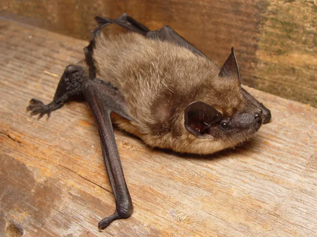
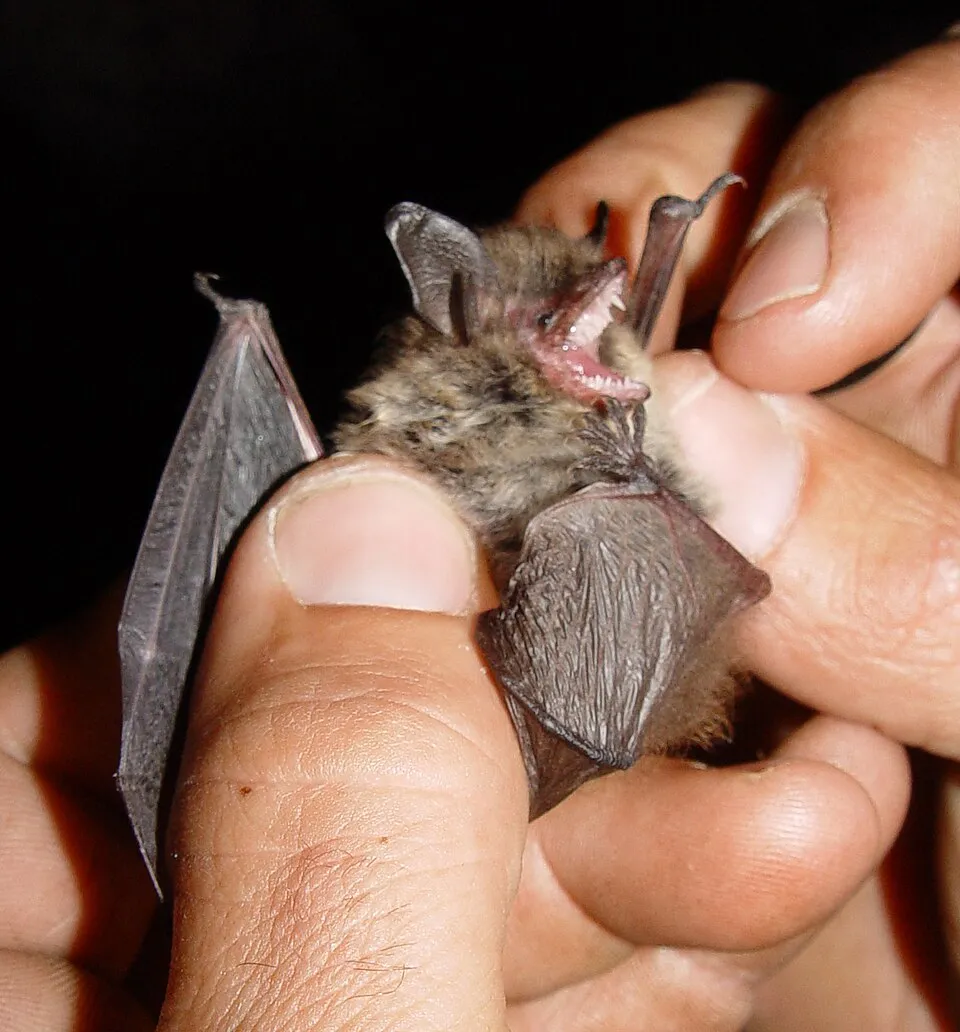
Occurrences documented via GBIF; they are neither an exhaustive inventory nor proof of current presence.
Records: GBIF.org (CC-BY). Names: Wikidata (CC0), GBIF. Photos: Wikimedia Commons.
The primary purpose of the site is to preserve its natural habitats and the biodiversity they support. The species recorded (Biodiversity tab) reflect its ecological value. The designations it holds frame its management and the control of land use.
According to Global Forest Change data (University of Maryland, Global Forest Watch), about 13,780 ha of tree cover were lost within the boundary between 2001 and 2023 (3% of its area), peaking in 2010 and 2020. These losses include logging, storms and fires, and do not account for regrowth. According to the European CORINE Land Cover inventory (Copernicus), land cover changed on about 7,840 ha of the site between 1990 and 2018 (2% of its area): open natural land shrank by 2,371 ha, mostly giving way to forest. Since 2016, the European EFFIS system (Copernicus) has mapped 159 fires here, burning about 9,777 ha within the boundary; the largest, in February 2019 (near Calenzana), covered 1,158 ha. At night, 1% of the area gives off artificial light detectable from space (NASA VIIRS Black Marble composite, 2016). According to the Natura 2000 forms, of 37 assessed habitats of European interest, 22 are in excellent condition and 5 in average or reduced condition. According to the Water Framework Directive assessment (2022 river basin management plans, data 2012–2017), 97% of the 1,581 km of rivers assessed within the site are in good or high ecological status. Other assessed water bodies: lakes, 3 of 3 in good ecological status or better; lagoons and estuaries, 0 of 1 in good ecological status or better; coastal waters, 3 of 3 in good ecological status or better. Since 2000, 66 invasive alien species have been recorded within the site (GBIF observations), 13 of them listed as of Union concern under EU Regulation 1143/2014. Among them: Ailanthus altissima (Tree-of-heaven), Gambusia affinis (Mosquitofish) and Procambarus clarkii (Red swamp crayfish).
13,781 ha
2001–2023 · 3% of the area
9,777 ha
burned within the boundary (159 mapped fires)
1%
of the area gives off artificial light visible from space
< 1%
buildings, business areas, roads, quarries · farmland 4%
7,840 ha
changed cover, 1990–2018 · CORINE · 2% of the area
97%
of the 1,581 km of assessed rivers in good or high ecological status · WFD 2022
Lakes: 3 of 3 good or better
Lagoons and estuaries: 0 of 1 good or better
Coastal waters: 3 of 3 good or better
assessments 2012–2017
66
incl. 13 of EU concern · since 2000
 Tree-of-heavenEU
 MosquitofishEU
 Red swamp crayfishEU
 Japanese KnotweedEU
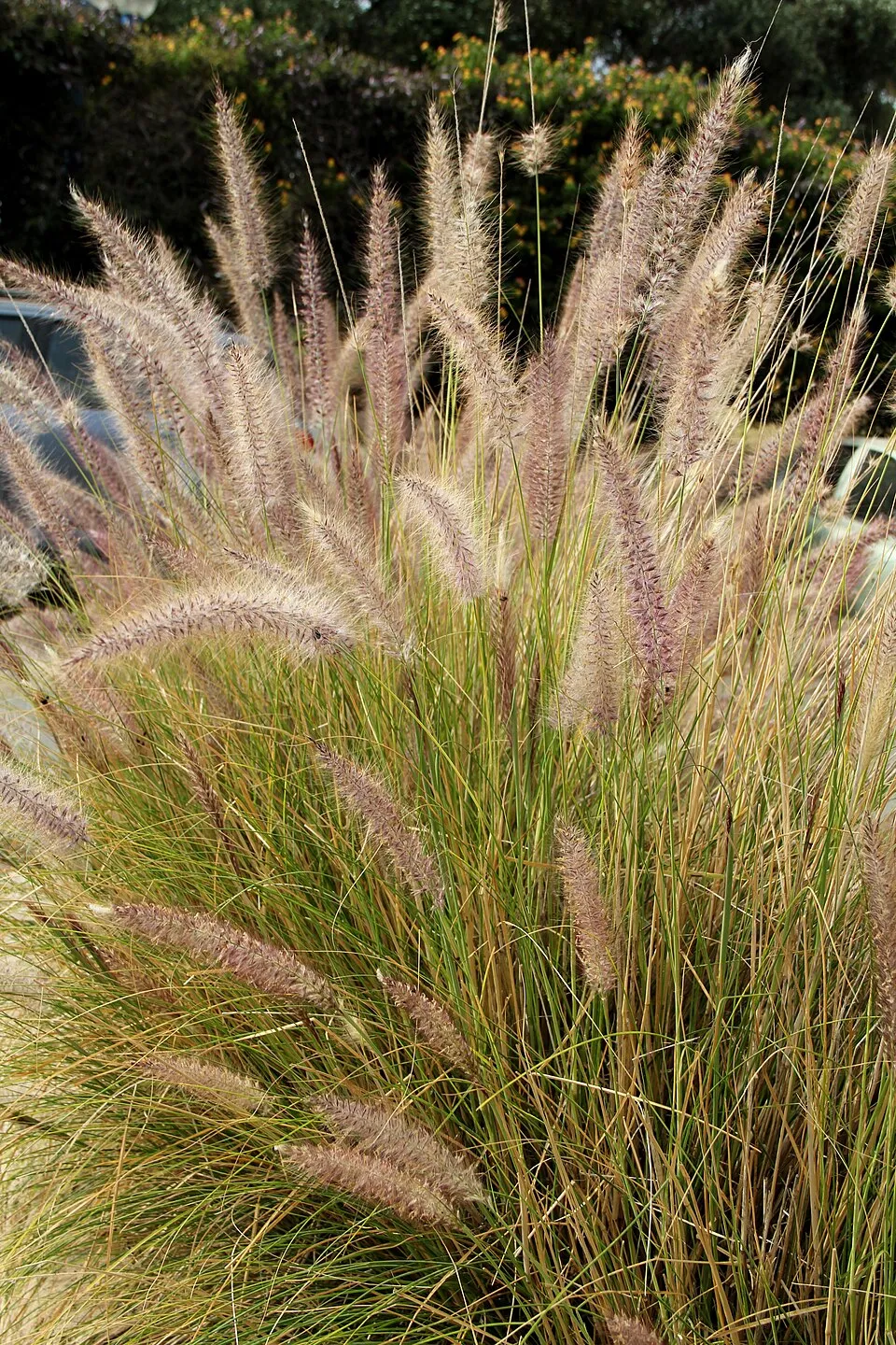 Crimson FountaingrassEU
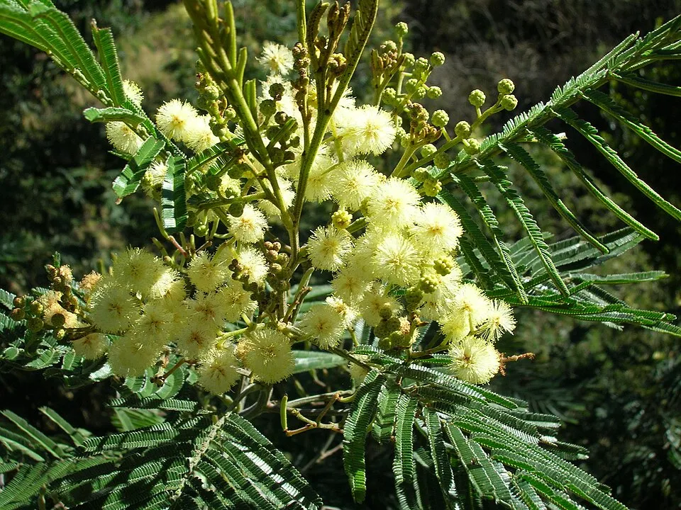 Black wattleEU
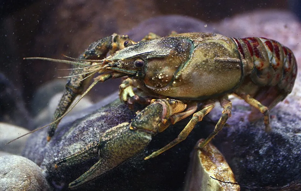 Spinycheek crayfishEU
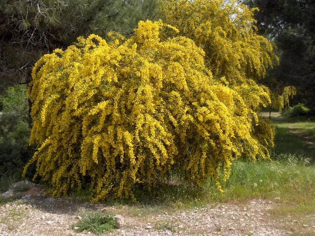 Orange wattleEU
Photos: Tree-of-heaven © Darkone · CC BY-SA 2.5; Mosquitofish © NOZO · CC BY-SA 3.0; Red swamp crayfish © MikeMurphy · Public domain; Japanese Knotweed © W.carter · CC0-1.0; Crimson Fountaingrass © Lazaregagnidze · CC BY-SA 4.0; Black wattle © Dcarlson · CC BY 2.5; Spinycheek crayfish © Astacoides · CC BY-SA 3.0; Orange wattle © JoJan · CC BY-SA 3.0
Sources: Global Forest Change (Hansen et al., University of Maryland, via Global Forest Watch, CC-BY 4.0); EFFIS, European Commission / Copernicus; NASA Black Marble 2016 (public domain); CORINE Land Cover 2018 (Copernicus) or MODIS.
CORINE Land Cover Change 1990–2018: generated using European Union's Copernicus Land Monitoring Service information (EEA), aggregated by Parkavela; DOI 10.2909/f30f1000-7cf8-43bb-872c-5eb093911b24.
Ecological status of water bodies: European Environment Agency, WISE – Water Framework Directive, 3rd river basin management plans (2022), CC BY 4.0. Official national classification, not comparable between countries.
Invasive alien species: Global Register of Introduced and Invasive Species (ISSG, CC BY 4.0); Union list, Regulation (EU) 1143/2014 (INBO, CC0); GBIF.org records (CC0 / CC BY 4.0), at least 2 per species.
179 viewpoints · 58 waterfalls · 53 lakes and ponds · 3 natural arches · 30 caves · 1 bird hide
49 mountain huts · 92 campsites
165 waymarked routes listed, including:
+ 4 local loops
Signed cycle routes: this does not mean that cycling is allowed on footpaths.
Reported by OpenStreetMap contributors (ODbL); check with the park before visiting.
Data © OpenStreetMap contributors (ODbL) · Wikidata (CC0)
Routes © OpenStreetMap contributors (ODbL), via Waymarked Trails
183.5 km within the site ↗ 8,449 m↘ 6,899 m 279–2,577 m
up to T4 · alpine hiking
60.4 km within the site ↗ 2,529 m↘ 2,408 m 536–1,506 m
58.4 km within the site ↗ 2,581 m↘ 2,922 m 73–1,176 m
Tracks © OpenStreetMap contributors (ODbL), clipped to the boundary; elevation gain and profiles computed on the longest section from Mapzen Terrain Tiles (≈ 30 m), indicative only. Indicative difficulty (SAC scale, OpenStreetMap, via Waymarked Trails): check with the park.
58 monitored bathing sites in or within 1 km of the site · 2025 classification
and 48 more
Source: European Environment Agency, official bathing water classification (Directive 2006/7/EC, CC-BY 4.0). Swimming is only permitted at the sites and times authorised locally.
Carbuccia railway station lies within the site. Nearest towns of over 50,000 people, as the crow flies: Ajaccio (14 km) and Olbia (76 km). Nearest airport: Calvi – Sainte-Catherine (CLY), less than 1 km away. About 220,000 people live within 20 km of the site boundary, 110,000 of them within 10 km; some 45,000 people are estimated to live inside (GHSL estimate, 2020). This population has grown by about 32% since 2000. Visitor information on site: Office de Tourisme de l'Alta Rocca, Office de Tourisme de Piana and Sites archéologiques cucuruzzu capula san larenzu. Waymarked hiking routes listed in OpenStreetMap: 165, including GR 20, Mare à Mare Nord Variante, Mare è Monti Nord Principal and Mare à Mare Nord Principal. A signed cycle route crosses the site: “GT20 Grande Traversée 20” (OpenStreetMap). OpenStreetMap contributors list one wheelchair-accessible place: Col de Bavella; check with the park before visiting. To see: 179 viewpoints, 58 waterfalls, 53 lakes and ponds, 3 natural arches, 30 caves and 1 bird hide, including Monte Senino (618 m), Cascade d'Undella, Lac de Bastani (2,092 m) and Arche de Corte. Where to stay: 49 mountain huts and 92 campsites, including Refuge d'Usciolu (1,750 m), AS Niolu and Bergerie de Tilarba (en ruine) (1,623 m). To plan a visit (access, opening periods, visitor rules), it is best to consult the official information from the managing body (Office de l'environnement de la Corse) and the official website listed in this page's sources.
Source: OpenStreetMap (ODbL), Wikidata (CC0), October 2026.
According to the French Ministry of Culture's Mérimée database, 88 historic monuments stand within the boundary, 46 of them with the highest level of protection (classé). Among them are 53 religious buildings, 15 houses and civic buildings and 8 bridges, lighthouses, mills and working buildings. Notable classé monuments include “Cavités de Laninca” in Lano, “Chapelle Saint-Georges” in Valle-d'Orezza and “Monument torréen de Foce” in Argiusta-Moriccio.
and 80 more
Source: Mérimée database, French Ministry of Culture (Licence Ouverte 2.0). Each record links to the Plateforme ouverte du patrimoine (POP).
Best time to visit: from May to October, with average temperatures of 10 to 19 °C and moderate rainfall. These averages apply to the site's representative point (1,370 m); higher up it is markedly cooler and snow lasts longer. Snow only makes brief appearances in winter (about 10 days a year on average, MODIS satellites 2015–2025). Day length ranges from about 9 h 08 min in December to 15 h 13 min in June. Wildlife records published on GBIF peak for birds (May), plants (May and June), butterflies and moths (June and July), dragonflies (June and July) and mammals (August). These peaks also reflect when observers are most active.
Source: Copernicus ERA5-Land (C3S), monthly averages 1996–2025 at the representative point, temperatures adjusted for elevation.
Contains modified Copernicus Climate Change Service information 2026. Neither the European Commission nor ECMWF is responsible for any use that may be made of the Copernicus information or data it contains.
Monthly records published on GBIF (CC-BY), relative to the busiest month; also reflects observer activity.
Data © OpenStreetMap contributors (ODbL), Wikidata (CC0) and the sources cited.