Bird
Hooded Crow
Corvus cornix543 records © Ricardo Tulio Gandelman from Rio de Janeiro, Brazil · CC BY 2.0
Italy · Terrestrial
Regional nature park of 23,115 hectares in Italy, established in 1979.
Regional nature park of 23,115 hectares in Italy, established in 1979.
Migliarino, San Rossore and Massaciuccoli Nature Park is a regional nature park in Italy (Europe). It is a predominantly terrestrial area. Established in 1979, it covers about 23,115 hectares.
Protected as a regional nature park. International labels and designations: Ramsar site (“Lago di Massaciuccoli”) and Natura 2000 network (4 sites). Key dates: established in 1979 and first Natura 2000 site under the Birds Directive in 1995.
Sources: Wikidata (CC0) for establishment and international labels; EEA Natura 2000 database (CC-BY 4.0) for site designation dates.
In Italy (Europe). Representative point: 43.7237° N, 10.3399° E.
About 23,115 hectares (231 km²). It is the 22nd largest of the 128 regional parks in Italy covered by Parkavela.
In 1979.
A terrestrial area, with forests and coasts.
According to the European 1:1 million geological map (EGDI), the bedrock consists mainly of unconsolidated deposits (100% of sampled points). These are mostly sedimentary rocks. The geological units date mainly from the Quaternary (100% of sampled points).
Ramsar site (“Lago di Massaciuccoli”) and Natura 2000 network (4 sites).
Best time to visit: from April to August, with average temperatures of 13 to 25 °C and moderate rainfall.
1 viewpoint, 4 lakes and ponds and 8 bird hides, including Idrovora di Marina di Pisa, Osservatorio Faunistico Sabrina Bulleri, Laghetto della Gusciana and Lago di Massaciuccoli (OpenStreetMap).
4 campsites, including Campeggio Bosco Verde, Camping Burlamacco and Marina di Pisa - Viale d’Annunzio (OpenStreetMap).
Yes. According to Wikidata, 4 monuments protected as Italian national cultural heritage stand within the boundary. For example: “Church of Saint Peter a Grado” in Pisa, “Forte di Bocca di Serchio” in San Giuliano Terme and “Viale dei Pini” in Vecchiano.
14 monitored bathing sites lie in or within 1 km of the site; official 2025 classification: 13 excellent and 1 good (European Environment Agency). Swimming is only permitted at the sites and times authorised locally.
Nearest towns of over 50,000 people, as the crow flies: Viareggio (1 km) and Pisa (4 km). Nearest airport: Pisa International Airport 'Galileo Galilei' (PSA), about 3 km away.
The nearest railway station is Torre del Lago Puccini, less than 1 km from the site boundary.
Ufficio Informazioni, Centro Visite San Rossore and Centro Visitatori Oasi Lipu Massaciuccoli.
Yes. Waymarked hiking routes listed in OpenStreetMap: 22, including Il Cammino di San Jacopo. The “Il Cammino di San Jacopo - Tappa 6” route runs for about 5 km through the site.
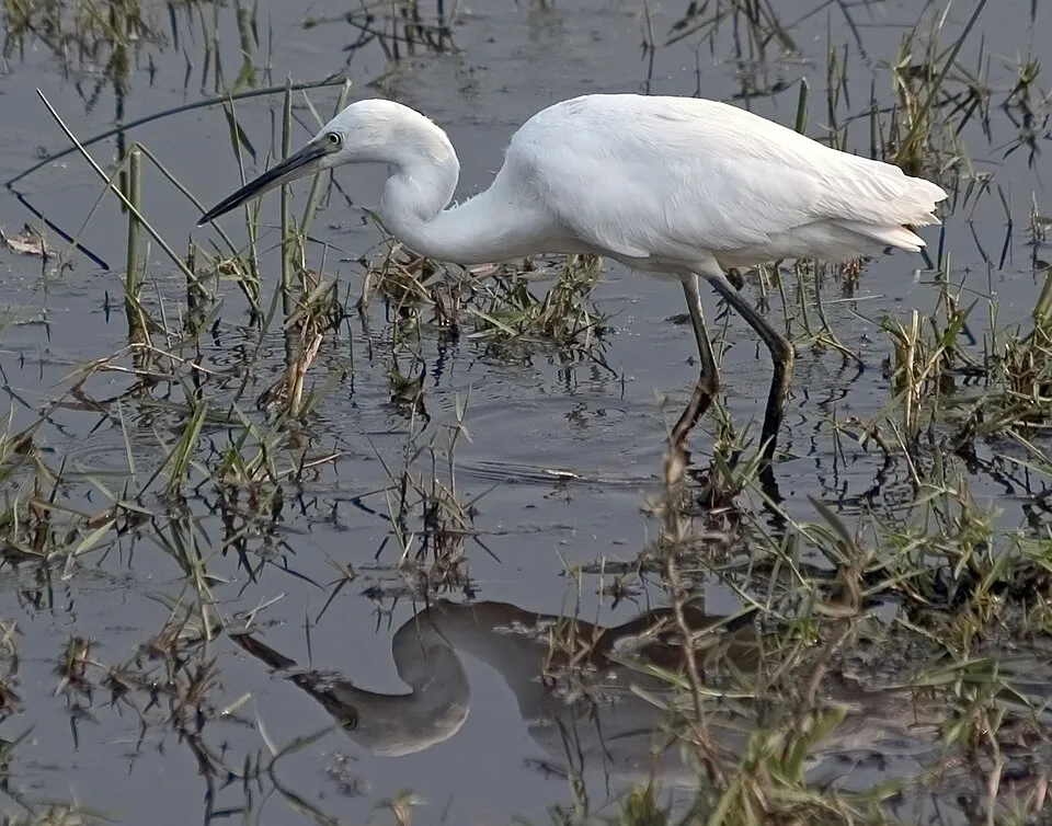
Among the species most often recorded on GBIF are Corvus cornix (Hooded Crow), Larus michahellis (Yellow-legged Gull), Ardea cinerea (Grey Heron) and Egretta garzetta (Little Egret).
© OpenStreetMap
Download the boundary: GeoJSON · GPX Boundary © OpenStreetMap contributors (ODbL).
The representative point of the site lies at around 4 m above sea level. Over the 1996–2025 period, the mean annual temperature is about 15.4 °C and total precipitation reaches roughly 1,093 mm per year. The warmest month is usually August, the coolest January, and the wettest November. According to the European 1:1 million geological map (EGDI), the bedrock consists mainly of unconsolidated deposits (100% of sampled points). These are mostly sedimentary rocks. The geological units date mainly from the Quaternary (100% of sampled points). The site contains 4 lakes larger than 10 ha, totalling 7.8 km² of water; the largest, lago di Massaciuccoli, covers 7.3 km² (HydroLAKES). lago di Massaciuccoli (690 ha) is 2.9 m deep (Wikidata).
Lakes: HydroLAKES (Messager et al. 2016, hydrosheds.org, CC BY 4.0) · depths: Wikidata (CC0)
Sedimentary rocks 100 % · Main age: Quaternary (100%)
Source: EGDI 1:1M geological map (EuroGeoSurveys and national geological surveys), CC BY 4.0 · 16 sampled points within the site.
● Mean temperature (°C) · ▮ Precipitation (mm)
Source: Copernicus ERA5-Land (C3S, doi:10.24381/cds.68d2bb30), monthly averages 1996–2025 interpolated to the representative point, temperatures adjusted for elevation.
Contains modified Copernicus Climate Change Service information 2026. Neither the European Commission nor ECMWF is responsible for any use that may be made of the Copernicus information or data it contains.
According to CORINE Land Cover (2018), the site is mainly made up of forests (42%), farmland (21%) and built-up or developed land (10%). Woodland mixes broadleaved and coniferous trees. The site borders the coast. The land is almost flat (mean slope under 2°). The 4 Natura 2000 sites overlapping the area list 29 habitats of European interest (7 priority), the most extensive being wooded dunes with Pinus pinea and/or Pinus pinaster, riparian mixed forests of Quercus robur, Ulmus laevis and Ulmus minor, Fraxinus excelsior or Fraxinus angustifolia, along the great rivers (Ulmenion minoris) and Quercus ilex and Quercus rotundifolia forests.
Based on occurrences aggregated by GBIF, several species are regularly recorded within the site. Among the most frequent are Corvus cornix (Hooded Crow), Larus michahellis (Yellow-legged Gull), Ardea cinerea (Grey Heron) and Egretta garzetta (Little Egret). The full list of documented taxa is shown below. The overlapping Natura 2000 sites list 141 species of European interest: 92 birds, 21 mammals, 7 reptiles, 5 amphibians, 4 fish, 8 invertebrates and 4 plants.
From the official forms of the 4 Natura 2000 sites overlapping the area (areas reported for each whole site).
and 21 more
Moustached Warbler (Acrocephalus melanopogon) passage breeding wintering, Aquatic warbler (Acrocephalus paludicola) passage, Common Kingfisher (Alcedo atthis) breeding wintering passage, Northern Pintail (Anas acuta) passage wintering, Eurasian Teal (Anas crecca) wintering passage, Mallard (Anas platyrhynchos) passage wintering breeding, Greylag Goose (Anser anser) passage wintering, Tawny Pipit (Anthus campestris) passage, Great Egret (Ardea alba) wintering passage, Purple Heron (Ardea purpurea) passage breeding, Squacco Heron (Ardeola ralloides) passage, Short-eared Owl (Asio flammeus) passage wintering and 80 more
Barbastelle (Barbastella barbastellus), Grey wolf (Canis lupus), Serotine bat (Eptesicus serotinus), Crested porcupine (Hystrix cristata), European pine marten (Martes martes), Common bent-wing bat (Miniopterus schreibersii), Hazel dormouse (Muscardinus avellanarius), Western Polecat (Mustela putorius), Lesser mouse-eared myotis (Myotis blythii), Daubenton's bat (Myotis daubentonii), Geoffroy's bat (Myotis emarginatus), Greater mouse-eared bat (Myotis myotis) and 9 more
Smooth snake (Coronella austriaca), European Pond Turtle (Emys orbicularis), Western Whip Snake (Hierophis viridiflavus), Dice snake (Natrix tessellata), Common wall lizard (Podarcis muralis), Italian wall lizard (Podarcis siculus), Aesculapian Snake (Zamenis longissimus)
Green Toad (Bufotes viridis complex), Common tree frog (Hyla arborea), Edible frog (Pelophylax esculentus), Agile frog (Rana dalmatina), Italian crested newt (Triturus carnifex)
Twait shad (Alosa fallax), Mediterranean killifish (Aphanius fasciatus), Italian Spined Loach (Cobitis bilineata), Sea lamprey (Petromyzon marinus)
Greater Capricorn Beetle (Cerambyx cerdo), Jersey Tiger (Euplagia quadripunctaria), Bladetail (Lindenia tetraphylla), Stag beetle (Lucanus cervus), Large copper (Lycaena dispar), Unio elongatulus, Narrow-mouthed whorl snail (Vertigo angustior), Desmoulin's whorl snail (Vertigo moulinsiana)
Marsh gladiolus (Gladiolus palustris), Water Shamrock (Marsilea quadrifolia), Sphagnum Mosses (Sphagnum spp.), Summer lady's-tresses (Spiranthes aestivalis)
Source: Natura 2000 standard data forms (EEA, CC-BY 4.0). Not exhaustive: sensitive species are not published.
Bird
543 records © Ricardo Tulio Gandelman from Rio de Janeiro, Brazil · CC BY 2.0


Bird
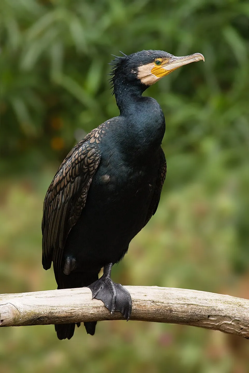
426 records © JJ Harrison (https://www.jjharrison.com.au/) · CC BY-SA 3.0

Occurrences documented via GBIF; they are neither an exhaustive inventory nor proof of current presence.
Records: GBIF.org (CC-BY). Names: Wikidata (CC0), GBIF. Photos: Wikimedia Commons.
The primary purpose of the site is to preserve its natural habitats and the biodiversity they support. The species recorded (Biodiversity tab) reflect its ecological value. The designations it holds frame its management and the control of land use.
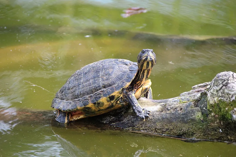
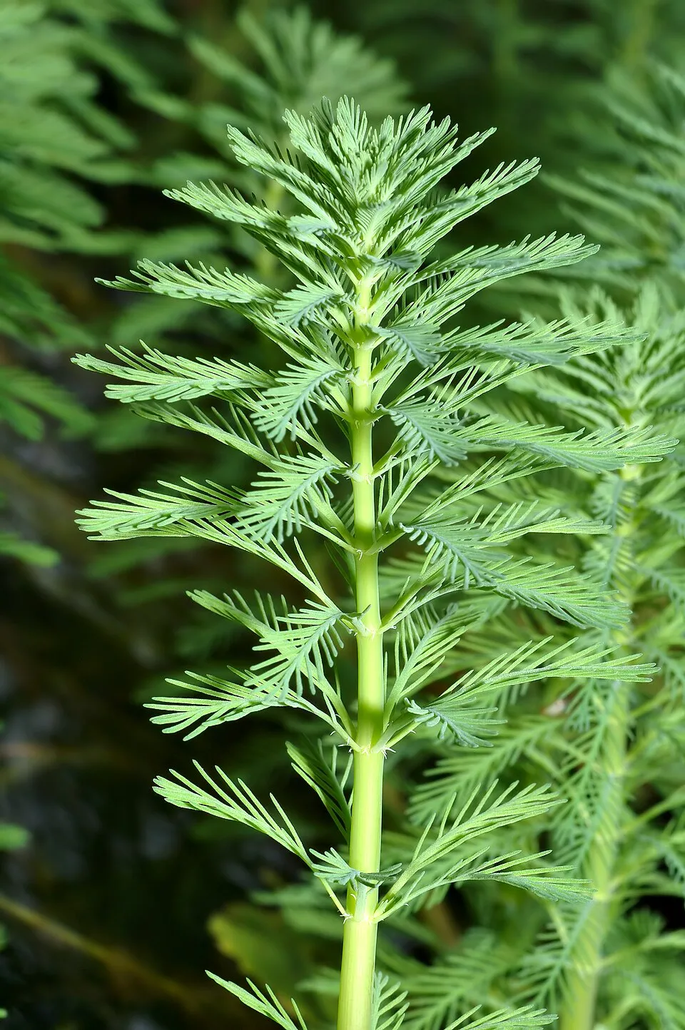
According to Global Forest Change data (University of Maryland, Global Forest Watch), about 1,540 ha of tree cover were lost within the boundary between 2001 and 2023 (7% of its area), peaking in 2012. These losses include logging, storms and fires, and do not account for regrowth. According to the European CORINE Land Cover inventory (Copernicus), land cover changed on about 381 ha of the site between 1990 and 2018 (3% of its area): forest shrank by 343 ha, mostly giving way to open natural land, while open natural land grew by 317 ha, mostly at the expense of forest. Forest felling and regrowth add about 530 ha in total over the period. Since 2016, the European EFFIS system (Copernicus) has mapped 2 fires here, burning about 26 ha within the boundary; the largest, in August 2024 (near Massarosa), covered 18 ha. At night, 65% of the area gives off artificial light detectable from space (NASA VIIRS Black Marble composite, 2016). Built-up and developed land (buildings, business areas, roads, quarries) covers 10% of the area, and farmland 21% (CORINE Land Cover). According to the Natura 2000 forms, of 24 assessed habitats of European interest, 2 are in excellent condition and 2 in average or reduced condition. According to the Water Framework Directive assessment (2022 river basin management plans, data 2016–2020), only 29% of the 31 km of rivers assessed within the site are in good or high ecological potential; the others mostly have bad ecological potential. Other assessed water bodies: lakes, 0 of 1 in good ecological status or better; lagoons and estuaries, 0 of 2 in good ecological status or better; coastal waters, 0 of 2 in good ecological status or better. Since 2000, 31 invasive alien species have been recorded within the site (GBIF observations), 6 of them listed as of Union concern under EU Regulation 1143/2014. Among them: Threskiornis aethiopicus (African Sacred Ibis), Procambarus clarkii (Red swamp crayfish) and Trachemys scripta (Pond slider).
1,535 ha
2001–2023 · 7% of the area
26 ha
burned within the boundary (2 mapped fires)
65%
of the area gives off artificial light visible from space
10%
buildings, business areas, roads, quarries · farmland 21%
381 ha
changed cover, 1990–2018 · CORINE · 3% of the area
forest felling and regrowth: 530 ha in total
29%
of the 31 km of assessed rivers at good or high ecological potential (mostly heavily modified water bodies) · WFD 2022
Lakes: 0 of 1 good or better
Lagoons and estuaries: 0 of 2 good or better
Coastal waters: 0 of 2 good or better
assessments 2016–2020
31
incl. 6 of EU concern · since 2000
 African Sacred IbisEU
 Red swamp crayfishEU
 Pond sliderEU
 Tree-of-heavenEU
 Eastern baccharisEU
 Parrot feather watermilfoilEU
 Mute Swan
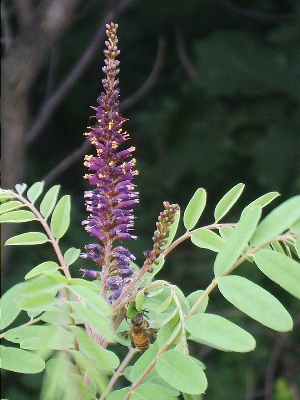 Desert false indigo
Photos: African Sacred Ibis © Steve Garvie from Dunfermline, Fife, Scotland · CC BY-SA 2.0; Red swamp crayfish © MikeMurphy · Public domain; Pond slider © Viva.Chelonia · CC BY 2.0; Tree-of-heaven © Darkone · CC BY-SA 2.5; Eastern baccharis © Jean-Jacques MILAN · CC BY-SA 3.0; Parrot feather watermilfoil © André Karwath aka Aka · CC BY-SA 2.5; Mute Swan © Geni · CC BY-SA 4.0; Desert false indigo © Dalgial · CC BY-SA 3.0
Sources: Global Forest Change (Hansen et al., University of Maryland, via Global Forest Watch, CC-BY 4.0); EFFIS, European Commission / Copernicus; NASA Black Marble 2016 (public domain); CORINE Land Cover 2018 (Copernicus) or MODIS.
CORINE Land Cover Change 1990–2018: generated using European Union's Copernicus Land Monitoring Service information (EEA), aggregated by Parkavela; DOI 10.2909/f30f1000-7cf8-43bb-872c-5eb093911b24.
Ecological status of water bodies: European Environment Agency, WISE – Water Framework Directive, 3rd river basin management plans (2022), CC BY 4.0. Official national classification, not comparable between countries.
Invasive alien species: Global Register of Introduced and Invasive Species (ISSG, CC BY 4.0); Union list, Regulation (EU) 1143/2014 (INBO, CC0); GBIF.org records (CC0 / CC BY 4.0), at least 2 per species.
1 viewpoint · 4 lakes and ponds · 8 bird hides
4 campsites
22 waymarked routes listed, including:
+ 3 local loops
Signed cycle routes: this does not mean that cycling is allowed on footpaths.
Data © OpenStreetMap contributors (ODbL) · Wikidata (CC0)
Routes © OpenStreetMap contributors (ODbL), via Waymarked Trails
5 km within the site ↗ 5 m↘ 5 m -3–9 m
Tracks © OpenStreetMap contributors (ODbL), clipped to the boundary; elevation gain and profiles computed on the longest section from Mapzen Terrain Tiles (≈ 30 m), indicative only.
14 monitored bathing sites in or within 1 km of the site · 2025 classification
and 4 more
Source: European Environment Agency, official bathing water classification (Directive 2006/7/EC, CC-BY 4.0). Swimming is only permitted at the sites and times authorised locally.
The nearest railway station is Torre del Lago Puccini, less than 1 km from the site boundary. Nearest towns of over 50,000 people, as the crow flies: Viareggio (1 km) and Pisa (4 km). Nearest airport: Pisa International Airport 'Galileo Galilei' (PSA), about 3 km away. About 710,000 people live within 20 km of the site boundary, 430,000 of them within 10 km; some 3,800 people are estimated to live inside (GHSL estimate, 2020). Visitor information on site: Ufficio Informazioni, Centro Visite San Rossore and Centro Visitatori Oasi Lipu Massaciuccoli. Waymarked hiking routes listed in OpenStreetMap: 22, including Il Cammino di San Jacopo. The site is crossed by 3 signed cycle routes, including “BI-19 Ciclovia Tirrenica” and “Ciclovia dell'Arno” (OpenStreetMap). To see: 1 viewpoint, 4 lakes and ponds and 8 bird hides, including Idrovora di Marina di Pisa, Osservatorio Faunistico Sabrina Bulleri, Laghetto della Gusciana and Lago di Massaciuccoli. Where to stay: 4 campsites, including Campeggio Bosco Verde, Camping Burlamacco and Marina di Pisa - Viale d’Annunzio. To plan a visit (access, opening periods, visitor rules), it is best to consult the official information from the managing body and the official website listed in this page's sources.
Source: OpenStreetMap (ODbL), Wikidata (CC0), October 2026.
According to Wikidata, 4 monuments protected as Italian national cultural heritage stand within the boundary. Examples include “Church of Saint Peter a Grado” in Pisa, “Forte di Bocca di Serchio” in San Giuliano Terme and “Viale dei Pini” in Vecchiano.
Source: Wikidata (CC0), monuments in each country’s official heritage protection registers, at national or regional level. Each item links to its Wikidata entry.
Best time to visit: from April to August, with average temperatures of 13 to 25 °C and moderate rainfall. Precipitation peaks in October and November (up to 170 mm per month). Day length ranges from about 8 h 56 min in December to 15 h 26 min in June. Wildlife records published on GBIF peak for birds (December and January), plants (May and June), butterflies and moths (May), dragonflies (July) and mammals (May). These peaks also reflect when observers are most active.
Source: Copernicus ERA5-Land (C3S), monthly averages 1996–2025 at the representative point, temperatures adjusted for elevation.
Contains modified Copernicus Climate Change Service information 2026. Neither the European Commission nor ECMWF is responsible for any use that may be made of the Copernicus information or data it contains.
Monthly records published on GBIF (CC-BY), relative to the busiest month; also reflects observer activity.
Data © OpenStreetMap contributors (ODbL), Wikidata (CC0) and the sources cited.