France · Terrestrial
Martinique Regional Natural Park
Regional nature park of 73,906 hectares in France, established in 1976.
Overview
Regional nature park of 73,906 hectares in France, established in 1976.
Martinique Regional Natural Park is a regional nature park in France (overseas). It is a predominantly terrestrial area. Established in 1976, it covers about 73,906 hectares.
Protections and designations
UNESCO World Heritage
Ramsar site
Protected as a regional nature park. International labels and designations: UNESCO World Heritage (“Volcanoes and Forests of Mount Pelée and the Pitons of Northern Martinique”) and Ramsar site (“Étang des Salines”). Key dates: established in 1976 and World Heritage listing in 2023.
In our collections
Timeline
-
1976
Established
-
2023
Inscribed as a UNESCO World Heritage Site Volcanoes and Forests of Mount Pelée and the Pitons of Northern Martinique
Sources: Wikidata (CC0) for establishment and international labels; EEA Natura 2000 database (CC-BY 4.0) for site designation dates.
Frequently asked questions
Where is Martinique Regional Natural Park?
In France (overseas). Representative point: 14.6337° N, 61.0194° W.
How large is Martinique Regional Natural Park?
About 73,906 hectares (739 km²). It is the 49th largest of the 59 regional parks in France covered by Parkavela.
When was Martinique Regional Natural Park established?
In 1976.
What habitats and landscapes does Martinique Regional Natural Park include?
A terrestrial area, with forests and coasts.
What is the highest point of Martinique Regional Natural Park?
Montagne Pelée, at 1,397 m (OpenStreetMap).
What are the main summits of Martinique Regional Natural Park?
Montagne Pelée (1,397 m), Le Chinois (1,395 m), Sommet ouest (1,388 m), Cône de 1902 (1,364 m) and Morne Macouba (1,300 m) (OpenStreetMap).
Which international labels apply to Martinique Regional Natural Park?
UNESCO World Heritage (“Volcanoes and Forests of Mount Pelée and the Pitons of Northern Martinique”) and Ramsar site (“Étang des Salines”).
When is the best time to visit Martinique Regional Natural Park?
Best time to visit: the dry season, from January to April, with less than 60 mm of rain per month.
What is there to see in Martinique Regional Natural Park?
71 viewpoints, 23 waterfalls, 5 lakes and ponds and 3 caves, including L’Aileron (1,107 m), 1er cascade de didier, Bassin Zombi and Grotte aux Chauves-Souris (OpenStreetMap).
Where can I stay in Martinique Regional Natural Park?
3 campsites, including Airstream Paradise, Camping Pointe-Marin and Parcelle de Gallochat (OpenStreetMap).
Are there historic monuments in Martinique Regional Natural Park?
Yes. According to the French Ministry of Culture's Mérimée database, 51 historic monuments stand within the boundary, 11 of them with the highest level of protection (classé). For example: “Bureau du Génie et des Ponts et Chaussées ou ancien asile” in Saint-Pierre, “Cimetière du Fort” in Saint-Pierre and “Habitation Clément ou Domaine de l'Acajou” in Le François.
Can you swim in Martinique Regional Natural Park?
47 monitored bathing sites lie in or within 1 km of the site; official 2025 classification: 23 excellent, 17 good, 6 sufficient and 1 poor (European Environment Agency). Swimming is only permitted at the sites and times authorised locally.
What is the nearest large city to Martinique Regional Natural Park?
Nearest towns of over 50,000 people, as the crow flies: Fort-de-France (4 km). Nearest airport: Martinique Aimé Césaire (FDF), less than 1 km away.
How can I reach Martinique Regional Natural Park by train?
The nearest railway station is Le Train des Plantations, about 2 km from the site boundary.
Where can I get visitor information on site?
Office du Tourisme Trois Îlets, Bureau d'Information Touristique du Vauclin and Office de Tourisme de Saint-Pierre.
Are there waymarked hiking trails in Martinique Regional Natural Park?
Yes. Waymarked hiking routes listed in OpenStreetMap: 8, including Sentier Littoral Nord Atlantique. The “GR M1” route runs for about 64 km through the site, with some 2,840 m of ascent on its longest section.
Which species can be seen in Martinique Regional Natural Park?
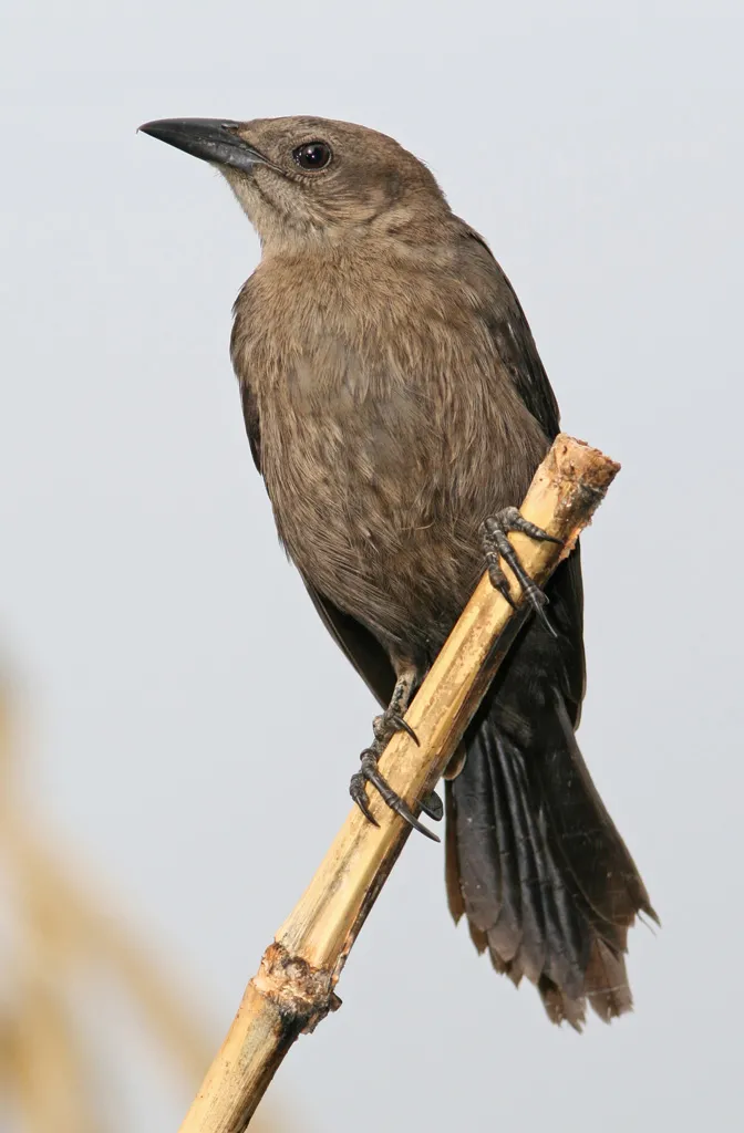
Among the species most often recorded on GBIF are Rattus rattus (Black Rat), Loxigilla noctis (Lesser Antillean Bullfinch), Coereba flaveola (Bananaquit) and Quiscalus lugubris (Carib Grackle).
What is the official website of Martinique Regional Natural Park?
© OpenStreetMap
Download the boundary: GeoJSON · GPX Boundary © OpenStreetMap contributors (ODbL).
Geography
The representative point of the site lies at around 104 m above sea level. Over the 1996–2025 period, the mean annual temperature is about 26.1 °C and total precipitation reaches roughly 1,095 mm per year. The warmest month is usually September, the coolest February, and the wettest October.
Area
- Area
- 73,906 ha
- Elevation
- 104 m
- Median elevation
- 166 m
- Mean slope
- 14°
- Coordinates
- 14.6337, -61.0194
Terrain: Mapzen Terrain Tiles (SRTM, USGS)
Elevation bands
- below 500 m 88%
- 500–1,000 m 11%
- 1,000–1,500 m 1%
share of the site in each elevation band (smoothed terrain model: summits are rounded off) · Terrain: Mapzen Terrain Tiles (SRTM, USGS)
Main summits
- Montagne Pelée1,397 m
- Le Chinois1,395 m
- Sommet ouest1,388 m
- Cône de 19021,364 m
- Morne Macouba1,300 m
- Piton Lacroix1,197 m
- Morne Piquet1,160 m
- Petit Bonhomme1,140 m
- Piton Dumauzé1,112 m
- Piton de l'Alma1,107 m
Data © OpenStreetMap contributors (ODbL)
Climate
● Mean temperature (°C) · ▮ Precipitation (mm)
Source: Copernicus ERA5-Land (C3S, doi:10.24381/cds.68d2bb30), monthly averages 1996–2025 interpolated to the representative point, temperatures adjusted for elevation.
Contains modified Copernicus Climate Change Service information 2026. Neither the European Commission nor ECMWF is responsible for any use that may be made of the Copernicus information or data it contains.
Natural habitats
According to CORINE Land Cover (2018), the site is mainly made up of forests (43%), farmland (28%) and Mediterranean scrub (8%). Woodland is mostly broadleaved. The site borders the coast. Elevation ranges from sea level to 1,397 m (highest point: Montagne Pelée). Median elevation is 166 m, and 12% of the site lies above 500 m (SRTM elevation model).
Biodiversity
Based on occurrences aggregated by GBIF, several species are regularly recorded within the site. Among the most frequent are Rattus rattus (Black Rat), Loxigilla noctis (Lesser Antillean Bullfinch), Coereba flaveola (Bananaquit) and Quiscalus lugubris (Carib Grackle). The full list of documented taxa is shown below.
Species to look out for



Observed species
Occurrences documented via GBIF; they are neither an exhaustive inventory nor proof of current presence.
- Black Rat · Rattus rattus · 3929
- Lesser Antillean Bullfinch · Loxigilla noctis · 2475
- Bananaquit · Coereba flaveola · 2402
- Carib Grackle · Quiscalus lugubris · 2121
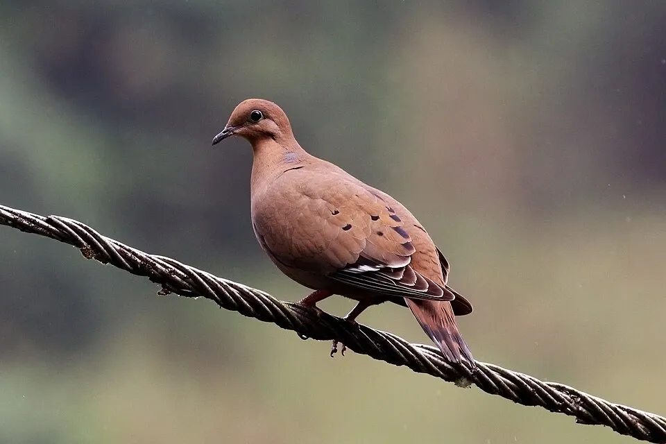
- Zenaida Dove · Zenaida aurita · 1847
- Davy's naked-backed bat · Pteronotus davyi · 1827
- Velvety Free-tailed Bat · Molossus molossus · 1767
- Black-faced Grassquit · Melanospiza bicolor · 1495
- Gray Kingbird · Tyrannus dominicensis · 1317
- Caribbean Elaenia · Elaenia martinica · 1176
- Antillean Crested Hummingbird · Orthorhyncus cristatus · 1130
- Tropical Mockingbird · Mimus gilvus · 1090
+18 more species
- Lesser Antillean Saltator · Saltator albicollis · 1044
- Spectacled Thrush · Turdus nudigenis · 950
- Mangrove Warbler · Setophaga petechia · 886
- Purple-throated Carib · Eulampis jugularis · 803
- Black-whiskered Vireo · Vireo altiloquus · 803
- Scaly-breasted Thrasher · Allenia fusca · 774
- Broad-winged Hawk · Buteo platypterus · 706
- Magnificent frigatebird · Fregata magnificens · 678
- Western Cattle Egret · Bubulcus ibis · 607
- Spotted sandpiper · Actitis macularius · 530
- Caribbean hermit crab · Coenobita clypeatus · 523
- Green Heron · Butorides virescens · 510
- Shiny Cowbird · Molothrus bonariensis · 483
- Martinique Oriole · Icterus bonana · 472
- Martinique's Anole · Anolis roquet · 470
- Royal Tern · Thalasseus maximus · 454
- Green-throated Carib · Eulampis holosericeus · 453
- Rufous-throated Solitaire · Myadestes genibarbis · 443
Records: GBIF.org (CC-BY). Names: Wikidata (CC0), GBIF. Photos: Wikimedia Commons.
Conservation challenges
The primary purpose of the site is to preserve its natural habitats and the biodiversity they support. The species recorded (Biodiversity tab) reflect its ecological value. The designations it holds frame its management and the control of land use.
According to Global Forest Change data (University of Maryland, Global Forest Watch), about 2,100 ha of tree cover were lost within the boundary between 2001 and 2023 (3% of its area), peaking in 2003 and 2012. These losses include logging, storms and fires, and do not account for regrowth. At night, 67% of the area gives off artificial light detectable from space (NASA VIIRS Black Marble composite, 2016). Built-up and developed land (buildings, business areas, roads, quarries) covers 7% of the area, and farmland 28% (CORINE Land Cover). According to the Water Framework Directive assessment (2022 river basin management plans, data 2012–2017), only 43% of the 144 km of rivers assessed within the site are in good or high ecological status; the others mostly have moderate ecological status. Other assessed water bodies: lagoons and estuaries, 0 of 1 in good ecological status or better; coastal waters, 0 of 18 in good ecological status or better. Since 2000, 12 invasive alien species have been recorded within the site (GBIF observations). Among them: Herpestes javanicus (Small Asian Mongoose), Spathodea campanulata (African tuliptree) and Gymnophthalmus underwoodi (Underwood's Spectacled Tegu).
Pressure indicators
Tree cover lost
2,100 ha
2001–2023 · 3% of the area
20012023
Fires since 2016
0
No large fire mapped (fires over about 30 ha)
Light at night
67%
of the area gives off artificial light visible from space
DarkLit
Built-up land
7%
buildings, business areas, roads, quarries · farmland 28%
Rivers and lakes
43%
of the 144 km of assessed rivers in good or high ecological status · WFD 2022
Lagoons and estuaries: 0 of 1 good or better
Coastal waters: 0 of 18 good or better
assessments 2012–2017
Invasive alien species
12
recorded since 2000
 Small Asian Mongoose
 African tuliptree
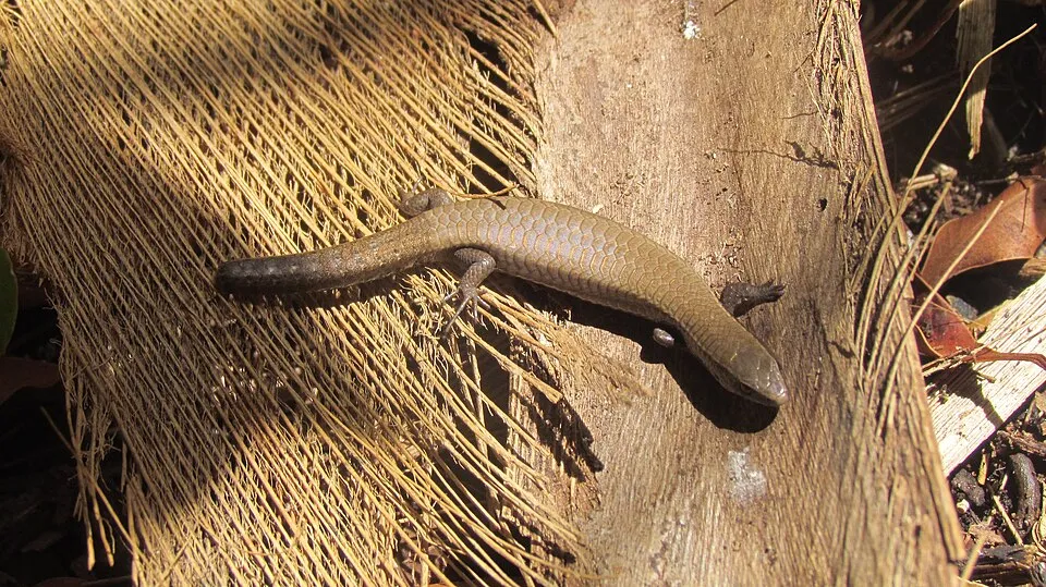 Underwood's Spectacled Tegu
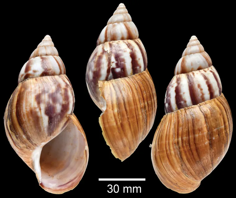 Giant African Snail
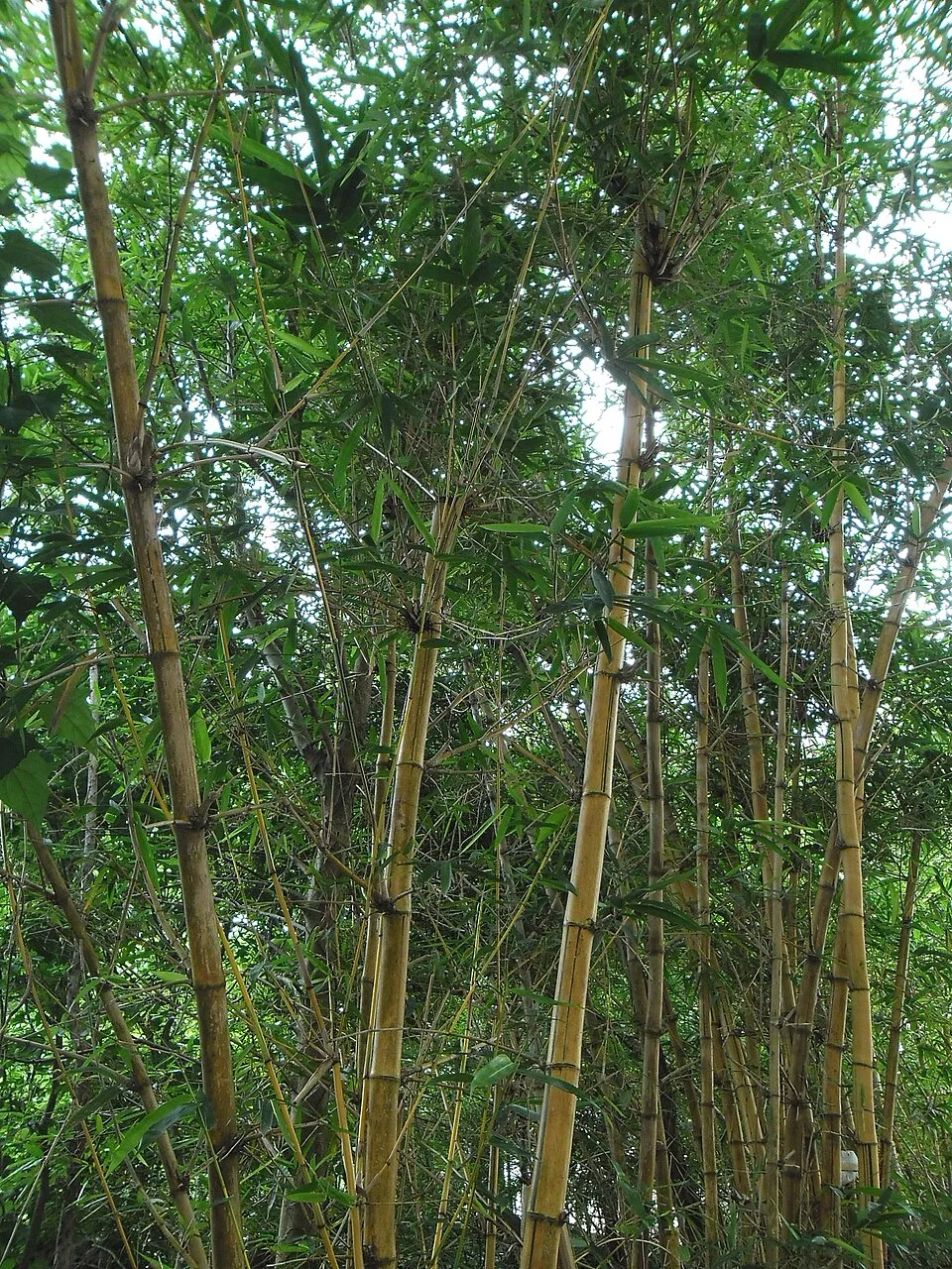 Common bamboo
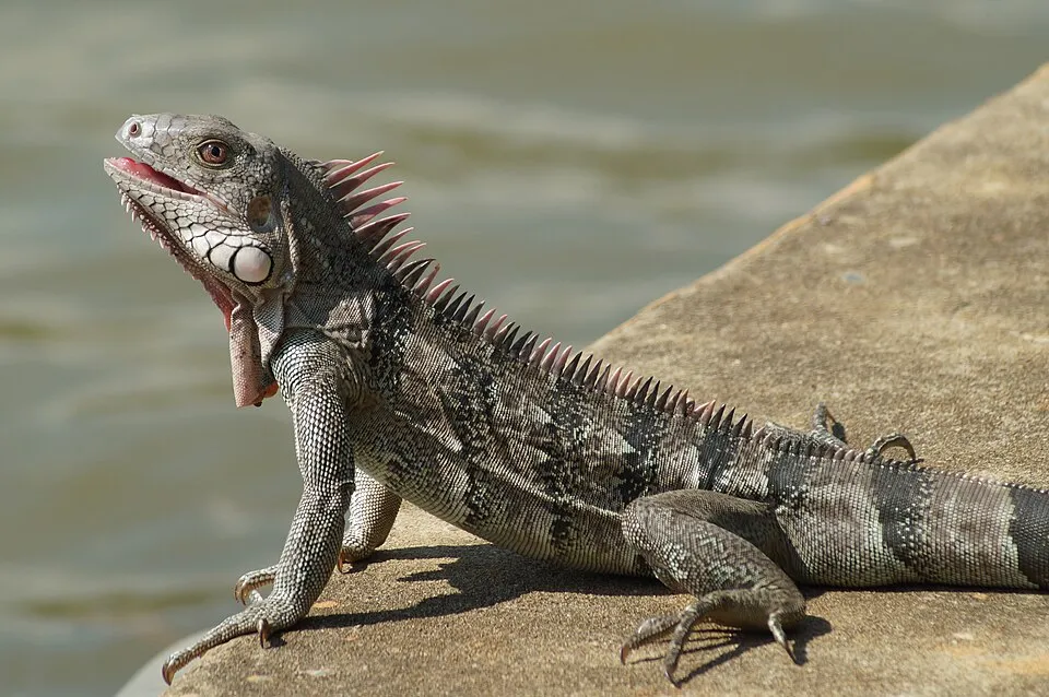 Green iguana
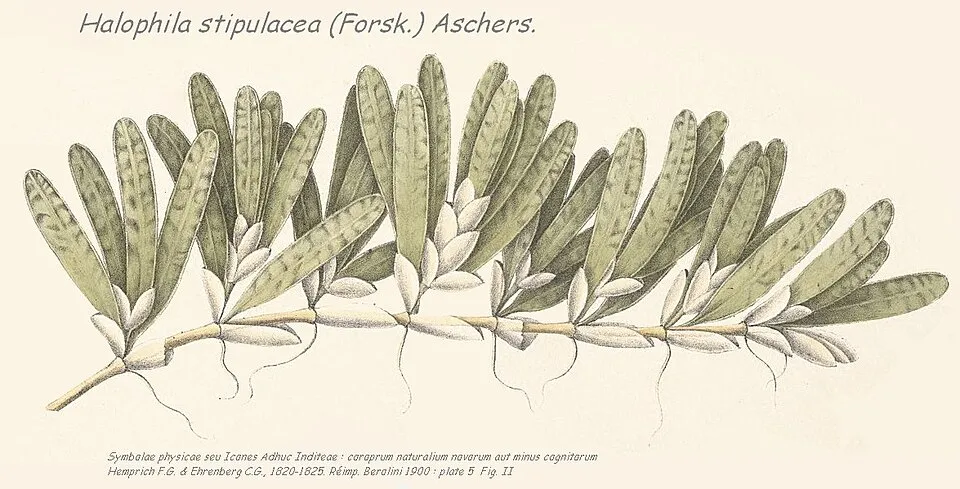 Species code: Hs
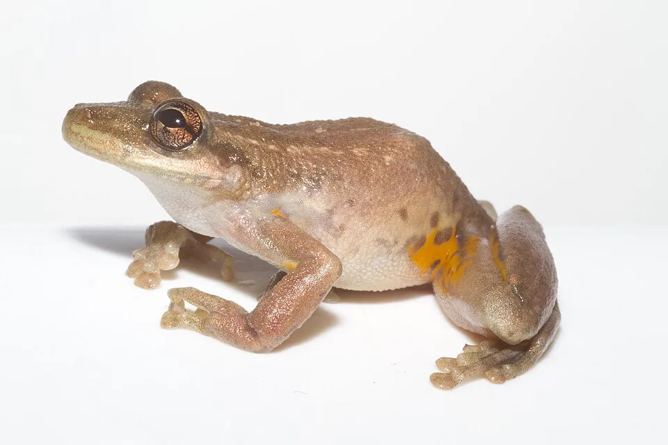 Red Snouted Treefrog
Photos: Small Asian Mongoose © Liné1 · CC BY 2.5; African tuliptree © Steven Haw · CC BY 2.0; Underwood's Spectacled Tegu © Josh Noseworthy · CC BY 2.0; Giant African Snail © Sutcharit C et al. · CC BY 4.0; Common bamboo © Earth100 · CC BY-SA 3.0; Green iguana © Rjcastillo · CC BY-SA 3.0; Species code: Hs © Hemprich F.G. & Ehrenberbg C.G. · Public domain; Red Snouted Treefrog © Brian Gratwicke · CC BY 2.0
Sources: Global Forest Change (Hansen et al., University of Maryland, via Global Forest Watch, CC-BY 4.0); EFFIS, European Commission / Copernicus; NASA Black Marble 2016 (public domain); CORINE Land Cover 2018 (Copernicus) or MODIS.
Ecological status of water bodies: European Environment Agency, WISE – Water Framework Directive, 3rd river basin management plans (2022), CC BY 4.0. Official national classification, not comparable between countries.
Invasive alien species: Global Register of Introduced and Invasive Species (ISSG, CC BY 4.0); Union list, Regulation (EU) 1143/2014 (INBO, CC0); GBIF.org records (CC0 / CC BY 4.0), at least 2 per species.
Practical information
Cities and airport
- Fort-de-France
4 km as the crow flies - Airport: Martinique Aimé Césaire (FDF)
< 1 km as the crow flies
Visitor information
- Office du Tourisme Trois Îlets
within the site - Bureau d'Information Touristique du Vauclin
within the site - Office de Tourisme de Saint-Pierre
within the site - Office de Tourisme Trois Îlets
within the site
Things to see
71 viewpoints · 23 waterfalls · 5 lakes and ponds · 3 caves
- L’Aileron
viewpoint · 1,107 m - 1er cascade de didier
waterfall - Bassin Zombi
lake or pond - Grotte aux Chauves-Souris
cave - Montagne du Vauclin
viewpoint · 504 m
Where to stay
3 campsites
- Airstream Paradise
campsite - Camping Pointe-Marin
campsite - Parcelle de Gallochat
campsite
Hiking
8 waymarked routes listed, including:
Sentier Littoral Nord Atlantique
Data © OpenStreetMap contributors (ODbL) · Wikidata (CC0)
Waymarked hiking routes
Sentier du Littoral du Diamant
9.8 km within the site ↗ 75 m↘ 69 m 5–45 m
Grand sentier Presqu'ile de la Caravelle
6.5 km within the site ↗ 62 m↘ 13 m 0–62 m
Tracks © OpenStreetMap contributors (ODbL), clipped to the boundary; elevation gain and profiles computed on the longest section from Mapzen Terrain Tiles (≈ 30 m), indicative only.
Bathing
47 monitored bathing sites in or within 1 km of the site · 2025 classification
Excellent · 23
Good · 17
Sufficient · 6
Poor · 1
- Anse Ceron : Milieu Plage · sea · Excellent
- Anse Couleuvre · sea · Excellent
- Anse l'Etang : Face Acces Principal · sea · Excellent
- Anse Moustique · sea · Excellent
- Anse Trabaud : Face Acces · sea · Excellent
- Anse-Mitan : Face Location de Planches · sea · Excellent
- Baie Coco · sea · Excellent
- Baie Granjean · sea · Excellent
- Bakoua : Milieu de Plage · sea · Excellent
- Cafard : Face Acces · sea · Excellent
and 37 more
Source: European Environment Agency, official bathing water classification (Directive 2006/7/EC, CC-BY 4.0). Swimming is only permitted at the sites and times authorised locally.
Access and visiting
The nearest railway station is Le Train des Plantations, about 2 km from the site boundary. Nearest towns of over 50,000 people, as the crow flies: Fort-de-France (4 km). Nearest airport: Martinique Aimé Césaire (FDF), less than 1 km away. About 260,000 people live within 20 km of the site boundary; some 110,000 people are estimated to live inside (GHSL estimate, 2020). This population has fallen by about 18% since 2000. Visitor information on site: Office du Tourisme Trois Îlets, Bureau d'Information Touristique du Vauclin and Office de Tourisme de Saint-Pierre. Waymarked hiking routes listed in OpenStreetMap: 8, including Sentier Littoral Nord Atlantique. To see: 71 viewpoints, 23 waterfalls, 5 lakes and ponds and 3 caves, including L’Aileron (1,107 m), 1er cascade de didier, Bassin Zombi and Grotte aux Chauves-Souris. Where to stay: 3 campsites, including Airstream Paradise, Camping Pointe-Marin and Parcelle de Gallochat. To plan a visit (access, opening periods, visitor rules), it is best to consult the official information from the managing body and the official website listed in this page's sources.
Source: OpenStreetMap (ODbL), Wikidata (CC0), October 2026.
Built heritage
According to the French Ministry of Culture's Mérimée database, 51 historic monuments stand within the boundary, 11 of them with the highest level of protection (classé). Among them are 25 houses and civic buildings, 11 religious buildings and 5 bridges, lighthouses, mills and working buildings. Notable classé monuments include “Bureau du Génie et des Ponts et Chaussées ou ancien asile” in Saint-Pierre, “Cimetière du Fort” in Saint-Pierre and “Habitation Clément ou Domaine de l'Acajou” in Le François.
25 houses and civic buildings11 religious buildings5 bridges, lighthouses, mills and working buildings3 castles and fortifications3 prehistoric and archaeological sites
-
Bureau du Génie et des Ponts et Chaussées ou ancien asile
Classé
Saint-Pierre · 18th c. -
Cimetière du Fort
Classé
Saint-Pierre · 17th c. -
Habitation Clément ou Domaine de l'Acajou
Classé
Le François · 18th c., 19th c. -
Poudrière Trouvaillant située Lot Saint-James
Classé
Saint-Pierre · 19th c. -
Église Notre-Dame-de-la-Délivrance
Classé
Les Trois-Ilets · 18th c. -
Habitation Le Galion
Classé
La Trinité · 19th c. -
Église du Fort
Classé
Saint-Pierre · 17th c. -
Habitation Pecoul
Classé
Basse-Pointe · 17th c., 18th c.
and 43 more
Source: Mérimée database, French Ministry of Culture (Licence Ouverte 2.0). Each record links to the Plateforme ouverte du patrimoine (POP).
When to visit
Best time to visit: the dry season, from January to April, with less than 60 mm of rain per month. Precipitation peaks from July to November (up to 160 mm per month). Day length ranges from about 11 h 16 min in December to 12 h 59 min in June. Wildlife records published on GBIF peak for birds (from January to April), plants (from January to April), butterflies and moths (May), dragonflies (March) and mammals (March). These peaks also reflect when observers are most active.
Source: Copernicus ERA5-Land (C3S), monthly averages 1996–2025 at the representative point, temperatures adjusted for elevation.
Contains modified Copernicus Climate Change Service information 2026. Neither the European Commission nor ECMWF is responsible for any use that may be made of the Copernicus information or data it contains.
Wildlife records calendar
JFMAMJJASOND
Birds
Plants
Butterflies & moths
Dragonflies
Mammals
Monthly records published on GBIF (CC-BY), relative to the busiest month; also reflects observer activity.
Gallery
© Frameme · CC BY-SA 3.0
© Jean & Nathalie · CC BY 2.0
© Jurassi · Public domain
© Ze Moudong · CC BY-SA 4.0
© Lcarpin · CC BY-SA 4.0
© Zinneke · CC BY-SA 3.0
Sources and licences
- Wikidata: Q3364623
- OpenStreetMap: relation 1106761
- Official website: http://www.pnr-martinique.com/
- Wikipedia: en.wikipedia.org/wiki/Parc_naturel_régional_de_la_Martinique
- WDPA: 147300
References
- cds.climate.copernicus.eu: climate · CC-BY-4.0
- registry.opendata.aws: elevation of the reference point, detailed relief · PD
- land.copernicus.eu: land cover, sea share · COPERNICUS
- doi.org: population around the site · CC-BY-4.0
- wikidata.org: official area, establishment date, nearby cities and airport, access and peaks, lake depths, places to see, official website · CC0-1.0
- eea.europa.eu: bathing water quality, ecological status of waters · CC-BY-4.0
- en.eurovelo.com: EuroVelo cycle routes · ODbL-1.0
- cycling.waymarkedtrails.org: cycle routes · ODbL-1.0
- opentopodata.org: elevations · PD
- forest-fire.emergency.copernicus.eu: wildfires · COPERNICUS
- globalforestwatch.org: tree cover loss · CC-BY-4.0
- gbif.org: seasonality of sightings, invasive alien species, observed species · CC-BY-4.0
- pop.culture.gouv.fr: protected heritage · LO-2.0
- hydrosheds.org: lakes · CC-BY-4.0
- openstreetmap.org: official name, access and peaks, places to see · ODbL-1.0
- earthobservatory.nasa.gov: night light · PD
- hiking.waymarkedtrails.org: route difficulty · ODbL-1.0
- nsidc.org: snow cover · PD
- wikidata.org: Wikipedia article · CC-BY-SA-4.0
Data © OpenStreetMap contributors (ODbL), Wikidata (CC0) and the sources cited.