United Kingdom · Terrestrial
North York Moors National Park
National park of 143,420 hectares in the United Kingdom, established in 1952.
Overview
National park of 143,420 hectares in the United Kingdom, established in 1952.
North York Moors National Park is located in the United Kingdom (Europe). It is a predominantly terrestrial area. Established in 1952, it covers about 143,420 hectares.
In our collections
Frequently asked questions
Where is North York Moors National Park?
In the United Kingdom (Europe). Representative point: 54.3333° N, 0.7500° W.
How large is North York Moors National Park?
About 143,420 hectares (1,434 km²). It is the 7th largest of the 15 national parks in the United Kingdom covered by Parkavela.
When was North York Moors National Park established?
In 1952.
What habitats and landscapes does North York Moors National Park include?
A terrestrial area, with wetlands and coasts.
What rocks lie beneath North York Moors National Park?
According to the European 1:1 million geological map (EGDI), the bedrock consists mainly of sandstones (31% of sampled points), unconsolidated deposits (25%) and mudstones (19%). These are mostly sedimentary rocks. The geological units date mainly from the Jurassic (63% of sampled points).
What is the highest point of North York Moors National Park?
Urra Moor - Round Hill, at 455 m (OpenStreetMap).
What are the main summits of North York Moors National Park?
Urra Moor - Round Hill (455 m), Cringle Moor (435 m), Cringle Moor - Drake Howe (434 m), Stony Ridge (433 m) and Cockayne Ridge (430 m) (OpenStreetMap).
When is the best time to visit North York Moors National Park?
Best time to visit: from June to September, with average temperatures of 12 to 15 °C and moderate rainfall.
What is there to see in North York Moors National Park?
3 waterfalls, 1 lake or pond and 1 cave, including Falling Foss, Gormire Lake (155 m), Excalibur Pot and Mallyan Spout (Wikidata).
Are there historic monuments in North York Moors National Park?
Yes. According to Wikidata, 32 monuments listed at the highest grade in the United Kingdom (Grade I; Category A in Scotland) stand within the boundary. For example: “Barn approximately 10 metres north east of The Hall” in Sinnington, “Ayton Castle” in West Ayton and “Arncliffe Hall” in Ingleby Arncliffe.
What is the nearest large city to North York Moors National Park?
Nearest towns of over 50,000 people, as the crow flies: Middlesbrough (10 km) and York (27 km). Nearest airport: Teesside (MME), about 14 km away.
How can I reach North York Moors National Park by train?
Great Ayton railway station lies within the site.
Where can I get visitor information on site?
The Old School House / White Horse View / Mouseman Visitor Centre, Rievaulx Abbey Visitor Centre and Helmsley Castle Visitor Centre.
Are there waymarked hiking trails in North York Moors National Park?
Yes. Waymarked hiking routes listed in OpenStreetMap: 16, including North Sea Trail, England, Cleveland Way, Coast to Coast Walk (Richmond to Robin Hood’s Bay) and King Charles III England Coast Path. The “The Inn Way” route runs for about 115 km through the site, with some 910 m of ascent on its longest section.
Which species can be seen in North York Moors National Park?
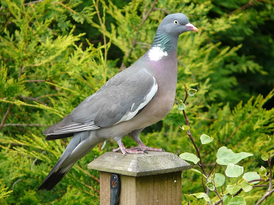
Among the species most often recorded on GBIF are Columba palumbus (Common Wood Pigeon), Fringilla coelebs (Eurasian Chaffinch), Turdus merula (Common Blackbird) and Erithacus rubecula (European robin).
What is the official website of North York Moors National Park?
© OpenStreetMap
Download the boundary: GeoJSON · GPX Boundary © OpenStreetMap contributors (ODbL).
Geography
The representative point of the site lies at around 235 m above sea level. Over the 1996–2025 period, the mean annual temperature is about 8.8 °C and total precipitation reaches roughly 832 mm per year. The warmest month is usually August, the coolest January, and the wettest November. According to the European 1:1 million geological map (EGDI), the bedrock consists mainly of sandstones (31% of sampled points), unconsolidated deposits (25%) and mudstones (19%). These are mostly sedimentary rocks. The geological units date mainly from the Jurassic (63% of sampled points).
Area
- Area of the boundary
- 143,420 ha
- Elevation
- 235 m
- Coordinates
- 54.3333, -0.75
Bedrock
- Sandstones 31 %
- Unconsolidated deposits 25 %
- Mudstones 19 %
- Limestones 19 %
- Peat 6 %
Sedimentary rocks 100 % · Main age: Jurassic (63%)
Source: EGDI 1:1M geological map (EuroGeoSurveys and national geological surveys), CC BY 4.0 · 16 sampled points within the site.
Main summits
- Urra Moor - Round Hill455 m
- Cringle Moor435 m
- Cringle Moor - Drake Howe434 m
- Stony Ridge433 m
- Cockayne Ridge430 m
- Ledging Hill429 m
- Carlton Bank408 m
- Noon Hill404 m
- Cock Heads402 m
- Cock Howe400 m
Data © OpenStreetMap contributors (ODbL)
Climate
● Mean temperature (°C) · ▮ Precipitation (mm)
Source: Copernicus ERA5-Land (C3S, doi:10.24381/cds.68d2bb30), monthly averages 1996–2025 interpolated to the representative point, temperatures adjusted for elevation.
Contains modified Copernicus Climate Change Service information 2026. Neither the European Commission nor ECMWF is responsible for any use that may be made of the Copernicus information or data it contains.
Natural habitats
According to CORINE Land Cover (2018), the site is mainly made up of grassland and meadows (31%), marshes and bogs (20%) and forests (19%). The site borders the coast. Elevation ranges from about 50 m to 455 m (highest point: Urra Moor - Round Hill).
Biodiversity
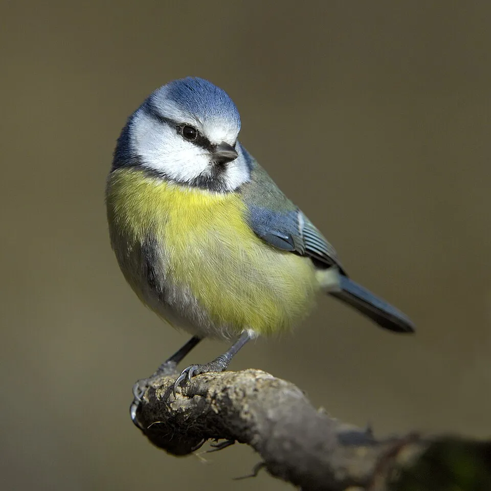
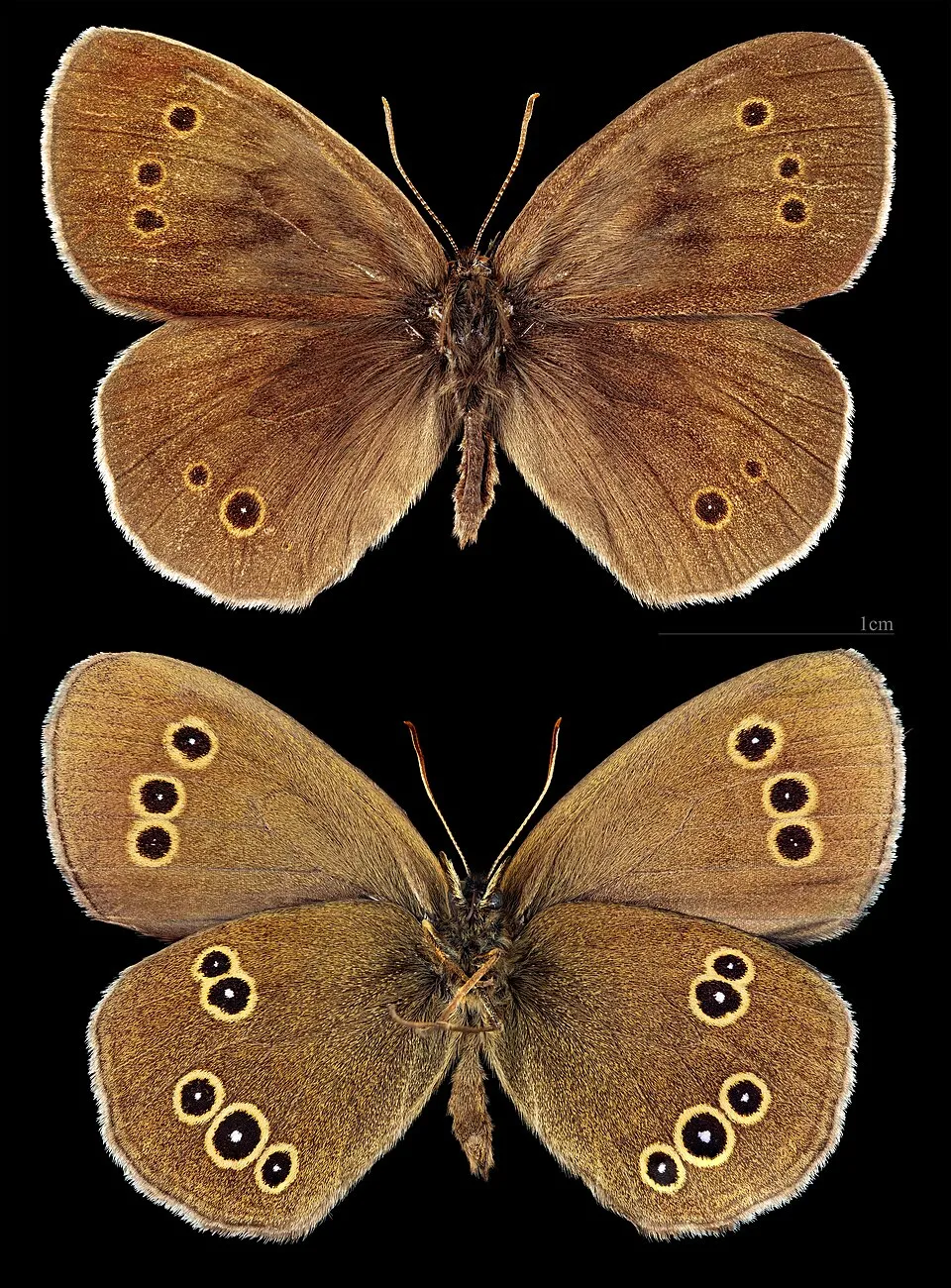
Based on occurrences aggregated by GBIF, several species are regularly recorded within the site. Among the most frequent are Columba palumbus (Common Wood Pigeon), Fringilla coelebs (Eurasian Chaffinch), Turdus merula (Common Blackbird) and Erithacus rubecula (European robin). The full list of documented taxa is shown below.
Species to look out for



Observed species
Occurrences documented via GBIF; they are neither an exhaustive inventory nor proof of current presence.
- Common Wood Pigeon · Columba palumbus · 3667
- Eurasian Chaffinch · Fringilla coelebs · 3531
- Common Blackbird · Turdus merula · 3451
- European robin · Erithacus rubecula · 3158
- Eurasian blue tit · Cyanistes caeruleus · 2861
- Ringlet · Aphantopus hyperantus · 2835
- Carrion crow · Corvus corone · 2404
- Common Pheasant · Phasianus colchicus · 2300
- Meadow brown · Maniola jurtina · 2250
- Eurasian Wren · Troglodytes troglodytes · 2159
- Great tit · Parus major · 2154
- Western Jackdaw · Coloeus monedula · 2124
+18 more species
- Common Buzzard · Buteo buteo · 2043
- Northern Lapwing · Vanellus vanellus · 2019
- Coal tit · Periparus ater · 1868
- European Herring Gull · Larus argentatus · 1831
- Small white · Pieris rapae · 1821
- European Goldfinch · Carduelis carduelis · 1811
- Small Heath · Coenonympha pamphilus · 1789
- Willow Grouse · Lagopus lagopus · 1784
- Eurasian Curlew · Numenius arquata · 1760
- Common Chiffchaff · Phylloscopus collybita · 1759
- Green-veined white · Pieris napi · 1723
- Barn Swallow · Hirundo rustica · 1719
- Mallard · Anas platyrhynchos · 1717
- Peacock · Aglais io · 1712
- Speckled Wood · Pararge aegeria · 1604
- Dunnock · Prunella modularis · 1536
- Meadow Pipit · Anthus pratensis · 1469
- White Wagtail · Motacilla alba · 1460
Records: GBIF.org (CC-BY). Names: Wikidata (CC0), GBIF. Photos: Wikimedia Commons.
Conservation challenges
The primary purpose of the site is to preserve its natural habitats and the biodiversity they support. The species recorded (Biodiversity tab) reflect its ecological value. Its status as a national park sets the regulatory framework for its protection.
According to Global Forest Change data (University of Maryland, Global Forest Watch), about 8,050 ha of tree cover were lost within the boundary between 2001 and 2023 (6% of its area), peaking in 2006 and 2010. These losses include logging, storms and fires, and do not account for regrowth. Apart from forest felling and regrowth (about 4,900 ha in total), land cover remained almost unchanged between 2000 and 2018 according to CORINE Land Cover. Since 2016, the European EFFIS system (Copernicus) has mapped 58 fires here, burning about 3,546 ha within the boundary; the largest, in August 2025 (near Scarborough), covered 1,677 ha. At night, the area gives off virtually no artificial light detectable from space (NASA VIIRS Black Marble composite, 2016). Since 2000, 11 invasive alien species have been recorded within the site (GBIF observations), 11 of them on the European Union's list. Among them: Sciurus carolinensis (Eastern gray squirrel), Impatiens glandulifera (Himalayan Balsam) and Reynoutria japonica (Japanese Knotweed).
Pressure indicators
Tree cover lost
8,052 ha
2001–2023
20012023
Fires since 2016
3,546 ha
burned within the boundary (58 mapped fires)
- 2025 · Scarborough · 1,677 ha
- 2022 · N.A. · 152 ha
- 2020 · N.A. · 143 ha
Light at night
< 1%
of the area gives off artificial light visible from space
DarkLit
Built-up land
< 1%
buildings, business areas, roads, quarries · farmland 15%
Land cover change
< 0.5%
of the area changed, 2000–2018 · CORINE
forest felling and regrowth: 4,900 ha in total
Invasive alien species
11
incl. 11 on the EU list · since 2000
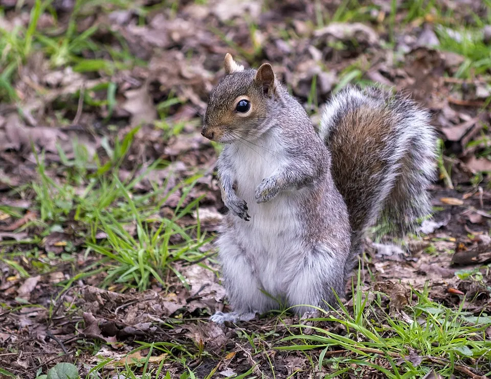 Eastern gray squirrelEU
 Himalayan BalsamEU
 Japanese KnotweedEU
 Giant HogweedEU
 Egyptian GooseEU
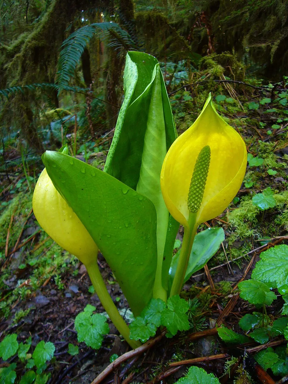 American skunkcabbageEU
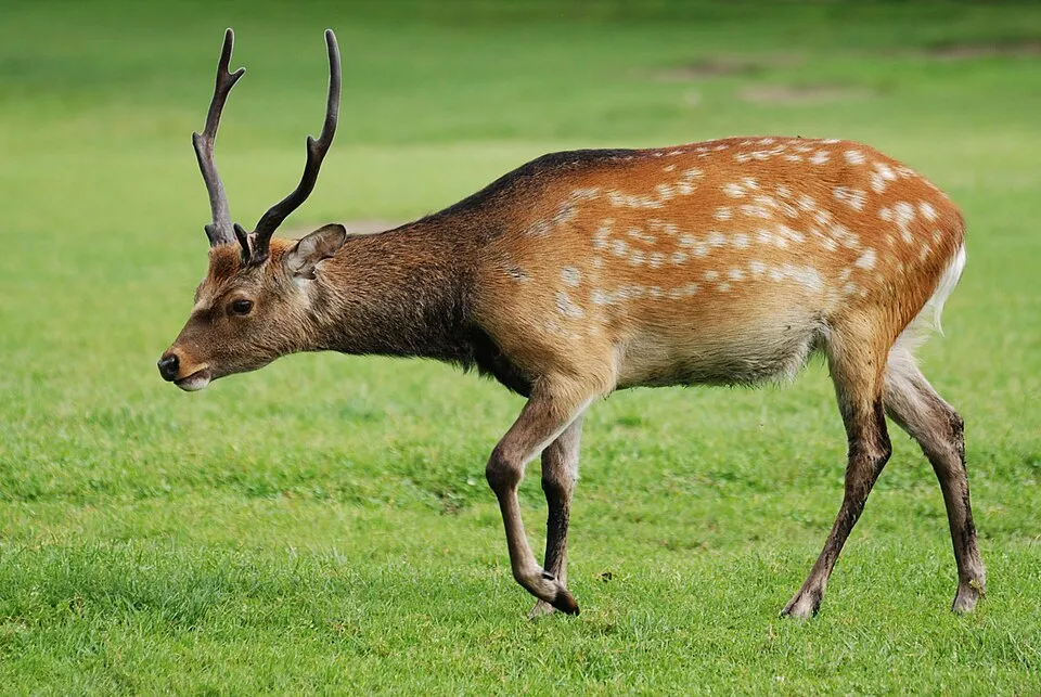 Sika deerEU
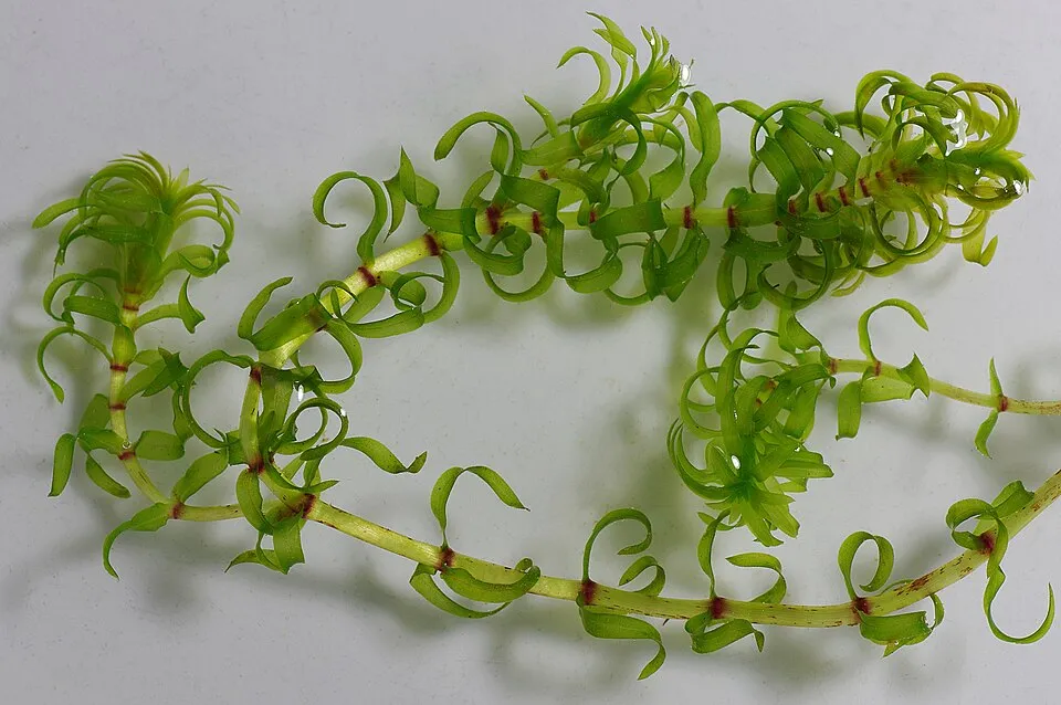 Western waterweedEU
Photos: Eastern gray squirrel © Dominic Nelson · CC BY-SA 4.0; Himalayan Balsam © Guptaele · CC BY-SA 4.0; Japanese Knotweed © W.carter · CC0-1.0; Giant Hogweed © anastasiiamerkulova · CC BY 4.0; Egyptian Goose © Rhododendrites · CC BY-SA 4.0; American skunkcabbage © Martin Bravenboer · Public domain; Sika deer © Lilly M · CC BY-SA 3.0; Western waterweed © Christian Fischer · CC BY-SA 3.0
Sources: Global Forest Change (Hansen et al., University of Maryland, via Global Forest Watch, CC-BY 4.0); EFFIS, European Commission / Copernicus; NASA Black Marble 2016 (public domain); CORINE Land Cover 2018 (Copernicus) or MODIS.
CORINE Land Cover Change 2000–2018: generated using European Union's Copernicus Land Monitoring Service information (EEA), aggregated by Parkavela; DOI 10.2909/f30f1000-7cf8-43bb-872c-5eb093911b24.
Invasive alien species: Global Register of Introduced and Invasive Species (ISSG, CC BY 4.0); Union list, Regulation (EU) 1143/2014 (INBO, CC0); GBIF.org records (CC0 / CC BY 4.0), at least 2 per species.
Practical information
Cities and airport
- Middlesbrough
10 km as the crow flies - York
27 km as the crow flies - Airport: Teesside (MME)
14 km as the crow flies
Visitor information
- The Old School House / White Horse View / Mouseman Visitor Centre
within the site - Rievaulx Abbey Visitor Centre
within the site - Helmsley Castle Visitor Centre
within the site - Guisborough Forest & Walkway Visitor Centre
within the site
Parking
312 public car parks listed within the site
Anya's Wood Car ParkLevisham Station Car ParkOverflowSquare Corner
Things to see
3 waterfalls · 1 lake or pond · 1 cave
- Falling Foss
waterfall - Gormire Lake
lake or pond · 155 m - Excalibur Pot
cave - Mallyan Spout
waterfall - Hayburn Wyke
waterfall
Hiking
16 waymarked routes listed, including:
North Sea Trail, EnglandCleveland WayCoast to Coast Walk (Richmond to Robin Hood’s Bay)King Charles III England Coast PathLyke Wake WalkTabular Hills Walk
By bike
EV12 · 60 km 165 National Cycle Route 165 · 37 km656 The White Rose - Moors Variant · 29 km1 · 27 km65 The White Rose Cycle Route · 25 km
+ 4 local loops
Signed cycle routes: this does not mean that cycling is allowed on footpaths.
Data © OpenStreetMap contributors (ODbL) · Wikidata (CC0)
Contains information from EuroVelo GPX tracks downloaded from www.EuroVelo.com on 2026-10-22, which is made available here under the Open Database License (ODbL). EuroVelo® is a registered trademark of the ECF. Routes © OpenStreetMap contributors (ODbL), via Waymarked Trails
Waymarked hiking routes
C2C Coast to Coast Walk (Richmond to Robin Hood’s Bay)
77.8 km within the site ↗ 1,545 m↘ 1,610 m 4–449 m
ECP King Charles III England Coast Path: Filey Brigg to Newport Bridge
36.9 km within the site ↗ 404 m↘ 363 m 7–194 m
Tracks © OpenStreetMap contributors (ODbL), clipped to the boundary; elevation gain and profiles computed on the longest section from Mapzen Terrain Tiles (≈ 30 m), indicative only.
Access and visiting
Great Ayton railway station lies within the site. Nearest towns of over 50,000 people, as the crow flies: Middlesbrough (10 km) and York (27 km). Nearest airport: Teesside (MME), about 14 km away. About 830,000 people live within 20 km of the site boundary, 440,000 of them within 10 km; some 32,000 people are estimated to live inside (GHSL estimate, 2020). This population has grown by about 6% since 2000. Visitor information on site: The Old School House / White Horse View / Mouseman Visitor Centre, Rievaulx Abbey Visitor Centre and Helmsley Castle Visitor Centre. Public car parks listed within the site: 312, including Anya's Wood Car Park, Levisham Station Car Park and Overflow. Waymarked hiking routes listed in OpenStreetMap: 16, including North Sea Trail, England, Cleveland Way, Coast to Coast Walk (Richmond to Robin Hood’s Bay) and King Charles III England Coast Path. The EuroVelo 12 cycle route (North Sea Cycle Route) crosses the site for about 60 km; 7 other signed cycle routes also pass through, including “165 National Cycle Route 165” and “656 The White Rose - Moors Variant” (EuroVelo, OpenStreetMap). To see: 3 waterfalls, 1 lake or pond and 1 cave, including Falling Foss, Gormire Lake (155 m), Excalibur Pot and Mallyan Spout. To plan a visit (access, opening periods, visitor rules), it is best to consult the official information from the managing body and the official website listed in this page's sources.
Source: OpenStreetMap (ODbL), Wikidata (CC0), October 2026.
Built heritage
According to Wikidata, 32 monuments listed at the highest grade in the United Kingdom (Grade I; Category A in Scotland) stand within the boundary. Among them are 15 religious buildings, 5 castles and fortifications and 4 houses and civic buildings. Examples include “Barn approximately 10 metres north east of The Hall” in Sinnington, “Ayton Castle” in West Ayton and “Arncliffe Hall” in Ingleby Arncliffe.
15 religious buildings5 castles and fortifications4 houses and civic buildings
-
Barn approximately 10 metres north east of The Hall
Sinnington -
Ayton Castle
West Ayton -
Arncliffe Hall
Ingleby Arncliffe -
Doric Temple
Rievaulx -
Byland Abbey
Byland with Wass · 12th c. -
Danby Castle
Danby · 14th c. -
Duncombe Park
Helmsley -
Duncombe Park Gates And Railings
Rievaulx
and 24 more
Source: Wikidata (CC0), monuments in each country’s official heritage protection registers, at national or regional level. Each item links to its Wikidata entry.
When to visit
Best time to visit: from June to September, with average temperatures of 12 to 15 °C and moderate rainfall. Day length ranges from about 7 h 20 min in December to 17 h 11 min in June. Wildlife records published on GBIF peak for birds (May and June), plants (from June to August), butterflies and moths (July), dragonflies (July and August) and mammals (August). These peaks also reflect when observers are most active.
Source: Copernicus ERA5-Land (C3S), monthly averages 1996–2025 at the representative point, temperatures adjusted for elevation.
Contains modified Copernicus Climate Change Service information 2026. Neither the European Commission nor ECMWF is responsible for any use that may be made of the Copernicus information or data it contains.
Wildlife records calendar
JFMAMJJASOND
Birds
Plants
Butterflies & moths
Dragonflies
Mammals
Monthly records published on GBIF (CC-BY), relative to the busiest month; also reflects observer activity.
Gallery
© MarcusBritish · CC BY-SA 3.0
© Andy Beecroft · CC BY-SA 2.0
© Martin Dawes · CC BY-SA 2.0
© T Eyre · CC BY-SA 2.0
© T Eyre · CC BY-SA 2.0
© Mark Anderson · CC BY-SA 2.0
Sources and licences
- Wikidata: Q24638865
- OpenStreetMap: relation 409150
- Official website: https://www.northyorkmoors.org.uk/
- WDPA: 962
References
- cds.climate.copernicus.eu: climate · CC-BY-4.0
- registry.opendata.aws: elevation of the reference point, detailed relief · PD
- land.copernicus.eu: land cover, land cover change, sea share · COPERNICUS
- doi.org: population around the site · CC-BY-4.0
- openstreetmap.org: official name, access and peaks, trail difficulty, wheelchair access · ODbL-1.0
- eea.europa.eu: bathing water quality · CC-BY-4.0
- en.eurovelo.com: EuroVelo cycle routes · ODbL-1.0
- cycling.waymarkedtrails.org: cycle routes · ODbL-1.0
- opentopodata.org: elevations · PD
- wikidata.org: establishment date, protected heritage, nearby cities and airport, access and peaks, lake depths, places to see, official website · CC0-1.0
- forest-fire.emergency.copernicus.eu: wildfires · COPERNICUS
- globalforestwatch.org: tree cover loss · CC-BY-4.0
- gbif.org: seasonality of sightings, invasive alien species, observed species · CC-BY-4.0
- europe-geology.eu: geology · CC-BY-4.0
- hydrosheds.org: lakes · CC-BY-4.0
- earthobservatory.nasa.gov: night light · PD
- hiking.waymarkedtrails.org: route difficulty · ODbL-1.0
- nsidc.org: snow cover · PD
Data © OpenStreetMap contributors (ODbL), Wikidata (CC0) and the sources cited.