Italy · Terrestrial
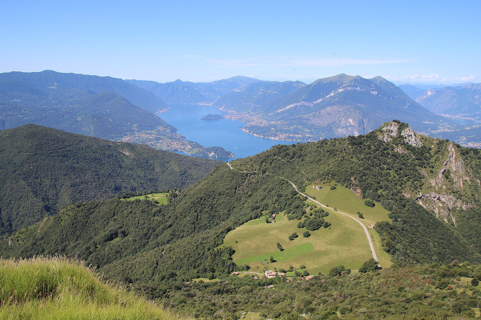
Northern Grigna Regional Park
Regional nature park of 5,541 hectares in Italy, established in 2005.
Overview
Regional nature park of 5,541 hectares in Italy, established in 2005.
Northern Grigna Regional Park is a regional nature park in Italy (Europe). It is a predominantly terrestrial area. Established on 2 March 2005, it covers about 5,541 hectares.
Protections and designations
Natura 2000 · habitats (SAC)
- Grigna Settentrionale IT2030001
Natura 2000 · birds (SPA)
- Grigne IT2030601
Protected as a regional nature park. International labels and designations: Natura 2000 network (2 sites). Key dates: established in 2005 and first Natura 2000 site under the Birds Directive in 2007.
In our collections
Timeline
-
2005
Established
-
2007
First Natura 2000 site under the Birds Directive
Sources: Wikidata (CC0) for establishment and international labels; EEA Natura 2000 database (CC-BY 4.0) for site designation dates.
Frequently asked questions
Where is Northern Grigna Regional Park?
In Italy (Europe). Representative point: 45.9732° N, 9.3806° E.
How large is Northern Grigna Regional Park?
About 5,541 hectares (55 km²). It is the 72nd largest of the 128 regional parks in Italy covered by Parkavela.
When was Northern Grigna Regional Park established?
On 2 March 2005.
What habitats and landscapes does Northern Grigna Regional Park include?
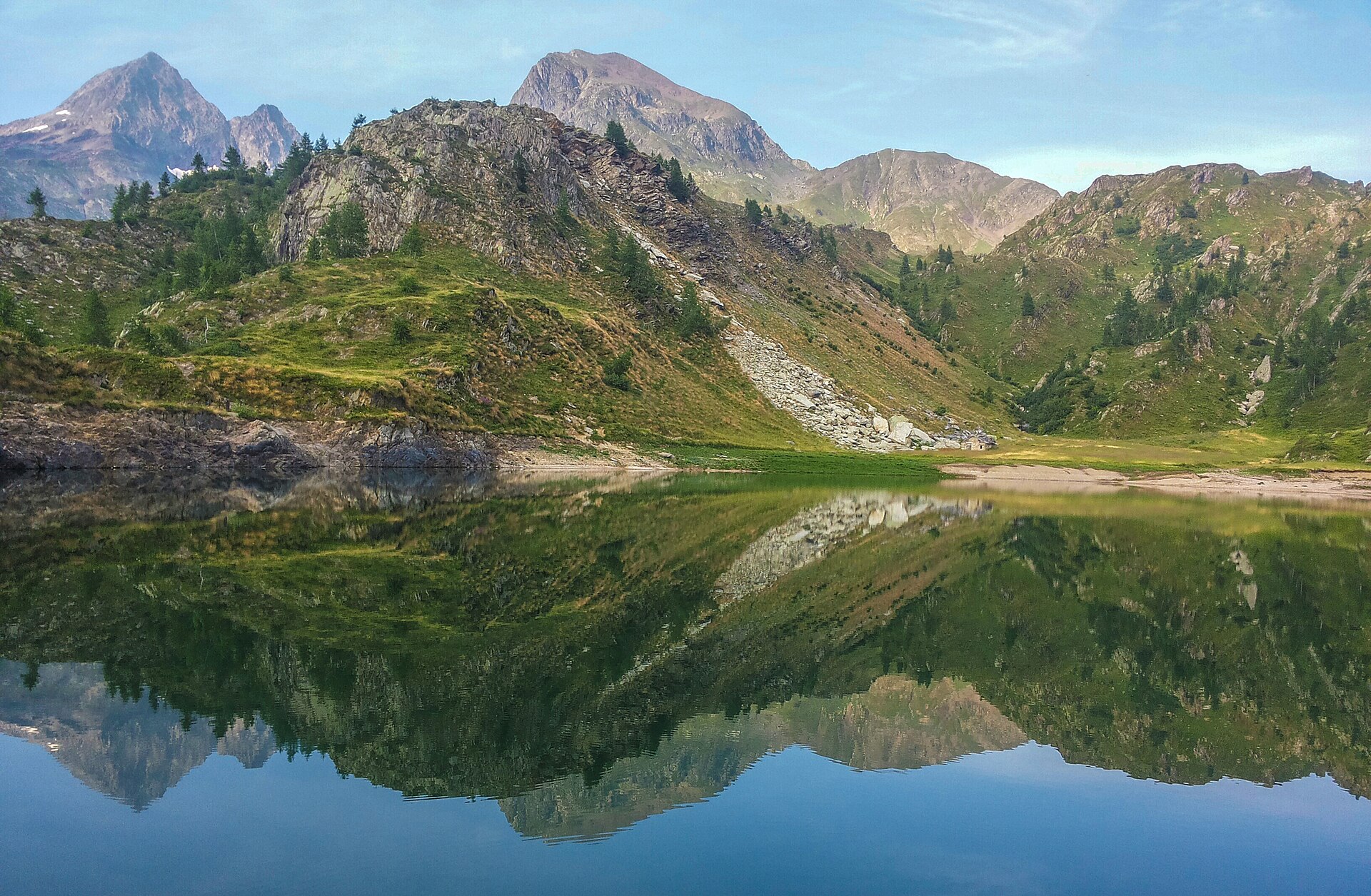
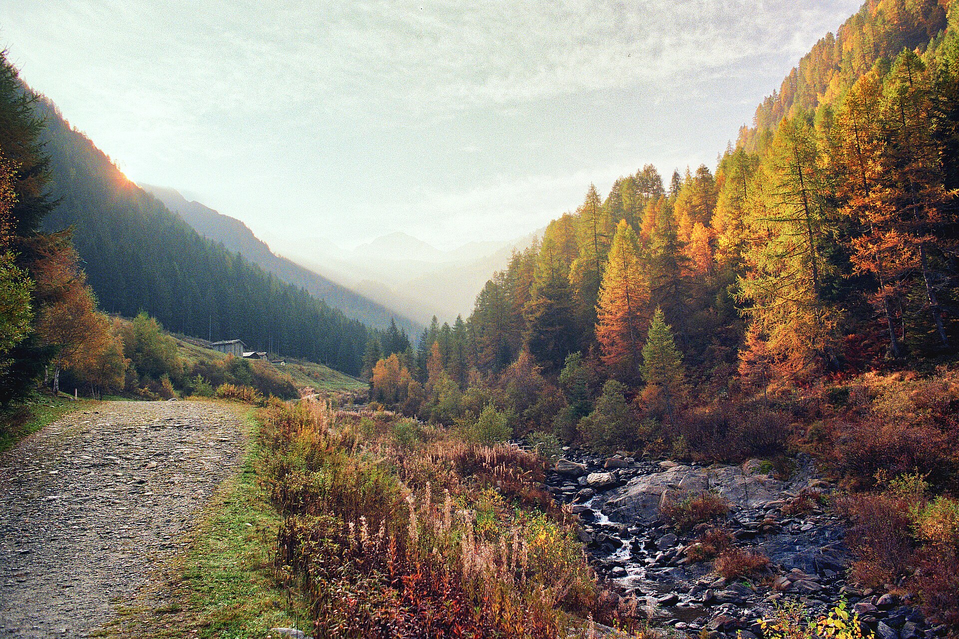
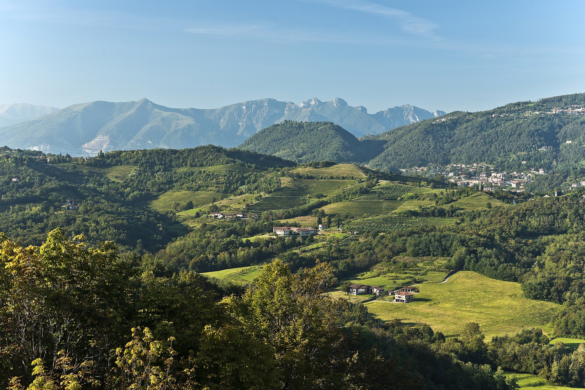
A terrestrial area, with forests and mountains.
What rocks lie beneath Northern Grigna Regional Park?
According to the European 1:1 million geological map (EGDI), the bedrock consists mainly of dolomites (100% of sampled points). These are mostly sedimentary rocks. The geological units date mainly from the Triassic (100% of sampled points).
What is the highest point of Northern Grigna Regional Park?
Grigna Settentrionale, at 2,410 m (OpenStreetMap).
What are the main summits of Northern Grigna Regional Park?
Grigna Settentrionale (2,410 m), Pizzo della Pieve (2,257 m), Zucco dei Chignoli (2,163 m), Cima di Campione (2,157 m) and Cima del Palone (2,089 m) (OpenStreetMap).
Which international labels apply to Northern Grigna Regional Park?
Natura 2000 network (2 sites).
When is the best time to visit Northern Grigna Regional Park?
Best time to visit: from June to August, with average temperatures of 11 to 13 °C and moderate rainfall.
Is there snow in Northern Grigna Regional Park?
Yes. According to NASA's MODIS satellites (2015–2025 average), snow covers the site about 40 days a year, mostly from December to February.
What is there to see in Northern Grigna Regional Park?
15 viewpoints, 1 waterfall, 1 lake or pond, 1 natural arch and 7 caves, including Sasso Rosso (676 m), Stagno del Pozzal, Porta di Prada (1,686 m) and Abisso W le donne (2,170 m) (OpenStreetMap).
Where can I stay in Northern Grigna Regional Park?
7 mountain huts and 2 campsites, including Rifugio Brioschi (2,403 m), San Pietro and Bivacco Riva - Girani (1,850 m) (OpenStreetMap).
Are there historic monuments in Northern Grigna Regional Park?
Yes. According to Wikidata, 31 monuments protected as Italian national cultural heritage stand within the boundary. For example: “"Casa Estiva del P.I.M.E" chapel” in Esino Lario, “Museo delle Grigne” in Esino Lario and “Caprera square” in Esino Lario.
Can you swim in Northern Grigna Regional Park?
One monitored bathing site lies in or within 1 km of the site; official 2025 classification: 1 excellent (European Environment Agency). Swimming is only permitted at the sites and times authorised locally.
What is the nearest large city to Northern Grigna Regional Park?
Nearest towns of over 50,000 people, as the crow flies: Como (25 km) and Lugano (26 km). Nearest airport: Bergamo-Il Caravaggio (BGY), about 36 km away.
How can I reach Northern Grigna Regional Park by train?
The nearest railway station is Monte Generoso Vetta, about 23 km from the site boundary.
Where can I get visitor information on site?
Ufficio turistico, I Viaggi del Tivano and Tourist Office / Pro Varenna.
Are there waymarked hiking trails in Northern Grigna Regional Park?
Yes. Waymarked hiking routes listed in OpenStreetMap: 29, including Sentiero del Viandante (Lierna and CamminaForeste. The “SI” route runs for about 6 km through the site, with some 1,250 m of ascent on its longest section.
Which species can be seen in Northern Grigna Regional Park?
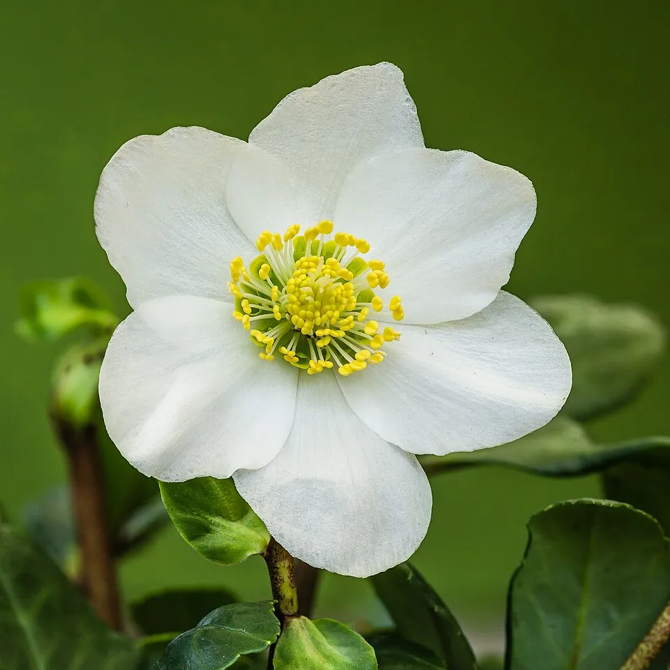
Among the species most often recorded on GBIF are Helleborus niger (Black hellebore), Corvus cornix (Hooded Crow), Fagus sylvatica (European Beech) and Periparus ater (Coal tit).
What is the official website of Northern Grigna Regional Park?
© OpenStreetMap
Download the boundary: GeoJSON · GPX Boundary © OpenStreetMap contributors (ODbL).
Geography
The representative point of the site lies at around 1,771 m above sea level. Over the 1996–2025 period, the mean annual temperature is about 3.6 °C and total precipitation reaches roughly 1,778 mm per year. The warmest month is usually July, the coolest January, and the wettest August. According to the European 1:1 million geological map (EGDI), the bedrock consists mainly of dolomites (100% of sampled points). These are mostly sedimentary rocks. The geological units date mainly from the Triassic (100% of sampled points).
Area
- Area
- 5,541 ha
- Elevation
- 1,771 m
- Median elevation
- 1,114 m
- Mean slope
- 28°
- Snow cover
- ≈ 40 days a year
- Coordinates
- 45.9732, 9.3806
Terrain: Mapzen Terrain Tiles (SRTM, USGS)
Elevation bands
- 500–1,000 m 36%
- 1,000–1,500 m 43%
- 1,500–2,000 m 17%
- 2,000–2,500 m 4%
share of the site in each elevation band (smoothed terrain model: summits are rounded off) · Terrain: Mapzen Terrain Tiles (SRTM, USGS)
Bedrock
- Dolomites 100 %
Sedimentary rocks 100 % · Main age: Triassic (100%)
Source: EGDI 1:1M geological map (EuroGeoSurveys and national geological surveys), CC BY 4.0 · 13 sampled points within the site.
Main summits
- Grigna Settentrionale2,410 m
- Pizzo della Pieve2,257 m
- Zucco dei Chignoli2,163 m
- Cima di Campione2,157 m
- Cima del Palone2,089 m
- Cima Palone Settentrionale1,995 m
- Sasso di Grigna1,967 m
- Il Pizzo1,829 m
- Monte Pilastro1,827 m
- Il Dente1,704 m
Data © OpenStreetMap contributors (ODbL)
Climate
● Mean temperature (°C) · ▮ Precipitation (mm)
Source: Copernicus ERA5-Land (C3S, doi:10.24381/cds.68d2bb30), monthly averages 1996–2025 interpolated to the representative point, temperatures adjusted for elevation.
Contains modified Copernicus Climate Change Service information 2026. Neither the European Commission nor ECMWF is responsible for any use that may be made of the Copernicus information or data it contains.
Snow cover measured by satellite
J
F
M
A
M
J
J
A
S
O
N
D
average share of the site under snow · snowiest parts · ≈ 40 days a year
Snow cover: MODIS/Terra MOD10CM v61 (Hall & Riggs, 2021, NASA NSIDC DAAC, doi:10.5067/MODIS/MOD10CM.061), imagery from NASA GIBS (ESDIS); 2015–2025 average, grid of about 5 km.
Natural habitats
According to CORINE Land Cover (2018), the site is mainly made up of forests (72%), grassland and meadows (12%) and heath and scrub (6%). Woodland is mostly broadleaved. Elevation ranges from about 580 m to 2,410 m (highest point: Grigna Settentrionale). Median elevation is 1,114 m, and 21% of the site lies above 1,500 m (SRTM elevation model). The terrain is steep: 42% of slopes exceed 30° (mean slope 28°). The 2 Natura 2000 sites overlapping the area list 14 habitats of European interest (2 priority), the most extensive being alpine and subalpine calcareous grasslands, Asperulo-Fagetum beech forests and calcareous rocky slopes with chasmophytic vegetation.
Biodiversity
Based on occurrences aggregated by GBIF, several species are regularly recorded within the site. Among the most frequent are Helleborus niger (Black hellebore), Corvus cornix (Hooded Crow), Fagus sylvatica (European Beech) and Periparus ater (Coal tit). The full list of documented taxa is shown below. The overlapping Natura 2000 sites list 115 species of European interest: 85 birds, 14 mammals, 4 reptiles, 3 amphibians, 5 invertebrates and 4 plants.
Habitats of European interest
From the official forms of the 2 Natura 2000 sites overlapping the area (areas reported for each whole site).
- Alpine and subalpine calcareous grasslands 532 ha
- Asperulo-Fagetum beech forests 362 ha
- Calcareous rocky slopes with chasmophytic vegetation 138 ha
- Illyrian Fagus sylvatica forests (Aremonio-Fagion) 118 ha
- Alpine Larix decidua and/or Pinus cembra forests 75 ha
- Bushes with Pinus mugo and Rhododendron hirsutum (Mugo-Rhododendretum hirsuti) priority 43 ha
- Castanea sativa woods 35 ha
- Mountain hay meadows 33 ha
and 6 more
Species of European interest
Birds · 85
Eurasian Sparrowhawk (Accipiter nisus) resident, Long-tailed Tit (Aegithalos caudatus) resident breeding wintering, Boreal Owl (Aegolius funereus) resident, Eurasian Skylark (Alauda arvensis) breeding, Rock Partridge (Alectoris graeca saxatilis) resident, Tawny Pipit (Anthus campestris) breeding, Water Pipit (Anthus spinoletta) breeding wintering passage, Tree Pipit (Anthus trivialis) breeding passage, Golden Eagle (Aquila chrysaetos) resident, Hazel Grouse (Bonasa bonasia) resident, Eurasian Eagle-owl (Bubo bubo) resident, Common Buzzard (Buteo buteo) resident and 73 more
Mammals · 14
European pine marten (Martes martes), Daubenton's bat (Myotis daubentonii), Whiskered bat (Myotis mystacinus), Natterer's bat (Myotis nattereri), Lesser noctule (Nyctalus leisleri), Kuhl's pipistrelle (Pipistrellus kuhlii), Nathusius's pipistrelle (Pipistrellus nathusii), Common pipistrelle (Pipistrellus pipistrellus), Brown long-eared bat (Plecotus auritus), Grey long-eared bat (Plecotus austriacus), Greater Horseshoe Bat (Rhinolophus ferrumequinum), Lesser horseshoe bat (Rhinolophus hipposideros) and 2 more
Reptiles · 4
Smooth snake (Coronella austriaca), Dice snake (Natrix tessellata), Common wall lizard (Podarcis muralis), Aesculapian Snake (Zamenis longissimus)
Amphibians · 3
Agile frog (Rana dalmatina), Common frog (Rana temporaria), Italian crested newt (Triturus carnifex)
Invertebrates · 5
White-clawed Crayfish (Austropotamobius pallipes), Greater Capricorn Beetle (Cerambyx cerdo), Roman Snail (Helix pomatia), Woodland brown (Lopinga achine), Clouded apollo (Parnassius mnemosyne)
Plants · 4
Marsh gladiolus (Gladiolus palustris), Field Macewort (Mannia triandra), Tufted horned rampion (Physoplexis comosa), Glaucous Primrose (Primula glaucescens)
Source: Natura 2000 standard data forms (EEA, CC-BY 4.0). Not exhaustive: sensitive species are not published.
Species to look out for

Bird
Hooded Crow
Corvus cornix25 records © Ricardo Tulio Gandelman from Rio de Janeiro, Brazil · CC BY 2.0




Observed species
Occurrences documented via GBIF; they are neither an exhaustive inventory nor proof of current presence.
- Black hellebore · Helleborus niger · 47
- Hooded Crow · Corvus cornix · 25
- European Beech · Fagus sylvatica · 25
- Coal tit · Periparus ater · 23
- Eurasian Chaffinch · Fringilla coelebs · 23
- Common Blackbird · Turdus merula · 22
- Italian Sparrow · Passer italiae · 22
- European robin · Erithacus rubecula · 21
- Great masterwort · Astrantia major · 21
- Seven-spot Ladybird · Coccinella septempunctata · 20
- Common Kestrel · Falco tinnunculus · 20
- Great tit · Parus major · 20
Records: GBIF.org (CC-BY). Names: Wikidata (CC0), GBIF. Photos: Wikimedia Commons.
Conservation challenges
The primary purpose of the site is to preserve its natural habitats and the biodiversity they support. The species recorded (Biodiversity tab) reflect its ecological value. The designations it holds frame its management and the control of land use.
According to Global Forest Change data (University of Maryland, Global Forest Watch), about 26 ha of tree cover were lost within the boundary between 2001 and 2023 (under 1% of its area), peaking in 2016 and 2019. These losses include logging, storms and fires, and do not account for regrowth. According to CORINE Land Cover, land cover here remained almost unchanged between 1990 and 2018 (less than 0.5% of the area affected). Since 2016, the European EFFIS system (Copernicus) has mapped one fire here, in April 2021 (near Esino Lario), which burned about 22 ha of the site. At night, 8% of the area gives off artificial light detectable from space (NASA VIIRS Black Marble composite, 2016). According to the Natura 2000 forms, of 12 assessed habitats of European interest, 6 are in excellent condition and the rest in good condition. According to the Water Framework Directive assessment (2022 river basin management plans, data 2014–2018), of the 2 rivers assessed within the site, 1 has good ecological status and 1 moderate ecological status. Invasive alien species have been recorded within the site since 2000 (GBIF observations). Among them: Buddleja davidii (Butterfly-bush), Impatiens parviflora (Small balsam) and Erigeron annuus (Eastern daisy fleabane).
Pressure indicators
Tree cover lost
26 ha
2001–2023 · < 1% of the area
20012023
Fires since 2016
22 ha
burned within the boundary (1 mapped fire)
- 2021 · Esino Lario · 22 ha
Light at night
8%
of the area gives off artificial light visible from space
DarkLit
Built-up land
< 1%
buildings, business areas, roads, quarries
Land cover change
< 0.5%
of the area changed, 1990–2018 · CORINE
Rivers and lakes
40%
of the 9 km of assessed rivers in good or high ecological status · WFD 2022
assessments 2014–2018
Invasive alien species
3
recorded since 2000
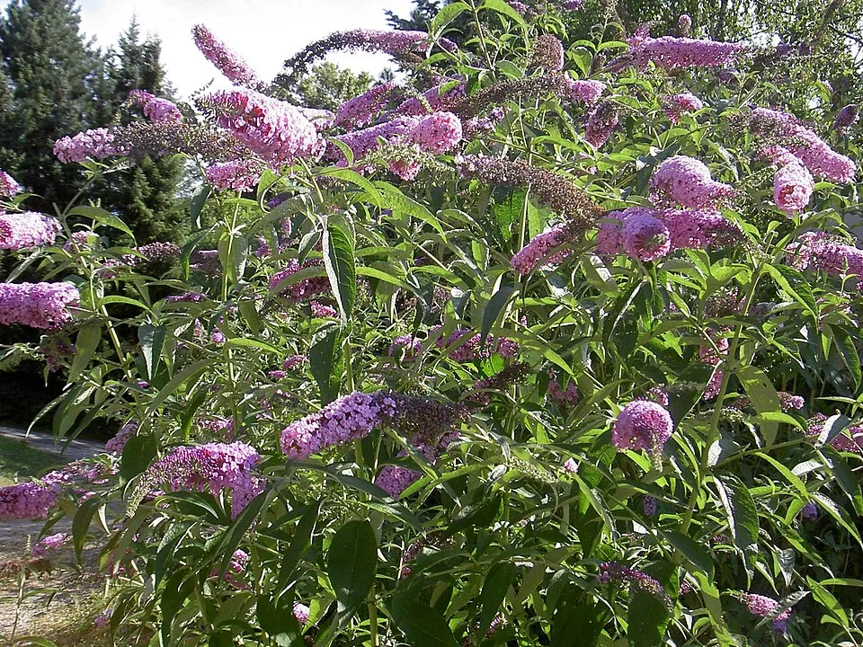 Butterfly-bush
 Small balsam
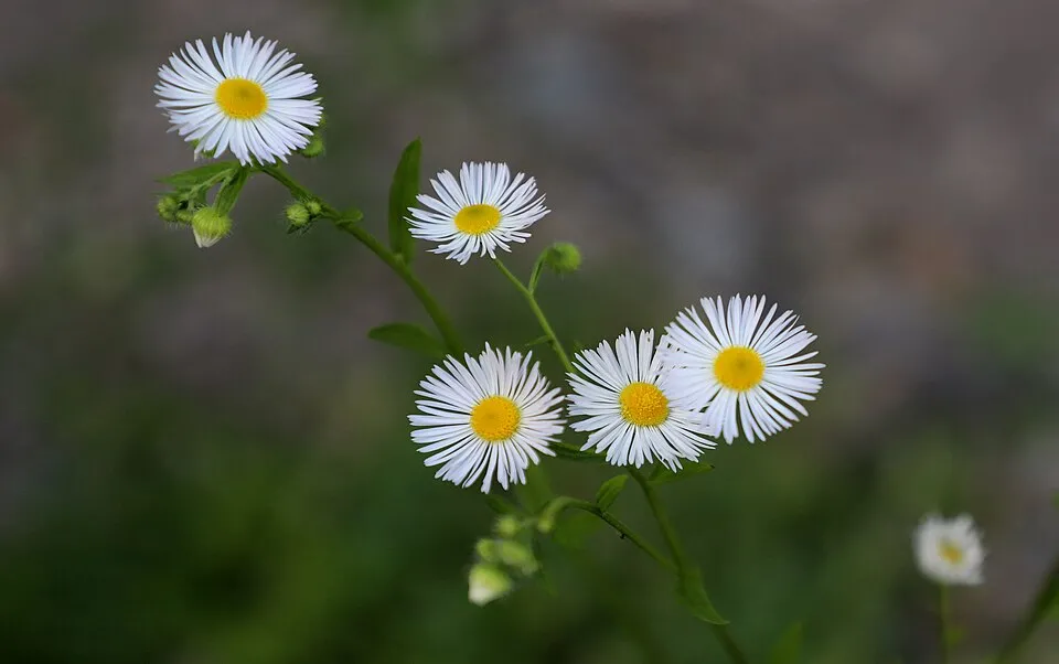 Eastern daisy fleabane
Photos: Butterfly-bush © --IKAl 15:22, 23 July 2007 (UTC) · CC BY-SA 2.5; Small balsam © André Karwath aka Aka · CC BY-SA 2.5; Eastern daisy fleabane © W. Bulach · CC BY-SA 4.0
Sources: Global Forest Change (Hansen et al., University of Maryland, via Global Forest Watch, CC-BY 4.0); EFFIS, European Commission / Copernicus; NASA Black Marble 2016 (public domain); CORINE Land Cover 2018 (Copernicus) or MODIS.
CORINE Land Cover Change 1990–2018: generated using European Union's Copernicus Land Monitoring Service information (EEA), aggregated by Parkavela; DOI 10.2909/f30f1000-7cf8-43bb-872c-5eb093911b24.
Ecological status of water bodies: European Environment Agency, WISE – Water Framework Directive, 3rd river basin management plans (2022), CC BY 4.0. Official national classification, not comparable between countries.
Invasive alien species: Global Register of Introduced and Invasive Species (ISSG, CC BY 4.0); Union list, Regulation (EU) 1143/2014 (INBO, CC0); GBIF.org records (CC0 / CC BY 4.0), at least 2 per species.
Practical information
Cities and airport
- Como
25 km as the crow flies - Lugano
26 km as the crow flies - Airport: Bergamo-Il Caravaggio (BGY)
36 km as the crow flies
Visitor information
- Ufficio turistico
within the site - I Viaggi del Tivano
1 km from the site boundary - Tourist Office / Pro Varenna
1 km from the site boundary - Proloco di Lierna
2 km from the site boundary
Things to see
15 viewpoints · 1 waterfall · 1 lake or pond · 1 natural arch · 7 caves
- Sasso Rosso
viewpoint · 676 m - Stagno del Pozzal
lake or pond - Porta di Prada
natural arch · 1,686 m - Abisso W le donne
cave · 2,170 m - Belvedere dal San Defendente
viewpoint
Where to stay
7 mountain huts · 2 campsites
- Rifugio Brioschi
Staffed hut · 2,403 m - San Pietro
campsite - Bivacco Riva - Girani
Unstaffed hut · 1,850 m - Rifugio Arnaldo Bogani
Staffed hut · 1,816 m - Bivacco Baitello dell'amicizia
Unstaffed hut · 1,740 m
Hiking
29 waymarked routes listed, including:
Sentiero del Viandante (LiernaCamminaForeste
Data © OpenStreetMap contributors (ODbL) · Wikidata (CC0)
Waymarked hiking routes
Sentiero del Viandante (Lierna - Perledo) (variante bassa)
6.1 km within the site ↗ 53 m↘ 257 m 756–978 m
up to T2 · mountain hiking
CF CamminaForeste - Tappa 7D
3.8 km within the site ↗ 41 m↘ 756 m 530–1,295 m
up to T2 · mountain hiking
38 Palone Vallori
1.6 km within the site ↗ 200 m↘ 0 m 1,819–2,029 m
up to T4 · alpine hiking faint path in places
Tracks © OpenStreetMap contributors (ODbL), clipped to the boundary; elevation gain and profiles computed on the longest section from Mapzen Terrain Tiles (≈ 30 m), indicative only. Indicative difficulty (SAC scale, OpenStreetMap, via Waymarked Trails): check with the park.
Bathing
1 monitored bathing site in or within 1 km of the site · 2025 classification
Excellent · 1
- Riva Bianca · lake · Excellent
Source: European Environment Agency, official bathing water classification (Directive 2006/7/EC, CC-BY 4.0). Swimming is only permitted at the sites and times authorised locally.
Access and visiting
The nearest railway station is Monte Generoso Vetta, about 23 km from the site boundary. Nearest towns of over 50,000 people, as the crow flies: Como (25 km) and Lugano (26 km). Nearest airport: Bergamo-Il Caravaggio (BGY), about 36 km away. About 390,000 people live within 20 km of the site boundary, 130,000 of them within 10 km; some 1,000 people are estimated to live inside (GHSL estimate, 2020). This population has grown by about 7% since 2000. Visitor information on site: Ufficio turistico, I Viaggi del Tivano and Tourist Office / Pro Varenna. Waymarked hiking routes listed in OpenStreetMap: 29, including Sentiero del Viandante (Lierna and CamminaForeste. To see: 15 viewpoints, 1 waterfall, 1 lake or pond, 1 natural arch and 7 caves, including Sasso Rosso (676 m), Stagno del Pozzal, Porta di Prada (1,686 m) and Abisso W le donne (2,170 m). Where to stay: 7 mountain huts and 2 campsites, including Rifugio Brioschi (2,403 m), San Pietro and Bivacco Riva - Girani (1,850 m). To plan a visit (access, opening periods, visitor rules), it is best to consult the official information from the managing body and the official website listed in this page's sources.
Source: OpenStreetMap (ODbL), Wikidata (CC0), October 2026.
Built heritage
According to Wikidata, 31 monuments protected as Italian national cultural heritage stand within the boundary. Among them are 13 religious buildings, 4 bridges, lighthouses, mills and working buildings and 4 houses and civic buildings. Examples include “"Casa Estiva del P.I.M.E" chapel” in Esino Lario, “Museo delle Grigne” in Esino Lario and “Caprera square” in Esino Lario.
13 religious buildings4 bridges, lighthouses, mills and working buildings4 houses and civic buildings1 prehistoric or archaeological site
-
"Casa Estiva del P.I.M.E" chapel
Esino Lario -
Museo delle Grigne
Esino Lario · 20th c. -
Caprera square
Esino Lario -
Tower of Esino
Esino Lario · 12th c. -
Pasture shelter Alpe di Esino
Esino Lario -
Primary school chapel and parish works
Esino Lario -
Villa Rogo in Esino Lario
Esino Lario -
Fountain Piach in Esino Lario
Esino Lario
and 23 more
Source: Wikidata (CC0), monuments in each country’s official heritage protection registers, at national or regional level. Each item links to its Wikidata entry.
When to visit
Best time to visit: from June to August, with average temperatures of 11 to 13 °C and moderate rainfall. Average temperatures drop below 0 °C from November to March: frost is common. These averages apply to the site's representative point (1,771 m); higher up it is markedly cooler and snow lasts longer. According to NASA's MODIS satellites (2015–2025 average), snow covers the site about 40 days a year, mostly from December to February. Day length ranges from about 8 h 40 min in December to 15 h 43 min in June. Wildlife records published on GBIF peak for birds (January), plants (July and August) and butterflies and moths (July). These peaks also reflect when observers are most active.
Source: Copernicus ERA5-Land (C3S), monthly averages 1996–2025 at the representative point, temperatures adjusted for elevation.
Contains modified Copernicus Climate Change Service information 2026. Neither the European Commission nor ECMWF is responsible for any use that may be made of the Copernicus information or data it contains.
Wildlife records calendar
JFMAMJJASOND
Birds
Plants
Butterflies & moths
Monthly records published on GBIF (CC-BY), relative to the busiest month; also reflects observer activity.
Gallery
© Francescoviglienghi · CC BY-SA 3.0
© Carlo Maria Pensa · CC BY-SA 4.0
© Luisella Aliprandi · CC BY-SA 3.0
© Martin Lindner · CC BY-SA 4.0
© Zui Tao · CC BY-SA 4.0
© Pier Carlo Barindelli · CC BY-SA 3.0
Sources and licences
- Wikidata: Q3895531
- OpenStreetMap: relation 15657153
- Official website: http://www.parcogrigna.it
- Wikipedia: en.wikipedia.org/wiki/Northern_Grigna_Regional_Park
References
- cds.climate.copernicus.eu: climate · CC-BY-4.0
- registry.opendata.aws: elevation of the reference point, detailed relief · PD
- land.copernicus.eu: land cover, land cover change, sea share · COPERNICUS
- doi.org: population around the site · CC-BY-4.0
- wikidata.org: official area, highest point, establishment date, protected heritage, nearby cities and airport, access and peaks, lake depths, places to see, official website · CC0-1.0
- eea.europa.eu: bathing water quality, ecological status of waters · CC-BY-4.0
- en.eurovelo.com: EuroVelo cycle routes · ODbL-1.0
- cycling.waymarkedtrails.org: cycle routes · ODbL-1.0
- opentopodata.org: elevations · PD
- forest-fire.emergency.copernicus.eu: wildfires · COPERNICUS
- globalforestwatch.org: tree cover loss · CC-BY-4.0
- gbif.org: seasonality of sightings, invasive alien species, observed species · CC-BY-4.0
- europe-geology.eu: geology · CC-BY-4.0
- hydrosheds.org: lakes · CC-BY-4.0
- natura2000.eea.europa.eu: Natura 2000 habitats and species · CC-BY-4.0
- openstreetmap.org: official name, access and peaks, places to see · ODbL-1.0
- earthobservatory.nasa.gov: night light · PD
- hiking.waymarkedtrails.org: route difficulty · ODbL-1.0
- nsidc.org: snow cover · PD
- wikidata.org: Wikipedia article · CC-BY-SA-4.0
Data © OpenStreetMap contributors (ODbL), Wikidata (CC0) and the sources cited.