Austria · Terrestrial
Ötztal Nature Park
Nature park of 50,680 hectares in Austria.
Overview
Nature park of 50,680 hectares in Austria.
Ötztal Nature Park is located in Austria (Europe). It is a predominantly terrestrial area. It covers about 50,680 hectares.
Protections and designations
Natura 2000 · habitats (SAC) · 2 sites
- Engelswand AT3311000
- Ötztaler Alpen AT3305000
Natura 2000 · birds (SPA)
- Ötztaler Alpen AT3305000
Protected as a nature park. International labels and designations: Natura 2000 network (2 sites). Key dates: first Natura 2000 site under the Birds Directive in 1996 and first Natura 2000 site under the Habitats Directive in 2005.
In our collections
Timeline
-
1996
First Natura 2000 site under the Birds Directive
-
2005
First Natura 2000 site under the Habitats Directive 2 such sites designated up to 2009
Sources: Wikidata (CC0) for establishment and international labels; EEA Natura 2000 database (CC-BY 4.0) for site designation dates.
Frequently asked questions
Where is Ötztal Nature Park?
In Austria (Europe). Representative point: 46.7629° N, 10.8830° E.
How large is Ötztal Nature Park?
About 50,680 hectares (507 km²). It is the 3rd largest of the 21 nature parks in Austria covered by Parkavela.
What habitats and landscapes does Ötztal Nature Park include?
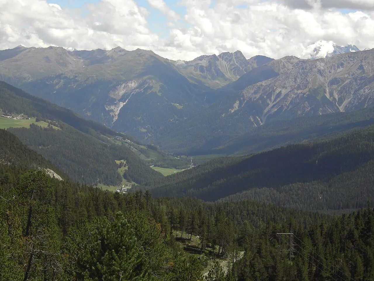
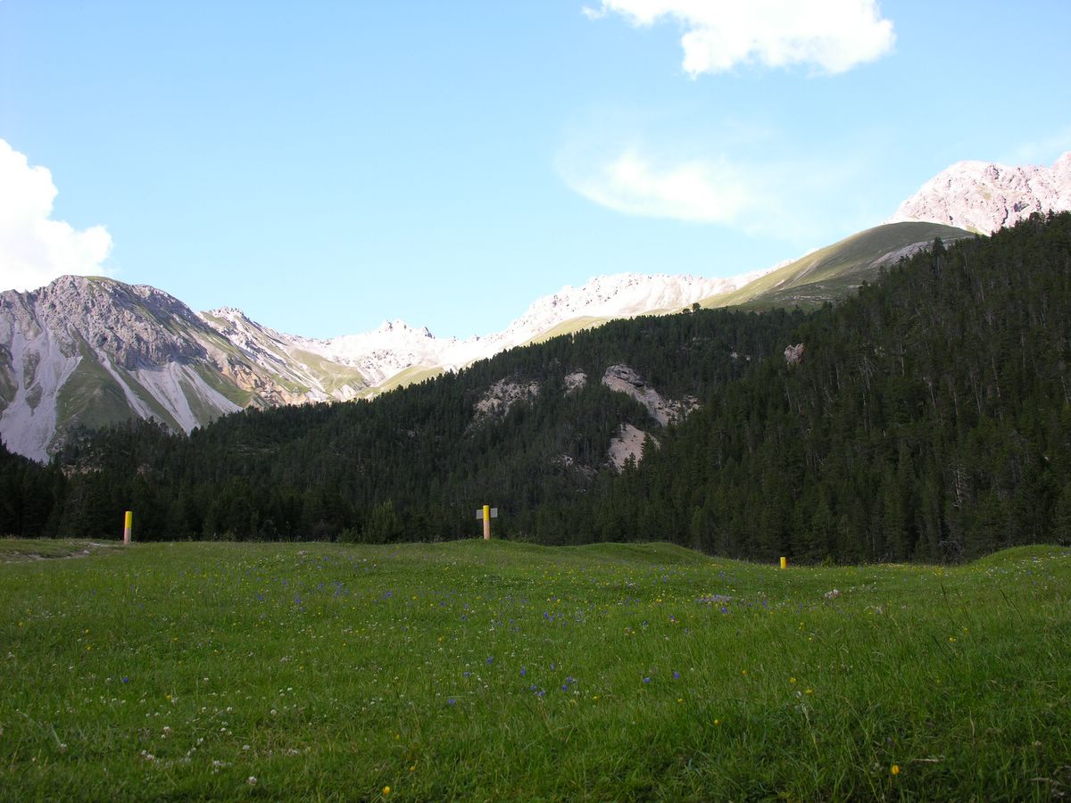
A terrestrial area, with mountains.
What rocks lie beneath Ötztal Nature Park?
According to the European 1:1 million geological map (EGDI), the bedrock consists mainly of mica schists (100% of sampled points). These are mostly metamorphic rocks. The geological units date mainly from the Precambrian (100% of sampled points).
What is the highest point of Ötztal Nature Park?
Wildspitze, at 3,768 m (OpenStreetMap).
What are the main summits of Ötztal Nature Park?
Wildspitze (3,768 m), Wildspitze (Nordgipfel) (3,750 m), Hinterer Brochkogel (3,635 m), Hintere Schwärze (3,624 m) and Vorderer Brochkogel (3,565 m) (OpenStreetMap).
Which international labels apply to Ötztal Nature Park?
Natura 2000 network (2 sites).
When is the best time to visit Ötztal Nature Park?
Mildest period: from June to August, with average temperatures of -1 to 2 °C.
Is there snow in Ötztal Nature Park?
Yes. According to NASA's MODIS satellites (2015–2025 average), snow covers most of the site from October to June, and until July on higher ground, with about 250 snow-covered days a year on average. Permanent snow remains on the summits even in midsummer.
What is there to see in Ötztal Nature Park?
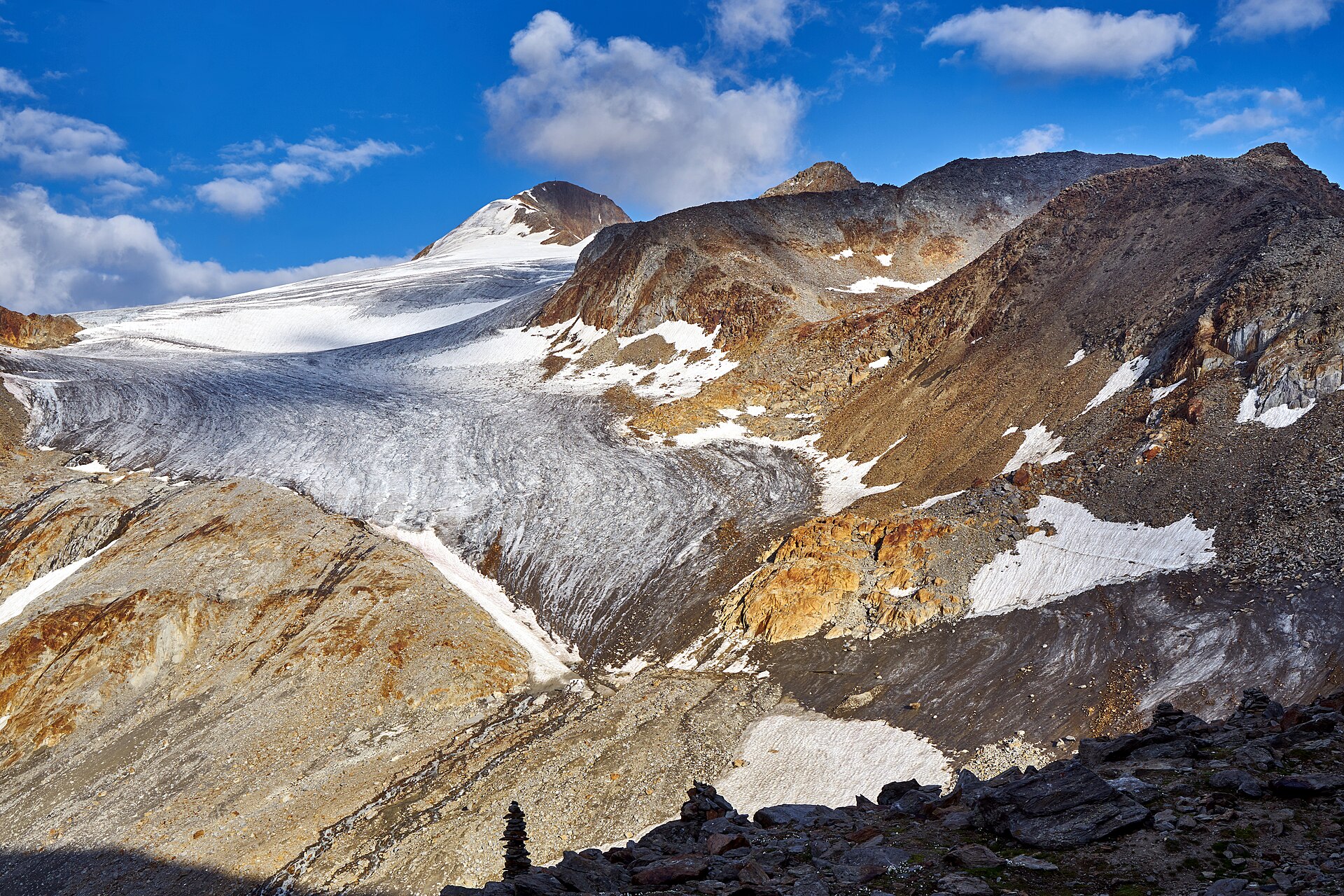
5 lakes and ponds and 24 glaciers, including Piburger See (913 m), Gaisbergferner, Seekarsee (2,658 m) and Sulztalferner (2,925 m) (Wikidata).
Where can I stay in Ötztal Nature Park?
14 mountain huts, including Hochstubaihütte (3,173 m), Ramolhaus (3,006 m) and Hildesheimer Hütte (2,899 m) (Wikidata).
Are there historic monuments in Ötztal Nature Park?
Yes. According to Wikidata, 8 monuments listed as protected monuments in Austria stand within the boundary. For example: “Neue Blasiuskapelle Piburg” in Oetz, “Mesolithische bis neuzeitliche Fundstelle am Beilstein” in Sölden and “Hildesheimer Hütte” in Sölden.
Can you swim in Ötztal Nature Park?
One monitored bathing site lies in or within 1 km of the site; official 2025 classification: 1 excellent (European Environment Agency). Swimming is only permitted at the sites and times authorised locally.
What is the nearest large city to Ötztal Nature Park?
Nearest towns of over 50,000 people, as the crow flies: Innsbruck (28 km) and Bolzano (39 km). Nearest airport: Innsbruck (INN), about 24 km away.
How can I reach Ötztal Nature Park by train?
The nearest railway station is Ötztal, about 5 km from the site boundary.
Where can I get visitor information on site?
Ötztal Tourismus, Informationsbüro Vent, Information Obergurgl and Naturparkverwaltung Ötztal.
Are there waymarked hiking trails in Ötztal Nature Park?
Yes. Waymarked hiking routes listed in OpenStreetMap: 51, including E 5, Via Alpina Yellow, Zentralalpenweg and Ötztaler Urweg. The “Zentralalpenweg 02” route runs for about 45 km through the site, with some 1,280 m of ascent on its longest section.
Which species can be seen in Ötztal Nature Park?
Among the species most often recorded on GBIF are Poa laxa (Mt. Washington bluegrass), Saxifraga bryoides (Mossy saxifrage), Leucanthemopsis alpina (Alpine moon daisy) and Luzula spicata (Spiked woodrush).
What is the official website of Ötztal Nature Park?
© OpenStreetMap
Download the boundary: GeoJSON · GPX Boundary © OpenStreetMap contributors (ODbL).
Geography
The representative point of the site lies at around 3,482 m above sea level. Over the 1996–2025 period, the mean annual temperature is about -8.2 °C and total precipitation reaches roughly 1,267 mm per year. The warmest month is usually July, the coolest January, and the wettest August. According to the European 1:1 million geological map (EGDI), the bedrock consists mainly of mica schists (100% of sampled points). These are mostly metamorphic rocks. The geological units date mainly from the Precambrian (100% of sampled points). In 2015, 171 glaciers covered 79.3 km² within the site (Sentinel-2 glacier inventory of the Alps).
Area
- Area of the boundary
- 50,680 ha
- Elevation
- 3,482 m
- Median elevation
- 2,728 m
- Mean slope
- 28°
- Snow cover
- ≈ 250 days a year
- Coordinates
- 46.7629, 10.883
Terrain: Mapzen Terrain Tiles (SRTM, USGS; © offene Daten Österreichs – Digitales Geländemodell (DGM) Österreich, CC BY 3.0 AT)
Elevation bands
- 1,500–2,000 m 6%
- 2,000–2,500 m 23%
- 2,500–3,000 m 47%
- above 3,000 m 23%
share of the site in each elevation band (smoothed terrain model: summits are rounded off) · Terrain: Mapzen Terrain Tiles (SRTM, USGS; © offene Daten Österreichs – Digitales Geländemodell (DGM) Österreich, CC BY 3.0 AT)
Bedrock
- Mica schists 100 %
Metamorphic rocks 100 % · Main age: Precambrian (100%)
Source: EGDI 1:1M geological map (EuroGeoSurveys and national geological surveys), CC BY 4.0 · 14 sampled points within the site.
Main summits
- Wildspitze3,768 m
- Wildspitze (Nordgipfel)3,750 m
- Hinterer Brochkogel3,635 m
- Hintere Schwärze3,624 m
- Vorderer Brochkogel3,565 m
- Punta di Marzèl Est/Östliche Marzellspitze3,555 m
- Ötztaler Urkund3,554 m
- Großer Ramolkogel3,549 m
- Schalfkogel3,537 m
- Hochvernagtspitze3,536 m
Data © OpenStreetMap contributors (ODbL)
Climate
● Mean temperature (°C) · ▮ Precipitation (mm)
Source: Copernicus ERA5-Land (C3S, doi:10.24381/cds.68d2bb30), monthly averages 1996–2025 interpolated to the representative point, temperatures adjusted for elevation.
Contains modified Copernicus Climate Change Service information 2026. Neither the European Commission nor ECMWF is responsible for any use that may be made of the Copernicus information or data it contains.
Snow cover measured by satellite
J
F
M
A
M
J
J
A
S
O
N
D
average share of the site under snow · snowiest parts · ≈ 250 days a year
Snow cover: MODIS/Terra MOD10CM v61 (Hall & Riggs, 2021, NASA NSIDC DAAC, doi:10.5067/MODIS/MOD10CM.061), imagery from NASA GIBS (ESDIS); 2015–2025 average, grid of about 5 km.
Natural habitats
According to CORINE Land Cover (2018), the site is mainly made up of bare rock and scree (38%), sparsely vegetated land (23%) and grassland and meadows (18%). Elevation ranges from about 1,660 m to 3,768 m (highest point: Wildspitze). Median elevation is 2,728 m, and 23% of the site lies above 3,000 m (SRTM and DGM Österreich elevation models). The terrain is steep: 45% of slopes exceed 30° (mean slope 28°). The 2 Natura 2000 sites overlapping the area list 25 habitats of European interest (5 priority), the most extensive being siliceous scree of the montane to snow levels (Androsacetalia alpinae and Galeopsietalia ladani), permanent glaciers and Alpine and Boreal heaths.
Biodiversity
Based on occurrences aggregated by GBIF, several species are regularly recorded within the site. Among the most frequent are Poa laxa (Mt. Washington bluegrass), Saxifraga bryoides (Mossy saxifrage), Leucanthemopsis alpina (Alpine moon daisy) and Luzula spicata (Spiked woodrush). The full list of documented taxa is shown below. The overlapping Natura 2000 sites list 44 species of European interest: 40 birds, 1 fish and 3 plants.
Habitats of European interest
From the official forms of the 2 Natura 2000 sites overlapping the area (areas reported for each whole site).
- Siliceous scree of the montane to snow levels (Androsacetalia alpinae and Galeopsietalia ladani) 11,086 ha
- Permanent glaciers 10,728 ha
- Alpine and Boreal heaths 2,852 ha
- Siliceous alpine and boreal grasslands 1,691 ha
- Siliceous rocky slopes with chasmophytic vegetation 945 ha
- Alpine Larix decidua and/or Pinus cembra forests 664 ha
- Acidophilous Picea forests of the montane to alpine levels (Vaccinio-Piceetea) 299 ha
- Bushes with Pinus mugo and Rhododendron hirsutum (Mugo-Rhododendretum hirsuti) priority 186 ha
and 17 more
Species of European interest
Birds · 40
Boreal Owl (Aegolius funereus) resident, Eurasian Skylark (Alauda arvensis) breeding, Rock Partridge (Alectoris graeca saxatilis) resident, Meadow Pipit (Anthus pratensis) breeding, Water Pipit (Anthus spinoletta) breeding, Tree Pipit (Anthus trivialis) breeding, Common Swift (Apus apus) breeding, Golden Eagle (Aquila chrysaetos) resident, Hazel Grouse (Bonasa bonasia) resident, Eurasian Eagle-owl (Bubo bubo) resident, European Goldfinch (Carduelis carduelis) resident, Common Rosefinch (Carpodacus erythrinus) breeding and 28 more
Fish · 1
Plants · 3
Little grapefern (Botrychium simplex), Riccia breidleri, Trifolium saxatile
Source: Natura 2000 standard data forms (EEA, CC-BY 4.0). Not exhaustive: sensitive species are not published.
Species to look out for
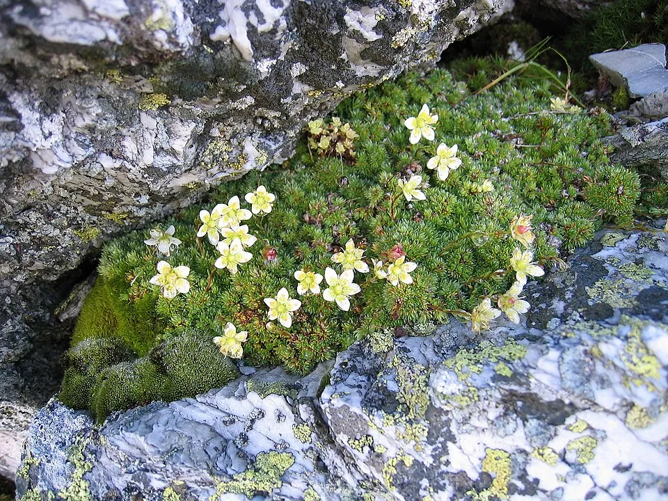

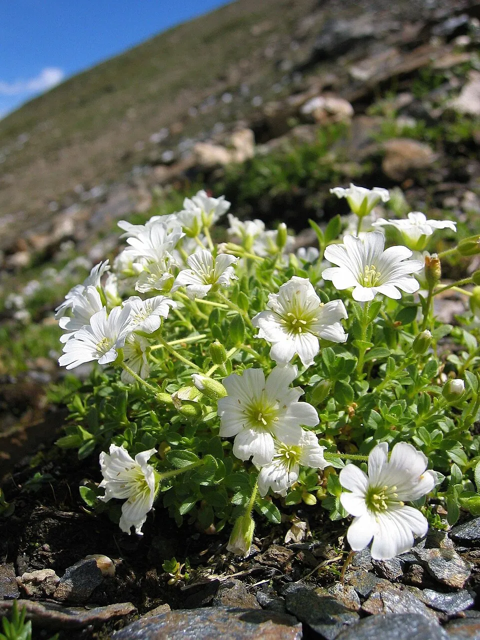
Plant
Alpine moon daisy
Leucanthemopsis alpina1,712 records © Stéphane TASSON – own photograph · CC BY-SA 3.0
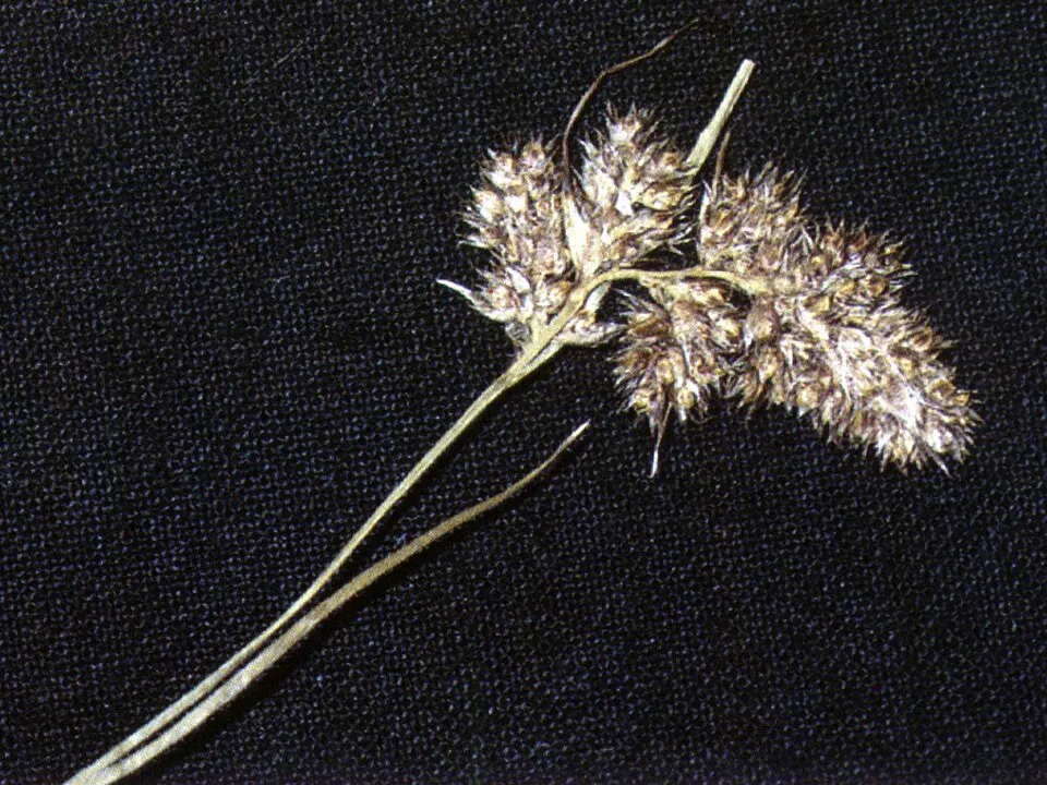

Observed species
Occurrences documented via GBIF; they are neither an exhaustive inventory nor proof of current presence.
- Mt. Washington bluegrass · Poa laxa · 1936
- Mossy saxifrage · Saxifraga bryoides · 1801
- Alpine moon daisy · Leucanthemopsis alpina · 1712
- Spiked woodrush · Luzula spicata · 1470
- One-flowered Mouse-ear · Cerastium uniflorum · 1427
- Glacier buttercup · Ranunculus glacialis · 1403
- Moss campion · Silene acaulis · 1326
- Cyphel · Cherleria sedoides · 1272
- Gentiana bavarica · 986
- Primula glutinosa · 869
- Alpine rock-jasmine · Androsace alpina · 770
- Oneflower fleabane · Erigeron uniflorus · 767
+18 more species
- Oreochloa disticha · 758
- Alpine Stonecrop · Sedum alpestre · 693
- Alpine bluegrass · Poa alpina · 675
- Festuca intercedens · 592
- Saxifraga exarata · 525
- Alpine speedwell · Veronica alpina · 521
- Alpine arctic cudweed · Omalotheca supina · 495
- Euphrasia minima · 433
- Carex curvula · 357
- Spring Sandwort · Sabulina verna · 327
- Arctic pearlwort · Sagina saginoides · 320
- Purple mountain saxifrage · Saxifraga oppositifolia · 262
- Spike trisetum · Koeleria spicata · 194
- Mignonette-leaved Bittercress · Cardamine resedifolia · 191
- Pedicularis asplenifolia · 181
- Rock Bent · Agrostis rupestris · 158
- Jacobaea carniolica · 154
- Austrian draba · Draba fladnizensis · 145
Records: GBIF.org (CC-BY). Names: Wikidata (CC0), GBIF. Photos: Wikimedia Commons.
Conservation challenges
The primary purpose of the site is to preserve its natural habitats and the biodiversity they support. The species recorded (Biodiversity tab) reflect its ecological value. The designations it holds frame its management and the control of land use.
According to Global Forest Change data (University of Maryland, Global Forest Watch), about 71 ha of tree cover were lost within the boundary between 2001 and 2023 (under 1% of its area), peaking in 2019 and 2021. These losses include logging, storms and fires, and do not account for regrowth. According to CORINE Land Cover, land cover here remained almost unchanged between 1990 and 2018 (less than 0.5% of the area affected). At night, the area gives off virtually no artificial light detectable from space (NASA VIIRS Black Marble composite, 2016). According to the Natura 2000 forms, of 16 assessed habitats of European interest, 6 are in excellent condition and the rest in good condition. According to the Water Framework Directive assessment (2022 river basin management plans, data 2016–2021), 96% of the 91 km of rivers assessed within the site are in good or high ecological status.
Pressure indicators
Tree cover lost
71 ha
2001–2023
20012023
Fires since 2016
0
No large fire mapped (fires over about 30 ha)
Light at night
0%
of the area gives off artificial light visible from space
DarkLit
Built-up land
< 1%
buildings, business areas, roads, quarries
Land cover change
< 0.5%
of the area changed, 1990–2018 · CORINE
Rivers and lakes
96%
of the 91 km of assessed rivers in good or high ecological status · WFD 2022
assessments 2016–2021
Sources: Global Forest Change (Hansen et al., University of Maryland, via Global Forest Watch, CC-BY 4.0); EFFIS, European Commission / Copernicus; NASA Black Marble 2016 (public domain); CORINE Land Cover 2018 (Copernicus) or MODIS.
CORINE Land Cover Change 1990–2018: generated using European Union's Copernicus Land Monitoring Service information (EEA), aggregated by Parkavela; DOI 10.2909/f30f1000-7cf8-43bb-872c-5eb093911b24.
Ecological status of water bodies: European Environment Agency, WISE – Water Framework Directive, 3rd river basin management plans (2022), CC BY 4.0. Official national classification, not comparable between countries.
Practical information
Cities and airport
- Innsbruck
28 km as the crow flies - Bolzano
39 km as the crow flies - Airport: Innsbruck (INN)
24 km as the crow flies
Visitor information
- Ötztal Tourismus, Informationsbüro Vent
< 1 km from the site boundary - Information Obergurgl
< 1 km from the site boundary - Naturparkverwaltung Ötztal
< 1 km from the site boundary - Bergführerstelle
< 1 km from the site boundary
Things to see
5 lakes and ponds · 24 glaciers
- Piburger See
lake or pond · 913 m - Gaisbergferner
glacier - Seekarsee
lake or pond · 2,658 m - Sulztalferner
glacier · 2,925 m - Grastalsee
lake or pond · 2,532 m
Where to stay
14 mountain huts
- Hochstubaihütte
mountain hut · 3,173 m - Ramolhaus
mountain hut · 3,006 m - Hildesheimer Hütte
mountain hut · 2,899 m - Hochwildehaus
mountain hut · 2,883 m - Breslauer Hütte
mountain hut · 2,844 m
Hiking
51 waymarked routes listed, including:
E 5Via Alpina YellowZentralalpenwegÖtztaler UrwegÖtztal Trek Etappe
Trail difficulty
- T1 · easy hiking · 5% · 34 km
- T2 · mountain hiking · 35% · 183 km
- T3–T6 · demanding or alpine hiking · 55% · 278 km
495 km graded out of 632 km of paths
SAC scale (T1–T6) © OpenStreetMap contributors (ODbL): indicative only, check with the park.
Data © OpenStreetMap contributors (ODbL) · Wikidata (CC0)
Waymarked hiking routes
E5 Europäischer Fernwanderweg E5, Österreich Tirol
6.4 km within the site ↗ 555 m↘ 0 m 1,927–2,488 m
up to T2 · mountain hiking
VA-B33 Via Alpina Yellow B33
3.9 km within the site ↗ 256 m↘ 76 m 2,506–2,700 m
up to T2 · mountain hiking
02 Zentralalpenweg 02
44.5 km within the site ↗ 1,280 m↘ 865 m 1,893–3,181 m
up to T5 · demanding alpine hiking
02A Zentralalpenweg 02A
8.4 km within the site ↗ 578 m↘ 813 m 2,021–2,843 m
up to T2 · mountain hiking
Ötztaler Urweg
27.6 km within the site ↗ 890 m↘ 1,310 m 1,890–3,188 m
up to T3 · demanding mountain hiking
Ötztal Trek Etappe 13
6.4 km within the site ↗ 112 m↘ 980 m 2,288–3,273 m
up to T5 · demanding alpine hiking
Tracks © OpenStreetMap contributors (ODbL), clipped to the boundary; elevation gain and profiles computed on the longest section from Mapzen Terrain Tiles (≈ 30 m), indicative only. Indicative difficulty (SAC scale, OpenStreetMap, via Waymarked Trails): check with the park.
Bathing
1 monitored bathing site in or within 1 km of the site · 2025 classification
Excellent · 1
- Piburger See, Strandbad · lake · Excellent
Source: European Environment Agency, official bathing water classification (Directive 2006/7/EC, CC-BY 4.0). Swimming is only permitted at the sites and times authorised locally.
Access and visiting
The nearest railway station is Ötztal, about 5 km from the site boundary. Nearest towns of over 50,000 people, as the crow flies: Innsbruck (28 km) and Bolzano (39 km). Nearest airport: Innsbruck (INN), about 24 km away. About 240,000 people live within 20 km of the site boundary, 38,000 of them within 10 km; some 1,300 people are estimated to live inside (GHSL estimate, 2020). This population has grown by about 13% since 2000. Visitor information on site: Ötztal Tourismus, Informationsbüro Vent, Information Obergurgl and Naturparkverwaltung Ötztal. Waymarked hiking routes listed in OpenStreetMap: 51, including E 5, Via Alpina Yellow, Zentralalpenweg and Ötztaler Urweg. Of the roughly 500 km of paths with a difficulty grade in OpenStreetMap, 5% are easy hiking (T1), 35% mountain hiking (T2) and 55% demanding or alpine hiking (T3–T6). This is indicative only: check with the park. To see: 5 lakes and ponds and 24 glaciers, including Piburger See (913 m), Gaisbergferner, Seekarsee (2,658 m) and Sulztalferner (2,925 m). Where to stay: 14 mountain huts, including Hochstubaihütte (3,173 m), Ramolhaus (3,006 m) and Hildesheimer Hütte (2,899 m). To plan a visit (access, opening periods, visitor rules), it is best to consult the official information from the managing body and the official website listed in this page's sources.
Source: OpenStreetMap (ODbL), Wikidata (CC0), October 2026.
Built heritage
According to Wikidata, 8 monuments listed as protected monuments in Austria stand within the boundary. Among them are 2 religious buildings and 1 prehistoric or archaeological site. Examples include “Neue Blasiuskapelle Piburg” in Oetz, “Mesolithische bis neuzeitliche Fundstelle am Beilstein” in Sölden and “Hildesheimer Hütte” in Sölden.
2 religious buildings1 prehistoric or archaeological site
-
Neue Blasiuskapelle Piburg
Oetz -
Mesolithische bis neuzeitliche Fundstelle am Beilstein
Sölden -
Hildesheimer Hütte
Sölden · 19th c. -
Wegkapelle in Burgstall
Oetz -
Martin-Busch-Hütte und Alte Samoarhütte
Sölden -
Wüstung der Alten Samoarhütte samt archäologischen Überresten
Sölden -
Hochjochhospiz
Sölden · 20th c. -
Martin-Busch-Hütte
Sölden
Source: Wikidata (CC0), monuments in each country’s official heritage protection registers, at national or regional level. Each item links to its Wikidata entry.
When to visit
Mildest period: from June to August, with average temperatures of -1 to 2 °C. Average temperatures drop below 0 °C from September to June: frost is common. Precipitation peaks from June to August (up to 160 mm per month). These averages apply to the site's representative point (3,482 m); higher up it is markedly cooler and snow lasts longer. According to NASA's MODIS satellites (2015–2025 average), snow covers most of the site from October to June, and until July on higher ground, with about 250 snow-covered days a year on average. Permanent snow remains on the summits even in midsummer. Day length ranges from about 8 h 33 min in December to 15 h 50 min in June. Wildlife records published on GBIF peak for birds (July and August), plants (July and August), butterflies and moths (July and August), dragonflies (July and August) and mammals (July). These peaks also reflect when observers are most active.
Source: Copernicus ERA5-Land (C3S), monthly averages 1996–2025 at the representative point, temperatures adjusted for elevation.
Contains modified Copernicus Climate Change Service information 2026. Neither the European Commission nor ECMWF is responsible for any use that may be made of the Copernicus information or data it contains.
Wildlife records calendar
JFMAMJJASOND
Birds
Plants
Butterflies & moths
Dragonflies
Mammals
Monthly records published on GBIF (CC-BY), relative to the busiest month; also reflects observer activity.
Gallery
© Trldp · CC BY-SA 4.0
© Günter Seggebäing, Coesfeld · CC BY-SA 3.0
© Doronenko · CC BY-SA 4.0
© Earth Science and Remote Sensing Unit, Lyndon B. Johnson Space Center · Public domain
© Günter Seggebäing, Coesfeld · CC BY-SA 3.0
© Trldp · CC BY-SA 4.0
Sources and licences
- Wikidata: Q108273558
- OpenStreetMap: relation 17271701
- Official website: https://www.naturpark-oetztal.at/
References
- cds.climate.copernicus.eu: climate · CC-BY-4.0
- registry.opendata.aws: elevation of the reference point, detailed relief · CC-BY-3.0
- doi.org: glaciers, population around the site · CC-BY-4.0
- land.copernicus.eu: land cover, land cover change, sea share · COPERNICUS
- openstreetmap.org: official name, access and peaks, trail difficulty · ODbL-1.0
- eea.europa.eu: bathing water quality, ecological status of waters · CC-BY-4.0
- en.eurovelo.com: EuroVelo cycle routes · ODbL-1.0
- cycling.waymarkedtrails.org: cycle routes · ODbL-1.0
- opentopodata.org: elevations · PD
- forest-fire.emergency.copernicus.eu: wildfires · COPERNICUS
- globalforestwatch.org: tree cover loss · CC-BY-4.0
- gbif.org: seasonality of sightings, invasive alien species, observed species · CC-BY-4.0
- europe-geology.eu: geology · CC-BY-4.0
- wikidata.org: protected heritage, nearby cities and airport, access and peaks, lake depths, places to see, official website · CC0-1.0
- hydrosheds.org: lakes · CC-BY-4.0
- natura2000.eea.europa.eu: Natura 2000 habitats and species · CC-BY-4.0
- earthobservatory.nasa.gov: night light · PD
- hiking.waymarkedtrails.org: route difficulty · ODbL-1.0
- nsidc.org: snow cover · PD
Data © OpenStreetMap contributors (ODbL), Wikidata (CC0) and the sources cited.