France · Terrestrial
Réserve biologique dirigée de la Wantzenau
Nature reserve of 41 hectares in France, established in 2004.
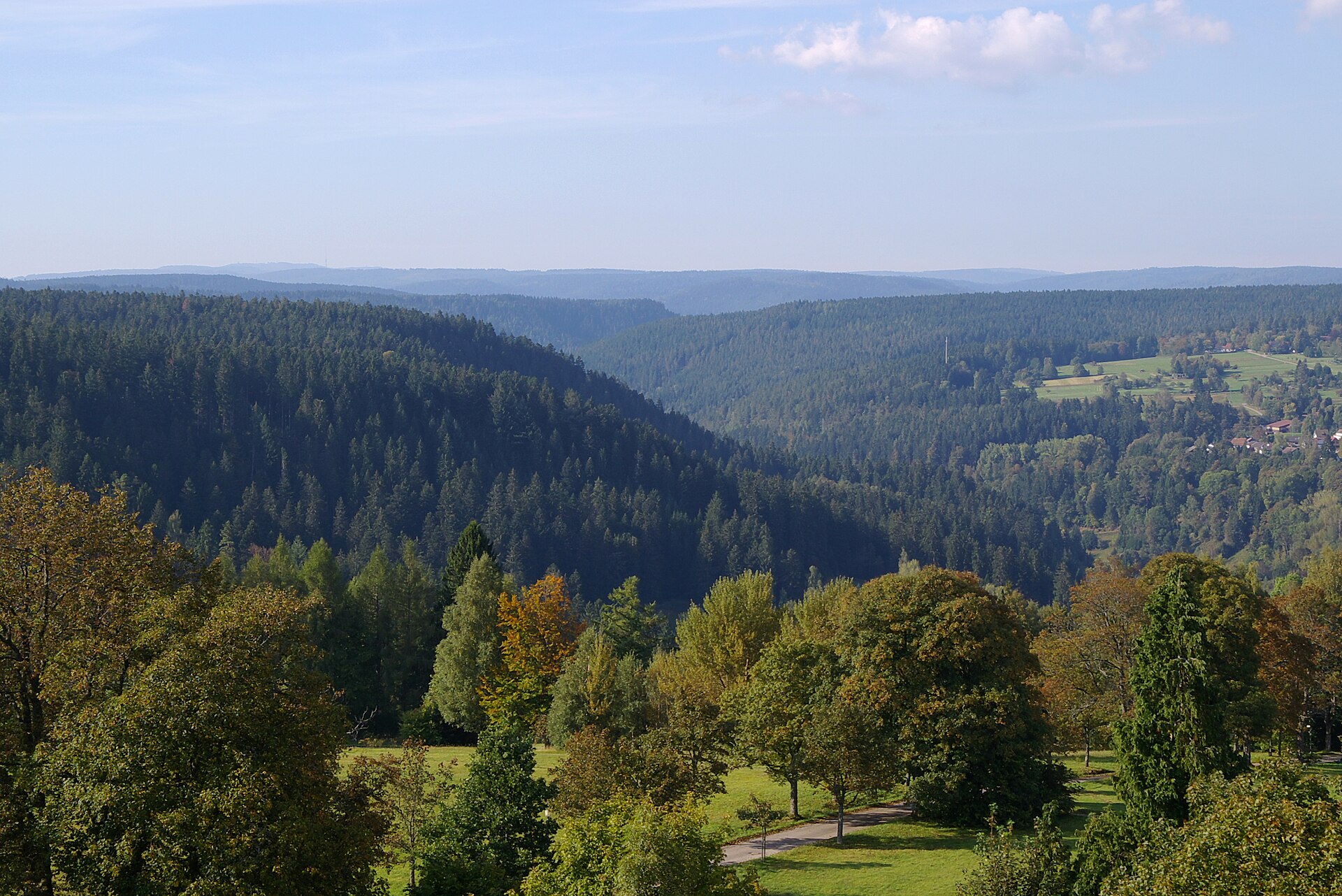
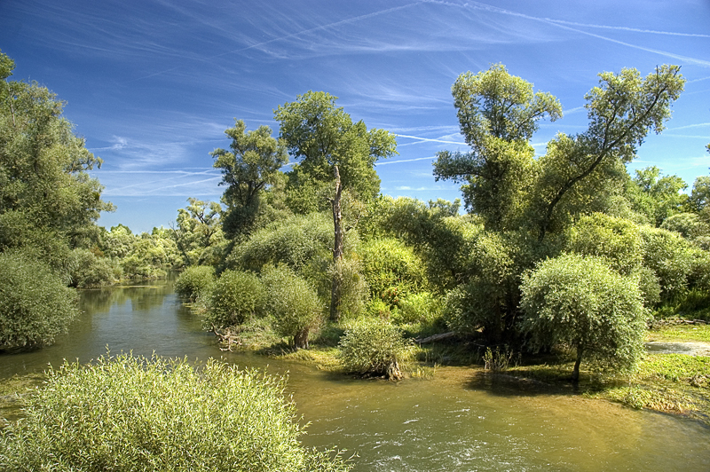
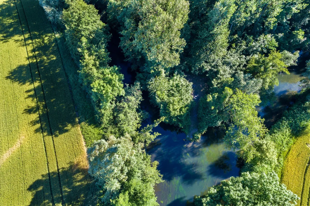
Illustrative photo · Alsace · © user21859082 / Magnific
Overview
Nature reserve of 41 hectares in France, established in 2004.
Réserve biologique dirigée de la Wantzenau is a nature reserve in France (Europe). It is a predominantly terrestrial area. Established in 2004, it covers about 41 hectares.
Protections and designations
Natura 2000 · habitats (SAC)
Natura 2000 · birds (SPA)
Protected as a nature reserve. International labels and designations: Natura 2000 network (2 sites). Key dates: established in 2004, first Natura 2000 site under the Birds Directive in 2005 and first Natura 2000 site under the Habitats Directive in 2014.
In our collections
Timeline
-
2004
Established
-
2005
First Natura 2000 site under the Birds Directive
-
2014
First Natura 2000 site under the Habitats Directive
Sources: Wikidata (CC0) for establishment and international labels; EEA Natura 2000 database (CC-BY 4.0) for site designation dates.
Frequently asked questions
Where is Réserve biologique dirigée de la Wantzenau?
In France (Europe). Representative point: 48.6546° N, 7.8554° E.
How large is Réserve biologique dirigée de la Wantzenau?
About 41 hectares. It is the 104th largest of the 121 nature reserves in France covered by Parkavela.
When was Réserve biologique dirigée de la Wantzenau established?
In 2004.
What habitats and landscapes does Réserve biologique dirigée de la Wantzenau include?
A terrestrial area, with forests.
What rocks lie beneath Réserve biologique dirigée de la Wantzenau?
According to the BRGM's simplified lithological map, the bedrock consists mainly of sands (100% of sampled points). These are mostly sedimentary rocks.
Which international labels apply to Réserve biologique dirigée de la Wantzenau?
Natura 2000 network (2 sites).
When is the best time to visit Réserve biologique dirigée de la Wantzenau?
Best time to visit: from April to October, with average temperatures of 10 to 21 °C and moderate rainfall.
Can you swim in Réserve biologique dirigée de la Wantzenau?
One monitored bathing site lies in or within 1 km of the site; official 2025 classification: 1 excellent (European Environment Agency). Swimming is only permitted at the sites and times authorised locally.
What is the nearest large city to Réserve biologique dirigée de la Wantzenau?
Nearest towns of over 50,000 people, as the crow flies: Strasbourg (10 km) and Offenburg (21 km). Nearest airport: Strasbourg (SXB), about 18 km away.
How can I reach Réserve biologique dirigée de la Wantzenau by train?
The nearest railway station is Kilstett, about 2 km from the site boundary.
Which species can be seen in Réserve biologique dirigée de la Wantzenau?
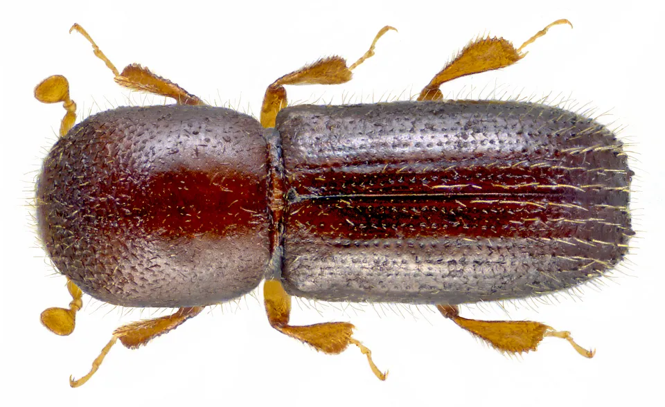
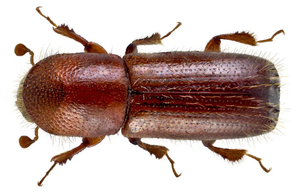
Among the species most often recorded on GBIF are Squalius cephalus (Chub), Xyleborinus saxesenii, Xyleborus germanus and Xyleborus monographus (Mediterranean Oak Borer).
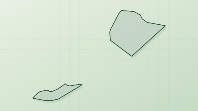
© OpenStreetMap
Download the boundary: GeoJSON · GPX Boundary © OpenStreetMap contributors (ODbL).
Geography
The representative point of the site lies at around 141 m above sea level. Over the 1996–2025 period, the mean annual temperature is about 11.1 °C and total precipitation reaches roughly 927 mm per year. The warmest month is usually July, the coolest January, and the wettest December. According to the BRGM's simplified lithological map, the bedrock consists mainly of sands (100% of sampled points). These are mostly sedimentary rocks.
Area
- Area of the boundary
- 40.5 ha
- Elevation
- 141 m
- Coordinates
- 48.6546, 7.8554
Bedrock
- Sands 100 %
Sedimentary rocks 100 %
Source: BRGM, simplified lithological map at 1:1,000,000 (Licence Ouverte), 3 points sampled within the boundary.
Climate
● Mean temperature (°C) · ▮ Precipitation (mm)
Source: Copernicus ERA5-Land (C3S, doi:10.24381/cds.68d2bb30), monthly averages 1996–2025 interpolated to the representative point, temperatures adjusted for elevation.
Contains modified Copernicus Climate Change Service information 2026. Neither the European Commission nor ECMWF is responsible for any use that may be made of the Copernicus information or data it contains.
Natural habitats
According to CORINE Land Cover (2018), the site is mainly made up of forests (100%). Woodland is mostly broadleaved. The land is almost flat (mean slope under 2°). The 2 Natura 2000 sites overlapping the area list 14 habitats of European interest (1 priority), the most extensive being riparian mixed forests of Quercus robur, Ulmus laevis and Ulmus minor, Fraxinus excelsior or Fraxinus angustifolia, along the great rivers (Ulmenion minoris), alluvial forests with Alnus glutinosa and Fraxinus excelsior (Alno-Padion, Alnion incanae, Salicion albae) and lowland hay meadows (Alopecurus pratensis, Sanguisorba officinalis).
Biodiversity
Based on occurrences aggregated by GBIF, several species are regularly recorded within the site. Among the most frequent are Squalius cephalus (Chub), Xyleborinus saxesenii, Xyleborus germanus and Xyleborus monographus (Mediterranean Oak Borer). The full list of documented taxa is shown below. The overlapping Natura 2000 sites list 118 species of European interest: 65 birds, 7 mammals, 2 reptiles, 11 amphibians, 12 fish, 17 invertebrates and 4 plants.
Habitats of European interest
From the official forms of the 2 Natura 2000 sites overlapping the area (areas reported for each whole site).
- Riparian mixed forests of Quercus robur, Ulmus laevis and Ulmus minor, Fraxinus excelsior or Fraxinus angustifolia, along the great rivers (Ulmenion minoris) 7,391 ha
- Alluvial forests with Alnus glutinosa and Fraxinus excelsior (Alno-Padion, Alnion incanae, Salicion albae) priority 2,392 ha
- Lowland hay meadows (Alopecurus pratensis, Sanguisorba officinalis) 1,007 ha
- Sub-Atlantic and medio-European oak or oak-hornbeam forests of the Carpinion betuli 822 ha
- Molinia meadows on calcareous, peaty or clayey-silt-laden soils (Molinion caeruleae) 396 ha
- Galio-Carpinetum oak-hornbeam forests 310 ha
- Water courses of plain to montane levels with the Ranunculion fluitantis and Callitricho-Batrachion vegetation 198 ha
- Semi-natural dry grasslands and scrubland facies on calcareous substrates (Festuco-Brometalia) (* important orchid sites) 138 ha
and 6 more
Species of European interest
Birds · 65
Common Sandpiper (Actitis hypoleucos) resident, Common Kingfisher (Alcedo atthis) resident, Northern Pintail (Anas acuta) wintering, Eurasian Teal (Anas crecca) wintering, Mallard (Anas platyrhynchos) wintering, Greylag Goose (Anser anser) wintering, Great Egret (Ardea alba) wintering, Grey Heron (Ardea cinerea) wintering, Common Pochard (Aythya ferina) wintering, Tufted Duck (Aythya fuligula) wintering, Greater Scaup (Aythya marila) wintering, Eurasian Bittern (Botaurus stellaris) wintering and 53 more
Mammals · 7
Eurasian Beaver (Castor fiber), European wildcat (Felis silvestris), Eurasian otter (Lutra lutra), Western Polecat (Mustela putorus), Bechstein's bat (Myotis bechsteinii), Geoffroy's bat (Myotis emarginatus), Greater mouse-eared bat (Myotis myotis)
Amphibians · 11
Yellow-bellied toad (Bombina variegata), Natterjack (Bufo calamita), Natterjack (Bufo calamite), Common tree frog (Hyla arborea), Common Spadefoot (Pelobates fuscus), Moor frog (Rana arvalis), Agile frog (Rana dalmatina), Pool frog (Rana lessonae), Marsh frog (Rana ridibunda), Common frog (Rana temporaria), Great crested newt (Triturus cristatus)
Fish · 12
Allis shad (Alosa alosa), Asp (Aspius aspius), Spined loach (Cobitis taenia), European bullhead (Cottus gobio), European river lamprey (Lampetra fluviatilis), European brook lamprey (Lampetra planeri), Weatherfish (Misgurnus fossilis), Sea lamprey (Petromyzon marinus), European bitterling (Rhodeus amarus), Atlantic salmon (Salmo salar), Souffia (Telestes souffia), Grayling (Thymallus thymallus)
Invertebrates · 17
White-clawed Crayfish (Austropotamobius pallipes), Greater Capricorn Beetle (Cerambyx cerdo), Southern damselfly (Coenagrion mercuriale), Cucujus cinnaberinus, Jersey Tiger (Euplagia quadripunctaria), Fisher's estuarine moth (Gortyna borelii lunata), Yellow-spotted Whiteface (Leucorrhinia pectoralis), Stag beetle (Lucanus cervus), Large copper (Lycaena dispar), Dusky Large Blue (Maculinea nausithous), Scarce large blue (Maculinea teleius), Green snaketail (Ophiogomphus cecilia) and 5 more
Plants · 4
Creeping marshwort (Apium repens), Dicranum moss (Dicranum viride), Marsh gladiolus (Gladiolus palustris L.), Prostrate false pimpernel (Lindernia procumbens)
Source: Natura 2000 standard data forms (EEA, CC-BY 4.0). Not exhaustive: sensitive species are not published.
Species to look out for

Observed species
Occurrences documented via GBIF; they are neither an exhaustive inventory nor proof of current presence.
- Chub · Squalius cephalus · 86
- Xyleborinus saxesenii · 68
- Xyleborus germanus · 56
- Mediterranean Oak Borer · Xyleborus monographus · 46
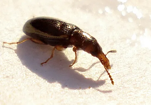
- Salpingus planirostris · 44
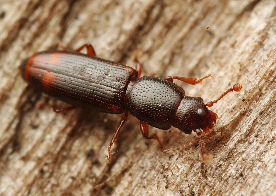
- Root-eating beetle · Rhizophagus bipustulatus · 36
- Four-spotted Sap Beetle · Glischrochilus quadrisignatus · 34
- Litargus connexus · 30
- Trypodendron signatum · 28
- Paromalus flavicornis · 28
- Xyleborus dispar · 28
- Melanotus villosus · 28
+18 more species
- Placonotus testaceus · 26
- Ambrosia Beetle · Xyleborus dryographus · 24
- Rose Chafer · Cetonia aurata · 22
- Two-toothed pine beetle · Pityogenes bidentatus · 22
- Red-thorax click beetle · Ischnodes sanguinicollis · 22
- Orchesia undulata · 22
- Palorus depressus · 22
- Salpingus ruficollis · 22
- Colydium elongatus · Colydium elongatum · 22
- Platystomos albinus · 20
- Pinhole Borer · Platypus cylindrus · 20
- Roach · Rutilus rutilus · 20
- Bordered click beetle · Denticollis linearis · 20
- Plegaderus dissectus · 20
- Mycetochara maura · 20
- Red-breasted carrion beetle · Oiceoptoma thoracicum · 19
- Gudgeon · Gobio gobio · 18
- Dull red click beetle · Ampedus pomorum · 18
Records: GBIF.org (CC-BY). Names: Wikidata (CC0), GBIF. Photos: Wikimedia Commons.
Conservation challenges
The primary purpose of the site is to preserve its natural habitats and the biodiversity they support. The species recorded (Biodiversity tab) reflect its ecological value. The designations it holds frame its management and the control of land use.
At night, 38% of the area gives off artificial light detectable from space (NASA VIIRS Black Marble composite, 2016). According to the Natura 2000 forms, of 11 assessed habitats of European interest, 5 are in average or reduced condition and the rest in good condition. Invasive alien species have been recorded within the site since 2000 (GBIF observations), one of them listed as of Union concern. Among them: Faxonius limosus (Spinycheek crayfish) and Silurus glanis (Wels catfish).
Pressure indicators
Fires since 2016
0
No large fire mapped (fires over about 30 ha)
Light at night
38%
of the area gives off artificial light visible from space
DarkLit
Invasive alien species
3
incl. 1 of EU concern · since 2000
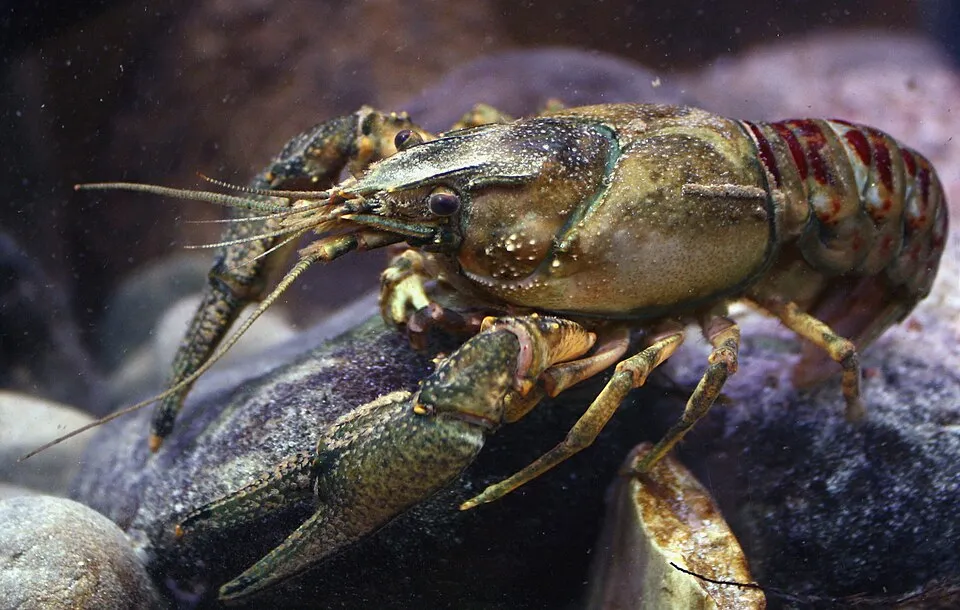 Spinycheek crayfishEU
Xyleborus germanus
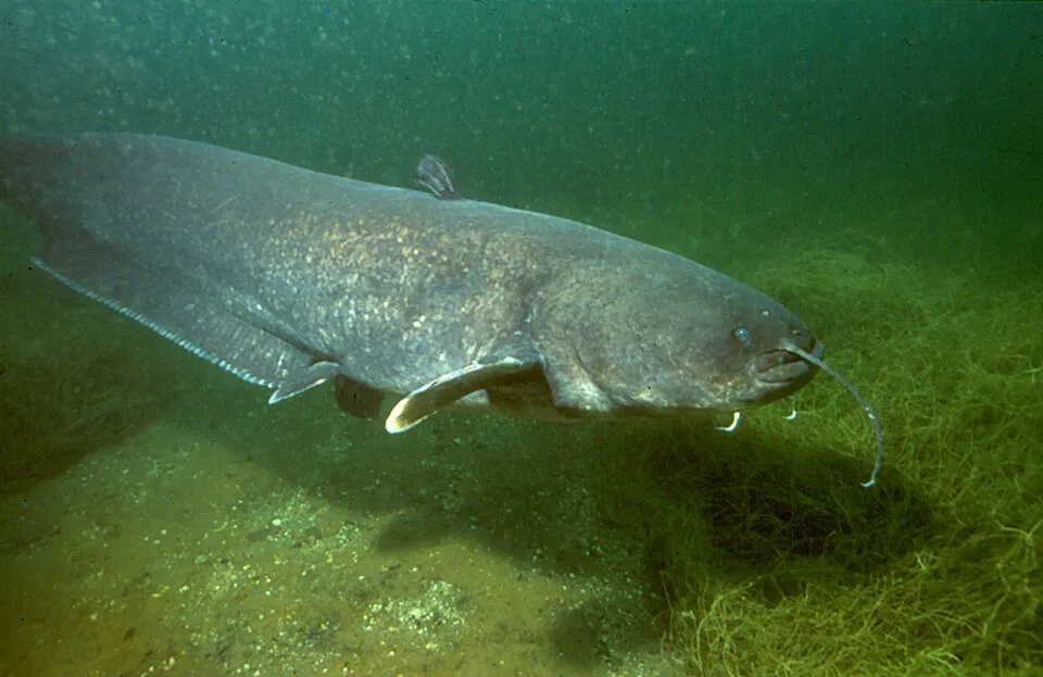 Wels catfish
Photos: Spinycheek crayfish © Astacoides · CC BY-SA 3.0; Wels catfish © Dieter Florian (To contact the author, ask the uploader or take a look at tauchshop-florian.de.) · CC BY-SA 3.0
Sources: Global Forest Change (Hansen et al., University of Maryland, via Global Forest Watch, CC-BY 4.0); EFFIS, European Commission / Copernicus; NASA Black Marble 2016 (public domain); CORINE Land Cover 2018 (Copernicus) or MODIS.
Invasive alien species: Global Register of Introduced and Invasive Species (ISSG, CC BY 4.0); Union list, Regulation (EU) 1143/2014 (INBO, CC0); GBIF.org records (CC0 / CC BY 4.0), at least 2 per species.
Practical information
Cities and airport
- Strasbourg
10 km as the crow flies - Offenburg
21 km as the crow flies - Airport: Strasbourg (SXB)
18 km as the crow flies
Data © OpenStreetMap contributors (ODbL) · Wikidata (CC0)
Bathing
1 monitored bathing site in or within 1 km of the site · 2025 classification
Excellent · 1
- Honau Badesee · lake · Excellent
Source: European Environment Agency, official bathing water classification (Directive 2006/7/EC, CC-BY 4.0). Swimming is only permitted at the sites and times authorised locally.
Access and visiting
The nearest railway station is Kilstett, about 2 km from the site boundary. Nearest towns of over 50,000 people, as the crow flies: Strasbourg (10 km) and Offenburg (21 km). Nearest airport: Strasbourg (SXB), about 18 km away. About 810,000 people live within 20 km of the site boundary, 330,000 of them within 10 km (GHSL estimate, 2020). This population has grown by about 7% since 2000. To plan a visit (access, opening periods, visitor rules), it is best to consult the official information from the managing body and the official website listed in this page's sources.
Source: OpenStreetMap (ODbL), Wikidata (CC0), October 2026.
When to visit
Best time to visit: from April to October, with average temperatures of 10 to 21 °C and moderate rainfall. Day length ranges from about 8 h 18 min in December to 16 h 07 min in June. Wildlife records published on GBIF peak for plants (April) and mammals (June). These peaks also reflect when observers are most active.
Source: Copernicus ERA5-Land (C3S), monthly averages 1996–2025 at the representative point, temperatures adjusted for elevation.
Contains modified Copernicus Climate Change Service information 2026. Neither the European Commission nor ECMWF is responsible for any use that may be made of the Copernicus information or data it contains.
Wildlife records calendar
JFMAMJJASOND
Birds
Plants
Mammals
Monthly records published on GBIF (CC-BY), relative to the busiest month; also reflects observer activity.
Gallery
© user21859082 / Magnific
Sources and licences
- Wikidata: Q65953775
- OpenStreetMap: relation 1178051
- WDPA: 330617
References
- cds.climate.copernicus.eu: climate · CC-BY-4.0
- registry.opendata.aws: elevation of the reference point, detailed relief · PD
- land.copernicus.eu: land cover, land cover change, sea share · COPERNICUS
- doi.org: population around the site · CC-BY-4.0
- openstreetmap.org: access and peaks, places to see · ODbL-1.0
- eea.europa.eu: bathing water quality, ecological status of waters · CC-BY-4.0
- en.eurovelo.com: EuroVelo cycle routes · ODbL-1.0
- cycling.waymarkedtrails.org: cycle routes · ODbL-1.0
- opentopodata.org: elevations · PD
- wikidata.org: establishment date, official name, nearby cities and airport, access and peaks, lake depths, places to see · CC0-1.0
- forest-fire.emergency.copernicus.eu: wildfires · COPERNICUS
- globalforestwatch.org: tree cover loss · CC-BY-4.0
- gbif.org: seasonality of sightings, invasive alien species, observed species · CC-BY-4.0
- infoterre.brgm.fr: geology · LO-2.0
- pop.culture.gouv.fr: protected heritage · LO-2.0
- hydrosheds.org: lakes · CC-BY-4.0
- natura2000.eea.europa.eu: Natura 2000 habitats and species · CC-BY-4.0
- earthobservatory.nasa.gov: night light · PD
- nsidc.org: snow cover · PD
Data © OpenStreetMap contributors (ODbL), Wikidata (CC0) and the sources cited.