Austria · Terrestrial
Rosalia-Kogelberg Nature Park
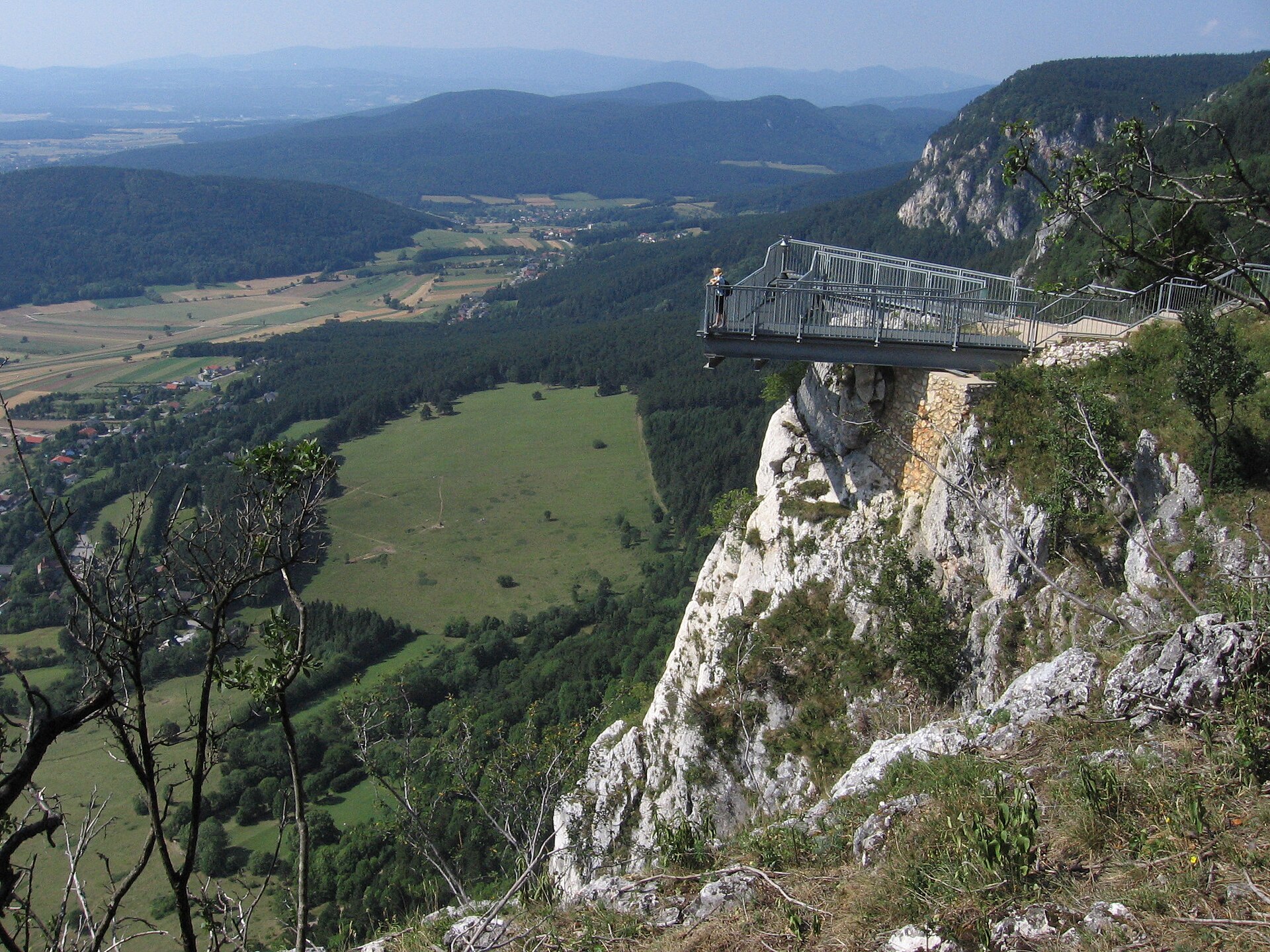
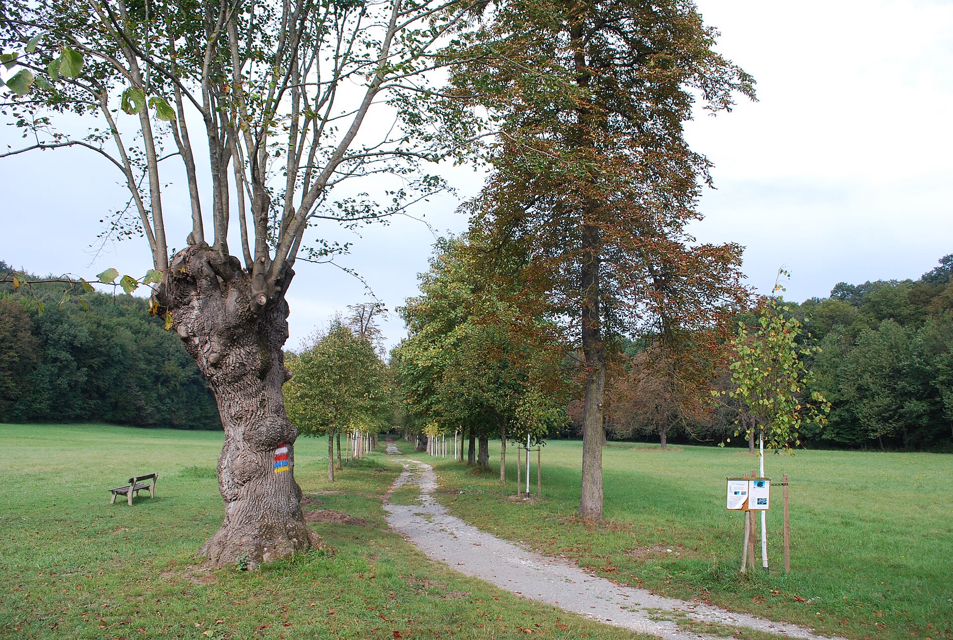
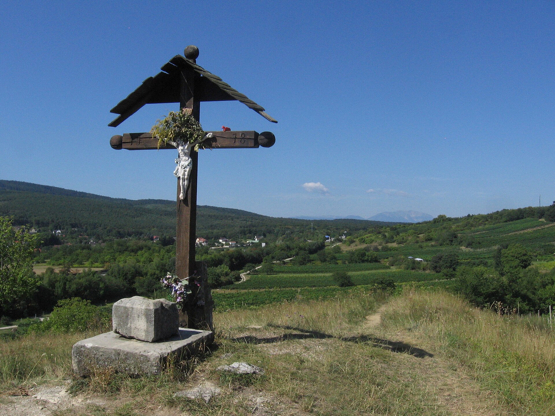
Nature park of 7,208 hectares in Austria, established in 2006.
Overview
Nature park of 7,208 hectares in Austria, established in 2006.
Rosalia-Kogelberg Nature Park is located in Austria (Europe). It is a predominantly terrestrial area. Established in 2006, it covers about 7,208 hectares.
Protections and designations
Natura 2000 · habitats (SAC)
- Mattersburger Hügelland AT1123323
Natura 2000 · birds (SPA)
- Mattersburger Hügelland AT1123323
Protected as a nature park. International labels and designations: Natura 2000 network (1 site: “Mattersburger Hügelland”). Key dates: first Natura 2000 site under the Birds Directive in 1999, established in 2006 and first Natura 2000 site under the Habitats Directive in 2013.
In our collections
Timeline
-
1999
First Natura 2000 site under the Birds Directive
-
2006
Established
-
2013
First Natura 2000 site under the Habitats Directive
Sources: Wikidata (CC0) for establishment and international labels; EEA Natura 2000 database (CC-BY 4.0) for site designation dates.
Frequently asked questions
Where is Rosalia-Kogelberg Nature Park?
In Austria (Europe). Representative point: 47.7765° N, 16.3272° E.
How large is Rosalia-Kogelberg Nature Park?
About 7,208 hectares (72 km²). It is the 12th largest of the 21 nature parks in Austria covered by Parkavela.
When was Rosalia-Kogelberg Nature Park established?
In 2006.
What habitats and landscapes does Rosalia-Kogelberg Nature Park include?
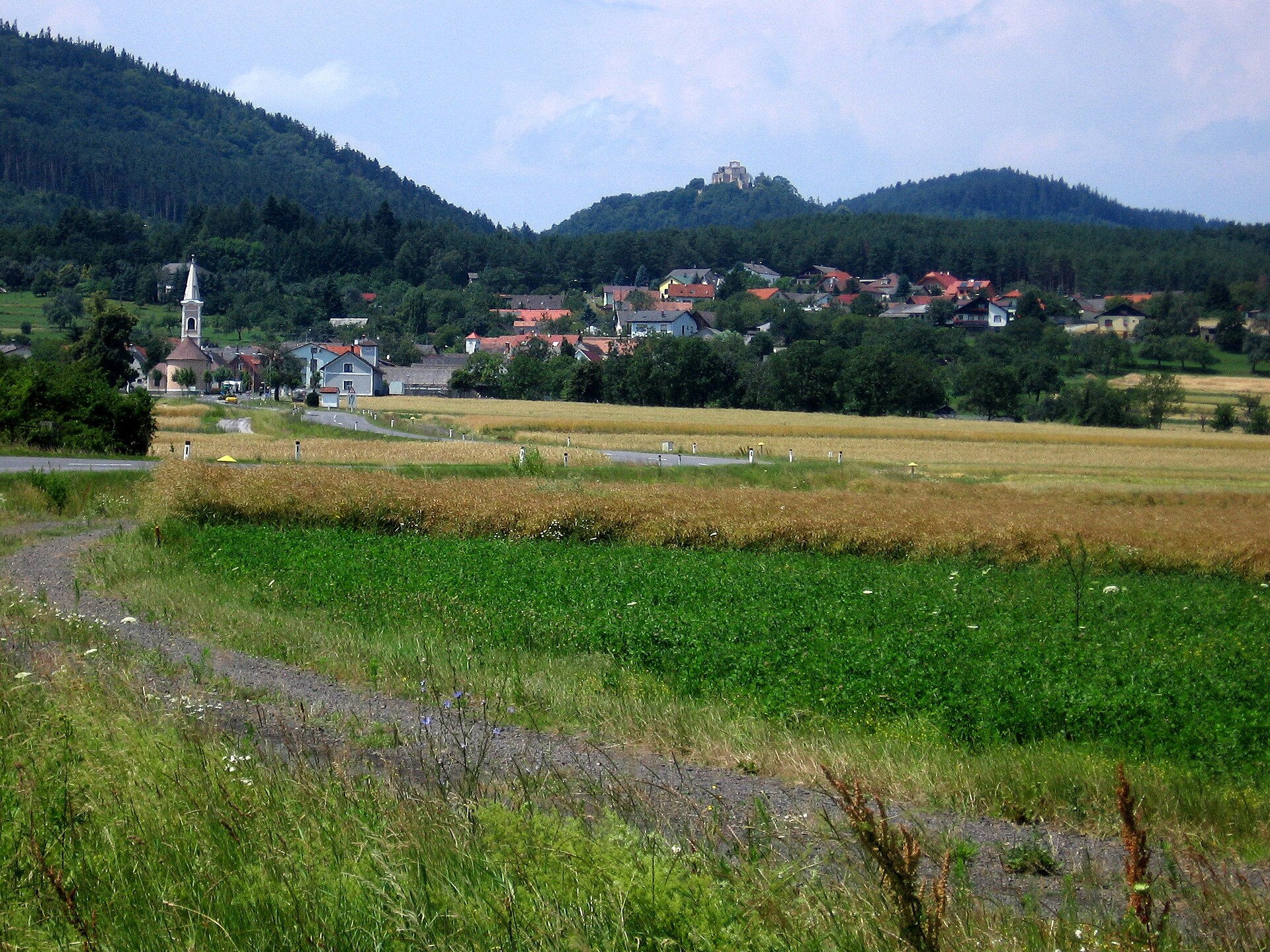
A terrestrial area, with forests and mountains.
What rocks lie beneath Rosalia-Kogelberg Nature Park?
According to the European 1:1 million geological map (EGDI), the bedrock consists mainly of clastic sedimentary rocks (69% of sampled points), mica schists (19%) and gneiss (13%). These are mostly sedimentary rocks. The geological units date mainly from the Neogene (69% of sampled points).
What is the highest point of Rosalia-Kogelberg Nature Park?
Heuberg, at 748 m (OpenStreetMap).
What are the main summits of Rosalia-Kogelberg Nature Park?
Heuberg (748 m), Rauher Stein (716 m), Sieggrabener Kogel (650 m), Geißspitz (565 m) and Hausberg (485 m) (OpenStreetMap).
Which international labels apply to Rosalia-Kogelberg Nature Park?
Natura 2000 network (1 site: “Mattersburger Hügelland”).
When is the best time to visit Rosalia-Kogelberg Nature Park?
Mildest period: from June to August, with average temperatures of 19 to 21 °C.
Are there historic monuments in Rosalia-Kogelberg Nature Park?
Yes. According to Wikidata, 13 monuments listed as protected monuments in Austria stand within the boundary. For example: “Rosalienkapelle Forchtenstein” in Forchtenstein, “Forchtenstein Castle” in Forchtenstein and “Grabhügel Krippelberg” in Baumgarten.
Can you swim in Rosalia-Kogelberg Nature Park?
2 monitored bathing sites lie in or within 1 km of the site; official 2025 classification: 2 excellent (European Environment Agency). Swimming is only permitted at the sites and times authorised locally.
What is the nearest large city to Rosalia-Kogelberg Nature Park?
Nearest towns of over 50,000 people, as the crow flies: Sopron (4 km) and Vienna (45 km). Nearest airport: Wien-Schwechat (VIE), about 37 km away.
How can I reach Rosalia-Kogelberg Nature Park by train?
The nearest railway station is Bad Sauerbrunn, less than 1 km from the site boundary.
Where can I get visitor information on site?
Informationsbüro.
Are there waymarked hiking trails in Rosalia-Kogelberg Nature Park?
Yes. Waymarked hiking routes listed in OpenStreetMap: 71, including E 4, Nordalpenweg, Zentralalpenweg and Burgenländischer Mariazellerweg. The “Eulenweg” route runs for about 31 km through the site.
Which species can be seen in Rosalia-Kogelberg Nature Park?
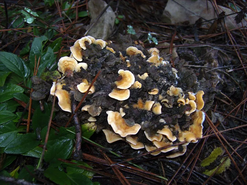
Among the species most often recorded on GBIF are Stereum hirsutum (Hairy Curtain Crust), Vuilleminia comedens (Waxy Crust), Trametes versicolor (Turkey tail) and Diatrype stigma (Common Tarcrust).
© OpenStreetMap
Download the boundary: GeoJSON · GPX Boundary © OpenStreetMap contributors (ODbL).
Geography
The representative point of the site lies at around 267 m above sea level. Over the 1996–2025 period, the mean annual temperature is about 10.6 °C and total precipitation reaches roughly 820 mm per year. The warmest month is usually July, the coolest January, and the wettest July. According to the European 1:1 million geological map (EGDI), the bedrock consists mainly of clastic sedimentary rocks (69% of sampled points), mica schists (19%) and gneiss (13%). These are mostly sedimentary rocks. The geological units date mainly from the Neogene (69% of sampled points).
Area
- Area
- 7,208 ha
- Elevation
- 267 m
- Median elevation
- 317 m
- Mean slope
- 8°
- Coordinates
- 47.7765, 16.3272
Terrain: Mapzen Terrain Tiles (SRTM, USGS; © offene Daten Österreichs – Digitales Geländemodell (DGM) Österreich, CC BY 3.0 AT)
Bedrock
- Clastic sedimentary rocks 69 %
- Mica schists 19 %
- Gneiss 13 %
Sedimentary rocks 69 % · Metamorphic rocks 31 % · Main age: Neogene (69%)
Source: EGDI 1:1M geological map (EuroGeoSurveys and national geological surveys), CC BY 4.0 · 16 sampled points within the site.
Main summits
- Heuberg748 m
- Rauher Stein716 m
- Sieggrabener Kogel650 m
- Geißspitz565 m
- Hausberg485 m
- Reisnerkogel443 m
- Rohrbacher Kogel388 m
- Schreindlberg354 m
- Krippelberg349 m
- Wieserberg313 m
Data © OpenStreetMap contributors (ODbL)
Climate
● Mean temperature (°C) · ▮ Precipitation (mm)
Source: Copernicus ERA5-Land (C3S, doi:10.24381/cds.68d2bb30), monthly averages 1996–2025 interpolated to the representative point, temperatures adjusted for elevation.
Contains modified Copernicus Climate Change Service information 2026. Neither the European Commission nor ECMWF is responsible for any use that may be made of the Copernicus information or data it contains.
Snow cover measured by satellite
J
F
M
A
M
J
J
A
S
O
N
D
average share of the site under snow · snowiest parts · ≈ 20 days a year
Snow cover: MODIS/Terra MOD10CM v61 (Hall & Riggs, 2021, NASA NSIDC DAAC, doi:10.5067/MODIS/MOD10CM.061), imagery from NASA GIBS (ESDIS); 2015–2025 average, grid of about 5 km.
Natural habitats
According to CORINE Land Cover (2018), the site is mainly made up of forests (52%), farmland (41%) and built-up or developed land (5%). Woodland is mostly broadleaved. Elevation ranges from about 230 m to 748 m (highest point: Heuberg). The Natura 2000 site overlapping the area lists 10 habitats of European interest (5 priority), the most extensive being lowland hay meadows (Alopecurus pratensis, Sanguisorba officinalis), semi-natural dry grasslands and scrubland facies on calcareous substrates (Festuco-Brometalia) (* important orchid sites) and Pannonic woods with Quercus petraea and Carpinus betulus.
Biodiversity
Based on occurrences aggregated by GBIF, several species are regularly recorded within the site. Among the most frequent are Stereum hirsutum (Hairy Curtain Crust), Vuilleminia comedens (Waxy Crust), Trametes versicolor (Turkey tail) and Diatrype stigma (Common Tarcrust). The full list of documented taxa is shown below. The overlapping Natura 2000 site lists 60 species of European interest: 42 birds, 5 mammals, 4 amphibians, 7 invertebrates and 2 plants.
Habitats of European interest
From the official form of the Natura 2000 site overlapping the area (areas reported for the whole site).
- Lowland hay meadows (Alopecurus pratensis, Sanguisorba officinalis) 92 ha
- Semi-natural dry grasslands and scrubland facies on calcareous substrates (Festuco-Brometalia) (* important orchid sites) 61 ha
- Pannonic woods with Quercus petraea and Carpinus betulus priority 33 ha
- Molinia meadows on calcareous, peaty or clayey-silt-laden soils (Molinion caeruleae) 13 ha
- Alluvial forests with Alnus glutinosa and Fraxinus excelsior (Alno-Padion, Alnion incanae, Salicion albae) priority 10 ha
- Natural eutrophic lakes with Magnopotamion or Hydrocharition-type vegetation 10 ha
- Species-rich Nardus grasslands, on silicious substrates in mountain areas (and submountain areas in Continental Europe) priority 1 ha
- Pannonian woods with Quercus pubescens priority 1 ha
and 2 more
Species of European interest
Birds · 42
Great Reed Warbler (Acrocephalus arundinaceus) breeding passage, Marsh Warbler (Acrocephalus palustris) breeding passage, Sedge warbler (Acrocephalus schoenobaenus) breeding passage, Eurasian Reed Warbler (Acrocephalus scirpaceus) passage breeding, Eurasian Teal (Anas crecca) passage, Grey Heron (Ardea cinerea) passage breeding, Purple Heron (Ardea purpurea) passage breeding, Eurasian Bittern (Botaurus stellaris) passage, Eurasian Eagle-owl (Bubo bubo) resident, European Nightjar (Caprimulgus europaeus) passage breeding, White stork (Ciconia ciconia) breeding passage, Black Stork (Ciconia nigra) breeding passage and 30 more
Mammals · 5
Lesser mouse-eared myotis (Myotis blythii), Geoffroy's bat (Myotis emarginatus), Greater mouse-eared bat (Myotis myotis), Greater Horseshoe Bat (Rhinolophus ferrumequinum), Lesser horseshoe bat (Rhinolophus hipposideros)
Amphibians · 4
European fire-bellied toad (Bombina bombina), Yellow-bellied toad (Bombina variegata), Italian crested newt (Triturus carnifex), Danube Crested Newt (Triturus dobrogicus)
Invertebrates · 7
Carabus (variolosus) nodulosus, Balkan goldenring (Cordulegaster heros), Eastern Eggar (Eriogaster catax), Jersey Tiger (Euplagia quadripunctaria), Stag beetle (Lucanus cervus), Large copper (Lycaena dispar), Scarce Large Blue (Phengaris teleius)
Plants · 2
Adriatic lizard orchid (Himantoglossum adriaticum), Greater Pasque Flower (Pulsatilla grandis)
Source: Natura 2000 standard data forms (EEA, CC-BY 4.0). Not exhaustive: sensitive species are not published.
Species to look out for
Fungus
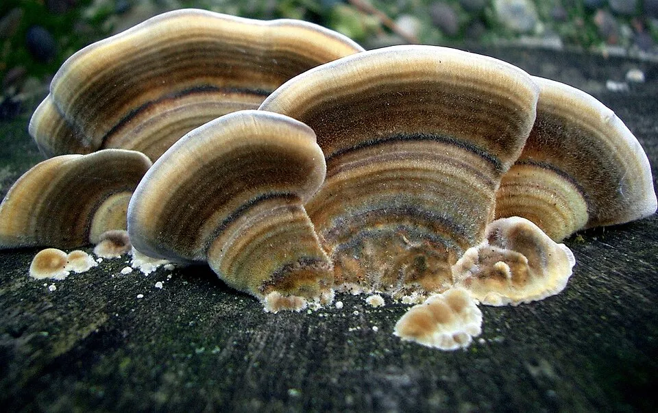
Turkey tail
Trametes versicolor153 records © Steve Jurvetson from Menlo Park, USA · CC BY 2.0

Fungus
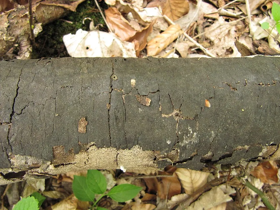
Oak Blackhead
Diatrypella quercina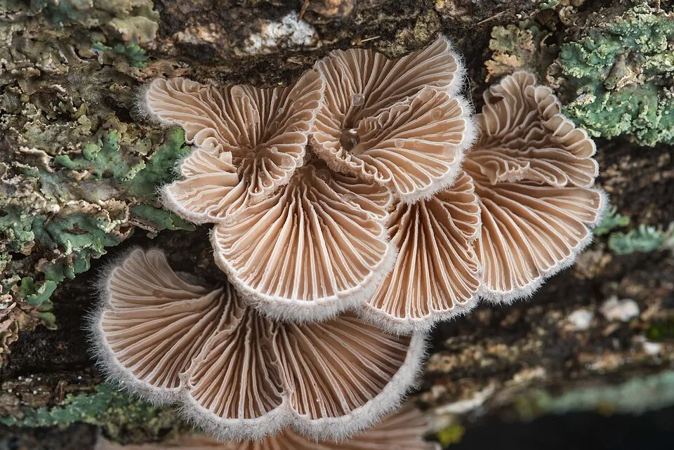
Fungus
Splitgill
Schizophyllum communeObserved species
Occurrences documented via GBIF; they are neither an exhaustive inventory nor proof of current presence.
- Hairy Curtain Crust · Stereum hirsutum · 236
- Waxy Crust · Vuilleminia comedens · 175
- Turkey tail · Trametes versicolor · 153
- Common Tarcrust · Diatrype stigma · 150
- Oak Blackhead · Diatrypella quercina · 141
- Splitgill · Schizophyllum commune · 133
- Warlock's Butter · Exidia nigricans · 122
- Violet Bramble Rust · Phragmidium violaceum · 118
- Charcoal Burner · Russula cyanoxantha · 101
- Blusher · Amanita rubescens · 91
- Oak Mildew · Erysiphe alphitoides · 83
- Birch Blackhead · Diatrypella favacea · 83
+18 more species
- The Flirt · Russula vesca · 81
- Oak Crust · Peniophora quercina · 80
- Hairy Bracket · Trametes hirsuta · 76
- Suede bolete · Xerocomus subtomentosus · 74
- Common puffball · Lycoperdon perlatum · 71
- Summer cep · Boletus reticulatus · 71
- Oak Curtain Crust · Hymenochaete rubiginosa · 68
- Maple Whitewash · Dendrothele acerina · 68
- Xylodon flaviporus · 68
- Greasy Green Brittlegill · Russula heterophylla · 67
- Colpoma quercinum · 66
- Winecork Brittlegill · Russula adusta · 66
- Smoky Polypore · Bjerkandera adusta · 65
- Golden Brittlegill · Russula risigallina · 65
- Blushing Bracket · Daedaleopsis confragosa · 63
- Rosy Brittlegill · Russula rosea · 62
- Hoof Fungus · Fomes fomentarius · 62
- Hazel Woodwart · Hypoxylon fuscum · 61
Records: GBIF.org (CC-BY). Names: Wikidata (CC0), GBIF. Photos: Wikimedia Commons.
Conservation challenges
The primary purpose of the site is to preserve its natural habitats and the biodiversity they support. The species recorded (Biodiversity tab) reflect its ecological value. The designations it holds frame its management and the control of land use.
According to Global Forest Change data (University of Maryland, Global Forest Watch), about 358 ha of tree cover were lost within the boundary between 2001 and 2023 (5% of its area). These losses include logging, storms and fires, and do not account for regrowth. Apart from forest felling and regrowth (about 110 ha in total), land cover remained almost unchanged between 1990 and 2018 according to CORINE Land Cover; only some 7 ha were built over. At night, 7% of the area gives off artificial light detectable from space (NASA VIIRS Black Marble composite, 2016). Built-up and developed land (buildings, business areas, roads, quarries) covers 5% of the area, and farmland 41% (CORINE Land Cover). According to the Natura 2000 forms, of 10 assessed habitats of European interest, 1 is in excellent condition and 1 in average or reduced condition. According to the Water Framework Directive assessment (2022 river basin management plans, data 2016–2021), only 7% of the 15 km of rivers assessed within the site are in good or high ecological status; the others mostly have moderate ecological status. Invasive alien species have been recorded within the site since 2000 (GBIF observations), one of them listed as of Union concern. Among them: Impatiens glandulifera (Himalayan Balsam), Harmonia axyridis (Asian Lady Beetle) and Cryphonectria parasitica (Chestnut blight).
Pressure indicators
Tree cover lost
358 ha
2001–2023 · 5% of the area
20012023
Fires since 2016
0
No large fire mapped (fires over about 30 ha)
Light at night
7%
of the area gives off artificial light visible from space
DarkLit
Built-up land
5%
buildings, business areas, roads, quarries · farmland 41%
Land cover change
< 0.5%
of the area changed, 1990–2018 · CORINE
forest felling and regrowth: 110 ha in total
Rivers and lakes
7%
of the 15 km of assessed rivers in good or high ecological status · WFD 2022
assessments 2016–2021
Invasive alien species
3
incl. 1 of EU concern · since 2000
 Himalayan Balsam
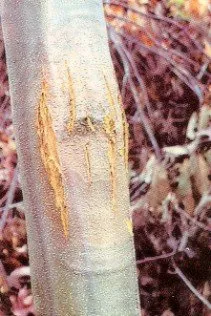 Chestnut blight
Photos: Himalayan Balsam © Guptaele · CC BY-SA 4.0; Chestnut blight © Jomegat · Public domain
Sources: Global Forest Change (Hansen et al., University of Maryland, via Global Forest Watch, CC-BY 4.0); EFFIS, European Commission / Copernicus; NASA Black Marble 2016 (public domain); CORINE Land Cover 2018 (Copernicus) or MODIS.
CORINE Land Cover Change 1990–2018: generated using European Union's Copernicus Land Monitoring Service information (EEA), aggregated by Parkavela; DOI 10.2909/f30f1000-7cf8-43bb-872c-5eb093911b24.
Ecological status of water bodies: European Environment Agency, WISE – Water Framework Directive, 3rd river basin management plans (2022), CC BY 4.0. Official national classification, not comparable between countries.
Invasive alien species: Global Register of Introduced and Invasive Species (ISSG, CC BY 4.0); Union list, Regulation (EU) 1143/2014 (INBO, CC0); GBIF.org records (CC0 / CC BY 4.0), at least 2 per species.
Practical information
Cities and airport
- Sopron
4 km as the crow flies - Vienna
45 km as the crow flies - Airport: Wien-Schwechat (VIE)
37 km as the crow flies
Visitor information
- Informationsbüro
within the site
Hiking
71 waymarked routes listed, including:
E 4NordalpenwegZentralalpenwegBurgenländischer MariazellerwegOstösterreichischer GrenzlandwegBurgenland-Weitwanderweg
By bike
R1 Jubiläumsradweg R1 · 6 km
+ 7 local loops
Signed cycle routes: this does not mean that cycling is allowed on footpaths.
Data © OpenStreetMap contributors (ODbL) · Wikidata (CC0)
Routes © OpenStreetMap contributors (ODbL), via Waymarked Trails
Waymarked hiking routes
E4 Europäischer Fernwanderweg E4 (Wien - Rattersdorf)
5.9 km within the site ↗ 90 m↘ 128 m 267–382 m
Tracks © OpenStreetMap contributors (ODbL), clipped to the boundary; elevation gain and profiles computed on the longest section from Mapzen Terrain Tiles (≈ 30 m), indicative only.
Bathing
2 monitored bathing sites in or within 1 km of the site · 2025 classification
Excellent · 2
- Römersee Wiesen · lake · Excellent
- Stausee Forchtenstein · lake · Excellent
Source: European Environment Agency, official bathing water classification (Directive 2006/7/EC, CC-BY 4.0). Swimming is only permitted at the sites and times authorised locally.
Access and visiting
The nearest railway station is Bad Sauerbrunn, less than 1 km from the site boundary. Nearest towns of over 50,000 people, as the crow flies: Sopron (4 km) and Vienna (45 km). Nearest airport: Wien-Schwechat (VIE), about 37 km away. About 410,000 people live within 20 km of the site boundary, 210,000 of them within 10 km; some 4,500 people are estimated to live inside (GHSL estimate, 2020). This population has grown by about 15% since 2000. Visitor information on site: Informationsbüro. Waymarked hiking routes listed in OpenStreetMap: 71, including E 4, Nordalpenweg, Zentralalpenweg and Burgenländischer Mariazellerweg. A signed cycle route crosses the site: “R1 Jubiläumsradweg R1” (OpenStreetMap). To plan a visit (access, opening periods, visitor rules), it is best to consult the official information from the managing body and the official website listed in this page's sources.
Source: OpenStreetMap (ODbL), Wikidata (CC0), October 2026.
Built heritage
According to Wikidata, 13 monuments listed as protected monuments in Austria stand within the boundary. Among them are 3 prehistoric and archaeological sites, 2 religious buildings and 1 castle or fortification. Examples include “Rosalienkapelle Forchtenstein” in Forchtenstein, “Forchtenstein Castle” in Forchtenstein and “Grabhügel Krippelberg” in Baumgarten.
3 prehistoric and archaeological sites2 religious buildings1 castle or fortification1 bridge, lighthouse, mill or working building
-
Rosalienkapelle Forchtenstein
Forchtenstein -
Forchtenstein Castle
Forchtenstein -
Grabhügel Krippelberg
Baumgarten -
Neumühle/ehem. Heroldmühle
Marz -
Fundzone Edeltal
Pöttsching -
Oedes Kloster
Baumgarten -
Hausberg Lahmenwald
Pöttsching -
Hügelgräberfeld Haidspitzwald
Schattendorf
and 5 more
Source: Wikidata (CC0), monuments in each country’s official heritage protection registers, at national or regional level. Each item links to its Wikidata entry.
When to visit
Mildest period: from June to August, with average temperatures of 19 to 21 °C. Precipitation peaks in July (up to 100 mm per month). Snow only makes brief appearances in winter (about 20 days a year on average, MODIS satellites 2015–2025). Day length ranges from about 8 h 25 min in December to 15 h 59 min in June. Wildlife records published on GBIF peak for birds (May and June), plants (May), butterflies and moths (from June to August), dragonflies (June) and mammals (March and April). These peaks also reflect when observers are most active.
Source: Copernicus ERA5-Land (C3S), monthly averages 1996–2025 at the representative point, temperatures adjusted for elevation.
Contains modified Copernicus Climate Change Service information 2026. Neither the European Commission nor ECMWF is responsible for any use that may be made of the Copernicus information or data it contains.
Wildlife records calendar
JFMAMJJASOND
Birds
Plants
Butterflies & moths
Dragonflies
Mammals
Monthly records published on GBIF (CC-BY), relative to the busiest month; also reflects observer activity.
Gallery
© Roman Klementschitz, Wien · CC BY-SA 3.0
© Clemens Mosch · CC BY-SA 4.0
© Haeferl · CC BY-SA 3.0
© Kstipek · CC BY-SA 4.0
© Loimo · CC BY 4.0
© Haeferl · CC BY-SA 3.0
Sources and licences
- Wikidata: Q1970617
- OpenStreetMap: relation 13291131
- Wikipedia: de.wikipedia.org/wiki/Naturpark_Rosalia-Kogelberg
- WDPA: 555513711
References
- cds.climate.copernicus.eu: climate · CC-BY-4.0
- registry.opendata.aws: elevation of the reference point, detailed relief · CC-BY-3.0
- land.copernicus.eu: land cover, land cover change, sea share · COPERNICUS
- doi.org: population around the site · CC-BY-4.0
- wikidata.org: official area, establishment date, protected heritage, nearby cities and airport, access and peaks, lake depths, places to see · CC0-1.0
- eea.europa.eu: bathing water quality, ecological status of waters · CC-BY-4.0
- en.eurovelo.com: EuroVelo cycle routes · ODbL-1.0
- cycling.waymarkedtrails.org: cycle routes · ODbL-1.0
- opentopodata.org: elevations · PD
- forest-fire.emergency.copernicus.eu: wildfires · COPERNICUS
- globalforestwatch.org: tree cover loss · CC-BY-4.0
- gbif.org: seasonality of sightings, invasive alien species, observed species · CC-BY-4.0
- europe-geology.eu: geology · CC-BY-4.0
- hydrosheds.org: lakes · CC-BY-4.0
- natura2000.eea.europa.eu: Natura 2000 habitats and species · CC-BY-4.0
- openstreetmap.org: official name, access and peaks, trail difficulty, wheelchair access · ODbL-1.0
- earthobservatory.nasa.gov: night light · PD
- hiking.waymarkedtrails.org: route difficulty · ODbL-1.0
- nsidc.org: snow cover · PD
- wikidata.org: Wikipedia article · CC-BY-SA-4.0
Data © OpenStreetMap contributors (ODbL), Wikidata (CC0) and the sources cited.