Austria · Terrestrial
Landseer Berge Nature Park
Nature park of 5,643 hectares in Austria, established in 2000.
Overview
Nature park of 5,643 hectares in Austria, established in 2000.
Landseer Berge Nature Park is located in Austria (Europe). It is a predominantly terrestrial area. Established in 2000, it covers about 5,643 hectares.
In our collections
Frequently asked questions
Where is Landseer Berge Nature Park?
In Austria (Europe). Representative point: 47.5441° N, 16.3339° E.
How large is Landseer Berge Nature Park?
About 5,643 hectares (56 km²). It is the 13th largest of the 21 nature parks in Austria covered by Parkavela.
When was Landseer Berge Nature Park established?
In 2000.
What habitats and landscapes does Landseer Berge Nature Park include?
A terrestrial area, with forests and mountains.
What rocks lie beneath Landseer Berge Nature Park?
According to the European 1:1 million geological map (EGDI), the bedrock consists mainly of mica schists (69% of sampled points), gneiss (19%) and clastic sedimentary rocks (13%). These are mostly metamorphic rocks. The geological units date mainly from the Precambrian (69% of sampled points).
What is the highest point of Landseer Berge Nature Park?
Klosterberg, at 746 m (OpenStreetMap).
What are the main summits of Landseer Berge Nature Park?
Klosterberg (746 m), Heidriegel (659 m), Pfefferriegel (632 m), Burgberg (544 m) and Schlossberg (526 m) (OpenStreetMap).
When is the best time to visit Landseer Berge Nature Park?
Mildest period: from June to August, with average temperatures of 17 to 20 °C.
Are there historic monuments in Landseer Berge Nature Park?
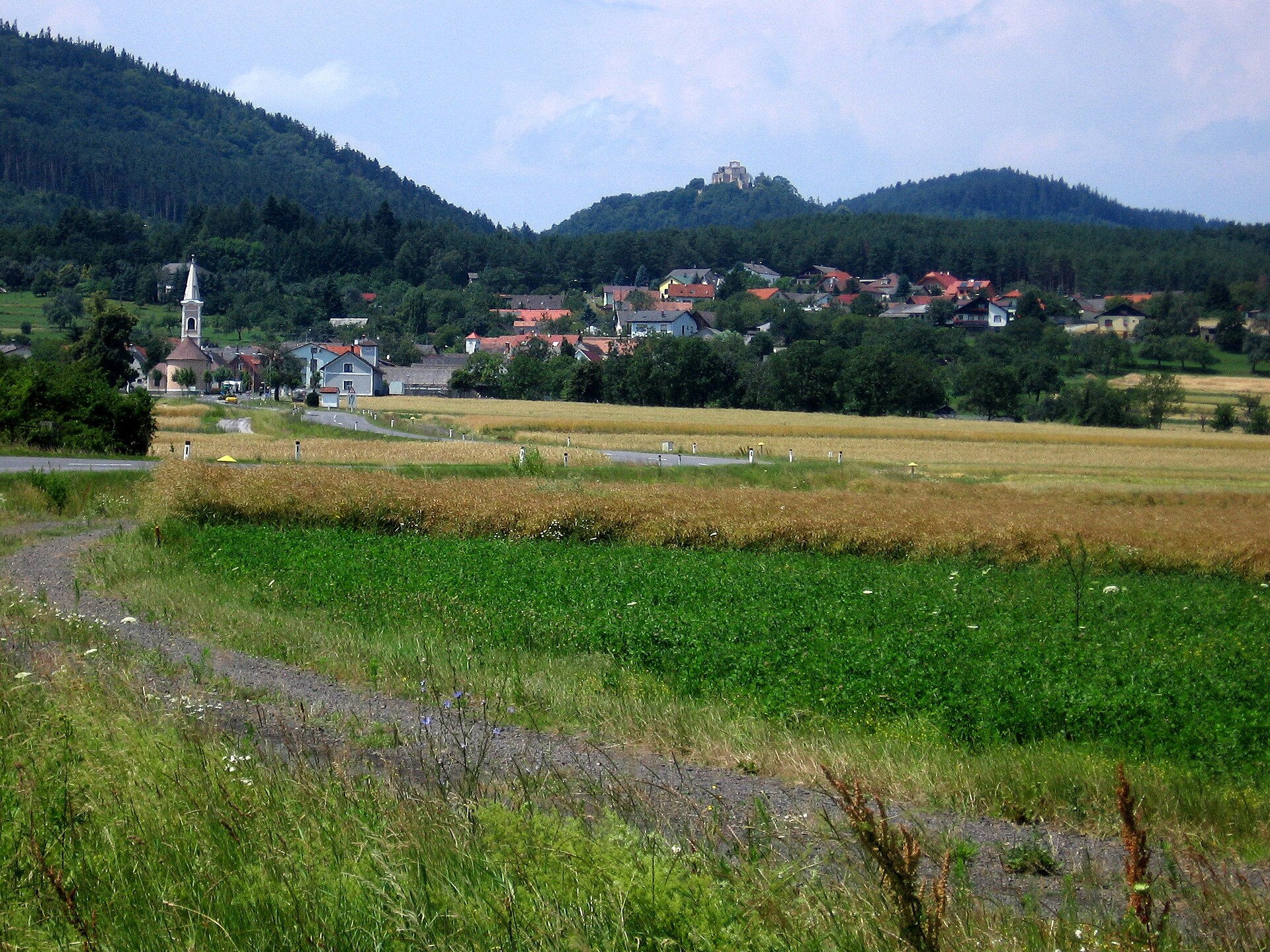
Yes. According to Wikidata, 13 monuments listed as protected monuments in Austria stand within the boundary. For example: “Kath. Filialkirche hl. Matthäus” in Markt Sankt Martin, “Burgruine Schwarzenbach” in Schwarzenbach and “Keltendorf Schwarzenbach” in Schwarzenbach.
What is the nearest large city to Landseer Berge Nature Park?
Nearest towns of over 50,000 people, as the crow flies: Sopron (17 km) and Szombathely (34 km). Nearest airport: Wien-Schwechat (VIE), about 53 km away.
How can I reach Landseer Berge Nature Park by train?
The nearest railway station is Marz-Rohrbach, about 9 km from the site boundary.
Are there waymarked hiking trails in Landseer Berge Nature Park?
Yes. Waymarked hiking routes listed in OpenStreetMap: 22, including E 4, Zentralalpenweg, Ostösterreichischer Grenzlandweg and Burgenland-Weitwanderweg. The “NLW · NÖ Landesrundwanderweg” route runs for about 17 km through the site, with some 620 m of ascent on its longest section.
Which species can be seen in Landseer Berge Nature Park?
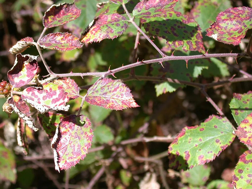
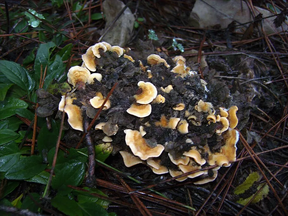
Among the species most often recorded on GBIF are Phragmidium violaceum (Violet Bramble Rust), Dryopteris filix-mas (Male fern), Trametes versicolor (Turkey tail) and Stereum hirsutum (Hairy Curtain Crust).
© OpenStreetMap
Download the boundary: GeoJSON · GPX Boundary © OpenStreetMap contributors (ODbL).
Geography
The representative point of the site lies at around 577 m above sea level. Over the 1996–2025 period, the mean annual temperature is about 9.1 °C and total precipitation reaches roughly 834 mm per year. The warmest month is usually July, the coolest January, and the wettest August. According to the European 1:1 million geological map (EGDI), the bedrock consists mainly of mica schists (69% of sampled points), gneiss (19%) and clastic sedimentary rocks (13%). These are mostly metamorphic rocks. The geological units date mainly from the Precambrian (69% of sampled points).
Area
- Area
- 5,643 ha
- Elevation
- 577 m
- Median elevation
- 469 m
- Mean slope
- 10°
- Coordinates
- 47.5441, 16.3339
Terrain: Mapzen Terrain Tiles (SRTM, USGS; © offene Daten Österreichs – Digitales Geländemodell (DGM) Österreich, CC BY 3.0 AT)
Bedrock
- Mica schists 69 %
- Gneiss 19 %
- Clastic sedimentary rocks 13 %
Metamorphic rocks 88 % · Sedimentary rocks 13 % · Main age: Precambrian (69%)
Source: EGDI 1:1M geological map (EuroGeoSurveys and national geological surveys), CC BY 4.0 · 16 sampled points within the site.
Main summits
- Klosterberg746 m
- Heidriegel659 m
- Pfefferriegel632 m
- Burgberg544 m
- Schlossberg526 m
- Goldvater510 m
- Mauerberg460 m
Data © OpenStreetMap contributors (ODbL)
Climate
● Mean temperature (°C) · ▮ Precipitation (mm)
Source: Copernicus ERA5-Land (C3S, doi:10.24381/cds.68d2bb30), monthly averages 1996–2025 interpolated to the representative point, temperatures adjusted for elevation.
Contains modified Copernicus Climate Change Service information 2026. Neither the European Commission nor ECMWF is responsible for any use that may be made of the Copernicus information or data it contains.
Snow cover measured by satellite
J
F
M
A
M
J
J
A
S
O
N
D
average share of the site under snow · snowiest parts · ≈ 20 days a year
Snow cover: MODIS/Terra MOD10CM v61 (Hall & Riggs, 2021, NASA NSIDC DAAC, doi:10.5067/MODIS/MOD10CM.061), imagery from NASA GIBS (ESDIS); 2015–2025 average, grid of about 5 km.
Natural habitats
According to CORINE Land Cover (2018), the site is mainly made up of forests (78%) and farmland (19%). Woodland mixes broadleaved and coniferous trees. Elevation ranges from about 380 m to 746 m (highest point: Klosterberg).
Biodiversity
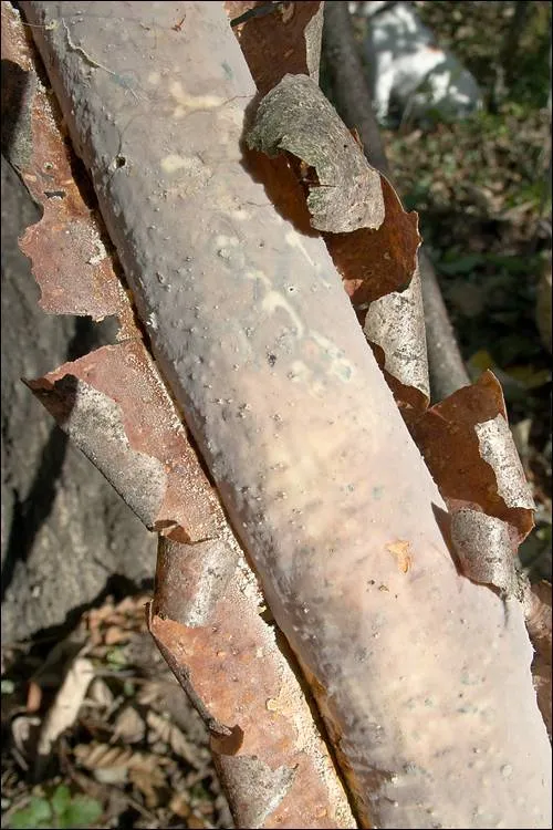
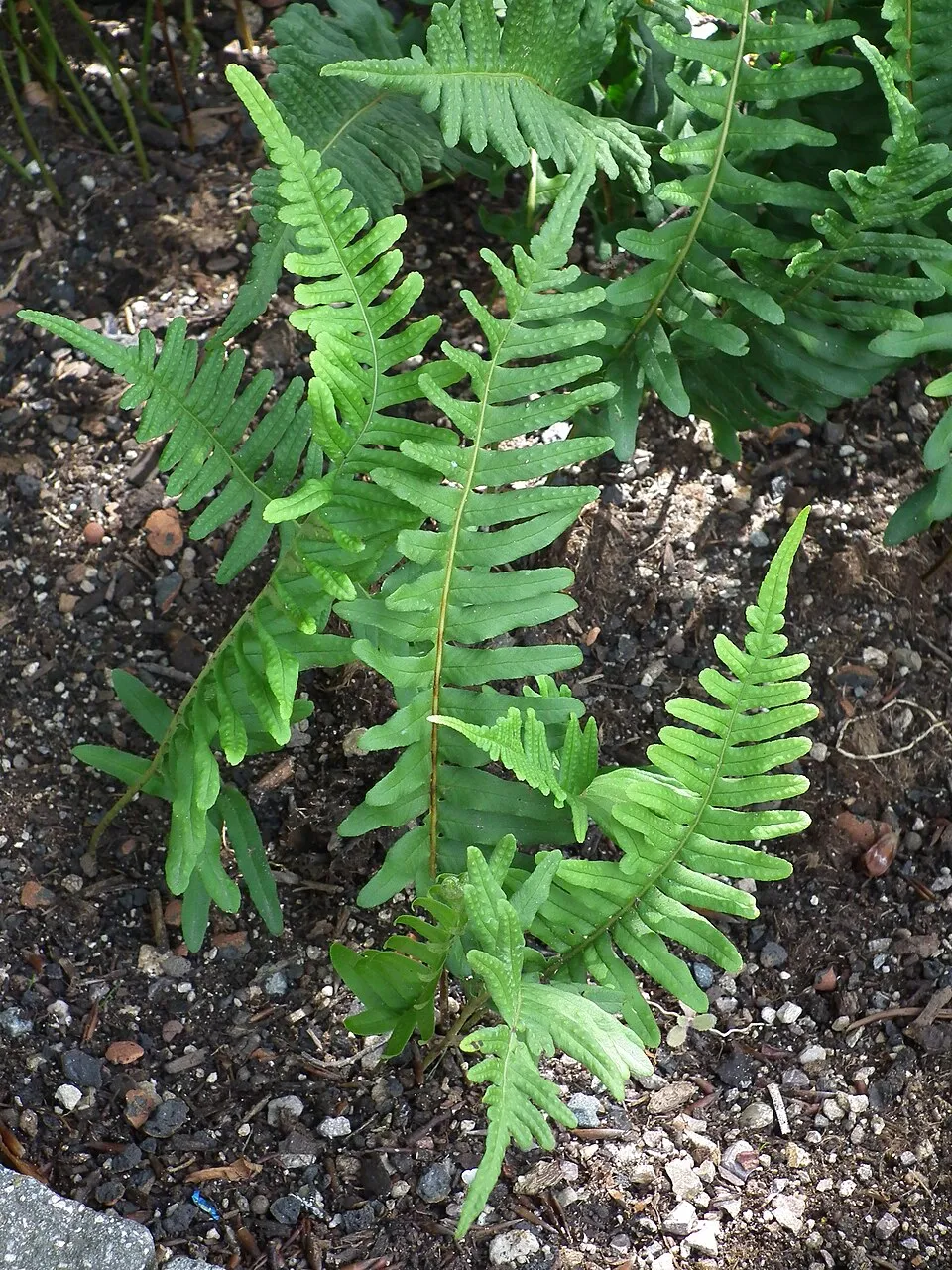
Based on occurrences aggregated by GBIF, several species are regularly recorded within the site. Among the most frequent are Phragmidium violaceum (Violet Bramble Rust), Dryopteris filix-mas (Male fern), Trametes versicolor (Turkey tail) and Stereum hirsutum (Hairy Curtain Crust). The full list of documented taxa is shown below.
Species to look out for

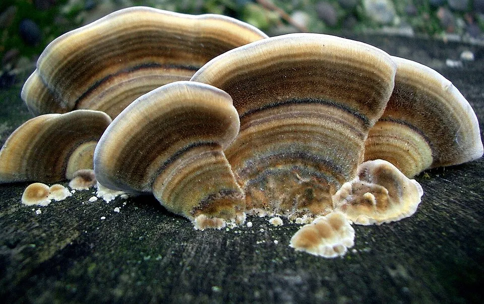
Fungus
Turkey tail
Trametes versicolor27 records © Steve Jurvetson from Menlo Park, USA · CC BY 2.0
Observed species
Occurrences documented via GBIF; they are neither an exhaustive inventory nor proof of current presence.
- Violet Bramble Rust · Phragmidium violaceum · 31
- Male fern · Dryopteris filix-mas · 30
- Turkey tail · Trametes versicolor · 27
- Hairy Curtain Crust · Stereum hirsutum · 25
- Waxy Crust · Vuilleminia comedens · 22
- Common polypody · Polypodium vulgare · 22
- Maidenhair Spleenwort · Asplenium trichomanes · 22
- Common Tarcrust · Diatrype stigma · 21
- Warlock's Butter · Exidia nigricans · 20
- Splitgill · Schizophyllum commune · 19
- Serpentine black spleenwort · Asplenium cuneifolium · 17
- Hairy Bracket · Trametes hirsuta · 16
+18 more species
- Eutypa maura · 14
- Diatrype decorticata · 14
- Ascodichaena rugosa · 13
- Dwarf Elder · Sambucus ebulus · 13
- Sulphur Tuft · Hypholoma fasciculare · 12
- Nettle pox · Calloria urticae · 12
- Purplepore Bracket · Trichaptum abietinum · 12
- Beech Barkspot · Diatrype disciformis · 11
- Purple-loosestrife · Lythrum salicaria · 11
- Elbowpatch Crust · Fomitiporia punctata · 11
- Birch Blackhead · Diatrypella favacea · 11
- Dark bush-cricket · Pholidoptera griseoaptera · 10
- Hypholoma sublateritium · Hypholoma lateritium · 10
- Oak Mildew · Erysiphe alphitoides · 10
- Himalayan Balsam · Impatiens glandulifera · 10
- Oak Mazegill · Daedalea quercina · 10
- Volucella pellucens · 9
- Blushing Bracket · Daedaleopsis confragosa · 9
Records: GBIF.org (CC-BY). Names: Wikidata (CC0), GBIF. Photos: Wikimedia Commons.
Conservation challenges
The primary purpose of the site is to preserve its natural habitats and the biodiversity they support. The species recorded (Biodiversity tab) reflect its ecological value. Its status as a nature park sets the regulatory framework for its protection.
According to Global Forest Change data (University of Maryland, Global Forest Watch), about 660 ha of tree cover were lost within the boundary between 2001 and 2023 (12% of its area), peaking in 2005 and 2023. These losses include logging, storms and fires, and do not account for regrowth. Apart from forest felling and regrowth (about 150 ha in total), land cover remained almost unchanged between 1990 and 2018 according to CORINE Land Cover; only some 7 ha were built over. At night, the area gives off virtually no artificial light detectable from space (NASA VIIRS Black Marble composite, 2016). Built-up and developed land (buildings, business areas, roads, quarries) covers 2% of the area, and farmland 19% (CORINE Land Cover). According to the Water Framework Directive assessment (2022 river basin management plans, data 2016–2021), only 47% of the 19 km of rivers assessed within the site are in good or high ecological status; the others mostly have moderate ecological status. Invasive alien species have been recorded within the site since 2000 (GBIF observations), several of them listed as of Union concern. Among them: Impatiens glandulifera (Himalayan Balsam), Reynoutria japonica (Japanese Knotweed) and Impatiens parviflora (Small balsam).
Pressure indicators
Tree cover lost
660 ha
2001–2023 · 12% of the area
20012023
Fires since 2016
0
No large fire mapped (fires over about 30 ha)
Light at night
< 1%
of the area gives off artificial light visible from space
DarkLit
Built-up land
2%
buildings, business areas, roads, quarries · farmland 19%
Land cover change
< 0.5%
of the area changed, 1990–2018 · CORINE
forest felling and regrowth: 150 ha in total
Rivers and lakes
47%
of the 19 km of assessed rivers in good or high ecological status · WFD 2022
assessments 2016–2021
Invasive alien species
3
incl. 2 of EU concern · since 2000
 Himalayan Balsam
 Japanese Knotweed
 Small balsam
Photos: Himalayan Balsam © Guptaele · CC BY-SA 4.0; Japanese Knotweed © W.carter · CC0-1.0; Small balsam © André Karwath aka Aka · CC BY-SA 2.5
Sources: Global Forest Change (Hansen et al., University of Maryland, via Global Forest Watch, CC-BY 4.0); EFFIS, European Commission / Copernicus; NASA Black Marble 2016 (public domain); CORINE Land Cover 2018 (Copernicus) or MODIS.
CORINE Land Cover Change 1990–2018: generated using European Union's Copernicus Land Monitoring Service information (EEA), aggregated by Parkavela; DOI 10.2909/f30f1000-7cf8-43bb-872c-5eb093911b24.
Ecological status of water bodies: European Environment Agency, WISE – Water Framework Directive, 3rd river basin management plans (2022), CC BY 4.0. Official national classification, not comparable between countries.
Invasive alien species: Global Register of Introduced and Invasive Species (ISSG, CC BY 4.0); Union list, Regulation (EU) 1143/2014 (INBO, CC0); GBIF.org records (CC0 / CC BY 4.0), at least 2 per species.
Practical information
Cities and airport
- Sopron
17 km as the crow flies - Szombathely
34 km as the crow flies - Airport: Wien-Schwechat (VIE)
53 km as the crow flies
Hiking
22 waymarked routes listed, including:
E 4ZentralalpenwegOstösterreichischer GrenzlandwegBurgenland-WeitwanderwegNÖ LandesrundwanderwegRundwanderweg Bucklige Welt
By bike
+ 5 local loops
Signed cycle routes: this does not mean that cycling is allowed on footpaths.
Data © OpenStreetMap contributors (ODbL) · Wikidata (CC0)
Routes © OpenStreetMap contributors (ODbL), via Waymarked Trails
Waymarked hiking routes
E4 Europäischer Fernwanderweg E4 (Wien - Rattersdorf)
12.2 km within the site ↗ 340 m↘ 261 m 349–630 m
rot Entenstein - Tafeleiche - Streitwiese - Fernblick Karl Rundwanderweg
8.1 km within the site ↗ 233 m↘ 180 m 351–524 m
Tracks © OpenStreetMap contributors (ODbL), clipped to the boundary; elevation gain and profiles computed on the longest section from Mapzen Terrain Tiles (≈ 30 m), indicative only.
Access and visiting
The nearest railway station is Marz-Rohrbach, about 9 km from the site boundary. Nearest towns of over 50,000 people, as the crow flies: Sopron (17 km) and Szombathely (34 km). Nearest airport: Wien-Schwechat (VIE), about 53 km away. About 240,000 people live within 20 km of the site boundary, 48,000 of them within 10 km; some 1,400 people are estimated to live inside (GHSL estimate, 2020). This population has grown by about 8% since 2000. Waymarked hiking routes listed in OpenStreetMap: 22, including E 4, Zentralalpenweg, Ostösterreichischer Grenzlandweg and Burgenland-Weitwanderweg. To plan a visit (access, opening periods, visitor rules), it is best to consult the official information from the managing body and the official website listed in this page's sources.
Source: OpenStreetMap (ODbL), Wikidata (CC0), October 2026.
Built heritage
According to Wikidata, 13 monuments listed as protected monuments in Austria stand within the boundary. Among them are 6 religious buildings, 2 castles and fortifications and 1 prehistoric or archaeological site. Examples include “Kath. Filialkirche hl. Matthäus” in Markt Sankt Martin, “Burgruine Schwarzenbach” in Schwarzenbach and “Keltendorf Schwarzenbach” in Schwarzenbach.
6 religious buildings2 castles and fortifications1 prehistoric or archaeological site1 house or civic building
-
Kath. Filialkirche hl. Matthäus
Markt Sankt Martin -
Burgruine Schwarzenbach
Schwarzenbach -
Keltendorf Schwarzenbach
Schwarzenbach -
Mida Huber House
Markt Sankt Martin · 20th c. -
Figurenbildstock hl. Johannes Nepomuk
Markt Sankt Martin -
Kath. Filialkirche „Zum gegeißelten Heiland“
Markt Sankt Martin -
Landsee castle ruins
Markt Sankt Martin · 12th c. -
Figurenbildstock hl. Maria
Markt Sankt Martin
and 5 more
Source: Wikidata (CC0), monuments in each country’s official heritage protection registers, at national or regional level. Each item links to its Wikidata entry.
When to visit
Mildest period: from June to August, with average temperatures of 17 to 20 °C. Average temperatures drop below 0 °C in December and January: frost is common. Precipitation peaks in July and August (up to 100 mm per month). Snow only makes brief appearances in winter (about 20 days a year on average, MODIS satellites 2015–2025). Day length ranges from about 8 h 27 min in December to 15 h 57 min in June. Wildlife records published on GBIF peak for plants (May). These peaks also reflect when observers are most active.
Source: Copernicus ERA5-Land (C3S), monthly averages 1996–2025 at the representative point, temperatures adjusted for elevation.
Contains modified Copernicus Climate Change Service information 2026. Neither the European Commission nor ECMWF is responsible for any use that may be made of the Copernicus information or data it contains.
Wildlife records calendar
JFMAMJJASOND
Plants
Monthly records published on GBIF (CC-BY), relative to the busiest month; also reflects observer activity.
Gallery
© Einer flog zu Weit · CC BY-SA 3.0
© Herzi Pinki · CC BY-SA 4.0
© Mattes · CC BY 3.0
© Herzi Pinki · CC BY-SA 4.0
© Herzi Pinki · CC BY-SA 4.0
© Herzi Pinki · CC BY-SA 4.0
Sources and licences
- Wikidata: Q1373109
- OpenStreetMap: relation 11041372
- Wikipedia: de.wikipedia.org/wiki/Naturpark_Landseer_Berge
- WDPA: 387313
References
- cds.climate.copernicus.eu: climate · CC-BY-4.0
- registry.opendata.aws: elevation of the reference point, detailed relief · CC-BY-3.0
- land.copernicus.eu: land cover, land cover change, sea share · COPERNICUS
- doi.org: population around the site · CC-BY-4.0
- wikidata.org: official area, establishment date, protected heritage, nearby cities and airport, access and peaks, lake depths, places to see · CC0-1.0
- eea.europa.eu: bathing water quality, ecological status of waters · CC-BY-4.0
- en.eurovelo.com: EuroVelo cycle routes · ODbL-1.0
- cycling.waymarkedtrails.org: cycle routes · ODbL-1.0
- opentopodata.org: elevations · PD
- forest-fire.emergency.copernicus.eu: wildfires · COPERNICUS
- globalforestwatch.org: tree cover loss · CC-BY-4.0
- gbif.org: seasonality of sightings, invasive alien species, observed species · CC-BY-4.0
- europe-geology.eu: geology · CC-BY-4.0
- hydrosheds.org: lakes · CC-BY-4.0
- openstreetmap.org: official name, access and peaks, trail difficulty · ODbL-1.0
- earthobservatory.nasa.gov: night light · PD
- hiking.waymarkedtrails.org: route difficulty · ODbL-1.0
- nsidc.org: snow cover · PD
- wikidata.org: Wikipedia article · CC-BY-SA-4.0
Data © OpenStreetMap contributors (ODbL), Wikidata (CC0) and the sources cited.