Spain · Terrestrial
Sierra Nevada National and Natural Park
National park of 86,200 hectares in Spain, established in 1999.
Overview
National park of 86,200 hectares in Spain, established in 1999.
Sierra Nevada National and Natural Park is a national park in Spain (Europe). It is a predominantly terrestrial area. Established on 11 January 1999, it covers about 86,200 hectares.
Protections and designations
UNESCO Biosphere Reserve
Natura 2000 · habitats (SAC)
- Sierra Nevada ES6140004
Natura 2000 · birds (SPA)
- Sierra Nevada ES6140004
Protected as a national park. International labels and designations: UNESCO Biosphere Reserve (“Sierra Nevada Biosphere Reserve”) and Natura 2000 network (1 site: “Sierra Nevada”). Key dates: established in 1999, first Natura 2000 site under the Birds Directive in 2002 and first Natura 2000 site under the Habitats Directive in 2012.
In our collections
Timeline
-
1999
Established
-
2002
First Natura 2000 site under the Birds Directive
-
2012
First Natura 2000 site under the Habitats Directive
Sources: Wikidata (CC0) for establishment and international labels; EEA Natura 2000 database (CC-BY 4.0) for site designation dates.
Frequently asked questions
Where is Sierra Nevada National and Natural Park?
In Spain (Europe). Representative point: 37.1000° N, 3.0900° W.
How large is Sierra Nevada National and Natural Park?
About 86,200 hectares (862 km²). It is the 2nd largest of the 16 national parks in Spain covered by Parkavela.
When was Sierra Nevada National and Natural Park established?
On 11 January 1999.
What habitats and landscapes does Sierra Nevada National and Natural Park include?
A terrestrial area, with mountains.
What rocks lie beneath Sierra Nevada National and Natural Park?
According to the European 1:1 million geological map (EGDI), the bedrock consists mainly of mica schists (71% of sampled points), amphibolites (14%) and gneiss (14%). These are mostly metamorphic rocks. The geological units date mainly from the Precambrian (71% of sampled points).
What is the highest point of Sierra Nevada National and Natural Park?
Pico de Mulhacén, at 3,479 m (OpenStreetMap).
What are the main summits of Sierra Nevada National and Natural Park?
Pico de Mulhacén (3,479 m), Mulhacén Antecima Sur (3,427 m), Pico del Veleta (3,396 m), La Alcazaba (3,369 m) and Mulhacén II (3,362 m) (OpenStreetMap).
Which international labels apply to Sierra Nevada National and Natural Park?
UNESCO Biosphere Reserve (“Sierra Nevada Biosphere Reserve”) and Natura 2000 network (1 site: “Sierra Nevada”).
When is the best time to visit Sierra Nevada National and Natural Park?
Best time to visit: from June to September, with average temperatures of 13 to 19 °C and moderate rainfall.
Is there snow in Sierra Nevada National and Natural Park?
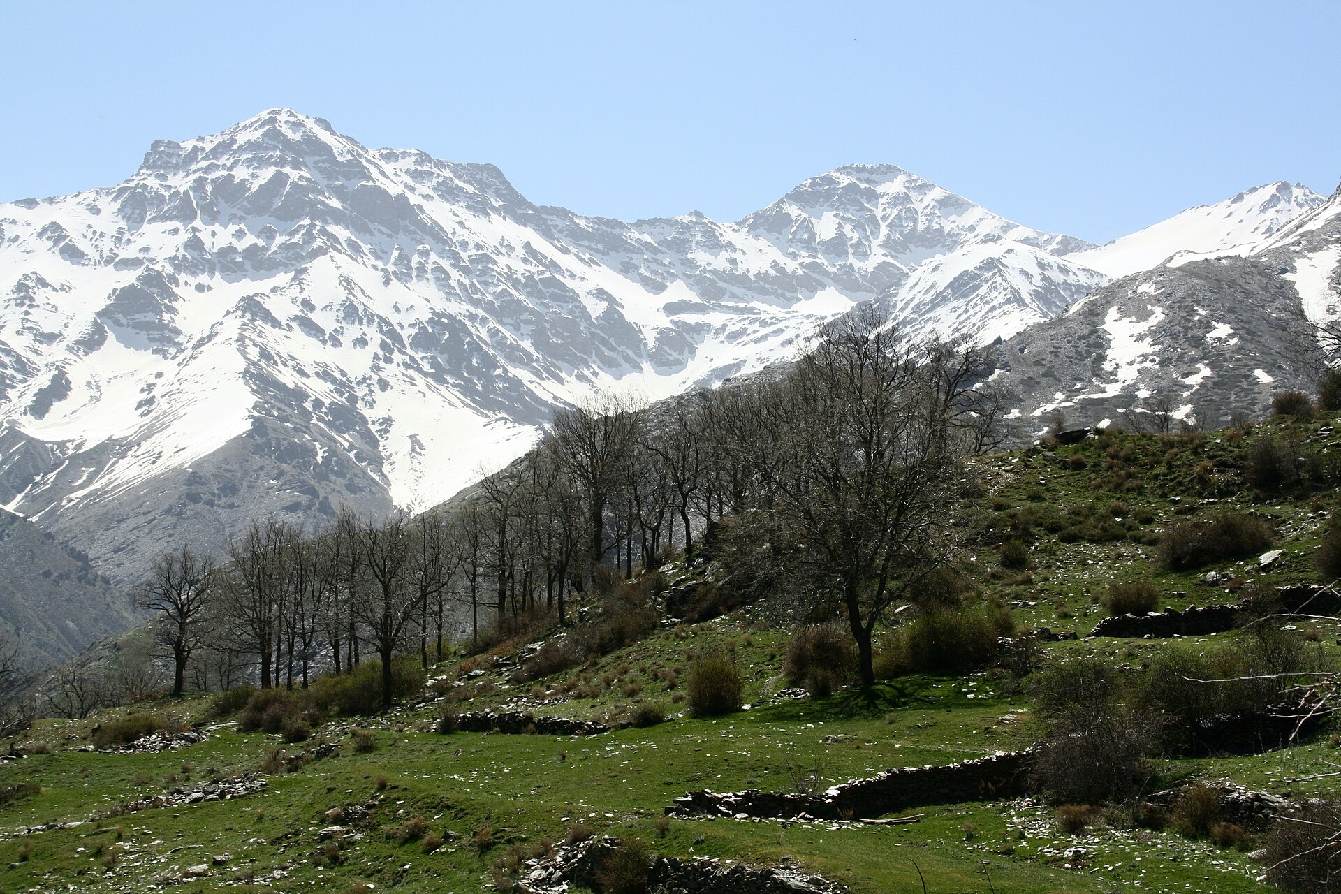
Yes. According to NASA's MODIS satellites (2015–2025 average), snow covers the site about 55 days a year, mostly from December to April.
What is there to see in Sierra Nevada National and Natural Park?
2 waterfalls and 24 lakes and ponds, including Chorreras del Molinillo (2,340 m), Laguna de las Yeguas (2,859 m), Cascajar del Cartujo and Lagunas de Río Seco (3,065 m) (Wikidata).
Where can I stay in Sierra Nevada National and Natural Park?
4 mountain huts, including Refugio Poqueira (2,500 m), Refugio Postero Alto (1,990 m) and Refugio Elorrieta (Wikidata).
Are there historic monuments in Sierra Nevada National and Natural Park?
Yes. According to Wikidata, 2 monuments listed as Bien de Interés Cultural stand within the boundary. For example: “Tajo del Reyecillo” in Bérchules and “Acequia Alta de Pitres” in La Taha.
What is the nearest large city to Sierra Nevada National and Natural Park?
Nearest towns of over 50,000 people, as the crow flies: Almería (30 km) and Jaén (75 km). Nearest airport: Federico García Lorca Granada (GRX), about 24 km away.
How can I reach Sierra Nevada National and Natural Park by train?
The nearest railway station is Abla y Abrucena, about 6 km from the site boundary.
Where can I get visitor information on site?
El Dornajo, Información Turística and Servicio de Interpretación de Altas Cumbres.
Are there waymarked hiking trails in Sierra Nevada National and Natural Park?
Yes. Waymarked hiking routes listed in OpenStreetMap: 78, including GR 140 (12 km), GR 142 (22 km), GR 240 (19 km) and GR 7. The “Integral de Sierra Nevada” route runs for about 35 km through the site, with some 610 m of ascent on its longest section.
Which species can be seen in Sierra Nevada National and Natural Park?
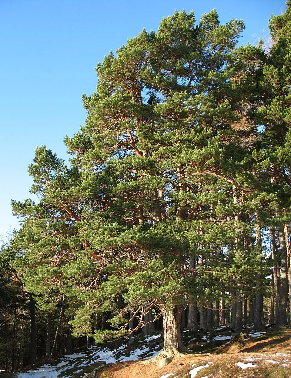
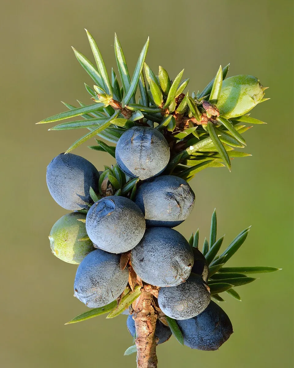
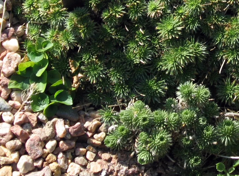
Among the species most often recorded on GBIF are Pinus sylvestris (Scots Pine), Juniperus communis (Common Juniper), Quercus rotundifolia (Ballota oak) and Draba hispanica (Spanish draba).
What is the official website of Sierra Nevada National and Natural Park?
miteco.gob.es/es/red-parques-nacionales/nuestros-parques/sierra-nevada
© OpenStreetMap
Download the boundary: GeoJSON · GPX Boundary © OpenStreetMap contributors (ODbL).
Geography
The representative point of the site lies at around 2,385 m above sea level. Over the 1996–2025 period, the mean annual temperature is about 8.0 °C and total precipitation reaches roughly 570 mm per year. The warmest month is usually July, the coolest January, and the wettest March. According to the European 1:1 million geological map (EGDI), the bedrock consists mainly of mica schists (71% of sampled points), amphibolites (14%) and gneiss (14%). These are mostly metamorphic rocks. The geological units date mainly from the Precambrian (71% of sampled points).
Area
- Area
- 86,200 ha
- Elevation
- 2,385 m
- Median elevation
- 2,124 m
- Mean slope
- 19°
- Snow cover
- ≈ 55 days a year
- Coordinates
- 37.1, -3.09
Terrain: Mapzen Terrain Tiles (SRTM, USGS)
Elevation bands
- 1,000–1,500 m 6%
- 1,500–2,000 m 32%
- 2,000–2,500 m 40%
- 2,500–3,000 m 19%
- above 3,000 m 3%
share of the site in each elevation band (smoothed terrain model: summits are rounded off) · Terrain: Mapzen Terrain Tiles (SRTM, USGS)
Bedrock
- Mica schists 71 %
- Amphibolites 14 %
- Gneiss 14 %
Metamorphic rocks 100 % · Main age: Precambrian (71%)
Source: EGDI 1:1M geological map (EuroGeoSurveys and national geological surveys), CC BY 4.0 · 14 sampled points within the site.
Main summits
- Pico de Mulhacén3,479 m
- Mulhacén Antecima Sur3,427 m
- Pico del Veleta3,396 m
- La Alcazaba3,369 m
- Mulhacén II3,362 m
- Salón3,352 m
- Campanario3,329 m
- Cerro de los Machos3,329 m
- Zacatín3,327 m
- Puntal de la Cornisa3,316 m
Data © OpenStreetMap contributors (ODbL)
Climate
● Mean temperature (°C) · ▮ Precipitation (mm)
Source: Copernicus ERA5-Land (C3S, doi:10.24381/cds.68d2bb30), monthly averages 1996–2025 interpolated to the representative point, temperatures adjusted for elevation.
Contains modified Copernicus Climate Change Service information 2026. Neither the European Commission nor ECMWF is responsible for any use that may be made of the Copernicus information or data it contains.
Snow cover measured by satellite
J
F
M
A
M
J
J
A
S
O
N
D
average share of the site under snow · snowiest parts · ≈ 55 days a year
Snow cover: MODIS/Terra MOD10CM v61 (Hall & Riggs, 2021, NASA NSIDC DAAC, doi:10.5067/MODIS/MOD10CM.061), imagery from NASA GIBS (ESDIS); 2015–2025 average, grid of about 5 km.
Natural habitats
According to CORINE Land Cover (2018), the site is mainly made up of heath and scrub (34%), forests (26%) and Mediterranean scrub (16%). Woodland is mostly coniferous. Elevation ranges from about 1,520 m to 3,479 m (highest point: Pico de Mulhacén). Median elevation is 2,124 m, and 21% of the site lies above 2,500 m (SRTM elevation model). The terrain is steep: 71% of slopes exceed 15° (mean slope 19°). The Natura 2000 site overlapping the area lists 37 habitats of European interest (7 priority), the most extensive being pseudo-steppe with grasses and annuals of the Thero-Brachypodietea, Oro-Iberian Festuca indigesta grasslands and endemic oro-Mediterranean heaths with gorse.
Biodiversity
Based on occurrences aggregated by GBIF, several species are regularly recorded within the site. Among the most frequent are Pinus sylvestris (Scots Pine), Juniperus communis (Common Juniper), Quercus rotundifolia (Ballota oak) and Draba hispanica (Spanish draba). The full list of documented taxa is shown below. The overlapping Natura 2000 site lists 117 species of European interest: 73 birds, 16 mammals, 4 reptiles, 4 amphibians, 5 invertebrates and 15 plants.
Habitats of European interest
From the official form of the Natura 2000 site overlapping the area (areas reported for the whole site).
- Pseudo-steppe with grasses and annuals of the Thero-Brachypodietea priority 43,308 ha
- Oro-Iberian Festuca indigesta grasslands 10,173 ha
- Endemic oro-Mediterranean heaths with gorse 9,418 ha
- Quercus ilex and Quercus rotundifolia forests 6,299 ha
- Thermo-Mediterranean and pre-desert scrub 5,918 ha
- Western Mediterranean and thermophilous scree 4,808 ha
- Siliceous rocky slopes with chasmophytic vegetation 3,275 ha
- Dehesas with evergreen Quercus spp. 2,751 ha
and 29 more
Species of European interest
Birds · 73
Eurasian Goshawk (Accipiter gentilis) breeding, Great Reed Warbler (Acrocephalus arundinaceus) breeding, Common Sandpiper (Actitis hypoleucos) resident, Common Kingfisher (Alcedo atthis) resident, Eurasian Teal (Anas crecca) wintering, Mallard (Anas platyrhynchos) breeding wintering, Tawny Pipit (Anthus campestris) breeding, Golden Eagle (Aquila chrysaetos) resident, Bonelli's Eagle (Aquila fasciata) resident, Grey Heron (Ardea cinerea) wintering breeding, Purple Heron (Ardea purpurea) breeding, Common Pochard (Aythya ferina) wintering breeding and 61 more
Mammals · 16
Serotine bat (Eptesicus serotinus), European wildcat (Felis silvestris), Savi's Pipistrelle (Hypsugo savii), Cabrera's vole (Microtus cabrerae), Common bent-wing bat (Miniopterus schreibersii), Lesser mouse-eared myotis (Myotis blythii), Long-fingered bat (Myotis capaccinii), Geoffroy's bat (Myotis emarginatus), Escalera’s Bat (Myotis escalerai), Greater mouse-eared bat (Myotis myotis), Natterer's bat (Myotis nattereri), Grey long-eared bat (Plecotus austriacus) and 4 more
Reptiles · 4
Bedriaga's skink (Chalcides bedriagai), Smooth snake (Coronella austriaca), Horseshoe Whip Snake (Hemorrhois hippocrepis), Iberian pond turtle (Mauremys leprosa)
Amphibians · 4
Iberian painted frog (Discoglossus galganoi), Natterjack toad (Epidalea calamita), Stripeless tree frog (Hyla meridionalis), Western Spadefoot (Pelobates cultripes)
Invertebrates · 5
White-clawed Crayfish (Austropotamobius pallipes), Sierra Nevadan Saddle Bush-cricket (Baetica ustulata), Greater Capricorn Beetle (Cerambyx cerdo), Marsh fritillary (Euphydryas aurinia), Nevada Blue (Polyommatus golgus)
Plants · 15
Arenaria funiculata, Centaurea gadorensis, Erodium rupicola, Euphorbia nevadensis, Festuca elegans, Galium viridiflorum, Great Yellow Gentian (Gentiana lutea), Leontodon boryi, Angel's-tears (Narcissus triandrus), Pinguicula nevadensis, Santolina elegans, Scorzoneroides microcephala and 3 more
Source: Natura 2000 standard data forms (EEA, CC-BY 4.0). Not exhaustive: sensitive species are not published.
Species to look out for

Observed species
Occurrences documented via GBIF; they are neither an exhaustive inventory nor proof of current presence.
- Scots Pine · Pinus sylvestris · 14678
- Common Juniper · Juniperus communis · 6234
- Ballota oak · Quercus rotundifolia · 6117
- Spanish draba · Draba hispanica · 5538
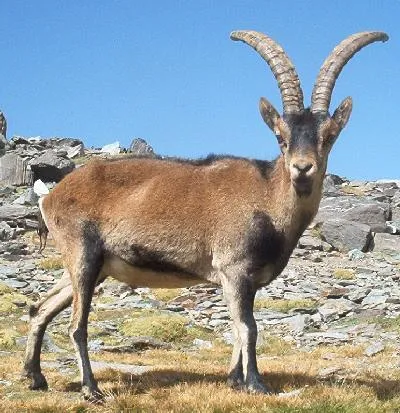
- Spanish Ibex · Capra pyrenaica · 5522
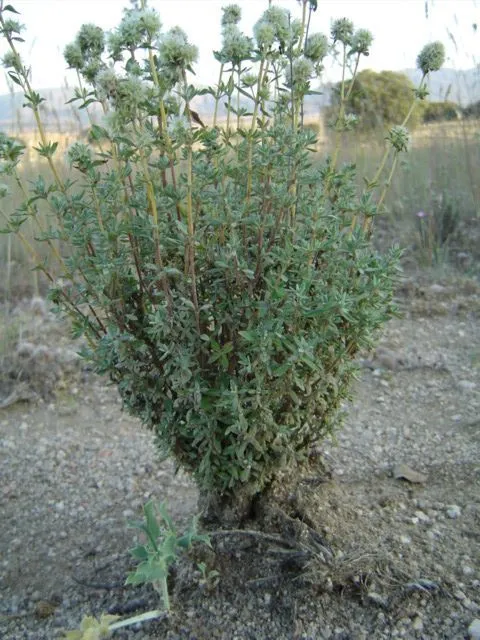
- Spanish Marjoram · Thymus mastichina · 5080
- Spanish thyme · Thymus zygis · 4050
- Black pine · Pinus nigra · 4029
- Lampwickplant · Phlomis lychnitis · 3940
- Genista versicolor · 3876
- Pyrenean Oak · Quercus pyrenaica · 3783
- Maritime pine · Pinus pinaster · 3117
+18 more species
- Flatpod · Adenocarpus decorticans · 3099
- Brown Trout · Salmo trutta · 2537
- Pine Processionary · Thaumetopoea pityocampa · 1531
- French lavender · Lavandula stoechas · 1359
- Aleppo Pine · Pinus halepensis · 1240
- Black Satyr · Satyrus actaea · 1212
- Clouded yellow · Colias croceus · 1175
- Montpelier cistus · Cistus monspeliensis · 1156
- Salvia blancoana · 1032
- Small tortoiseshell · Aglais urticae · 1029
- Small white · Pieris rapae · 872
- Hedgehog-broom · Erinacea anthyllis · 868
- Wall brown · Lasiommata megera · 856
- Small-flowered Gorse · Ulex parviflorus · 791
- Apollo · Parnassius apollo · 772
- Genista umbellata · 704
- Red fox · Vulpes vulpes · 693
- Eurasian Chaffinch · Fringilla coelebs · 676
Records: GBIF.org (CC-BY). Names: Wikidata (CC0), GBIF. Photos: Wikimedia Commons.
Conservation challenges
The primary purpose of the site is to preserve its natural habitats and the biodiversity they support. The species recorded (Biodiversity tab) reflect its ecological value. The designations it holds frame its management and the control of land use.
According to Global Forest Change data (University of Maryland, Global Forest Watch), about 1,100 ha of tree cover were lost within the boundary between 2001 and 2023 (1% of its area), peaking in 2006 and 2020. These losses include logging, storms and fires, and do not account for regrowth. According to the European CORINE Land Cover inventory (Copernicus), land cover changed on about 712 ha of the site between 1990 and 2018 (under 1% of its area). Forest felling and regrowth add about 1,900 ha in total over the period. At night, the area gives off virtually no artificial light detectable from space (NASA VIIRS Black Marble composite, 2016). According to the Natura 2000 forms, of 37 assessed habitats of European interest, 10 are in excellent condition and 9 in average or reduced condition. According to the Water Framework Directive assessment (2022 river basin management plans, data 2014–2019), 96% of the 93 km of rivers assessed within the site are in good or high ecological status. Other assessed water bodies: lakes, 1 of 1 in good ecological status or better.
Pressure indicators
Tree cover lost
1,096 ha
2001–2023 · 1% of the area
20012023
Fires since 2016
0
No large fire mapped (fires over about 30 ha)
Light at night
< 1%
of the area gives off artificial light visible from space
DarkLit
Land cover change
712 ha
changed cover, 1990–2018 · CORINE · < 1% of the area
forest felling and regrowth: 1,900 ha in total
Rivers and lakes
96%
of the 93 km of assessed rivers in good or high ecological status · WFD 2022
Lakes: 1 of 1 good or better
assessments 2014–2019
Sources: Global Forest Change (Hansen et al., University of Maryland, via Global Forest Watch, CC-BY 4.0); EFFIS, European Commission / Copernicus; NASA Black Marble 2016 (public domain); CORINE Land Cover 2018 (Copernicus) or MODIS.
CORINE Land Cover Change 1990–2018: generated using European Union's Copernicus Land Monitoring Service information (EEA), aggregated by Parkavela; DOI 10.2909/f30f1000-7cf8-43bb-872c-5eb093911b24.
Ecological status of water bodies: European Environment Agency, WISE – Water Framework Directive, 3rd river basin management plans (2022), CC BY 4.0. Official national classification, not comparable between countries.
Practical information
Cities and airport
- Almería
30 km as the crow flies - Jaén
75 km as the crow flies - Airport: Federico García Lorca Granada (GRX)
24 km as the crow flies
Visitor information
- El Dornajo
< 1 km from the site boundary - Información Turística
< 1 km from the site boundary - Servicio de Interpretación de Altas Cumbres
2 km from the site boundary - Punto de Información
2 km from the site boundary
Parking
7 public car parks listed within the site · 15 trailheads
Things to see
2 waterfalls · 24 lakes and ponds
- Chorreras del Molinillo
waterfall · 2,340 m - Laguna de las Yeguas
lake or pond · 2,859 m - Cascajar del Cartujo
waterfall - Lagunas de Río Seco
lake or pond · 3,065 m - Laguna del Río Veleta
lake or pond · 3,082 m
Where to stay
4 mountain huts
- Refugio Poqueira
mountain hut · 2,500 m - Refugio Postero Alto
mountain hut · 1,990 m - Refugio Elorrieta
mountain hut - Piedra Negra
mountain hut
Hiking
78 waymarked routes listed, including:
GR 140 (12 km)GR 142 (22 km)GR 240 (19 km)GR 7Integral de Sierra NevadaCañada Real de Sierra Nevada
Trail difficulty
- T1 · easy hiking · 5% · 19 km
- T2 · mountain hiking · 40% · 251 km
- T3–T6 · demanding or alpine hiking · 55% · 357 km
627 km graded out of 1,298 km of paths
SAC scale (T1–T6) © OpenStreetMap contributors (ODbL): indicative only, check with the park.
By bike
+ 6 local loops
Signed cycle routes: this does not mean that cycling is allowed on footpaths.
Data © OpenStreetMap contributors (ODbL) · Wikidata (CC0)
Routes © OpenStreetMap contributors (ODbL), via Waymarked Trails
Waymarked hiking routes
GR 140 Unnamed route
4.4 km within the site ↗ 312 m↘ 7 m 1,738–2,048 m
up to T2 · mountain hiking
GR 142 Unnamed route
10.4 km within the site ↗ 234 m↘ 402 m 1,318–1,632 m
GR 240 Unnamed route
15.1 km within the site ↗ 556 m↘ 700 m 1,664–1,981 m
GR 7 Andalucía - South Route (Provincia de Granada)
9.8 km within the site ↗ 306 m↘ 299 m 1,738–2,046 m
Integral de Sierra Nevada
34.9 km within the site ↗ 608 m↘ 1,052 m 2,890–3,450 m
up to T5 · demanding alpine hiking faint path in places
Puerto de la Ragua-Mulhacen
34.9 km within the site ↗ 1,679 m↘ 2,676 m 2,058–3,343 m
up to T6 · difficult alpine hiking faint path in places
Tracks © OpenStreetMap contributors (ODbL), clipped to the boundary; elevation gain and profiles computed on the longest section from Mapzen Terrain Tiles (≈ 30 m), indicative only. Indicative difficulty (SAC scale, OpenStreetMap, via Waymarked Trails): check with the park.
Access and visiting
The nearest railway station is Abla y Abrucena, about 6 km from the site boundary. Nearest towns of over 50,000 people, as the crow flies: Almería (30 km) and Jaén (75 km). Nearest airport: Federico García Lorca Granada (GRX), about 24 km away. About 590,000 people live within 20 km of the site boundary, 270,000 of them within 10 km; some 940 people are estimated to live inside (GHSL estimate, 2020). Visitor information on site: El Dornajo, Información Turística and Servicio de Interpretación de Altas Cumbres. Public car parks listed within the site: 7. Waymarked hiking routes listed in OpenStreetMap: 78, including GR 140 (12 km), GR 142 (22 km), GR 240 (19 km) and GR 7. Of the roughly 630 km of paths with a difficulty grade in OpenStreetMap, 5% are easy hiking (T1), 40% mountain hiking (T2) and 55% demanding or alpine hiking (T3–T6). This is indicative only: check with the park. To see: 2 waterfalls and 24 lakes and ponds, including Chorreras del Molinillo (2,340 m), Laguna de las Yeguas (2,859 m), Cascajar del Cartujo and Lagunas de Río Seco (3,065 m). Where to stay: 4 mountain huts, including Refugio Poqueira (2,500 m), Refugio Postero Alto (1,990 m) and Refugio Elorrieta. To plan a visit (access, opening periods, visitor rules), it is best to consult the official information from the managing body and the official website listed in this page's sources.
Source: OpenStreetMap (ODbL), Wikidata (CC0), October 2026.
Built heritage
According to Wikidata, 2 monuments listed as Bien de Interés Cultural stand within the boundary. Examples include “Tajo del Reyecillo” in Bérchules and “Acequia Alta de Pitres” in La Taha.
-
Tajo del Reyecillo
Bérchules -
Acequia Alta de Pitres
La Taha
Source: Wikidata (CC0), monuments in each country’s official heritage protection registers, at national or regional level. Each item links to its Wikidata entry.
When to visit
Best time to visit: from June to September, with average temperatures of 13 to 19 °C and moderate rainfall. Average temperatures drop below 0 °C in January: frost is common. These averages apply to the site's representative point (2,385 m); higher up it is markedly cooler and snow lasts longer. According to NASA's MODIS satellites (2015–2025 average), snow covers the site about 55 days a year, mostly from December to April. Day length ranges from about 9 h 37 min in December to 14 h 42 min in June. Wildlife records published on GBIF peak for birds (May and June), plants (June and July), butterflies and moths (July), dragonflies (July) and mammals (October). These peaks also reflect when observers are most active.
Source: Copernicus ERA5-Land (C3S), monthly averages 1996–2025 at the representative point, temperatures adjusted for elevation.
Contains modified Copernicus Climate Change Service information 2026. Neither the European Commission nor ECMWF is responsible for any use that may be made of the Copernicus information or data it contains.
Wildlife records calendar
JFMAMJJASOND
Birds
Plants
Butterflies & moths
Dragonflies
Mammals
Monthly records published on GBIF (CC-BY), relative to the busiest month; also reflects observer activity.
Gallery
© FrDr · CC BY-SA 4.0
© Trougnouf (Benoit Brummer) · CC BY 4.0
© Andrew Hurley from Wallasey, England, United Kingdom · CC BY-SA 2.0
© Earth Science and Remote Sensing Unit, Lyndon B. Johnson Space Center · Public domain
© Luis Daniel Carbia Cabeza from Almeria, Spain · CC BY 2.0
© Andrés Martín Rodríguez · CC BY-SA 2.0
Sources and licences
- Wikidata: Q1969050
- OpenStreetMap: relation 4829086
- Official website: https://www.miteco.gob.es/es/red-parques-nacionales/nuestros-parques/sierra-nevada/
- Wikipedia: en.wikipedia.org/wiki/Sierra_Nevada_National_Park_(Spain)
- Natura 2000: ES6140004
- WDPA: 555549110
References
- cds.climate.copernicus.eu: climate · CC-BY-4.0
- registry.opendata.aws: elevation of the reference point, detailed relief · PD
- land.copernicus.eu: land cover, land cover change, sea share · COPERNICUS
- doi.org: population around the site · CC-BY-4.0
- wikidata.org: official area, highest point, establishment date, protected heritage, nearby cities and airport, access and peaks, lake depths, places to see, official website · CC0-1.0
- eea.europa.eu: bathing water quality, ecological status of waters · CC-BY-4.0
- en.eurovelo.com: EuroVelo cycle routes · ODbL-1.0
- cycling.waymarkedtrails.org: cycle routes · ODbL-1.0
- opentopodata.org: elevations · PD
- forest-fire.emergency.copernicus.eu: wildfires · COPERNICUS
- globalforestwatch.org: tree cover loss · CC-BY-4.0
- gbif.org: seasonality of sightings, invasive alien species, observed species · CC-BY-4.0
- europe-geology.eu: geology · CC-BY-4.0
- hydrosheds.org: lakes · CC-BY-4.0
- natura2000.eea.europa.eu: Natura 2000 habitats and species · CC-BY-4.0
- openstreetmap.org: official name, access and peaks, trail difficulty, wheelchair access · ODbL-1.0
- earthobservatory.nasa.gov: night light · PD
- hiking.waymarkedtrails.org: route difficulty · ODbL-1.0
- nsidc.org: snow cover · PD
- wikidata.org: Wikipedia article · CC-BY-SA-4.0
Data © OpenStreetMap contributors (ODbL), Wikidata (CC0) and the sources cited.