United Kingdom · Terrestrial
South Downs National Park
National park of 162,700 hectares in the United Kingdom, established in 2010.
Overview
National park of 162,700 hectares in the United Kingdom, established in 2010.
South Downs National Park is located in the United Kingdom (Europe). It is a predominantly terrestrial area. Established in 2010, it covers about 162,700 hectares. The site is managed by South Downs National Park Authority.
Protections and designations
Dark Sky Place
Protected as a national park. International labels and designations: Dark Sky Place.
In our collections
Frequently asked questions
Where is South Downs National Park?
In the United Kingdom (Europe). Representative point: 50.9512° N, 0.6660° W.
How large is South Downs National Park?
About 162,700 hectares (1,627 km²). It is the 6th largest of the 15 national parks in the United Kingdom covered by Parkavela.
When was South Downs National Park established?
In 2010.
What habitats and landscapes does South Downs National Park include?
A terrestrial area, where land cover is dominated by farmland (41%).
What rocks lie beneath South Downs National Park?
According to the European 1:1 million geological map (EGDI), the bedrock consists mainly of chalk (44% of sampled points), unconsolidated deposits (25%) and sandstones (25%). These are mostly sedimentary rocks. The geological units date mainly from the Cretaceous (75% of sampled points).
What is the highest point of South Downs National Park?
Blackdown, at 280 m (OpenStreetMap).
What are the main summits of South Downs National Park?
Blackdown (280 m), Butser Hill (270 m), Ditchling Beacon (249 m), Shoulder Of Mutton Hill (248 m) and Linch Down (248 m) (OpenStreetMap).
Which international labels apply to South Downs National Park?
Dark Sky Place.
When is the best time to visit South Downs National Park?
Best time to visit: from May to September, with average temperatures of 12 to 18 °C and moderate rainfall.
What is there to see in South Downs National Park?
Shillinglee Lake (Wikidata).
Are there historic monuments in South Downs National Park?
Yes. According to Wikidata, 150 monuments listed at the highest grade in the United Kingdom (Grade I; Category A in Scotland) stand within the boundary. For example: “Chithurst Church” in Trotton with Chithurst, “Amberley Castle” in Amberley and “Aldworth House” in Lurgashall.
What is the nearest large city to South Downs National Park?
Nearest towns of over 50,000 people, as the crow flies: Eastbourne (1 km) and Brighton and Hove (3 km). Nearest airport: Southampton (SOU), about 6 km away.
Where can I get visitor information on site?
Queen Elizabeth Country Park Visitor Centre, Highdown Gardens Visitor Centre and South Downs Centre, tourist information and visitor exhibition.
Are there waymarked hiking trails in South Downs National Park?
Yes. Waymarked hiking routes listed in OpenStreetMap: 67, including E 9, South Downs Way, King Charles III England Coast Path and South Downs Way (Inland Route). The “South Downs Way” route runs for about 159 km through the site, with some 2,280 m of ascent on its longest section.
Which species can be seen in South Downs National Park?
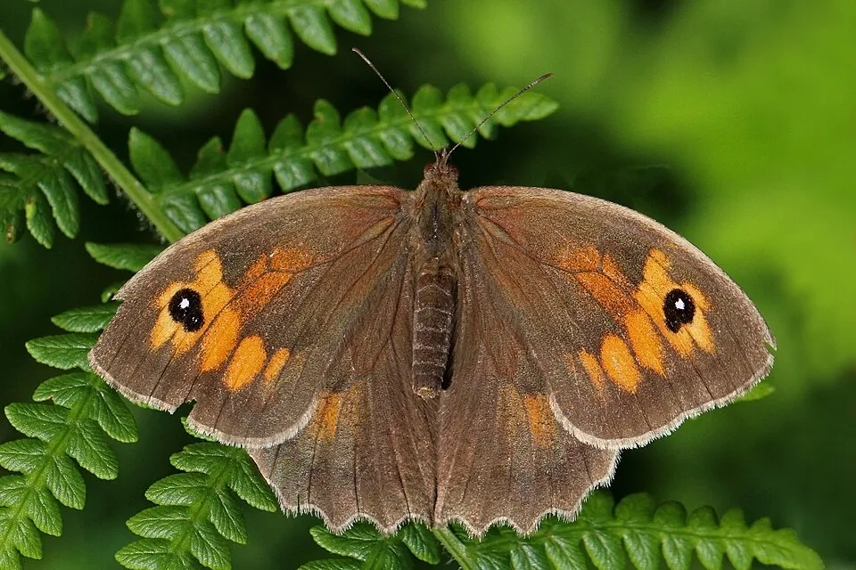
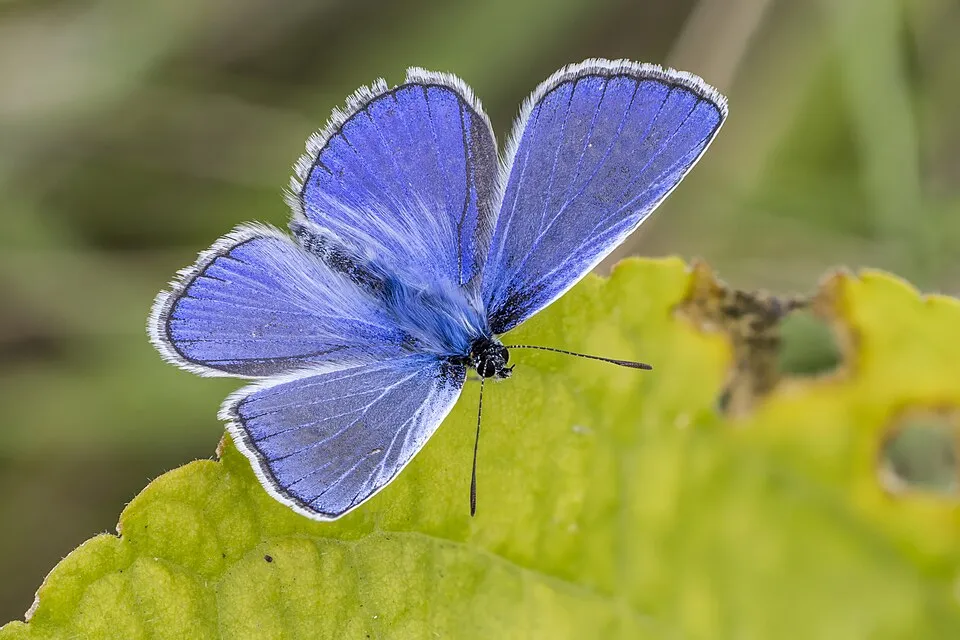
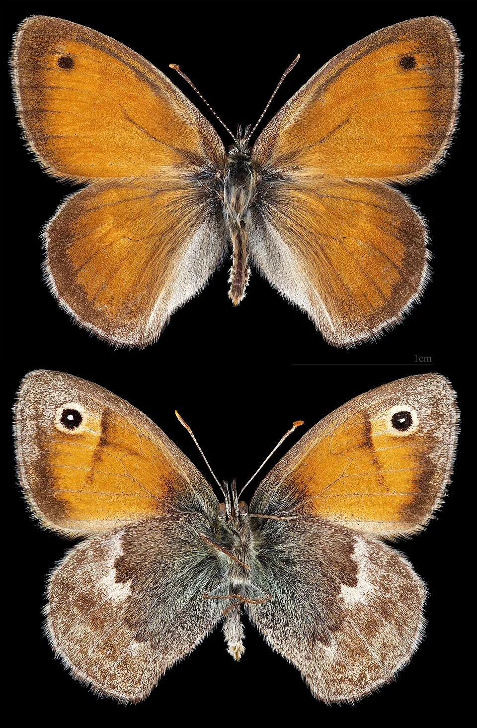
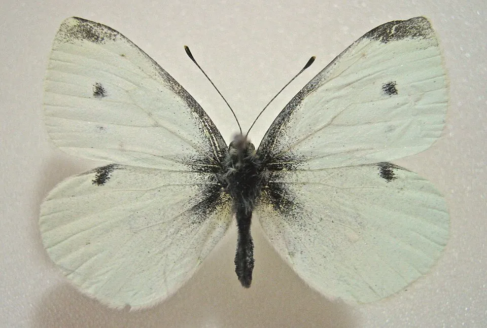
Among the species most often recorded on GBIF are Maniola jurtina (Meadow brown), Polyommatus icarus (Common blue), Coenonympha pamphilus (Small Heath) and Pieris rapae (Small white).
Who manages South Downs National Park?
South Downs National Park Authority.
What is the official website of South Downs National Park?
© OpenStreetMap
Download the boundary: GeoJSON · GPX Boundary © OpenStreetMap contributors (ODbL).
Geography
The representative point of the site lies at around 52 m above sea level. Over the 1996–2025 period, the mean annual temperature is about 11.0 °C and total precipitation reaches roughly 774 mm per year. The warmest month is usually July, the coolest January, and the wettest October. According to the European 1:1 million geological map (EGDI), the bedrock consists mainly of chalk (44% of sampled points), unconsolidated deposits (25%) and sandstones (25%). These are mostly sedimentary rocks. The geological units date mainly from the Cretaceous (75% of sampled points).
Area
- Area
- 162,700 ha
- Elevation
- 52 m
- Coordinates
- 50.9512, -0.666
Bedrock
- Chalk 44 %
- Unconsolidated deposits 25 %
- Sandstones 25 %
- Mudstones 6 %
Sedimentary rocks 100 % · Main age: Cretaceous (75%)
Source: EGDI 1:1M geological map (EuroGeoSurveys and national geological surveys), CC BY 4.0 · 16 sampled points within the site.
Main summits
- Blackdown280 m
- Butser Hill270 m
- Ditchling Beacon249 m
- Shoulder Of Mutton Hill248 m
- Linch Down248 m
- Warren Corner246 m
- Glatting Beacon246 m
- War Down244 m
- Wheatham Hill244 m
- Beacon Hill242 m
Data © OpenStreetMap contributors (ODbL)
Climate
● Mean temperature (°C) · ▮ Precipitation (mm)
Source: Copernicus ERA5-Land (C3S, doi:10.24381/cds.68d2bb30), monthly averages 1996–2025 interpolated to the representative point, temperatures adjusted for elevation.
Contains modified Copernicus Climate Change Service information 2026. Neither the European Commission nor ECMWF is responsible for any use that may be made of the Copernicus information or data it contains.
Natural habitats
According to CORINE Land Cover (2018), the site is mainly made up of farmland (41%), grassland and meadows (34%) and forests (17%). Elevation ranges from sea level to 280 m (highest point: Blackdown).
Biodiversity
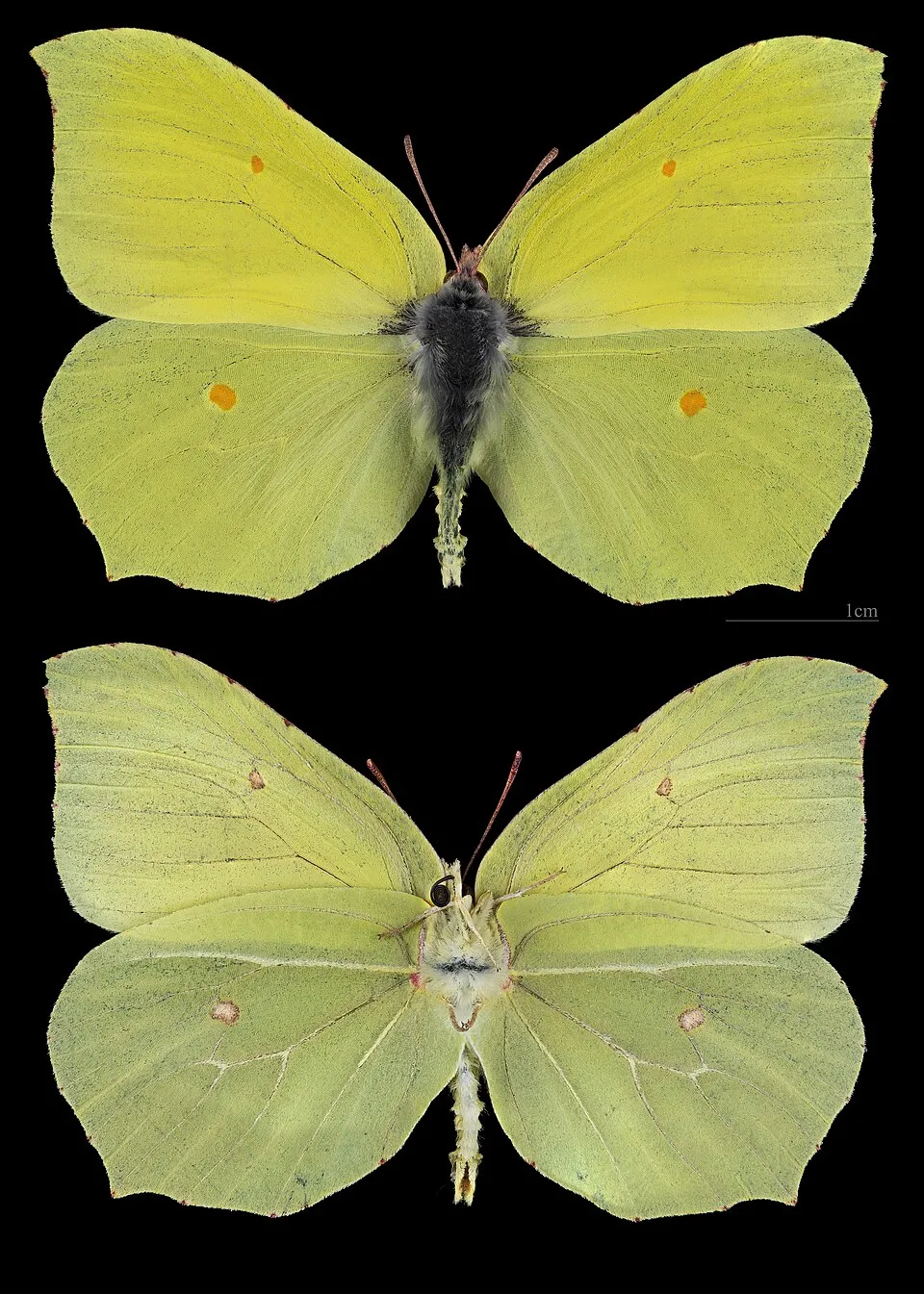
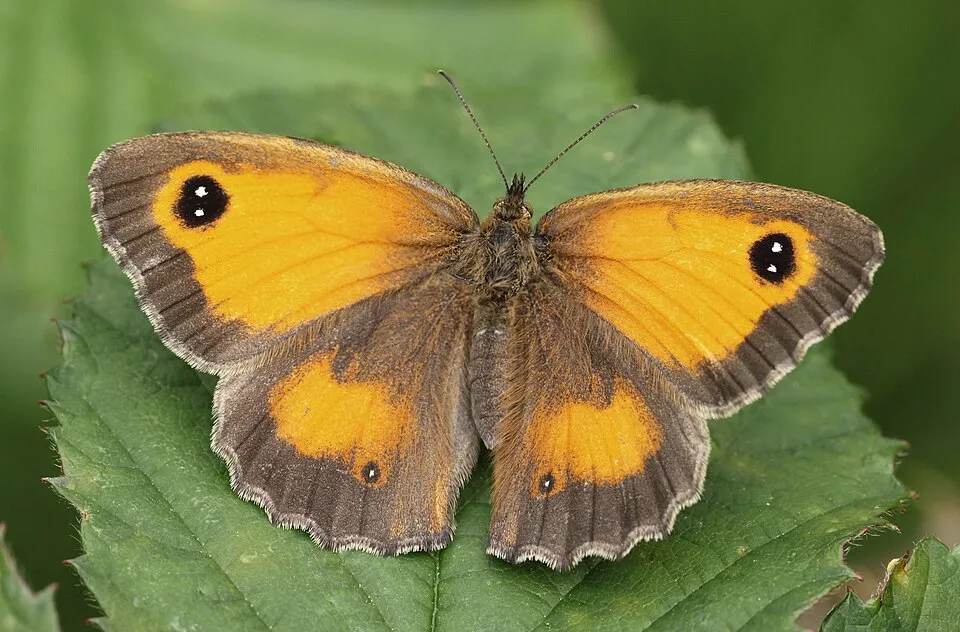
Based on occurrences aggregated by GBIF, several species are regularly recorded within the site. Among the most frequent are Maniola jurtina (Meadow brown), Polyommatus icarus (Common blue), Coenonympha pamphilus (Small Heath) and Pieris rapae (Small white). The full list of documented taxa is shown below.
Species to look out for
Observed species
Occurrences documented via GBIF; they are neither an exhaustive inventory nor proof of current presence.
- Meadow brown · Maniola jurtina · 90323
- Common blue · Polyommatus icarus · 45431
- Small Heath · Coenonympha pamphilus · 41807
- Small white · Pieris rapae · 40740
- Common brimstone · Gonepteryx rhamni · 33209
- Gatekeeper · Pyronia tithonus · 32518
- Speckled Wood · Pararge aegeria · 29324
- Large white · Pieris brassicae · 26347
- Marbled white · Melanargia galathea · 24479
- Ringlet · Aphantopus hyperantus · 20445
- Common Wood Pigeon · Columba palumbus · 19950
- Chalk-hill Blue · Lysandra coridon · 19243
+18 more species
- Carrion crow · Corvus corone · 18264
- European robin · Erithacus rubecula · 18207
- Peacock · Aglais io · 18124
- Common Blackbird · Turdus merula · 17076
- Red admiral · Vanessa atalanta · 15854
- Eurasian blue tit · Cyanistes caeruleus · 15396
- Western Jackdaw · Coloeus monedula · 15029
- Eurasian Magpie · Pica pica · 14859
- Small copper · Lycaena phlaeas · 14843
- Eurasian Wren · Troglodytes troglodytes · 13913
- Small skipper · Thymelicus sylvestris · 13867
- European Goldfinch · Carduelis carduelis · 13814
- Great tit · Parus major · 13507
- Small tortoiseshell · Aglais urticae · 12471
- Brown argus · Aricia agestis · 11974
- Green-veined white · Pieris napi · 11856
- Asian Large Skipper · Ochlodes venata · 11765
- Mallard · Anas platyrhynchos · 11509
Records: GBIF.org (CC-BY). Names: Wikidata (CC0), GBIF. Photos: Wikimedia Commons.
Conservation challenges
The primary purpose of the site is to preserve its natural habitats and the biodiversity they support. The species recorded (Biodiversity tab) reflect its ecological value. The designations it holds frame its management and the control of land use.
According to Global Forest Change data (University of Maryland, Global Forest Watch), about 1,180 ha of tree cover were lost within the boundary between 2001 and 2023 (under 1% of its area), peaking in 2008 and 2014. These losses include logging, storms and fires, and do not account for regrowth. According to CORINE Land Cover, land cover here remained almost unchanged between 2000 and 2018 (less than 0.5% of the area affected); only some 66 ha were built over. Since 2016, the European EFFIS system (Copernicus) has mapped one fire here, in June 2023 (near East Hampshire), which burned about 66 ha of the site. At night, 12% of the area gives off artificial light detectable from space (NASA VIIRS Black Marble composite, 2016). Built-up and developed land (buildings, business areas, roads, quarries) covers 6% of the area, and farmland 41% (CORINE Land Cover). Since 2000, 20 invasive alien species have been recorded within the site (GBIF observations), 20 of them on the European Union's list. Among them: Alopochen aegyptiaca (Egyptian Goose), Sciurus carolinensis (Eastern gray squirrel) and Impatiens glandulifera (Himalayan Balsam).
Pressure indicators
Tree cover lost
1,184 ha
2001–2023 · < 1% of the area
20012023
Fires since 2016
66 ha
burned within the boundary (1 mapped fire)
- 2023 · East Hampshire · 66 ha
Light at night
12%
of the area gives off artificial light visible from space
DarkLit
Built-up land
6%
buildings, business areas, roads, quarries · farmland 41%
Land cover change
< 0.5%
of the area changed, 2000–2018 · CORINE
Invasive alien species
20
incl. 20 on the EU list · since 2000
 Egyptian GooseEU
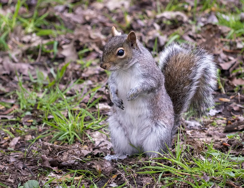 Eastern gray squirrelEU
 Himalayan BalsamEU
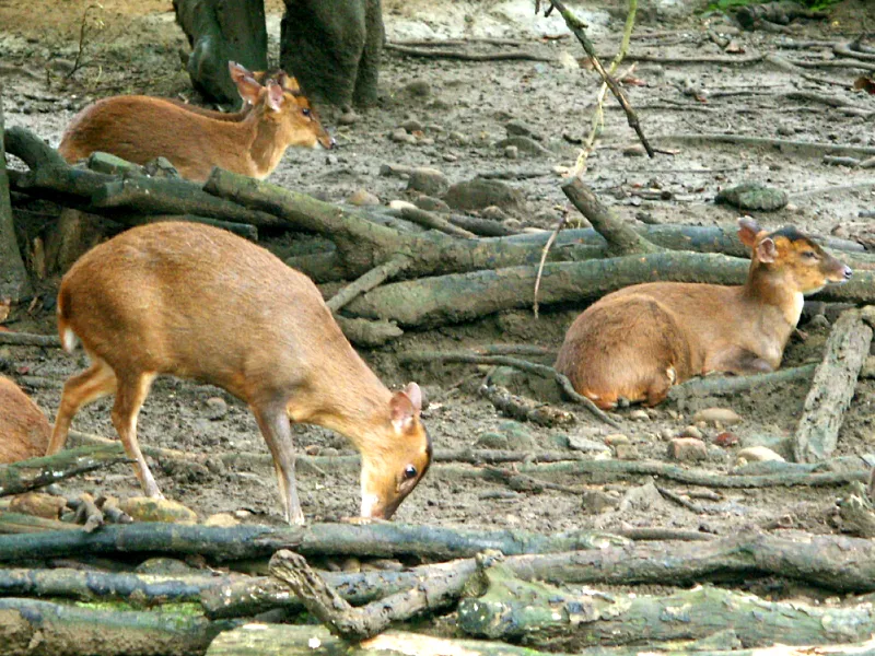 Reeves's muntjacEU
 Western waterweedEU
 Japanese KnotweedEU
 Giant HogweedEU
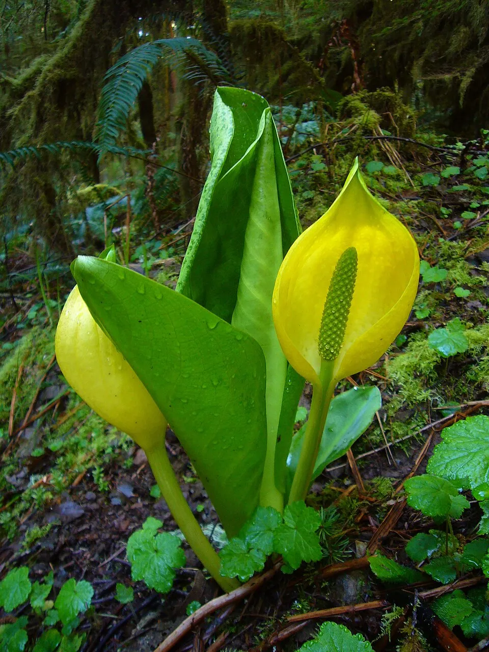 American skunkcabbageEU
Photos: Egyptian Goose © Rhododendrites · CC BY-SA 4.0; Eastern gray squirrel © Dominic Nelson · CC BY-SA 4.0; Himalayan Balsam © Guptaele · CC BY-SA 4.0; Reeves's muntjac © KaurJmeb · CC BY-SA 2.0; Western waterweed © Christian Fischer · CC BY-SA 3.0; Japanese Knotweed © W.carter · CC0-1.0; Giant Hogweed © anastasiiamerkulova · CC BY 4.0; American skunkcabbage © Martin Bravenboer · Public domain
Sources: Global Forest Change (Hansen et al., University of Maryland, via Global Forest Watch, CC-BY 4.0); EFFIS, European Commission / Copernicus; NASA Black Marble 2016 (public domain); CORINE Land Cover 2018 (Copernicus) or MODIS.
CORINE Land Cover Change 2000–2018: generated using European Union's Copernicus Land Monitoring Service information (EEA), aggregated by Parkavela; DOI 10.2909/f30f1000-7cf8-43bb-872c-5eb093911b24.
Invasive alien species: Global Register of Introduced and Invasive Species (ISSG, CC BY 4.0); Union list, Regulation (EU) 1143/2014 (INBO, CC0); GBIF.org records (CC0 / CC BY 4.0), at least 2 per species.
Practical information
Cities and airport
- Eastbourne
1 km as the crow flies - Brighton and Hove
3 km as the crow flies - Airport: Southampton (SOU)
6 km as the crow flies
Visitor information
- Queen Elizabeth Country Park Visitor Centre
within the site - Highdown Gardens Visitor Centre
within the site - South Downs Centre, tourist information and visitor exhibition
within the site - Hinton Ampner
within the site
Parking
589 public car parks listed within the site
Chappetts CopseTullecombeAshford FarmLongmoor Ranges
Hiking
67 waymarked routes listed, including:
E 9South Downs WayKing Charles III England Coast PathSouth Downs Way (Inland Route)Sussex Border PathClarendon Way
By bike
AV Avenue Verte London ↔ Paris · 16 km22 · 35 km224 · 22 km2 National Cycle Route 2 · 20 km
+ 12 local loops
Signed cycle routes: this does not mean that cycling is allowed on footpaths.
Wheelchair access
- Highdown Gardens Visitor Centre
visitor information - Hinton Ampner
visitor information · partial access - Seven Sisters
viewpoint · partial access - Customer Entrance
path
accessible toilets: 27
Reported by OpenStreetMap contributors (ODbL); check with the park before visiting.
Data © OpenStreetMap contributors (ODbL) · Wikidata (CC0)
Routes © OpenStreetMap contributors (ODbL), via Waymarked Trails
Waymarked hiking routes
E9 European walking route E9, Queen Elizabeth Country Park to Jevington
114.6 km within the site ↗ 1,923 m↘ 1,979 m 2–236 m
ECP King Charles III England Coast Path: Shoreham to Eastbourne
18.3 km within the site ↗ 301 m↘ 271 m 3–85 m
Tracks © OpenStreetMap contributors (ODbL), clipped to the boundary; elevation gain and profiles computed on the longest section from Mapzen Terrain Tiles (≈ 30 m), indicative only.
Access and visiting
Nearest towns of over 50,000 people, as the crow flies: Eastbourne (1 km) and Brighton and Hove (3 km). Nearest airport: Southampton (SOU), about 6 km away. About 3.4 million people live within 20 km of the site boundary, 2 million of them within 10 km; some 200,000 people are estimated to live inside (GHSL estimate, 2020). This population has grown by about 14% since 2000. Visitor information on site: Queen Elizabeth Country Park Visitor Centre, Highdown Gardens Visitor Centre and South Downs Centre, tourist information and visitor exhibition. Public car parks listed within the site: 589, including Chappetts Copse, Tullecombe and Ashford Farm. Waymarked hiking routes listed in OpenStreetMap: 67, including E 9, South Downs Way, King Charles III England Coast Path and South Downs Way (Inland Route). The site is crossed by 12 signed cycle routes, including “AV Avenue Verte London ↔ Paris” and “22” (OpenStreetMap). OpenStreetMap contributors list 9 wheelchair-accessible places, including Highdown Gardens Visitor Centre and Customer Entrance; check with the park before visiting. To see: Shillinglee Lake. To plan a visit (access, opening periods, visitor rules), it is best to consult the official information from the managing body (South Downs National Park Authority) and the official website listed in this page's sources.
Source: OpenStreetMap (ODbL), Wikidata (CC0), October 2026.
Built heritage
According to Wikidata, 150 monuments listed at the highest grade in the United Kingdom (Grade I; Category A in Scotland) stand within the boundary. Among them are 100 religious buildings, 20 houses and civic buildings and 9 castles and fortifications. Examples include “Chithurst Church” in Trotton with Chithurst, “Amberley Castle” in Amberley and “Aldworth House” in Lurgashall.
100 religious buildings20 houses and civic buildings9 castles and fortifications2 bridges, lighthouses, mills and working buildings
-
Chithurst Church
Trotton with Chithurst · 11th c. -
Amberley Castle
Amberley -
Aldworth House
Lurgashall -
Stopham Bridge
Pulborough · 15th c. -
Alfriston Market Cross
Alfriston -
Church of All Saints
East Meon · 12th c. -
Arundel Castle
Arundel · 11th c. -
Anne of Cleves House
Lewes
and 142 more
Source: Wikidata (CC0), monuments in each country’s official heritage protection registers, at national or regional level. Each item links to its Wikidata entry.
When to visit
Best time to visit: from May to September, with average temperatures of 12 to 18 °C and moderate rainfall. Day length ranges from about 7 h 57 min in December to 16 h 30 min in June. Wildlife records published on GBIF peak for birds (April and May), plants (from May to August), butterflies and moths (July and August), dragonflies (June and July) and mammals (October). These peaks also reflect when observers are most active.
Source: Copernicus ERA5-Land (C3S), monthly averages 1996–2025 at the representative point, temperatures adjusted for elevation.
Contains modified Copernicus Climate Change Service information 2026. Neither the European Commission nor ECMWF is responsible for any use that may be made of the Copernicus information or data it contains.
Wildlife records calendar
JFMAMJJASOND
Birds
Plants
Butterflies & moths
Dragonflies
Mammals
Monthly records published on GBIF (CC-BY), relative to the busiest month; also reflects observer activity.
Gallery
© SuzanneKn · Public domain
© John Wallace · CC BY-SA 4.0
© Malcolm Oakley · CC BY-SA 3.0
© ITookSomePhotos · CC BY 4.0
© Ak689 · CC BY-SA 4.0
© Tristan Gooley · CC0-1.0
Sources and licences
- Wikidata: Q3695606
- OpenStreetMap: relation 1596374
- Official website: http://www.southdowns.gov.uk/
- Wikipedia: en.wikipedia.org/wiki/South_Downs_National_Park
- WDPA: 555545758
References
- cds.climate.copernicus.eu: climate · CC-BY-4.0
- registry.opendata.aws: elevation of the reference point, detailed relief · PD
- land.copernicus.eu: land cover, land cover change, sea share · COPERNICUS
- doi.org: population around the site · CC-BY-4.0
- wikidata.org: official area, establishment date, protected heritage, managing body, nearby cities and airport, access and peaks, lake depths, places to see, official website · CC0-1.0
- eea.europa.eu: bathing water quality · CC-BY-4.0
- en.eurovelo.com: EuroVelo cycle routes · ODbL-1.0
- cycling.waymarkedtrails.org: cycle routes · ODbL-1.0
- opentopodata.org: elevations · PD
- forest-fire.emergency.copernicus.eu: wildfires · COPERNICUS
- globalforestwatch.org: tree cover loss · CC-BY-4.0
- gbif.org: seasonality of sightings, invasive alien species, observed species · CC-BY-4.0
- europe-geology.eu: geology · CC-BY-4.0
- hydrosheds.org: lakes · CC-BY-4.0
- openstreetmap.org: official name, access and peaks, trail difficulty, wheelchair access · ODbL-1.0
- earthobservatory.nasa.gov: night light · PD
- hiking.waymarkedtrails.org: route difficulty · ODbL-1.0
- nsidc.org: snow cover · PD
- wikidata.org: Wikipedia article · CC-BY-SA-4.0
Data © OpenStreetMap contributors (ODbL), Wikidata (CC0) and the sources cited.