
Bird
Hooded Crow
Corvus cornix385 records © Ricardo Tulio Gandelman from Rio de Janeiro, Brazil · CC BY 2.0
Italy · Terrestrial
Regional nature park of 24,320 hectares in Italy, established in 1983.
Regional nature park of 24,320 hectares in Italy, established in 1983.
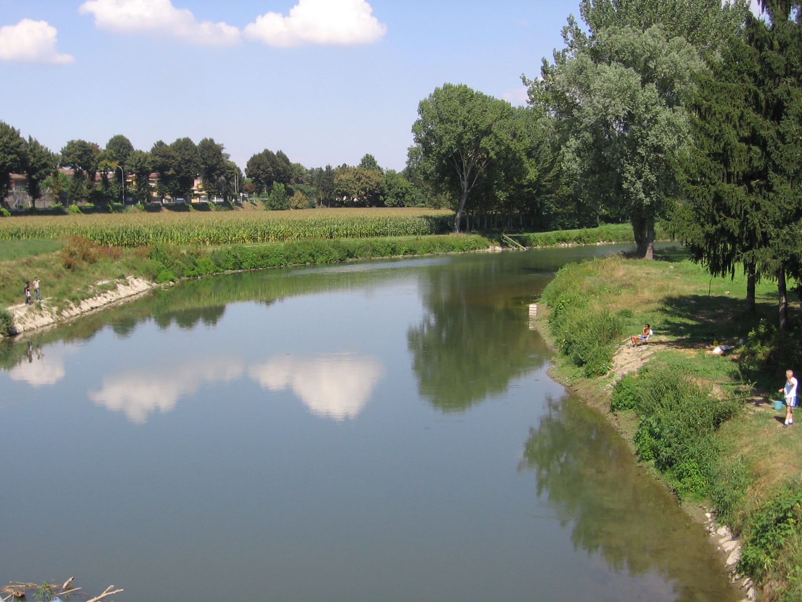
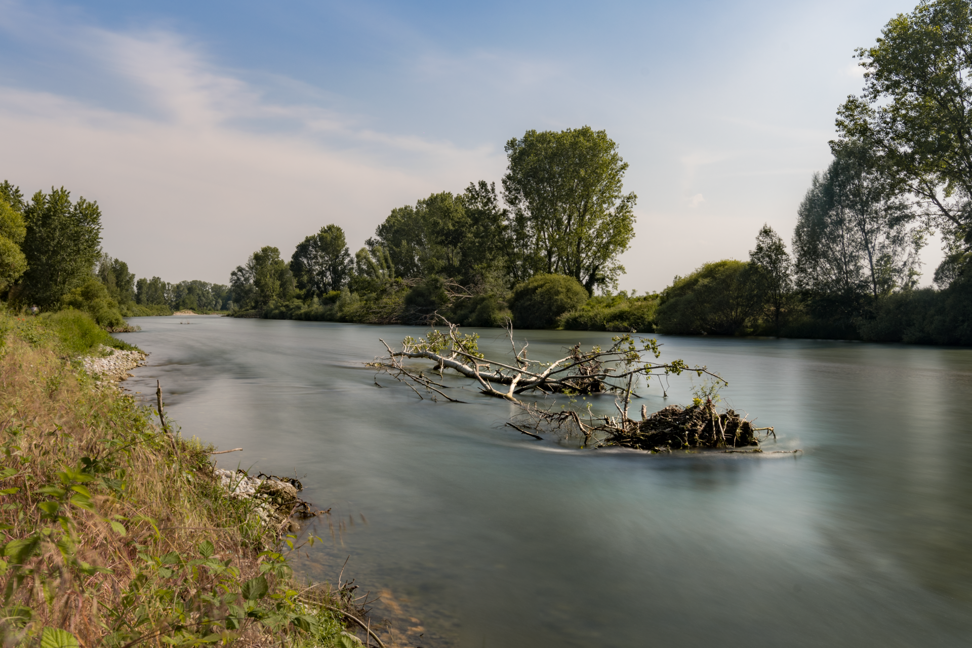
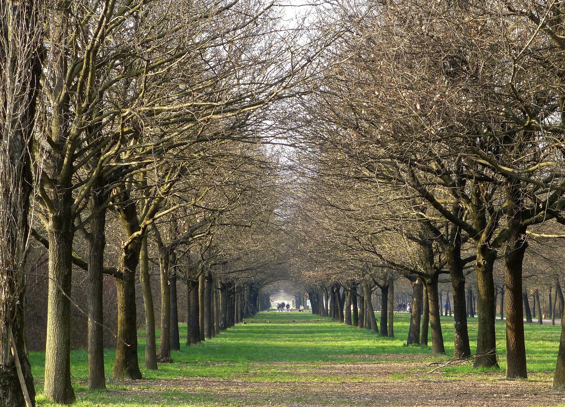
Adda Sud Regional Park is a regional nature park in Italy (Europe). It is a predominantly terrestrial area. Established in 1983, it covers about 24,320 hectares.
Protected as a regional nature park. International labels and designations: Natura 2000 network (13 sites). Key dates: established in 1983 and first Natura 2000 site under the Birds Directive in 2005.
Sources: Wikidata (CC0) for establishment and international labels; EEA Natura 2000 database (CC-BY 4.0) for site designation dates.
In Italy (Europe). Representative point: 45.2868° N, 9.6244° E.
About 24,320 hectares (243 km²). It is the 21st largest of the 128 regional parks in Italy covered by Parkavela.
In 1983.
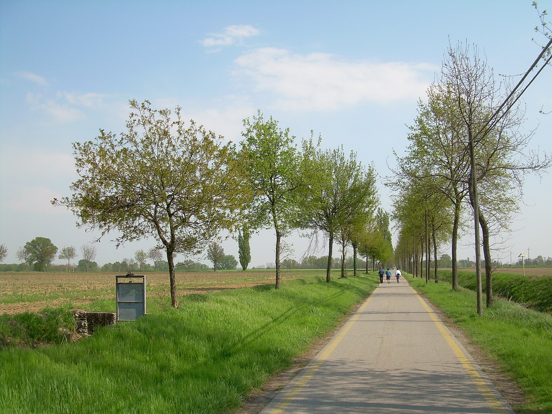
A terrestrial area, where land cover is dominated by farmland (82%).
According to the European 1:1 million geological map (EGDI), the bedrock consists mainly of unconsolidated deposits (100% of sampled points). These are mostly sedimentary rocks. The geological units date mainly from the Quaternary (100% of sampled points).
Natura 2000 network (13 sites).
Best time to visit: from April to October, with average temperatures of 13 to 25 °C and moderate rainfall.
1 viewpoint and 8 lakes and ponds, including Navigare l'Adda, Adda Morta, Adda Morta di Bertonico and Laghetto Dantesco (OpenStreetMap).
Yes. According to Wikidata, 174 monuments protected as Italian national cultural heritage stand within the boundary. For example: “Cerreto Abbey” in Abbadia Cerreto, “Pallavicini Serbelloni Castle South Wing” in Castiglione d'Adda and “Casa Strada Comunale Lavagna Gardino” in Comazzo.
Nearest towns of over 50,000 people, as the crow flies: Cremona (9 km) and Piacenza (13 km). Nearest airport: Linate (LIN), about 11 km away.
The nearest railway station is Treviglio Ovest, about 5 km from the site boundary.
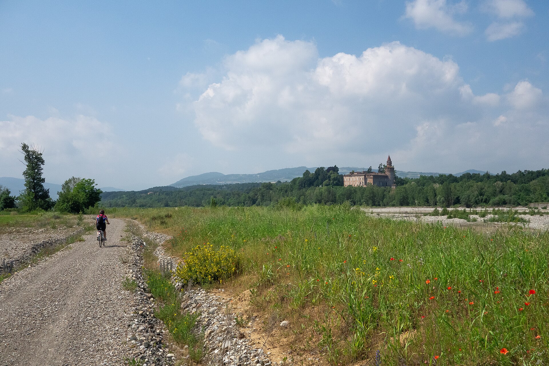
Yes. Waymarked hiking routes listed in OpenStreetMap: 3. The “399” route runs for about 14 km through the site.
Among the species most often recorded on GBIF are Corvus cornix (Hooded Crow), Columba palumbus (Common Wood Pigeon), Pica pica (Eurasian Magpie) and Parus major (Great tit).
© OpenStreetMap
Download the boundary: GeoJSON · GPX Boundary © OpenStreetMap contributors (ODbL).
The representative point of the site lies at around 57 m above sea level. Over the 1996–2025 period, the mean annual temperature is about 13.9 °C and total precipitation reaches roughly 1,051 mm per year. The warmest month is usually July, the coolest January, and the wettest November. According to the European 1:1 million geological map (EGDI), the bedrock consists mainly of unconsolidated deposits (100% of sampled points). These are mostly sedimentary rocks. The geological units date mainly from the Quaternary (100% of sampled points).
Sedimentary rocks 100 % · Main age: Quaternary (100%)
Source: EGDI 1:1M geological map (EuroGeoSurveys and national geological surveys), CC BY 4.0 · 13 sampled points within the site.
● Mean temperature (°C) · ▮ Precipitation (mm)
Source: Copernicus ERA5-Land (C3S, doi:10.24381/cds.68d2bb30), monthly averages 1996–2025 interpolated to the representative point, temperatures adjusted for elevation.
Contains modified Copernicus Climate Change Service information 2026. Neither the European Commission nor ECMWF is responsible for any use that may be made of the Copernicus information or data it contains.
According to CORINE Land Cover (2018), the site is mainly made up of farmland (82%). The 13 Natura 2000 sites overlapping the area list 6 habitats of European interest (1 priority), the most extensive being riparian mixed forests of Quercus robur, Ulmus laevis and Ulmus minor, Fraxinus excelsior or Fraxinus angustifolia, along the great rivers (Ulmenion minoris), alluvial forests with Alnus glutinosa and Fraxinus excelsior (Alno-Padion, Alnion incanae, Salicion albae) and natural eutrophic lakes with Magnopotamion or Hydrocharition-type vegetation.
Based on occurrences aggregated by GBIF, several species are regularly recorded within the site. Among the most frequent are Corvus cornix (Hooded Crow), Columba palumbus (Common Wood Pigeon), Pica pica (Eurasian Magpie) and Parus major (Great tit). The full list of documented taxa is shown below. The overlapping Natura 2000 sites list 153 species of European interest: 109 birds, 11 mammals, 6 reptiles, 4 amphibians, 14 fish and 9 invertebrates.
From the official forms of the 13 Natura 2000 sites overlapping the area (areas reported for each whole site).
Eurasian Sparrowhawk (Accipiter nisus) breeding resident, Great Reed Warbler (Acrocephalus arundinaceus) breeding passage, Marsh Warbler (Acrocephalus palustris) breeding passage, Sedge warbler (Acrocephalus schoenobaenus) breeding passage, Eurasian Reed Warbler (Acrocephalus scirpaceus) breeding passage, Common Sandpiper (Actitis hypoleucos) passage breeding, Long-tailed Tit (Aegithalos caudatus) resident, Eurasian Skylark (Alauda arvensis) passage breeding wintering, Common Kingfisher (Alcedo atthis) resident, Eurasian Teal (Anas crecca) wintering passage, Mallard (Anas platyrhynchos) wintering passage breeding, Meadow Pipit (Anthus pratensis) wintering and 97 more
Serotine bat (Eptesicus serotinus), Savi's Pipistrelle (Hypsugo savii), European pine marten (Martes martes), Hazel dormouse (Muscardinus avellanarius), Western Polecat (Mustela putorius), Daubenton's bat (Myotis daubentonii), Greater mouse-eared bat (Myotis myotis), Common noctule (Nyctalus noctula), Kuhl's pipistrelle (Pipistrellus kuhlii), Common pipistrelle (Pipistrellus pipistrellus), Brown long-eared bat (Plecotus auritus)
Smooth snake (Coronella austriaca), European Pond Turtle (Emys orbicularis), Dice snake (Natrix tessellata), Common wall lizard (Podarcis muralis), Italian wall lizard (Podarcis siculus), Aesculapian Snake (Zamenis longissimus)
Green Toad (Bufotes viridis complex), Agile frog (Rana dalmatina), Italian agile frog (Rana latastei), Italian crested newt (Triturus carnifex)
Adriatic sturgeon (Acipenser naccarii), Twait shad (Alosa fallax), Italian Barbel (Barbus plebejus), Italian nase (Chondrostoma soetta), Italian Spined Loach (Cobitis bilineata), European bullhead (Cottus gobio), Beluga (Huso huso), Lombardy lamprey (Lethenteron zanandreai), South European Nase (Protochondrostoma genei), Danube Roach (Rutilus pigus), Italian Loach (Sabanejewia larvata), Marble Trout (Salmo marmoratus) and 2 more
Greater Capricorn Beetle (Cerambyx cerdo), Roman Snail (Helix pomatia), Stag beetle (Lucanus cervus), Large copper (Lycaena dispar), Green snaketail (Ophiogomphus cecilia), Hermit beetle (Osmoderma eremita), Orange-spotted Emerald (Oxygastra curtisii), Unio elongatulus, Southern Festoon (Zerynthia polyxena)
Source: Natura 2000 standard data forms (EEA, CC-BY 4.0). Not exhaustive: sensitive species are not published.
Bird
385 records © Ricardo Tulio Gandelman from Rio de Janeiro, Brazil · CC BY 2.0
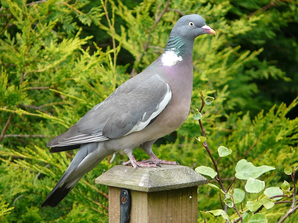
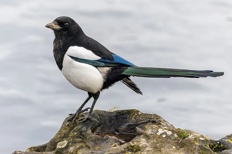



Occurrences documented via GBIF; they are neither an exhaustive inventory nor proof of current presence.
Records: GBIF.org (CC-BY). Names: Wikidata (CC0), GBIF. Photos: Wikimedia Commons.
The primary purpose of the site is to preserve its natural habitats and the biodiversity they support. The species recorded (Biodiversity tab) reflect its ecological value. The designations it holds frame its management and the control of land use.
According to Global Forest Change data (University of Maryland, Global Forest Watch), about 131 ha of tree cover were lost within the boundary between 2001 and 2023 (under 1% of its area), peaking in 2005 and 2022. These losses include logging, storms and fires, and do not account for regrowth. According to the European CORINE Land Cover inventory (Copernicus), land cover changed on about 436 ha of the site between 1990 and 2018 (2% of its area): built-up land grew by 119 ha, mostly at the expense of farmland. Forest felling and regrowth add about 640 ha in total over the period. At night, 76% of the area gives off artificial light detectable from space (NASA VIIRS Black Marble composite, 2016). Built-up and developed land (buildings, business areas, roads, quarries) covers 3% of the area, and farmland 82% (CORINE Land Cover). According to the Natura 2000 forms, all 6 assessed habitats of European interest are in good condition. According to the Water Framework Directive assessment (2022 river basin management plans, data 2014–2019), only 2% of the 142 km of rivers assessed within the site are in good or high ecological status; the others mostly have moderate ecological status. Since 2000, 24 invasive alien species have been recorded within the site (GBIF observations), 7 of them listed as of Union concern under EU Regulation 1143/2014. Among them: Threskiornis aethiopicus (African Sacred Ibis), Broussonetia papyrifera (Paper mulberry) and Lepomis gibbosus (Pumpkinseed).
131 ha
2001–2023
0
No large fire mapped (fires over about 30 ha)
76%
of the area gives off artificial light visible from space
3%
buildings, business areas, roads, quarries · farmland 82%
436 ha
changed cover, 1990–2018 · CORINE · 2% of the area
forest felling and regrowth: 640 ha in total
2%
of the 142 km of assessed rivers in good or high ecological status · WFD 2022
assessments 2014–2019
24
incl. 7 of EU concern · since 2000
 African Sacred IbisEU
 Paper mulberryEU
 PumpkinseedEU
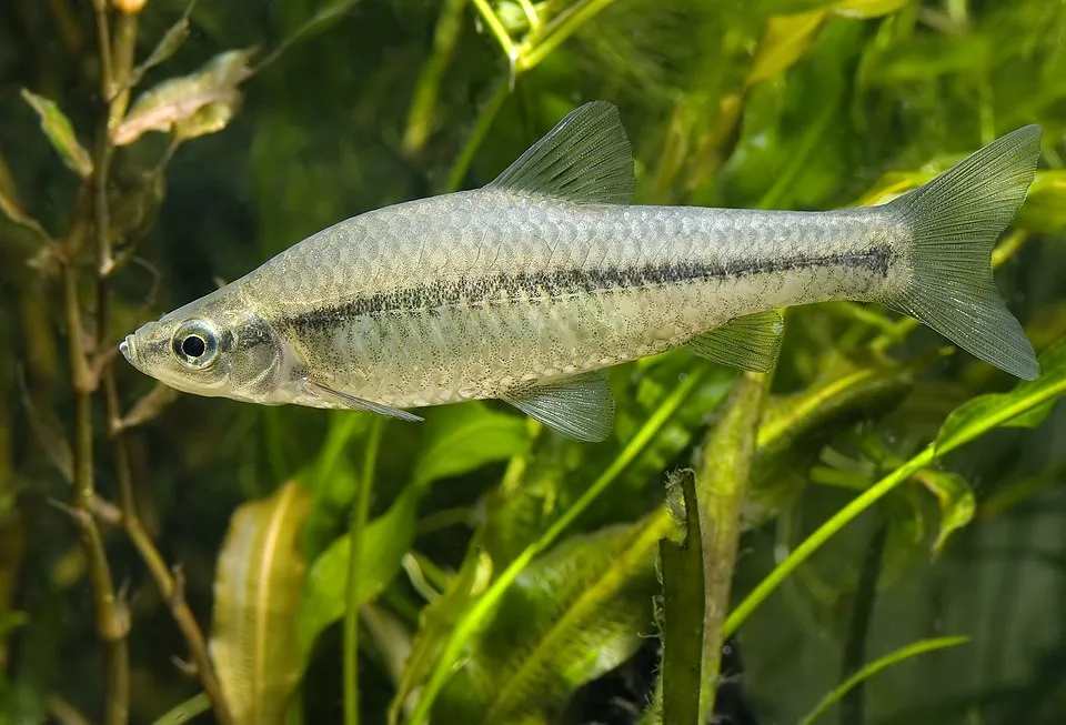 Topmouth gudgeonEU
 CoypuEU
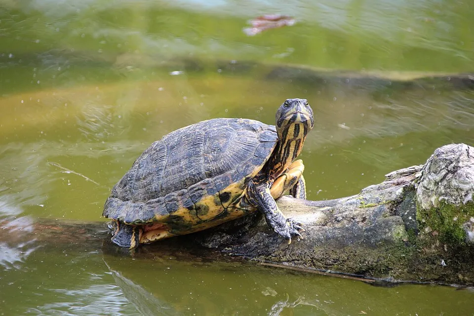 Pond sliderEU
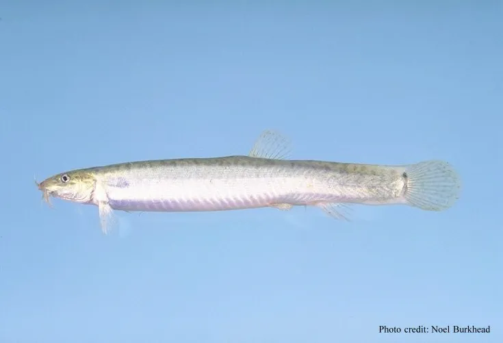 Pond loachEU
 Mute Swan
Photos: African Sacred Ibis © Steve Garvie from Dunfermline, Fife, Scotland · CC BY-SA 2.0; Paper mulberry © Didier Descouens · CC BY-SA 4.0; Pumpkinseed © Cephas · CC BY-SA 3.0; Topmouth gudgeon © Seotaro, edited by Lycaon · CC BY-SA 3.0; Coypu © Philippe Amelant · CC BY-SA 3.0; Pond slider © Viva.Chelonia · CC BY 2.0; Pond loach © Eugene van der Pijll · Public domain; Mute Swan © Geni · CC BY-SA 4.0
Sources: Global Forest Change (Hansen et al., University of Maryland, via Global Forest Watch, CC-BY 4.0); EFFIS, European Commission / Copernicus; NASA Black Marble 2016 (public domain); CORINE Land Cover 2018 (Copernicus) or MODIS.
CORINE Land Cover Change 1990–2018: generated using European Union's Copernicus Land Monitoring Service information (EEA), aggregated by Parkavela; DOI 10.2909/f30f1000-7cf8-43bb-872c-5eb093911b24.
Ecological status of water bodies: European Environment Agency, WISE – Water Framework Directive, 3rd river basin management plans (2022), CC BY 4.0. Official national classification, not comparable between countries.
Invasive alien species: Global Register of Introduced and Invasive Species (ISSG, CC BY 4.0); Union list, Regulation (EU) 1143/2014 (INBO, CC0); GBIF.org records (CC0 / CC BY 4.0), at least 2 per species.
1 viewpoint · 8 lakes and ponds
3 waymarked routes listed
+ 16 local loops
Signed cycle routes: this does not mean that cycling is allowed on footpaths.
Data © OpenStreetMap contributors (ODbL) · Wikidata (CC0)
Contains information from EuroVelo GPX tracks downloaded from www.EuroVelo.com on 2026-10-22, which is made available here under the Open Database License (ODbL). EuroVelo® is a registered trademark of the ECF. Routes © OpenStreetMap contributors (ODbL), via Waymarked Trails
Tracks © OpenStreetMap contributors (ODbL), clipped to the boundary; elevation gain and profiles computed on the longest section from Mapzen Terrain Tiles (≈ 30 m), indicative only.
The nearest railway station is Treviglio Ovest, about 5 km from the site boundary. Nearest towns of over 50,000 people, as the crow flies: Cremona (9 km) and Piacenza (13 km). Nearest airport: Linate (LIN), about 11 km away. About 3 million people live within 20 km of the site boundary, 830,000 of them within 10 km; some 31,000 people are estimated to live inside (GHSL estimate, 2020). This population has grown by about 10% since 2000. Waymarked hiking routes listed in OpenStreetMap: 3. The EuroVelo 8 cycle route (Mediterranean Route) crosses the site for about 11 km, mostly developed and signed; 3 other signed cycle routes also pass through, including “VENTO Ciclovia Vento” and “PCIR 3 PCIR 3 - Adda” (EuroVelo, OpenStreetMap). To see: 1 viewpoint and 8 lakes and ponds, including Navigare l'Adda, Adda Morta, Adda Morta di Bertonico and Laghetto Dantesco. To plan a visit (access, opening periods, visitor rules), it is best to consult the official information from the managing body and the official website listed in this page's sources.
Source: OpenStreetMap (ODbL), Wikidata (CC0), October 2026.
According to Wikidata, 174 monuments protected as Italian national cultural heritage stand within the boundary. Among them are 29 religious buildings, 18 houses and civic buildings and 14 castles and fortifications. Examples include “Cerreto Abbey” in Abbadia Cerreto, “Pallavicini Serbelloni Castle South Wing” in Castiglione d'Adda and “Casa Strada Comunale Lavagna Gardino” in Comazzo.
and 166 more
Source: Wikidata (CC0), monuments in each country’s official heritage protection registers, at national or regional level. Each item links to its Wikidata entry.
Best time to visit: from April to October, with average temperatures of 13 to 25 °C and moderate rainfall. Day length ranges from about 8 h 45 min in December to 15 h 38 min in June. Wildlife records published on GBIF peak for birds (January), plants (April and May) and butterflies and moths (May). These peaks also reflect when observers are most active.
Source: Copernicus ERA5-Land (C3S), monthly averages 1996–2025 at the representative point, temperatures adjusted for elevation.
Contains modified Copernicus Climate Change Service information 2026. Neither the European Commission nor ECMWF is responsible for any use that may be made of the Copernicus information or data it contains.
Monthly records published on GBIF (CC-BY), relative to the busiest month; also reflects observer activity.
Data © OpenStreetMap contributors (ODbL), Wikidata (CC0) and the sources cited.