Bird
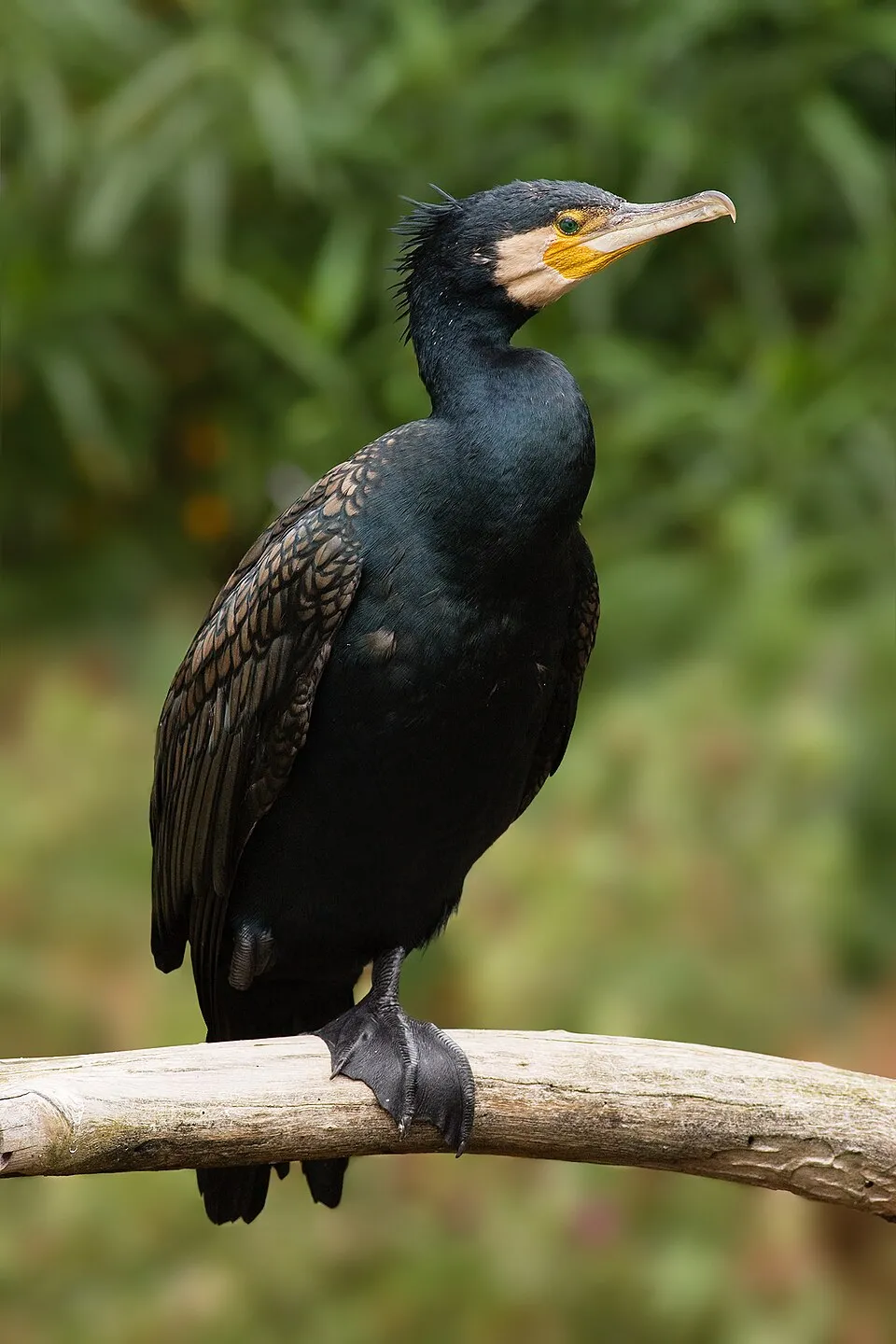
Great Cormorant
Phalacrocorax carbo2,693 records © JJ Harrison (https://www.jjharrison.com.au/) · CC BY-SA 3.0
Romania · Mixed
Protected area of 452,500 hectares in Romania, established in 1992.
Protected area of 452,500 hectares in Romania, established in 1992.
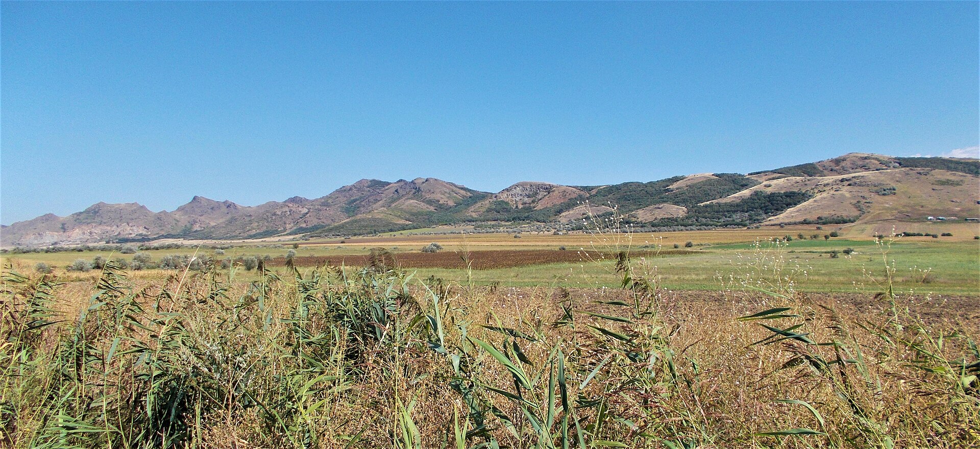
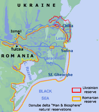
Danube Delta Biosphere Reserve is a protected area in Romania (Europe). It covers both land and sea. Established on 20 January 1992, it covers about 452,500 hectares. The site is managed by Tulcea.
Designated as a protected area. International labels and designations: UNESCO World Heritage (“Danube Delta”), Ramsar site (“Chilia branch”, “Danube Delta”) and Natura 2000 network (3 sites). Key dates: World Heritage listing in 1991, established in 1992, first Natura 2000 site under the Birds Directive in 2007 and first Natura 2000 site under the Habitats Directive in 2008.
Sources: Wikidata (CC0) for establishment and international labels; EEA Natura 2000 database (CC-BY 4.0) for site designation dates.
In Romania (Europe). Representative point: 45.0517° N, 29.2027° E.
About 452,500 hectares (4,525 km²). About 73,500 ha are at sea.
On 20 January 1992.
An area spanning land and sea, with wetlands and coasts.
Beştepe, at 242 m (OpenStreetMap).
Beştepe (242 m), Movila Cinci parale (225 m), Dealul Ivan (63 m), Dealul Doloșman (57 m) and Dealul Popina (48 m) (OpenStreetMap).
UNESCO World Heritage (“Danube Delta”), Ramsar site (“Chilia branch”, “Danube Delta”) and Natura 2000 network (3 sites).
Best time to visit: from May to October, with average temperatures of 13 to 25 °C and moderate rainfall.
14 lakes and ponds, including Lacul Rotundu, Sărăturile Murighiol, Lacul Belciug and Lacul Potcoava (Wikidata).
Yes. According to Wikidata, 14 monuments listed in the Romanian List of Historic Monuments stand within the boundary, 9 of them of national and universal value (group A). For example: “Biserica ortodoxă „Sf. Arhangheli Mihail și Gavril””, “Castrum Argamum” in Jurilovca and “Situl arheologic de la Babadag”.
One monitored bathing site lies in or within 1 km of the site; official 2025 classification: 1 excellent (European Environment Agency). Swimming is only permitted at the sites and times authorised locally.
Nearest towns of over 50,000 people, as the crow flies: Tulcea (0.3 km) and Izmail (2 km). Nearest airport: Mihail Kogălniceanu (CND), about 16 km away.
The nearest railway station is Zebil, less than 1 km from the site boundary.
Centrul de Informare şi Educaţie Ecologică and Centrul de Informare Turistică.
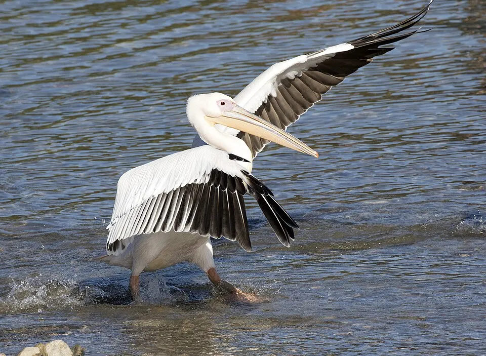
Among the species most often recorded on GBIF are Phalacrocorax carbo (Great Cormorant), Pelecanus onocrotalus (Great White Pelican), Ardea cinerea (Grey Heron) and Chroicocephalus ridibundus (Black-headed Gull).
Tulcea.
© OpenStreetMap
Download the boundary: GeoJSON · GPX Boundary © OpenStreetMap contributors (ODbL).
Over the 1996–2025 period, the mean annual temperature is about 12.8 °C and total precipitation reaches roughly 478 mm per year. The warmest month is usually July, the coolest January, and the wettest June. The site contains 310 lakes larger than 10 ha, totalling 1,011 km² of water; the largest, Razelm, covers 511 km² (HydroLAKES). Babadag (2,370 ha) is 3.1 m deep (Wikidata).
Lakes: HydroLAKES (Messager et al. 2016, hydrosheds.org, CC BY 4.0) · depths: Wikidata (CC0)
Data © OpenStreetMap contributors (ODbL)
● Mean temperature (°C) · ▮ Precipitation (mm)
Source: Copernicus ERA5-Land (C3S, doi:10.24381/cds.68d2bb30), monthly averages 1996–2025 interpolated to the representative point, temperatures adjusted for elevation.
Contains modified Copernicus Climate Change Service information 2026. Neither the European Commission nor ECMWF is responsible for any use that may be made of the Copernicus information or data it contains.
average share of the site under snow · snowiest parts · ≈ 10 days a year
Snow cover: MODIS/Terra MOD10CM v61 (Hall & Riggs, 2021, NASA NSIDC DAAC, doi:10.5067/MODIS/MOD10CM.061), imagery from NASA GIBS (ESDIS); 2015–2025 average, grid of about 5 km.
According to CORINE Land Cover (2018), the land area is mainly made up of marshes and bogs (55%), farmland (15%) and lakes and rivers (13%). The sea covers about 16% of the site. The seabed reaches about 8 m deep (median depth 1 m; GEBCO bathymetry). Elevation ranges from sea level to 242 m (highest point: Beştepe). The 3 Natura 2000 sites overlapping the area list 28 habitats of European interest (8 priority), the most extensive being Mediterranean salt meadows (Juncetalia maritimi), Salicornia and other annuals colonizing mud and sand and fixed coastal dunes with herbaceous vegetation (‘grey dunes’).
Based on occurrences aggregated by GBIF, several species are regularly recorded within the site. Among the most frequent are Phalacrocorax carbo (Great Cormorant), Pelecanus onocrotalus (Great White Pelican), Ardea cinerea (Grey Heron) and Chroicocephalus ridibundus (Black-headed Gull). The full list of documented taxa is shown below. The overlapping Natura 2000 sites list 272 species of European interest: 231 birds, 7 mammals, 3 reptiles, 2 amphibians, 15 fish, 9 invertebrates and 5 plants.
From the official forms of the 3 Natura 2000 sites overlapping the area (areas reported for each whole site).
and 20 more
Levant Sparrowhawk (Accipiter brevipes) breeding passage, Eurasian Sparrowhawk (Accipiter nisus) passage wintering, Great Reed Warbler (Acrocephalus arundinaceus) passage breeding, Moustached Warbler (Acrocephalus melanopogon) breeding, Marsh Warbler (Acrocephalus palustris) passage breeding, Sedge warbler (Acrocephalus schoenobaenus) passage breeding, Eurasian Reed Warbler (Acrocephalus scirpaceus) passage breeding, Common Sandpiper (Actitis hypoleucos) passage, Eurasian Skylark (Alauda arvensis) breeding, Common Kingfisher (Alcedo atthis) breeding, Northern Pintail (Anas acuta) passage, Northern Shoveler (Anas clypeata) passage and 219 more
Eurasian Beaver (Castor fiber), Eurasian otter (Lutra lutra), Romanian hamster (Mesocricetus newtoni), Steppe Polecat (Mustela eversmanii), European Mink (Mustela lutreola), European ground squirrel (Spermophilus citellus), Marbled polecat (Vormela peregusna)
European Pond Turtle (Emys orbicularis), Common Tortoise (Testudo graeca), Meadow viper (Vipera ursinii)
European fire-bellied toad (Bombina bombina), Danube Crested Newt (Triturus dobrogicus)
Pontic Shad (Alosa immaculata), Azov shad (Alosa tanaica), Asp (Aspius aspius), Spined Loach (Cobitis taenia Complex), Balon's ruffe (Gymnocephalus baloni), Striped Ruffe (Gymnocephalus schraetzer), Weatherfish (Misgurnus fossilis), Ziege (Pelecus cultratus), European bitterling (Rhodeus amarus), Kessler's Gudgeon (Romanogobio kesslerii), Danube Whitefin Gudgeon (Romanogobio vladykovi), Bulgarian Golden Loach (Sabanejewia bulgarica) and 3 more
Lesser Ramshorn Snail (Anisus vorticulus), Arytrura musculus, Catopta thrips, Ornate Bluet (Coenagrion ornatum), Water beetle (Graphoderus bilineatus), Mediterranean Medicinal Leech (Hirudo verbana), Large copper (Lycaena dispar), Morimus asper funereus, Green snaketail (Ophiogomphus cecilia)
Waterwheel plant (Aldrovanda vesiculosa), Centaurea jankae, Centaurea pontica, Water Shamrock (Marsilea quadrifolia), Pontechium maculatum subsp. maculatum
Source: Natura 2000 standard data forms (EEA, CC-BY 4.0). Not exhaustive: sensitive species are not published.
Bird
2,693 records © JJ Harrison (https://www.jjharrison.com.au/) · CC BY-SA 3.0

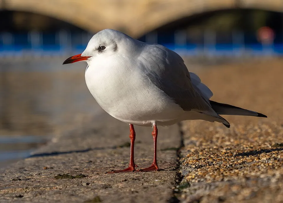


Occurrences documented via GBIF; they are neither an exhaustive inventory nor proof of current presence.
Records: GBIF.org (CC-BY). Names: Wikidata (CC0), GBIF. Photos: Wikimedia Commons.
The primary purpose of the site is to preserve its natural habitats and the biodiversity they support. The species recorded (Biodiversity tab) reflect its ecological value. The designations it holds frame its management and the control of land use.
According to Global Forest Change data (University of Maryland, Global Forest Watch), about 2,390 ha of tree cover were lost within the boundary between 2001 and 2023 (under 1% of its area), peaking in 2010 and 2012. These losses include logging, storms and fires, and do not account for regrowth. According to the European CORINE Land Cover inventory (Copernicus), land cover changed on about 15,820 ha of the site between 1990 and 2018 (4% of its area): wetlands shrank by 3,763 ha, mostly giving way to farmland, while farmland grew by 3,386 ha, mostly at the expense of wetlands. Since 2016, the European EFFIS system (Copernicus) has mapped 1118 fires here, burning about 350,650 ha within the boundary; the largest, in January 2025 (near Sfântu Gheorghe), covered 10,843 ha. At night, 1% of the area gives off artificial light detectable from space (NASA VIIRS Black Marble composite, 2016). According to the Natura 2000 forms, of 28 assessed habitats of European interest, 12 are in excellent condition and the rest in good condition. According to the Water Framework Directive assessment (2022 river basin management plans, data 2017–2020), 97% of the 401 km of rivers assessed within the site are in good or high ecological status. Other assessed water bodies: lakes, 61 of 62 in good ecological status or better; lagoons and estuaries, 0 of 2 in good ecological status or better; coastal waters, 0 of 1 in good ecological status or better. Since 2000, 65 invasive alien species have been recorded within the site (GBIF observations), 10 of them listed as of Union concern under EU Regulation 1143/2014. Among them: Ailanthus altissima (Tree-of-heaven), Elodea nuttallii (Western waterweed) and Ondatra zibethicus (Muskrat).
2,390 ha
2001–2023
350,650 ha
burned within the boundary (1118 mapped fires)
1%
of the area gives off artificial light visible from space
< 1%
buildings, business areas, roads, quarries · farmland 13%
15,820 ha
changed cover, 1990–2018 · CORINE · 4% of the area
97%
of the 401 km of assessed rivers in good or high ecological status · WFD 2022
Lakes: 61 of 62 good or better
Lagoons and estuaries: 0 of 2 good or better
Coastal waters: 0 of 1 good or better
assessments 2017–2020
65
incl. 10 of EU concern · since 2000
 Tree-of-heavenEU
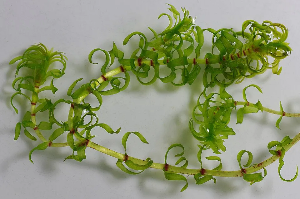 Western waterweedEU
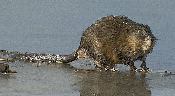 MuskratEU
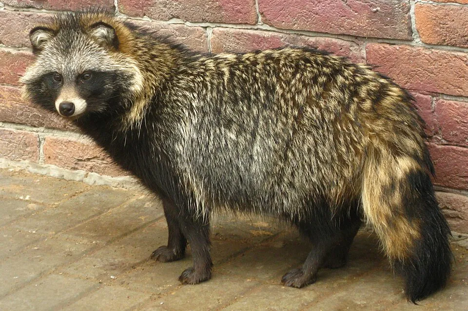 Raccoon DogEU
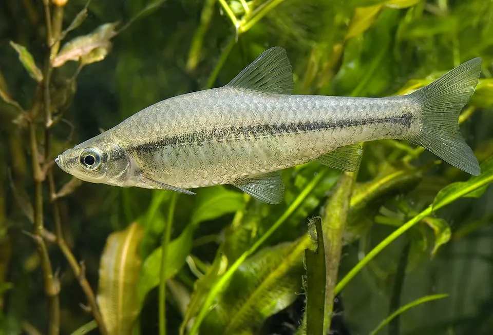 Topmouth gudgeonEU
 PumpkinseedEU
 Egyptian GooseEU
Common milkweedEU
Photos: Tree-of-heaven © Darkone · CC BY-SA 2.5; Western waterweed © Christian Fischer · CC BY-SA 3.0; Muskrat © David Menke · Public domain; Raccoon Dog © Доктор рукиноги · CC BY-SA 3.0; Topmouth gudgeon © Seotaro, edited by Lycaon · CC BY-SA 3.0; Pumpkinseed © Cephas · CC BY-SA 3.0; Egyptian Goose © Rhododendrites · CC BY-SA 4.0
Sources: Global Forest Change (Hansen et al., University of Maryland, via Global Forest Watch, CC-BY 4.0); EFFIS, European Commission / Copernicus; NASA Black Marble 2016 (public domain); CORINE Land Cover 2018 (Copernicus) or MODIS.
CORINE Land Cover Change 1990–2018: generated using European Union's Copernicus Land Monitoring Service information (EEA), aggregated by Parkavela; DOI 10.2909/f30f1000-7cf8-43bb-872c-5eb093911b24.
Ecological status of water bodies: European Environment Agency, WISE – Water Framework Directive, 3rd river basin management plans (2022), CC BY 4.0. Official national classification, not comparable between countries.
Invasive alien species: Global Register of Introduced and Invasive Species (ISSG, CC BY 4.0); Union list, Regulation (EU) 1143/2014 (INBO, CC0); GBIF.org records (CC0 / CC BY 4.0), at least 2 per species.
11 public car parks listed within the site
14 lakes and ponds
EV6: route still largely undeveloped
Signed cycle routes: this does not mean that cycling is allowed on footpaths.
Data © OpenStreetMap contributors (ODbL) · Wikidata (CC0)
Contains information from EuroVelo GPX tracks downloaded from www.EuroVelo.com on 2026-10-22, which is made available here under the Open Database License (ODbL). EuroVelo® is a registered trademark of the ECF. Routes © OpenStreetMap contributors (ODbL), via Waymarked Trails
1 monitored bathing site in or within 1 km of the site · 2025 classification
Source: European Environment Agency, official bathing water classification (Directive 2006/7/EC, CC-BY 4.0). Swimming is only permitted at the sites and times authorised locally.
The nearest railway station is Zebil, less than 1 km from the site boundary. Nearest towns of over 50,000 people, as the crow flies: Tulcea (0.3 km) and Izmail (2 km). Nearest airport: Mihail Kogălniceanu (CND), about 16 km away. About 540,000 people live within 20 km of the site boundary, 260,000 of them within 10 km; some 21,000 people are estimated to live inside (GHSL estimate, 2020). This population has fallen by about 17% since 2000. Visitor information on site: Centrul de Informare şi Educaţie Ecologică and Centrul de Informare Turistică. Public car parks listed within the site: 11, including Te pupă Stelea, Cetatea Argamum and Parcare Star 2000. The EuroVelo 6 cycle route (Atlantic – Black Sea) crosses the site for about 19 km, on a route still largely undeveloped; another signed cycle route also passes through: “Danube Cycle Path” (EuroVelo, OpenStreetMap). To see: 14 lakes and ponds, including Lacul Rotundu, Sărăturile Murighiol, Lacul Belciug and Lacul Potcoava. To plan a visit (access, opening periods, visitor rules), it is best to consult the official information from the managing body (Tulcea) and the official website listed in this page's sources.
Source: OpenStreetMap (ODbL), Wikidata (CC0), October 2026.
According to Wikidata, 14 monuments listed in the Romanian List of Historic Monuments stand within the boundary, 9 of them of national and universal value (group A). Among them are 6 prehistoric and archaeological sites, 2 religious buildings and 2 bridges, lighthouses, mills and working buildings. Nationally designated items include “Biserica ortodoxă „Sf. Arhangheli Mihail și Gavril””, “Castrum Argamum” in Jurilovca and “Situl arheologic de la Babadag”.
and 6 more
Source: Wikidata (CC0), monuments in each country’s official heritage protection registers, at national or regional level. Each item links to its Wikidata entry.
Best time to visit: from May to October, with average temperatures of 13 to 25 °C and moderate rainfall. Snow only makes brief appearances in winter (about 10 days a year on average, MODIS satellites 2015–2025). Day length ranges from about 8 h 47 min in December to 15 h 36 min in June. Wildlife records published on GBIF peak for birds (May), plants (May), butterflies and moths (August), dragonflies (July) and mammals (May). These peaks also reflect when observers are most active.
Source: Copernicus ERA5-Land (C3S), monthly averages 1996–2025 at the representative point, temperatures adjusted for elevation.
Contains modified Copernicus Climate Change Service information 2026. Neither the European Commission nor ECMWF is responsible for any use that may be made of the Copernicus information or data it contains.
Monthly records published on GBIF (CC-BY), relative to the busiest month; also reflects observer activity.
Data © OpenStreetMap contributors (ODbL), Wikidata (CC0) and the sources cited.