Spain · Mixed
Dunas de Liencres y Costa Quebrada Natural Park
Nature park of 1,946 hectares in Spain, established in 2021.
Overview
Nature park of 1,946 hectares in Spain, established in 2021.
Dunas de Liencres y Costa Quebrada Natural Park is a nature park in Spain (Europe). It covers both land and sea. Established on 28 April 2021, it covers about 1,946 hectares.
Protections and designations
Natura 2000 · habitats (SAC)
- Dunas de Liencres y Estuario del Pas ES1300004
Protected as a nature park. International labels and designations: Natura 2000 network (1 site: “Dunas de Liencres y Estuario del Pas”).
In our collections
Frequently asked questions
Where is Dunas de Liencres y Costa Quebrada Natural Park?
In Spain (Europe). Representative point: 43.4478° N, 3.9626° W.
How large is Dunas de Liencres y Costa Quebrada Natural Park?
About 1,946 hectares (19 km²). It is the 69th largest of the 73 nature parks in Spain covered by Parkavela. About 300 ha are at sea.
When was Dunas de Liencres y Costa Quebrada Natural Park established?
On 28 April 2021.
What habitats and landscapes does Dunas de Liencres y Costa Quebrada Natural Park include?
An area spanning land and sea, with coasts.
What rocks lie beneath Dunas de Liencres y Costa Quebrada Natural Park?
According to the European 1:1 million geological map (EGDI), the bedrock consists mainly of marly limestones (50% of sampled points), sands and gravels (31%) and dolomites (13%). These are mostly sedimentary rocks. The geological units date mainly from the Cretaceous (50% of sampled points).
What is the highest point of Dunas de Liencres y Costa Quebrada Natural Park?
Monte Picota, at 240 m (OpenStreetMap).
Which international labels apply to Dunas de Liencres y Costa Quebrada Natural Park?
Natura 2000 network (1 site: “Dunas de Liencres y Estuario del Pas”).
When is the best time to visit Dunas de Liencres y Costa Quebrada Natural Park?
Best time to visit: from March to October, with average temperatures of 11 to 21 °C and moderate rainfall.
Can you swim in Dunas de Liencres y Costa Quebrada Natural Park?
6 monitored bathing sites lie in or within 1 km of the site; official 2025 classification: 5 excellent and 1 sufficient (European Environment Agency). Swimming is only permitted at the sites and times authorised locally.
What is the nearest large city to Dunas de Liencres y Costa Quebrada Natural Park?
Nearest towns of over 50,000 people, as the crow flies: Santander (6 km) and Torrelavega (10 km). Nearest airport: Santander (SDR), about 7 km away.
How can I reach Dunas de Liencres y Costa Quebrada Natural Park by train?
Mogro railway station lies within the site.
Where can I get visitor information on site?
Punto de Información Turística.
Are there waymarked hiking trails in Dunas de Liencres y Costa Quebrada Natural Park?
Yes. Waymarked hiking routes listed in OpenStreetMap: 1, including Senda del Litoral. The “Senda del Litoral” route runs for about 19 km through the site, with some 110 m of ascent on its longest section.
Which species can be seen in Dunas de Liencres y Costa Quebrada Natural Park?
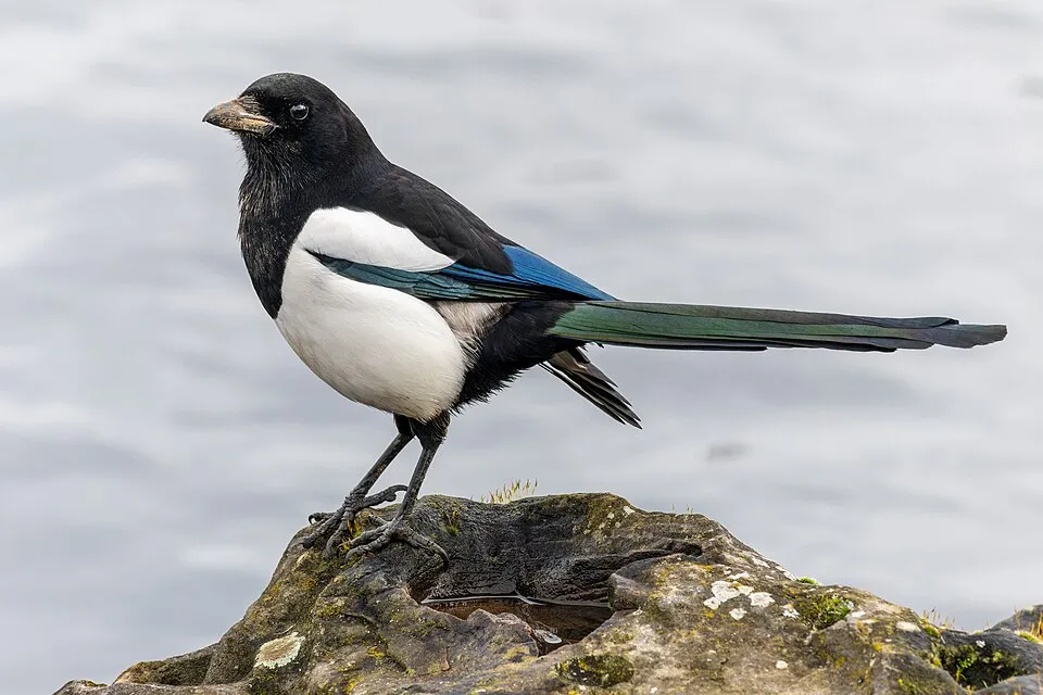
Among the species most often recorded on GBIF are Larus michahellis (Yellow-legged Gull), Corvus corone (Carrion crow), Saxicola rubicola (European Stonechat) and Pica pica (Eurasian Magpie).
What is the official website of Dunas de Liencres y Costa Quebrada Natural Park?
© OpenStreetMap
Download the boundary: GeoJSON · GPX Boundary © OpenStreetMap contributors (ODbL).
Geography
The representative point of the site lies at around 25 m above sea level. Over the 1996–2025 period, the mean annual temperature is about 14.3 °C and total precipitation reaches roughly 1,077 mm per year. The warmest month is usually August, the coolest January, and the wettest November. According to the European 1:1 million geological map (EGDI), the bedrock consists mainly of marly limestones (50% of sampled points), sands and gravels (31%) and dolomites (13%). These are mostly sedimentary rocks. The geological units date mainly from the Cretaceous (50% of sampled points).
Area
- Area
- 1,946 ha
- Elevation
- 25 m
- Mean slope
- 6°
- Coordinates
- 43.4478, -3.9626
Terrain: Mapzen Terrain Tiles (SRTM, USGS)
Bedrock
- Marly limestones 50 %
- Sands and gravels 31 %
- Dolomites 13 %
- Limestones 6 %
Sedimentary rocks 100 % · Main age: Cretaceous (50%)
Source: EGDI 1:1M geological map (EuroGeoSurveys and national geological surveys), CC BY 4.0 · 16 sampled points within the site.
Climate
● Mean temperature (°C) · ▮ Precipitation (mm)
Source: Copernicus ERA5-Land (C3S, doi:10.24381/cds.68d2bb30), monthly averages 1996–2025 interpolated to the representative point, temperatures adjusted for elevation.
Contains modified Copernicus Climate Change Service information 2026. Neither the European Commission nor ECMWF is responsible for any use that may be made of the Copernicus information or data it contains.
Natural habitats
According to CORINE Land Cover (2018), the land area is mainly made up of grassland and meadows (47%), forests (12%) and heath and scrub (12%). The sea covers about 16% of the site. Elevation ranges from sea level to 240 m (highest point: Monte Picota). The Natura 2000 site overlapping the area lists 11 habitats of European interest (2 priority), the most extensive being mudflats and sandflats not covered by seawater at low tide, estuaries and vegetated sea cliffs of the Atlantic and Baltic Coasts.
Biodiversity
Based on occurrences aggregated by GBIF, several species are regularly recorded within the site. Among the most frequent are Larus michahellis (Yellow-legged Gull), Corvus corone (Carrion crow), Saxicola rubicola (European Stonechat) and Pica pica (Eurasian Magpie). The full list of documented taxa is shown below. The overlapping Natura 2000 site lists 11 species of European interest: 4 mammals, 1 reptile, 1 amphibian, 2 fish, 2 invertebrates and 1 plant.
Habitats of European interest
From the official form of the Natura 2000 site overlapping the area (areas reported for the whole site).
- Mudflats and sandflats not covered by seawater at low tide 179 ha
- Estuaries 45 ha
- Vegetated sea cliffs of the Atlantic and Baltic Coasts 30 ha
- Shifting dunes along the shoreline with Ammophila arenaria (‘white dunes’) 21 ha
- Fixed coastal dunes with herbaceous vegetation (‘grey dunes’) priority 12 ha
- Atlantic salt meadows (Glauco-Puccinellietalia maritimae) 11 ha
- Embryonic shifting dunes 9 ha
- Dry Atlantic coastal heaths with Erica vagans priority 4 ha
and 3 more
Species of European interest
Mammals · 4
Common bent-wing bat (Miniopterus schreibersii), Greater mouse-eared bat (Myotis myotis), Mediterranean Horseshoe Bat (Rhinolophus euryale), Greater Horseshoe Bat (Rhinolophus ferrumequinum)
Reptiles · 1
Amphibians · 1
Invertebrates · 2
Greater Capricorn Beetle (Cerambyx cerdo), Stag beetle (Lucanus cervus)
Plants · 1
Limonium lanceolatum
Source: Natura 2000 standard data forms (EEA, CC-BY 4.0). Not exhaustive: sensitive species are not published.
Species to look out for


Observed species
Occurrences documented via GBIF; they are neither an exhaustive inventory nor proof of current presence.
- Yellow-legged Gull · Larus michahellis · 457
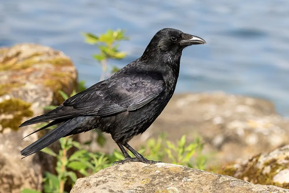
- Carrion crow · Corvus corone · 298
- European Stonechat · Saxicola rubicola · 292
- Eurasian Magpie · Pica pica · 285
- Common Blackbird · Turdus merula · 283
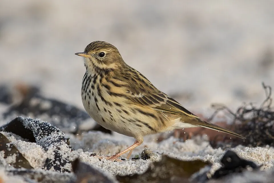
- Meadow Pipit · Anthus pratensis · 210
- Common Wood Pigeon · Columba palumbus · 209
- European robin · Erithacus rubecula · 204
- Black Redstart · Phoenicurus ochruros · 203
- Zitting Cisticola · Cisticola juncidis · 199
- White Wagtail · Motacilla alba · 193
- Lesser Black-backed Gull · Larus fuscus · 191
+18 more species
- Common Kestrel · Falco tinnunculus · 187
- European Goldfinch · Carduelis carduelis · 180
- Great Cormorant · Phalacrocorax carbo · 177
- House Sparrow · Passer domesticus · 171
- Common Buzzard · Buteo buteo · 165
- Black-headed Gull · Chroicocephalus ridibundus · 160
- Little Egret · Egretta garzetta · 153
- Common Starling · Sturnus vulgaris · 147
- Eurasian Wren · Troglodytes troglodytes · 141
- Western Cattle Egret · Bubulcus ibis · 138
- Barn Swallow · Hirundo rustica · 137
- Grey Heron · Ardea cinerea · 124
- Sardinian Warbler · Curruca melanocephala · 121
- Dunlin · Calidris alpina · 103
- European shag · Phalacrocorax aristotelis · 102
- Iberian Woodpecker · Picus sharpei · 101
- Mallard · Anas platyrhynchos · 100
- Grey Plover · Pluvialis squatarola · 99
Records: GBIF.org (CC-BY). Names: Wikidata (CC0), GBIF. Photos: Wikimedia Commons.
Conservation challenges
The primary purpose of the site is to preserve its natural habitats and the biodiversity they support. The species recorded (Biodiversity tab) reflect its ecological value. The designations it holds frame its management and the control of land use.
According to Global Forest Change data (University of Maryland, Global Forest Watch), about 53 ha of tree cover were lost within the boundary between 2001 and 2023 (3% of its area), peaking in 2013 and 2022. These losses include logging, storms and fires, and do not account for regrowth. According to the European CORINE Land Cover inventory (Copernicus), land cover changed on about 93 ha of the site between 1990 and 2018 (6% of its area): built-up land grew by 79 ha, mostly at the expense of farmland, while farmland shrank by 61 ha, mostly giving way to built-up land. Forest felling and regrowth add about 70 ha in total over the period. At night, 100% of the area gives off artificial light detectable from space (NASA VIIRS Black Marble composite, 2016). Built-up and developed land (buildings, business areas, roads, quarries) covers 7% of the area, and farmland 7% (CORINE Land Cover). According to the Natura 2000 forms, of 11 assessed habitats of European interest, 1 is in excellent condition and 1 in average or reduced condition. According to the Water Framework Directive assessment (2022 river basin management plans, data 2015–2019), water bodies assessed within the site: lagoons and estuaries, 1 of 1 in good ecological status or better; coastal waters, 2 of 2 in good ecological status or better. Since 2000, 5 invasive alien species have been recorded within the site (GBIF observations), one of them listed as of Union concern under EU Regulation 1143/2014. Among them: Delairea odorata (Cape-ivy), Cortaderia selloana (Pampas grass) and Tradescantia fluminensis (Small-leaf spiderwort).
Pressure indicators
Tree cover lost
53 ha
2001–2023 · 3% of the area
20012023
Fires since 2016
0
No large fire mapped (fires over about 30 ha)
Light at night
100%
of the area gives off artificial light visible from space
DarkLit
Built-up land
7%
buildings, business areas, roads, quarries · farmland 7%
Land cover change
93 ha
changed cover, 1990–2018 · CORINE · 6% of the area
- +79 ha · built-up land
- −61 ha · farmland
forest felling and regrowth: 70 ha in total
Rivers and lakes
Lagoons and estuaries: 1 of 1 good or better
Coastal waters: 2 of 2 good or better
assessments 2015–2019
Invasive alien species
5
incl. 1 of EU concern · since 2000
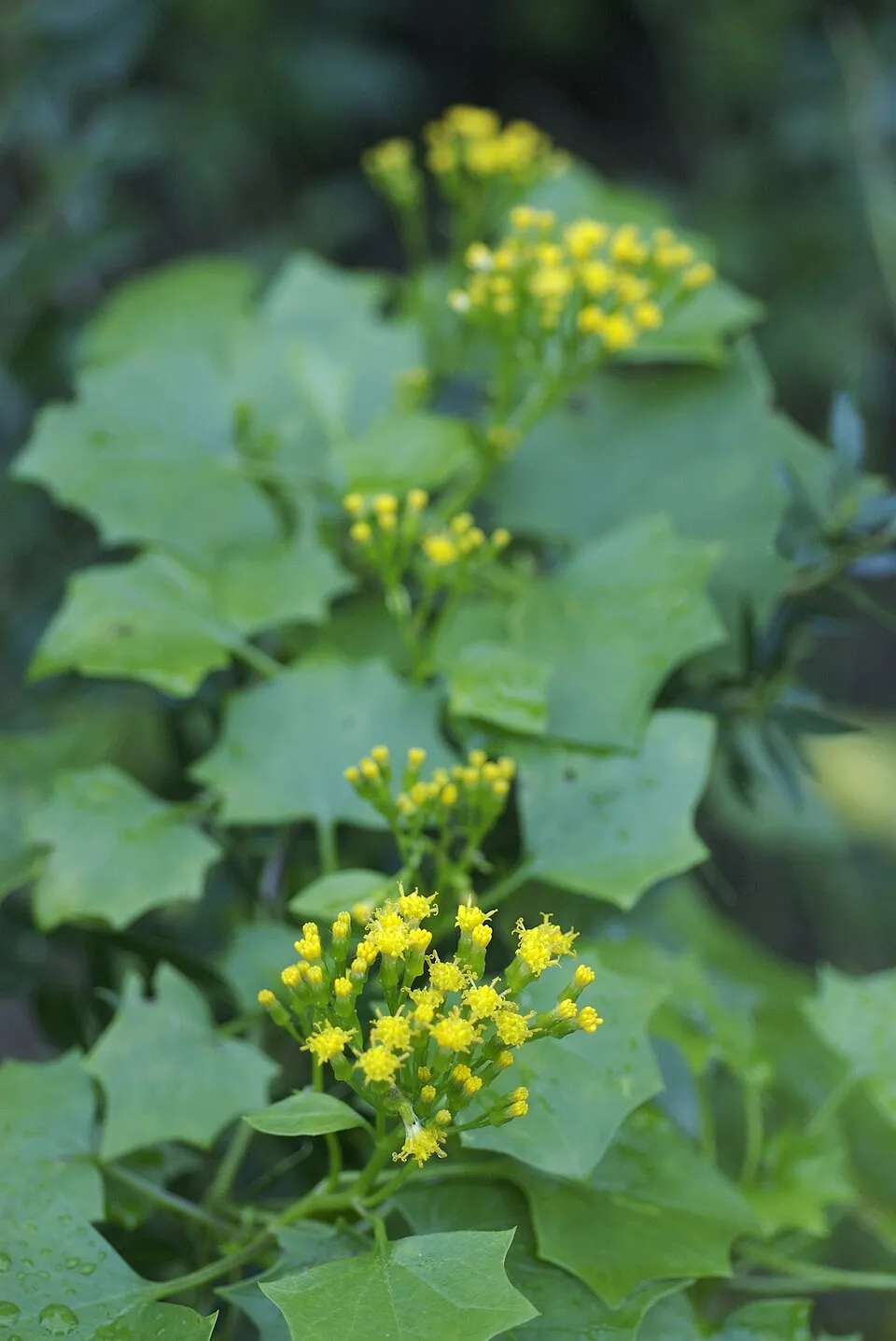 Cape-ivyEU
 Pampas grass
 Small-leaf spiderwort
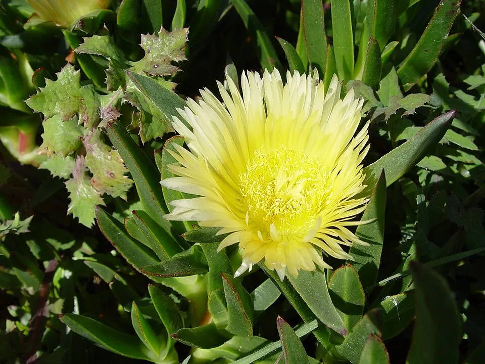 Hottentot-fig
 Bermuda buttercup
Photos: Cape-ivy © Eric in SF · CC BY-SA 3.0; Pampas grass © Solipsist · CC BY-SA 2.0; Small-leaf spiderwort © Enrique Dans from Madrid, Spain · CC BY 2.0; Hottentot-fig © Taken by Carsten Niehaus (user:Lumbar). · CC BY-SA 3.0; Bermuda buttercup © MathKnight and Zachi Evenor אביר המתמטיקה וצחי אבנור · CC BY-SA 4.0
Sources: Global Forest Change (Hansen et al., University of Maryland, via Global Forest Watch, CC-BY 4.0); EFFIS, European Commission / Copernicus; NASA Black Marble 2016 (public domain); CORINE Land Cover 2018 (Copernicus) or MODIS.
CORINE Land Cover Change 1990–2018: generated using European Union's Copernicus Land Monitoring Service information (EEA), aggregated by Parkavela; DOI 10.2909/f30f1000-7cf8-43bb-872c-5eb093911b24.
Ecological status of water bodies: European Environment Agency, WISE – Water Framework Directive, 3rd river basin management plans (2022), CC BY 4.0. Official national classification, not comparable between countries.
Invasive alien species: Global Register of Introduced and Invasive Species (ISSG, CC BY 4.0); Union list, Regulation (EU) 1143/2014 (INBO, CC0); GBIF.org records (CC0 / CC BY 4.0), at least 2 per species.
Practical information
Cities and airport
- Santander
6 km as the crow flies - Torrelavega
10 km as the crow flies - Airport: Santander (SDR)
7 km as the crow flies
Visitor information
- Punto de Información Turística
2 km from the site boundary
Hiking
1 waymarked routes listed, including:
Senda del Litoral
Data © OpenStreetMap contributors (ODbL) · Wikidata (CC0)
Waymarked hiking routes
Tracks © OpenStreetMap contributors (ODbL), clipped to the boundary; elevation gain and profiles computed on the longest section from Mapzen Terrain Tiles (≈ 30 m), indicative only.
Bathing
6 monitored bathing sites in or within 1 km of the site · 2025 classification
Excellent · 5
Sufficient · 1
- Playa Cuchia Pm1 · sea · Excellent
- Playa de Liencres Pm1 · sea · Excellent
- Playa de Usgo Pm1 · sea · Excellent
- Playa San Juan de la Canal Pm1 · sea · Excellent
- Playa Virgen del Mar Pm1 · sea · Excellent
- Playa de Mogro Pm1 · estuary or lagoon · Sufficient
Source: European Environment Agency, official bathing water classification (Directive 2006/7/EC, CC-BY 4.0). Swimming is only permitted at the sites and times authorised locally.
Access and visiting
Mogro railway station lies within the site. Nearest towns of over 50,000 people, as the crow flies: Santander (6 km) and Torrelavega (10 km). Nearest airport: Santander (SDR), about 7 km away. About 390,000 people live within 20 km of the site boundary, 310,000 of them within 10 km; some 3,800 people are estimated to live inside (GHSL estimate, 2020). Visitor information on site: Punto de Información Turística. Waymarked hiking routes listed in OpenStreetMap: 1, including Senda del Litoral. To plan a visit (access, opening periods, visitor rules), it is best to consult the official information from the managing body and the official website listed in this page's sources.
Source: OpenStreetMap (ODbL), Wikidata (CC0), October 2026.
When to visit
Best time to visit: from March to October, with average temperatures of 11 to 21 °C and moderate rainfall. Day length ranges from about 8 h 58 min in December to 15 h 24 min in June. Wildlife records published on GBIF peak for birds (from April to September), plants (May and June), butterflies and moths (July) and dragonflies (July). These peaks also reflect when observers are most active.
Source: Copernicus ERA5-Land (C3S), monthly averages 1996–2025 at the representative point, temperatures adjusted for elevation.
Contains modified Copernicus Climate Change Service information 2026. Neither the European Commission nor ECMWF is responsible for any use that may be made of the Copernicus information or data it contains.
Wildlife records calendar
JFMAMJJASOND
Birds
Plants
Butterflies & moths
Dragonflies
Monthly records published on GBIF (CC-BY), relative to the busiest month; also reflects observer activity.
Gallery
© Maite Von Thode · CC BY-SA 4.0
© serdio · CC BY 3.0
© Ongayo · Public domain
© Uhanu · CC BY-SA 4.0
© Tony Rotondas · CC BY-SA 3.0
© Armando Gonzalez Alameda · CC BY-SA 4.0
Sources and licences
- Wikidata: Q3384715
- OpenStreetMap: relation 16235587
- Official website: http://www.spain.info/TourSpain/Naturaleza/Espacios+Naturales/0/Parque+Natural+de+las+Dunas+de+Liencres?Language=es
- Wikipedia: it.wikipedia.org/wiki/Parco_nazionale_delle_dune_di_Liencres
- Natura 2000: ES1300004
- WDPA: 63492
References
- cds.climate.copernicus.eu: climate · CC-BY-4.0
- registry.opendata.aws: elevation of the reference point, detailed relief · PD
- land.copernicus.eu: land cover, land cover change, sea share · COPERNICUS
- doi.org: population around the site · CC-BY-4.0
- wikidata.org: official area, establishment date, protected heritage, nearby cities and airport, access and peaks, lake depths, places to see, official website · CC0-1.0
- eea.europa.eu: bathing water quality, ecological status of waters · CC-BY-4.0
- en.eurovelo.com: EuroVelo cycle routes · ODbL-1.0
- cycling.waymarkedtrails.org: cycle routes · ODbL-1.0
- opentopodata.org: elevations · PD
- forest-fire.emergency.copernicus.eu: wildfires · COPERNICUS
- globalforestwatch.org: tree cover loss · CC-BY-4.0
- gbif.org: seasonality of sightings, invasive alien species, observed species · CC-BY-4.0
- europe-geology.eu: geology · CC-BY-4.0
- hydrosheds.org: lakes · CC-BY-4.0
- natura2000.eea.europa.eu: Natura 2000 habitats and species · CC-BY-4.0
- openstreetmap.org: official name, access and peaks · ODbL-1.0
- earthobservatory.nasa.gov: night light · PD
- hiking.waymarkedtrails.org: route difficulty · ODbL-1.0
- nsidc.org: snow cover · PD
- wikidata.org: Wikipedia article · CC-BY-SA-4.0
Data © OpenStreetMap contributors (ODbL), Wikidata (CC0) and the sources cited.