
Italy · Terrestrial
La Mandria Natural Park
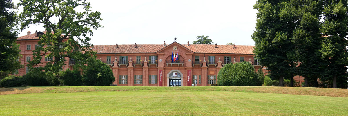
Regional nature park of 6,571 hectares in Italy, established in 1978.
Overview
Regional nature park of 6,571 hectares in Italy, established in 1978.
La Mandria Natural Park is a regional nature park in Italy (Europe). It is a predominantly terrestrial area. Established in 1978, it covers about 6,571 hectares.
Protections and designations
UNESCO World Heritage
Natura 2000 · habitats (SAC)
- La Mandria IT1110079
Protected as a regional nature park. International labels and designations: UNESCO World Heritage (“Residences of the Royal House of Savoy”) and Natura 2000 network (1 site: “La Mandria”). Key dates: established in 1978 and World Heritage listing in 1997.
In our collections
Timeline
-
1978
Established
-
1997
Inscribed as a UNESCO World Heritage Site Residences of the Royal House of Savoy
Sources: Wikidata (CC0) for establishment and international labels; EEA Natura 2000 database (CC-BY 4.0) for site designation dates.
Frequently asked questions
Where is La Mandria Natural Park?
In Italy (Europe). Representative point: 45.1353° N, 7.6253° E.
How large is La Mandria Natural Park?
About 6,571 hectares (66 km²). It is the 64th largest of the 128 regional parks in Italy covered by Parkavela.
When was La Mandria Natural Park established?
In 1978.
What habitats and landscapes does La Mandria Natural Park include?
A terrestrial area, where land cover is dominated by farmland (33%).
What rocks lie beneath La Mandria Natural Park?
According to the European 1:1 million geological map (EGDI), the bedrock consists mainly of unconsolidated deposits (100% of sampled points). These are mostly sedimentary rocks. The geological units date mainly from the Quaternary (100% of sampled points).
Which international labels apply to La Mandria Natural Park?
UNESCO World Heritage (“Residences of the Royal House of Savoy”) and Natura 2000 network (1 site: “La Mandria”).
When is the best time to visit La Mandria Natural Park?
Best time to visit: from April to October, with average temperatures of 11 to 23 °C and moderate rainfall.
What is there to see in La Mandria Natural Park?
6 lakes and ponds, including Laghi Ceretta, Lago Cristoforo, Lago Grande and Lago Risera (OpenStreetMap).
Where can I stay in La Mandria Natural Park?
4 campsites, including Area Camper "Relax and Go", Area Camping La Cassa and La Sosta del Re (OpenStreetMap).
Are there historic monuments in La Mandria Natural Park?
Yes. According to Wikidata, 3 monuments protected as Italian national cultural heritage stand within the boundary. For example: “Chiesa di San Giuliano” in Druento, “La Rubbianetta Castle” in Druento and “Palace of Venaria” in Venaria Reale.
What is the nearest large city to La Mandria Natural Park?
Nearest towns of over 50,000 people, as the crow flies: Turin (6 km) and Moncalieri (14 km). Nearest airport: Turin (TRN), about 4 km away.
How can I reach La Mandria Natural Park by train?
The nearest railway station is Turin-Porta Susa, about 6 km from the site boundary.
Where can I get visitor information on site?
Ponte Verde, Ciabot degli animali and Infoturismo Piemonte.
Are there waymarked hiking trails in La Mandria Natural Park?
Yes. Waymarked hiking routes listed in OpenStreetMap: 15. The “007” route runs for about 11 km through the site, with some 80 m of ascent on its longest section.
Which species can be seen in La Mandria Natural Park?
Among the species most often recorded on GBIF are Fringilla coelebs (Eurasian Chaffinch), Corvus cornix (Hooded Crow), Parus major (Great tit) and Turdus merula (Common Blackbird).
What is the official website of La Mandria Natural Park?
© OpenStreetMap
Download the boundary: GeoJSON · GPX Boundary © OpenStreetMap contributors (ODbL).
Geography
The representative point of the site lies at around 261 m above sea level. Over the 1996–2025 period, the mean annual temperature is about 12.0 °C and total precipitation reaches roughly 1,217 mm per year. The warmest month is usually July, the coolest January, and the wettest May. According to the European 1:1 million geological map (EGDI), the bedrock consists mainly of unconsolidated deposits (100% of sampled points). These are mostly sedimentary rocks. The geological units date mainly from the Quaternary (100% of sampled points).
Area
- Area
- 6,571 ha
- Elevation
- 261 m
- Coordinates
- 45.1353, 7.6253
Bedrock
- Unconsolidated deposits 100 %
Sedimentary rocks 100 % · Main age: Quaternary (100%)
Source: EGDI 1:1M geological map (EuroGeoSurveys and national geological surveys), CC BY 4.0 · 16 sampled points within the site.
Climate
● Mean temperature (°C) · ▮ Precipitation (mm)
Source: Copernicus ERA5-Land (C3S, doi:10.24381/cds.68d2bb30), monthly averages 1996–2025 interpolated to the representative point, temperatures adjusted for elevation.
Contains modified Copernicus Climate Change Service information 2026. Neither the European Commission nor ECMWF is responsible for any use that may be made of the Copernicus information or data it contains.
Natural habitats
According to CORINE Land Cover (2018), the site is mainly made up of farmland (33%), forests (26%) and grassland and meadows (22%). Woodland is mostly broadleaved. Elevation ranges from about 240 to 420 m (sampled elevations, SRTM). The Natura 2000 site overlapping the area lists 9 habitats of European interest (1 priority), the most extensive being Sub-Atlantic and medio-European oak or oak-hornbeam forests of the Carpinion betuli, lowland hay meadows (Alopecurus pratensis, Sanguisorba officinalis) and Molinia meadows on calcareous, peaty or clayey-silt-laden soils (Molinion caeruleae).
Biodiversity
Based on occurrences aggregated by GBIF, several species are regularly recorded within the site. Among the most frequent are Fringilla coelebs (Eurasian Chaffinch), Corvus cornix (Hooded Crow), Parus major (Great tit) and Turdus merula (Common Blackbird). The full list of documented taxa is shown below. The overlapping Natura 2000 site lists 52 species of European interest: 17 mammals, 4 reptiles, 6 amphibians, 8 fish, 13 invertebrates and 4 plants.
Habitats of European interest
From the official form of the Natura 2000 site overlapping the area (areas reported for the whole site).
- Sub-Atlantic and medio-European oak or oak-hornbeam forests of the Carpinion betuli 865 ha
- Lowland hay meadows (Alopecurus pratensis, Sanguisorba officinalis) 718 ha
- Molinia meadows on calcareous, peaty or clayey-silt-laden soils (Molinion caeruleae) 68 ha
- Alluvial forests with Alnus glutinosa and Fraxinus excelsior (Alno-Padion, Alnion incanae, Salicion albae) priority 57 ha
- Alpine rivers and their ligneous vegetation with Salix elaeagnos 8 ha
- Natural eutrophic lakes with Magnopotamion or Hydrocharition-type vegetation 2 ha
- Oligotrophic to mesotrophic standing waters with vegetation of the Littorelletea uniflorae and/or of the Isoëto-Nanojuncetea 2 ha
- European dry heaths 1 ha
and 1 more
Species of European interest
Mammals · 17
Barbastelle (Barbastella barbastellus), Grey wolf (Canis lupus), Serotine bat (Eptesicus serotinus), Savi's Pipistrelle (Hypsugo savii), European pine marten (Martes martes), Hazel dormouse (Muscardinus avellanarius), Bechstein's bat (Myotis bechsteinii), Lesser mouse-eared myotis (Myotis blythii), Daubenton's bat (Myotis daubentonii), Geoffroy's bat (Myotis emarginatus), Greater mouse-eared bat (Myotis myotis), Natterer's bat (Myotis nattereri) and 5 more
Reptiles · 4
Western green lizard (Lacerta bilineata), Dice snake (Natrix tessellata), Common wall lizard (Podarcis muralis), Aesculapian Snake (Zamenis longissimus)
Amphibians · 6
Green Toad (Bufotes viridis complex), Italian Tree Frog (Hyla intermedia), Edible frog (Pelophylax esculentus), Agile frog (Rana dalmatina), Common frog (Rana temporaria), Italian crested newt (Triturus carnifex)
Fish · 8
Brook barbel (Barbus caninus), Italian Barbel (Barbus plebejus), Italian Spined Loach (Cobitis bilineata), European bullhead (Cottus gobio), Lombardy lamprey (Lethenteron zanandreai), South European Nase (Protochondrostoma genei), Marble Trout (Salmo marmoratus), Italian Riffle Dace (Telestes muticellus)
Invertebrates · 13
White-clawed Crayfish (Austropotamobius pallipes), Greater Capricorn Beetle (Cerambyx cerdo), False ringlet (Coenonympha oedippus), Eastern Eggar (Eriogaster catax), Marsh fritillary (Euphydryas aurinia), Jersey Tiger (Euplagia quadripunctaria), Mediterranean Medicinal Leech (Hirudo verbana), Woodland brown (Lopinga achine), Stag beetle (Lucanus cervus), Large copper (Lycaena dispar), Hermit beetle (Osmoderma eremita), Unio elongatulus and 1 more
Plants · 4
Dicranum moss (Dicranum viride), Eleocharis carniolica, Marsh gladiolus (Gladiolus palustris), Orthotrichum rogeri
Source: Natura 2000 standard data forms (EEA, CC-BY 4.0). Not exhaustive: sensitive species are not published.
Species to look out for

Bird
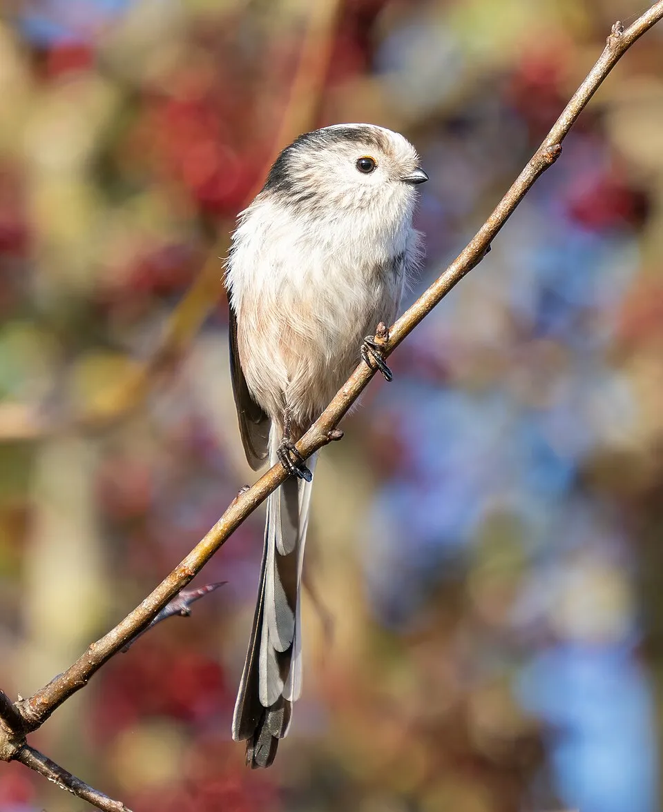
Hooded Crow
Corvus cornix161 records © Ricardo Tulio Gandelman from Rio de Janeiro, Brazil · CC BY 2.0



Observed species
Occurrences documented via GBIF; they are neither an exhaustive inventory nor proof of current presence.
- Eurasian Chaffinch · Fringilla coelebs · 168
- Hooded Crow · Corvus cornix · 161
- Great tit · Parus major · 159
- Common Blackbird · Turdus merula · 145
- European robin · Erithacus rubecula · 126
- Long-tailed Tit · Aegithalos caudatus · 122
- Eurasian blue tit · Cyanistes caeruleus · 115
- Great Spotted Woodpecker · Dendrocopos major · 112
- European Green Woodpecker · Picus viridis · 108
- Mallard · Anas platyrhynchos · 106
- Grey Heron · Ardea cinerea · 103
- Great Cormorant · Phalacrocorax carbo · 99
Records: GBIF.org (CC-BY). Names: Wikidata (CC0), GBIF. Photos: Wikimedia Commons.
Conservation challenges
The primary purpose of the site is to preserve its natural habitats and the biodiversity they support. The species recorded (Biodiversity tab) reflect its ecological value. The designations it holds frame its management and the control of land use.
According to Global Forest Change data (University of Maryland, Global Forest Watch), about 118 ha of tree cover were lost within the boundary between 2001 and 2023 (2% of its area), peaking in 2022 and 2023. These losses include logging, storms and fires, and do not account for regrowth. According to the European CORINE Land Cover inventory (Copernicus), land cover changed on about 171 ha of the site between 1990 and 2018 (2% of its area): farmland shrank by 146 ha, mostly giving way to built-up land, while built-up land grew by 93 ha, mostly at the expense of farmland. At night, 100% of the area gives off artificial light detectable from space (NASA VIIRS Black Marble composite, 2016). Built-up and developed land (buildings, business areas, roads, quarries) covers 14% of the area, and farmland 33% (CORINE Land Cover). According to the Natura 2000 forms, of 9 assessed habitats of European interest, 4 are in average or reduced condition and the rest in good condition. According to the Water Framework Directive assessment (2022 river basin management plans, data 2014–2019), none of the 55 km of rivers assessed within the site reaches good ecological status; they mostly have moderate ecological status. Since 2000, 15 invasive alien species have been recorded within the site (GBIF observations), 2 of them listed as of Union concern under EU Regulation 1143/2014. Among them: Reynoutria japonica (Japanese Knotweed), Ailanthus altissima (Tree-of-heaven) and Ricinus communis (Castor oil plant).
Pressure indicators
Tree cover lost
118 ha
2001–2023 · 2% of the area
20012023
Fires since 2016
0
No large fire mapped (fires over about 30 ha)
Light at night
100%
of the area gives off artificial light visible from space
DarkLit
Built-up land
14%
buildings, business areas, roads, quarries · farmland 33%
Land cover change
171 ha
changed cover, 1990–2018 · CORINE · 2% of the area
- −146 ha · farmland
- +93 ha · built-up land
Rivers and lakes
0%
of the 55 km of assessed rivers in good or high ecological status · WFD 2022
assessments 2014–2019
Invasive alien species
15
incl. 2 of EU concern · since 2000
 Japanese KnotweedEU
 Tree-of-heavenEU
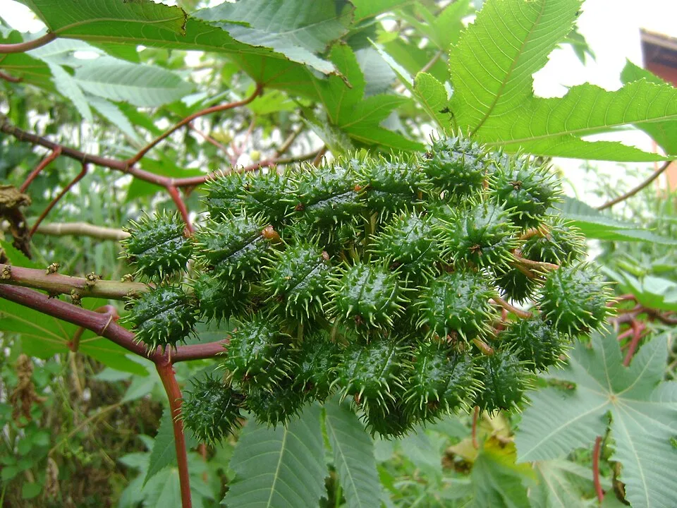 Castor oil plant
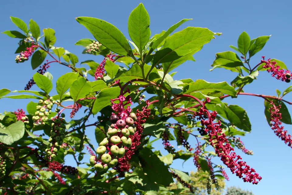 American pokeweed
 Mute Swan
 Velvetleaf
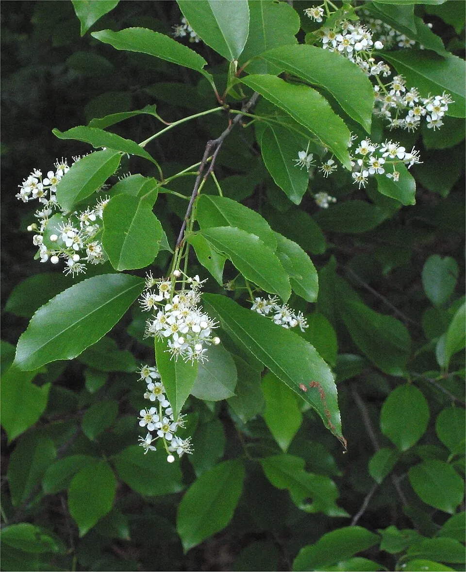 Black cherry
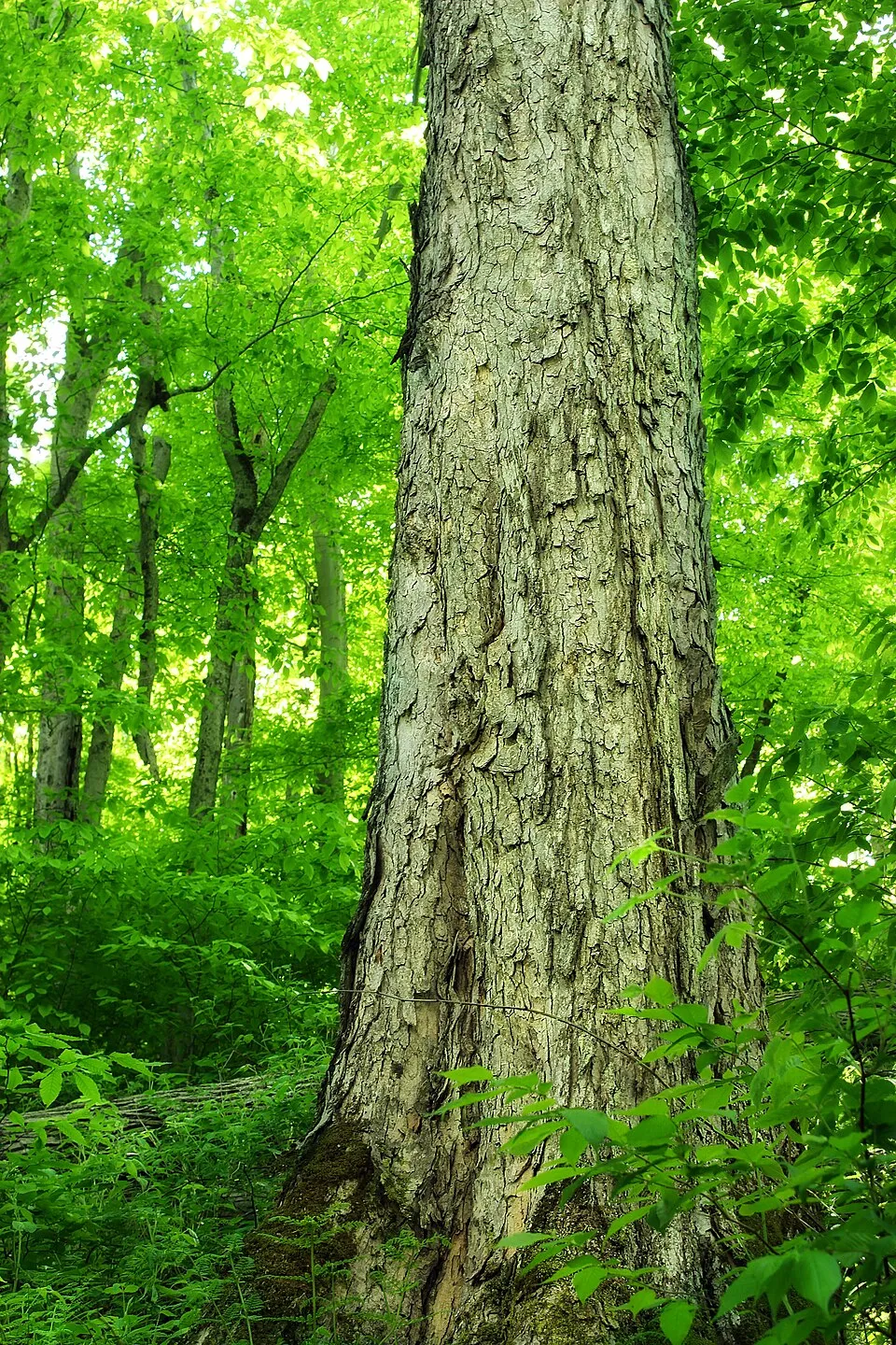 Northern red oak
Photos: Japanese Knotweed © W.carter · CC0-1.0; Tree-of-heaven © Darkone · CC BY-SA 2.5; Castor oil plant © Onjacktallcuca · Public domain; American pokeweed © Huw Williams (Huwmanbeing) · Public domain; Mute Swan © Geni · CC BY-SA 4.0; Velvetleaf © Salicyna · CC BY-SA 4.0; Black cherry © Rasbak · CC BY-SA 3.0; Northern red oak © Nicholas A. Tonelli from Northeast Pennsylvania, USA · CC BY 2.0
Sources: Global Forest Change (Hansen et al., University of Maryland, via Global Forest Watch, CC-BY 4.0); EFFIS, European Commission / Copernicus; NASA Black Marble 2016 (public domain); CORINE Land Cover 2018 (Copernicus) or MODIS.
CORINE Land Cover Change 1990–2018: generated using European Union's Copernicus Land Monitoring Service information (EEA), aggregated by Parkavela; DOI 10.2909/f30f1000-7cf8-43bb-872c-5eb093911b24.
Ecological status of water bodies: European Environment Agency, WISE – Water Framework Directive, 3rd river basin management plans (2022), CC BY 4.0. Official national classification, not comparable between countries.
Invasive alien species: Global Register of Introduced and Invasive Species (ISSG, CC BY 4.0); Union list, Regulation (EU) 1143/2014 (INBO, CC0); GBIF.org records (CC0 / CC BY 4.0), at least 2 per species.
Practical information
Cities and airport
- Turin
6 km as the crow flies - Moncalieri
14 km as the crow flies - Airport: Turin (TRN)
4 km as the crow flies
Visitor information
- Ponte Verde
within the site - Ciabot degli animali
within the site - Infoturismo Piemonte
3 km from the site boundary
Things to see
6 lakes and ponds
- Laghi Ceretta
lake or pond - Lago Cristoforo
lake or pond - Lago Grande
lake or pond - Lago Risera
lake or pond - Lago della Strada
lake or pond
Where to stay
4 campsites
- Area Camper "Relax and Go"
campsite - Area Camping La Cassa
campsite - La Sosta del Re
campsite
Hiking
15 waymarked routes listed
By bike
BI-12 Ciclovia Pedemontana Alpina · 17 kmCorona di Delizie · 14 km
+ 4 local loops
Signed cycle routes: this does not mean that cycling is allowed on footpaths.
Data © OpenStreetMap contributors (ODbL) · Wikidata (CC0)
Routes © OpenStreetMap contributors (ODbL), via Waymarked Trails
Waymarked hiking routes
Tracks © OpenStreetMap contributors (ODbL), clipped to the boundary; elevation gain and profiles computed on the longest section from Mapzen Terrain Tiles (≈ 30 m), indicative only. Indicative difficulty (SAC scale, OpenStreetMap, via Waymarked Trails): check with the park.
Access and visiting
The nearest railway station is Turin-Porta Susa, about 6 km from the site boundary. Nearest towns of over 50,000 people, as the crow flies: Turin (6 km) and Moncalieri (14 km). Nearest airport: Turin (TRN), about 4 km away. About 1.8 million people live within 20 km of the site boundary, 1.2 million of them within 10 km; some 19,000 people are estimated to live inside (GHSL estimate, 2020). This population has grown by about 5% since 2000. Visitor information on site: Ponte Verde, Ciabot degli animali and Infoturismo Piemonte. Waymarked hiking routes listed in OpenStreetMap: 15. The site is crossed by 2 signed cycle routes: “BI-12 Ciclovia Pedemontana Alpina” and “Corona di Delizie” (OpenStreetMap). To see: 6 lakes and ponds, including Laghi Ceretta, Lago Cristoforo, Lago Grande and Lago Risera. Where to stay: 4 campsites, including Area Camper "Relax and Go", Area Camping La Cassa and La Sosta del Re. To plan a visit (access, opening periods, visitor rules), it is best to consult the official information from the managing body and the official website listed in this page's sources.
Source: OpenStreetMap (ODbL), Wikidata (CC0), October 2026.
Built heritage
According to Wikidata, 3 monuments protected as Italian national cultural heritage stand within the boundary. Examples include “Chiesa di San Giuliano” in Druento, “La Rubbianetta Castle” in Druento and “Palace of Venaria” in Venaria Reale.
1 castle or fortification1 religious building1 bridge, lighthouse, mill or working building
-
Chiesa di San Giuliano
Druento -
La Rubbianetta Castle
Druento -
Palace of Venaria
Venaria Reale
Source: Wikidata (CC0), monuments in each country’s official heritage protection registers, at national or regional level. Each item links to its Wikidata entry.
When to visit
Best time to visit: from April to October, with average temperatures of 11 to 23 °C and moderate rainfall. Precipitation peaks in May (up to 150 mm per month). Day length ranges from about 8 h 46 min in December to 15 h 37 min in June. Wildlife records published on GBIF peak for birds (November), plants (May), butterflies and moths (April and May) and mammals (June and July). These peaks also reflect when observers are most active.
Source: Copernicus ERA5-Land (C3S), monthly averages 1996–2025 at the representative point, temperatures adjusted for elevation.
Contains modified Copernicus Climate Change Service information 2026. Neither the European Commission nor ECMWF is responsible for any use that may be made of the Copernicus information or data it contains.
Wildlife records calendar
JFMAMJJASOND
Birds
Plants
Butterflies & moths
Mammals
Monthly records published on GBIF (CC-BY), relative to the busiest month; also reflects observer activity.
Gallery
© Alessandro Vecchi · CC BY-SA 3.0
© F Ceragioli · CC BY-SA 3.0
© italo losero · CC BY-SA 3.0
© Pmk58 · CC BY-SA 4.0
© Davdinun · CC BY-SA 4.0
© Monica Rondoni · CC0-1.0
Sources and licences
- Wikidata: Q3895633
- Official website: https://www.parchireali.it/parco.mandria/
- Wikipedia: en.wikipedia.org/wiki/La_Mandria_Regional_Park
- WDPA: 14611
References
- cds.climate.copernicus.eu: climate · CC-BY-4.0
- registry.opendata.aws: elevation of the reference point, detailed relief · PD
- land.copernicus.eu: land cover, land cover change, sea share · COPERNICUS
- doi.org: population around the site · CC-BY-4.0
- wikidata.org: official area, establishment date, protected heritage, nearby cities and airport, access and peaks, lake depths, places to see, official website · CC0-1.0
- eea.europa.eu: bathing water quality, ecological status of waters · CC-BY-4.0
- en.eurovelo.com: EuroVelo cycle routes · ODbL-1.0
- cycling.waymarkedtrails.org: cycle routes · ODbL-1.0
- opentopodata.org: elevations · PD
- forest-fire.emergency.copernicus.eu: wildfires · COPERNICUS
- globalforestwatch.org: tree cover loss · CC-BY-4.0
- gbif.org: seasonality of sightings, invasive alien species, observed species · CC-BY-4.0
- europe-geology.eu: geology · CC-BY-4.0
- hydrosheds.org: lakes · CC-BY-4.0
- natura2000.eea.europa.eu: Natura 2000 habitats and species · CC-BY-4.0
- openstreetmap.org: official name, access and peaks, places to see, trail difficulty, wheelchair access · ODbL-1.0
- earthobservatory.nasa.gov: night light · PD
- hiking.waymarkedtrails.org: route difficulty · ODbL-1.0
- nsidc.org: snow cover · PD
- wikidata.org: Wikipedia article · CC-BY-SA-4.0
Data © OpenStreetMap contributors (ODbL), Wikidata (CC0) and the sources cited.