France · Terrestrial
Pyrénées National Park
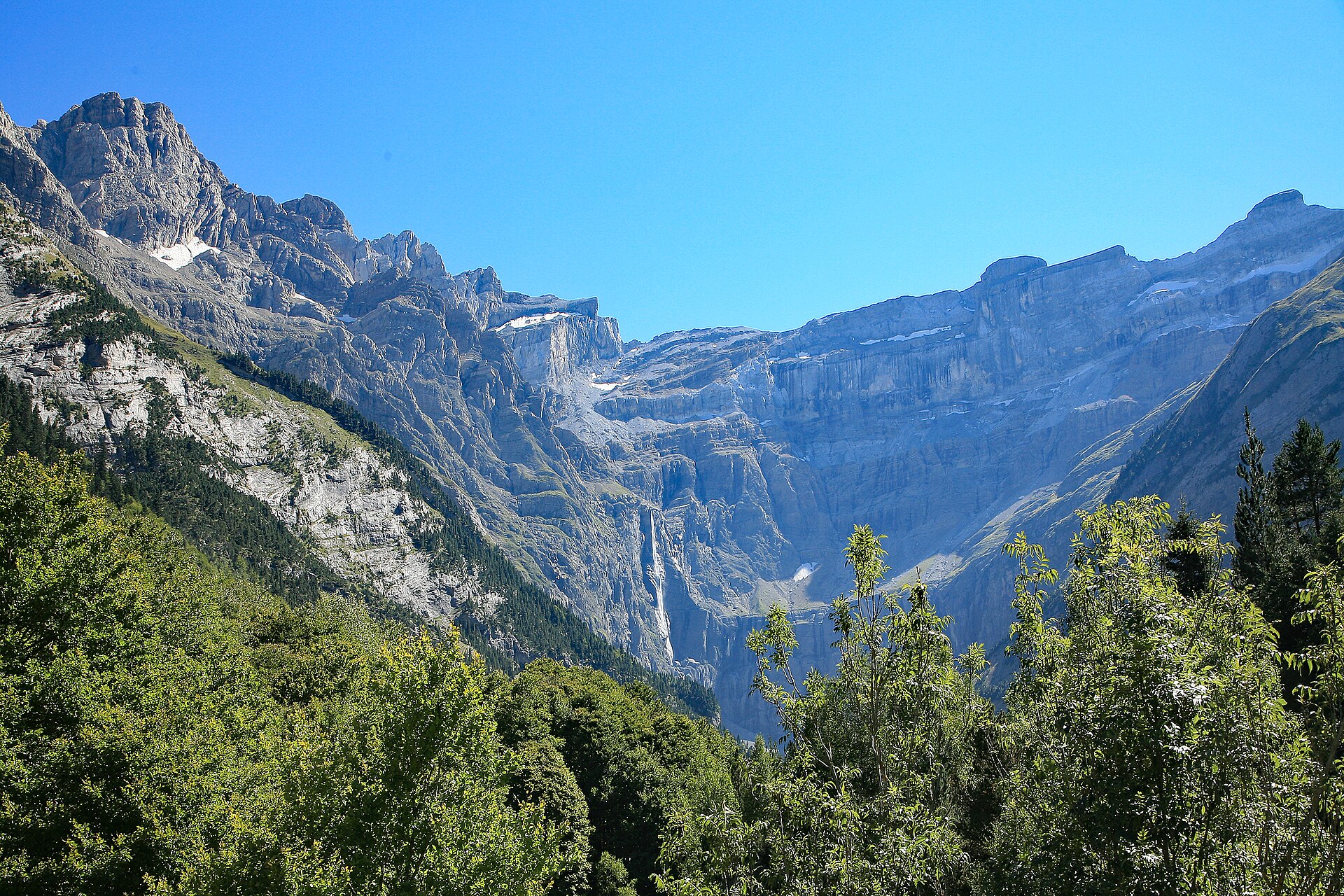
National park of 45,700 hectares in France, established in 1967.
Overview
National park of 45,700 hectares in France, established in 1967.
Pyrénées National Park is located in France (Europe). It is a predominantly terrestrial area. Established on 23 March 1967, it covers about 45,700 hectares.
Protections and designations
UNESCO World Heritage
Natura 2000 · habitats (SAC) · 13 sites
- Estaubé, Gavarnie, Troumouse et Barroude FR7300927
- Gabizos (et vallée d'Arrens, versant sud-est du Gabizos) FR7300921
- Gaube, Vignemale FR7300925
- Gaves de Pau et de Cauterets (et gorge de Cauterets) FR7300922
- Le Gave d'Aspe et le Lourdios (cours d'eau) FR7200792
- Le Gave d'Ossau FR7200793
- and 7 more
Natura 2000 · birds (SPA) · 2 sites
- Cirque de Gavarnie FR7310088
- Hautes vallées d'Aspe et d'Ossau FR7210087
Protected as a national park. International labels and designations: UNESCO World Heritage (“Pyrénées – Mont Perdu World Heritage Site”) and Natura 2000 network (15 sites). Key dates: established in 1967, World Heritage listing in 1997, first Natura 2000 site under the Birds Directive in 2004 and first Natura 2000 site under the Habitats Directive in 2007.
In our collections
Timeline
-
1967
Established
-
1997
Inscribed as a UNESCO World Heritage Site Pyrénées – Mont Perdu World Heritage Site
-
2004
First Natura 2000 site under the Birds Directive 2 such sites designated up to 2004
-
2007
First Natura 2000 site under the Habitats Directive 13 such sites designated up to 2014
Sources: Wikidata (CC0) for establishment and international labels; EEA Natura 2000 database (CC-BY 4.0) for site designation dates.
Frequently asked questions
Where is Pyrénées National Park?
In France (Europe). Representative point: 42.7946° N, 0.2602° W.
How large is Pyrénées National Park?
About 45,700 hectares (457 km²). It is the 11th largest of the 13 national parks in France covered by Parkavela.
When was Pyrénées National Park established?
On 23 March 1967.
What habitats and landscapes does Pyrénées National Park include?
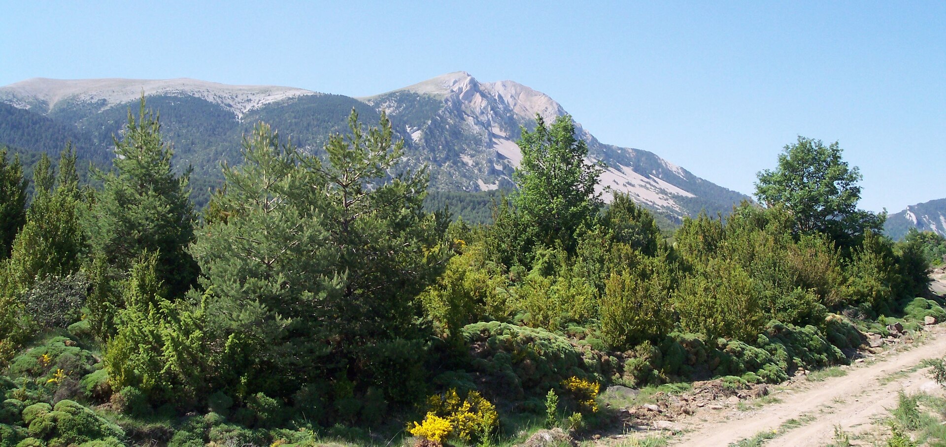
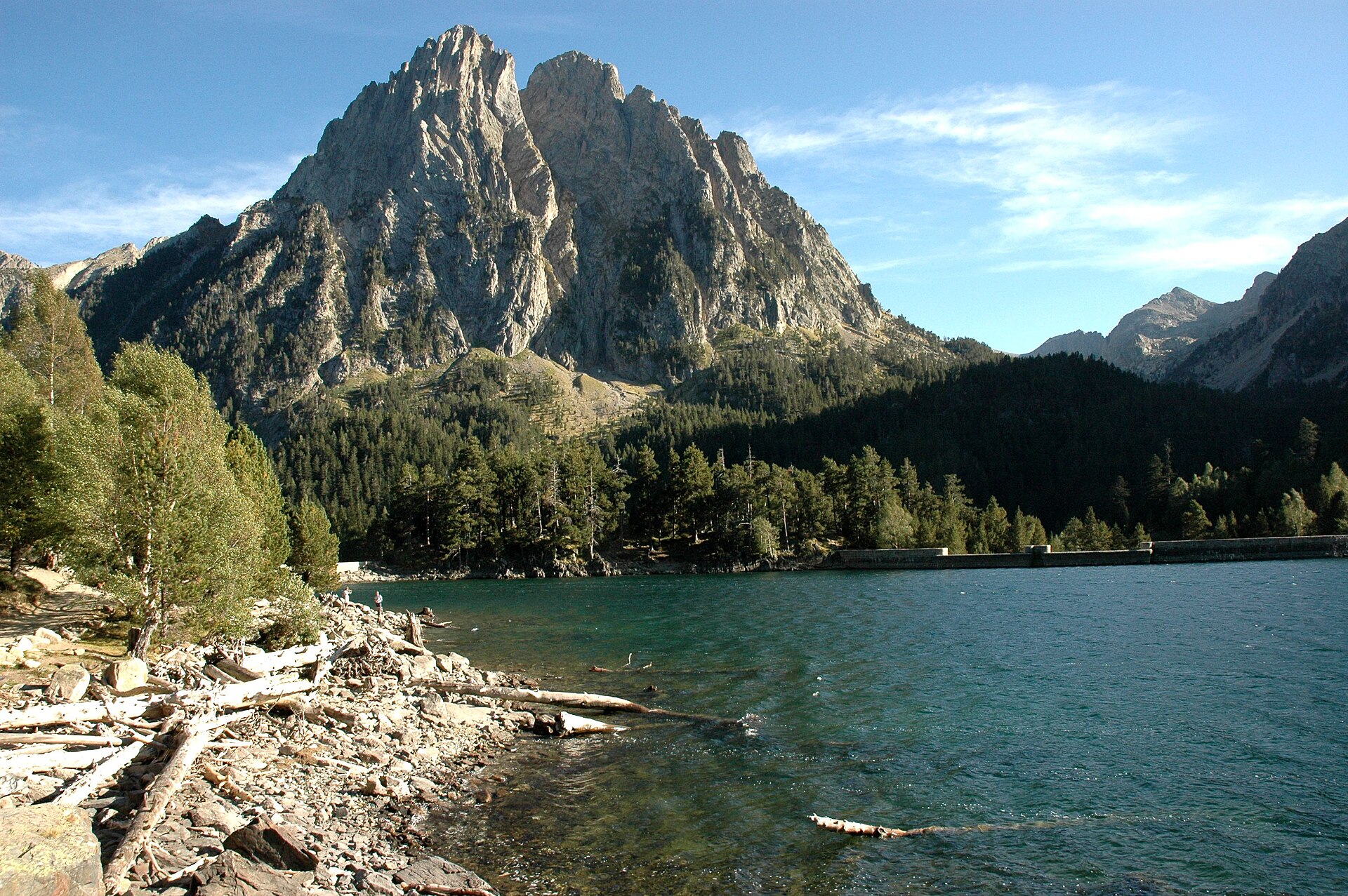
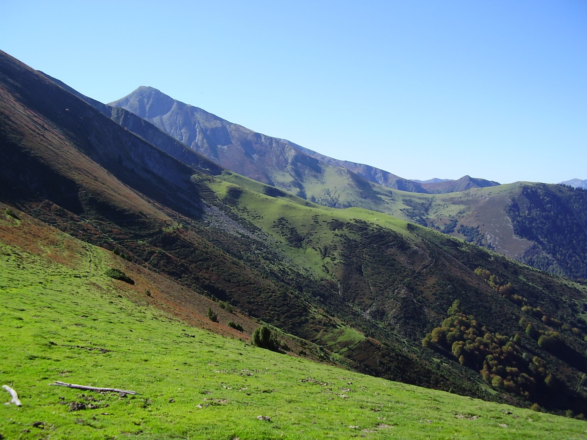
A terrestrial area, with mountains.
What rocks lie beneath Pyrénées National Park?
According to the BRGM's simplified lithological map, the bedrock consists mainly of limestones, marls and gypsum (38% of sampled points), sandstones (31%) and granites (25%). These are mostly sedimentary rocks.
What is the highest point of Pyrénées National Park?
Vignemale, at 3,298 m (OpenStreetMap).
What are the main summits of Pyrénées National Park?
Vignemale (3,298 m), Pic de Montferrat (3,219 m), Pointe Chausenque (3,204 m), Piton Carré (3,197 m) and Pic Long (3,192 m) (OpenStreetMap).
Which international labels apply to Pyrénées National Park?
UNESCO World Heritage (“Pyrénées – Mont Perdu World Heritage Site”) and Natura 2000 network (15 sites).
When is the best time to visit Pyrénées National Park?
Mildest period: July and August, with average temperatures of 8 to 9 °C.
Is there snow in Pyrénées National Park?
Yes. According to NASA's MODIS satellites (2015–2025 average), snow covers most of the site from November to April, and until May on higher ground, with about 175 snow-covered days a year on average.
What is there to see in Pyrénées National Park?
9 viewpoints, 34 waterfalls, 115 lakes and ponds, 5 caves and 19 glaciers, including Vue sur le Cirque d'Aspe, Cascade Darré Splumouse, Lac de Montferrat (2,374 m) and Cueva (OpenStreetMap).
Where can I stay in Pyrénées National Park?
34 mountain huts and 16 campsites, including Refuge de Bayssellance (2,651 m), Aire Camping-cars Station de Piau and Refuge de la Breche de Roland (2,587 m) (OpenStreetMap).
What is the nearest large city to Pyrénées National Park?
Nearest towns of over 50,000 people, as the crow flies: Pau (44 km) and Huesca (68 km). Nearest airport: Tarbes-Lourdes-Pyrénées (LDE), about 34 km away.
How can I reach Pyrénées National Park by train?
The nearest railway station is Canfranc, about 4 km from the site boundary.
Where can I get visitor information on site?
Maison du Parc National des Pyrénées, Le bureau d'information Touristique d'Artouste and Forfaits Candanchú.
Are there waymarked hiking trails in Pyrénées National Park?
Yes. Waymarked hiking routes listed in OpenStreetMap: 76, including GR 10, GR 108, Variante and Haute Randonnée Pyrénéenne. The “HRP Variante 14.2” route runs for about 15 km through the site, with some 690 m of ascent on its longest section.
Which species can be seen in Pyrénées National Park?
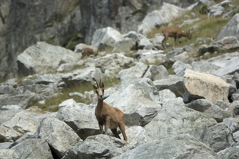
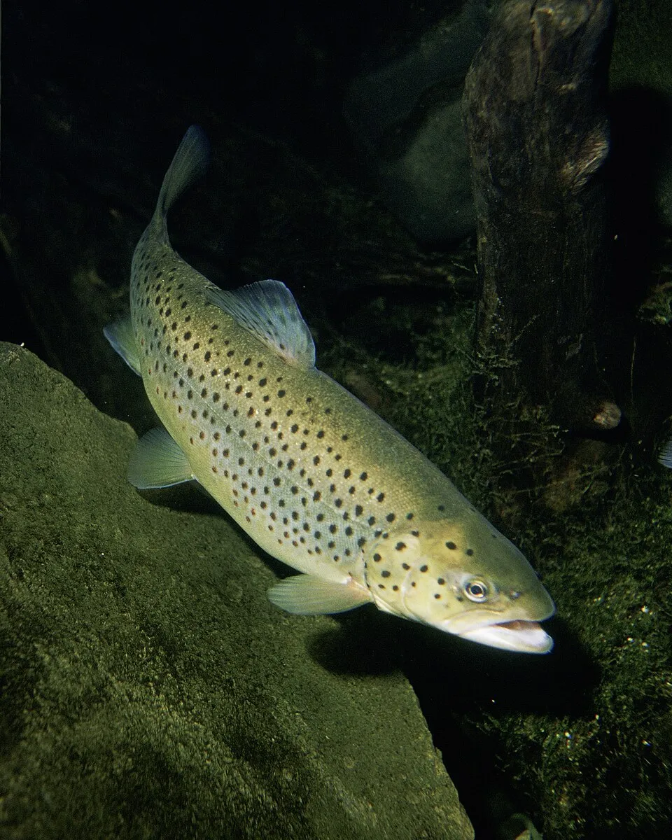
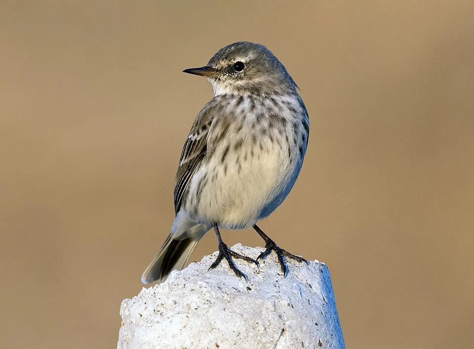
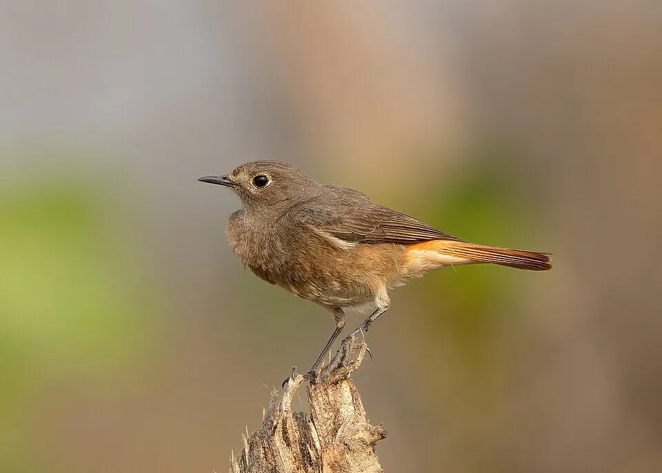
Among the species most often recorded on GBIF are Rupicapra pyrenaica (Southern Chamois), Salmo trutta (Brown Trout), Anthus spinoletta (Water Pipit) and Phoenicurus ochruros (Black Redstart).
What is the official website of Pyrénées National Park?
© OpenStreetMap
Download the boundary: GeoJSON · GPX Boundary © OpenStreetMap contributors (ODbL).
Geography
The representative point of the site lies at around 2,763 m above sea level. Over the 1996–2025 period, the mean annual temperature is about 0.2 °C and total precipitation reaches roughly 1,689 mm per year. The warmest month is usually July, the coolest January, and the wettest May. According to the BRGM's simplified lithological map, the bedrock consists mainly of limestones, marls and gypsum (38% of sampled points), sandstones (31%) and granites (25%). These are mostly sedimentary rocks. In 2020, 15 glaciers covered 89 ha within the site (Pyrenean glacier inventory). The site contains 2 lakes larger than 10 ha, totalling 52 ha of water; the largest, lac de Migouélou, covers 19 ha (HydroLAKES). lac de Migouélou (48 ha) is 60 m deep (Wikidata).
Area
- Area
- 45,700 ha
- Elevation
- 2,763 m
- Median elevation
- 2,108 m
- Mean slope
- 27°
- Snow cover
- ≈ 175 days a year
- Lakes over 10 ha
- 2 (52 ha)
- Coordinates
- 42.7946, -0.2602
Terrain: Mapzen Terrain Tiles (SRTM, USGS) · Lakes: HydroLAKES (Messager et al. 2016, hydrosheds.org, CC BY 4.0) · depths: Wikidata (CC0)
Elevation bands
- 1,000–1,500 m 5%
- 1,500–2,000 m 34%
- 2,000–2,500 m 46%
- 2,500–3,000 m 15%
share of the site in each elevation band (smoothed terrain model: summits are rounded off) · Terrain: Mapzen Terrain Tiles (SRTM, USGS)
Bedrock
- Limestones, marls and gypsum 38 %
- Sandstones 31 %
- Granites 25 %
- Gneiss 6 %
Sedimentary rocks 69 % · Igneous rocks 25 % · Metamorphic rocks 6 %
Source: BRGM, simplified lithological map at 1:1,000,000 (Licence Ouverte), 16 points sampled within the boundary.
Main summits
- Vignemale3,298 m
- Pic de Montferrat3,219 m
- Pointe Chausenque3,204 m
- Piton Carré3,197 m
- Pic Long3,192 m
- Pic de Campbieil3,173 m
- Pic de Campbeilh3,160 m
- Pic de Lentilla3,157 m
- Épaule de Chausenque3,154 m
- Grand Pic de Tapou3,151 m
Data © OpenStreetMap contributors (ODbL)
Climate
● Mean temperature (°C) · ▮ Precipitation (mm)
Source: Copernicus ERA5-Land (C3S, doi:10.24381/cds.68d2bb30), monthly averages 1996–2025 interpolated to the representative point, temperatures adjusted for elevation.
Contains modified Copernicus Climate Change Service information 2026. Neither the European Commission nor ECMWF is responsible for any use that may be made of the Copernicus information or data it contains.
Snow cover measured by satellite
J
F
M
A
M
J
J
A
S
O
N
D
average share of the site under snow · snowiest parts · ≈ 175 days a year
Snow cover: MODIS/Terra MOD10CM v61 (Hall & Riggs, 2021, NASA NSIDC DAAC, doi:10.5067/MODIS/MOD10CM.061), imagery from NASA GIBS (ESDIS); 2015–2025 average, grid of about 5 km.
Natural habitats
According to CORINE Land Cover (2018), the site is mainly made up of bare rock and scree (37%), grassland and meadows (26%) and sparsely vegetated land (23%). Elevation ranges from about 1,290 m to 3,298 m (highest point: Vignemale). Median elevation is 2,108 m, and 15% of the site lies above 2,500 m (SRTM elevation model). The terrain is steep: 41% of slopes exceed 30° (mean slope 27°). The 15 Natura 2000 sites overlapping the area list 46 habitats of European interest (10 priority), the most extensive being species-rich Nardus grasslands, on silicious substrates in mountain areas (and submountain areas in Continental Europe), Alpine and Boreal heaths and siliceous rocky slopes with chasmophytic vegetation.
Biodiversity
Based on occurrences aggregated by GBIF, several species are regularly recorded within the site. Among the most frequent are Rupicapra pyrenaica (Southern Chamois), Salmo trutta (Brown Trout), Anthus spinoletta (Water Pipit) and Phoenicurus ochruros (Black Redstart). The full list of documented taxa is shown below. The overlapping Natura 2000 sites list 90 species of European interest: 26 birds, 29 mammals, 6 reptiles, 4 amphibians, 4 fish, 13 invertebrates and 8 plants.
Habitats of European interest
From the official forms of the 15 Natura 2000 sites overlapping the area (areas reported for each whole site).
- Species-rich Nardus grasslands, on silicious substrates in mountain areas (and submountain areas in Continental Europe) priority 10,126 ha
- Alpine and Boreal heaths 9,583 ha
- Siliceous rocky slopes with chasmophytic vegetation 7,194 ha
- Western Mediterranean and thermophilous scree 5,859 ha
- Siliceous scree of the montane to snow levels (Androsacetalia alpinae and Galeopsietalia ladani) 5,801 ha
- Atlantic acidophilous beech forests with Ilex and sometimes also Taxus in the shrublayer (Quercion robori-petraeae or Ilici-Fagenion) 5,636 ha
- Alpine and subalpine calcareous grasslands 5,039 ha
- Calcareous rocky slopes with chasmophytic vegetation 4,946 ha
and 38 more
Species of European interest
Birds · 26
Common Sandpiper (Actitis hypoleucos) passage breeding, Boreal Owl (Aegolius funereus) breeding resident, Golden Eagle (Aquila chrysaetos) breeding wintering resident, Bonelli's Eagle (Aquila fasciata) passage, Eurasian Eagle-owl (Bubo bubo) wintering breeding resident, European Nightjar (Caprimulgus europaeus) breeding, Short-toed Snake Eagle (Circaetus gallicus) passage breeding, Hen Harrier (Circus cyaneus) breeding resident, White-backed Woodpecker (Dendrocopos leucotos) breeding wintering, Black Woodpecker (Dryocopus martius) breeding wintering resident, Ortolan Bunting (Emberiza hortulana) breeding, Peregrine Falcon (Falco peregrinus) passage breeding wintering and 14 more
Mammals · 29
Barbastelle (Barbastella barbastellus), Serotine bat (Eptesicus serotinus), European wildcat (Felis silvestris), Wildcat (Felis silvestris schreber), Pyrenean desman (Galemys pyrenaicus), Common genet (Genetta genetta), Savi's Pipistrelle (Hypsugo savii), Eurasian otter (Lutra lutra), European pine marten (Martes martes), Bechstein's bat (Myotis bechsteinii), Lesser mouse-eared myotis (Myotis blythii), Daubenton's bat (Myotis daubentonii) and 17 more
Reptiles · 6
Dark green snake (Coluber viridiflavus lacepède), Smooth snake (Coronella austriaca), Pyrenean rock lizard (Iberolacerta bonnali), Western green lizard (Lacerta bilineata), Common wall lizard (Podarcis muralis), Aesculapian Snake (Zamenis longissimus)
Amphibians · 4
Midwife toad (Alytes obstetricans), Pyrenean brook salamander (Calotriton asper), Pyrenean newt (Euproctus asper), Common frog (Rana temporaria)
Fish · 4
Adour Sculpin (Cottus aturi), European bullhead (Cottus gobio), European brook lamprey (Lampetra planeri), Atlantic salmon (Salmo salar)
Invertebrates · 13
White-clawed Crayfish (Austropotamobius pallipes), Greater Capricorn Beetle (Cerambyx cerdo), Southern damselfly (Coenagrion mercuriale), False ringlet (Coenonympha oedippus), Quimper snail (Elona quimperiana), Marsh fritillary (Euphydryas aurinia), Stag beetle (Lucanus cervus), Hermit beetle (Osmoderma eremita), Apollo (Parnassius apollo), Parnassius apollo pyrenaicus, Clouded apollo (Parnassius mnemosyne), Rhysodes sulcatus and 1 more
Plants · 8
Androsace cylindrica subsp. hirtella, Androsace pyrenaica, Aster pyrenaeus, Buxbaumia moss (Buxbaumia viridis), Great Yellow Gentian (Gentiana lutea), Hamatocaulis moss (Hamatocaulis vernicosus), Orthotrichum rogeri, Butcher's-broom (Ruscus aculeatus)
Source: Natura 2000 standard data forms (EEA, CC-BY 4.0). Not exhaustive: sensitive species are not published.
Species to look out for
Fish
Brown Trout
Salmo trutta2,617 records © Eric Engbretson for U.S. Fish and Wildlife Service · Public domain
Mammal
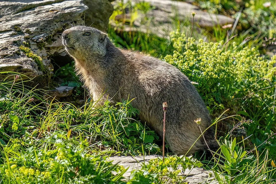
Alpine marmot
Marmota marmota1,297 records © Photography captured by Giles Laurent · CC BY-SA 4.0
Observed species
Occurrences documented via GBIF; they are neither an exhaustive inventory nor proof of current presence.
- Southern Chamois · Rupicapra pyrenaica · 4824
- Brown Trout · Salmo trutta · 2617
- Water Pipit · Anthus spinoletta · 1766
- Black Redstart · Phoenicurus ochruros · 1565
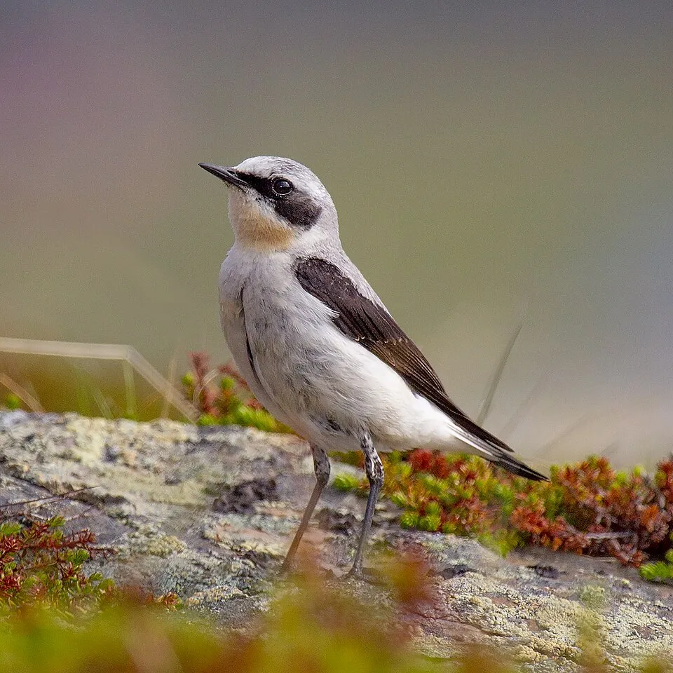
- Northern Wheatear · Oenanthe oenanthe · 1493
- Alpine marmot · Marmota marmota · 1297
- Pyrenean brook salamander · Calotriton asper · 1252
- Spanish Ibex · Capra pyrenaica · 1199
- Common frog · Rana temporaria · 1072
- Alpenrose · Rhododendron ferrugineum · 962
- Grey Partridge · Perdix perdix · 884
- Griffon Vulture · Gyps fulvus · 878
+18 more species
- Alpine Chough · Pyrrhocorax graculus · 866
- Eurasian Chaffinch · Fringilla coelebs · 824
- Red-billed Chough · Pyrrhocorax pyrrhocorax · 814
- Alpine Accentor · Prunella collaris · 794
- Dunnock · Prunella modularis · 767
- Coal tit · Periparus ater · 751
- Pyrenean rock lizard · Iberolacerta bonnali · 738
- Bilberry · Vaccinium myrtillus · 717
- Wild boar · Sus scrofa · 693
- Common Kestrel · Falco tinnunculus · 673
- White-throated Dipper · Cinclus cinclus · 666
- Geranium cinereum · 662
- Black Woodpecker · Dryocopus martius · 633
- Scottish Heather · Calluna vulgaris · 596
- Moss campion · Silene acaulis · 590
- Grey Wagtail · Motacilla cinerea · 575
- Roe deer · Capreolus capreolus · 562
- European robin · Erithacus rubecula · 520
Records: GBIF.org (CC-BY). Names: Wikidata (CC0), GBIF. Photos: Wikimedia Commons.
Conservation challenges
The primary purpose of the site is to preserve its natural habitats and the biodiversity they support. The species recorded (Biodiversity tab) reflect its ecological value. The designations it holds frame its management and the control of land use.
According to Global Forest Change data (University of Maryland, Global Forest Watch), about 21 ha of tree cover were lost within the boundary between 2001 and 2023, peaking in 2013 and 2015. These losses include logging, storms and fires, and do not account for regrowth. According to CORINE Land Cover, land cover here remained almost unchanged between 1990 and 2018 (less than 0.5% of the area affected); only some 25 ha were built over. Since 2016, the European EFFIS system (Copernicus) has mapped 4 fires here, burning about 67 ha within the boundary; the largest, in February 2026 (near Accous), covered 30 ha. At night, the area gives off virtually no artificial light detectable from space (NASA VIIRS Black Marble composite, 2016). According to the Natura 2000 forms, of 45 assessed habitats of European interest, 33 are in excellent condition and 3 in average or reduced condition. According to the Water Framework Directive assessment (2022 river basin management plans, data 2012–2017), 100% of the 117 km of rivers assessed within the site are in good or high ecological status. Other assessed water bodies: lakes, 3 of 3 in good ecological status or better. Since 2000, 11 invasive alien species have been recorded within the site (GBIF observations), 4 of them listed as of Union concern under EU Regulation 1143/2014. Among them: Heracleum mantegazzianum (Giant Hogweed), Reynoutria japonica (Japanese Knotweed) and Vespa velutina (Asian hornet).
Pressure indicators
Tree cover lost
21 ha
2001–2023 · < 1% of the area
20012023
Fires since 2016
67 ha
burned within the boundary (4 mapped fires)
- 2026 · Accous · 30 ha
- 2024 · Urdos · 18 ha
- 2026 · Accous · 11 ha
Light at night
< 1%
of the area gives off artificial light visible from space
DarkLit
Land cover change
< 0.5%
of the area changed, 1990–2018 · CORINE
Rivers and lakes
100%
of the 117 km of assessed rivers in good or high ecological status · WFD 2022
Lakes: 3 of 3 good or better
assessments 2012–2017
Invasive alien species
11
incl. 4 of EU concern · since 2000
 Giant HogweedEU
 Japanese KnotweedEU
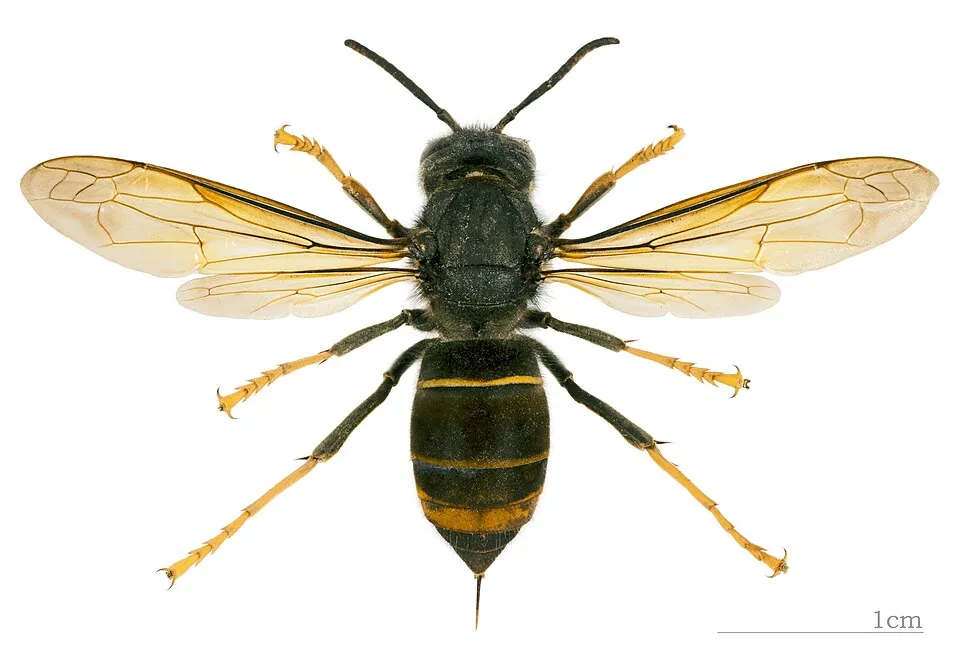 Asian hornetEU
 CoypuEU
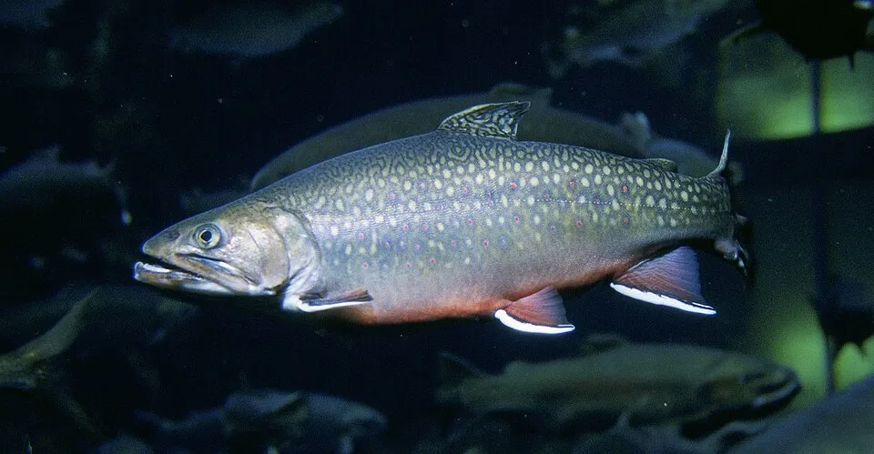 Brook trout
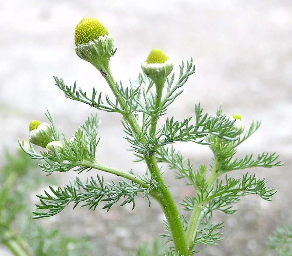 Pineappleweed
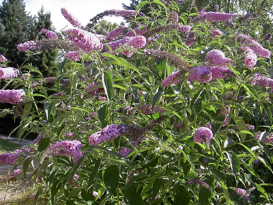 Butterfly-bush
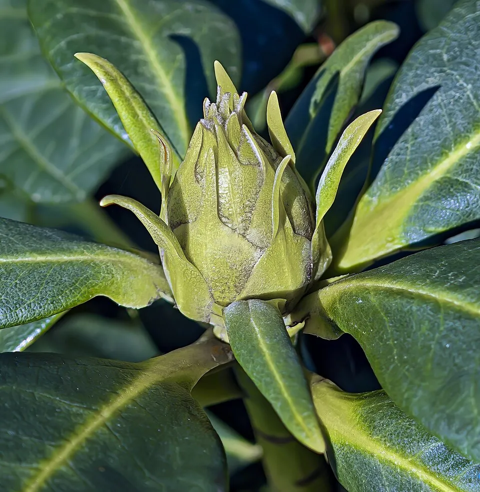 Rhododendron
Photos: Giant Hogweed © anastasiiamerkulova · CC BY 4.0; Japanese Knotweed © W.carter · CC0-1.0; Asian hornet © Didier Descouens · CC BY-SA 4.0; Coypu © Philippe Amelant · CC BY-SA 3.0; Brook trout © Engbretson, Eric · Public domain; Pineappleweed © Krzysztof Ziarnek · CC BY-SA 3.0; Butterfly-bush © --IKAl 15:22, 23 July 2007 (UTC) · CC BY-SA 2.5; Rhododendron © Didier Descouens · CC BY-SA 4.0
Sources: Global Forest Change (Hansen et al., University of Maryland, via Global Forest Watch, CC-BY 4.0); EFFIS, European Commission / Copernicus; NASA Black Marble 2016 (public domain); CORINE Land Cover 2018 (Copernicus) or MODIS.
CORINE Land Cover Change 1990–2018: generated using European Union's Copernicus Land Monitoring Service information (EEA), aggregated by Parkavela; DOI 10.2909/f30f1000-7cf8-43bb-872c-5eb093911b24.
Ecological status of water bodies: European Environment Agency, WISE – Water Framework Directive, 3rd river basin management plans (2022), CC BY 4.0. Official national classification, not comparable between countries.
Invasive alien species: Global Register of Introduced and Invasive Species (ISSG, CC BY 4.0); Union list, Regulation (EU) 1143/2014 (INBO, CC0); GBIF.org records (CC0 / CC BY 4.0), at least 2 per species.
Practical information
Cities and airport
- Pau
44 km as the crow flies - Huesca
68 km as the crow flies - Airport: Tarbes-Lourdes-Pyrénées (LDE)
34 km as the crow flies
Visitor information
- Maison du Parc National des Pyrénées
within the site - Le bureau d'information Touristique d'Artouste
< 1 km from the site boundary - Forfaits Candanchú
< 1 km from the site boundary - Informations/Billetterie
1 km from the site boundary
Parking
29 public car parks listed within the site
Parking du SansanetParking du col des Tentesparking d'AumetParking de Bious-Artigues
Things to see
9 viewpoints · 34 waterfalls · 115 lakes and ponds · 5 caves · 19 glaciers
- Vue sur le Cirque d'Aspe
viewpoint - Cascade Darré Splumouse
waterfall - Lac de Montferrat
lake or pond · 2,374 m - Cueva
cave - Couloir de Gaube
glacier
Where to stay
34 mountain huts · 16 campsites
- Refuge de Bayssellance
Staffed hut · 2,651 m · 58 beds - Aire Camping-cars Station de Piau
campsite - Refuge de la Breche de Roland
Staffed hut · 2,587 m · 57 beds - Aire de bivouac
campsite - Refuge d'Arrémoulit 2265mtrs
Staffed hut · 2,265 m · 28 beds
Hiking
76 waymarked routes listed, including:
GR 10GR 108VarianteHaute Randonnée Pyrénéenne
Trail difficulty
- T1 · easy hiking · 20% · 142 km
- T2 · mountain hiking · 55% · 341 km
- T3–T6 · demanding or alpine hiking · 25% · 155 km
638 km graded out of 896 km of paths
SAC scale (T1–T6) © OpenStreetMap contributors (ODbL): indicative only, check with the park.
Data © OpenStreetMap contributors (ODbL) · Wikidata (CC0)
Waymarked hiking routes
HRP Variante 14.2
15.4 km within the site ↗ 693 m↘ 382 m 1,507–2,147 m
up to T2 · mountain hiking
GR 10 La traversée des Pyrénées - sec.7
10 km within the site ↗ 700 m↘ 181 m 1,472–2,182 m
Tracks © OpenStreetMap contributors (ODbL), clipped to the boundary; elevation gain and profiles computed on the longest section from Mapzen Terrain Tiles (≈ 30 m), indicative only. Indicative difficulty (SAC scale, OpenStreetMap, via Waymarked Trails): check with the park.
Access and visiting
The nearest railway station is Canfranc, about 4 km from the site boundary. Nearest towns of over 50,000 people, as the crow flies: Pau (44 km) and Huesca (68 km). Nearest airport: Tarbes-Lourdes-Pyrénées (LDE), about 34 km away. About 39,000 people live within 20 km of the site boundary, 12,000 of them within 10 km; some 280 people are estimated to live inside (GHSL estimate, 2020). Visitor information on site: Maison du Parc National des Pyrénées, Le bureau d'information Touristique d'Artouste and Forfaits Candanchú. Public car parks listed within the site: 29, including Parking du Sansanet, Parking du col des Tentes and parking d'Aumet. Waymarked hiking routes listed in OpenStreetMap: 76, including GR 10, GR 108, Variante and Haute Randonnée Pyrénéenne. Of the roughly 640 km of paths with a difficulty grade in OpenStreetMap, 20% are easy hiking (T1), 55% mountain hiking (T2) and 25% demanding or alpine hiking (T3–T6). This is indicative only: check with the park. To see: 9 viewpoints, 34 waterfalls, 115 lakes and ponds, 5 caves and 19 glaciers, including Vue sur le Cirque d'Aspe, Cascade Darré Splumouse, Lac de Montferrat (2,374 m) and Cueva. Where to stay: 34 mountain huts and 16 campsites, including Refuge de Bayssellance (2,651 m), Aire Camping-cars Station de Piau and Refuge de la Breche de Roland (2,587 m). To plan a visit (access, opening periods, visitor rules), it is best to consult the official information from the managing body and the official website listed in this page's sources.
Source: OpenStreetMap (ODbL), Wikidata (CC0), October 2026.
When to visit
Mildest period: July and August, with average temperatures of 8 to 9 °C. Average temperatures drop below 0 °C from November to April: frost is common. These averages apply to the site's representative point (2,763 m); higher up it is markedly cooler and snow lasts longer. According to NASA's MODIS satellites (2015–2025 average), snow covers most of the site from November to April, and until May on higher ground, with about 175 snow-covered days a year on average. Day length ranges from about 9 h 03 min in December to 15 h 19 min in June. Wildlife records published on GBIF peak for birds (July and August), plants (July and August), butterflies and moths (July), dragonflies (July and August) and mammals (June). These peaks also reflect when observers are most active.
Source: Copernicus ERA5-Land (C3S), monthly averages 1996–2025 at the representative point, temperatures adjusted for elevation.
Contains modified Copernicus Climate Change Service information 2026. Neither the European Commission nor ECMWF is responsible for any use that may be made of the Copernicus information or data it contains.
Wildlife records calendar
JFMAMJJASOND
Birds
Plants
Butterflies & moths
Dragonflies
Mammals
Monthly records published on GBIF (CC-BY), relative to the busiest month; also reflects observer activity.
Gallery
© W. Bulach · CC BY-SA 4.0
© Moahim · CC BY-SA 4.0
© Tybo2 · CC BY-SA 4.0
© Tournasol7 · CC BY 4.0
© pere prlpz · CC BY-SA 3.0
© Iñaki LL · CC BY-SA 4.0
Sources and licences
- Wikidata: Q738435
- OpenStreetMap: relation 1024513
- Official website: https://www.pyrenees-parcnational.fr/fr
- Wikipedia: en.wikipedia.org/wiki/Pyrénées_National_Park
- WDPA: 662
References
- cds.climate.copernicus.eu: climate · CC-BY-4.0
- registry.opendata.aws: elevation of the reference point, detailed relief · PD
- doi.org: glaciers, population around the site · CC-BY-4.0
- land.copernicus.eu: land cover, land cover change, sea share · COPERNICUS
- wikidata.org: official area, establishment date, nearby cities and airport, access and peaks, lake depths, places to see, official website · CC0-1.0
- eea.europa.eu: bathing water quality, ecological status of waters · CC-BY-4.0
- en.eurovelo.com: EuroVelo cycle routes · ODbL-1.0
- cycling.waymarkedtrails.org: cycle routes · ODbL-1.0
- opentopodata.org: elevations · PD
- forest-fire.emergency.copernicus.eu: wildfires · COPERNICUS
- globalforestwatch.org: tree cover loss · CC-BY-4.0
- gbif.org: seasonality of sightings, invasive alien species, observed species · CC-BY-4.0
- infoterre.brgm.fr: geology · LO-2.0
- pop.culture.gouv.fr: protected heritage · LO-2.0
- hydrosheds.org: lakes · CC-BY-4.0
- natura2000.eea.europa.eu: Natura 2000 habitats and species · CC-BY-4.0
- openstreetmap.org: official name, access and peaks, places to see, trail difficulty, wheelchair access · ODbL-1.0
- earthobservatory.nasa.gov: night light · PD
- hiking.waymarkedtrails.org: route difficulty · ODbL-1.0
- nsidc.org: snow cover · PD
- wikidata.org: Wikipedia article · CC-BY-SA-4.0
Data © OpenStreetMap contributors (ODbL), Wikidata (CC0) and the sources cited.