
Italy · Marine
Capo Carbonara Marine Protected Area
Marine protected area of 14,361 hectares in Italy, established in 1998.
Overview
Marine protected area of 14,361 hectares in Italy, established in 1998.
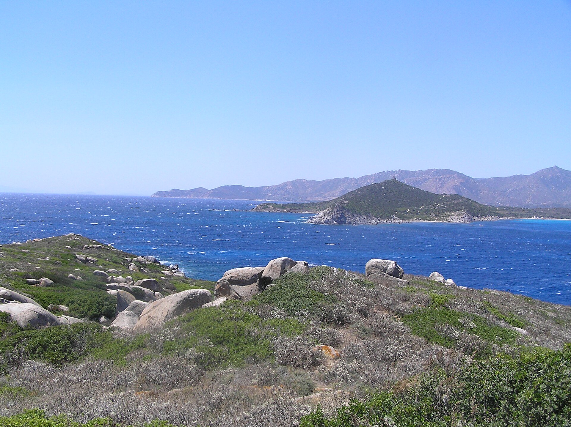
Capo Carbonara Marine Protected Area is located in Italy (Europe). It is a predominantly marine area. Established in 1998, it covers about 14,361 hectares. The site is managed by Villasimius.
Protections and designations
Natura 2000 · habitats (SAC)
Natura 2000 · birds (SPA) · 3 sites
- Capo Carbonara e stagno di Notteri - Punta Molentis ITB043028
- Isola dei Cavoli ITB043027
- Isola Serpentara ITB043026
Designated as a marine protected area. International labels and designations: Natura 2000 network (4 sites). Key dates: established in 1998 and first Natura 2000 site under the Birds Directive in 2009.
In our collections
Timeline
-
1998
Established
-
2009
First Natura 2000 site under the Birds Directive 3 such sites designated up to 2009
Sources: Wikidata (CC0) for establishment and international labels; EEA Natura 2000 database (CC-BY 4.0) for site designation dates.
Frequently asked questions
Where is Capo Carbonara Marine Protected Area?
In Italy (Europe). Representative point: 39.1271° N, 9.5290° E.
How large is Capo Carbonara Marine Protected Area?
About 14,361 hectares (144 km²). It is the 3rd largest of the 12 marine protected areas in Italy covered by Parkavela.
When was Capo Carbonara Marine Protected Area established?
In 1998.
What habitats and landscapes does Capo Carbonara Marine Protected Area include?
A marine area.
Which international labels apply to Capo Carbonara Marine Protected Area?
Natura 2000 network (4 sites).
When is the best time to visit Capo Carbonara Marine Protected Area?
Best time to visit: from April to June, with average temperatures of 15 to 25 °C and moderate rainfall.
Are there historic monuments in Capo Carbonara Marine Protected Area?
Yes. According to Wikidata, 2 monuments protected as Italian national cultural heritage stand within the boundary. For example: “Torre dell'Isola dei Cavoli” in Villasimius and “Torre di San Luigi” in Villasimius.
Can you swim in Capo Carbonara Marine Protected Area?
15 monitored bathing sites lie in or within 1 km of the site; official 2025 classification: 15 excellent (European Environment Agency). Swimming is only permitted at the sites and times authorised locally.
What is the nearest large city to Capo Carbonara Marine Protected Area?
Nearest towns of over 50,000 people, as the crow flies: Quartu Sant'Elena (26 km) and Cagliari (30 km). Nearest airport: Cagliari Elmas (CAG), about 36 km away.
How can I reach Capo Carbonara Marine Protected Area by train?
The nearest railway station is Settimo San Pietro, about 29 km from the site boundary.
Where can I get visitor information on site?
Ufficio Turistico di Villasimius.
Which species can be seen in Capo Carbonara Marine Protected Area?
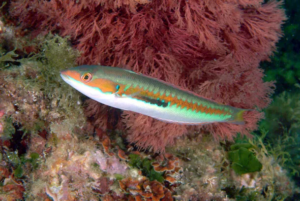
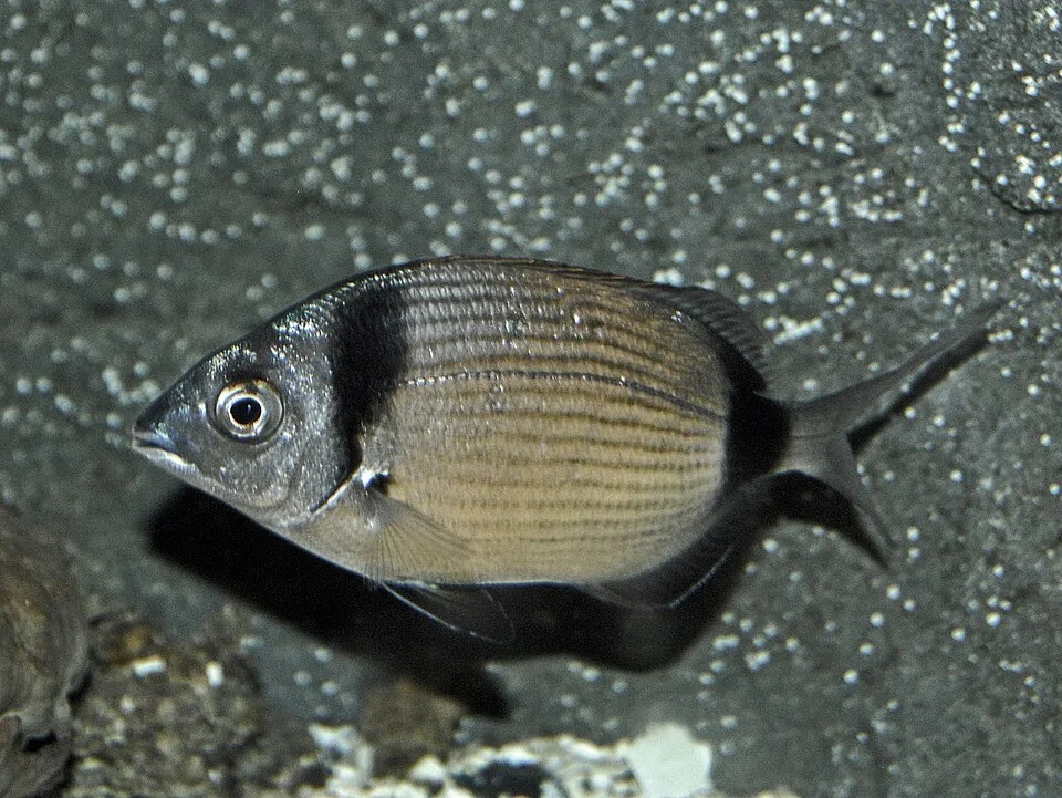
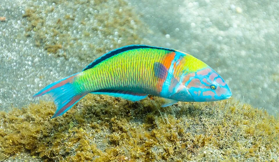
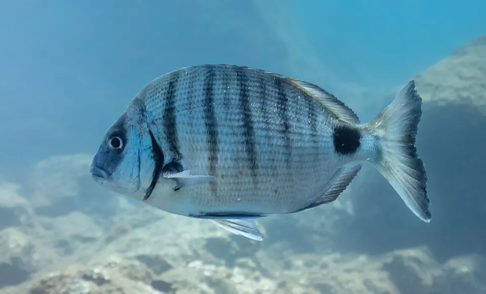
Among the species most often recorded on GBIF are Oblada melanura (Saddled seabream), Coris julis (Mediterranean rainbow wrasse), Diplodus vulgaris (Common Two-banded Seabream) and Thalassoma pavo (Ornate Wrasse).
Who manages Capo Carbonara Marine Protected Area?
Villasimius.
What is the official website of Capo Carbonara Marine Protected Area?
© OpenStreetMap
Download the boundary: GeoJSON · GPX Boundary © OpenStreetMap contributors (ODbL).
Geography
The representative point of the site lies at around 1 m above sea level. Over the 1996–2025 period, the mean annual temperature is about 18.6 °C and total precipitation reaches roughly 380 mm per year. The warmest month is usually July, the coolest January, and the wettest November.
Area
- Area
- 14,361 ha
- Elevation
- 1 m
- Coordinates
- 39.1271, 9.529
Climate
● Mean temperature (°C) · ▮ Precipitation (mm)
Source: Copernicus ERA5-Land (C3S, doi:10.24381/cds.68d2bb30), monthly averages 1996–2025 interpolated to the representative point, temperatures adjusted for elevation.
Contains modified Copernicus Climate Change Service information 2026. Neither the European Commission nor ECMWF is responsible for any use that may be made of the Copernicus information or data it contains.
Natural habitats
The site is almost entirely marine. The seabed reaches about 484 m deep (median depth 64 m; GEBCO bathymetry). The 4 Natura 2000 sites overlapping the area list 22 habitats of European interest (6 priority), the most extensive being Posidonia beds (Posidonion oceanicae), sandbanks which are slightly covered by sea water all the time and Thermo-Mediterranean and pre-desert scrub.
Biodiversity
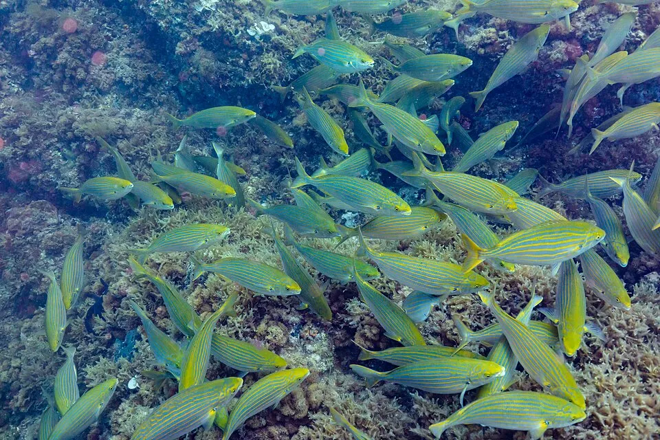
Based on occurrences aggregated by GBIF, several species are regularly recorded within the site. Among the most frequent are Oblada melanura (Saddled seabream), Coris julis (Mediterranean rainbow wrasse), Diplodus vulgaris (Common Two-banded Seabream) and Thalassoma pavo (Ornate Wrasse). The full list of documented taxa is shown below. The overlapping Natura 2000 sites list 27 species of European interest: 19 birds, 2 mammals, 3 reptiles, 2 invertebrates and 1 plant.
Habitats of European interest
From the official forms of the 4 Natura 2000 sites overlapping the area (areas reported for each whole site).
- Posidonia beds (Posidonion oceanicae) priority 2,537 ha
- Sandbanks which are slightly covered by sea water all the time 272 ha
- Thermo-Mediterranean and pre-desert scrub 181 ha
- Reefs 101 ha
- Large shallow inlets and bays 91 ha
- Halo-nitrophilous scrubs (Pegano-Salsoletea) 91 ha
- Oligotrophic to mesotrophic standing waters with vegetation of the Littorelletea uniflorae and/or of the Isoëto-Nanojuncetea 91 ha
- Coastal lagoons priority 34 ha
and 14 more
Species of European interest
Birds · 19
Common Kingfisher (Alcedo atthis) wintering passage, Barbary Partridge (Alectoris barbara) resident, Tawny Pipit (Anthus campestris) passage breeding, Greater Short-toed Lark (Calandrella brachydactyla) passage, Scopoli's Shearwater (Calonectris diomedea) passage breeding, European Nightjar (Caprimulgus europaeus) passage breeding, Western Marsh Harrier (Circus aeruginosus) passage, Little Egret (Egretta garzetta) wintering breeding passage, Peregrine Falcon (Falco peregrinus) resident passage, Audouin's Gull (Larus audouinii) passage breeding, Woodlark (Lullula arborea) resident, Black Kite (Milvus migrans) passage and 7 more
Reptiles · 3
Loggerhead sea turtle (Caretta caretta), European leaf-toed gecko (Euleptes europaea), Hermann's tortoise (Testudo hermanni)
Invertebrates · 2
Red coral (Corallium rubrum), Fan Mussel (Pinna nobilis)
Plants · 1
Source: Natura 2000 standard data forms (EEA, CC-BY 4.0). Not exhaustive: sensitive species are not published.
Species to look out for
Observed species
Occurrences documented via GBIF; they are neither an exhaustive inventory nor proof of current presence.
- Saddled seabream · Oblada melanura · 21
- Mediterranean rainbow wrasse · Coris julis · 21
- Common Two-banded Seabream · Diplodus vulgaris · 19
- Ornate Wrasse · Thalassoma pavo · 18
- Sargo · Diplodus sargus · 18
- Salema porgy · Sarpa salpa · 10
- Mastic Tree · Pistacia lentiscus · 9
- Painted comber · Serranus scriba · 8
- East Atlantic peacock wrasse · Symphodus tinca · 6
- Parrotfish · Sparisoma cretense · 5
- Mediterranean jelly · Cotylorhiza tuberculata · 4
- Striped Red Mullet · Mullus surmuletus · 4
+18 more species
- European shag · Phalacrocorax aristotelis · 4
- Yellow-legged Gull · Larus michahellis · 4
- Mauve stinger · Pelagia noctiluca · 3
- Gilt-head Seabream · Sparus aurata · 3
- Rock Dove · Columba livia · 3
- Roccella lichen · Roccella phycopsis · 3
- Brassica insularis · 3
- Laugier's top shell · Calliostoma laugieri · 3
- Sardinian Warbler · Curruca melanocephala · 3
- Helmutiopsis alba · 2
- Sanguineodiscus aractinus · 2
- Rusty topsnail · Calliostoma conulus · 2
- Five-spotted wrasse · Symphodus roissali · 2
- Blue runner · Caranx crysos · 2
- Eleonora's Falcon · Falco eleonorae · 2
- Barrel medic · Medicago truncatula · 2
- Hoary mustard · Hirschfeldia incana · 2
- Niebla bourgaeana · 2
Records: GBIF.org (CC-BY). Names: Wikidata (CC0), GBIF. Photos: Wikimedia Commons.
Conservation challenges
The primary purpose of the site is to preserve its natural habitats and the biodiversity they support. The species recorded (Biodiversity tab) reflect its ecological value. The designations it holds frame its management and the control of land use.
According to the Natura 2000 forms, of 20 assessed habitats of European interest, 4 are in excellent condition and 4 in average or reduced condition. According to the Water Framework Directive assessment (2022 river basin management plans, data 2019–2021), water bodies assessed within the site: coastal waters, 5 of 5 in good ecological status or better.
Pressure indicators
Built-up land
< 1%
buildings, business areas, roads, quarries
Rivers and lakes
Coastal waters: 5 of 5 good or better
assessments 2019–2021
Sources: Global Forest Change (Hansen et al., University of Maryland, via Global Forest Watch, CC-BY 4.0); EFFIS, European Commission / Copernicus; NASA Black Marble 2016 (public domain); CORINE Land Cover 2018 (Copernicus) or MODIS.
Ecological status of water bodies: European Environment Agency, WISE – Water Framework Directive, 3rd river basin management plans (2022), CC BY 4.0. Official national classification, not comparable between countries.
Practical information
Cities and airport
- Quartu Sant'Elena
26 km as the crow flies - Cagliari
30 km as the crow flies - Airport: Cagliari Elmas (CAG)
36 km as the crow flies
Visitor information
- Ufficio Turistico di Villasimius
2 km from the site boundary
Data © OpenStreetMap contributors (ODbL) · Wikidata (CC0)
Bathing
15 monitored bathing sites in or within 1 km of the site · 2025 classification
Excellent · 15
- Cala di S. Caterina · sea · Excellent
- Campus · sea · Excellent
- Capo Boy · sea · Excellent
- Capo Carbonara · sea · Excellent
- Est Rio Fraischeddu · sea · Excellent
- Foce del Rio Foxi di Villasimius · sea · Excellent
- Fortezza Vecchia · sea · Excellent
- Porto Giunco · sea · Excellent
- Porto Luna · sea · Excellent
- Porto Sa Ruxi-Residence · sea · Excellent
and 5 more
Source: European Environment Agency, official bathing water classification (Directive 2006/7/EC, CC-BY 4.0). Swimming is only permitted at the sites and times authorised locally.
Access and visiting
The nearest railway station is Settimo San Pietro, about 29 km from the site boundary. Nearest towns of over 50,000 people, as the crow flies: Quartu Sant'Elena (26 km) and Cagliari (30 km). Nearest airport: Cagliari Elmas (CAG), about 36 km away. About 19,000 people live within 20 km of the site boundary, 4,300 of them within 10 km (GHSL estimate, 2020). This population has grown by about 7% since 2000. Visitor information on site: Ufficio Turistico di Villasimius. To plan a visit (access, opening periods, visitor rules), it is best to consult the official information from the managing body (Villasimius) and the official website listed in this page's sources.
Source: OpenStreetMap (ODbL), Wikidata (CC0), October 2026.
Built heritage
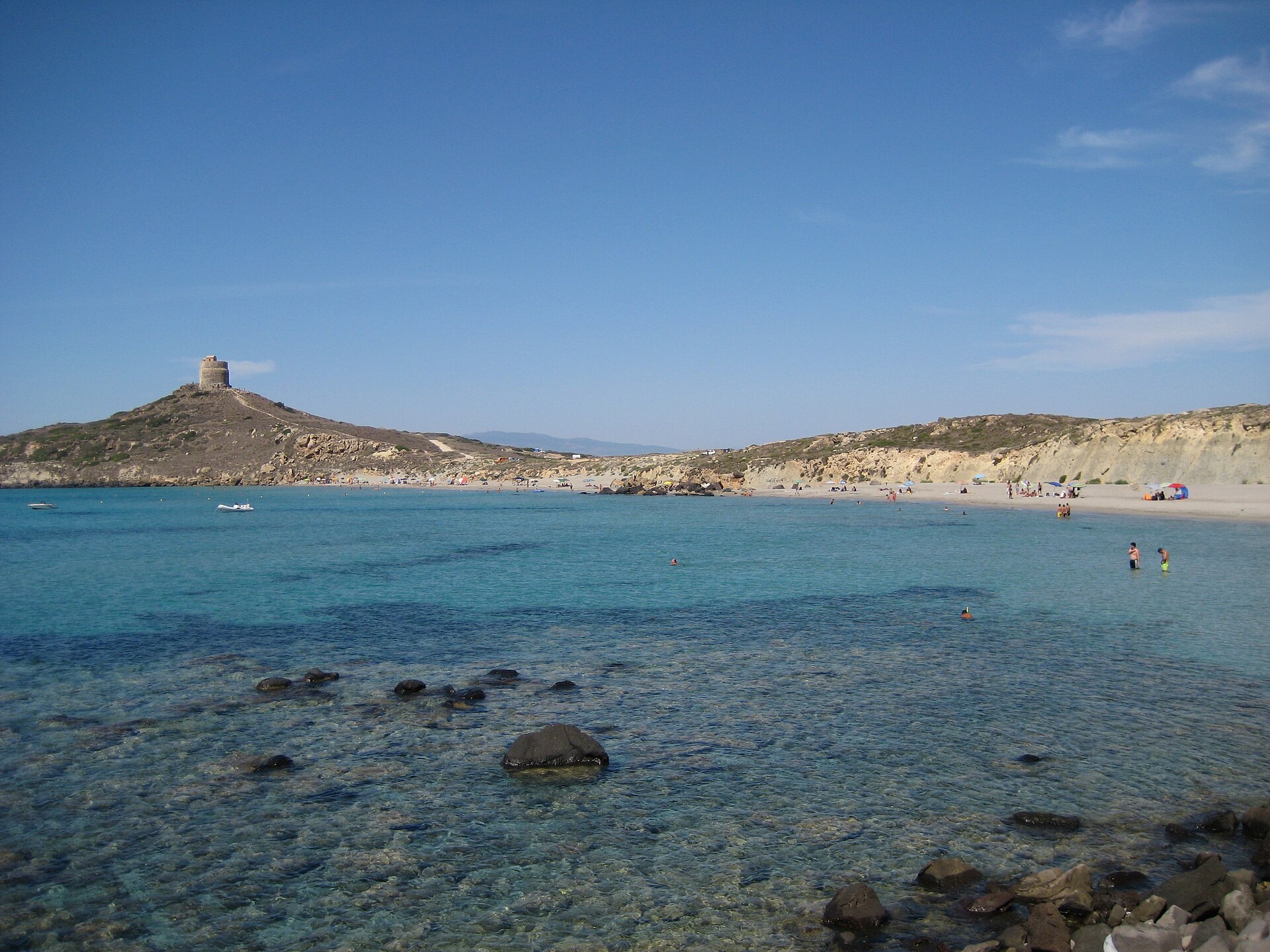
According to Wikidata, 2 monuments protected as Italian national cultural heritage stand within the boundary. Examples include “Torre dell'Isola dei Cavoli” in Villasimius and “Torre di San Luigi” in Villasimius.
-
Torre dell'Isola dei Cavoli
Villasimius -
Torre di San Luigi
Villasimius
Source: Wikidata (CC0), monuments in each country’s official heritage protection registers, at national or regional level. Each item links to its Wikidata entry.
When to visit
Best time to visit: from April to June, with average temperatures of 15 to 25 °C and moderate rainfall. Day length ranges from about 9 h 26 min in December to 14 h 54 min in June. Wildlife records published on GBIF peak for birds (June and July) and plants (September). These peaks also reflect when observers are most active.
Source: Copernicus ERA5-Land (C3S), monthly averages 1996–2025 at the representative point, temperatures adjusted for elevation.
Contains modified Copernicus Climate Change Service information 2026. Neither the European Commission nor ECMWF is responsible for any use that may be made of the Copernicus information or data it contains.
Wildlife records calendar
JFMAMJJASOND
Birds
Plants
Monthly records published on GBIF (CC-BY), relative to the busiest month; also reflects observer activity.
Gallery
© Raffaelino · CC BY 3.0
© Raffaelino · CC BY-SA 3.0
© Geo atom ant · Public domain
© Alistair young · CC BY 2.0
© dronepicr · CC BY 2.0
© Alistair young · CC BY 2.0
Sources and licences
- Wikidata: Q3622031
- OpenStreetMap: relation 15012960
- Official website: http://www.ampcapocarbonara.it/
- Wikipedia: it.wikipedia.org/wiki/Area_naturale_marina_protetta_Capo_Carbonara
- WDPA: 178838
References
- cds.climate.copernicus.eu: climate · CC-BY-4.0
- registry.opendata.aws: elevation of the reference point · PD
- land.copernicus.eu: land cover, land cover change, sea share · COPERNICUS
- doi.org: population around the site · CC-BY-4.0
- wikidata.org: official area, establishment date, protected heritage, managing body, nearby cities and airport, access and peaks, places to see, official website · CC0-1.0
- eea.europa.eu: bathing water quality, ecological status of waters · CC-BY-4.0
- gebco.net: depths · PD
- opentopodata.org: elevations · PD
- gbif.org: seasonality of sightings, invasive alien species, observed species · CC-BY-4.0
- natura2000.eea.europa.eu: Natura 2000 habitats and species · CC-BY-4.0
- openstreetmap.org: official name, access and peaks, places to see, trail difficulty · ODbL-1.0
- wikidata.org: Wikipedia article · CC-BY-SA-4.0
Data © OpenStreetMap contributors (ODbL), Wikidata (CC0) and the sources cited.