
Italy · Terrestrial
Gennargentu National Park
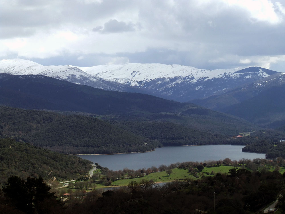
National park of 73,940 hectares in Italy, established in 1998.
Overview
National park of 73,940 hectares in Italy, established in 1998.
Gennargentu National Park is located in Italy (Europe). It is a predominantly terrestrial area. Established in 1998, it covers about 73,940 hectares.
Protections and designations
Natura 2000 · habitats (SAC) · 5 sites
- Golfo di Orosei ITB020014
- Monti del Gennargentu ITB021103
- Riu Sicaderba ITB022215
- Su de Maccioni - Texile di Aritzo ITB022217
- Supramonte di Oliena, Orgosolo e Urzulei - Su Sercone ITB022212
Natura 2000 · birds (SPA) · 3 sites
- Golfo di Orosei ITB020014
- Monti del Gennargentu ITB021103
- Supramonte di Oliena, Orgosolo e Urzulei - Su Sercone ITB022212
Protected as a national park. International labels and designations: Natura 2000 network (5 sites). Key dates: established in 1998 and first Natura 2000 site under the Birds Directive in 2009.
In our collections
Timeline
-
1998
Established
-
2009
First Natura 2000 site under the Birds Directive 3 such sites designated up to 2009
Sources: Wikidata (CC0) for establishment and international labels; EEA Natura 2000 database (CC-BY 4.0) for site designation dates.
Frequently asked questions
Where is Gennargentu National Park?
In Italy (Europe). Representative point: 39.9897° N, 9.3247° E.
How large is Gennargentu National Park?
About 73,940 hectares (739 km²). It is the 9th largest of the 26 national parks in Italy covered by Parkavela.
When was Gennargentu National Park established?
In 1998.
What habitats and landscapes does Gennargentu National Park include?
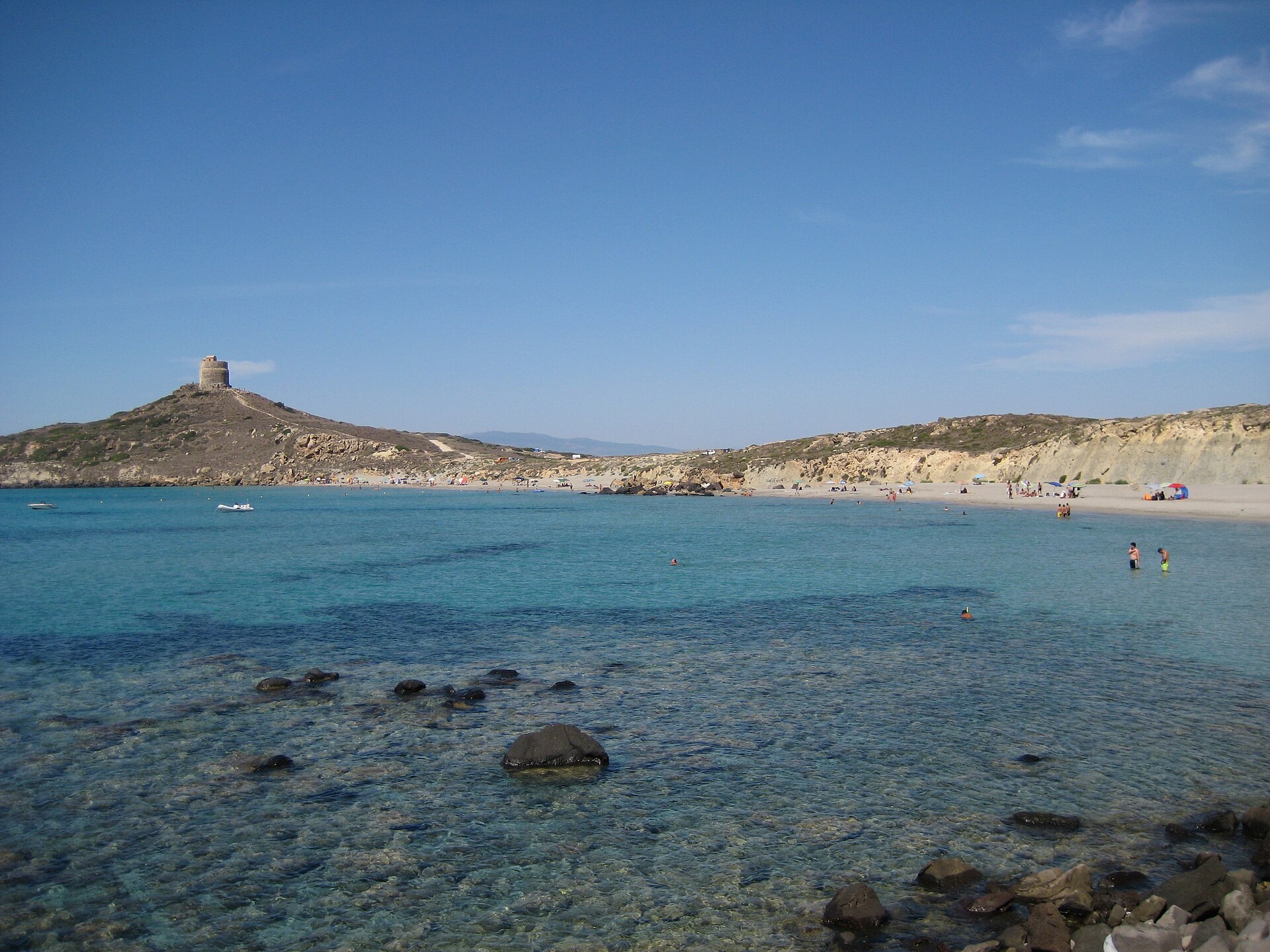
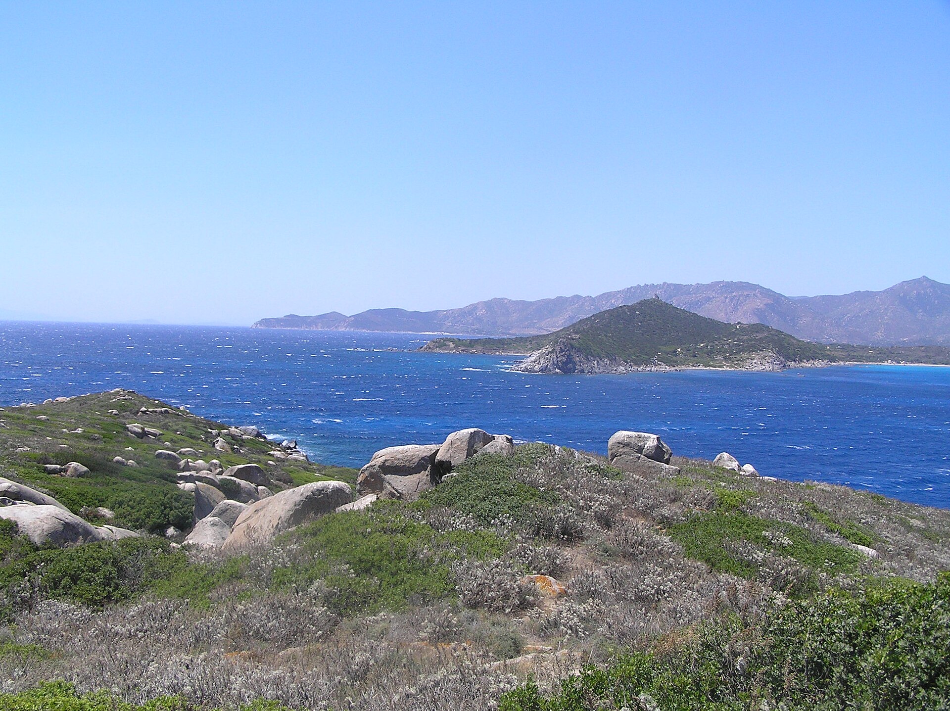
A terrestrial area, with forests and mountains.
What rocks lie beneath Gennargentu National Park?
According to the European 1:1 million geological map (EGDI), the bedrock consists mainly of sandstones (44% of sampled points), limestones (31%) and granites (19%). These are mostly sedimentary rocks. The geological units date mainly from the Cambrian (44% of sampled points).
What is the highest point of Gennargentu National Park?
Perda Cràpias/Punta La Marmora, at 1,833 m (OpenStreetMap).
What are the main summits of Gennargentu National Park?
Perda Cràpias/Punta La Marmora (1,833 m), Punta della Croce (1,829 m), Bruncu Spina (1,828 m), Punta Florisa (1,822 m) and Su Mullone de Enna Orisa (1,819 m) (OpenStreetMap).
Which international labels apply to Gennargentu National Park?
Natura 2000 network (5 sites).
When is the best time to visit Gennargentu National Park?
Best time to visit: from June to September, with average temperatures of 12 to 18 °C and moderate rainfall.
What is there to see in Gennargentu National Park?
61 viewpoints, 6 waterfalls, 6 lakes and ponds, 3 natural arches and 78 caves, including Punta Muggianeddu (1,452 m), Cascata Sa Giuntura, Lacu and Arco Suttaterra (OpenStreetMap).
Where can I stay in Gennargentu National Park?
15 mountain huts and 4 campsites, including Cuile Su Vicu I (370 m), Agriturismo Camping Nuraghe Mannu and Rifugio Picave (130 m) (OpenStreetMap).
Are there historic monuments in Gennargentu National Park?
Yes. According to Wikidata, 4 monuments protected as Italian national cultural heritage stand within the boundary. For example: “Church of the Assumption” in Sorgono, “Nuragic complex of Sa Sedda e Sos Carros” in Oliena and “Miniera di Funtana Raminosa” in Gadoni.
Can you swim in Gennargentu National Park?
6 monitored bathing sites lie in or within 1 km of the site; official 2025 classification: 6 excellent (European Environment Agency). Swimming is only permitted at the sites and times authorised locally.
What is the nearest large city to Gennargentu National Park?
Nearest towns of over 50,000 people, as the crow flies: Quartu Sant'Elena (68 km) and Olbia (68 km). Nearest airport: Olbia Costa Smeralda (OLB), about 66 km away.
How can I reach Gennargentu National Park by train?
The nearest railway station is Abbasanta, about 22 km from the site boundary.
Where can I get visitor information on site?
Ecomuseo del Flumendosa, Caserma Forestale Ilodei Malu and Jeep transfer - pick up point.
Are there waymarked hiking trails in Gennargentu National Park?
Yes. Waymarked hiking routes listed in OpenStreetMap: 91, including Cammino di Santo Jacu. The “181” route runs for about 17 km through the site, with some 180 m of ascent on its longest section.
Which species can be seen in Gennargentu National Park?
Among the species most often recorded on GBIF are Fringilla coelebs (Eurasian Chaffinch), Pistacia lentiscus (Mastic Tree), Corvus corax (Northern Raven) and Garrulus glandarius (Eurasian Jay).
What is the official website of Gennargentu National Park?
© OpenStreetMap
Download the boundary: GeoJSON · GPX Boundary © OpenStreetMap contributors (ODbL).
Geography
The representative point of the site lies at around 1,805 m above sea level. Over the 1996–2025 period, the mean annual temperature is about 7.5 °C and total precipitation reaches roughly 730 mm per year. The warmest month is usually July, the coolest January, and the wettest November. According to the European 1:1 million geological map (EGDI), the bedrock consists mainly of sandstones (44% of sampled points), limestones (31%) and granites (19%). These are mostly sedimentary rocks. The geological units date mainly from the Cambrian (44% of sampled points).
Area
- Area
- 73,940 ha
- Elevation
- 1,805 m
- Median elevation
- 881 m
- Mean slope
- 18°
- Coordinates
- 39.9897, 9.3247
Terrain: Mapzen Terrain Tiles (SRTM, USGS)
Elevation bands
- below 500 m 16%
- 500–1,000 m 50%
- 1,000–1,500 m 32%
- 1,500–2,000 m 2%
share of the site in each elevation band (smoothed terrain model: summits are rounded off) · Terrain: Mapzen Terrain Tiles (SRTM, USGS)
Bedrock
- Sandstones 44 %
- Limestones 31 %
- Granites 19 %
- Unconsolidated deposits 6 %
Sedimentary rocks 81 % · Igneous rocks 19 % · Main age: Cambrian (44%)
Source: EGDI 1:1M geological map (EuroGeoSurveys and national geological surveys), CC BY 4.0 · 16 sampled points within the site.
Main summits
- Perda Cràpias/Punta La Marmora1,833 m
- Punta della Croce1,829 m
- Bruncu Spina1,828 m
- Punta Florisa1,822 m
- Su Mullone de Enna Orisa1,819 m
- Bruncu de Maide1,703 m
- Punta Erba Irdes1,689 m
- Monte Arbu1,567 m
- Punta Corra Cherbina1,562 m
- Punta 'E S'Abile1,554 m
Data © OpenStreetMap contributors (ODbL)
Climate
● Mean temperature (°C) · ▮ Precipitation (mm)
Source: Copernicus ERA5-Land (C3S, doi:10.24381/cds.68d2bb30), monthly averages 1996–2025 interpolated to the representative point, temperatures adjusted for elevation.
Contains modified Copernicus Climate Change Service information 2026. Neither the European Commission nor ECMWF is responsible for any use that may be made of the Copernicus information or data it contains.
Natural habitats
According to CORINE Land Cover (2018), the site is mainly made up of forests (45%), Mediterranean scrub (28%) and grassland and meadows (10%). Woodland is mostly broadleaved. Elevation ranges from about 60 m to 1,833 m (highest point: Perda Cràpias/Punta La Marmora). Median elevation is 881 m, and 34% of the site lies above 1,000 m (SRTM elevation model). The terrain is steep: 59% of slopes exceed 15° (mean slope 18°). The 5 Natura 2000 sites overlapping the area list 41 habitats of European interest (8 priority), the most extensive being Quercus ilex and Quercus rotundifolia forests, arborescent matorral with Juniperus spp. and pseudo-steppe with grasses and annuals of the Thero-Brachypodietea.
Biodiversity
Based on occurrences aggregated by GBIF, several species are regularly recorded within the site. Among the most frequent are Fringilla coelebs (Eurasian Chaffinch), Pistacia lentiscus (Mastic Tree), Corvus corax (Northern Raven) and Garrulus glandarius (Eurasian Jay). The full list of documented taxa is shown below. The overlapping Natura 2000 sites list 152 species of European interest: 104 birds, 16 mammals, 10 reptiles, 6 amphibians, 1 fish, 6 invertebrates and 9 plants.
Habitats of European interest
From the official forms of the 5 Natura 2000 sites overlapping the area (areas reported for each whole site).
- Quercus ilex and Quercus rotundifolia forests 22,259 ha
- Arborescent matorral with Juniperus spp. 7,079 ha
- Pseudo-steppe with grasses and annuals of the Thero-Brachypodietea priority 4,739 ha
- Endemic phryganas of the Euphorbio-Verbascion 4,554 ha
- Calcareous rocky slopes with chasmophytic vegetation 2,108 ha
- Alpine and Boreal heaths 1,781 ha
- Posidonia beds (Posidonion oceanicae) priority 1,738 ha
- Thermo-Mediterranean and pre-desert scrub 1,604 ha
and 33 more
Species of European interest
Birds · 104
Goshawk (Accipiter gentilis arrigonii) resident, Eurasian Sparrowhawk (Accipiter nisus) passage resident wintering, Common Sandpiper (Actitis hypoleucos) passage, Eurasian Skylark (Alauda arvensis) passage breeding wintering, Common Kingfisher (Alcedo atthis) passage, Barbary Partridge (Alectoris barbara) resident, Mallard (Anas platyrhynchos) passage, Tawny Pipit (Anthus campestris) breeding passage, Meadow Pipit (Anthus pratensis) wintering passage, Water Pipit (Anthus spinoletta) wintering passage breeding, Tree Pipit (Anthus trivialis) passage, Common Swift (Apus apus) passage breeding and 92 more
Mammals · 16
Barbastelle (Barbastella barbastellus), Corsican red deer (Cervus elaphus corsicanus), European wildcat (Felis silvestris), European pine marten (Martes martes), Common bent-wing bat (Miniopterus schreibersii), Mediterranean Monk Seal (Monachus monachus), Long-fingered bat (Myotis capaccinii), Geoffroy's bat (Myotis emarginatus), Felten's myotis (Myotis punicus), Lesser noctule (Nyctalus leisleri), European mouflon (Ovis aries musimon), Common pipistrelle (Pipistrellus pipistrellus) and 4 more
Reptiles · 10
Fitzinger's Algyroides (Algyroides fitzingeri), Bedriaga's Rock Lizard (Archaeolacerta bedriagae), Loggerhead sea turtle (Caretta caretta), Ocellated skink (Chalcides ocellatus), European Pond Turtle (Emys orbicularis), European leaf-toed gecko (Euleptes europaea), Horseshoe Whip Snake (Hemorrhois hippocrepis), Western Whip Snake (Hierophis viridiflavus), Italian wall lizard (Podarcis siculus), Tyrrhenian Wall Lizard (Podarcis tiliguerta)
Amphibians · 6
Green Toad (Bufotes viridis complex), Tyrrhenian painted frog (Discoglossus sardus), Sardinian brook salamander (Euproctus platycephalus), Sardinian tree frog (Hyla sarda), Imperial cave salamander (Speleomantes imperialis), Supramonte Cave Salamander (Speleomantes supramontis)
Fish · 1
Sicilian Trout (Salmo cetti)
Invertebrates · 6
Greater Capricorn Beetle (Cerambyx cerdo), Red coral (Corallium rubrum), Corsican Fritillary (Fabriciana elisa), Corsican Swallowtail (Papilio hospiton), Ribbed Mediterranean limpet (Patella ferruginea), Fan Mussel (Pinna nobilis)
Plants · 9
Brassica insularis, Carex panormitana, Centranthus amazonum, Euphrasia nana, Great Yellow Gentian (Gentiana lutea), Herniaria litardierei, Thistle (Lamyropsis microcephala), Marsilea strigosa, Sardinian currant (Ribes sardoum)
Source: Natura 2000 standard data forms (EEA, CC-BY 4.0). Not exhaustive: sensitive species are not published.
Species to look out for
Plant
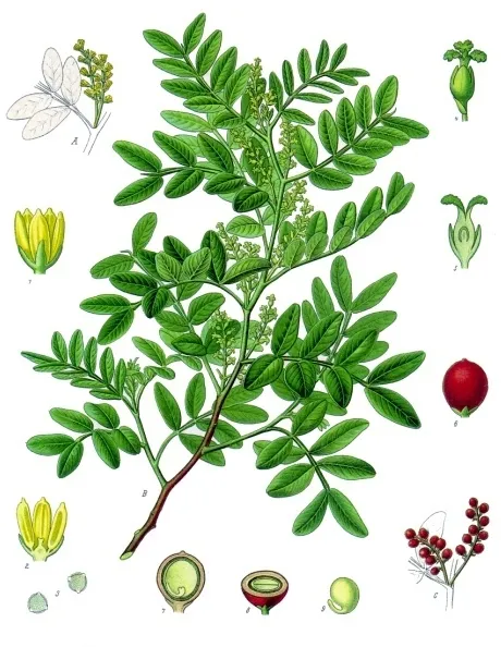
Mastic Tree
Pistacia lentiscus89 records © Franz Eugen Köhler, Köhler's Medizinal-Pflanzen · Public domain

Observed species
Occurrences documented via GBIF; they are neither an exhaustive inventory nor proof of current presence.
- Eurasian Chaffinch · Fringilla coelebs · 89
- Mastic Tree · Pistacia lentiscus · 89
- Northern Raven · Corvus corax · 88
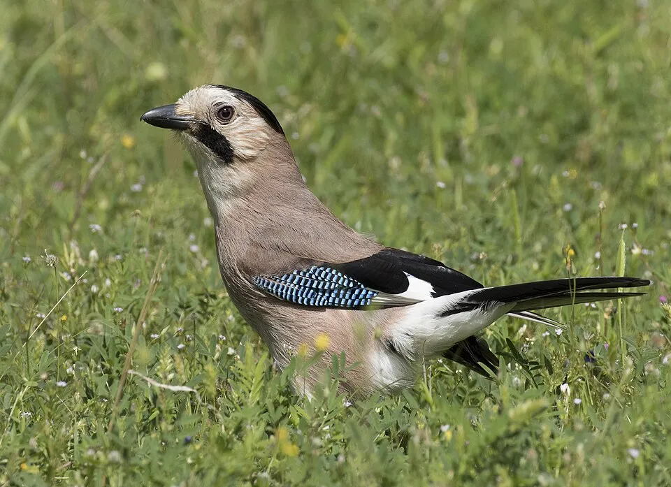
- Eurasian Jay · Garrulus glandarius · 84
- Common Blackbird · Turdus merula · 81
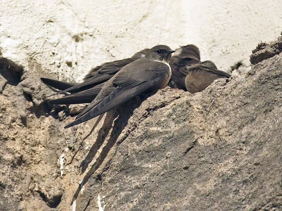
- Eurasian Crag Martin · Ptyonoprogne rupestris · 78
- Cirl Bunting · Emberiza cirlus · 76
- European robin · Erithacus rubecula · 74
- Coal tit · Periparus ater · 72
- Eurasian blue tit · Cyanistes caeruleus · 70
- Eurasian Blackcap · Sylvia atricapilla · 67
- Great tit · Parus major · 67
+18 more species
- Common Firecrest · Regulus ignicapilla · 60
- Corsican finch · Carduelis corsicana · 53
- Spotted Flycatcher · Muscicapa striata · 50
- Marmora's Warbler · Sylvia sarda · 50
- European Goldfinch · Carduelis carduelis · 49
- Sardinian Warbler · Curruca melanocephala · 47
- Sardinian pika · Prolagus sardus · 46
- Common Wood Pigeon · Columba palumbus · 46
- Holm Oak · Quercus ilex · 43
- European mouflon · Ovis aries musimon · 41
- Woodlark · Lullula arborea · 40
- Holm-oak Pigmy · Stigmella suberivora · 40
- Common Linnet · Linaria cannabina · 40
- Tyrrhenian Wall Lizard · Podarcis tiliguerta · 38
- Great Spotted Woodpecker · Dendrocopos major · 38
- Illyrian Star Lily · Pancratium illyricum · 38
- Grey Wagtail · Motacilla cinerea · 37
- Alpine Swift · Tachymarptis melba · 36
Records: GBIF.org (CC-BY). Names: Wikidata (CC0), GBIF. Photos: Wikimedia Commons.
Conservation challenges
The primary purpose of the site is to preserve its natural habitats and the biodiversity they support. The species recorded (Biodiversity tab) reflect its ecological value. The designations it holds frame its management and the control of land use.
According to Global Forest Change data (University of Maryland, Global Forest Watch), about 1,100 ha of tree cover were lost within the boundary between 2001 and 2023 (1% of its area), peaking in 2005 and 2012. These losses include logging, storms and fires, and do not account for regrowth. Apart from forest felling and regrowth (about 2,510 ha in total), land cover remained almost unchanged between 1990 and 2018 according to CORINE Land Cover; only some 88 ha were built over. Since 2016, the European EFFIS system (Copernicus) has mapped 4 fires here, burning about 94 ha within the boundary; the largest, in August 2021 (near Villagrande Strisaili), covered 52 ha. At night, 1% of the area gives off artificial light detectable from space (NASA VIIRS Black Marble composite, 2016): it ranks among the darkest places in the atlas for this country. According to the Natura 2000 forms, of 34 assessed habitats of European interest, 18 are in excellent condition and 5 in average or reduced condition. According to the Water Framework Directive assessment (2022 river basin management plans, data 2016–2021), 100% of the 183 km of rivers assessed within the site are in good or high ecological status. Other assessed water bodies: lakes, 2 of 3 in good ecological status or better; coastal waters, 1 of 1 in good ecological status or better. Invasive alien species have been recorded within the site since 2000 (GBIF observations). Among them: Gomphocarpus fruticosus (Swan Plant), Populus canadensis (Canada poplar) and Xanthium spinosum (Spiny cocklebur).
Pressure indicators
Tree cover lost
1,098 ha
2001–2023 · 1% of the area
20012023
Fires since 2016
94 ha
burned within the boundary (4 mapped fires)
- 2021 · Villagrande Strisaili · 52 ha
- 2025 · Seulo · 21 ha
- 2022 · Desulo · 11 ha
Light at night
1%
of the area gives off artificial light visible from space
DarkLit
Built-up land
< 1%
buildings, business areas, roads, quarries · farmland 3%
Land cover change
< 0.5%
of the area changed, 1990–2018 · CORINE
forest felling and regrowth: 2,510 ha in total
Rivers and lakes
100%
of the 183 km of assessed rivers in good or high ecological status · WFD 2022
Lakes: 2 of 3 good or better
Coastal waters: 1 of 1 good or better
assessments 2016–2021
Invasive alien species
3
recorded since 2000
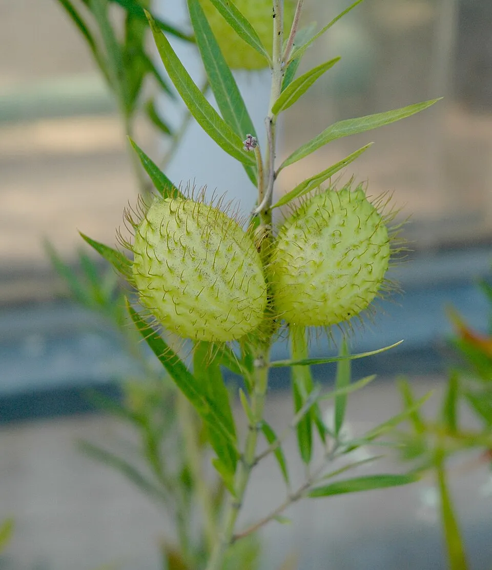 Swan Plant
Canada poplar
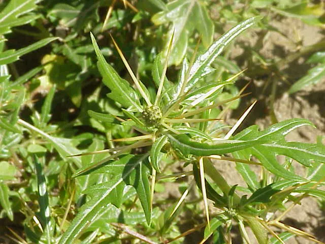 Spiny cocklebur
Photos: Swan Plant © Carstor · CC BY-SA 3.0; Spiny cocklebur © Kurt Stüber [1] · CC BY-SA 3.0
Sources: Global Forest Change (Hansen et al., University of Maryland, via Global Forest Watch, CC-BY 4.0); EFFIS, European Commission / Copernicus; NASA Black Marble 2016 (public domain); CORINE Land Cover 2018 (Copernicus) or MODIS.
CORINE Land Cover Change 1990–2018: generated using European Union's Copernicus Land Monitoring Service information (EEA), aggregated by Parkavela; DOI 10.2909/f30f1000-7cf8-43bb-872c-5eb093911b24.
Ecological status of water bodies: European Environment Agency, WISE – Water Framework Directive, 3rd river basin management plans (2022), CC BY 4.0. Official national classification, not comparable between countries.
Invasive alien species: Global Register of Introduced and Invasive Species (ISSG, CC BY 4.0); Union list, Regulation (EU) 1143/2014 (INBO, CC0); GBIF.org records (CC0 / CC BY 4.0), at least 2 per species.
Practical information
Cities and airport
- Quartu Sant'Elena
68 km as the crow flies - Olbia
68 km as the crow flies - Airport: Olbia Costa Smeralda (OLB)
66 km as the crow flies
Visitor information
- Ecomuseo del Flumendosa
< 1 km from the site boundary - Caserma Forestale Ilodei Malu
within the site - Jeep transfer - pick up point
within the site - Centro Visita di Montarbu
within the site
Parking
57 public car parks listed within the site
Planu e MurtaPiazza Eleonora D'ArboreaS'ArenaSu Filariu
Things to see
61 viewpoints · 6 waterfalls · 6 lakes and ponds · 3 natural arches · 78 caves
- Punta Muggianeddu
viewpoint · 1,452 m - Cascata Sa Giuntura
waterfall - Lacu
lake or pond - Arco Suttaterra
natural arch - Grotta di Punta Sa Pruna
cave · 1,326 m
Where to stay
15 mountain huts · 4 campsites
- Cuile Su Vicu I
Unstaffed hut · 370 m - Agriturismo Camping Nuraghe Mannu
campsite - Rifugio Picave
Unstaffed hut · 130 m · 9 beds - Caserma Ula
campsite - Caraxiu
Unstaffed hut
Hiking
91 waymarked routes listed, including:
Cammino di Santo Jacu
Trail difficulty
- T1 · easy hiking · 15% · 60 km
- T2 · mountain hiking · 45% · 167 km
- T3–T6 · demanding or alpine hiking · 40% · 161 km
388 km graded out of 1,007 km of paths
SAC scale (T1–T6) © OpenStreetMap contributors (ODbL): indicative only, check with the park.
Data © OpenStreetMap contributors (ODbL) · Wikidata (CC0)
Waymarked hiking routes
445 Unnamed route
3.4 km within the site ↗ 0 m↘ 412 m 503–920 m
up to T2 · mountain hiking faint path in places
CSJ 10 Cammino di Santo Jacu - Tappa 10
9.4 km within the site ↗ 272 m↘ 268 m 883–1,125 m
CSJ 11 Cammino di Santo Jacu - Tappa 11
5.1 km within the site ↗ 51 m↘ 355 m 646–994 m
CSJ 12 Cammino di Santo Jacu - Tappa 12
2 km within the site ↗ 24 m↘ 60 m 652–693 m
CSJ 9 Cammino di Santo Jacu - Tappa 9
7.1 km within the site ↗ 39 m↘ 228 m 781–977 m
Tracks © OpenStreetMap contributors (ODbL), clipped to the boundary; elevation gain and profiles computed on the longest section from Mapzen Terrain Tiles (≈ 30 m), indicative only. Indicative difficulty (SAC scale, OpenStreetMap, via Waymarked Trails): check with the park.
Bathing
6 monitored bathing sites in or within 1 km of the site · 2025 classification
Excellent · 6
- Cala Luna · sea · Excellent
- Cala Mariolu · sea · Excellent
- Cala Sisine · sea · Excellent
- Pedra Longa · sea · Excellent
- Spiaggia 'Fuile' · sea · Excellent
- Spiaggia 'Ziu Martine' · sea · Excellent
Source: European Environment Agency, official bathing water classification (Directive 2006/7/EC, CC-BY 4.0). Swimming is only permitted at the sites and times authorised locally.
Access and visiting
The nearest railway station is Abbasanta, about 22 km from the site boundary. Nearest towns of over 50,000 people, as the crow flies: Quartu Sant'Elena (68 km) and Olbia (68 km). Nearest airport: Olbia Costa Smeralda (OLB), about 66 km away. About 170,000 people live within 20 km of the site boundary, 91,000 of them within 10 km; some 3,500 people are estimated to live inside (GHSL estimate, 2020). This population has fallen by about 14% since 2000. Visitor information on site: Ecomuseo del Flumendosa, Caserma Forestale Ilodei Malu and Jeep transfer - pick up point. Public car parks listed within the site: 57, including Planu e Murta, Piazza Eleonora D'Arborea and S'Arena. Waymarked hiking routes listed in OpenStreetMap: 91, including Cammino di Santo Jacu. Of the roughly 390 km of paths with a difficulty grade in OpenStreetMap, 15% are easy hiking (T1), 45% mountain hiking (T2) and 40% demanding or alpine hiking (T3–T6). This is indicative only: check with the park. To see: 61 viewpoints, 6 waterfalls, 6 lakes and ponds, 3 natural arches and 78 caves, including Punta Muggianeddu (1,452 m), Cascata Sa Giuntura, Lacu and Arco Suttaterra. Where to stay: 15 mountain huts and 4 campsites, including Cuile Su Vicu I (370 m), Agriturismo Camping Nuraghe Mannu and Rifugio Picave (130 m). To plan a visit (access, opening periods, visitor rules), it is best to consult the official information from the managing body and the official website listed in this page's sources.
Source: OpenStreetMap (ODbL), Wikidata (CC0), October 2026.
Built heritage
According to Wikidata, 4 monuments protected as Italian national cultural heritage stand within the boundary. Examples include “Church of the Assumption” in Sorgono, “Nuragic complex of Sa Sedda e Sos Carros” in Oliena and “Miniera di Funtana Raminosa” in Gadoni.
2 prehistoric and archaeological sites1 religious building1 bridge, lighthouse, mill or working building
-
Church of the Assumption
Sorgono -
Nuragic complex of Sa Sedda e Sos Carros
Oliena -
Miniera di Funtana Raminosa
Gadoni -
Tiscali
Dorgali
Source: Wikidata (CC0), monuments in each country’s official heritage protection registers, at national or regional level. Each item links to its Wikidata entry.
When to visit
Best time to visit: from June to September, with average temperatures of 12 to 18 °C and moderate rainfall. Average temperatures drop below 0 °C in January and February: frost is common. These averages apply to the site's representative point (1,805 m); higher up it is markedly cooler and snow lasts longer. Day length ranges from about 9 h 20 min in December to 15 h 00 min in June. Wildlife records published on GBIF peak for birds (December and January), plants (from April to June), butterflies and moths (June and July), dragonflies (June and July) and mammals (April). These peaks also reflect when observers are most active.
Source: Copernicus ERA5-Land (C3S), monthly averages 1996–2025 at the representative point, temperatures adjusted for elevation.
Contains modified Copernicus Climate Change Service information 2026. Neither the European Commission nor ECMWF is responsible for any use that may be made of the Copernicus information or data it contains.
Wildlife records calendar
JFMAMJJASOND
Birds
Plants
Butterflies & moths
Dragonflies
Mammals
Monthly records published on GBIF (CC-BY), relative to the busiest month; also reflects observer activity.
Gallery
© Gianfranco · CC BY-SA 4.0
© Max.oppo · CC BY-SA 3.0
© Tuverivalentina89 · CC BY-SA 4.0
© Holger Krisp · CC BY 3.0
© Max.oppo · CC BY-SA 3.0
© Anne Mcglone · CC BY-SA 4.0
Sources and licences
- Wikidata: Q1425154
- OpenStreetMap: relation 15657352
- Official website: http://www.parcogennargentu.it/
- Wikipedia: en.wikipedia.org/wiki/Gulf_of_Orosei_and_Gennargentu_National_Park
- WDPA: 63647
References
- cds.climate.copernicus.eu: climate · CC-BY-4.0
- registry.opendata.aws: elevation of the reference point, detailed relief · PD
- land.copernicus.eu: land cover, land cover change, sea share · COPERNICUS
- doi.org: population around the site · CC-BY-4.0
- wikidata.org: official area, establishment date, protected heritage, nearby cities and airport, access and peaks, lake depths, places to see, official website · CC0-1.0
- eea.europa.eu: bathing water quality, ecological status of waters · CC-BY-4.0
- en.eurovelo.com: EuroVelo cycle routes · ODbL-1.0
- cycling.waymarkedtrails.org: cycle routes · ODbL-1.0
- opentopodata.org: elevations · PD
- forest-fire.emergency.copernicus.eu: wildfires · COPERNICUS
- globalforestwatch.org: tree cover loss · CC-BY-4.0
- gbif.org: seasonality of sightings, invasive alien species, observed species · CC-BY-4.0
- europe-geology.eu: geology · CC-BY-4.0
- hydrosheds.org: lakes · CC-BY-4.0
- natura2000.eea.europa.eu: Natura 2000 habitats and species · CC-BY-4.0
- openstreetmap.org: official name, access and peaks, places to see, trail difficulty · ODbL-1.0
- earthobservatory.nasa.gov: night light · PD
- hiking.waymarkedtrails.org: route difficulty · ODbL-1.0
- nsidc.org: snow cover · PD
- wikidata.org: Wikipedia article · CC-BY-SA-4.0
Data © OpenStreetMap contributors (ODbL), Wikidata (CC0) and the sources cited.