
Netherlands · Terrestrial
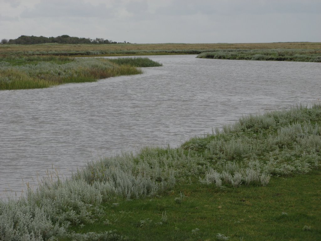
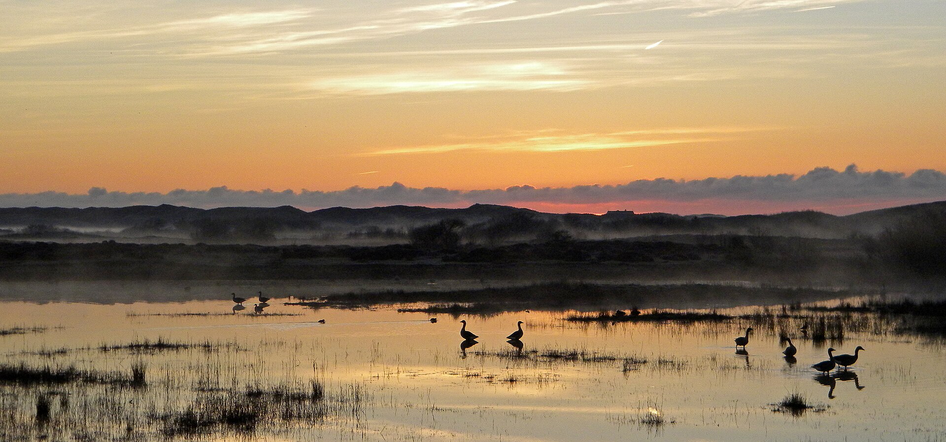
Dunes of Texel National Park
National park of 4,300 hectares in the Netherlands, established in 2002.
Overview
National park of 4,300 hectares in the Netherlands, established in 2002.
Dunes of Texel National Park is located in the Netherlands (Europe). It is a predominantly terrestrial area. Established on 1 May 2002, it covers about 4,300 hectares.
Protections and designations
Ramsar site
Natura 2000 · habitats (SAC)
- Duinen en Lage Land Texel NL2003060
Natura 2000 · birds (SPA)
- Duinen en Lage Land Texel NL3009008
Protected as a national park. International labels and designations: Ramsar site (“Duinen en Lage Land Texel”) and Natura 2000 network (2 sites). Key dates: Ramsar Site in 2000, first Natura 2000 site under the Birds Directive in 2000, established in 2002 and first Natura 2000 site under the Habitats Directive in 2009.
In our collections
Timeline
-
2000
Ramsar Site (wetland of international importance) Duinen en Lage Land Texel
-
2000
First Natura 2000 site under the Birds Directive
-
2002
Established
-
2009
First Natura 2000 site under the Habitats Directive
Sources: Wikidata (CC0) for establishment and international labels; EEA Natura 2000 database (CC-BY 4.0) for site designation dates.
Frequently asked questions
Where is Dunes of Texel National Park?
In the Netherlands (Europe). Representative point: 53.1458° N, 4.8025° E.
How large is Dunes of Texel National Park?
About 4,300 hectares (43 km²). It is the 16th largest of the 26 national parks in the Netherlands covered by Parkavela.
When was Dunes of Texel National Park established?
On 1 May 2002.
What habitats and landscapes does Dunes of Texel National Park include?
A terrestrial area, with coasts.
What rocks lie beneath Dunes of Texel National Park?
According to the European 1:1 million geological map (EGDI), the bedrock consists mainly of sands and gravels (94% of sampled points). These are mostly sedimentary rocks. The geological units date mainly from the Quaternary (100% of sampled points).
What is the highest point of Dunes of Texel National Park?
Loodsmansduin, at 24 m (OpenStreetMap).
What are the main summits of Dunes of Texel National Park?
Loodsmansduin (24 m), Ockesnol (21 m), Fonteinsnol (19 m) and Stooknol (12 m) (OpenStreetMap).
Which international labels apply to Dunes of Texel National Park?
Ramsar site (“Duinen en Lage Land Texel”) and Natura 2000 network (2 sites).
When is the best time to visit Dunes of Texel National Park?
Best time to visit: from May to September, with average temperatures of 11 to 18 °C and moderate rainfall.
Are there historic monuments in Dunes of Texel National Park?
Yes. According to Wikidata, 7 monuments listed in the Dutch national register of monuments (Rijksmonumentenregister) stand within the boundary. For example: “Batterij Den Hoorn: voormalige meetpost” in Texel, “Eierland Lighthouse” in Texel and “Batterij Den Hoorn” in Texel.
Can you swim in Dunes of Texel National Park?
4 monitored bathing sites lie in or within 1 km of the site; official 2025 classification: 4 excellent (European Environment Agency). Swimming is only permitted at the sites and times authorised locally.
What is the nearest large city to Dunes of Texel National Park?
Nearest towns of over 50,000 people, as the crow flies: Den Helder (4 km) and Alkmaar (40 km). Nearest airport: Amsterdam Schiphol (AMS), about 75 km away.
How can I reach Dunes of Texel National Park by train?
The nearest railway station is Den Helder, about 4 km from the site boundary.
Where can I get visitor information on site?
Vogelinformatiecentrum Texel, Receptie Dennenoord and Loodsmansduin.
Are there waymarked hiking trails in Dunes of Texel National Park?
Yes. Waymarked hiking routes listed in OpenStreetMap: 38, including Noord-Hollandpad and WaddenWandelen. The “SP4-Tx · WaddenWandelen - Texel - 01” route runs for about 16 km through the site.
Which species can be seen in Dunes of Texel National Park?
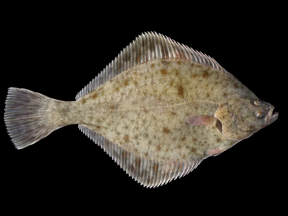
Among the species most often recorded on GBIF are Larus fuscus (Lesser Black-backed Gull), Larus argentatus (European Herring Gull), Platichthys flesus (European flounder) and Pleuronectes platessa (European plaice).
What is the official website of Dunes of Texel National Park?
© OpenStreetMap
Download the boundary: GeoJSON · GPX Boundary © OpenStreetMap contributors (ODbL).
Geography
The representative point of the site lies at around 7 m above sea level. Over the 1996–2025 period, the mean annual temperature is about 10.9 °C and total precipitation reaches roughly 947 mm per year. The warmest month is usually August, the coolest February, and the wettest October. According to the European 1:1 million geological map (EGDI), the bedrock consists mainly of sands and gravels (94% of sampled points). These are mostly sedimentary rocks. The geological units date mainly from the Quaternary (100% of sampled points). The site contains 2 lakes larger than 10 ha, totalling 37 ha of water (HydroLAKES).
Area
- Area
- 4,300 ha
- Elevation
- 7 m
- Lakes over 10 ha
- 2 (37 ha)
- Coordinates
- 53.1458, 4.8025
Lakes: HydroLAKES (Messager et al. 2016, hydrosheds.org, CC BY 4.0) · depths: Wikidata (CC0)
Bedrock
- Sands and gravels 94 %
- Clays and silts 6 %
Sedimentary rocks 100 % · Main age: Quaternary (100%)
Source: EGDI 1:1M geological map (EuroGeoSurveys and national geological surveys), CC BY 4.0 · 16 sampled points within the site.
Main summits
- Loodsmansduin24 m
- Ockesnol21 m
- Fonteinsnol19 m
- Stooknol12 m
Data © OpenStreetMap contributors (ODbL)
Climate
● Mean temperature (°C) · ▮ Precipitation (mm)
Source: Copernicus ERA5-Land (C3S, doi:10.24381/cds.68d2bb30), monthly averages 1996–2025 interpolated to the representative point, temperatures adjusted for elevation.
Contains modified Copernicus Climate Change Service information 2026. Neither the European Commission nor ECMWF is responsible for any use that may be made of the Copernicus information or data it contains.
Natural habitats
According to CORINE Land Cover (2018), the site is mainly made up of grassland and meadows (54%), beaches and dunes (15%) and forests (10%). The site borders the coast. The land is almost flat (mean slope under 2°). The 2 Natura 2000 sites overlapping the area list 16 habitats of European interest (5 priority), the most extensive being fixed coastal dunes with herbaceous vegetation (‘grey dunes’), decalcified fixed dunes with Empetrum nigrum and Atlantic salt meadows (Glauco-Puccinellietalia maritimae).
Biodiversity
Based on occurrences aggregated by GBIF, several species are regularly recorded within the site. Among the most frequent are Larus fuscus (Lesser Black-backed Gull), Larus argentatus (European Herring Gull), Platichthys flesus (European flounder) and Pleuronectes platessa (European plaice). The full list of documented taxa is shown below. The overlapping Natura 2000 sites list 15 species of European interest: 12 birds, 2 mammals and 1 plant.
Habitats of European interest
From the official forms of the 2 Natura 2000 sites overlapping the area (areas reported for each whole site).
- Fixed coastal dunes with herbaceous vegetation (‘grey dunes’) priority 867 ha
- Decalcified fixed dunes with Empetrum nigrum priority 286 ha
- Atlantic salt meadows (Glauco-Puccinellietalia maritimae) 246 ha
- Wooded dunes of the Atlantic, Continental and Boreal region 245 ha
- Humid dune slacks 163 ha
- Dunes with Hippophaë rhamnoides 152 ha
- Shifting dunes along the shoreline with Ammophila arenaria (‘white dunes’) 148 ha
- Salicornia and other annuals colonizing mud and sand 112 ha
and 8 more
Species of European interest
Birds · 12
Short-eared Owl (Asio flammeus) resident, Eurasian Bittern (Botaurus stellaris) resident, Common Ringed Plover (Charadrius hiaticula) breeding, Western Marsh Harrier (Circus aeruginosus) breeding, Hen Harrier (Circus cyaneus) resident, Lesser Black-backed Gull (Larus fuscus) breeding, Northern Wheatear (Oenanthe oenanthe) breeding, Eurasian Spoonbill (Platalea leucorodia) breeding, Pied Avocet (Recurvirostra avosetta) breeding, European stonechat (Saxicola torquatus) breeding, Common Eider (Somateria mollissima) resident, Little Tern (Sternula albifrons) breeding
Mammals · 2
Grey Seal (Halichoerus grypus), Microtus oeconomus arenicola
Plants · 1
Source: Natura 2000 standard data forms (EEA, CC-BY 4.0). Not exhaustive: sensitive species are not published.
Species to look out for



Observed species
Occurrences documented via GBIF; they are neither an exhaustive inventory nor proof of current presence.
- Lesser Black-backed Gull · Larus fuscus · 135324
- European Herring Gull · Larus argentatus · 74057
- European flounder · Platichthys flesus · 37084
- European plaice · Pleuronectes platessa · 26694
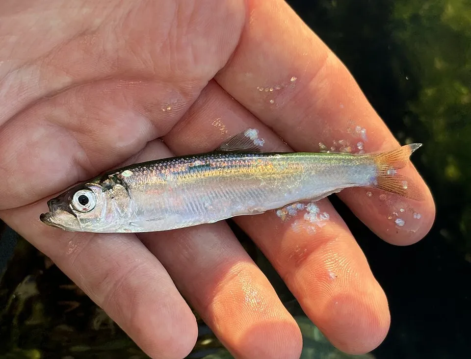
- Atlantic herring · Clupea harengus · 23728
- Twait shad · Alosa fallax · 16011
- Garfish · Belone belone · 12888
- Common shore crab · Carcinus maenas · 12565
- Fivebeard rockling · Ciliata mustela · 11869
- Bull rout · Myoxocephalus scorpius · 10706
- Thicklip grey mullet · Chelon labrosus · 10488
- Common dab · Limanda limanda · 9391
+18 more species
- European eel · Anguilla anguilla · 8683
- Eurasian Oystercatcher · Haematopus ostralegus · 8364
- Whiting · Merlangius merlangus · 7466
- Atlantic horse mackerel · Trachurus trachurus · 7071
- European seabass · Dicentrarchus labrax · 6893
- Viviparous eelpout · Zoarces viviparus · 6755
- Atlantic cod · Gadus morhua · 6530
- Common sole · Solea solea · 4778
- European sprat · Sprattus sprattus · 4620
- Pollack · Pollachius pollachius · 4531
- Brown Trout · Salmo trutta · 4190
- Sand smelt · Atherina presbyter · 3364
- Flying Crab · Liocarcinus holsatus · 3234
- Barrel jellyfish · Rhizostoma pulmo · 2786
- European smelt · Osmerus eperlanus · 2342
- Common shrimp · Crangon crangon · 2120
- Brill · Scophthalmus rhombus · 2034
- Bib · Trisopterus luscus · 1990
Records: GBIF.org (CC-BY). Names: Wikidata (CC0), GBIF. Photos: Wikimedia Commons.
Conservation challenges
The primary purpose of the site is to preserve its natural habitats and the biodiversity they support. The species recorded (Biodiversity tab) reflect its ecological value. The designations it holds frame its management and the control of land use.
According to the European CORINE Land Cover inventory (Copernicus), land cover changed on about 225 ha of the site between 1990 and 2018 (6% of its area): built-up land grew by 113 ha, mostly at the expense of open natural land, while farmland shrank by 106 ha, mostly giving way to open natural land. At night, 9% of the area gives off artificial light detectable from space (NASA VIIRS Black Marble composite, 2016). Built-up and developed land (buildings, business areas, roads, quarries) covers 6% of the area (CORINE Land Cover). According to the Natura 2000 forms, of 16 assessed habitats of European interest, 11 are in excellent condition and 2 in average or reduced condition. According to the Water Framework Directive assessment (2022 river basin management plans, data 2015–2020), water bodies assessed within the site: lakes, 0 of 1 in good ecological status or better; coastal waters, 0 of 2 in good ecological status or better. Since 2000, 21 invasive alien species have been recorded within the site (GBIF observations), 4 of them listed as of Union concern under EU Regulation 1143/2014. Among them: Alopochen aegyptiaca (Egyptian Goose), Eriocheir sinensis (Chinese mitten crab) and Oxyura jamaicensis (Ruddy Duck).
Pressure indicators
Tree cover lost
9 ha
2001–2023 · < 1% of the area
20012023
Fires since 2016
0
No large fire mapped (fires over about 30 ha)
Light at night
9%
of the area gives off artificial light visible from space
DarkLit
Built-up land
6%
buildings, business areas, roads, quarries · farmland 5%
Land cover change
225 ha
changed cover, 1990–2018 · CORINE · 6% of the area
- +113 ha · built-up land
- −106 ha · farmland
Rivers and lakes
Lakes: 0 of 1 good or better
Coastal waters: 0 of 2 good or better
assessments 2015–2020
Invasive alien species
21
incl. 4 of EU concern · since 2000
 Egyptian GooseEU
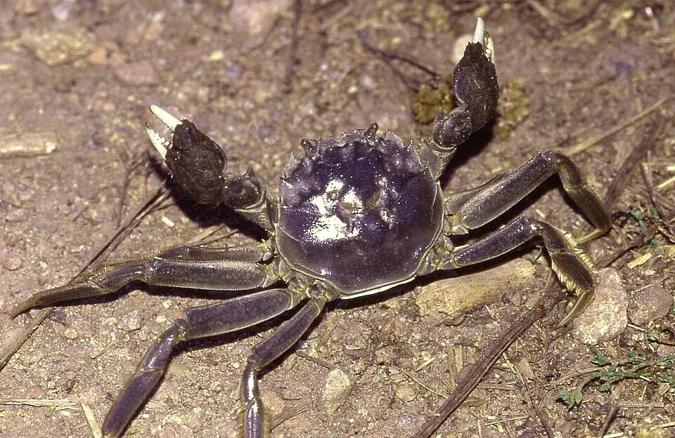 Chinese mitten crabEU
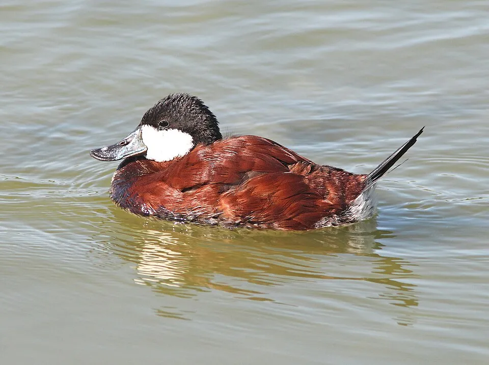 Ruddy DuckEU
 Giant HogweedEU
 Japanese rose
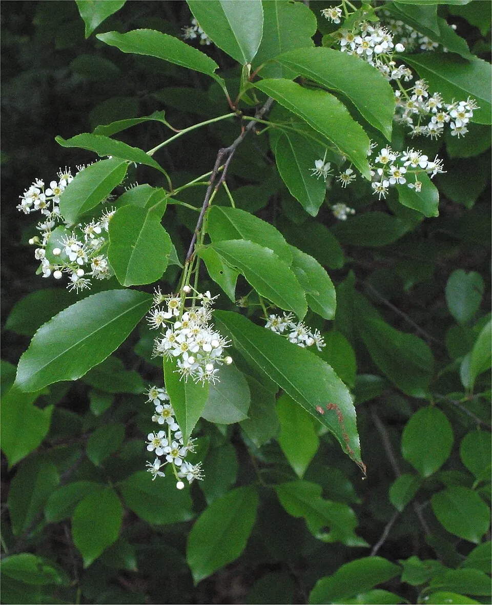 Black cherry
 Campylopus moss
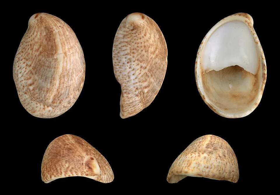 Common slipper shell
Photos: Egyptian Goose © Rhododendrites · CC BY-SA 4.0; Chinese mitten crab © Christian Fischer · CC BY-SA 3.0; Ruddy Duck © ALAN SCHMIERER · CC0-1.0; Giant Hogweed © anastasiiamerkulova · CC BY 4.0; Japanese rose © Vihljun · Public domain; Black cherry © Rasbak · CC BY-SA 3.0; Campylopus moss © Kristian Peters -- Fabelfroh · CC BY-SA 3.0; Common slipper shell © H. Zell · CC BY-SA 3.0
Sources: Global Forest Change (Hansen et al., University of Maryland, via Global Forest Watch, CC-BY 4.0); EFFIS, European Commission / Copernicus; NASA Black Marble 2016 (public domain); CORINE Land Cover 2018 (Copernicus) or MODIS.
CORINE Land Cover Change 1990–2018: generated using European Union's Copernicus Land Monitoring Service information (EEA), aggregated by Parkavela; DOI 10.2909/f30f1000-7cf8-43bb-872c-5eb093911b24.
Ecological status of water bodies: European Environment Agency, WISE – Water Framework Directive, 3rd river basin management plans (2022), CC BY 4.0. Official national classification, not comparable between countries.
Invasive alien species: Global Register of Introduced and Invasive Species (ISSG, CC BY 4.0); Union list, Regulation (EU) 1143/2014 (INBO, CC0); GBIF.org records (CC0 / CC BY 4.0), at least 2 per species.
Practical information
Cities and airport
- Den Helder
4 km as the crow flies - Alkmaar
40 km as the crow flies - Airport: Amsterdam Schiphol (AMS)
75 km as the crow flies
Visitor information
- Vogelinformatiecentrum Texel
< 1 km from the site boundary - Receptie Dennenoord
within the site - Loodsmansduin
< 1 km from the site boundary - Natuurcentrum De Marel
< 1 km from the site boundary
Parking
75 public car parks listed within the site · 8 trailheads
Camperplaats 2Camperplaats 3Camperplaats 4Camperplaats 5
Hiking
38 waymarked routes listed, including:
Noord-HollandpadWaddenWandelen
Data © OpenStreetMap contributors (ODbL) · Wikidata (CC0)
Waymarked hiking routes
orange De Muy- en Slufterbollenroute
7.6 km within the site ↗ 5 m↘ 11 m -1–11 m
Tracks © OpenStreetMap contributors (ODbL), clipped to the boundary; elevation gain and profiles computed on the longest section from Mapzen Terrain Tiles (≈ 30 m), indicative only.
Bathing
4 monitored bathing sites in or within 1 km of the site · 2025 classification
Excellent · 4
- Bleekersvallei · sea · Excellent
- De Koog · sea · Excellent
- De Krim · sea · Excellent
- Grote Vlak · sea · Excellent
Source: European Environment Agency, official bathing water classification (Directive 2006/7/EC, CC-BY 4.0). Swimming is only permitted at the sites and times authorised locally.
Access and visiting
The nearest railway station is Den Helder, about 4 km from the site boundary. Nearest towns of over 50,000 people, as the crow flies: Den Helder (4 km) and Alkmaar (40 km). Nearest airport: Amsterdam Schiphol (AMS), about 75 km away. About 100,000 people live within 20 km of the site boundary, 58,000 of them within 10 km; some 2,300 people are estimated to live inside (GHSL estimate, 2020). Visitor information on site: Vogelinformatiecentrum Texel, Receptie Dennenoord and Loodsmansduin. Public car parks listed within the site: 75, including Camperplaats 2, Camperplaats 3 and Camperplaats 4. Waymarked hiking routes listed in OpenStreetMap: 38, including Noord-Hollandpad and WaddenWandelen. To plan a visit (access, opening periods, visitor rules), it is best to consult the official information from the managing body and the official website listed in this page's sources.
Source: OpenStreetMap (ODbL), Wikidata (CC0), October 2026.
Built heritage
According to Wikidata, 7 monuments listed in the Dutch national register of monuments (Rijksmonumentenregister) stand within the boundary. Among them are 4 castles and fortifications and 1 bridge, lighthouse, mill or working building. Examples include “Batterij Den Hoorn: voormalige meetpost” in Texel, “Eierland Lighthouse” in Texel and “Batterij Den Hoorn” in Texel.
4 castles and fortifications1 bridge, lighthouse, mill or working building
-
Batterij Den Hoorn: voormalige meetpost
Texel -
Eierland Lighthouse
Texel · 19th c. -
Batterij Den Hoorn
Texel
and 4 more
Source: Wikidata (CC0), monuments in each country’s official heritage protection registers, at national or regional level. Each item links to its Wikidata entry.
When to visit
Best time to visit: from May to September, with average temperatures of 11 to 18 °C and moderate rainfall. Day length ranges from about 7 h 34 min in December to 16 h 56 min in June. Wildlife records published on GBIF peak for birds (October), plants (from May to July), butterflies and moths (from June to August), dragonflies (from June to August) and mammals (October). These peaks also reflect when observers are most active.
Source: Copernicus ERA5-Land (C3S), monthly averages 1996–2025 at the representative point, temperatures adjusted for elevation.
Contains modified Copernicus Climate Change Service information 2026. Neither the European Commission nor ECMWF is responsible for any use that may be made of the Copernicus information or data it contains.
Wildlife records calendar
JFMAMJJASOND
Birds
Plants
Butterflies & moths
Dragonflies
Mammals
Monthly records published on GBIF (CC-BY), relative to the busiest month; also reflects observer activity.
Gallery
© Alex76 · CC BY-SA 3.0
© Stormbeest · Public domain
© Traitor · CC BY-SA 3.0
© Femmark · CC BY-SA 3.0
© Michielverbeek · CC BY-SA 4.0
© Michielverbeek · CC BY-SA 4.0
Sources and licences
- Wikidata: Q1702843
- OpenStreetMap: relation 2746211
- Official website: http://www.npduinenvantexel.nl/
- Wikipedia: en.wikipedia.org/wiki/Duinen_van_Texel_National_Park
- WDPA: 331442
References
- cds.climate.copernicus.eu: climate · CC-BY-4.0
- registry.opendata.aws: elevation of the reference point, detailed relief · PD
- land.copernicus.eu: land cover, land cover change, sea share · COPERNICUS
- doi.org: population around the site · CC-BY-4.0
- wikidata.org: official area, establishment date, protected heritage, official name, nearby cities and airport, access and peaks, lake depths, places to see, official website · CC0-1.0
- eea.europa.eu: bathing water quality, ecological status of waters · CC-BY-4.0
- en.eurovelo.com: EuroVelo cycle routes · ODbL-1.0
- cycling.waymarkedtrails.org: cycle routes · ODbL-1.0
- opentopodata.org: elevations · PD
- forest-fire.emergency.copernicus.eu: wildfires · COPERNICUS
- globalforestwatch.org: tree cover loss · CC-BY-4.0
- gbif.org: seasonality of sightings, invasive alien species, observed species · CC-BY-4.0
- europe-geology.eu: geology · CC-BY-4.0
- hydrosheds.org: lakes · CC-BY-4.0
- natura2000.eea.europa.eu: Natura 2000 habitats and species · CC-BY-4.0
- earthobservatory.nasa.gov: night light · PD
- openstreetmap.org: access and peaks · ODbL-1.0
- hiking.waymarkedtrails.org: route difficulty · ODbL-1.0
- nsidc.org: snow cover · PD
- wikidata.org: Wikipedia article · CC-BY-SA-4.0
Data © OpenStreetMap contributors (ODbL), Wikidata (CC0) and the sources cited.