
Spain · Terrestrial
Guadarrama National Park
National park of 33,960 hectares in Spain, established in 2013.
Overview
National park of 33,960 hectares in Spain, established in 2013.
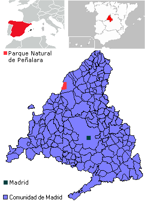
Guadarrama National Park is located in Spain (Europe). It is a predominantly terrestrial area. Established on 25 June 2013, it covers about 33,960 hectares. The site is managed by Board of Trustees of the Sierra de Guadarrama National Park.
Protections and designations
Ramsar site
Natura 2000 · habitats (SAC) · 4 sites
- Cuenca del río Guadarrama ES3110005
- Cuenca del río Lozoya y Sierra Norte ES3110002
- Cuenca del río Manzanares ES3110004
- Sierra de Guadarrama ES4160109
Natura 2000 · birds (SPA) · 2 sites
- Alto Lozoya ES0000057
- Sierra de Guadarrama - ZEPA ES0000010
Protected as a national park. International labels and designations: Ramsar site (“Peñalara Natural Park”) and Natura 2000 network (6 sites). Key dates: first Natura 2000 site under the Birds Directive in 1988, established in 2013 and first Natura 2000 site under the Habitats Directive in 2014.
In our collections
Timeline
-
1988
First Natura 2000 site under the Birds Directive 2 such sites designated up to 1990
-
2013
Established
-
2014
First Natura 2000 site under the Habitats Directive 4 such sites designated up to 2015
Sources: Wikidata (CC0) for establishment and international labels; EEA Natura 2000 database (CC-BY 4.0) for site designation dates.
Frequently asked questions
Where is Guadarrama National Park?
In Spain (Europe). Representative point: 40.7833° N, 3.9833° W.
How large is Guadarrama National Park?
About 33,960 hectares (340 km²). It is the 6th largest of the 16 national parks in Spain covered by Parkavela.
When was Guadarrama National Park established?
On 25 June 2013.
What habitats and landscapes does Guadarrama National Park include?
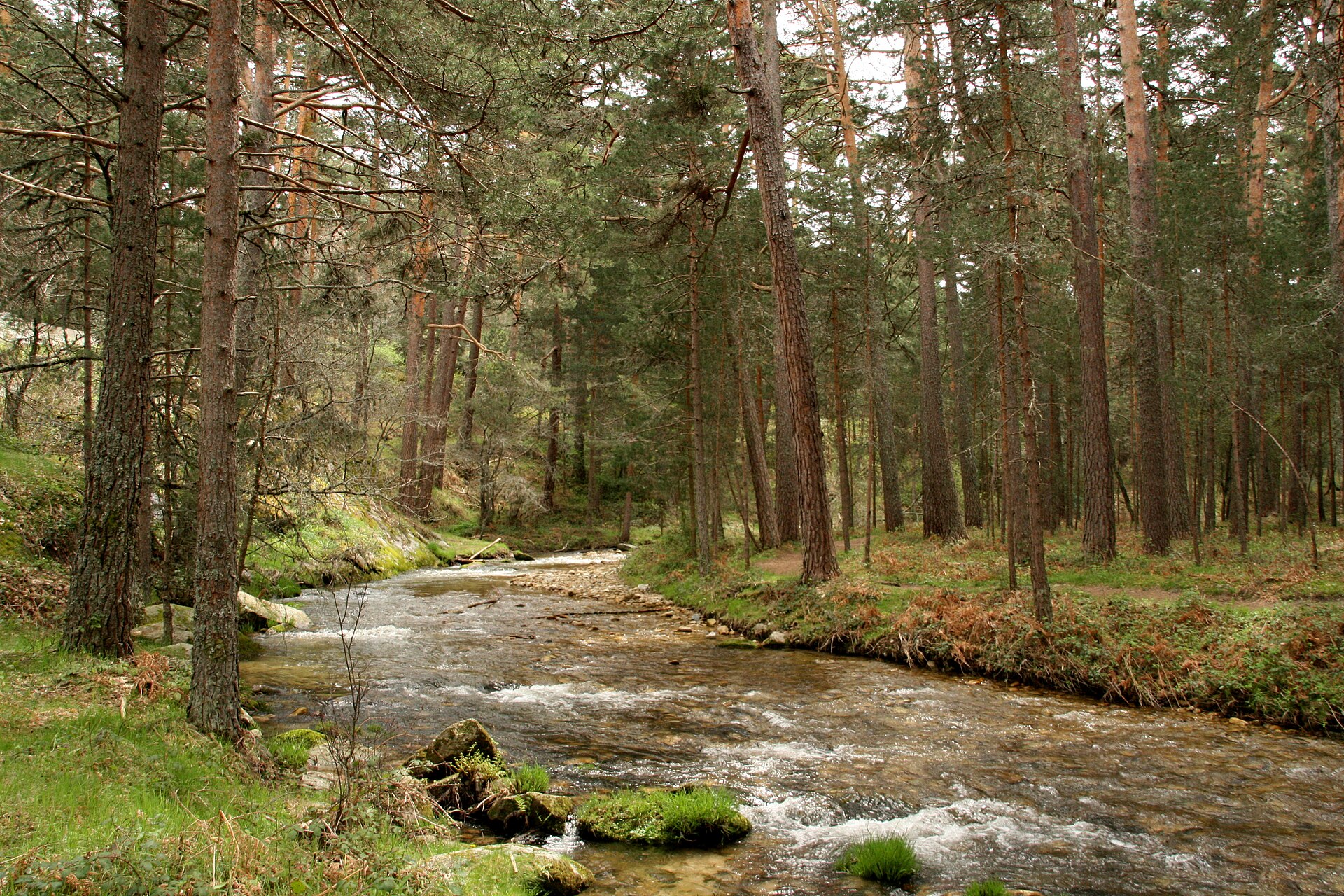
A terrestrial area, with forests and mountains.
What rocks lie beneath Guadarrama National Park?
According to the European 1:1 million geological map (EGDI), the bedrock consists mainly of gneiss (63% of sampled points) and granites (38%). These are mostly metamorphic rocks. The geological units date mainly from the Ordovician (63% of sampled points).
What is the highest point of Guadarrama National Park?
Peñalara, at 2,428 m (OpenStreetMap).
What are the main summits of Guadarrama National Park?
Peñalara (2,428 m), Risco de los Claveles (2,387 m), Cabeza de Hierro Mayor (2,383 m), Cabeza de Hierro Menor (2,376 m) and Hermana Mayor (2,284 m) (OpenStreetMap).
Which international labels apply to Guadarrama National Park?
Ramsar site (“Peñalara Natural Park”) and Natura 2000 network (6 sites).
When is the best time to visit Guadarrama National Park?
Best time to visit: from June to September, with average temperatures of 11 to 16 °C and moderate rainfall.
Is there snow in Guadarrama National Park?
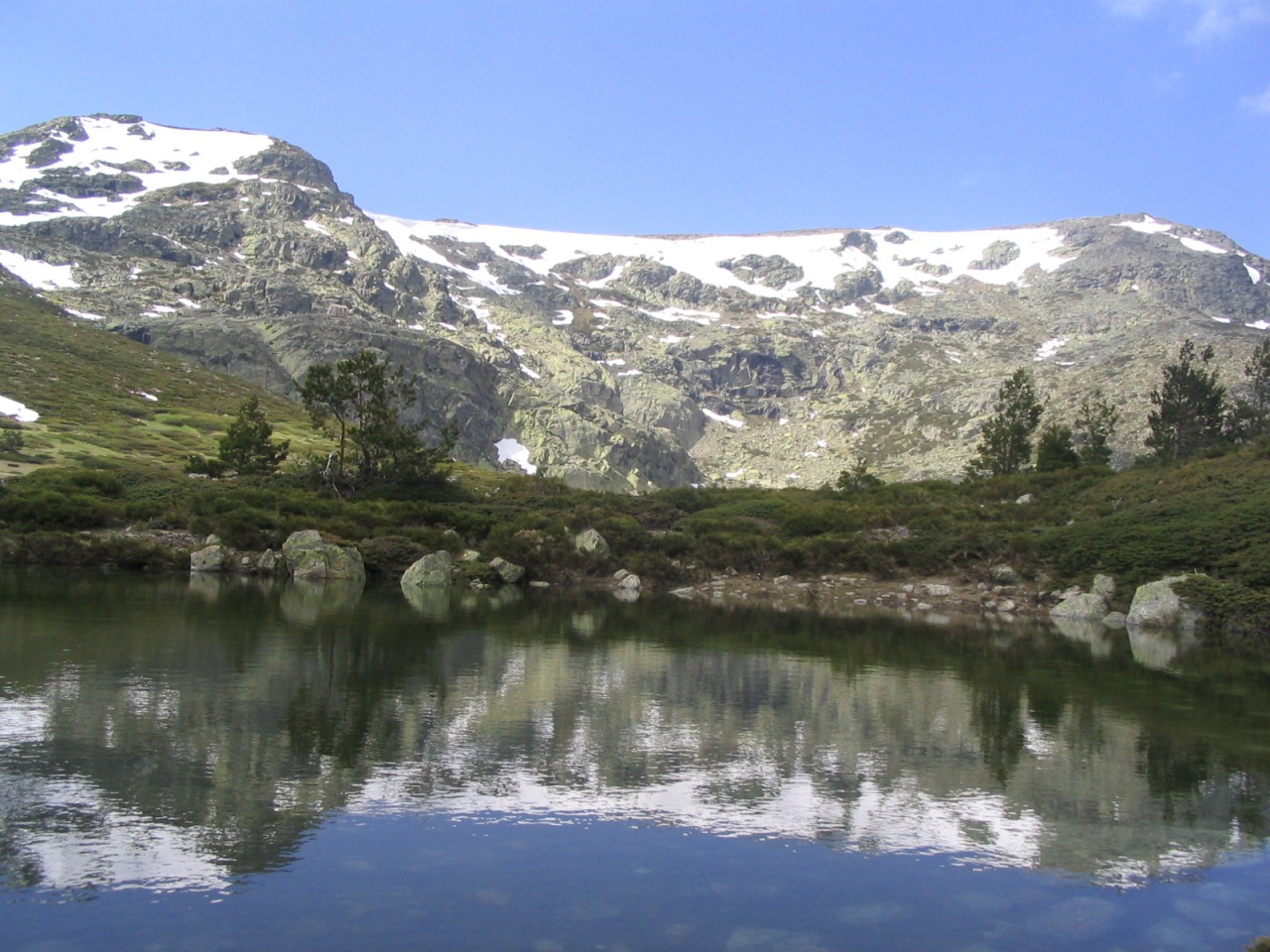
Yes. According to NASA's MODIS satellites (2015–2025 average), snow covers the site about 35 days a year, mostly from December to March.
What is there to see in Guadarrama National Park?
5 waterfalls and 4 lakes and ponds, including Cascadas del Purgatorio, Laguna Chica de Peñalara (1,970 m), Chorrera de San Mamés and Laguna Grande de Peñalara (2,017 m) (Wikidata).
Where can I stay in Guadarrama National Park?
5 mountain huts, including Refugio Zabala (2,075 m), Chozo del Ahorcado (1,950 m) and Refugio de Cancho Porrón (1,669 m) (Wikidata).
Are there historic monuments in Guadarrama National Park?
Yes. According to Wikidata, 2 monuments listed as Bien de Interés Cultural stand within the boundary. For example: “Fuenfría Roman road” in provincia de Segovia and “Zona arqueológica de La Pedriza” in Manzanares el Real.
Can you swim in Guadarrama National Park?
One monitored bathing site lies in or within 1 km of the site; official 2025 classification: 1 good (European Environment Agency). Swimming is only permitted at the sites and times authorised locally.
What is the nearest large city to Guadarrama National Park?
Nearest towns of over 50,000 people, as the crow flies: Segovia (9 km) and Alcobendas (30 km). Nearest airport: Madrid-Barajas (MAD), about 39 km away.
How can I reach Guadarrama National Park by train?
Puerto de Navacerrada railway station lies within the site.
Where can I get visitor information on site?
Casa del Parque, Casa Forestal de las Dehesas and Agentes Forestales - Comarca 13.
Are there waymarked hiking trails in Guadarrama National Park?
Yes. Waymarked hiking routes listed in OpenStreetMap: 47, including Ruta Jacobea Madrileña, Camino de Santiago Complutense, Calzada romana de la Fuenfría and Cordel de Santillana. The “Camino de Santiago Complutense” route runs for about 17 km through the site, with some 370 m of ascent on its longest section.
Which species can be seen in Guadarrama National Park?
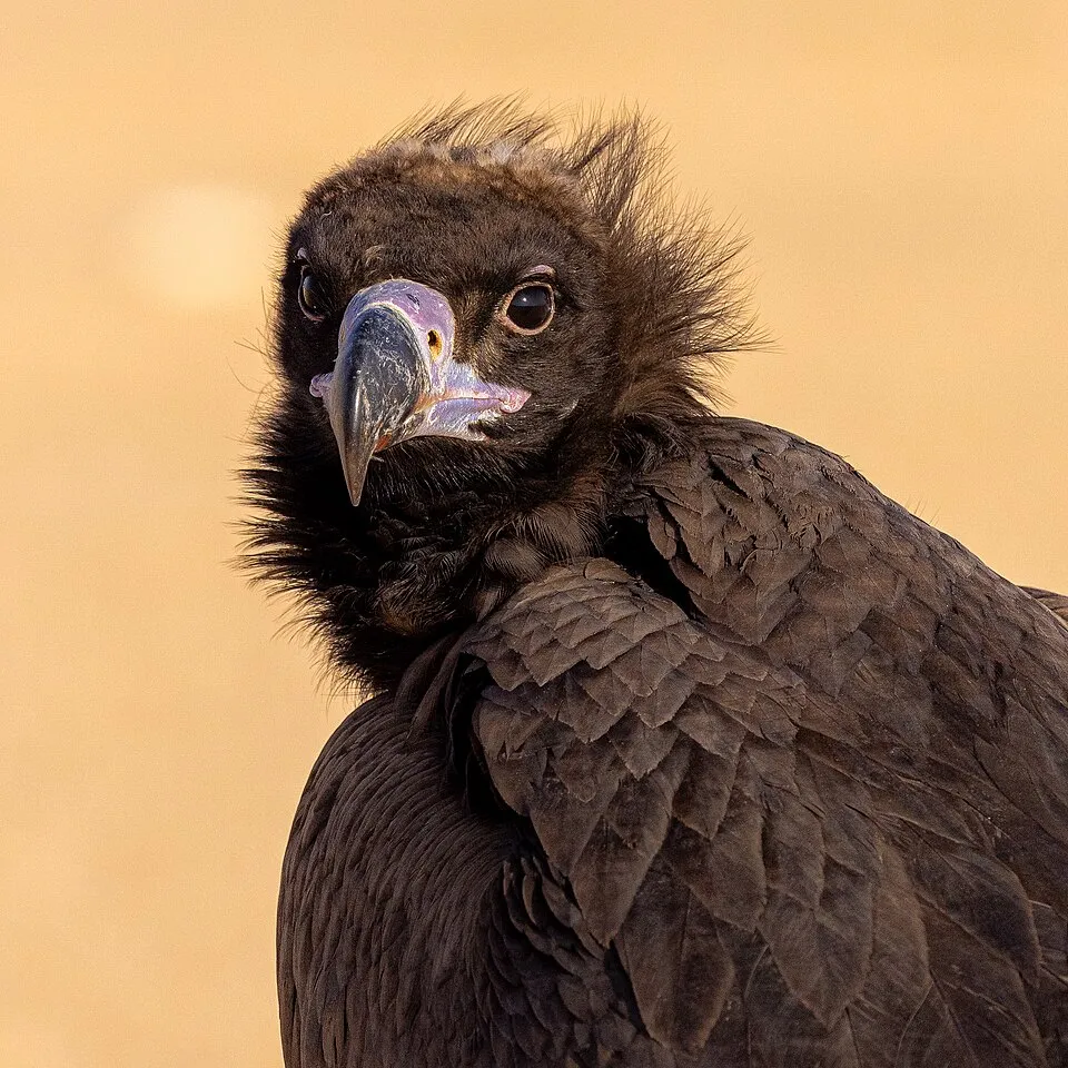
Among the species most often recorded on GBIF are Gyps fulvus (Griffon Vulture), Periparus ater (Coal tit), Fringilla coelebs (Eurasian Chaffinch) and Aegypius monachus (Cinereous Vulture).
Who manages Guadarrama National Park?
Board of Trustees of the Sierra de Guadarrama National Park.
What is the official website of Guadarrama National Park?
© OpenStreetMap
Download the boundary: GeoJSON · GPX Boundary © OpenStreetMap contributors (ODbL).
Geography
The representative point of the site lies at around 2,195 m above sea level. Over the 1996–2025 period, the mean annual temperature is about 5.4 °C and total precipitation reaches roughly 722 mm per year. The warmest month is usually July, the coolest January, and the wettest April. According to the European 1:1 million geological map (EGDI), the bedrock consists mainly of gneiss (63% of sampled points) and granites (38%). These are mostly metamorphic rocks. The geological units date mainly from the Ordovician (63% of sampled points).
Area
- Area
- 33,960 ha
- Elevation
- 2,195 m
- Median elevation
- 1,776 m
- Mean slope
- 17°
- Snow cover
- ≈ 35 days a year
- Coordinates
- 40.7833, -3.9833
Terrain: Mapzen Terrain Tiles (SRTM, USGS)
Elevation bands
- 1,000–1,500 m 17%
- 1,500–2,000 m 67%
- 2,000–2,500 m 16%
share of the site in each elevation band (smoothed terrain model: summits are rounded off) · Terrain: Mapzen Terrain Tiles (SRTM, USGS)
Bedrock
- Gneiss 63 %
- Granites 38 %
Metamorphic rocks 63 % · Igneous rocks 38 % · Main age: Ordovician (63%)
Source: EGDI 1:1M geological map (EuroGeoSurveys and national geological surveys), CC BY 4.0 · 16 sampled points within the site.
Main summits
- Peñalara2,428 m
- Risco de los Claveles2,387 m
- Cabeza de Hierro Mayor2,383 m
- Cabeza de Hierro Menor2,376 m
- Hermana Mayor2,284 m
- Hermana Menor2,269 m
- Risco de los Pájaros2,265 m
- Asomate de Hoyos2,242 m
- Loma de Pandasco2,238 m
- Navahondilla2,234 m
Data © OpenStreetMap contributors (ODbL)
Climate
● Mean temperature (°C) · ▮ Precipitation (mm)
Source: Copernicus ERA5-Land (C3S, doi:10.24381/cds.68d2bb30), monthly averages 1996–2025 interpolated to the representative point, temperatures adjusted for elevation.
Contains modified Copernicus Climate Change Service information 2026. Neither the European Commission nor ECMWF is responsible for any use that may be made of the Copernicus information or data it contains.
Snow cover measured by satellite
J
F
M
A
M
J
J
A
S
O
N
D
average share of the site under snow · snowiest parts · ≈ 35 days a year
Snow cover: MODIS/Terra MOD10CM v61 (Hall & Riggs, 2021, NASA NSIDC DAAC, doi:10.5067/MODIS/MOD10CM.061), imagery from NASA GIBS (ESDIS); 2015–2025 average, grid of about 5 km.
Natural habitats
According to CORINE Land Cover (2018), the site is mainly made up of forests (51%), heath and scrub (28%) and grassland and meadows (7%). Woodland is mostly coniferous. Elevation ranges from about 1,060 m to 2,428 m (highest point: Peñalara). Median elevation is 1,776 m, and 16% of the site lies above 2,000 m (SRTM elevation model). The terrain is steep: 62% of slopes exceed 15° (mean slope 17°). The 6 Natura 2000 sites overlapping the area list 40 habitats of European interest (7 priority), the most extensive being mountain Cytisus purgans formations, Quercus ilex and Quercus rotundifolia forests and pseudo-steppe with grasses and annuals of the Thero-Brachypodietea.
Biodiversity
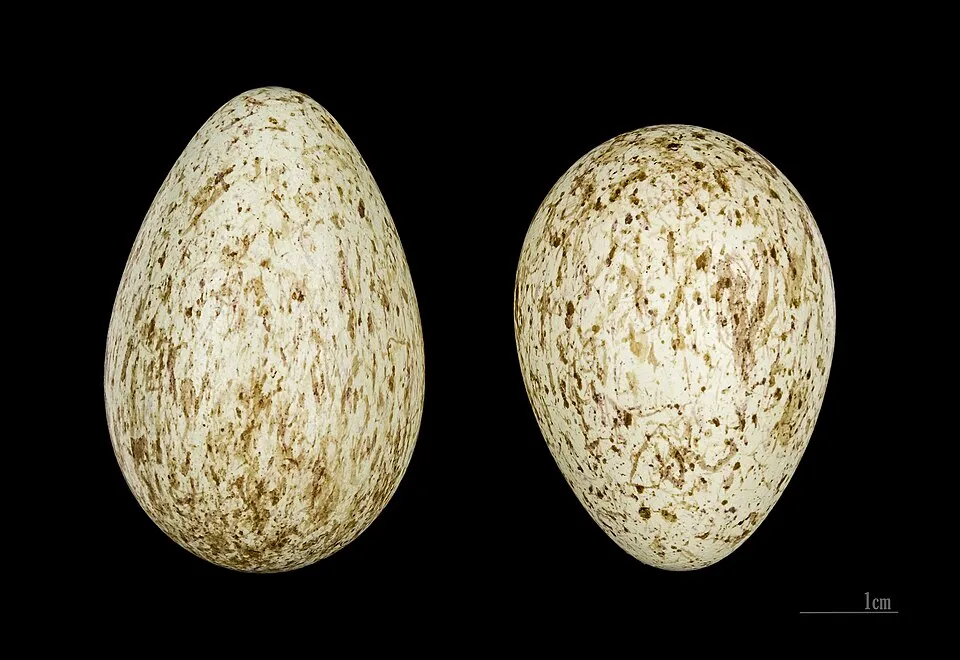
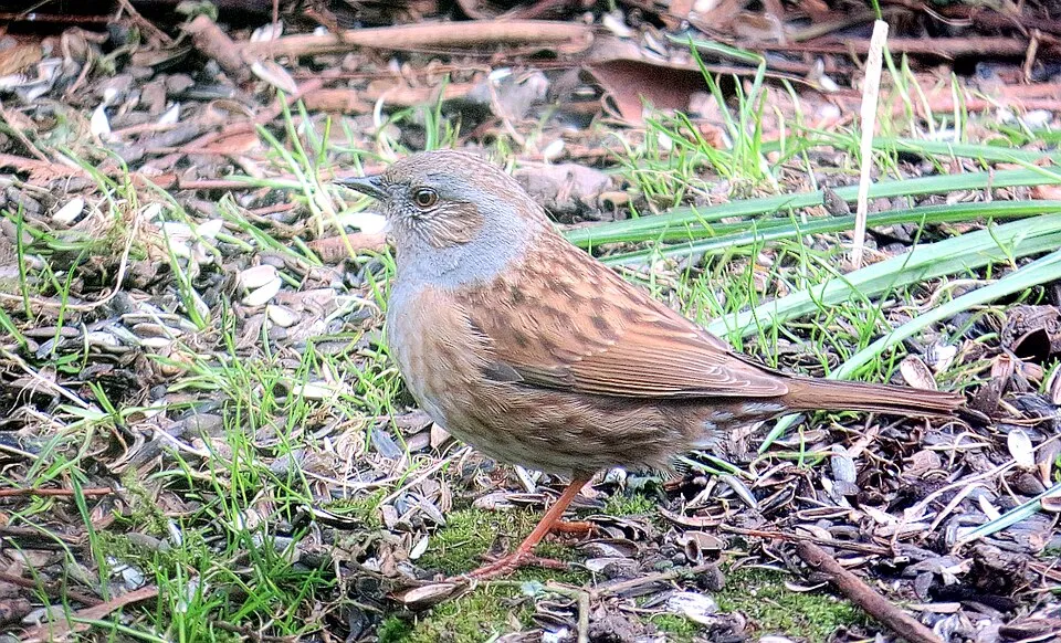
Based on occurrences aggregated by GBIF, several species are regularly recorded within the site. Among the most frequent are Gyps fulvus (Griffon Vulture), Periparus ater (Coal tit), Fringilla coelebs (Eurasian Chaffinch) and Aegypius monachus (Cinereous Vulture). The full list of documented taxa is shown below. The overlapping Natura 2000 sites list 152 species of European interest: 77 birds, 30 mammals, 7 reptiles, 10 amphibians, 8 fish, 9 invertebrates and 11 plants.
Habitats of European interest
From the official forms of the 6 Natura 2000 sites overlapping the area (areas reported for each whole site).
- Mountain Cytisus purgans formations 14,870 ha
- Quercus ilex and Quercus rotundifolia forests 14,059 ha
- Pseudo-steppe with grasses and annuals of the Thero-Brachypodietea priority 13,273 ha
- Galicio-Portuguese oak woods with Quercus robur and Quercus pyrenaica 9,267 ha
- Dehesas with evergreen Quercus spp. 8,232 ha
- Endemic oro-Mediterranean heaths with gorse 6,181 ha
- Endemic forests with Juniperus spp. priority 4,089 ha
- Thermo-Mediterranean and pre-desert scrub 3,270 ha
and 32 more
Species of European interest
Birds · 77
Eurasian Goshawk (Accipiter gentilis) resident, Great Reed Warbler (Acrocephalus arundinaceus) breeding, Common Sandpiper (Actitis hypoleucos) passage, Cinereous Vulture (Aegypius monachus) resident, Common Kingfisher (Alcedo atthis) resident, Mallard (Anas platyrhynchos) resident, Tawny Pipit (Anthus campestris) breeding passage, Meadow Pipit (Anthus pratensis) wintering, Water Pipit (Anthus spinoletta) resident passage, Spanish Imperial Eagle (Aquila adalberti) resident breeding, Golden Eagle (Aquila chrysaetos) resident breeding, Bonelli's Eagle (Aquila fasciata) resident and 65 more
Mammals · 30
Barbastelle (Barbastella barbastellus), Grey wolf (Canis lupus), Serotine bat (Eptesicus serotinus), European wildcat (Felis silvestris), Pyrenean desman (Galemys pyrenaicus), Common genet (Genetta genetta), Savi's Pipistrelle (Hypsugo savii), Eurasian otter (Lutra lutra), Cabrera's vole (Microtus cabrerae), Common bent-wing bat (Miniopterus schreibersii), Western Polecat (Mustela putorius), Alcathoe Whiskered Bat (Myotis alcathoe) and 18 more
Reptiles · 7
Smooth snake (Coronella austriaca), European Pond Turtle (Emys orbicularis), Iberolacerta cireni (Iberolacerta cyreni), Iberian rock lizard (Iberolacerta monticola), Iberian emerald lizard (Lacerta schreiberi), Iberian pond turtle (Mauremys leprosa), Common wall lizard (Podarcis muralis)
Amphibians · 10
Iberian midwife toad (Alytes cisternasii), Midwife toad (Alytes obstetricans), Iberian painted frog (Discoglossus galganoi), Natterjack toad (Epidalea calamita), European Treefrog (Hyla molleri), Alpine newt (Ichthyosaura alpestris), Western Spadefoot (Pelobates cultripes), Perez's Frog (Pelophylax perezi), Iberian Frog (Rana iberica), Marbled newt (Triturus marmoratus)
Fish · 8
Bermejuela (Achondrostoma arcasii), Northern Iberian spined-loach (Cobitis calderoni), Lamprehuela (Cobitis paludica), Luciobarbus bocagei, Iberian Barbel (Luciobarbus comizo), Northern straight-mouth nase (Pseudochondrostoma duriense), Iberian nase (Pseudochondrostoma polylepis), Squalius alburnoides
Invertebrates · 9
Wingless mantis (Apteromantis aptera), White-clawed Crayfish (Austropotamobius pallipes), Greater Capricorn Beetle (Cerambyx cerdo), Marsh fritillary (Euphydryas aurinia), Jersey Tiger (Euplagia quadripunctaria), Spanish Moon Moth (Graellsia isabellae), Stag beetle (Lucanus cervus), Dusky Large Blue (Maculinea nausithous), Apollo (Parnassius apollo)
Plants · 11
Creeping marshwort (Apium repens), Erodium paularense, Euphorbia nevadensis, Great Yellow Gentian (Gentiana lutea), Lythrum flexuosum, Petticoat daffodil (Narcissus bulbocodium), Large-flowered Daffodil (Narcissus pseudonarcissus subsp. nobilis), Angel's-tears (Narcissus triandrus), Butcher's-broom (Ruscus aculeatus), Sphagnum Mosses (Sphagnum spp.), Summer lady's-tresses (Spiranthes aestivalis)
Source: Natura 2000 standard data forms (EEA, CC-BY 4.0). Not exhaustive: sensitive species are not published.
Species to look out for


Observed species
Occurrences documented via GBIF; they are neither an exhaustive inventory nor proof of current presence.
- Griffon Vulture · Gyps fulvus · 1900
- Coal tit · Periparus ater · 1716
- Eurasian Chaffinch · Fringilla coelebs · 1689
- Cinereous Vulture · Aegypius monachus · 1538
- Northern Raven · Corvus corax · 1364
- Dunnock · Prunella modularis · 1281
- European Crested Tit · Lophophanes cristatus · 1071
- Carrion crow · Corvus corone · 1061
- Rock Bunting · Emberiza cia · 1055
- European robin · Erithacus rubecula · 1048
- Common Blackbird · Turdus merula · 992
- Black Redstart · Phoenicurus ochruros · 978
+18 more species
- Great tit · Parus major · 831
- Short-toed Treecreeper · Certhia brachydactyla · 830
- Eurasian Jay · Garrulus glandarius · 782
- Northern Wheatear · Oenanthe oenanthe · 742
- Mistle Thrush · Turdus viscivorus · 732
- White Wagtail · Motacilla alba · 717
- European Stonechat · Saxicola rubicola · 685
- Eurasian Nuthatch · Sitta europaea · 654
- Common Wood Pigeon · Columba palumbus · 590
- Woodlark · Lullula arborea · 578
- Common Firecrest · Regulus ignicapilla · 566
- Great Spotted Woodpecker · Dendrocopos major · 564
- Red Crossbill · Loxia curvirostra · 560
- Booted Eagle · Hieraaetus pennatus · 556
- Red Kite · Milvus milvus · 534
- Eurasian blue tit · Cyanistes caeruleus · 521
- Common Linnet · Linaria cannabina · 452
- European Serin · Serinus serinus · 442
Records: GBIF.org (CC-BY). Names: Wikidata (CC0), GBIF. Photos: Wikimedia Commons.
Conservation challenges
The primary purpose of the site is to preserve its natural habitats and the biodiversity they support. The species recorded (Biodiversity tab) reflect its ecological value. The designations it holds frame its management and the control of land use.
According to Global Forest Change data (University of Maryland, Global Forest Watch), about 500 ha of tree cover were lost within the boundary between 2001 and 2023 (1% of its area), peaking in 2003 and 2019. These losses include logging, storms and fires, and do not account for regrowth. According to the European CORINE Land Cover inventory (Copernicus), land cover changed on about 3,380 ha of the site between 1990 and 2018 (10% of its area): forest grew by 3,384 ha, mostly at the expense of open natural land, while open natural land shrank by 3,384 ha, mostly giving way to forest. Forest felling and regrowth add about 390 ha in total over the period. Since 2016, the European EFFIS system (Copernicus) has mapped 2 fires here, burning about 479 ha within the boundary; the largest, in August 2019 (near Real Sitio de San Ildefonso), covered 302 ha. At night, 2% of the area gives off artificial light detectable from space (NASA VIIRS Black Marble composite, 2016). According to the Natura 2000 forms, of 39 assessed habitats of European interest, 30 are in excellent condition and 1 in average or reduced condition. According to the Water Framework Directive assessment (2022 river basin management plans, data 2015–2020), 86% of the 24 km of rivers assessed within the site are in good or high ecological status. Other assessed water bodies: lakes, 2 of 3 in good ecological status or better. One invasive alien species has been recorded within the site since 2000 (GBIF observations), listed as of Union concern: Alopochen aegyptiaca (Egyptian Goose).
Pressure indicators
Tree cover lost
500 ha
2001–2023 · 1% of the area
20012023
Fires since 2016
479 ha
burned within the boundary (2 mapped fires)
- 2019 · Real Sitio de San Ildefonso · 302 ha
- 2019 · Rascafría · 177 ha
Light at night
2%
of the area gives off artificial light visible from space
DarkLit
Built-up land
< 1%
buildings, business areas, roads, quarries
Land cover change
3,380 ha
changed cover, 1990–2018 · CORINE · 10% of the area
- +3,384 ha · forest
- −3,384 ha · open natural land
forest felling and regrowth: 390 ha in total
Rivers and lakes
86%
of the 24 km of assessed rivers in good or high ecological status · WFD 2022
Lakes: 2 of 3 good or better
assessments 2015–2020
Invasive alien species
1
incl. 1 of EU concern · since 2000
Sources: Global Forest Change (Hansen et al., University of Maryland, via Global Forest Watch, CC-BY 4.0); EFFIS, European Commission / Copernicus; NASA Black Marble 2016 (public domain); CORINE Land Cover 2018 (Copernicus) or MODIS.
CORINE Land Cover Change 1990–2018: generated using European Union's Copernicus Land Monitoring Service information (EEA), aggregated by Parkavela; DOI 10.2909/f30f1000-7cf8-43bb-872c-5eb093911b24.
Ecological status of water bodies: European Environment Agency, WISE – Water Framework Directive, 3rd river basin management plans (2022), CC BY 4.0. Official national classification, not comparable between countries.
Invasive alien species: Global Register of Introduced and Invasive Species (ISSG, CC BY 4.0); Union list, Regulation (EU) 1143/2014 (INBO, CC0); GBIF.org records (CC0 / CC BY 4.0), at least 2 per species.
Practical information
Cities and airport
- Segovia
9 km as the crow flies - Alcobendas
30 km as the crow flies - Airport: Madrid-Barajas (MAD)
39 km as the crow flies
Visitor information
- Casa del Parque
within the site - Casa Forestal de las Dehesas
< 1 km from the site boundary - Agentes Forestales - Comarca 13
2 km from the site boundary - Casa Forestal de la Fonda
3 km from the site boundary
Parking
15 public car parks listed within the site
Aparcamiento de Peña AltaAparcamiento El MiradorAparcamiento Las LagunillasAparcamientos en el Puerto de Navafría
Things to see
5 waterfalls · 4 lakes and ponds
- Cascadas del Purgatorio
waterfall - Laguna Chica de Peñalara
lake or pond · 1,970 m - Chorrera de San Mamés
waterfall - Laguna Grande de Peñalara
lake or pond · 2,017 m - Chorros del Manzanares
waterfall
Where to stay
5 mountain huts
- Refugio Zabala
mountain hut · 2,075 m - Chozo del Ahorcado
mountain hut · 1,950 m - Refugio de Cancho Porrón
mountain hut · 1,669 m - Refugio Giner de los Ríos
mountain hut · 1,200 m - Refugio Majada Hambrienta
mountain hut
Hiking
47 waymarked routes listed, including:
Ruta Jacobea MadrileñaCamino de Santiago ComplutenseCalzada romana de la FuenfríaCordel de SantillanaLaguna de los Pájaros de PeñalaraLas Lagunillas y El Nevero
Trail difficulty
- T1 · easy hiking · 10% · 67 km
- T2 · mountain hiking · 85% · 705 km
- T3–T6 · demanding or alpine hiking · 5% · 37 km
808 km graded out of 887 km of paths
SAC scale (T1–T6) © OpenStreetMap contributors (ODbL): indicative only, check with the park.
By bike
+ 7 local loops
Signed cycle routes: this does not mean that cycling is allowed on footpaths.
Wheelchair access
- Casa del Parque
visitor information
accessible toilets: 1
Reported by OpenStreetMap contributors (ODbL); check with the park before visiting.
Data © OpenStreetMap contributors (ODbL) · Wikidata (CC0)
Routes © OpenStreetMap contributors (ODbL), via Waymarked Trails
Waymarked hiking routes
Camino de Santiago Complutense
17.4 km within the site ↗ 365 m↘ 542 m 1,503–2,038 m
VÍA XXIV Calzada romana de la Fuenfría
8.6 km within the site ↗ 141 m↘ 292 m 1,513–1,802 m
Las Lagunillas y El Nevero
7 km within the site ↗ 420 m↘ 428 m 1,776–2,206 m
up to T2 · mountain hiking
PR-M 10 Rascafría - Puerto del Reventón
8.2 km within the site ↗ 208 m↘ 540 m 1,504–2,038 m
PR-M 11 Cuerda Larga
17.1 km within the site ↗ 975 m↘ 554 m 1,773–2,372 m
up to T2 · mountain hiking
Tracks © OpenStreetMap contributors (ODbL), clipped to the boundary; elevation gain and profiles computed on the longest section from Mapzen Terrain Tiles (≈ 30 m), indicative only. Indicative difficulty (SAC scale, OpenStreetMap, via Waymarked Trails): check with the park.
Bathing
1 monitored bathing site in or within 1 km of the site · 2025 classification
Good · 1
- Rio Lozoya Rascafr?a Pm1 · river · Good
Source: European Environment Agency, official bathing water classification (Directive 2006/7/EC, CC-BY 4.0). Swimming is only permitted at the sites and times authorised locally.
Access and visiting
Puerto de Navacerrada railway station lies within the site. Nearest towns of over 50,000 people, as the crow flies: Segovia (9 km) and Alcobendas (30 km). Nearest airport: Madrid-Barajas (MAD), about 39 km away. About 490,000 people live within 20 km of the site boundary, 160,000 of them within 10 km; some 550 people are estimated to live inside (GHSL estimate, 2020). This population has grown by about 22% since 2000. Visitor information on site: Casa del Parque, Casa Forestal de las Dehesas and Agentes Forestales - Comarca 13. Public car parks listed within the site: 15, including Aparcamiento de Peña Alta, Aparcamiento El Mirador and Aparcamiento Las Lagunillas. Waymarked hiking routes listed in OpenStreetMap: 47, including Ruta Jacobea Madrileña, Camino de Santiago Complutense, Calzada romana de la Fuenfría and Cordel de Santillana. Of the roughly 810 km of paths with a difficulty grade in OpenStreetMap, 10% are easy hiking (T1), 85% mountain hiking (T2) and 5% demanding or alpine hiking (T3–T6). This is indicative only: check with the park. OpenStreetMap contributors list one wheelchair-accessible place: Casa del Parque; check with the park before visiting. To see: 5 waterfalls and 4 lakes and ponds, including Cascadas del Purgatorio, Laguna Chica de Peñalara (1,970 m), Chorrera de San Mamés and Laguna Grande de Peñalara (2,017 m). Where to stay: 5 mountain huts, including Refugio Zabala (2,075 m), Chozo del Ahorcado (1,950 m) and Refugio de Cancho Porrón (1,669 m). To plan a visit (access, opening periods, visitor rules), it is best to consult the official information from the managing body (Board of Trustees of the Sierra de Guadarrama National Park) and the official website listed in this page's sources.
Source: OpenStreetMap (ODbL), Wikidata (CC0), October 2026.
Built heritage
According to Wikidata, 2 monuments listed as Bien de Interés Cultural stand within the boundary. Examples include “Fuenfría Roman road” in provincia de Segovia and “Zona arqueológica de La Pedriza” in Manzanares el Real.
-
Fuenfría Roman road
provincia de Segovia -
Zona arqueológica de La Pedriza
Manzanares el Real
Source: Wikidata (CC0), monuments in each country’s official heritage protection registers, at national or regional level. Each item links to its Wikidata entry.
When to visit
Best time to visit: from June to September, with average temperatures of 11 to 16 °C and moderate rainfall. Average temperatures drop below 0 °C from December to February: frost is common. These averages apply to the site's representative point (2,195 m); higher up it is markedly cooler and snow lasts longer. According to NASA's MODIS satellites (2015–2025 average), snow covers the site about 35 days a year, mostly from December to March. Day length ranges from about 9 h 16 min in December to 15 h 05 min in June. Wildlife records published on GBIF peak for birds (June), plants (May and June), butterflies and moths (June and July) and dragonflies (July). These peaks also reflect when observers are most active.
Source: Copernicus ERA5-Land (C3S), monthly averages 1996–2025 at the representative point, temperatures adjusted for elevation.
Contains modified Copernicus Climate Change Service information 2026. Neither the European Commission nor ECMWF is responsible for any use that may be made of the Copernicus information or data it contains.
Wildlife records calendar
JFMAMJJASOND
Birds
Plants
Butterflies & moths
Dragonflies
Mammals
Monthly records published on GBIF (CC-BY), relative to the busiest month; also reflects observer activity.
Gallery
© Miguel303xm · CC BY-SA 2.5
© Adam Cli · CC BY-SA 4.0
© Arturo Francisco Barbero · CC BY-SA 4.0
© Miguel303xm · CC BY-SA 2.5
© Arturo Francisco Barbero · CC BY-SA 4.0
© Mario peces · CC BY-SA 4.0
Sources and licences
- Wikidata: Q1324805
- OpenStreetMap: relation 3121944
- Official website: https://www.parquenacionalsierraguadarrama.es/
- Wikipedia: en.wikipedia.org/wiki/Guadarrama_National_Park
- WDPA: 555546231
References
- cds.climate.copernicus.eu: climate · CC-BY-4.0
- registry.opendata.aws: elevation of the reference point, detailed relief · PD
- land.copernicus.eu: land cover, land cover change, sea share · COPERNICUS
- doi.org: population around the site · CC-BY-4.0
- wikidata.org: official area, establishment date, protected heritage, managing body, nearby cities and airport, access and peaks, lake depths, places to see, official website · CC0-1.0
- eea.europa.eu: bathing water quality, ecological status of waters · CC-BY-4.0
- en.eurovelo.com: EuroVelo cycle routes · ODbL-1.0
- cycling.waymarkedtrails.org: cycle routes · ODbL-1.0
- opentopodata.org: elevations · PD
- forest-fire.emergency.copernicus.eu: wildfires · COPERNICUS
- globalforestwatch.org: tree cover loss · CC-BY-4.0
- gbif.org: seasonality of sightings, invasive alien species, observed species · CC-BY-4.0
- europe-geology.eu: geology · CC-BY-4.0
- hydrosheds.org: lakes · CC-BY-4.0
- natura2000.eea.europa.eu: Natura 2000 habitats and species · CC-BY-4.0
- openstreetmap.org: official name, access and peaks, trail difficulty, wheelchair access · ODbL-1.0
- earthobservatory.nasa.gov: night light · PD
- hiking.waymarkedtrails.org: route difficulty · ODbL-1.0
- nsidc.org: snow cover · PD
- wikidata.org: Wikipedia article · CC-BY-SA-4.0
Data © OpenStreetMap contributors (ODbL), Wikidata (CC0) and the sources cited.