
Greece · Terrestrial
Oiti National Park
National park of 19,780 hectares in Greece, established in 1971.
Overview
National park of 19,780 hectares in Greece, established in 1971.
Oiti National Park is located in Greece (Europe). It is a predominantly terrestrial area. Established in 1971, it covers about 19,780 hectares.
Protections and designations
Natura 2000 · habitats (SAC) · 2 sites
- Ethnikos Drymos Oitis GR2440004
- Farangi Gorgopotamou GR2440003
Natura 2000 · birds (SPA)
- Ethnikos Drymos Oitis - Koilada Asopou GR2440007
Protected as a national park. International labels and designations: Natura 2000 network (3 sites). Key dates: established in 1971, first Natura 2000 site under the Birds Directive in 1987 and first Natura 2000 site under the Habitats Directive in 2011.
In our collections
Timeline
-
1971
Established
-
1987
First Natura 2000 site under the Birds Directive
-
2011
First Natura 2000 site under the Habitats Directive 2 such sites designated up to 2011
Sources: Wikidata (CC0) for establishment and international labels; EEA Natura 2000 database (CC-BY 4.0) for site designation dates.
Frequently asked questions
Where is Oiti National Park?
In Greece (Europe). Representative point: 38.8286° N, 22.2886° E.
How large is Oiti National Park?
About 19,780 hectares (198 km²). It is the 10th largest of the 14 national parks in Greece covered by Parkavela.
When was Oiti National Park established?
In 1971.
What habitats and landscapes does Oiti National Park include?
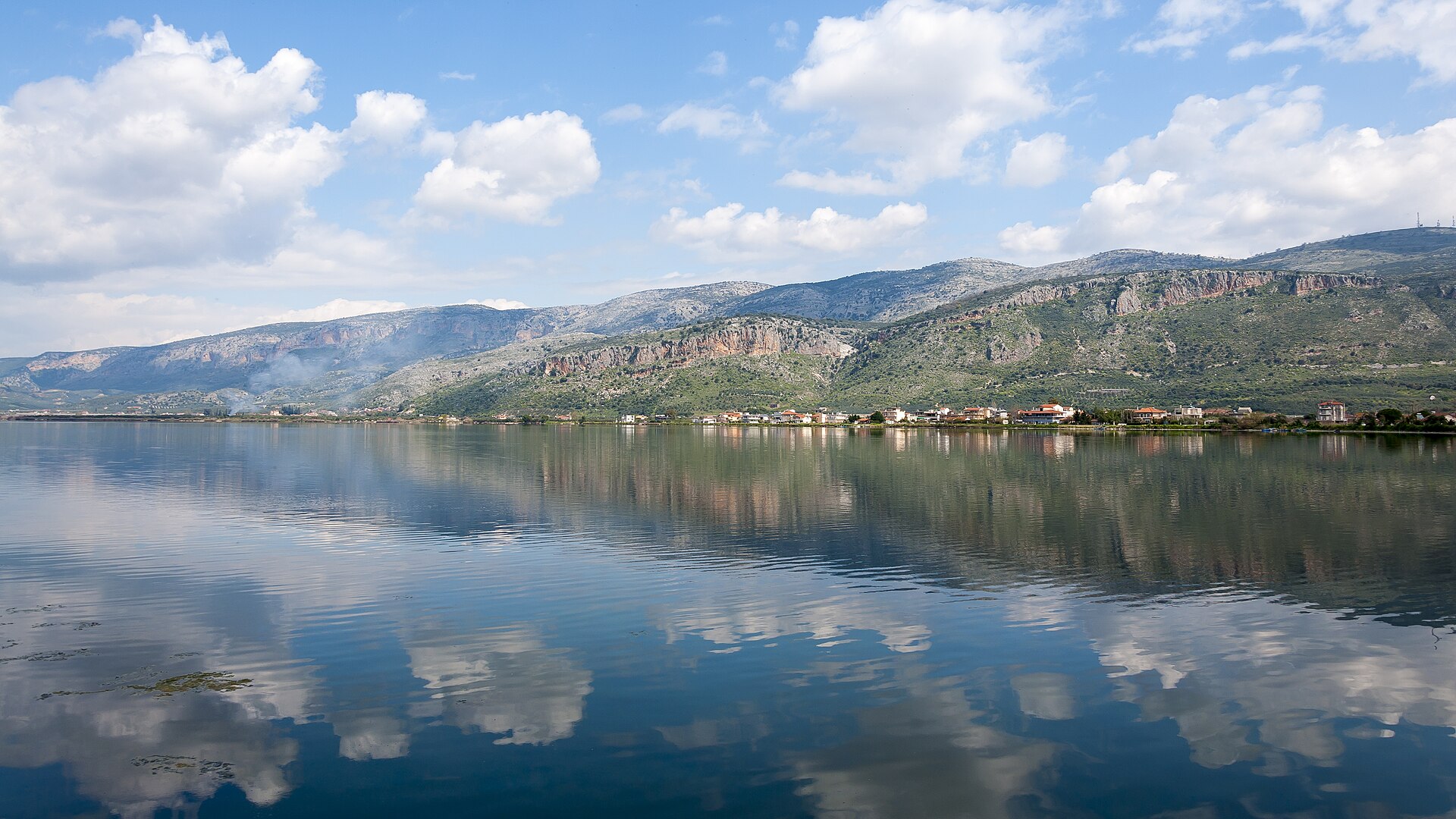
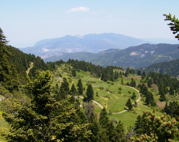
A terrestrial area, with forests and mountains.
What rocks lie beneath Oiti National Park?
According to the European 1:1 million geological map (EGDI), the bedrock consists mainly of mudstones (38% of sampled points), limestones (25%) and volcanic rocks (19%). These are mostly sedimentary rocks. The geological units date mainly from the Cretaceous (38% of sampled points).
Which international labels apply to Oiti National Park?
Natura 2000 network (3 sites).
When is the best time to visit Oiti National Park?
Best time to visit: from June to September, with average temperatures of 11 to 17 °C and moderate rainfall.
Is there snow in Oiti National Park?
Yes. According to NASA's MODIS satellites (2015–2025 average), snow covers most of the site in January and February, and until March on higher ground, with about 65 snow-covered days a year on average.
Are there historic monuments in Oiti National Park?
Yes. According to Wikidata, one monument protected as Greek cultural heritage stands within the boundary. For example: “Pyre of Herakles” in Lamia.
What is the nearest large city to Oiti National Park?
Nearest towns of over 50,000 people, as the crow flies: Patras (69 km) and Volos (75 km). Nearest airport: Araxos (GPA), about 95 km away.
How can I reach Oiti National Park by train?
The nearest railway station is Gorgopotamos, about 1 km from the site boundary.
Which species can be seen in Oiti National Park?
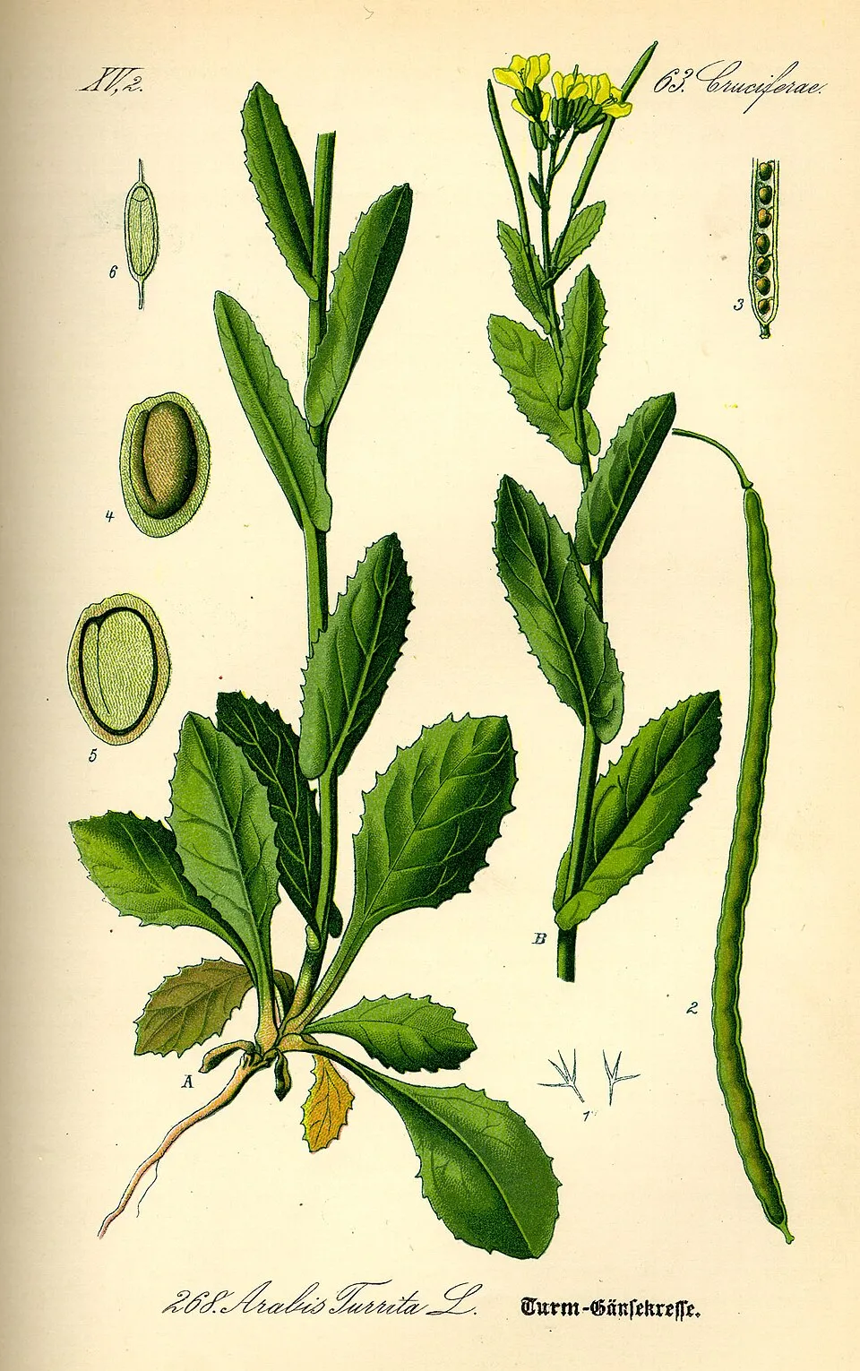
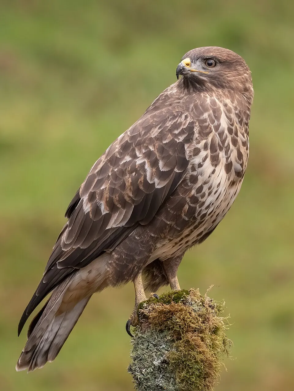
Among the species most often recorded on GBIF are Fringilla coelebs (Eurasian Chaffinch), Pseudoturritis turrita (Tower Cress), Buteo buteo (Common Buzzard) and Turdus merula (Common Blackbird).
What is the official website of Oiti National Park?
© OpenStreetMap
Download the boundary: GeoJSON · GPX Boundary © OpenStreetMap contributors (ODbL).
Geography
The representative point of the site lies at around 1,929 m above sea level. Over the 1996–2025 period, the mean annual temperature is about 5.6 °C and total precipitation reaches roughly 869 mm per year. The warmest month is usually July, the coolest January, and the wettest December. According to the European 1:1 million geological map (EGDI), the bedrock consists mainly of mudstones (38% of sampled points), limestones (25%) and volcanic rocks (19%). These are mostly sedimentary rocks. The geological units date mainly from the Cretaceous (38% of sampled points).
Area
- Area of the boundary
- 19,780 ha
- Elevation
- 1,929 m
- Median elevation
- 1,448 m
- Mean slope
- 19°
- Snow cover
- ≈ 65 days a year
- Coordinates
- 38.8286, 22.2886
Terrain: Mapzen Terrain Tiles (SRTM, USGS)
Elevation bands
- below 500 m 2%
- 500–1,000 m 12%
- 1,000–1,500 m 42%
- 1,500–2,000 m 42%
- 2,000–2,500 m 2%
share of the site in each elevation band (smoothed terrain model: summits are rounded off) · Terrain: Mapzen Terrain Tiles (SRTM, USGS)
Bedrock
- Mudstones 38 %
- Limestones 25 %
- Volcanic rocks 19 %
- Unconsolidated deposits 13 %
- Conglomerates and breccias 6 %
Sedimentary rocks 81 % · Igneous rocks 19 % · Main age: Cretaceous (38%)
Source: EGDI 1:1M geological map (EuroGeoSurveys and national geological surveys), CC BY 4.0 · 16 sampled points within the site.
Climate
● Mean temperature (°C) · ▮ Precipitation (mm)
Source: Copernicus ERA5-Land (C3S, doi:10.24381/cds.68d2bb30), monthly averages 1996–2025 interpolated to the representative point, temperatures adjusted for elevation.
Contains modified Copernicus Climate Change Service information 2026. Neither the European Commission nor ECMWF is responsible for any use that may be made of the Copernicus information or data it contains.
Snow cover measured by satellite
J
F
M
A
M
J
J
A
S
O
N
D
average share of the site under snow · snowiest parts · ≈ 65 days a year
Snow cover: MODIS/Terra MOD10CM v61 (Hall & Riggs, 2021, NASA NSIDC DAAC, doi:10.5067/MODIS/MOD10CM.061), imagery from NASA GIBS (ESDIS); 2015–2025 average, grid of about 5 km.
Natural habitats
According to CORINE Land Cover (2018), the site is mainly made up of forests (54%), heath and scrub (36%) and grassland and meadows (5%). Woodland is mostly coniferous. Elevation ranges from about 340 to 1,940 m (sampled elevations, SRTM). Median elevation is 1,448 m, and 44% of the site lies above 1,500 m (SRTM elevation model). The terrain is steep: 12% of slopes exceed 30° (mean slope 19°). The 3 Natura 2000 sites overlapping the area list 14 habitats of European interest (4 priority), the most extensive being Olea and Ceratonia forests, Quercus ilex and Quercus rotundifolia forests and Alpine and Boreal heaths.
Biodiversity
Based on occurrences aggregated by GBIF, several species are regularly recorded within the site. Among the most frequent are Fringilla coelebs (Eurasian Chaffinch), Pseudoturritis turrita (Tower Cress), Buteo buteo (Common Buzzard) and Turdus merula (Common Blackbird). The full list of documented taxa is shown below. The overlapping Natura 2000 sites list 110 species of European interest: 81 birds, 7 mammals, 15 reptiles, 5 amphibians and 2 plants.
Habitats of European interest
From the official forms of the 3 Natura 2000 sites overlapping the area (areas reported for each whole site).
- Olea and Ceratonia forests 532 ha
- Quercus ilex and Quercus rotundifolia forests 346 ha
- Alpine and Boreal heaths 240 ha
- Species-rich Nardus grasslands, on silicious substrates in mountain areas (and submountain areas in Continental Europe) priority 217 ha
- Calcareous rocky slopes with chasmophytic vegetation 202 ha
- Endemic oro-Mediterranean heaths with gorse 167 ha
- Endemic forests with Juniperus spp. priority 121 ha
- Platanus orientalis and Liquidambar orientalis woods (Platanion orientalis) 43 ha
and 6 more
Species of European interest
Birds · 81
Levant Sparrowhawk (Accipiter brevipes) breeding, Boreal Owl (Aegolius funereus) resident, Eurasian Skylark (Alauda arvensis) resident, Common Kingfisher (Alcedo atthis) passage, Tawny Pipit (Anthus campestris) breeding, Meadow Pipit (Anthus pratensis) wintering, Water Pipit (Anthus spinoletta) wintering, Tree Pipit (Anthus trivialis) passage, Common Swift (Apus apus) breeding, Pallid Swift (Apus pallidus) breeding, Long-eared Owl (Asio otus) resident, Eurasian Eagle-owl (Bubo bubo) resident and 69 more
Mammals · 7
Barbastelle (Barbastella barbastellus), Grey wolf (Canis lupus), Forest dormouse (Dryomys nitedula), Eurasian otter (Lutra lutra), Daubenton's bat (Myotis daubentonii), Brown long-eared bat (Plecotus auritus), Brown bear (Ursus arctos)
Reptiles · 15
Snake-eyed Skink (Ablepharus kitaibelii), Smooth snake (Coronella austriaca), Caspian whipsnake (Dolichophis caspius), Four-lined snake (Elaphe quatuorlineata), Balkan green lizard (Lacerta trilineata), Green lizard (Lacerta viridis), Armored glass lizard (Ophisaurus apodus), Dahl's Whip Snake (Platyceps najadum), Erhard's wall lizard (Podarcis erhardii), Common wall lizard (Podarcis muralis), Hermann's tortoise (Testudo hermanni), Marginated tortoise (Testudo marginata) and 3 more
Amphibians · 5
Yellow-bellied toad (Bombina variegata), Green Toad (Bufotes viridis), Common tree frog (Hyla arborea), Agile frog (Rana dalmatina), Greek Stream Frog (Rana graeca)
Plants · 2
Butcher's-broom (Ruscus aculeatus), Veronica oetaea
Source: Natura 2000 standard data forms (EEA, CC-BY 4.0). Not exhaustive: sensitive species are not published.
Species to look out for



Observed species
Occurrences documented via GBIF; they are neither an exhaustive inventory nor proof of current presence.
- Eurasian Chaffinch · Fringilla coelebs · 54
- Tower Cress · Pseudoturritis turrita · 51
- Common Buzzard · Buteo buteo · 49
- Common Blackbird · Turdus merula · 44
- Coal tit · Periparus ater · 43
- European robin · Erithacus rubecula · 41
- Eurasian Jay · Garrulus glandarius · 41
- Cirl Bunting · Emberiza cirlus · 37
- Eurasian blue tit · Cyanistes caeruleus · 35
- Common Firecrest · Regulus ignicapilla · 35
- Great tit · Parus major · 33
- Mistle Thrush · Turdus viscivorus · 29
+18 more species
- Eurasian Blackcap · Sylvia atricapilla · 27
- Hooded Crow · Corvus cornix · 26
- Veluchi Bright Bush-cricket · Poecilimon veluchianus · 25
- Red-backed Shrike · Lanius collurio · 25
- European Green Woodpecker · Picus viridis · 23
- Alyssum · Alyssum simplex · 23
- Black Woodpecker · Dryocopus martius · 22
- Common Chiffchaff · Phylloscopus collybita · 22
- Eurasian Wren · Troglodytes troglodytes · 22
- Common Kestrel · Falco tinnunculus · 22
- Eurasian Nuthatch · Sitta europaea · 21
- Hairy bittercress · Cardamine hirsuta · 21
- European Greenfinch · Chloris chloris · 20
- Grey Wagtail · Motacilla cinerea · 19
- European Serin · Serinus serinus · 19
- House Sparrow · Passer domesticus · 19
- Woodlark · Lullula arborea · 17
- European Goldfinch · Carduelis carduelis · 17
Records: GBIF.org (CC-BY). Names: Wikidata (CC0), GBIF. Photos: Wikimedia Commons.
Conservation challenges
The primary purpose of the site is to preserve its natural habitats and the biodiversity they support. The species recorded (Biodiversity tab) reflect its ecological value. The designations it holds frame its management and the control of land use.
According to Global Forest Change data (University of Maryland, Global Forest Watch), about 44 ha of tree cover were lost within the boundary between 2001 and 2023 (under 1% of its area), peaking in 2017 and 2018. These losses include logging, storms and fires, and do not account for regrowth. According to CORINE Land Cover, land cover here remained almost unchanged between 1990 and 2018 (less than 0.5% of the area affected). Since 2016, the European EFFIS system (Copernicus) has mapped one fire here, in February 2024 (near Τοπική Κοινότητα Νεοχωρίου Υπάτης), which burned about 7 ha of the site. At night, 3% of the area gives off artificial light detectable from space (NASA VIIRS Black Marble composite, 2016). According to the Natura 2000 forms, of 14 assessed habitats of European interest, 11 are in excellent condition and the rest in good condition. According to the Water Framework Directive assessment (2022 river basin management plans, data 2018–2021), only 48% of the 13 km of rivers assessed within the site are in good or high ecological status; the others mostly have moderate ecological status.
Pressure indicators
Tree cover lost
44 ha
2001–2023
20012023
Fires since 2016
7 ha
burned within the boundary (1 mapped fire)
- 2024 · Τοπική Κοινότητα Νεοχωρίου Υπάτης · 7 ha
Light at night
3%
of the area gives off artificial light visible from space
DarkLit
Built-up land
< 1%
buildings, business areas, roads, quarries · farmland 1%
Land cover change
< 0.5%
of the area changed, 1990–2018 · CORINE
Rivers and lakes
48%
of the 13 km of assessed rivers in good or high ecological status · WFD 2022
assessments 2018–2021
Invasive alien species
2
recorded since 2000
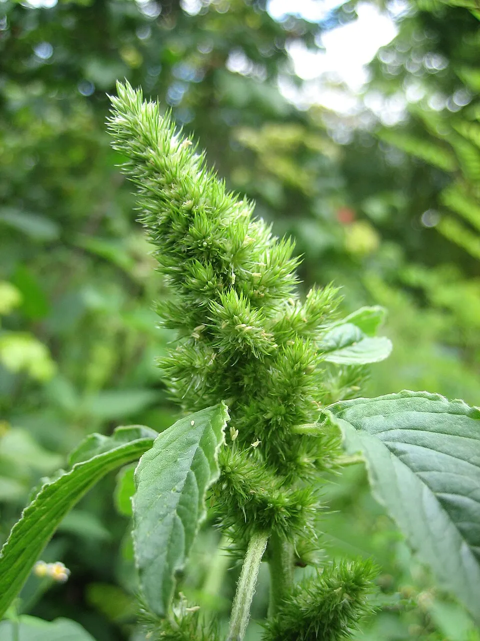 Common Amaranth
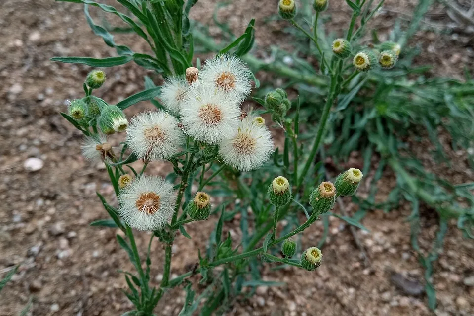 Argentine fleabane
Photos: Common Amaranth © Lynk media · CC BY-SA 3.0; Argentine fleabane © Josep Gesti · CC BY-SA 4.0
Sources: Global Forest Change (Hansen et al., University of Maryland, via Global Forest Watch, CC-BY 4.0); EFFIS, European Commission / Copernicus; NASA Black Marble 2016 (public domain); CORINE Land Cover 2018 (Copernicus) or MODIS.
CORINE Land Cover Change 1990–2018: generated using European Union's Copernicus Land Monitoring Service information (EEA), aggregated by Parkavela; DOI 10.2909/f30f1000-7cf8-43bb-872c-5eb093911b24.
Ecological status of water bodies: European Environment Agency, WISE – Water Framework Directive, 3rd river basin management plans (2022), CC BY 4.0. Official national classification, not comparable between countries.
Invasive alien species: Global Register of Introduced and Invasive Species (ISSG, CC BY 4.0); Union list, Regulation (EU) 1143/2014 (INBO, CC0); GBIF.org records (CC0 / CC BY 4.0), at least 2 per species.
Practical information
Cities and airport
- Patras
69 km as the crow flies - Volos
75 km as the crow flies - Airport: Araxos (GPA)
95 km as the crow flies
Parking
2 public car parks listed within the site
Data © OpenStreetMap contributors (ODbL) · Wikidata (CC0)
Access and visiting
The nearest railway station is Gorgopotamos, about 1 km from the site boundary. Nearest towns of over 50,000 people, as the crow flies: Patras (69 km) and Volos (75 km). Nearest airport: Araxos (GPA), about 95 km away. About 96,000 people live within 20 km of the site boundary, 75,000 of them within 10 km; some 790 people are estimated to live inside (GHSL estimate, 2020). This population has fallen by about 7% since 2000. Public car parks listed within the site: 2. To plan a visit (access, opening periods, visitor rules), it is best to consult the official information from the managing body and the official website listed in this page's sources.
Source: OpenStreetMap (ODbL), Wikidata (CC0), October 2026.
Built heritage
According to Wikidata, one monument protected as Greek cultural heritage stands within the boundary. It is “Pyre of Herakles” in Lamia.
-
Pyre of Herakles
Lamia
Source: Wikidata (CC0), monuments in each country’s official heritage protection registers, at national or regional level. Each item links to its Wikidata entry.
When to visit
Best time to visit: from June to September, with average temperatures of 11 to 17 °C and moderate rainfall. Average temperatures drop below 0 °C from December to March: frost is common. Precipitation peaks in December (up to 110 mm per month). These averages apply to the site's representative point (1,929 m); higher up it is markedly cooler and snow lasts longer. According to NASA's MODIS satellites (2015–2025 average), snow covers most of the site in January and February, and until March on higher ground, with about 65 snow-covered days a year on average. Day length ranges from about 9 h 27 min in December to 14 h 52 min in June. Wildlife records published on GBIF peak for birds (May), plants (July) and butterflies and moths (June). These peaks also reflect when observers are most active.
Source: Copernicus ERA5-Land (C3S), monthly averages 1996–2025 at the representative point, temperatures adjusted for elevation.
Contains modified Copernicus Climate Change Service information 2026. Neither the European Commission nor ECMWF is responsible for any use that may be made of the Copernicus information or data it contains.
Wildlife records calendar
JFMAMJJASOND
Birds
Plants
Butterflies & moths
Monthly records published on GBIF (CC-BY), relative to the busiest month; also reflects observer activity.
Gallery
© Costas78 · Public domain
© Ferengi · CC BY-SA 3.0
© Nikf · CC BY-SA 4.0
© Nikos Laskaridis · CC BY-SA 4.0
© Thomas Fytsilis · CC BY-SA 4.0
© AKMilos · CC BY-SA 4.0
Sources and licences
- Wikidata: Q26001162
- Official website: https://oiti.gr/?q=en%2Fhome
- WDPA: 92540
References
- cds.climate.copernicus.eu: climate · CC-BY-4.0
- registry.opendata.aws: elevation of the reference point, detailed relief · PD
- land.copernicus.eu: land cover, land cover change, sea share · COPERNICUS
- doi.org: population around the site · CC-BY-4.0
- openstreetmap.org: official name, access and peaks, trail difficulty · ODbL-1.0
- wikidata.org: establishment date, protected heritage, nearby cities and airport, access and peaks, lake depths, places to see, official website · CC0-1.0
- eea.europa.eu: bathing water quality, ecological status of waters · CC-BY-4.0
- en.eurovelo.com: EuroVelo cycle routes · ODbL-1.0
- cycling.waymarkedtrails.org: cycle routes · ODbL-1.0
- opentopodata.org: elevations · PD
- forest-fire.emergency.copernicus.eu: wildfires · COPERNICUS
- globalforestwatch.org: tree cover loss · CC-BY-4.0
- gbif.org: seasonality of sightings, invasive alien species, observed species · CC-BY-4.0
- europe-geology.eu: geology · CC-BY-4.0
- hydrosheds.org: lakes · CC-BY-4.0
- natura2000.eea.europa.eu: Natura 2000 habitats and species · CC-BY-4.0
- earthobservatory.nasa.gov: night light · PD
- nsidc.org: snow cover · PD
Data © OpenStreetMap contributors (ODbL), Wikidata (CC0) and the sources cited.