Bird
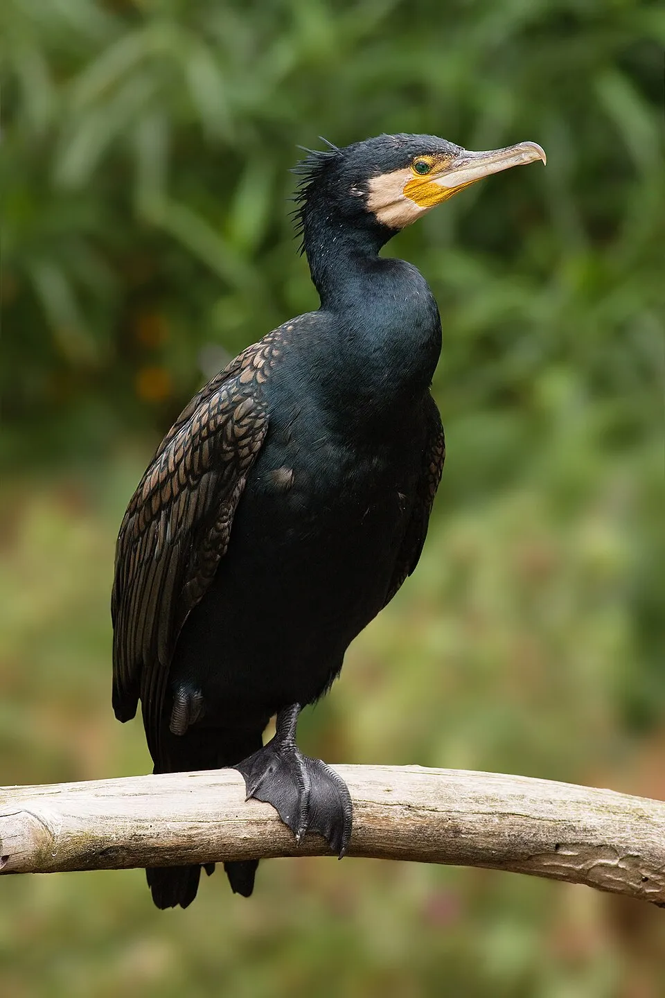
Great Cormorant
Phalacrocorax carbo47 records © JJ Harrison (https://www.jjharrison.com.au/) · CC BY-SA 3.0
Bulgaria · Terrestrial
Nature park of 22,420 hectares in Bulgaria, established in 2000.
Nature park of 22,420 hectares in Bulgaria, established in 2000.
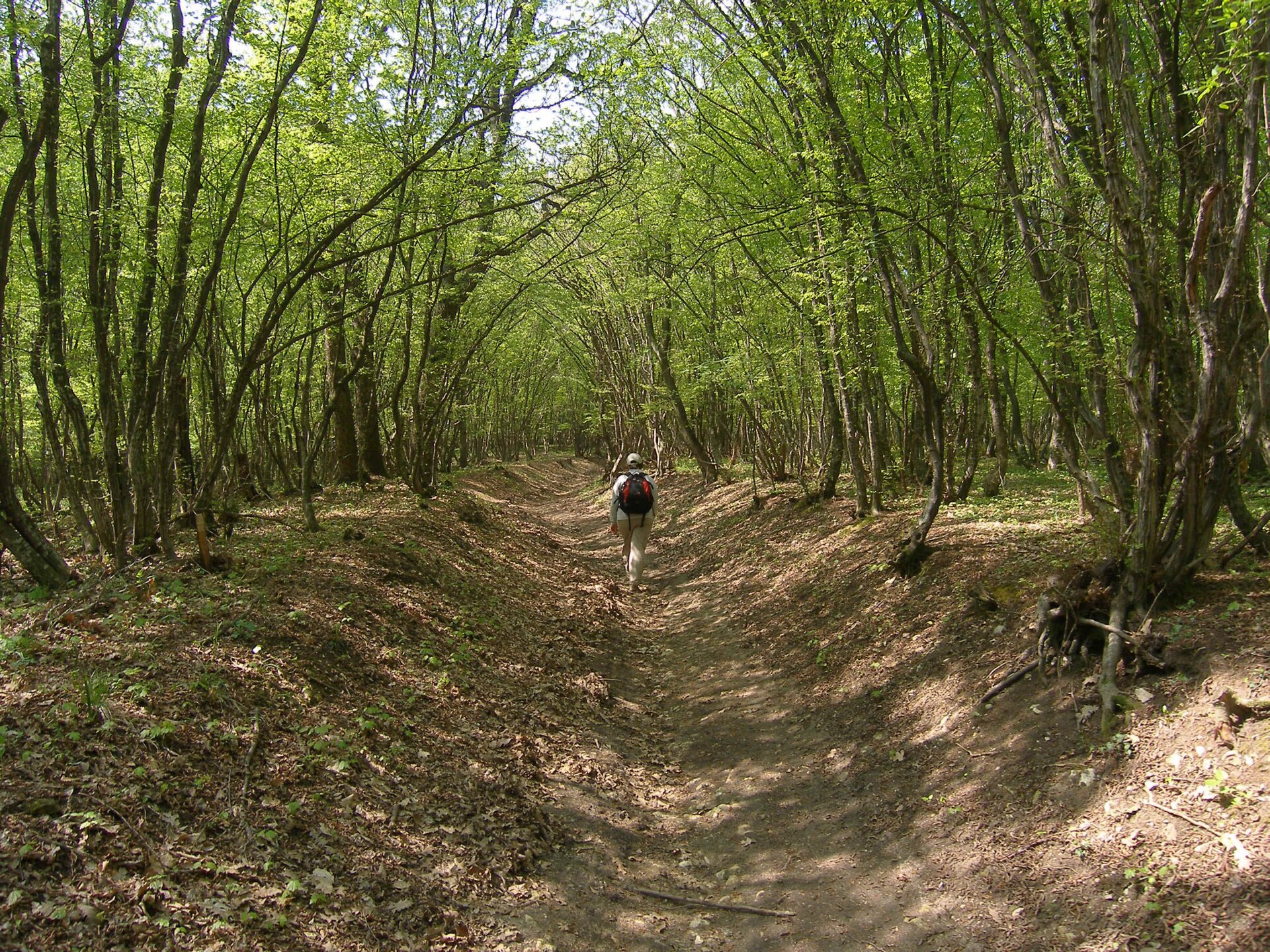
Persina Nature Park is located in Bulgaria (Europe). It is a predominantly terrestrial area. Established on 4 December 2000, it covers about 22,420 hectares.
Protected as a nature park. International labels and designations: Ramsar site and Natura 2000 network (5 sites). Key dates: established in 2000, Ramsar Site in 2002, first Natura 2000 site under the Birds Directive in 2007 and first Natura 2000 site under the Habitats Directive in 2008.
Sources: Wikidata (CC0) for establishment and international labels; EEA Natura 2000 database (CC-BY 4.0) for site designation dates.
In Bulgaria (Europe). Representative point: 43.6667° N, 25.1667° E.
About 22,420 hectares (224 km²). It is the 5th largest of the 11 nature parks in Bulgaria covered by Parkavela.
On 4 December 2000.
A terrestrial area, where land cover is dominated by farmland (68%).
Ramsar site and Natura 2000 network (5 sites).
Best time to visit: September and October, with average temperatures of 13 to 20 °C and moderate rainfall.
Nearest towns of over 50,000 people, as the crow flies: Pleven (35 km) and Ruse (57 km). Nearest airport: Sofia (SOF), about 160 km away.
The nearest railway station is Kreta, about 16 km from the site boundary.
Persina Nature Park Visitor Centre.
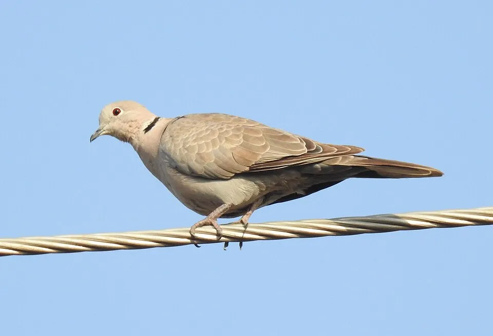
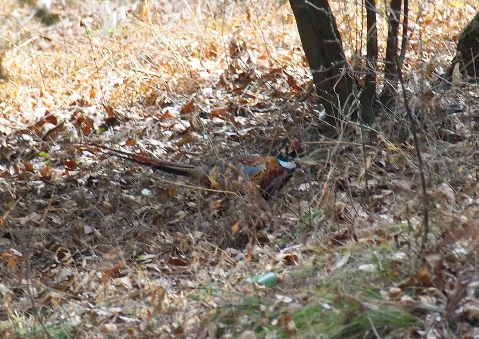
Among the species most often recorded on GBIF are Phalacrocorax carbo (Great Cormorant), Streptopelia decaocto (Eurasian Collared Dove), Parus major (Great tit) and Phasianus colchicus (Common Pheasant).
© OpenStreetMap
Download the boundary: GeoJSON · GPX Boundary © OpenStreetMap contributors (ODbL).
The representative point of the site lies at around 20 m above sea level. Over the 1996–2025 period, the mean annual temperature is about 13.2 °C and total precipitation reaches roughly 613 mm per year. The warmest month is usually July, the coolest January, and the wettest June.
● Mean temperature (°C) · ▮ Precipitation (mm)
Source: Copernicus ERA5-Land (C3S, doi:10.24381/cds.68d2bb30), monthly averages 1996–2025 interpolated to the representative point, temperatures adjusted for elevation.
Contains modified Copernicus Climate Change Service information 2026. Neither the European Commission nor ECMWF is responsible for any use that may be made of the Copernicus information or data it contains.
average share of the site under snow · snowiest parts · ≈ 20 days a year
Snow cover: MODIS/Terra MOD10CM v61 (Hall & Riggs, 2021, NASA NSIDC DAAC, doi:10.5067/MODIS/MOD10CM.061), imagery from NASA GIBS (ESDIS); 2015–2025 average, grid of about 5 km.
According to CORINE Land Cover (2018), the site is mainly made up of farmland (68%), forests (10%) and marshes and bogs (6%). Elevation ranges from about 20 to 190 m (sampled elevations, SRTM). The 5 Natura 2000 sites overlapping the area list 18 habitats of European interest (8 priority), the most extensive being alluvial forests with Alnus glutinosa and Fraxinus excelsior (Alno-Padion, Alnion incanae, Salicion albae), natural eutrophic lakes with Magnopotamion or Hydrocharition-type vegetation and Pannonic loess steppic grasslands.
Based on occurrences aggregated by GBIF, several species are regularly recorded within the site. Among the most frequent are Phalacrocorax carbo (Great Cormorant), Streptopelia decaocto (Eurasian Collared Dove), Parus major (Great tit) and Phasianus colchicus (Common Pheasant). The full list of documented taxa is shown below. The overlapping Natura 2000 sites list 152 species of European interest: 108 birds, 13 mammals, 6 reptiles, 4 amphibians, 13 fish, 6 invertebrates and 2 plants.
From the official forms of the 5 Natura 2000 sites overlapping the area (areas reported for each whole site).
and 10 more
Levant Sparrowhawk (Accipiter brevipes) passage breeding, Eurasian Goshawk (Accipiter gentilis) resident passage, Eurasian Sparrowhawk (Accipiter nisus) wintering passage breeding resident, Common Sandpiper (Actitis hypoleucos) breeding passage, Common Kingfisher (Alcedo atthis) resident, Northern Pintail (Anas acuta) passage, Eurasian Teal (Anas crecca) breeding wintering passage, Mallard (Anas platyrhynchos) wintering passage resident, European White-fronted Goose (Anser albifrons albifrons) passage wintering, Greylag Goose (Anser anser) breeding passage wintering, Lesser white-fronted goose (Anser erythropus) wintering passage, Tawny Pipit (Anthus campestris) breeding and 96 more
Barbastelle (Barbastella barbastellus), Grey wolf (Canis lupus), European wildcat (Felis silvestris), Eurasian otter (Lutra lutra), Common bent-wing bat (Miniopterus schreibersii), Steppe Polecat (Mustela eversmanii), Bechstein's bat (Myotis bechsteinii), Lesser mouse-eared myotis (Myotis blythii), Long-fingered bat (Myotis capaccinii), Geoffroy's bat (Myotis emarginatus), Blasius's Horseshoe Bat (Rhinolophus blasii), Greater Horseshoe Bat (Rhinolophus ferrumequinum) and 1 more
Aesculapian snake (Elaphe longissima), Eastern Four-Lined Ratsnake (Elaphe sauromates), European Pond Turtle (Emys orbicularis), Balkan Wall Lizard (Podarcis taurica), Common Tortoise (Testudo graeca), Hermann's tortoise (Testudo hermanni)
European fire-bellied toad (Bombina bombina), Yellow-bellied toad (Bombina variegata), Agile frog (Rana dalmatina), Danube Crested Newt (Triturus dobrogicus)
Pontic Shad (Alosa immaculata), Asp (Aspius aspius), Spined Loach (Cobitis taenia Complex), Ukrainian brook lamprey (Eudontomyzon mariae), Balon's ruffe (Gymnocephalus baloni), Striped Ruffe (Gymnocephalus schraetzer), Weatherfish (Misgurnus fossilis), Ziege (Pelecus cultratus), European bitterling (Rhodeus amarus), Danube Whitefin Gudgeon (Romanogobio vladykovi), Golden Spined Loach (Sabanejewia aurata), Streber (Zingel streber) and 1 more
Greater Capricorn Beetle (Cerambyx cerdo), Stag beetle (Lucanus cervus), Large copper (Lycaena dispar), Morimus asper funereus, Striped nerite (Theodoxus transversalis), Thick shelled river mussel (Unio crassus)
Eleocharis carniolica, Water Shamrock (Marsilea quadrifolia)
Source: Natura 2000 standard data forms (EEA, CC-BY 4.0). Not exhaustive: sensitive species are not published.
Bird
47 records © JJ Harrison (https://www.jjharrison.com.au/) · CC BY-SA 3.0



Occurrences documented via GBIF; they are neither an exhaustive inventory nor proof of current presence.
Records: GBIF.org (CC-BY). Names: Wikidata (CC0), GBIF. Photos: Wikimedia Commons.
The primary purpose of the site is to preserve its natural habitats and the biodiversity they support. The species recorded (Biodiversity tab) reflect its ecological value. The designations it holds frame its management and the control of land use.
According to Global Forest Change data (University of Maryland, Global Forest Watch), about 439 ha of tree cover were lost within the boundary between 2001 and 2023 (2% of its area), peaking in 2014 and 2016. These losses include logging, storms and fires, and do not account for regrowth. According to the European CORINE Land Cover inventory (Copernicus), land cover changed on about 122 ha of the site between 1990 and 2018 (under 1% of its area). Forest felling and regrowth add about 1,760 ha in total over the period. Since 2016, the European EFFIS system (Copernicus) has mapped 5 fires here, burning about 311 ha within the boundary; the largest, in July 2026 (near Белене), covered 141 ha. At night, 5% of the area gives off artificial light detectable from space (NASA VIIRS Black Marble composite, 2016). Built-up and developed land (buildings, business areas, roads, quarries) covers 5% of the area, and farmland 68% (CORINE Land Cover). According to the Natura 2000 forms, of 17 assessed habitats of European interest, 3 are in excellent condition and 2 in average or reduced condition. According to the Water Framework Directive assessment (2022 river basin management plans, data 2015–2021), the only river assessed within the site has moderate ecological potential.
439 ha
2001–2023
311 ha
burned within the boundary (5 mapped fires)
5%
of the area gives off artificial light visible from space
5%
buildings, business areas, roads, quarries · farmland 68%
122 ha
changed cover, 1990–2018 · CORINE · < 1% of the area
forest felling and regrowth: 1,760 ha in total
0%
of the 25 km of assessed rivers at good or high ecological potential (mostly heavily modified water bodies) · WFD 2022
assessments 2015–2021
1
recorded since 2000
Sources: Global Forest Change (Hansen et al., University of Maryland, via Global Forest Watch, CC-BY 4.0); EFFIS, European Commission / Copernicus; NASA Black Marble 2016 (public domain); CORINE Land Cover 2018 (Copernicus) or MODIS.
CORINE Land Cover Change 1990–2018: generated using European Union's Copernicus Land Monitoring Service information (EEA), aggregated by Parkavela; DOI 10.2909/f30f1000-7cf8-43bb-872c-5eb093911b24.
Ecological status of water bodies: European Environment Agency, WISE – Water Framework Directive, 3rd river basin management plans (2022), CC BY 4.0. Official national classification, not comparable between countries.
Invasive alien species: Global Register of Introduced and Invasive Species (ISSG, CC BY 4.0); Union list, Regulation (EU) 1143/2014 (INBO, CC0); GBIF.org records (CC0 / CC BY 4.0), at least 2 per species.
EV6: route still largely undeveloped
Signed cycle routes: this does not mean that cycling is allowed on footpaths.
Data © OpenStreetMap contributors (ODbL) · Wikidata (CC0)
Contains information from EuroVelo GPX tracks downloaded from www.EuroVelo.com on 2026-10-22, which is made available here under the Open Database License (ODbL). EuroVelo® is a registered trademark of the ECF. Routes © OpenStreetMap contributors (ODbL), via Waymarked Trails
The nearest railway station is Kreta, about 16 km from the site boundary. Nearest towns of over 50,000 people, as the crow flies: Pleven (35 km) and Ruse (57 km). Nearest airport: Sofia (SOF), about 160 km away. About 140,000 people live within 20 km of the site boundary, 88,000 of them within 10 km; some 9,200 people are estimated to live inside (GHSL estimate, 2020). This population has fallen by about 20% since 2000. Visitor information on site: Persina Nature Park Visitor Centre. The EuroVelo 6 cycle route (Atlantic – Black Sea) crosses the site for about 25 km, on a route still largely undeveloped (EuroVelo). To plan a visit (access, opening periods, visitor rules), it is best to consult the official information from the managing body and the official website listed in this page's sources.
Source: OpenStreetMap (ODbL), Wikidata (CC0), October 2026.
Best time to visit: September and October, with average temperatures of 13 to 20 °C and moderate rainfall. Snow only makes brief appearances in winter (about 20 days a year on average, MODIS satellites 2015–2025). Day length ranges from about 8 h 57 min in December to 15 h 25 min in June. Wildlife records published on GBIF peak for birds (May and June), plants (June) and dragonflies (June). These peaks also reflect when observers are most active.
Source: Copernicus ERA5-Land (C3S), monthly averages 1996–2025 at the representative point, temperatures adjusted for elevation.
Contains modified Copernicus Climate Change Service information 2026. Neither the European Commission nor ECMWF is responsible for any use that may be made of the Copernicus information or data it contains.
Monthly records published on GBIF (CC-BY), relative to the busiest month; also reflects observer activity.
Data © OpenStreetMap contributors (ODbL), Wikidata (CC0) and the sources cited.