
Greece · Terrestrial
Schinias Marathon National Park
National park of 1,439 hectares in Greece, established in 2000.
Overview
National park of 1,439 hectares in Greece, established in 2000.
Schinias Marathon National Park is located in Greece (Europe). It is a predominantly terrestrial area. Established in 2000, it covers about 1,439 hectares.
Protections and designations
Natura 2000 · habitats (SAC)
- Ethniko Parko Schinia - Marathona GR3000003
Natura 2000 · birds (SPA)
- Ygrotopos Schinia GR3000016
Protected as a national park. International labels and designations: Natura 2000 network (2 sites). Key dates: established in 2000, first Natura 2000 site under the Birds Directive in 2010 and first Natura 2000 site under the Habitats Directive in 2011.
In our collections
Timeline
-
2000
Established
-
2010
First Natura 2000 site under the Birds Directive
-
2011
First Natura 2000 site under the Habitats Directive
Sources: Wikidata (CC0) for establishment and international labels; EEA Natura 2000 database (CC-BY 4.0) for site designation dates.
Frequently asked questions
Where is Schinias Marathon National Park?
In Greece (Europe). Representative point: 38.1511° N, 24.0283° E.
How large is Schinias Marathon National Park?
About 1,439 hectares (14 km²). It is the 14th largest of the 14 national parks in Greece covered by Parkavela. About 100 ha are at sea.
When was Schinias Marathon National Park established?
In 2000.
What habitats and landscapes does Schinias Marathon National Park include?
A terrestrial area, with wetlands and coasts.
What rocks lie beneath Schinias Marathon National Park?
According to the European 1:1 million geological map (EGDI), the bedrock consists mainly of unconsolidated deposits (88% of sampled points) and marbles (13%). These are mostly sedimentary rocks. The geological units date mainly from the Quaternary (88% of sampled points).
Which international labels apply to Schinias Marathon National Park?
Natura 2000 network (2 sites).
When is the best time to visit Schinias Marathon National Park?
Best time to visit: September and October, with average temperatures of 18 to 24 °C and moderate rainfall.
Can you swim in Schinias Marathon National Park?
2 monitored bathing sites lie in or within 1 km of the site; official 2025 classification: 2 excellent (European Environment Agency). Swimming is only permitted at the sites and times authorised locally.
What is the nearest large city to Schinias Marathon National Park?
Nearest towns of over 50,000 people, as the crow flies: Agia Paraskevi (23 km) and Chalandri (23 km). Nearest airport: Athens International Airport "Eleftherios Venizelos" (ATH), about 23 km away.
How can I reach Schinias Marathon National Park by train?
The nearest railway station is Agios Stefanos, about 13 km from the site boundary.
Which species can be seen in Schinias Marathon National Park?
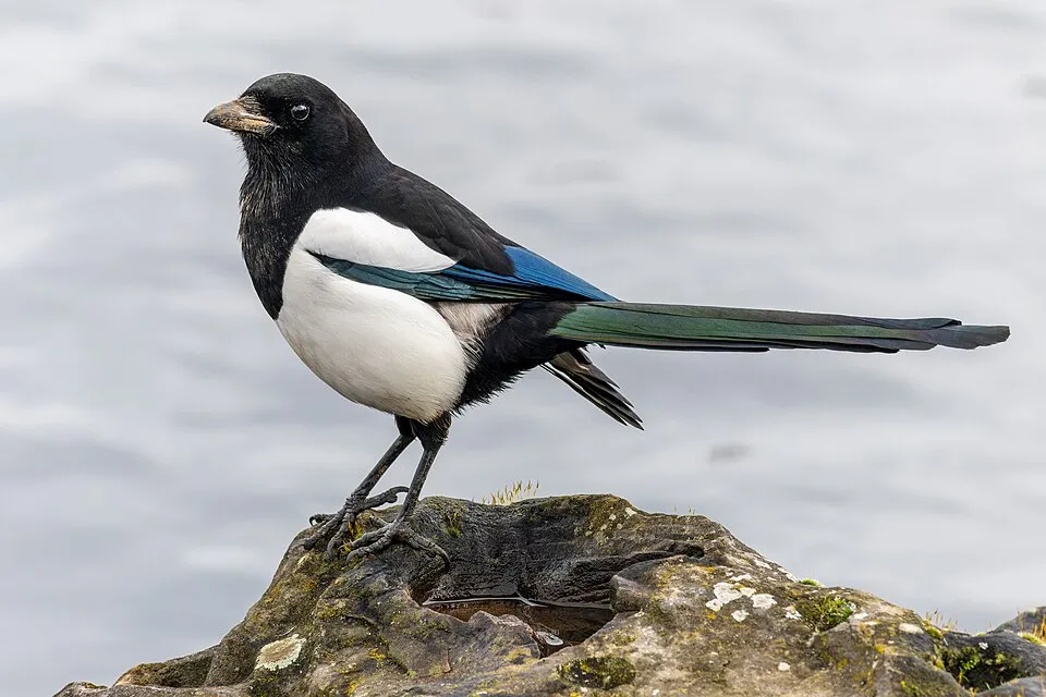
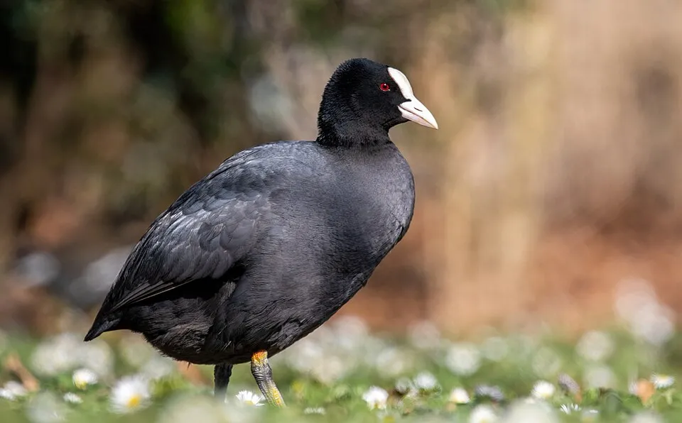
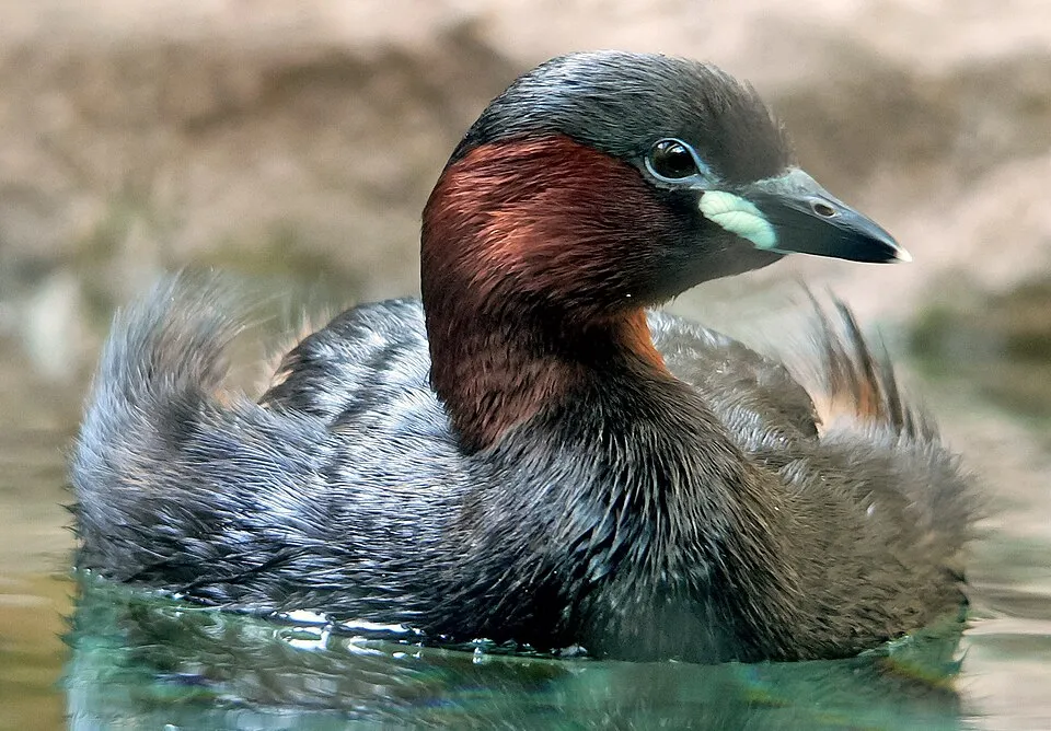
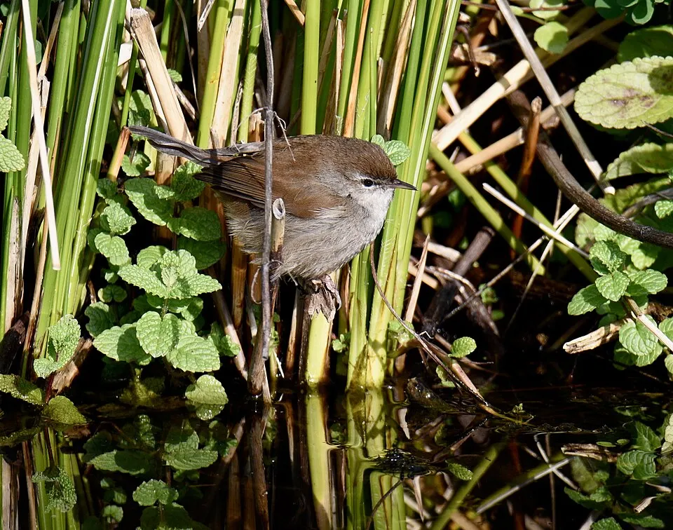
Among the species most often recorded on GBIF are Pica pica (Eurasian Magpie), Fulica atra (Common Coot), Larus michahellis (Yellow-legged Gull) and Tachybaptus ruficollis (Little Grebe).
What is the official website of Schinias Marathon National Park?
© OpenStreetMap
Download the boundary: GeoJSON · GPX Boundary © OpenStreetMap contributors (ODbL).
Geography
The representative point of the site lies at around 3 m above sea level. Over the 1996–2025 period, the mean annual temperature is about 18.0 °C and total precipitation reaches roughly 510 mm per year. The warmest month is usually July, the coolest January, and the wettest December. According to the European 1:1 million geological map (EGDI), the bedrock consists mainly of unconsolidated deposits (88% of sampled points) and marbles (13%). These are mostly sedimentary rocks. The geological units date mainly from the Quaternary (88% of sampled points).
Area
- Area
- 1,439 ha
- Elevation
- 3 m
- Coordinates
- 38.1511, 24.0283
Bedrock
- Unconsolidated deposits 88 %
- Marbles 13 %
Sedimentary rocks 88 % · Metamorphic rocks 13 % · Main age: Quaternary (88%)
Source: EGDI 1:1M geological map (EuroGeoSurveys and national geological surveys), CC BY 4.0 · 16 sampled points within the site.
Climate
● Mean temperature (°C) · ▮ Precipitation (mm)
Source: Copernicus ERA5-Land (C3S, doi:10.24381/cds.68d2bb30), monthly averages 1996–2025 interpolated to the representative point, temperatures adjusted for elevation.
Contains modified Copernicus Climate Change Service information 2026. Neither the European Commission nor ECMWF is responsible for any use that may be made of the Copernicus information or data it contains.
Natural habitats
According to CORINE Land Cover (2018), the site is mainly made up of marshes and bogs (48%), built-up or developed land (19%) and forests (13%). The site borders the coast. Elevation ranges from sea level to about 180 m (sampled elevations, SRTM). The 2 Natura 2000 sites overlapping the area list 21 habitats of European interest (4 priority), the most extensive being Mediterranean salt meadows (Juncetalia maritimi), arborescent matorral with Juniperus spp. and Posidonia beds (Posidonion oceanicae).
Biodiversity
Based on occurrences aggregated by GBIF, several species are regularly recorded within the site. Among the most frequent are Pica pica (Eurasian Magpie), Fulica atra (Common Coot), Larus michahellis (Yellow-legged Gull) and Tachybaptus ruficollis (Little Grebe). The full list of documented taxa is shown below. The overlapping Natura 2000 sites list 120 species of European interest: 102 birds, 13 reptiles, 2 amphibians, 1 invertebrate and 2 plants.
Habitats of European interest
From the official forms of the 2 Natura 2000 sites overlapping the area (areas reported for each whole site).
- Mediterranean salt meadows (Juncetalia maritimi) 359 ha
- Arborescent matorral with Juniperus spp. 186 ha
- Posidonia beds (Posidonion oceanicae) priority 106 ha
- Wooded dunes with Pinus pinea and/or Pinus pinaster priority 95 ha
- Sandbanks which are slightly covered by sea water all the time 79 ha
- Southern riparian galleries and thickets (Nerio-Tamaricetea and Securinegion tinctoriae) 23 ha
- Natural eutrophic lakes with Magnopotamion or Hydrocharition-type vegetation 14 ha
- Thermo-Mediterranean and pre-desert scrub 12 ha
and 13 more
Species of European interest
Birds · 102
Common Sandpiper (Actitis hypoleucos) passage, Eurasian Skylark (Alauda arvensis) wintering, Common Kingfisher (Alcedo atthis) passage wintering, Northern Pintail (Anas acuta) wintering, Eurasian Teal (Anas crecca) wintering, Mallard (Anas platyrhynchos) wintering resident, European White-fronted Goose (Anser albifrons albifrons) wintering, Tawny Pipit (Anthus campestris) passage, Meadow Pipit (Anthus pratensis) passage, Water Pipit (Anthus spinoletta) passage, Common Swift (Apus apus) passage breeding, Grey Heron (Ardea cinerea) passage and 90 more
Reptiles · 13
Snake-eyed Skink (Ablepharus kitaibelii), Ocellated skink (Chalcides ocellatus), Green Turtle (Chelonia mydas), European Pond Turtle (Emys orbicularis), Balkan green lizard (Lacerta trilineata), Balkan pond turtle (Mauremys rivulata), Kotschys Gecko (Mediodactylus kotschyi), Dice snake (Natrix tessellata), Armored glass lizard (Ophisaurus apodus), Hermann's tortoise (Testudo hermanni), Marginated tortoise (Testudo marginata), Nose-horned Viper (Vipera ammodytes) and 1 more
Amphibians · 2
Green Toad (Bufotes viridis), Common tree frog (Hyla arborea)
Invertebrates · 1
Fan Mussel (Pinna nobilis)
Plants · 2
Fritillaria obliqua, Butcher's-broom (Ruscus aculeatus)
Source: Natura 2000 standard data forms (EEA, CC-BY 4.0). Not exhaustive: sensitive species are not published.
Species to look out for

Observed species
Occurrences documented via GBIF; they are neither an exhaustive inventory nor proof of current presence.
- Eurasian Magpie · Pica pica · 1276
- Common Coot · Fulica atra · 1254
- Yellow-legged Gull · Larus michahellis · 1170
- Little Grebe · Tachybaptus ruficollis · 1162
- Cetti's Warbler · Cettia cetti · 1127
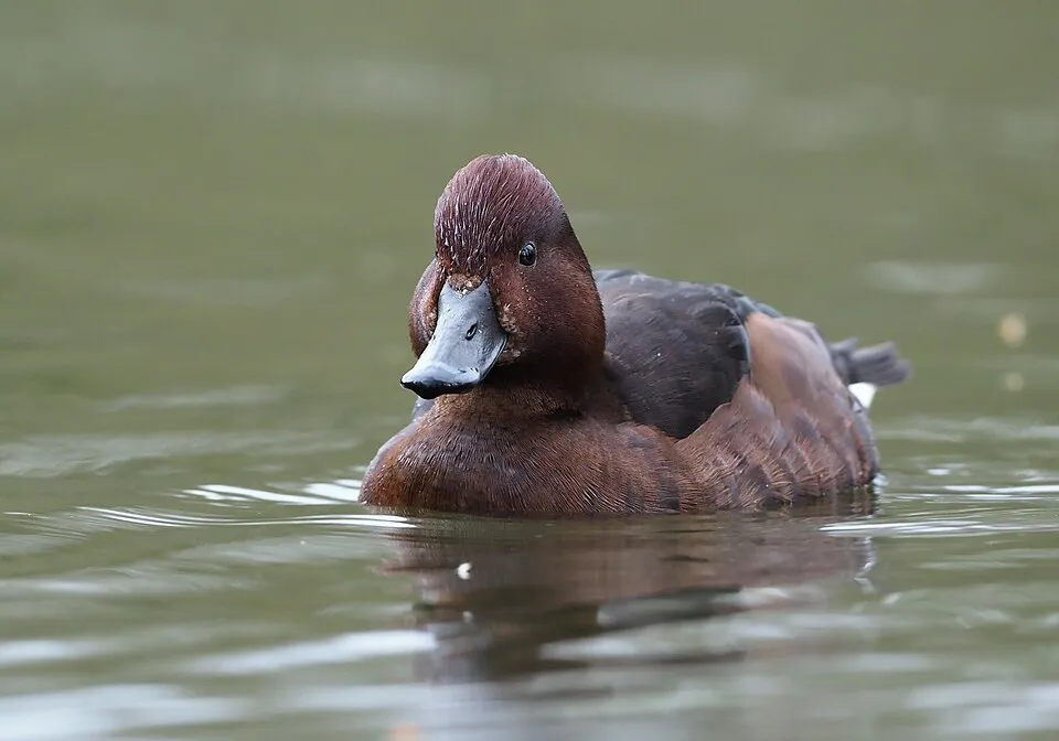
- Ferruginous Duck · Aythya nyroca · 1110
- House Sparrow · Passer domesticus · 1028
- Eurasian Collared Dove · Streptopelia decaocto · 1017
- Western Marsh Harrier · Circus aeruginosus · 1008
- Hooded Crow · Corvus cornix · 975
- Common Moorhen · Gallinula chloropus · 966
- Mallard · Anas platyrhynchos · 957
+18 more species
- Common Kestrel · Falco tinnunculus · 934
- Sardinian Warbler · Curruca melanocephala · 898
- Common Buzzard · Buteo buteo · 847
- Great tit · Parus major · 790
- Zitting Cisticola · Cisticola juncidis · 789
- European Goldfinch · Carduelis carduelis · 777
- Brown-cheeked rail · Rallus aquaticus · 699
- Barn Swallow · Hirundo rustica · 698
- Common Blackbird · Turdus merula · 694
- Eurasian Chaffinch · Fringilla coelebs · 661
- European Stonechat · Saxicola rubicola · 656
- Crested Lark · Galerida cristata · 653
- Grey Heron · Ardea cinerea · 629
- Little Egret · Egretta garzetta · 604
- European robin · Erithacus rubecula · 584
- European Greenfinch · Chloris chloris · 576
- Common Chiffchaff · Phylloscopus collybita · 566
- Great Cormorant · Phalacrocorax carbo · 561
Records: GBIF.org (CC-BY). Names: Wikidata (CC0), GBIF. Photos: Wikimedia Commons.
Conservation challenges
The primary purpose of the site is to preserve its natural habitats and the biodiversity they support. The species recorded (Biodiversity tab) reflect its ecological value. The designations it holds frame its management and the control of land use.
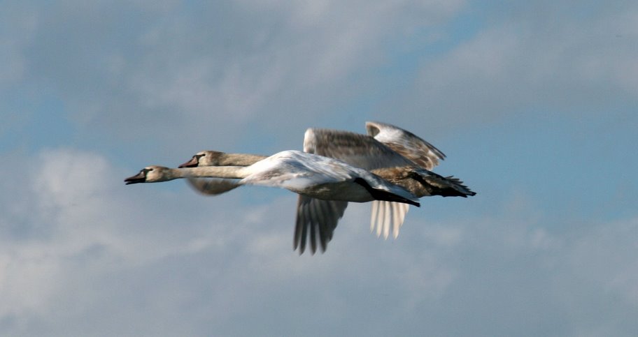
According to the European CORINE Land Cover inventory (Copernicus), land cover changed on about 153 ha of the site between 1990 and 2018 (18% of its area): built-up land grew by 127 ha, mostly at the expense of farmland, while farmland shrank by 77 ha, mostly giving way to built-up land. Since 2016, the European EFFIS system (Copernicus) has mapped one fire here, in October 2023 (near Δημοτική Κοινότητα Μαραθώνος), which burned about 57 ha of the site. At night, 60% of the area gives off artificial light detectable from space (NASA VIIRS Black Marble composite, 2016). Built-up and developed land (buildings, business areas, roads, quarries) covers 19% of the area (CORINE Land Cover). According to the Natura 2000 forms, of 19 assessed habitats of European interest, 4 are in excellent condition and 4 in average or reduced condition. According to the Water Framework Directive assessment (2022 river basin management plans, data 2018–2021), water bodies assessed within the site: coastal waters, 1 of 1 in good ecological status or better. Invasive alien species have been recorded within the site since 2000 (GBIF observations), several of them listed as of Union concern. Among them: Threskiornis aethiopicus (African Sacred Ibis), Trachemys scripta (Pond slider) and Cygnus olor (Mute Swan).
Pressure indicators
Tree cover lost
2 ha
2001–2023 · < 1% of the area
20012023
Fires since 2016
57 ha
burned within the boundary (1 mapped fire)
- 2023 · Δημοτική Κοινότητα Μαραθώνος · 57 ha
Light at night
60%
of the area gives off artificial light visible from space
DarkLit
Built-up land
19%
buildings, business areas, roads, quarries
Land cover change
153 ha
changed cover, 1990–2018 · CORINE · 18% of the area
- +127 ha · built-up land
- −77 ha · farmland
Rivers and lakes
Coastal waters: 1 of 1 good or better
assessments 2018–2021
Invasive alien species
4
incl. 2 of EU concern · since 2000
 African Sacred Ibis
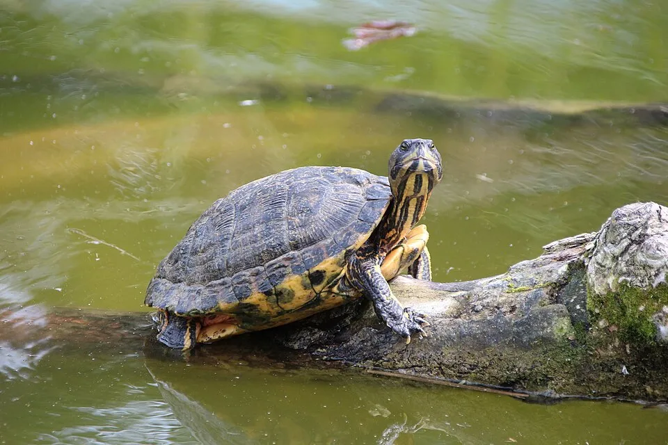 Pond sliderEU
 Mute Swan
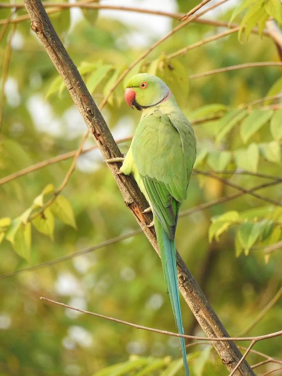 Rose-ringed Parakeet
Photos: African Sacred Ibis © Steve Garvie from Dunfermline, Fife, Scotland · CC BY-SA 2.0; Pond slider © Viva.Chelonia · CC BY 2.0; Mute Swan © Geni · CC BY-SA 4.0; Rose-ringed Parakeet © Afsarnayakkan · CC BY 3.0
Sources: Global Forest Change (Hansen et al., University of Maryland, via Global Forest Watch, CC-BY 4.0); EFFIS, European Commission / Copernicus; NASA Black Marble 2016 (public domain); CORINE Land Cover 2018 (Copernicus) or MODIS.
CORINE Land Cover Change 1990–2018: generated using European Union's Copernicus Land Monitoring Service information (EEA), aggregated by Parkavela; DOI 10.2909/f30f1000-7cf8-43bb-872c-5eb093911b24.
Ecological status of water bodies: European Environment Agency, WISE – Water Framework Directive, 3rd river basin management plans (2022), CC BY 4.0. Official national classification, not comparable between countries.
Invasive alien species: Global Register of Introduced and Invasive Species (ISSG, CC BY 4.0); Union list, Regulation (EU) 1143/2014 (INBO, CC0); GBIF.org records (CC0 / CC BY 4.0), at least 2 per species.
Practical information
Cities and airport
- Agia Paraskevi
23 km as the crow flies - Chalandri
23 km as the crow flies - Airport: Athens International Airport "Eleftherios Venizelos" (ATH)
23 km as the crow flies
Parking
3 public car parks listed within the site
Data © OpenStreetMap contributors (ODbL) · Wikidata (CC0)
Bathing
2 monitored bathing sites in or within 1 km of the site · 2025 classification
Excellent · 2
- Dikastika Schinia · sea · Excellent
- Sxinias · sea · Excellent
Source: European Environment Agency, official bathing water classification (Directive 2006/7/EC, CC-BY 4.0). Swimming is only permitted at the sites and times authorised locally.
Access and visiting
The nearest railway station is Agios Stefanos, about 13 km from the site boundary. Nearest towns of over 50,000 people, as the crow flies: Agia Paraskevi (23 km) and Chalandri (23 km). Nearest airport: Athens International Airport "Eleftherios Venizelos" (ATH), about 23 km away. About 320,000 people live within 20 km of the site boundary, 26,000 of them within 10 km; some 590 people are estimated to live inside (GHSL estimate, 2020). This population has fallen by about 5% since 2000. Public car parks listed within the site: 3. To plan a visit (access, opening periods, visitor rules), it is best to consult the official information from the managing body and the official website listed in this page's sources.
Source: OpenStreetMap (ODbL), Wikidata (CC0), October 2026.
When to visit
Best time to visit: September and October, with average temperatures of 18 to 24 °C and moderate rainfall. Day length ranges from about 9 h 31 min in December to 14 h 48 min in June. Wildlife records published on GBIF peak for birds (April), plants (April) and dragonflies (June). These peaks also reflect when observers are most active.
Source: Copernicus ERA5-Land (C3S), monthly averages 1996–2025 at the representative point, temperatures adjusted for elevation.
Contains modified Copernicus Climate Change Service information 2026. Neither the European Commission nor ECMWF is responsible for any use that may be made of the Copernicus information or data it contains.
Wildlife records calendar
JFMAMJJASOND
Birds
Plants
Dragonflies
Monthly records published on GBIF (CC-BY), relative to the busiest month; also reflects observer activity.
Gallery
© Phanis Koumpis · CC BY-SA 3.0
© Seisma · CC BY-SA 4.0
© Isidora Kyriazi · CC BY-SA 4.0
© Theodoros Alexandropoulos · CC BY-SA 4.0
© Isidora Kyriazi · CC BY-SA 4.0
© Foteini Malli · CC BY-SA 4.0
Sources and licences
- Wikidata: Q12876746
- OpenStreetMap: relation 8488240
- Official website: http://www.npschiniasmarathon.gr
- Wikipedia: fr.wikipedia.org/wiki/Parc_national_de_Schiniás-Marathon
- WDPA: 177845
References
- cds.climate.copernicus.eu: climate · CC-BY-4.0
- registry.opendata.aws: elevation of the reference point, detailed relief · PD
- land.copernicus.eu: land cover, land cover change, sea share · COPERNICUS
- doi.org: population around the site · CC-BY-4.0
- wikidata.org: official area, establishment date, protected heritage, nearby cities and airport, access and peaks, lake depths, places to see, official website · CC0-1.0
- eea.europa.eu: bathing water quality, ecological status of waters · CC-BY-4.0
- en.eurovelo.com: EuroVelo cycle routes · ODbL-1.0
- cycling.waymarkedtrails.org: cycle routes · ODbL-1.0
- opentopodata.org: elevations · PD
- forest-fire.emergency.copernicus.eu: wildfires · COPERNICUS
- globalforestwatch.org: tree cover loss · CC-BY-4.0
- gbif.org: seasonality of sightings, invasive alien species, observed species · CC-BY-4.0
- europe-geology.eu: geology · CC-BY-4.0
- hydrosheds.org: lakes · CC-BY-4.0
- natura2000.eea.europa.eu: Natura 2000 habitats and species · CC-BY-4.0
- openstreetmap.org: official name, access and peaks, trail difficulty · ODbL-1.0
- earthobservatory.nasa.gov: night light · PD
- nsidc.org: snow cover · PD
- wikidata.org: Wikipedia article · CC-BY-SA-4.0
Data © OpenStreetMap contributors (ODbL), Wikidata (CC0) and the sources cited.

