Greece · Terrestrial
Sounio National Park
National park of 3,480 hectares in Greece, established in 1974.
Overview
National park of 3,480 hectares in Greece, established in 1974.
Sounio National Park is located in Greece (Europe). It is a predominantly terrestrial area. Established in 1974, it covers about 3,480 hectares.
Protections and designations
Natura 2000 · habitats (SAC)
Protected as a national park. International labels and designations: Natura 2000 network (1 site: “Sounio - Nisida Patroklou kai Paraktia Thalassia Zoni”). Key dates: established in 1974 and first Natura 2000 site under the Habitats Directive in 2011.
In our collections
Timeline
-
1974
Established
-
2011
First Natura 2000 site under the Habitats Directive
Sources: Wikidata (CC0) for establishment and international labels; EEA Natura 2000 database (CC-BY 4.0) for site designation dates.
Frequently asked questions
Where is Sounio National Park?
In Greece (Europe). Representative point: 37.6510° N, 24.0275° E.
How large is Sounio National Park?
About 3,480 hectares (35 km²). It is the 12th largest of the 14 national parks in Greece covered by Parkavela.
When was Sounio National Park established?
In 1974.
What habitats and landscapes does Sounio National Park include?
A terrestrial area, with forests.
What rocks lie beneath Sounio National Park?
According to the European 1:1 million geological map (EGDI), the bedrock consists mainly of marbles (75% of sampled points) and greenschists (25%). These are mostly metamorphic rocks. The geological units date mainly from the Triassic (69% of sampled points).
Which international labels apply to Sounio National Park?
Natura 2000 network (1 site: “Sounio - Nisida Patroklou kai Paraktia Thalassia Zoni”).
When is the best time to visit Sounio National Park?
Best time to visit: May and June, with average temperatures of 20 to 25 °C and moderate rainfall.
What is there to see in Sounio National Park?
Cave of Kitsos (Wikidata).
Are there historic monuments in Sounio National Park?
Yes. According to Wikidata, 7 monuments protected as Greek cultural heritage stand within the boundary. For example: “Princess tower/farm” in Lavreotiki, “Cave of Kitsos” in Lavreotiki and “Kamariza Mines” in Lavreotiki.
Can you swim in Sounio National Park?
2 monitored bathing sites lie in or within 1 km of the site; official 2025 classification: 2 excellent (European Environment Agency). Swimming is only permitted at the sites and times authorised locally.
What is the nearest large city to Sounio National Park?
Nearest towns of over 50,000 people, as the crow flies: Glyfada (26 km) and Agia Paraskevi (31 km). Nearest airport: Athens International Airport "Eleftherios Venizelos" (ATH), about 20 km away.
How can I reach Sounio National Park by train?
The nearest railway station is Keratea Industrial Area, about 4 km from the site boundary.
Where can I get visitor information on site?
Lavrio.
Which species can be seen in Sounio National Park?
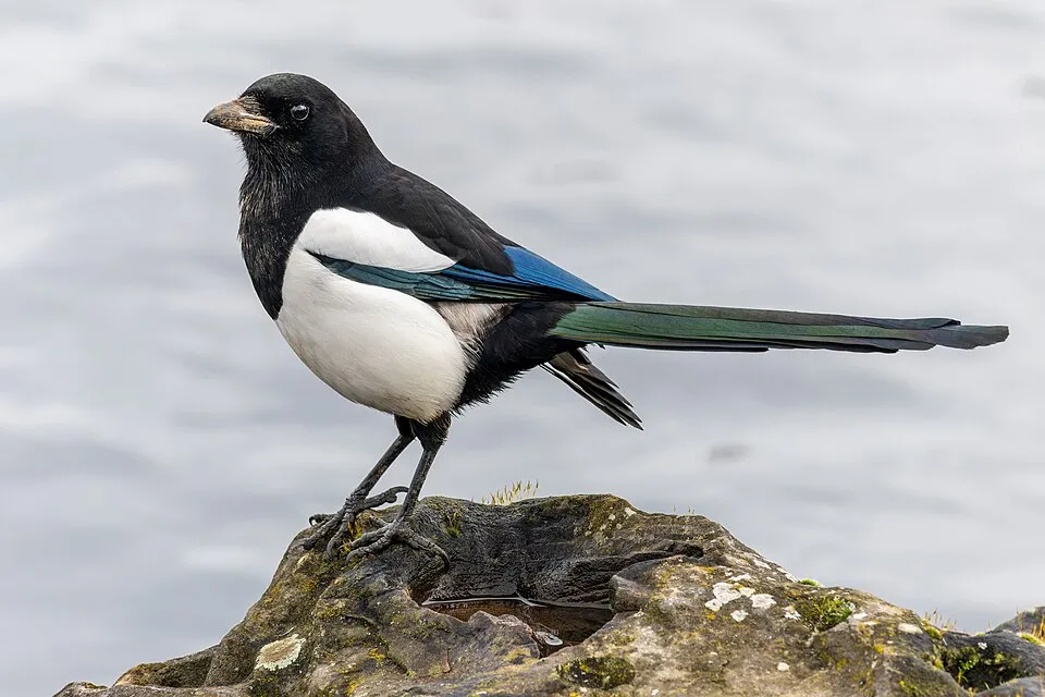
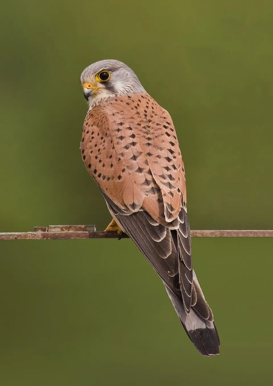
Among the species most often recorded on GBIF are Curruca melanocephala (Sardinian Warbler), Pica pica (Eurasian Magpie), Larus michahellis (Yellow-legged Gull) and Falco tinnunculus (Common Kestrel).
What is the official website of Sounio National Park?
© OpenStreetMap
Download the boundary: GeoJSON · GPX Boundary © OpenStreetMap contributors (ODbL).
Geography
The representative point of the site lies at around 36 m above sea level. Over the 1996–2025 period, the mean annual temperature is about 18.4 °C and total precipitation reaches roughly 320 mm per year. The warmest month is usually July, the coolest January, and the wettest December. According to the European 1:1 million geological map (EGDI), the bedrock consists mainly of marbles (75% of sampled points) and greenschists (25%). These are mostly metamorphic rocks. The geological units date mainly from the Triassic (69% of sampled points).
Area
- Area
- 3,480 ha
- Elevation
- 36 m
- Mean slope
- 8°
- Coordinates
- 37.651, 24.0275
Terrain: Mapzen Terrain Tiles (SRTM, USGS)
Bedrock
- Marbles 75 %
- Greenschists 25 %
Metamorphic rocks 100 % · Main age: Triassic (69%)
Source: EGDI 1:1M geological map (EuroGeoSurveys and national geological surveys), CC BY 4.0 · 16 sampled points within the site.
Climate
● Mean temperature (°C) · ▮ Precipitation (mm)
Source: Copernicus ERA5-Land (C3S, doi:10.24381/cds.68d2bb30), monthly averages 1996–2025 interpolated to the representative point, temperatures adjusted for elevation.
Contains modified Copernicus Climate Change Service information 2026. Neither the European Commission nor ECMWF is responsible for any use that may be made of the Copernicus information or data it contains.
Natural habitats
According to CORINE Land Cover (2018), the site is mainly made up of forests (51%), built-up or developed land (15%) and farmland (13%). Woodland mixes broadleaved and coniferous trees. Elevation ranges from about 10 to 290 m (sampled elevations, SRTM). The Natura 2000 site overlapping the area lists 15 habitats of European interest (2 priority), the most extensive being Olea and Ceratonia forests, Mediterranean pine forests with endemic Mesogean pines and Posidonia beds (Posidonion oceanicae).
Biodiversity
Based on occurrences aggregated by GBIF, several species are regularly recorded within the site. Among the most frequent are Curruca melanocephala (Sardinian Warbler), Pica pica (Eurasian Magpie), Larus michahellis (Yellow-legged Gull) and Falco tinnunculus (Common Kestrel). The full list of documented taxa is shown below. The overlapping Natura 2000 site lists 11 species of European interest: 4 mammals, 5 reptiles, 1 amphibian and 1 invertebrate.
Habitats of European interest
From the official form of the Natura 2000 site overlapping the area (areas reported for the whole site).
- Olea and Ceratonia forests 1,416 ha
- Mediterranean pine forests with endemic Mesogean pines 1,137 ha
- Posidonia beds (Posidonion oceanicae) priority 351 ha
- Sarcopoterium spinosum phryganas 318 ha
- Reefs 112 ha
- Sandbanks which are slightly covered by sea water all the time 41 ha
- Arborescent matorral with Juniperus spp. 28 ha
- Southern riparian galleries and thickets (Nerio-Tamaricetea and Securinegion tinctoriae) 10 ha
and 7 more
Species of European interest
Mammals · 4
Savi's Pipistrelle (Hypsugo savii), Kuhl's pipistrelle (Pipistrellus kuhlii), European free-tailed bat (Tadarida teniotis), Common bottlenose dolphin (Tursiops truncatus)
Reptiles · 5
Ocellated skink (Chalcides ocellatus), Balkan green lizard (Lacerta trilineata), Hermann's tortoise (Testudo hermanni), Marginated tortoise (Testudo marginata), Nose-horned Viper (Vipera ammodytes)
Amphibians · 1
Invertebrates · 1
Fan Mussel (Pinna nobilis)
Source: Natura 2000 standard data forms (EEA, CC-BY 4.0). Not exhaustive: sensitive species are not published.
Species to look out for


Observed species
Occurrences documented via GBIF; they are neither an exhaustive inventory nor proof of current presence.
- Sardinian Warbler · Curruca melanocephala · 164
- Eurasian Magpie · Pica pica · 161
- Yellow-legged Gull · Larus michahellis · 146
- Common Kestrel · Falco tinnunculus · 132
- House Sparrow · Passer domesticus · 130
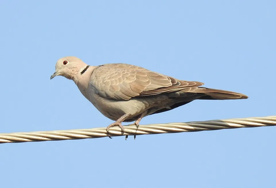
- Eurasian Collared Dove · Streptopelia decaocto · 110
- Crested Lark · Galerida cristata · 109
- Great tit · Parus major · 100
- Hooded Crow · Corvus cornix · 97
- Barn Swallow · Hirundo rustica · 84
- Eurasian Blackcap · Sylvia atricapilla · 75
- Blue Rock Thrush · Monticola solitarius · 74
+18 more species
- Meadow Pipit · Anthus pratensis · 69
- European Stonechat · Saxicola rubicola · 69
- Western Rock Nuthatch · Sitta neumayer · 68
- European Greenfinch · Chloris chloris · 68
- Western Black-eared Wheatear · Oenanthe hispanica · 65
- European robin · Erithacus rubecula · 60
- European Goldfinch · Carduelis carduelis · 60
- Eurasian Chaffinch · Fringilla coelebs · 59
- Common Linnet · Linaria cannabina · 59
- Common Buzzard · Buteo buteo · 58
- Alpine Swift · Tachymarptis melba · 57
- Common Chiffchaff · Phylloscopus collybita · 57
- European shag · Phalacrocorax aristotelis · 55
- Common Blackbird · Turdus merula · 55
- Eurasian Hoopoe · Upupa epops · 54
- Common House Martin · Delichon urbicum · 51
- Corn Bunting · Emberiza calandra · 51
- Eurasian Sparrowhawk · Accipiter nisus · 50
Records: GBIF.org (CC-BY). Names: Wikidata (CC0), GBIF. Photos: Wikimedia Commons.
Conservation challenges
The primary purpose of the site is to preserve its natural habitats and the biodiversity they support. The species recorded (Biodiversity tab) reflect its ecological value. The designations it holds frame its management and the control of land use.
According to Global Forest Change data (University of Maryland, Global Forest Watch), about 198 ha of tree cover were lost within the boundary between 2001 and 2023 (6% of its area), peaking in 2012 and 2021. These losses include logging, storms and fires, and do not account for regrowth. According to the European CORINE Land Cover inventory (Copernicus), land cover changed on about 282 ha of the site between 1990 and 2018 (7% of its area): open natural land shrank by 24 ha, mostly giving way to forest, while built-up land grew by 21 ha, mostly at the expense of open natural land. Forest felling and regrowth add about 1,670 ha in total over the period. Since 2016, the European EFFIS system (Copernicus) has mapped 3 fires here, burning about 988 ha within the boundary; the largest, in August 2021 (near Δημοτική Κοινότητα Κερατέας), covered 546 ha. At night, 99% of the area gives off artificial light detectable from space (NASA VIIRS Black Marble composite, 2016). Built-up and developed land (buildings, business areas, roads, quarries) covers 15% of the area, and farmland 13% (CORINE Land Cover). According to the Natura 2000 forms, of 15 assessed habitats of European interest, 1 is in excellent condition and 5 in average or reduced condition. One invasive alien species has been recorded within the site since 2000 (GBIF observations), listed as of Union concern: Ailanthus altissima (Tree-of-heaven).
Pressure indicators
Tree cover lost
198 ha
2001–2023 · 6% of the area
20012023
Fires since 2016
988 ha
burned within the boundary (3 mapped fires)
- 2021 · Δημοτική Κοινότητα Κερατέας · 546 ha
- 2024 · Δημοτική Κοινότητα Κερατέας · 383 ha
- 2020 · Δημοτική Κοινότητα Λαυρεωτικής · 59 ha
Light at night
99%
of the area gives off artificial light visible from space
DarkLit
Built-up land
15%
buildings, business areas, roads, quarries · farmland 13%
Land cover change
282 ha
changed cover, 1990–2018 · CORINE · 7% of the area
- −24 ha · open natural land
- +21 ha · built-up land
forest felling and regrowth: 1,670 ha in total
Invasive alien species
1
incl. 1 of EU concern · since 2000
Sources: Global Forest Change (Hansen et al., University of Maryland, via Global Forest Watch, CC-BY 4.0); EFFIS, European Commission / Copernicus; NASA Black Marble 2016 (public domain); CORINE Land Cover 2018 (Copernicus) or MODIS.
CORINE Land Cover Change 1990–2018: generated using European Union's Copernicus Land Monitoring Service information (EEA), aggregated by Parkavela; DOI 10.2909/f30f1000-7cf8-43bb-872c-5eb093911b24.
Invasive alien species: Global Register of Introduced and Invasive Species (ISSG, CC BY 4.0); Union list, Regulation (EU) 1143/2014 (INBO, CC0); GBIF.org records (CC0 / CC BY 4.0), at least 2 per species.
Practical information
Cities and airport
- Glyfada
26 km as the crow flies - Agia Paraskevi
31 km as the crow flies - Airport: Athens International Airport "Eleftherios Venizelos" (ATH)
20 km as the crow flies
Visitor information
- Lavrio
< 1 km from the site boundary
Parking
2 public car parks listed within the site
Data © OpenStreetMap contributors (ODbL) · Wikidata (CC0)
Bathing
2 monitored bathing sites in or within 1 km of the site · 2025 classification
Excellent · 2
- Limani Passa · sea · Excellent
- Sounio · sea · Excellent
Source: European Environment Agency, official bathing water classification (Directive 2006/7/EC, CC-BY 4.0). Swimming is only permitted at the sites and times authorised locally.
Access and visiting
The nearest railway station is Keratea Industrial Area, about 4 km from the site boundary. Nearest towns of over 50,000 people, as the crow flies: Glyfada (26 km) and Agia Paraskevi (31 km). Nearest airport: Athens International Airport "Eleftherios Venizelos" (ATH), about 20 km away. About 110,000 people live within 20 km of the site boundary, 35,000 of them within 10 km; some 5,900 people are estimated to live inside (GHSL estimate, 2020). This population has fallen by about 6% since 2000. Visitor information on site: Lavrio. Public car parks listed within the site: 2. To see: Cave of Kitsos. To plan a visit (access, opening periods, visitor rules), it is best to consult the official information from the managing body and the official website listed in this page's sources.
Source: OpenStreetMap (ODbL), Wikidata (CC0), October 2026.
Built heritage
According to Wikidata, 7 monuments protected as Greek cultural heritage stand within the boundary. Among them are 3 prehistoric and archaeological sites, 3 bridges, lighthouses, mills and working buildings and 1 castle or fortification. Examples include “Princess tower/farm” in Lavreotiki, “Cave of Kitsos” in Lavreotiki and “Kamariza Mines” in Lavreotiki.
3 prehistoric and archaeological sites3 bridges, lighthouses, mills and working buildings1 castle or fortification
-
Princess tower/farm
Lavreotiki -
Cave of Kitsos
Lavreotiki -
Kamariza Mines
Lavreotiki -
Agrileza ancient marble quarries
Lavreotiki -
Lavrion Technological and Cultural Park
Lavreotiki -
Souriza
Lavreotiki -
Ore washery at Lavrio
Lavreotiki
Source: Wikidata (CC0), monuments in each country’s official heritage protection registers, at national or regional level. Each item links to its Wikidata entry.
When to visit
Best time to visit: May and June, with average temperatures of 20 to 25 °C and moderate rainfall. Day length ranges from about 9 h 34 min in December to 14 h 45 min in June. Wildlife records published on GBIF peak for birds (March and April) and plants (April and May). These peaks also reflect when observers are most active.
Source: Copernicus ERA5-Land (C3S), monthly averages 1996–2025 at the representative point, temperatures adjusted for elevation.
Contains modified Copernicus Climate Change Service information 2026. Neither the European Commission nor ECMWF is responsible for any use that may be made of the Copernicus information or data it contains.
Wildlife records calendar
JFMAMJJASOND
Birds
Plants
Monthly records published on GBIF (CC-BY), relative to the busiest month; also reflects observer activity.
Gallery
© A.Savin · CC BY-SA 3.0
© A.Savin · CC BY-SA 3.0
© Adam Sofen · CC BY 2.0
© Tilemahos Efthimiadis from Athens, Greece · CC BY 2.0
© A.Savin · CC BY-SA 3.0
© M.Perdiou · CC BY-SA 4.0
Sources and licences
- Wikidata: Q26046204
- Official website: http://www.visitgreece.gr/en/nature/forests/sounio_national_park
- Wikipedia: it.wikipedia.org/wiki/Parco_nazionale_di_Capo_Sunio
- WDPA: 124202
References
- cds.climate.copernicus.eu: climate · CC-BY-4.0
- registry.opendata.aws: elevation of the reference point, detailed relief · PD
- land.copernicus.eu: land cover, land cover change, sea share · COPERNICUS
- doi.org: population around the site · CC-BY-4.0
- wikidata.org: official area, establishment date, protected heritage, nearby cities and airport, access and peaks, lake depths, places to see, official website · CC0-1.0
- eea.europa.eu: bathing water quality, ecological status of waters · CC-BY-4.0
- en.eurovelo.com: EuroVelo cycle routes · ODbL-1.0
- cycling.waymarkedtrails.org: cycle routes · ODbL-1.0
- opentopodata.org: elevations · PD
- forest-fire.emergency.copernicus.eu: wildfires · COPERNICUS
- globalforestwatch.org: tree cover loss · CC-BY-4.0
- gbif.org: seasonality of sightings, invasive alien species, observed species · CC-BY-4.0
- europe-geology.eu: geology · CC-BY-4.0
- hydrosheds.org: lakes · CC-BY-4.0
- natura2000.eea.europa.eu: Natura 2000 habitats and species · CC-BY-4.0
- openstreetmap.org: official name, access and peaks · ODbL-1.0
- earthobservatory.nasa.gov: night light · PD
- nsidc.org: snow cover · PD
- wikidata.org: Wikipedia article · CC-BY-SA-4.0
Data © OpenStreetMap contributors (ODbL), Wikidata (CC0) and the sources cited.