

Iceland · Terrestrial
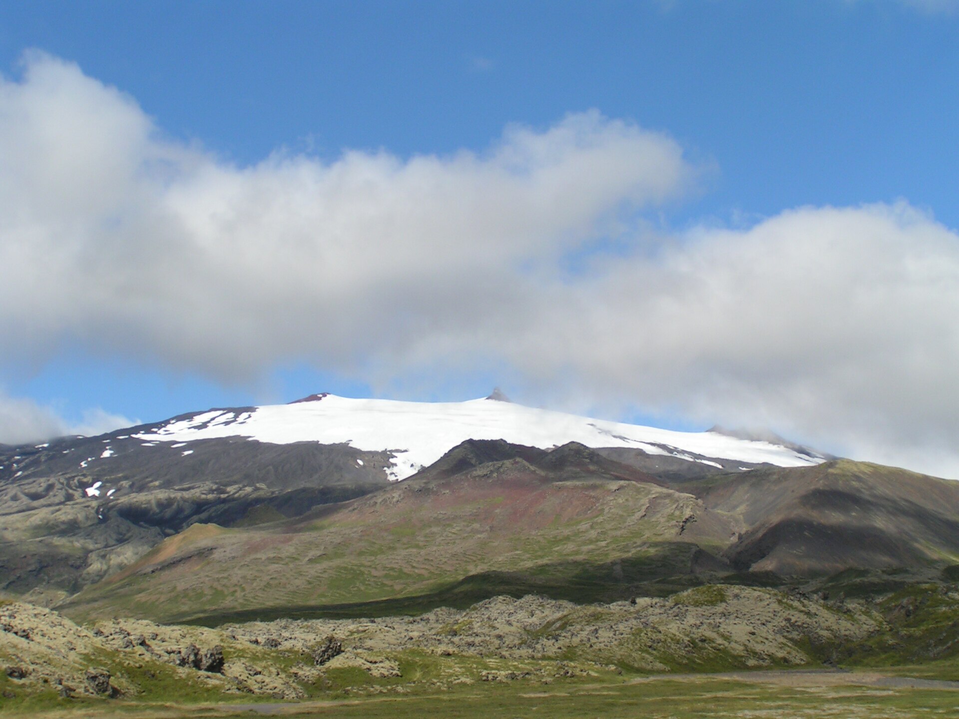
Snæfellsjökull National Park
National park of 16,694 hectares in Iceland, established in 2001.
Overview
National park of 16,694 hectares in Iceland, established in 2001.
Snæfellsjökull National Park is located in Iceland (Europe). It is a predominantly terrestrial area. Established on 28 June 2001, it covers about 16,694 hectares.
In our collections
Frequently asked questions
Where is Snæfellsjökull National Park?
In Iceland (Europe). Representative point: 64.8089° N, 23.7711° W.
How large is Snæfellsjökull National Park?
About 16,694 hectares (167 km²). It is the 3rd largest of the 3 national parks in Iceland covered by Parkavela.
When was Snæfellsjökull National Park established?
On 28 June 2001.
What habitats and landscapes does Snæfellsjökull National Park include?
A terrestrial area, with mountains.
What rocks lie beneath Snæfellsjökull National Park?
According to the European 1:1 million geological map (EGDI), the bedrock consists mainly of basalts (88% of sampled points) and volcanic tuffs (13%). These are mostly igneous rocks. The geological units date mainly from the Quaternary (100% of sampled points).
What is the highest point of Snæfellsjökull National Park?
Snæfellsjökull - Miðþúfa, at 1,446 m (OpenStreetMap).
What are the main summits of Snæfellsjökull National Park?
Snæfellsjökull - Miðþúfa (1,446 m), Snæfellsjökull - Vesturþúfa (1,442 m), Norðurþúfa (1,390 m), Sandfell (1,217 m) and Þríhyrningur (1,191 m) (OpenStreetMap).
When is the best time to visit Snæfellsjökull National Park?
Mildest period: from June to August, with average temperatures of 1 to 4 °C.
Is there snow in Snæfellsjökull National Park?
Yes. According to NASA's MODIS satellites (2015–2025 average), snow covers most of the site from November to March, and until May on higher ground, with about 175 snow-covered days a year on average. In midwinter, too dark for satellite measurements, snow cover is estimated from the neighbouring months.
What is there to see in Snæfellsjökull National Park?
1 waterfall and 1 cave, including Klukkufoss and Vatnshellir (Wikidata).
What is the nearest airport to Snæfellsjökull National Park?
Nearest airport: Keflavík (KEF), about 100 km away.
Where can I get visitor information on site?
Summit Adventure Guides, Gestastofa and National Park Center.
Which species can be seen in Snæfellsjökull National Park?
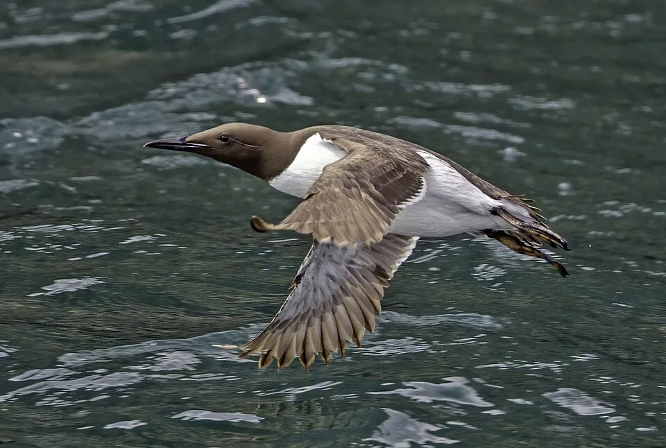
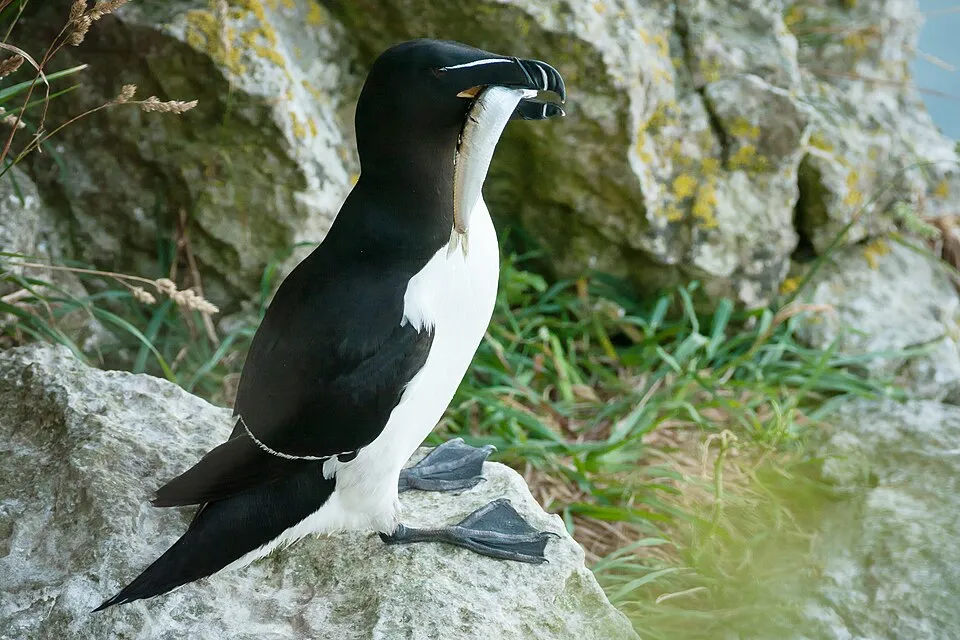
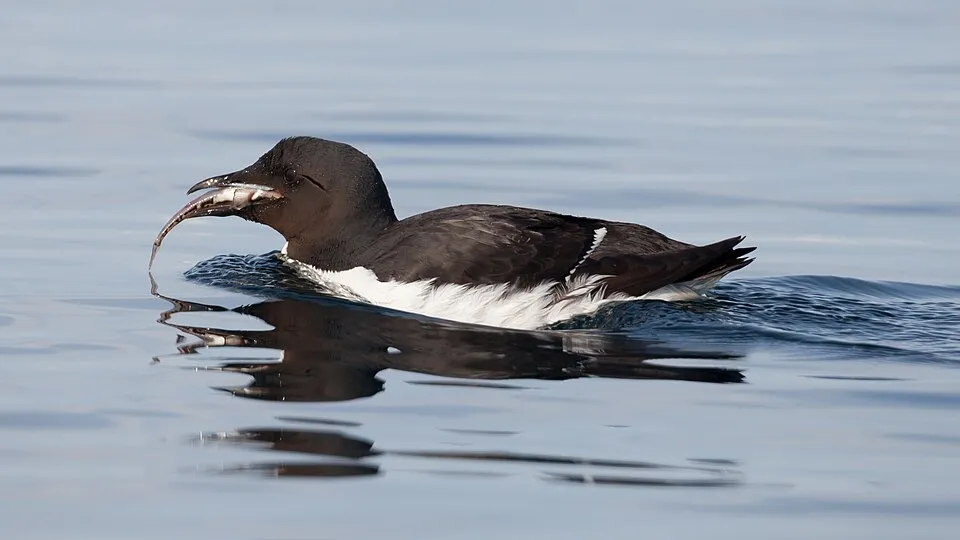
Among the species most often recorded on GBIF are Rissa tridactyla (Black-legged Kittiwake), Fulmarus glacialis (Northern Fulmar), Uria aalge (Common Murre) and Alca torda (Razorbill).
What is the official website of Snæfellsjökull National Park?
© OpenStreetMap
Download the boundary: GeoJSON · GPX Boundary © OpenStreetMap contributors (ODbL).
Geography
The representative point of the site lies at around 1,266 m above sea level. Over the 1996–2025 period, the mean annual temperature is about -3.1 °C and total precipitation reaches roughly 1,125 mm per year. The warmest month is usually July, the coolest February, and the wettest September. According to the European 1:1 million geological map (EGDI), the bedrock consists mainly of basalts (88% of sampled points) and volcanic tuffs (13%). These are mostly igneous rocks. The geological units date mainly from the Quaternary (100% of sampled points).
Area
- Area
- 16,694 ha
- Elevation
- 1,266 m
- Median elevation
- 160 m
- Mean slope
- 8°
- Snow cover
- ≈ 175 days a year
- Coordinates
- 64.8089, -23.7711
Terrain: Mapzen Terrain Tiles (SRTM, USGS)
Elevation bands
- below 500 m 73%
- 500–1,000 m 21%
- 1,000–1,500 m 6%
share of the site in each elevation band (smoothed terrain model: summits are rounded off) · Terrain: Mapzen Terrain Tiles (SRTM, USGS)
Bedrock
- Basalts 88 %
- Volcanic tuffs 13 %
Igneous rocks 100 % · Main age: Quaternary (100%)
Source: EGDI 1:1M geological map (EuroGeoSurveys and national geological surveys), CC BY 4.0 · 16 sampled points within the site.
Main summits
- Snæfellsjökull - Miðþúfa1,446 m
- Snæfellsjökull - Vesturþúfa1,442 m
- Norðurþúfa1,390 m
- Sandfell1,217 m
- Þríhyrningur1,191 m
- Geldingafell829 m
- Hólatindar693 m
- Svörtutindar605 m
- Hreggnasi469 m
- Ljósaskriða279 m
Data © OpenStreetMap contributors (ODbL)
Climate
● Mean temperature (°C) · ▮ Precipitation (mm)
Source: Copernicus ERA5-Land (C3S, doi:10.24381/cds.68d2bb30), monthly averages 1996–2025 interpolated to the representative point, temperatures adjusted for elevation.
Contains modified Copernicus Climate Change Service information 2026. Neither the European Commission nor ECMWF is responsible for any use that may be made of the Copernicus information or data it contains.
Snow cover measured by satellite
J
F
M
A
M
J
J
A
S
O
N
D
average share of the site under snow · snowiest parts · ≈ 175 days a year
Snow cover: MODIS/Terra MOD10CM v61 (Hall & Riggs, 2021, NASA NSIDC DAAC, doi:10.5067/MODIS/MOD10CM.061), imagery from NASA GIBS (ESDIS); 2015–2025 average, grid of about 5 km.
Natural habitats
According to CORINE Land Cover (2018), the site is mainly made up of heath and scrub (65%), bare rock and scree (16%) and sparsely vegetated land (10%). Elevation ranges from sea level to 1,446 m (highest point: Snæfellsjökull - Miðþúfa). Median elevation is 160 m, and 27% of the site lies above 500 m (SRTM elevation model).
Biodiversity
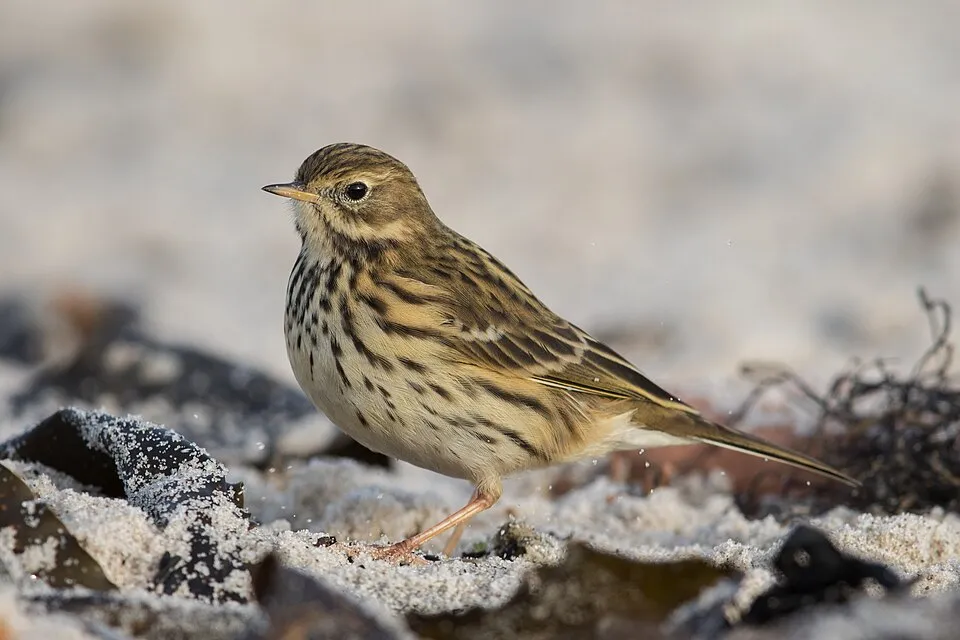
Based on occurrences aggregated by GBIF, several species are regularly recorded within the site. Among the most frequent are Rissa tridactyla (Black-legged Kittiwake), Fulmarus glacialis (Northern Fulmar), Uria aalge (Common Murre) and Alca torda (Razorbill). The full list of documented taxa is shown below.
Species to look out for

Bird
Northern Fulmar
Fulmarus glacialis792 records © Original: AWeith; this edit: MPF · CC BY-SA 4.0
Observed species
Occurrences documented via GBIF; they are neither an exhaustive inventory nor proof of current presence.
- Black-legged Kittiwake · Rissa tridactyla · 900
- Northern Fulmar · Fulmarus glacialis · 792
- Common Murre · Uria aalge · 787
- Razorbill · Alca torda · 673
- Meadow Pipit · Anthus pratensis · 499
- Thick-billed Murre · Uria lomvia · 494
- Northern Wheatear · Oenanthe oenanthe · 492
- Great Black-backed Gull · Larus marinus · 472
- Common Eider · Somateria mollissima · 438
- Northern Gannet · Morus bassanus · 437
- Atlantic Puffin · Fratercula arctica · 415
- Arctic Tern · Sterna paradisaea · 400
+18 more species
- European shag · Phalacrocorax aristotelis · 387
- Glaucous Gull · Larus hyperboreus · 343
- Black Guillemot · Cepphus grylle · 340
- White Wagtail · Motacilla alba · 323
- Great Cormorant · Phalacrocorax carbo · 310
- European Golden Plover · Pluvialis apricaria · 277
- Northern Raven · Corvus corax · 259
- Snow Bunting · Plectrophenax nivalis · 203
- Parasitic Jaeger · Stercorarius parasiticus · 176
- Harlequin Duck · Histrionicus histrionicus · 168
- Rock Ptarmigan · Lagopus muta · 167
- Eurasian Whimbrel · Numenius phaeopus · 165
- Lesser Black-backed Gull · Larus fuscus · 143
- Common Redshank · Tringa totanus · 140
- Redwing · Turdus iliacus · 135
- European Herring Gull · Larus argentatus · 132
- Black-headed Gull · Chroicocephalus ridibundus · 126
- Common Ringed Plover · Charadrius hiaticula · 126
Records: GBIF.org (CC-BY). Names: Wikidata (CC0), GBIF. Photos: Wikimedia Commons.
Conservation challenges
The primary purpose of the site is to preserve its natural habitats and the biodiversity they support. The species recorded (Biodiversity tab) reflect its ecological value. Its status as a national park sets the regulatory framework for its protection.
According to CORINE Land Cover, land cover here remained almost unchanged between 2000 and 2018 (less than 0.5% of the area affected). At night, 2% of the area gives off artificial light detectable from space (NASA VIIRS Black Marble composite, 2016).
Pressure indicators
Fires since 2016
0
No large fire mapped (fires over about 30 ha)
Light at night
2%
of the area gives off artificial light visible from space
DarkLit
Built-up land
< 1%
buildings, business areas, roads, quarries
Land cover change
< 0.5%
of the area changed, 2000–2018 · CORINE
Sources: Global Forest Change (Hansen et al., University of Maryland, via Global Forest Watch, CC-BY 4.0); EFFIS, European Commission / Copernicus; NASA Black Marble 2016 (public domain); CORINE Land Cover 2018 (Copernicus) or MODIS.
CORINE Land Cover Change 2000–2018: generated using European Union's Copernicus Land Monitoring Service information (EEA), aggregated by Parkavela; DOI 10.2909/f30f1000-7cf8-43bb-872c-5eb093911b24.
Practical information
Cities and airport
- Airport: Keflavík (KEF)
100 km as the crow flies
Visitor information
- Summit Adventure Guides
within the site - Gestastofa
within the site - National Park Center
1 km from the site boundary
Parking
34 public car parks listed within the site
SandhólarSaxhóll
Wheelchair access
- Gestastofa
visitor information
accessible toilets: 1
Reported by OpenStreetMap contributors (ODbL); check with the park before visiting.
Data © OpenStreetMap contributors (ODbL) · Wikidata (CC0)
Access and visiting
Nearest airport: Keflavík (KEF), about 100 km away. Fewer than 5,000 people live within 20 km of the site boundary, a very sparsely populated area; the site itself is virtually uninhabited (GHSL estimate, 2020). Visitor information on site: Summit Adventure Guides, Gestastofa and National Park Center. Public car parks listed within the site: 34, including Sandhólar and Saxhóll. OpenStreetMap contributors list 4 wheelchair-accessible places, including Gestastofa; check with the park before visiting. To see: 1 waterfall and 1 cave, including Klukkufoss and Vatnshellir. To plan a visit (access, opening periods, visitor rules), it is best to consult the official information from the managing body and the official website listed in this page's sources.
Source: OpenStreetMap (ODbL), Wikidata (CC0), October 2026.
When to visit
Mildest period: from June to August, with average temperatures of 1 to 4 °C. Average temperatures drop below 0 °C from October to May: frost is common. These averages apply to the site's representative point (1,266 m); higher up it is markedly cooler and snow lasts longer. According to NASA's MODIS satellites (2015–2025 average), snow covers most of the site from November to March, and until May on higher ground, with about 175 snow-covered days a year on average. In midwinter, too dark for satellite measurements, snow cover is estimated from the neighbouring months. Day length ranges from about 3 h 47 min in December to 21 h 39 min in June. Wildlife records published on GBIF peak for birds (June), plants (July) and mammals (July). These peaks also reflect when observers are most active.
Source: Copernicus ERA5-Land (C3S), monthly averages 1996–2025 at the representative point, temperatures adjusted for elevation.
Contains modified Copernicus Climate Change Service information 2026. Neither the European Commission nor ECMWF is responsible for any use that may be made of the Copernicus information or data it contains.
Wildlife records calendar
JFMAMJJASOND
Birds
Plants
Mammals
Monthly records published on GBIF (CC-BY), relative to the busiest month; also reflects observer activity.
Gallery
© HansOosting · CC BY-SA 3.0
© TommyBee · Public domain
© Bromr · CC BY-SA 3.0
© Markus Trienke · CC BY-SA 2.0
© Chris 73 · CC BY-SA 3.0
© Chris 73 · CC BY-SA 3.0
Sources and licences
- Wikidata: Q738103
- OpenStreetMap: relation 11315679
- Official website: http://www.snaefellsjokull.com/
- Wikipedia: fr.wikipedia.org/wiki/Parc_national_de_Snæfellsjökull
- WDPA: 346545
References
- cds.climate.copernicus.eu: climate · CC-BY-4.0
- registry.opendata.aws: elevation of the reference point · PD
- land.copernicus.eu: land cover, land cover change, sea share · COPERNICUS
- doi.org: population around the site · CC-BY-4.0
- wikidata.org: official area, establishment date, nearby cities and airport, access and peaks, lake depths, places to see, official website · CC0-1.0
- eea.europa.eu: bathing water quality · CC-BY-4.0
- en.eurovelo.com: EuroVelo cycle routes · ODbL-1.0
- cycling.waymarkedtrails.org: cycle routes · ODbL-1.0
- opentopodata.org: elevations · CC-BY-4.0
- forest-fire.emergency.copernicus.eu: wildfires · COPERNICUS
- gbif.org: seasonality of sightings, invasive alien species, observed species · CC-BY-4.0
- europe-geology.eu: geology · CC-BY-4.0
- hydrosheds.org: lakes · CC-BY-4.0
- openstreetmap.org: official name, access and peaks, trail difficulty, wheelchair access · ODbL-1.0
- earthobservatory.nasa.gov: night light · PD
- registry.opendata.aws: detailed relief · CC-BY-4.0
- nsidc.org: snow cover · PD
- wikidata.org: Wikipedia article · CC-BY-SA-4.0
Data © OpenStreetMap contributors (ODbL), Wikidata (CC0) and the sources cited.
