France · Terrestrial
Avesnois Regional Natural Park
Regional nature park of 118,220 hectares in France, established in 1998.
Overview
Regional nature park of 118,220 hectares in France, established in 1998.
Avesnois Regional Natural Park is a regional nature park in France (Europe). It is a predominantly terrestrial area. Established in 1998, it covers about 118,220 hectares.
Protections and designations
Natura 2000 · habitats (SAC) · 3 sites
Natura 2000 · birds (SPA)
- Forêt, bocage, étangs de Thiérache FR3112001
Protected as a regional nature park. International labels and designations: Natura 2000 network (4 sites). Key dates: established in 1998, first Natura 2000 site under the Birds Directive in 2006 and first Natura 2000 site under the Habitats Directive in 2007.
In our collections
Timeline
-
1998
Established
-
2006
First Natura 2000 site under the Birds Directive
-
2007
First Natura 2000 site under the Habitats Directive 2 such sites designated up to 2015
Sources: Wikidata (CC0) for establishment and international labels; EEA Natura 2000 database (CC-BY 4.0) for site designation dates.
Frequently asked questions
Where is Avesnois Regional Natural Park?
In France (Europe). Representative point: 50.1622° N, 3.8822° E.
How large is Avesnois Regional Natural Park?
About 118,220 hectares (1,182 km²). It is the 35th largest of the 59 regional parks in France covered by Parkavela.
When was Avesnois Regional Natural Park established?
In 1998.
What habitats and landscapes does Avesnois Regional Natural Park include?
A terrestrial area, where land cover is dominated by grassland and meadows (49%).
What rocks lie beneath Avesnois Regional Natural Park?
According to the BRGM's simplified lithological map, the bedrock consists mainly of limestones, marls and gypsum (44% of sampled points), sands (31%) and chalk (25%). These are mostly sedimentary rocks.
Which international labels apply to Avesnois Regional Natural Park?
Natura 2000 network (4 sites).
When is the best time to visit Avesnois Regional Natural Park?
Best time to visit: from May to October, with average temperatures of 11 to 18 °C and moderate rainfall.
What is there to see in Avesnois Regional Natural Park?
9 viewpoints, 4 waterfalls, 50 lakes and ponds and 3 bird hides, including Cascade de Quélipont, Gouffre, L'Epi de Facon and Étang de Milourd (OpenStreetMap).
Where can I stay in Avesnois Regional Natural Park?
35 campsites, including Aire de Landrecies, Camping Le Cambrinus and Camping Le Lac Vauban (OpenStreetMap).
Are there historic monuments in Avesnois Regional Natural Park?
Yes. According to the French Ministry of Culture's Mérimée database, 76 historic monuments stand within the boundary, 17 of them with the highest level of protection (classé). For example: “Chapelle Duchesne” in Flaumont-Waudrechies, “Château de Rametz” in Saint-Waast and “Deux menhirs dits Pierre Martine” in Solre-le-Château.
Can you swim in Avesnois Regional Natural Park?
2 monitored bathing sites lie in or within 1 km of the site; official 2025 classification: 2 excellent (European Environment Agency). Swimming is only permitted at the sites and times authorised locally.
What is the nearest large city to Avesnois Regional Natural Park?
Nearest towns of over 50,000 people, as the crow flies: Mons (13 km) and La Louvière (21 km). Nearest airport: Lille (LIL), about 45 km away.
How can I reach Avesnois Regional Natural Park by train?
Ors railway station lies within the site.
Where can I get visitor information on site?
Maison du Parc naturel régional de l'Avesnois, Maison Forestière and Office de tourisme du Quesnoy.
Are there waymarked hiking trails in Avesnois Regional Natural Park?
Yes. Waymarked hiking routes listed in OpenStreetMap: 95, including GR 121, GR 122, Boucle du Pays Solesmois and Accès Avesnes. The “AV-E · Boucle Forges et Etangs” route runs for about 80 km through the site, with some 520 m of ascent on its longest section.
Which species can be seen in Avesnois Regional Natural Park?
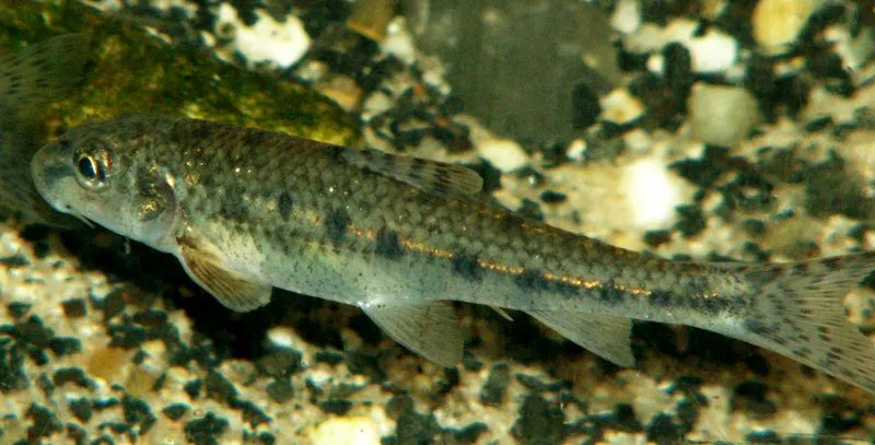
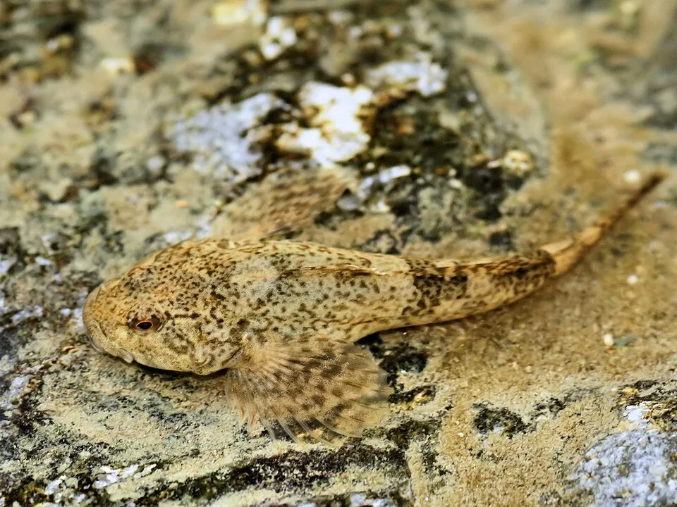
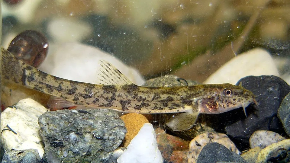
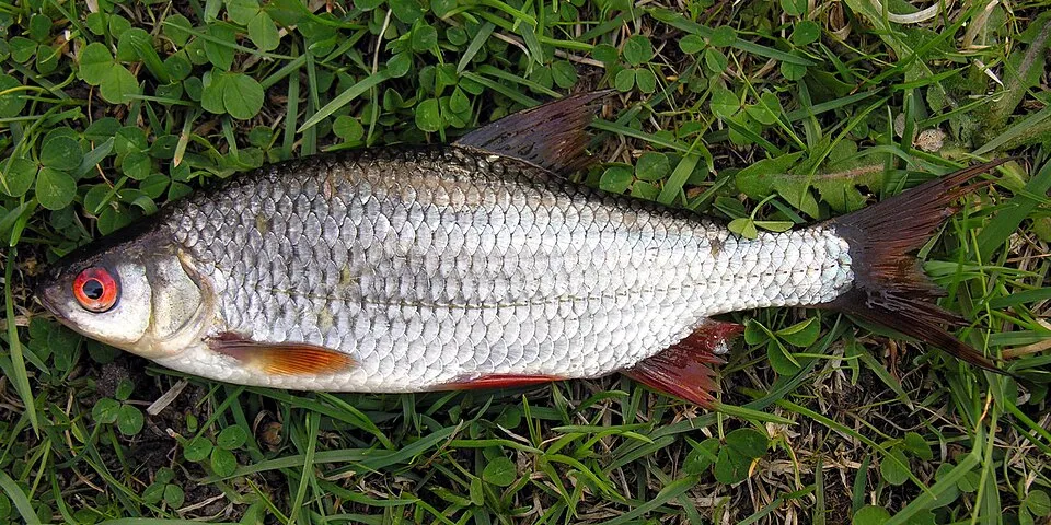
Among the species most often recorded on GBIF are Gobio gobio (Gudgeon), Cottus gobio (European bullhead), Barbatula barbatula (Stone loach) and Rutilus rutilus (Roach).
What is the official website of Avesnois Regional Natural Park?
© OpenStreetMap
Download the boundary: GeoJSON · GPX Boundary © OpenStreetMap contributors (ODbL).
Geography
The representative point of the site lies at around 181 m above sea level. Over the 1996–2025 period, the mean annual temperature is about 10.3 °C and total precipitation reaches roughly 904 mm per year. The warmest month is usually August, the coolest January, and the wettest December. According to the BRGM's simplified lithological map, the bedrock consists mainly of limestones, marls and gypsum (44% of sampled points), sands (31%) and chalk (25%). These are mostly sedimentary rocks. The site contains 3 lakes larger than 10 ha, totalling 1.6 km² of water; the largest, Val-Joly, covers 1.2 km² (HydroLAKES).
Area
- Area
- 118,220 ha
- Elevation
- 181 m
- Lakes over 10 ha
- 3 (1.6 km²)
- Coordinates
- 50.1622, 3.8822
Lakes: HydroLAKES (Messager et al. 2016, hydrosheds.org, CC BY 4.0) · depths: Wikidata (CC0)
Bedrock
- Limestones, marls and gypsum 44 %
- Sands 31 %
- Chalk 25 %
Sedimentary rocks 100 %
Source: BRGM, simplified lithological map at 1:1,000,000 (Licence Ouverte), 16 points sampled within the boundary.
Climate
● Mean temperature (°C) · ▮ Precipitation (mm)
Source: Copernicus ERA5-Land (C3S, doi:10.24381/cds.68d2bb30), monthly averages 1996–2025 interpolated to the representative point, temperatures adjusted for elevation.
Contains modified Copernicus Climate Change Service information 2026. Neither the European Commission nor ECMWF is responsible for any use that may be made of the Copernicus information or data it contains.
Natural habitats
According to CORINE Land Cover (2018), the site is mainly made up of grassland and meadows (49%), farmland (27%) and forests (15%). Elevation ranges from about 60 to 250 m (sampled elevations, SRTM). The 4 Natura 2000 sites overlapping the area list 19 habitats of European interest (5 priority), the most extensive being Sub-Atlantic and medio-European oak or oak-hornbeam forests of the Carpinion betuli, Asperulo-Fagetum beech forests and lowland hay meadows (Alopecurus pratensis, Sanguisorba officinalis).
Biodiversity
Based on occurrences aggregated by GBIF, several species are regularly recorded within the site. Among the most frequent are Gobio gobio (Gudgeon), Cottus gobio (European bullhead), Barbatula barbatula (Stone loach) and Rutilus rutilus (Roach). The full list of documented taxa is shown below. The overlapping Natura 2000 sites list 42 species of European interest: 29 birds, 3 mammals, 1 amphibian, 5 fish and 4 invertebrates.
Habitats of European interest
From the official forms of the 4 Natura 2000 sites overlapping the area (areas reported for each whole site).
- Sub-Atlantic and medio-European oak or oak-hornbeam forests of the Carpinion betuli 333 ha
- Asperulo-Fagetum beech forests 174 ha
- Lowland hay meadows (Alopecurus pratensis, Sanguisorba officinalis) 114 ha
- Alluvial forests with Alnus glutinosa and Fraxinus excelsior (Alno-Padion, Alnion incanae, Salicion albae) priority 80 ha
- Hydrophilous tall herb fringe communities of plains and of the montane to alpine levels 52 ha
- Molinia meadows on calcareous, peaty or clayey-silt-laden soils (Molinion caeruleae) 24 ha
- Luzulo-Fagetum beech forests 19 ha
- Semi-natural dry grasslands and scrubland facies on calcareous substrates (Festuco-Brometalia) (* important orchid sites) 16 ha
and 11 more
Species of European interest
Birds · 29
Common Kingfisher (Alcedo atthis) breeding, Eurasian Teal (Anas crecca) passage resident breeding, Great Egret (Ardea alba) passage, Grey Heron (Ardea cinerea) breeding passage resident, Eurasian Eagle-owl (Bubo bubo) breeding, European Nightjar (Caprimulgus europaeus) breeding, Black Tern (Chlidonias niger) passage, Black Stork (Ciconia nigra) breeding passage, Western Marsh Harrier (Circus aeruginosus) passage, Hen Harrier (Circus cyaneus) passage breeding, Corn Crake (Crex crex) breeding, Whooper Swan (Cygnus cygnus) wintering and 17 more
Mammals · 3
Bechstein's bat (Myotis bechsteinii), Geoffroy's bat (Myotis emarginatus), Greater mouse-eared bat (Myotis myotis)
Amphibians · 1
Fish · 5
Spined loach (Cobitis taenia), European bullhead (Cottus gobio), European brook lamprey (Lampetra planeri), Weatherfish (Misgurnus fossilis), European bitterling (Rhodeus amarus)
Invertebrates · 4
White-clawed Crayfish (Austropotamobius pallipes), Thick shelled river mussel (Unio crassus), Narrow-mouthed whorl snail (Vertigo angustior), Desmoulin's whorl snail (Vertigo moulinsiana)
Source: Natura 2000 standard data forms (EEA, CC-BY 4.0). Not exhaustive: sensitive species are not published.
Species to look out for
Plant
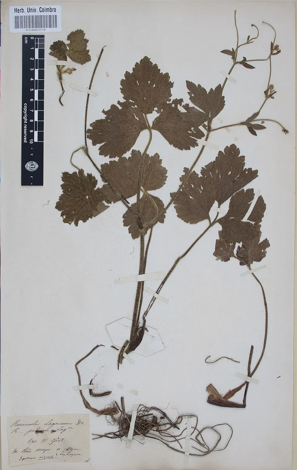
Creeping buttercup
Ranunculus repens4,535 records © Herbarium of the University of Coimbra (COI) · CC BY 4.0
Observed species
Occurrences documented via GBIF; they are neither an exhaustive inventory nor proof of current presence.
- Gudgeon · Gobio gobio · 6409
- European bullhead · Cottus gobio · 6340
- Stone loach · Barbatula barbatula · 5502
- Roach · Rutilus rutilus · 5067
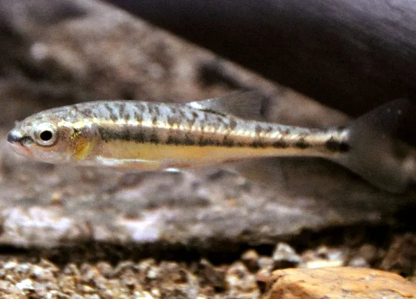
- Common minnow · Phoxinus phoxinus · 4626
- Creeping buttercup · Ranunculus repens · 4535
- Common Nettle · Urtica dioica · 4432
- Yorkshire-fog · Holcus lanatus · 4026
- Chub · Squalius cephalus · 3842
- Hogweed · Heracleum sphondylium · 3612
- Hornbeam · Carpinus betulus · 3534
- Lesser Black-backed Gull · Larus fuscus · 3500
+18 more species
- White Clover · Trifolium repens · 3464
- Meadow buttercup · Ranunculus acris · 3360
- Stickywilly · Galium aparine · 3351
- European ash · Fraxinus excelsior · 3199
- Ground-ivy · Glechoma hederacea · 3086
- Broad-leaved dock · Rumex obtusifolius · 3083
- Creeping Thistle · Cirsium arvense · 3062
- Meadowsweet · Filipendula ulmaria · 3026
- Perennial ryegrass · Lolium perenne · 2942
- Meadow foxtail · Alopecurus pratensis · 2896
- Wood avens · Geum urbanum · 2872
- Ribwort Plantain · Plantago lanceolata · 2859
- Rough bluegrass · Poa trivialis · 2848
- Cock's-foot · Dactylis glomerata · 2843
- Red clover · Trifolium pratense · 2758
- Soft rush · Juncus effusus · 2746
- Herb-robert · Geranium robertianum · 2743
- Hawthorn · Crataegus monogyna · 2695
Records: GBIF.org (CC-BY). Names: Wikidata (CC0), GBIF. Photos: Wikimedia Commons.
Conservation challenges
The primary purpose of the site is to preserve its natural habitats and the biodiversity they support. The species recorded (Biodiversity tab) reflect its ecological value. The designations it holds frame its management and the control of land use.
According to Global Forest Change data (University of Maryland, Global Forest Watch), about 2,100 ha of tree cover were lost within the boundary between 2001 and 2023 (2% of its area), peaking in 2010 and 2023. These losses include logging, storms and fires, and do not account for regrowth. Apart from forest felling and regrowth (about 2,420 ha in total), land cover remained almost unchanged between 1990 and 2018 according to CORINE Land Cover; only some 448 ha were built over. At night, 23% of the area gives off artificial light detectable from space (NASA VIIRS Black Marble composite, 2016). Built-up and developed land (buildings, business areas, roads, quarries) covers 9% of the area, and farmland 27% (CORINE Land Cover). According to the Natura 2000 forms, all 15 assessed habitats of European interest are in good condition. According to the Water Framework Directive assessment (2022 river basin management plans, data 2012–2017), only 5% of the 292 km of rivers assessed within the site are in good or high ecological status; the others mostly have moderate ecological status. Other assessed water bodies: lakes, 0 of 1 in good ecological status or better. Since 2000, 75 invasive alien species have been recorded within the site (GBIF observations), 19 of them listed as of Union concern under EU Regulation 1143/2014. Among them: Reynoutria japonica (Japanese Knotweed), Impatiens glandulifera (Himalayan Balsam) and Faxonius limosus (Spinycheek crayfish).
Pressure indicators
Tree cover lost
2,096 ha
2001–2023 · 2% of the area
20012023
Fires since 2016
0
No large fire mapped (fires over about 30 ha)
Light at night
23%
of the area gives off artificial light visible from space
DarkLit
Built-up land
9%
buildings, business areas, roads, quarries · farmland 27%
Land cover change
< 0.5%
of the area changed, 1990–2018 · CORINE
forest felling and regrowth: 2,420 ha in total
Rivers and lakes
5%
of the 292 km of assessed rivers in good or high ecological status · WFD 2022
Lakes: 0 of 1 good or better
assessments 2012–2017
Invasive alien species
75
incl. 19 of EU concern · since 2000
 Japanese KnotweedEU
 Himalayan BalsamEU
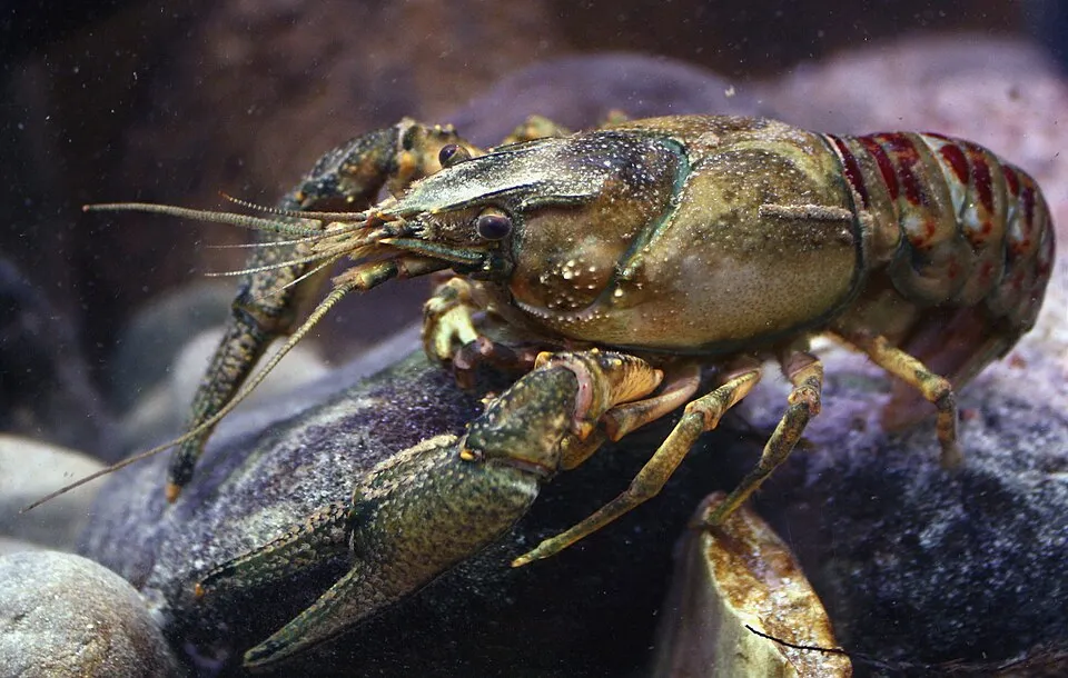 Spinycheek crayfishEU
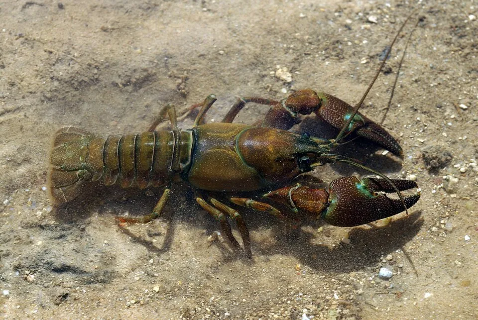 Signal crayfishEU
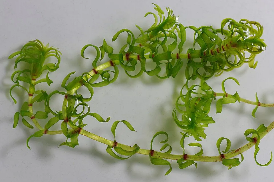 Western waterweedEU
 Egyptian GooseEU
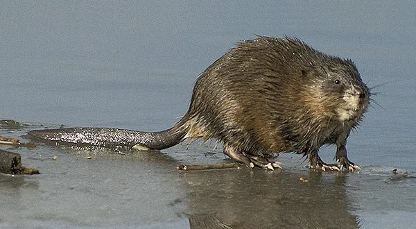 MuskratEU
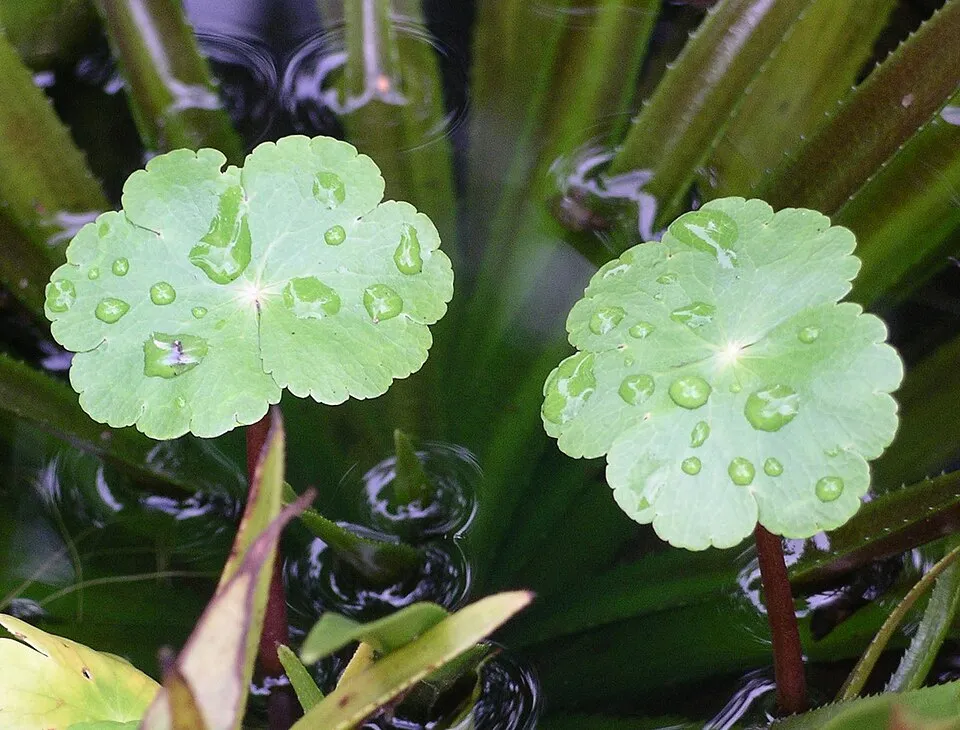 Floating marshpennywortEU
Photos: Japanese Knotweed © W.carter · CC0-1.0; Himalayan Balsam © Guptaele · CC BY-SA 4.0; Spinycheek crayfish © Astacoides · CC BY-SA 3.0; Signal crayfish © David Perez · CC BY 3.0; Western waterweed © Christian Fischer · CC BY-SA 3.0; Egyptian Goose © Rhododendrites · CC BY-SA 4.0; Muskrat © David Menke · Public domain; Floating marshpennywort © Velela · Public domain
Sources: Global Forest Change (Hansen et al., University of Maryland, via Global Forest Watch, CC-BY 4.0); EFFIS, European Commission / Copernicus; NASA Black Marble 2016 (public domain); CORINE Land Cover 2018 (Copernicus) or MODIS.
CORINE Land Cover Change 1990–2018: generated using European Union's Copernicus Land Monitoring Service information (EEA), aggregated by Parkavela; DOI 10.2909/f30f1000-7cf8-43bb-872c-5eb093911b24.
Ecological status of water bodies: European Environment Agency, WISE – Water Framework Directive, 3rd river basin management plans (2022), CC BY 4.0. Official national classification, not comparable between countries.
Invasive alien species: Global Register of Introduced and Invasive Species (ISSG, CC BY 4.0); Union list, Regulation (EU) 1143/2014 (INBO, CC0); GBIF.org records (CC0 / CC BY 4.0), at least 2 per species.
Practical information
Cities and airport
- Mons
13 km as the crow flies - La Louvière
21 km as the crow flies - Airport: Lille (LIL)
45 km as the crow flies
Visitor information
- Maison du Parc naturel régional de l'Avesnois
within the site - Maison Forestière
within the site - Office de tourisme du Quesnoy
within the site - Office de Tourisme Pays d'Avesnes
within the site
Things to see
9 viewpoints · 4 waterfalls · 50 lakes and ponds · 3 bird hides
- Cascade de Quélipont
waterfall - Gouffre
lake or pond - L'Epi de Facon
lake or pond - Étang de Milourd
lake or pond - Étang de Neuve Forge
lake or pond
Where to stay
35 campsites
- Aire de Landrecies
campsite - Camping Le Cambrinus
campsite - Camping Le Lac Vauban
campsite - Camping Municipal de Bellignies
campsite - Camping au Moulin de Frasnoy
campsite
Hiking
95 waymarked routes listed, including:
GR 121GR 122Boucle du Pays SolesmoisAccès AvesnesBoucle Val de Sambre et MaroillesBoucle Bocages et Maroilles
By bike
EV3 · 58 km V31 Véloroute du Bassin Minier · 23 kmVdL RAVeL Véloroute des Lacs · 3 kmMoulins et Kiosques en Thiérache · 42 km5900 Voie Verte de l'Avesnois · 30 km
EV3: route still largely undeveloped
+ 7 local loops
Signed cycle routes: this does not mean that cycling is allowed on footpaths.
Data © OpenStreetMap contributors (ODbL) · Wikidata (CC0)
Contains information from EuroVelo GPX tracks downloaded from www.EuroVelo.com on 2026-10-22, which is made available here under the Open Database License (ODbL). EuroVelo® is a registered trademark of the ECF. Routes © OpenStreetMap contributors (ODbL), via Waymarked Trails
Waymarked hiking routes
Tracks © OpenStreetMap contributors (ODbL), clipped to the boundary; elevation gain and profiles computed on the longest section from Mapzen Terrain Tiles (≈ 30 m), indicative only.
Bathing
2 monitored bathing sites in or within 1 km of the site · 2025 classification
Excellent · 2
- Etang des Moines · lake · Excellent
- Etang du Pont Rouge · lake · Excellent
Source: European Environment Agency, official bathing water classification (Directive 2006/7/EC, CC-BY 4.0). Swimming is only permitted at the sites and times authorised locally.
Access and visiting
Ors railway station lies within the site. Nearest towns of over 50,000 people, as the crow flies: Mons (13 km) and La Louvière (21 km). Nearest airport: Lille (LIL), about 45 km away. About 1.1 million people live within 20 km of the site boundary, 490,000 of them within 10 km; some 150,000 people are estimated to live inside (GHSL estimate, 2020). Visitor information on site: Maison du Parc naturel régional de l'Avesnois, Maison Forestière and Office de tourisme du Quesnoy. Waymarked hiking routes listed in OpenStreetMap: 95, including GR 121, GR 122, Boucle du Pays Solesmois and Accès Avesnes. The EuroVelo 3 cycle route (Pilgrims Route) crosses the site for about 58 km, on a route still largely undeveloped; 7 other signed cycle routes also pass through, including “V31 Véloroute du Bassin Minier” and “VdL RAVeL Véloroute des Lacs” (EuroVelo, OpenStreetMap). To see: 9 viewpoints, 4 waterfalls, 50 lakes and ponds and 3 bird hides, including Cascade de Quélipont, Gouffre, L'Epi de Facon and Étang de Milourd. Where to stay: 35 campsites, including Aire de Landrecies, Camping Le Cambrinus and Camping Le Lac Vauban. To plan a visit (access, opening periods, visitor rules), it is best to consult the official information from the managing body and the official website listed in this page's sources.
Source: OpenStreetMap (ODbL), Wikidata (CC0), October 2026.
Built heritage
According to the French Ministry of Culture's Mérimée database, 76 historic monuments stand within the boundary, 17 of them with the highest level of protection (classé). Among them are 34 religious buildings, 18 castles and fortifications and 10 houses and civic buildings. Notable classé monuments include “Chapelle Duchesne” in Flaumont-Waudrechies, “Château de Rametz” in Saint-Waast and “Deux menhirs dits Pierre Martine” in Solre-le-Château.
34 religious buildings18 castles and fortifications10 houses and civic buildings6 prehistoric and archaeological sites5 bridges, lighthouses, mills and working buildings
-
Chapelle Duchesne
Classé
Flaumont-Waudrechies -
Château de Rametz
Classé
Saint-Waast · 14th c., 18th c., 19th c. -
Deux menhirs dits Pierre Martine
Classé
Solre-le-Château -
Ancienne poterie Gibon
Classé
Ferrière-la-Petite · 19th c. -
Construction adossée à l'église
Classé
Sémeries · 16th c. -
Hôtel de ville
Classé
Avesnes-sur-Helpe · 18th c. -
Chapelle Sainte-Hiltrude
Classé
Liessies -
Remparts
Classé
Le Quesnoy
and 68 more
Source: Mérimée database, French Ministry of Culture (Licence Ouverte 2.0). Each record links to the Plateforme ouverte du patrimoine (POP).
When to visit
Best time to visit: from May to October, with average temperatures of 11 to 18 °C and moderate rainfall. Day length ranges from about 8 h 04 min in December to 16 h 22 min in June. Wildlife records published on GBIF peak for birds (April and May), plants (May and June), butterflies and moths (June and July), dragonflies (from May to July) and mammals (May). These peaks also reflect when observers are most active.
Source: Copernicus ERA5-Land (C3S), monthly averages 1996–2025 at the representative point, temperatures adjusted for elevation.
Contains modified Copernicus Climate Change Service information 2026. Neither the European Commission nor ECMWF is responsible for any use that may be made of the Copernicus information or data it contains.
Wildlife records calendar
JFMAMJJASOND
Birds
Plants
Butterflies & moths
Dragonflies
Mammals
Monthly records published on GBIF (CC-BY), relative to the busiest month; also reflects observer activity.
Gallery
© Parc Avesnois (Marc Grzemski) · CC BY-SA 3.0
© CPIE Bocage de l'Avesnois · CC BY-SA 3.0
© Budotradan · Public domain
© Saf Hao · CC BY-SA 3.0
© Camster · CC BY-SA 4.0
© Camster · CC BY-SA 4.0
Sources and licences
- Wikidata: Q3364624
- OpenStreetMap: relation 1291857
- Official website: http://www.parc-naturel-avesnois.fr/
- Wikipedia: fr.wikipedia.org/wiki/Parc_naturel_régional_de_l'Avesnois
- WDPA: 147523
References
- cds.climate.copernicus.eu: climate · CC-BY-4.0
- registry.opendata.aws: elevation of the reference point, detailed relief · PD
- land.copernicus.eu: land cover, land cover change, sea share · COPERNICUS
- doi.org: population around the site · CC-BY-4.0
- wikidata.org: official area, establishment date, nearby cities and airport, access and peaks, lake depths, places to see, official website · CC0-1.0
- eea.europa.eu: bathing water quality, ecological status of waters · CC-BY-4.0
- en.eurovelo.com: EuroVelo cycle routes · ODbL-1.0
- cycling.waymarkedtrails.org: cycle routes · ODbL-1.0
- opentopodata.org: elevations · PD
- forest-fire.emergency.copernicus.eu: wildfires · COPERNICUS
- globalforestwatch.org: tree cover loss · CC-BY-4.0
- gbif.org: seasonality of sightings, invasive alien species, observed species · CC-BY-4.0
- infoterre.brgm.fr: geology · LO-2.0
- pop.culture.gouv.fr: protected heritage · LO-2.0
- hydrosheds.org: lakes · CC-BY-4.0
- natura2000.eea.europa.eu: Natura 2000 habitats and species · CC-BY-4.0
- openstreetmap.org: official name, access and peaks, places to see · ODbL-1.0
- earthobservatory.nasa.gov: night light · PD
- hiking.waymarkedtrails.org: route difficulty · ODbL-1.0
- nsidc.org: snow cover · PD
- wikidata.org: Wikipedia article · CC-BY-SA-4.0
Data © OpenStreetMap contributors (ODbL), Wikidata (CC0) and the sources cited.