Belgium · Terrestrial
Entre-Sambre-et-Meuse National Park
National park of 22,730 hectares in Belgium, established in 2022.
Overview
National park of 22,730 hectares in Belgium, established in 2022.
Entre-Sambre-et-Meuse National Park is located in Belgium (Europe). It is a predominantly terrestrial area. Established on 9 December 2022, it covers about 22,730 hectares.
Protections and designations
Natura 2000 · habitats (SAC) · 11 sites
- Bassin ardennais de l'Eau Noire BE35031C0
- Bassin ardennais du Viroin BE35032C0
- Bois de Bourlers et de Baileux BE32038C0
- Bois Massart et forêts de Sivry-Rance BE32034C0
- La Calestienne entre Frasnes et Doische BE35030C0
- La Fagne entre Bailièvre et Robechies BE32035C0
- and 5 more
Natura 2000 · birds (SPA) · 11 sites
- Bassin ardennais de l'Eau Noire BE35031C0
- Bassin ardennais du Viroin BE35032C0
- Bois de Bourlers et de Baileux BE32038C0
- Bois Massart et forêts de Sivry-Rance BE32034C0
- La Calestienne entre Frasnes et Doische BE35030C0
- La Fagne entre Bailièvre et Robechies BE32035C0
- and 5 more
Protected as a national park. International labels and designations: Natura 2000 network (11 sites). Key dates: first Natura 2000 site under the Birds Directive in 2002, first Natura 2000 site under the Habitats Directive in 2014 and established in 2022.
In our collections
Timeline
-
2002
First Natura 2000 site under the Birds Directive 4 such sites designated up to 2015
-
2014
First Natura 2000 site under the Habitats Directive 3 such sites designated up to 2015
-
2022
Established
Sources: Wikidata (CC0) for establishment and international labels; EEA Natura 2000 database (CC-BY 4.0) for site designation dates.
Frequently asked questions
Where is Entre-Sambre-et-Meuse National Park?
In Belgium (Europe). Representative point: 50.0740° N, 4.4283° E.
How large is Entre-Sambre-et-Meuse National Park?
About 22,730 hectares (227 km²). It is the largest of the 5 national parks in Belgium covered by Parkavela.
When was Entre-Sambre-et-Meuse National Park established?
On 9 December 2022.
What habitats and landscapes does Entre-Sambre-et-Meuse National Park include?
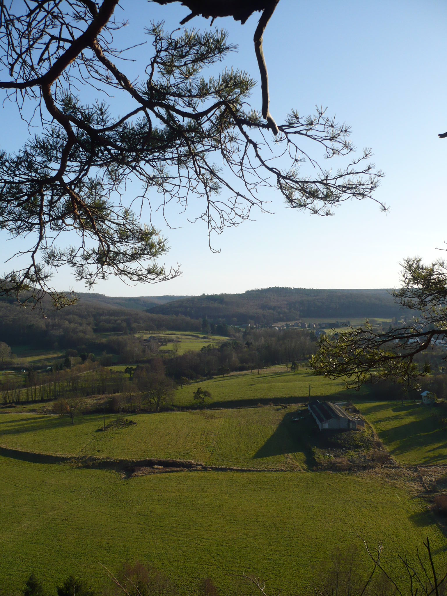
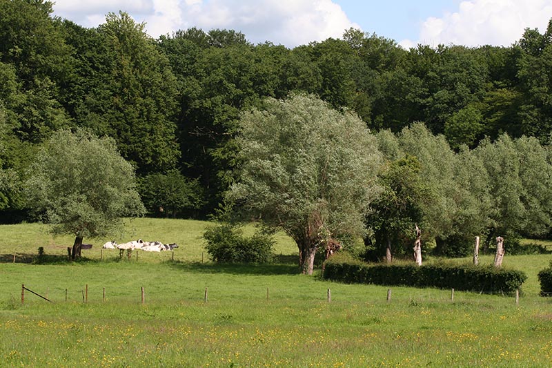
A terrestrial area, with forests.
What rocks lie beneath Entre-Sambre-et-Meuse National Park?
According to the European 1:1 million geological map (EGDI), the bedrock consists mainly of sandstones (38% of sampled points), mudstones (31%) and limestones (25%). These are mostly sedimentary rocks. The geological units date mainly from the Devonian (100% of sampled points).
Which international labels apply to Entre-Sambre-et-Meuse National Park?
Natura 2000 network (11 sites).
When is the best time to visit Entre-Sambre-et-Meuse National Park?
Best time to visit: from May to October, with average temperatures of 11 to 19 °C and moderate rainfall.
Are there historic monuments in Entre-Sambre-et-Meuse National Park?
Yes. According to Wikidata, 3 monuments listed as protected heritage in Wallonia or Flanders stand within the boundary, 2 of them exceptional heritage of Wallonia. For example: “Fondry des Chiens” in Viroinval and “Franc Bois” in Chimay.
What is the nearest large city to Entre-Sambre-et-Meuse National Park?
Nearest towns of over 50,000 people, as the crow flies: Charleroi (29 km) and La Louvière (38 km). Nearest airport: Brussels South Charleroi (CRL), about 34 km away.
How can I reach Entre-Sambre-et-Meuse National Park by train?
Couvin railway station lies within the site.
Where can I get visitor information on site?
Maison du Parc Naturel, Office Tourisme Viroinval and Maison du Tourisme.
Are there waymarked hiking trails in Entre-Sambre-et-Meuse National Park?
Yes. Waymarked hiking routes listed in OpenStreetMap: 89, including GR 12 and Sentier des Abbayes Trappistes de Wallonie. The “GRP 125 Tour de l'Entre-Sambre-et-Meuse” route runs for about 40 km through the site, with some 260 m of ascent on its longest section.
Which species can be seen in Entre-Sambre-et-Meuse National Park?
Among the species most often recorded on GBIF are Branta canadensis (Canada Goose), Alopochen aegyptiaca (Egyptian Goose), Myocastor coypus (Coypu) and Pseudochorthippus parallelus (Meadow Grasshopper).
What is the official website of Entre-Sambre-et-Meuse National Park?
© OpenStreetMap
Download the boundary: GeoJSON · GPX Boundary © OpenStreetMap contributors (ODbL).
Geography
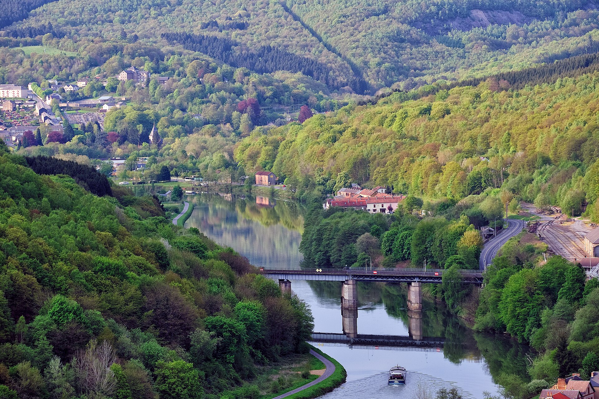
The representative point of the site lies at around 167 m above sea level. Over the 1996–2025 period, the mean annual temperature is about 10.6 °C and total precipitation reaches roughly 949 mm per year. The warmest month is usually August, the coolest January, and the wettest December. According to the European 1:1 million geological map (EGDI), the bedrock consists mainly of sandstones (38% of sampled points), mudstones (31%) and limestones (25%). These are mostly sedimentary rocks. The geological units date mainly from the Devonian (100% of sampled points). The site contains 2 lakes larger than 10 ha, totalling 88 ha of water; the largest, Meer van Virelles, covers 73 ha (HydroLAKES). Meer van de Ry de Rome (25 ha) is 35 m deep (Wikidata).
Area
- Area of the boundary
- 22,730 ha
- Elevation
- 167 m
- Lakes over 10 ha
- 2 (88 ha)
- Coordinates
- 50.074, 4.4283
Lakes: HydroLAKES (Messager et al. 2016, hydrosheds.org, CC BY 4.0) · depths: Wikidata (CC0)
Bedrock
- Sandstones 38 %
- Mudstones 31 %
- Limestones 25 %
- Conglomerates and breccias 6 %
Sedimentary rocks 100 % · Main age: Devonian (100%)
Source: EGDI 1:1M geological map (EuroGeoSurveys and national geological surveys), CC BY 4.0 · 16 sampled points within the site.
Climate
● Mean temperature (°C) · ▮ Precipitation (mm)
Source: Copernicus ERA5-Land (C3S, doi:10.24381/cds.68d2bb30), monthly averages 1996–2025 interpolated to the representative point, temperatures adjusted for elevation.
Contains modified Copernicus Climate Change Service information 2026. Neither the European Commission nor ECMWF is responsible for any use that may be made of the Copernicus information or data it contains.
Natural habitats
According to CORINE Land Cover (2018), the site is mainly made up of forests (72%), farmland (18%) and grassland and meadows (6%). Woodland is mostly broadleaved. Elevation ranges from about 150 to 350 m (sampled elevations, SRTM). The 11 Natura 2000 sites overlapping the area list 25 habitats of European interest (5 priority), the most extensive being Sub-Atlantic and medio-European oak or oak-hornbeam forests of the Carpinion betuli, Medio-European limestone beech forests of the Cephalanthero-Fagion and Luzulo-Fagetum beech forests.
Biodiversity
Based on occurrences aggregated by GBIF, several species are regularly recorded within the site. Among the most frequent are Branta canadensis (Canada Goose), Alopochen aegyptiaca (Egyptian Goose), Myocastor coypus (Coypu) and Pseudochorthippus parallelus (Meadow Grasshopper). The full list of documented taxa is shown below. The overlapping Natura 2000 sites list 94 species of European interest: 47 birds, 25 mammals, 2 reptiles, 8 amphibians, 5 fish, 5 invertebrates and 2 plants.
Habitats of European interest
From the official forms of the 11 Natura 2000 sites overlapping the area (areas reported for each whole site).
- Sub-Atlantic and medio-European oak or oak-hornbeam forests of the Carpinion betuli 1,626 ha
- Medio-European limestone beech forests of the Cephalanthero-Fagion 1,516 ha
- Luzulo-Fagetum beech forests 1,167 ha
- Asperulo-Fagetum beech forests 904 ha
- Lowland hay meadows (Alopecurus pratensis, Sanguisorba officinalis) 212 ha
- Alluvial forests with Alnus glutinosa and Fraxinus excelsior (Alno-Padion, Alnion incanae, Salicion albae) priority 197 ha
- Atlantic acidophilous beech forests with Ilex and sometimes also Taxus in the shrublayer (Quercion robori-petraeae or Ilici-Fagenion) 131 ha
- Natural eutrophic lakes with Magnopotamion or Hydrocharition-type vegetation 98 ha
and 17 more
Species of European interest
Birds · 47
Sedge warbler (Acrocephalus schoenobaenus) passage, Common Kingfisher (Alcedo atthis) resident, Eurasian Teal (Anas crecca) wintering passage, Garganey (Anas querquedula) passage, Purple Heron (Ardea purpurea) passage, Hazel Grouse (Bonasa bonasia) resident, Eurasian Bittern (Botaurus stellaris) wintering, Eurasian Eagle-owl (Bubo bubo) resident, European Nightjar (Caprimulgus europaeus) breeding, Whiskered Tern (Chlidonias hybridus) passage, Black Tern (Chlidonias niger) passage, White stork (Ciconia ciconia) breeding and 35 more
Mammals · 25
Eurasian Beaver (Castor fiber), Serotine bat (Eptesicus serotinus), European wildcat (Felis silvestris), Eurasian otter (Lutra lutra), European pine marten (Martes martes), Hazel dormouse (Muscardinus avellanarius), Western Polecat (Mustela putorius), Alcathoe Whiskered Bat (Myotis alcathoe), Bechstein's bat (Myotis bechsteinii), Brandt's Bat (Myotis brandtii), Pond bat (Myotis dasycneme), Daubenton's bat (Myotis daubentonii) and 13 more
Amphibians · 8
Midwife toad (Alytes obstetricans), Natterjack (Bufo calamita), Natterjack toad (Epidalea calamita), Edible frog (Rana esculenta), Pool frog (Rana lessonae), Lake frog (Rana ridibunda s.L.), Common frog (Rana temporaria), Great crested newt (Triturus cristatus)
Fish · 5
Noble crayfish (Astacus astacus), European bullhead (Cottus gobio), European brook lamprey (Lampetra planeri), European bitterling (Rhodeus sericeus), Grayling (Thymallus thymallus)
Invertebrates · 5
Jersey Tiger (Callimorpha quadripunctaria), Large Blue (Glaucopsyche arion), Roman Snail (Helix pomatia), Willowherb Hawkmoth (Proserpinus proserpina), Thick shelled river mussel (Unio crassus)
Plants · 2
Leucobryum moss (Leucobryum glaucum), Sphagnum Mosses (Sphagnum spp.)
Source: Natura 2000 standard data forms (EEA, CC-BY 4.0). Not exhaustive: sensitive species are not published.
Species to look out for



Insect
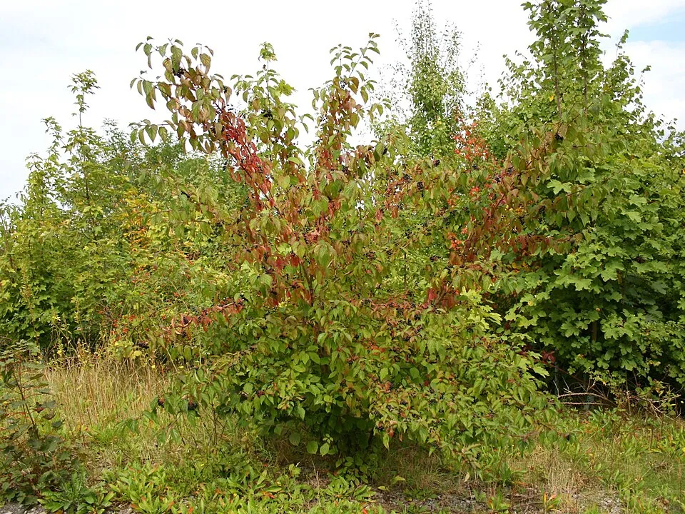
Wood-cricket
Nemobius sylvestris602 records © Gilles San Martin from Namur, Belgium · CC BY-SA 2.0
Observed species
Occurrences documented via GBIF; they are neither an exhaustive inventory nor proof of current presence.
- Canada Goose · Branta canadensis · 1672
- Egyptian Goose · Alopochen aegyptiaca · 1221
- Coypu · Myocastor coypus · 866
- Meadow Grasshopper · Pseudochorthippus parallelus · 646
- Wood-cricket · Nemobius sylvestris · 602
- Dogwood · Cornus sanguinea · 594
- Common Pheasant · Phasianus colchicus · 567
- Large gold grasshopper · Chrysochraon dispar · 555
- Stripe-winged grasshopper · Stenobothrus lineatus · 511
- Yellow Archangel · Lamium galeobdolon · 507
- Bow-winged grasshopper · Chorthippus biguttulus · 505
- Rufous Grasshopper · Gomphocerippus rufus · 497
+18 more species
- Common Wolf Spider · Pardosa pullata · 485
- Dark bush-cricket · Pholidoptera griseoaptera · 450
- Box Tree Moth · Cydalima perspectalis · 430
- Woodland grasshopper · Omocestus rufipes · 404
- Dame's-violet · Hesperis matronalis · 382
- Eurasian Sparrowhawk · Accipiter nisus · 371
- Common green grasshopper · Omocestus viridulus · 343
- Great green bush-cricket · Tettigonia viridissima · 338
- Sainfoin · Onobrychis viciifolia · 327
- Common Kingfisher · Alcedo atthis · 313
- Trochosa terricola · 311
- Degeer's Thickjaw · Pachygnatha degeeri · 309
- Common Kestrel · Falco tinnunculus · 308
- Scots Pine · Pinus sylvestris · 304
- Sickle-bearing bush-cricket · Phaneroptera falcata · 303
- Asian Lady Beetle · Harmonia axyridis · 300
- Common field grasshopper · Chorthippus brunneus · 281
- Common field-speedwell · Veronica persica · 264
Records: GBIF.org (CC-BY). Names: Wikidata (CC0), GBIF. Photos: Wikimedia Commons.
Conservation challenges
The primary purpose of the site is to preserve its natural habitats and the biodiversity they support. The species recorded (Biodiversity tab) reflect its ecological value. The designations it holds frame its management and the control of land use.
According to Global Forest Change data (University of Maryland, Global Forest Watch), about 1,370 ha of tree cover were lost within the boundary between 2001 and 2023 (6% of its area), peaking in 2010 and 2023. These losses include logging, storms and fires, and do not account for regrowth. According to the European CORINE Land Cover inventory (Copernicus), land cover changed on about 114 ha of the site between 1990 and 2018 (under 1% of its area). Forest felling and regrowth add about 340 ha in total over the period. At night, 1% of the area gives off artificial light detectable from space (NASA VIIRS Black Marble composite, 2016): it ranks among the darkest places in the atlas for this country. Built-up and developed land (buildings, business areas, roads, quarries) covers 3% of the area, and farmland 18% (CORINE Land Cover). According to the Natura 2000 forms, of 25 assessed habitats of European interest, 2 are in excellent condition and 10 in average or reduced condition. According to the Water Framework Directive assessment (2022 river basin management plans, data 2018), 93% of the 89 km of rivers assessed within the site are in good or high ecological status. Since 2000, 82 invasive alien species have been recorded within the site (GBIF observations), 16 of them listed as of Union concern under EU Regulation 1143/2014. Among them: Alopochen aegyptiaca (Egyptian Goose), Myocastor coypus (Coypu) and Procyon lotor (Raccoon).
Pressure indicators
Tree cover lost
1,368 ha
2001–2023
20012023
Fires since 2016
0
No large fire mapped (fires over about 30 ha)
Light at night
1%
of the area gives off artificial light visible from space
DarkLit
Built-up land
3%
buildings, business areas, roads, quarries · farmland 18%
Land cover change
114 ha
changed cover, 1990–2018 · CORINE · < 1% of the area
forest felling and regrowth: 340 ha in total
Rivers and lakes
93%
of the 89 km of assessed rivers in good or high ecological status · WFD 2022
assessments 2018
Invasive alien species
82
incl. 16 of EU concern · since 2000
Egyptian GooseEU
CoypuEU
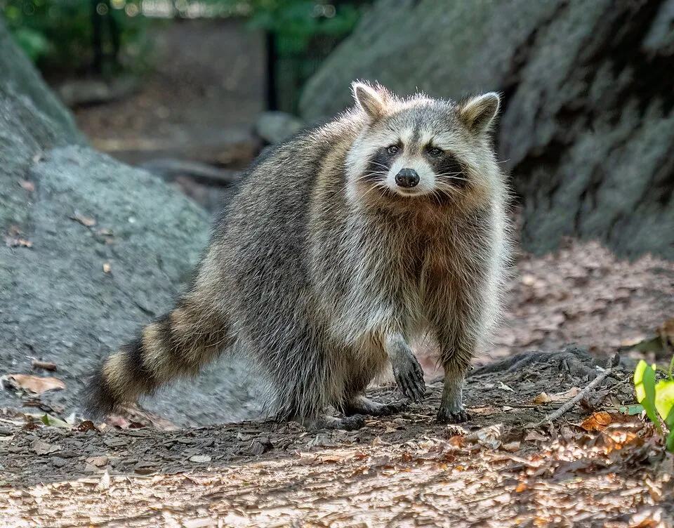 RaccoonEU
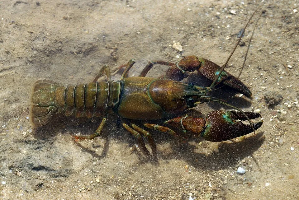 Signal crayfishEU
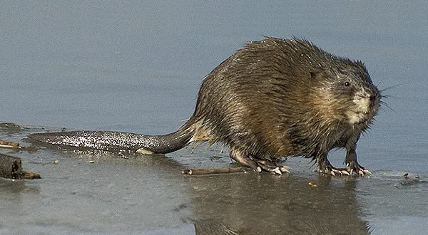 MuskratEU
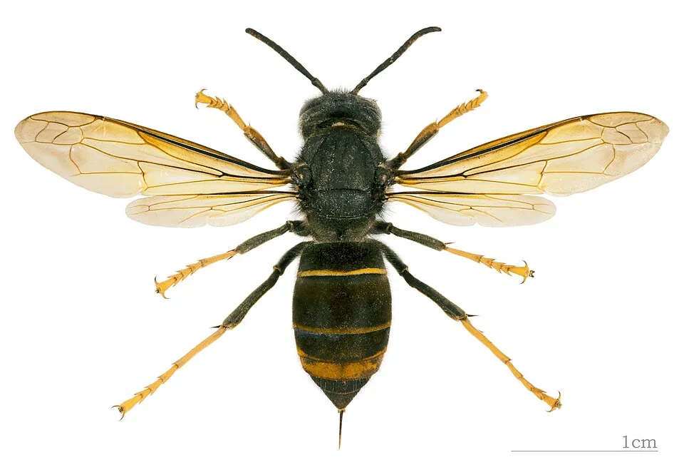 Asian hornetEU
 Himalayan BalsamEU
 Japanese KnotweedEU
Photos: Egyptian Goose © Rhododendrites · CC BY-SA 4.0; Coypu © Philippe Amelant · CC BY-SA 3.0; Raccoon © Rhododendrites · CC BY-SA 4.0; Signal crayfish © David Perez · CC BY 3.0; Muskrat © David Menke · Public domain; Asian hornet © Didier Descouens · CC BY-SA 4.0; Himalayan Balsam © Guptaele · CC BY-SA 4.0; Japanese Knotweed © W.carter · CC0-1.0
Sources: Global Forest Change (Hansen et al., University of Maryland, via Global Forest Watch, CC-BY 4.0); EFFIS, European Commission / Copernicus; NASA Black Marble 2016 (public domain); CORINE Land Cover 2018 (Copernicus) or MODIS.
CORINE Land Cover Change 1990–2018: generated using European Union's Copernicus Land Monitoring Service information (EEA), aggregated by Parkavela; DOI 10.2909/f30f1000-7cf8-43bb-872c-5eb093911b24.
Ecological status of water bodies: European Environment Agency, WISE – Water Framework Directive, 3rd river basin management plans (2022), CC BY 4.0. Official national classification, not comparable between countries.
Invasive alien species: Global Register of Introduced and Invasive Species (ISSG, CC BY 4.0); Union list, Regulation (EU) 1143/2014 (INBO, CC0); GBIF.org records (CC0 / CC BY 4.0), at least 2 per species.
Practical information
Cities and airport
- Charleroi
29 km as the crow flies - La Louvière
38 km as the crow flies - Airport: Brussels South Charleroi (CRL)
34 km as the crow flies
Visitor information
- Maison du Parc Naturel
within the site - Office Tourisme Viroinval
within the site - Maison du Tourisme
< 1 km from the site boundary - Office de Tourisme Communautaire Val d'Ardenne
2 km from the site boundary
Parking
29 public car parks listed within the site
Observatoire de l'Eau BlancheAire de Nismes 2
Hiking
89 waymarked routes listed, including:
GR 12Sentier des Abbayes Trappistes de Wallonie
By bike
L156 RAVeL Ligne 156 · 11 km8 RAVeL W8 Entre Fagnes et Famenne · 11 kmL523 RAVeL Ligne 523 · 6 kmW3 RAVeL W3 Véloroute des Carnavals · 5 km
Signed cycle routes: this does not mean that cycling is allowed on footpaths.
Data © OpenStreetMap contributors (ODbL) · Wikidata (CC0)
Routes © OpenStreetMap contributors (ODbL), via Waymarked Trails
Waymarked hiking routes
GR 12 GR 12 Wallonie, Fontaine-l'Évêque - Brûly-de-Pesche
14.4 km within the site ↗ 12 m↘ 189 m 177–368 m
GRP 124 GRP 124 Liaison 1 - Macquenoise
10 km within the site ↗ 35 m↘ 39 m 259–289 m
GRP 125 GRP 125 Tour de l'Entre-Sambre-et-Meuse
39.5 km within the site ↗ 257 m↘ 226 m 133–255 m
GRT SAT SAT Sentier des Abbayes Trappistes de Wallonie
30.4 km within the site ↗ 257 m↘ 226 m 133–255 m
CH08 Promenade de l'Eau Blanche
4.9 km within the site ↗ 55 m↘ 57 m 194–246 m
Tracks © OpenStreetMap contributors (ODbL), clipped to the boundary; elevation gain and profiles computed on the longest section from Mapzen Terrain Tiles (≈ 30 m), indicative only.
Access and visiting
Couvin railway station lies within the site. Nearest towns of over 50,000 people, as the crow flies: Charleroi (29 km) and La Louvière (38 km). Nearest airport: Brussels South Charleroi (CRL), about 34 km away. About 250,000 people live within 20 km of the site boundary, 110,000 of them within 10 km; some 6,400 people are estimated to live inside (GHSL estimate, 2020). Visitor information on site: Maison du Parc Naturel, Office Tourisme Viroinval and Maison du Tourisme. Public car parks listed within the site: 29, including Observatoire de l'Eau Blanche and Aire de Nismes 2. Waymarked hiking routes listed in OpenStreetMap: 89, including GR 12 and Sentier des Abbayes Trappistes de Wallonie. The site is crossed by 7 signed cycle routes, including “L156 RAVeL Ligne 156” and “8 RAVeL W8 Entre Fagnes et Famenne” (OpenStreetMap). To plan a visit (access, opening periods, visitor rules), it is best to consult the official information from the managing body and the official website listed in this page's sources.
Source: OpenStreetMap (ODbL), Wikidata (CC0), October 2026.
Built heritage
According to Wikidata, 3 monuments listed as protected heritage in Wallonia or Flanders stand within the boundary, 2 of them exceptional heritage of Wallonia. Nationally designated items include “Fondry des Chiens” in Viroinval and “Franc Bois” in Chimay.
-
Fondry des Chiens
National
Viroinval -
Franc Bois
National
Chimay -
Lompret
Chimay
Source: Wikidata (CC0), monuments in each country’s official heritage protection registers, at national or regional level. Each item links to its Wikidata entry.
When to visit
Best time to visit: from May to October, with average temperatures of 11 to 19 °C and moderate rainfall. Day length ranges from about 8 h 05 min in December to 16 h 21 min in June. Wildlife records published on GBIF peak for birds (April and May), plants (May and June), butterflies and moths (from May to July) and dragonflies (from May to August). These peaks also reflect when observers are most active.
Source: Copernicus ERA5-Land (C3S), monthly averages 1996–2025 at the representative point, temperatures adjusted for elevation.
Contains modified Copernicus Climate Change Service information 2026. Neither the European Commission nor ECMWF is responsible for any use that may be made of the Copernicus information or data it contains.
Wildlife records calendar
JFMAMJJASOND
Birds
Plants
Butterflies & moths
Dragonflies
Mammals
Monthly records published on GBIF (CC-BY), relative to the busiest month; also reflects observer activity.
Gallery
© Trougnouf (Benoit Brummer) · CC BY 4.0
© Trougnouf (Benoit Brummer) · CC BY 4.0
© Pamdex · CC BY-SA 4.0
© Earth Science and Remote Sensing Unit, Lyndon B. Johnson Space Center · Public domain
© Earth Science and Remote Sensing Unit, NASA Johnson Space Center · Public domain
© Earth Science and Remote Sensing Unit, Lyndon B. Johnson Space Center · Public domain
Sources and licences
- Wikidata: Q115659522
- OpenStreetMap: relation 16848166
- Official website: https://parc-national-esem.be/
- Wikipedia: en.wikipedia.org/wiki/National_Park_Entre-Sambre-et-Meuse
References
- cds.climate.copernicus.eu: climate · CC-BY-4.0
- registry.opendata.aws: elevation of the reference point, detailed relief · PD
- land.copernicus.eu: land cover, land cover change, sea share · COPERNICUS
- doi.org: population around the site · CC-BY-4.0
- openstreetmap.org: access and peaks, places to see, trail difficulty, wheelchair access · ODbL-1.0
- eea.europa.eu: bathing water quality, ecological status of waters · CC-BY-4.0
- en.eurovelo.com: EuroVelo cycle routes · ODbL-1.0
- cycling.waymarkedtrails.org: cycle routes · ODbL-1.0
- opentopodata.org: elevations · PD
- wikidata.org: establishment date, protected heritage, official name, nearby cities and airport, access and peaks, lake depths, places to see, official website · CC0-1.0
- forest-fire.emergency.copernicus.eu: wildfires · COPERNICUS
- globalforestwatch.org: tree cover loss · CC-BY-4.0
- gbif.org: seasonality of sightings, invasive alien species, observed species · CC-BY-4.0
- europe-geology.eu: geology · CC-BY-4.0
- hydrosheds.org: lakes · CC-BY-4.0
- natura2000.eea.europa.eu: Natura 2000 habitats and species · CC-BY-4.0
- earthobservatory.nasa.gov: night light · PD
- hiking.waymarkedtrails.org: route difficulty · ODbL-1.0
- nsidc.org: snow cover · PD
- wikidata.org: Wikipedia article · CC-BY-SA-4.0
Data © OpenStreetMap contributors (ODbL), Wikidata (CC0) and the sources cited.