Spain · Terrestrial
Bardenas Reales Natural Park
Nature park of 41,444 hectares in Spain, established in 1999.
Overview
Nature park of 41,444 hectares in Spain, established in 1999.
Bardenas Reales Natural Park is a nature park in Spain (Europe). It is a predominantly terrestrial area. Established in 1999, it covers about 41,444 hectares.
Protections and designations
Natura 2000 · habitats (SAC) · 2 sites
- Bardenas Reales ES2200037
- Loma Negra ES2430079
Natura 2000 · birds (SPA) · 3 sites
- El Plano-Blanca alta ES0000171
- Loma la Negra - Bardenas ES0000292
- Rincón del Bu-La Nasa-Tripazul ES0000172
Protected as a nature park. International labels and designations: Natura 2000 network (5 sites). Key dates: first Natura 2000 site under the Birds Directive in 1998, established in 1999 and first Natura 2000 site under the Habitats Directive in 2006.
In our collections
Timeline
-
1998
First Natura 2000 site under the Birds Directive 3 such sites designated up to 2001
-
1999
Established
-
2006
First Natura 2000 site under the Habitats Directive
Sources: Wikidata (CC0) for establishment and international labels; EEA Natura 2000 database (CC-BY 4.0) for site designation dates.
Frequently asked questions
Where is Bardenas Reales Natural Park?
In Spain (Europe). Representative point: 42.1900° N, 1.5000° W.
How large is Bardenas Reales Natural Park?
About 41,444 hectares (414 km²). It is the 15th largest of the 73 nature parks in Spain covered by Parkavela.
When was Bardenas Reales Natural Park established?
In 1999.
What habitats and landscapes does Bardenas Reales Natural Park include?
A terrestrial area, where land cover is dominated by farmland (56%).
What rocks lie beneath Bardenas Reales Natural Park?
According to the European 1:1 million geological map (EGDI), the bedrock consists mainly of limestones (42% of sampled points), sands and gravels (25%) and carbonate rocks (25%). These are mostly sedimentary rocks. The geological units date mainly from the Neogene (75% of sampled points).
What is the highest point of Bardenas Reales Natural Park?
Loma Negra, at 646 m (OpenStreetMap).
What are the main summits of Bardenas Reales Natural Park?
Loma Negra (646 m), Peña la Aguda (629 m), Nasa Alta (629 m), Cabezo Aguilar (613 m) and Punta del Aguilar (613 m) (OpenStreetMap).
Which international labels apply to Bardenas Reales Natural Park?
Natura 2000 network (5 sites).
What is the nearest large city to Bardenas Reales Natural Park?
Nearest towns of over 50,000 people, as the crow flies: Zaragoza (53 km) and Logroño (66 km). Nearest airport: Zaragoza (ZAZ), about 43 km away.
How can I reach Bardenas Reales Natural Park by train?
The nearest railway station is Villafranca de Navarra, about 5 km from the site boundary.
Where can I get visitor information on site?
Centro informacion de Bardenas Reales.
Which species can be seen in Bardenas Reales Natural Park?
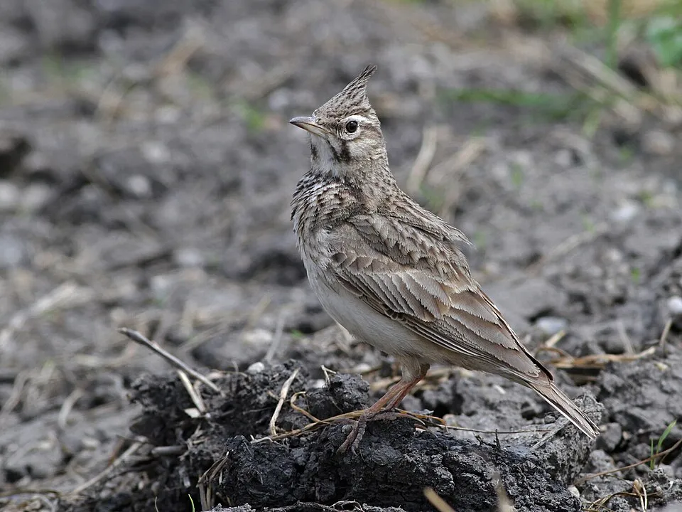
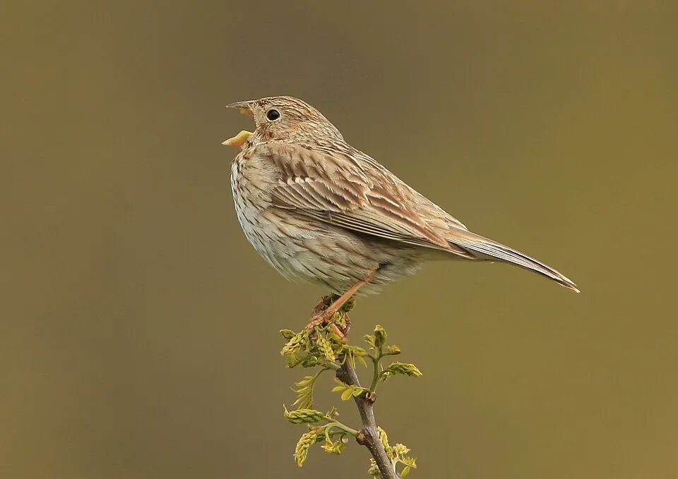
Among the species most often recorded on GBIF are Galerida cristata (Crested Lark), Emberiza calandra (Corn Bunting), Gyps fulvus (Griffon Vulture) and Circus aeruginosus (Western Marsh Harrier).
What is the official website of Bardenas Reales Natural Park?
© OpenStreetMap
Download the boundary: GeoJSON · GPX Boundary © OpenStreetMap contributors (ODbL).
Geography
According to the European 1:1 million geological map (EGDI), the bedrock consists mainly of limestones (42% of sampled points), sands and gravels (25%) and carbonate rocks (25%). These are mostly sedimentary rocks. The geological units date mainly from the Neogene (75% of sampled points).
Area
- Area
- 41,444 ha
- Elevation
- 650 m
- Median elevation
- 371 m
- Coordinates
- 42.19, -1.5
Terrain: Mapzen Terrain Tiles (SRTM, USGS)
Bedrock
- Limestones 42 %
- Sands and gravels 25 %
- Carbonate rocks 25 %
- Gypsum and evaporites 8 %
Sedimentary rocks 100 % · Main age: Neogene (75%)
Source: EGDI 1:1M geological map (EuroGeoSurveys and national geological surveys), CC BY 4.0 · 12 sampled points within the site.
Main summits
- Loma Negra646 m
- Peña la Aguda629 m
- Nasa Alta629 m
- Cabezo Aguilar613 m
- Punta del Aguilar613 m
- Nasa Baja602 m
- La Estaca593 m
- San Antón565 m
- Cabezo del Fraile557 m
- La Umbría549 m
Data © OpenStreetMap contributors (ODbL)
Natural habitats
According to CORINE Land Cover (2018), the site is mainly made up of farmland (56%), Mediterranean scrub (26%) and sparsely vegetated land (11%). Elevation ranges from about 280 m to 646 m (highest point: Loma Negra). The 5 Natura 2000 sites overlapping the area list 16 habitats of European interest (3 priority), the most extensive being endemic oro-Mediterranean heaths with gorse, halo-nitrophilous scrubs (Pegano-Salsoletea) and Mediterranean pine forests with endemic Mesogean pines.
Biodiversity
Based on occurrences aggregated by GBIF, several species are regularly recorded within the site. Among the most frequent are Galerida cristata (Crested Lark), Emberiza calandra (Corn Bunting), Gyps fulvus (Griffon Vulture) and Circus aeruginosus (Western Marsh Harrier). The full list of documented taxa is shown below. The overlapping Natura 2000 sites list 103 species of European interest: 80 birds, 15 mammals, 2 reptiles, 3 amphibians, 2 fish and 1 plant.
Habitats of European interest
From the official forms of the 5 Natura 2000 sites overlapping the area (areas reported for each whole site).
- Endemic oro-Mediterranean heaths with gorse 7,839 ha
- Halo-nitrophilous scrubs (Pegano-Salsoletea) 7,691 ha
- Mediterranean pine forests with endemic Mesogean pines 4,298 ha
- Mediterranean salt steppes (Limonietalia) priority 3,326 ha
- Pseudo-steppe with grasses and annuals of the Thero-Brachypodietea priority 3,189 ha
- Arborescent matorral with Juniperus spp. 2,319 ha
- Mediterranean and thermo-Atlantic halophilous scrubs (Sarcocornetea fruticosi) 1,364 ha
- Iberian gypsum vegetation (Gypsophiletalia) priority 727 ha
and 8 more
Species of European interest
Birds · 80
Eurasian Goshawk (Accipiter gentilis) resident, Northern Pintail (Anas acuta) wintering, Eurasian Teal (Anas crecca) wintering, Mallard (Anas platyrhynchos) wintering, Tawny Pipit (Anthus campestris) breeding, Golden Eagle (Aquila chrysaetos) resident, Grey Heron (Ardea cinerea) wintering, Purple Heron (Ardea purpurea) breeding, Short-eared Owl (Asio flammeus) wintering, Common Pochard (Aythya ferina) wintering, Eurasian Bittern (Botaurus stellaris) wintering breeding, Eurasian Eagle-owl (Bubo bubo) resident and 68 more
Mammals · 15
Serotine bat (Eptesicus serotinus), European wildcat (Felis silvestris), Savi's Pipistrelle (Hypsugo savii), Eurasian otter (Lutra lutra), Common bent-wing bat (Miniopterus schreibersii), European Mink (Mustela lutreola), Lesser mouse-eared myotis (Myotis blythii), Greater mouse-eared bat (Myotis myotis), Natterer's bat (Myotis nattereri), Lesser noctule (Nyctalus leisleri), Kuhl's pipistrelle (Pipistrellus kuhlii), Common pipistrelle (Pipistrellus pipistrellus) and 3 more
Reptiles · 2
Bedriaga's skink (Chalcides bedriagai), European Pond Turtle (Emys orbicularis)
Amphibians · 3
Natterjack toad (Epidalea calamita), Western Spadefoot (Pelobates cultripes), Marbled newt (Triturus marmoratus)
Plants · 1
Source: Natura 2000 standard data forms (EEA, CC-BY 4.0). Not exhaustive: sensitive species are not published.
Species to look out for


Observed species
Occurrences documented via GBIF; they are neither an exhaustive inventory nor proof of current presence.
- Crested Lark · Galerida cristata · 720
- Corn Bunting · Emberiza calandra · 702
- Griffon Vulture · Gyps fulvus · 638
- Western Marsh Harrier · Circus aeruginosus · 596
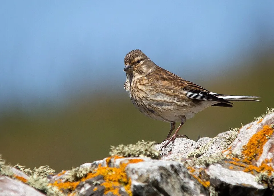
- Common Linnet · Linaria cannabina · 580
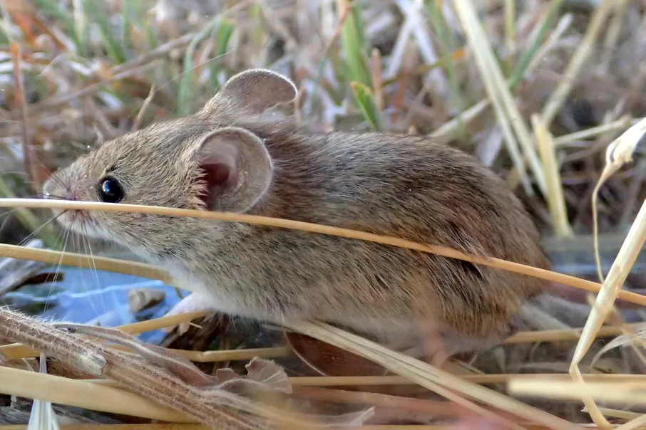
- Algerian mouse · Mus spretus · 524
- Eurasian Skylark · Alauda arvensis · 517
- House Sparrow · Passer domesticus · 483
- European Stonechat · Saxicola rubicola · 471
- Calandra Lark · Melanocorypha calandra · 439
- Wild boar · Sus scrofa · 424
- Northern Wheatear · Oenanthe oenanthe · 423
Records: GBIF.org (CC-BY). Names: Wikidata (CC0), GBIF. Photos: Wikimedia Commons.
Conservation challenges
The primary purpose of the site is to preserve its natural habitats and the biodiversity they support. The species recorded (Biodiversity tab) reflect its ecological value. The designations it holds frame its management and the control of land use.
According to Global Forest Change data (University of Maryland, Global Forest Watch), about 13 ha of tree cover were lost within the boundary between 2001 and 2023, peaking in 2001 and 2021. These losses include logging, storms and fires, and do not account for regrowth. According to the European CORINE Land Cover inventory (Copernicus), land cover changed on about 830 ha of the site between 1990 and 2018 (2% of its area): farmland shrank by 680 ha, mostly giving way to open natural land, while open natural land grew by 479 ha, mostly at the expense of farmland. Since 2016, the European EFFIS system (Copernicus) has mapped 3 fires here, burning about 128 ha within the boundary; the largest, in July 2021 (near Valtierra), covered 82 ha. At night, the area gives off virtually no artificial light detectable from space (NASA VIIRS Black Marble composite, 2016). According to the Natura 2000 forms, of 16 assessed habitats of European interest, 5 are in excellent condition and the rest in good condition. According to the Water Framework Directive assessment (2022 river basin management plans, data 2018), water bodies assessed within the site: lakes, 1 of 1 in good ecological status or better. Invasive alien species have been recorded within the site since 2000 (GBIF observations). Among them: Cuscuta campestris (Field dodder), Erigeron canadensis (Canada Horseweed) and Symphyotrichum squamatum (Southeastern annual saltmarsh aster).
Pressure indicators
Tree cover lost
13 ha
2001–2023 · < 1% of the area
20012023
Fires since 2016
128 ha
burned within the boundary (3 mapped fires)
- 2021 · Valtierra · 82 ha
- 2022 · N.A. · 31 ha
- 2023 · N.A. · 15 ha
Light at night
< 1%
of the area gives off artificial light visible from space
DarkLit
Built-up land
< 1%
buildings, business areas, roads, quarries · farmland 56%
Land cover change
830 ha
changed cover, 1990–2018 · CORINE · 2% of the area
- −680 ha · farmland
- +479 ha · open natural land
Rivers and lakes
Lakes: 1 of 1 good or better
assessments 2018
Invasive alien species
3
recorded since 2000
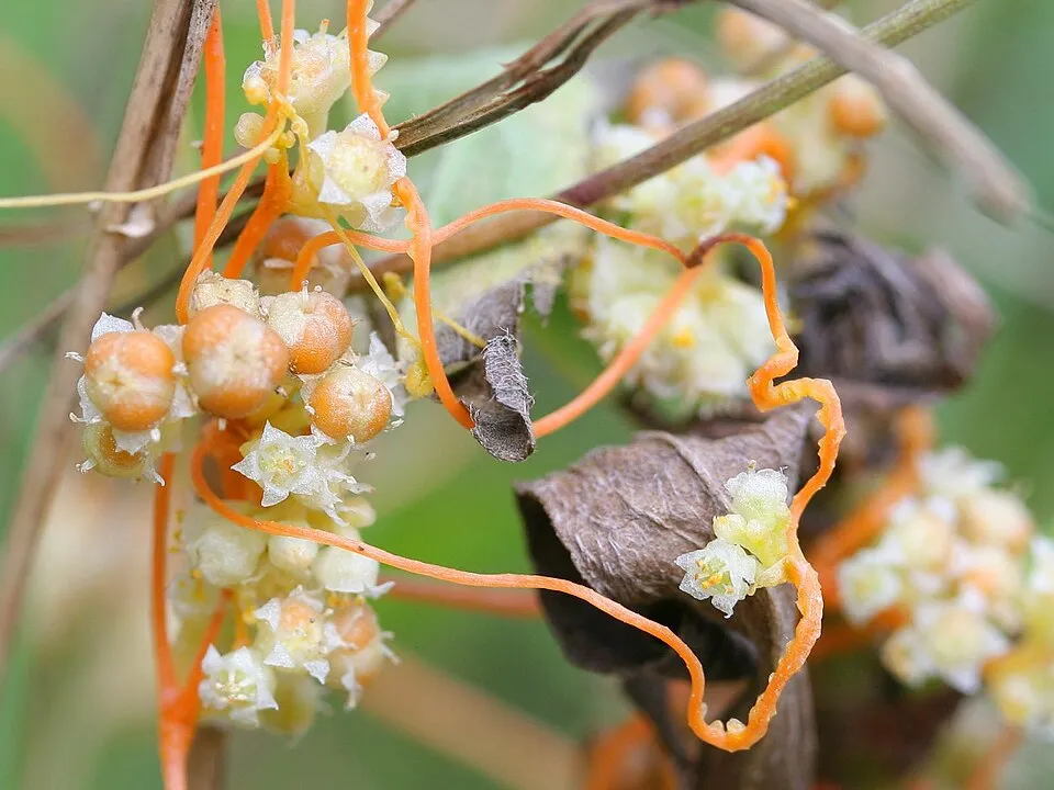 Field dodder
 Canada Horseweed
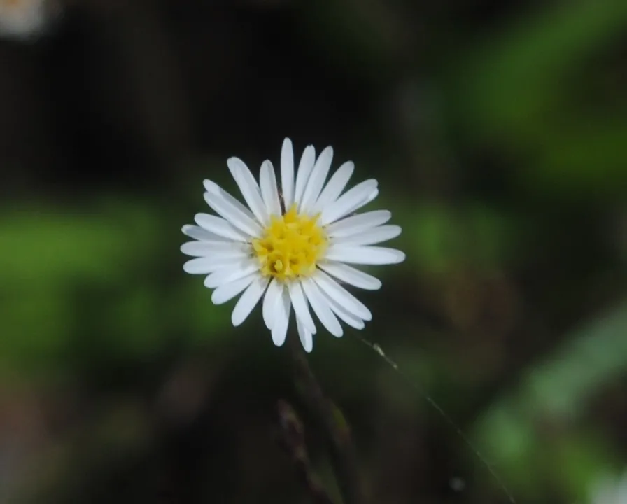 Southeastern annual saltmarsh aster
Photos: Field dodder © Kristian Peters -- Fabelfroh · CC BY-SA 3.0; Canada Horseweed © Andrey Zharkikh from Salt Lake City, USA · CC BY 2.0; Southeastern annual saltmarsh aster © Andrés González · CC BY-SA 3.0
Sources: Global Forest Change (Hansen et al., University of Maryland, via Global Forest Watch, CC-BY 4.0); EFFIS, European Commission / Copernicus; NASA Black Marble 2016 (public domain); CORINE Land Cover 2018 (Copernicus) or MODIS.
CORINE Land Cover Change 1990–2018: generated using European Union's Copernicus Land Monitoring Service information (EEA), aggregated by Parkavela; DOI 10.2909/f30f1000-7cf8-43bb-872c-5eb093911b24.
Ecological status of water bodies: European Environment Agency, WISE – Water Framework Directive, 3rd river basin management plans (2022), CC BY 4.0. Official national classification, not comparable between countries.
Invasive alien species: Global Register of Introduced and Invasive Species (ISSG, CC BY 4.0); Union list, Regulation (EU) 1143/2014 (INBO, CC0); GBIF.org records (CC0 / CC BY 4.0), at least 2 per species.
Practical information
Cities and airport
- Zaragoza
53 km as the crow flies - Logroño
66 km as the crow flies - Airport: Zaragoza (ZAZ)
43 km as the crow flies
Visitor information
- Centro informacion de Bardenas Reales
< 1 km from the site boundary
Data © OpenStreetMap contributors (ODbL) · Wikidata (CC0)
Access and visiting
The nearest railway station is Villafranca de Navarra, about 5 km from the site boundary. Nearest towns of over 50,000 people, as the crow flies: Zaragoza (53 km) and Logroño (66 km). Nearest airport: Zaragoza (ZAZ), about 43 km away. About 170,000 people live within 20 km of the site boundary, 84,000 of them within 10 km; some 190 people are estimated to live inside (GHSL estimate, 2020). This population has grown by about 9% since 2000. Visitor information on site: Centro informacion de Bardenas Reales. To plan a visit (access, opening periods, visitor rules), it is best to consult the official information from the managing body and the official website listed in this page's sources.
Source: OpenStreetMap (ODbL), Wikidata (CC0), October 2026.
Wildlife records calendar
JFMAMJJASOND
Birds
Plants
Butterflies & moths
Dragonflies
Mammals
Monthly records published on GBIF (CC-BY), relative to the busiest month; also reflects observer activity.
Gallery
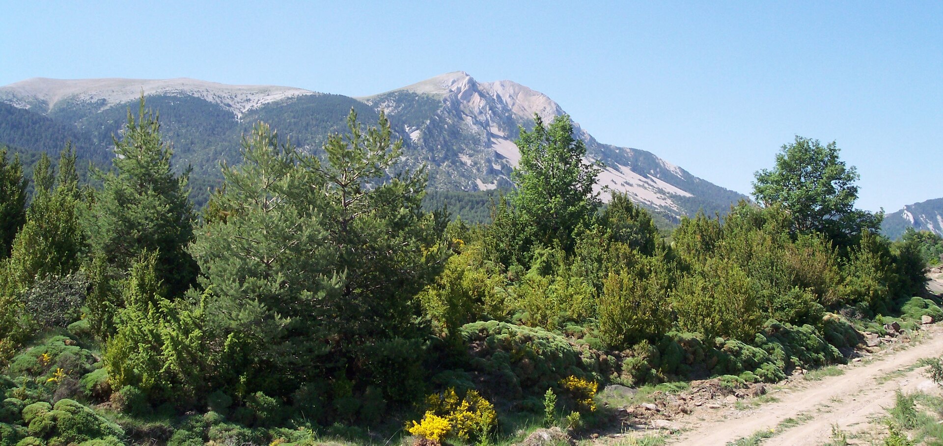
© A1AA1A · CC BY-SA 4.0
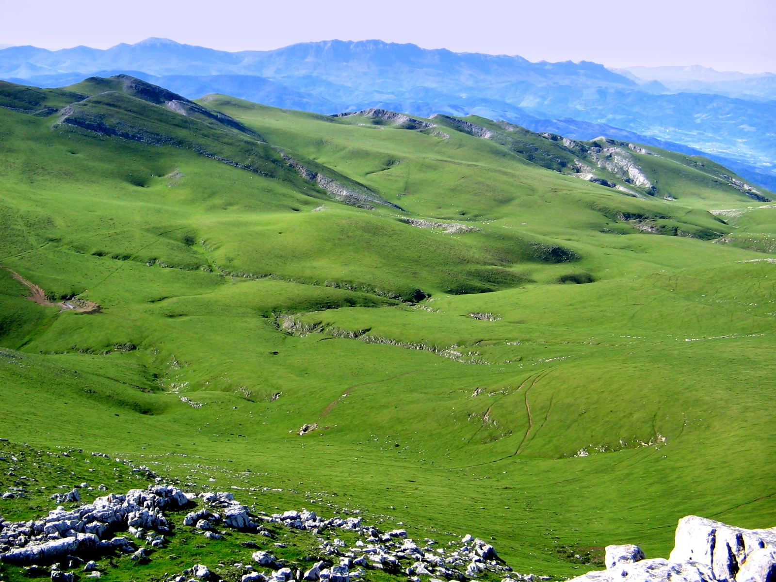
© Mikipons · CC BY-SA 3.0
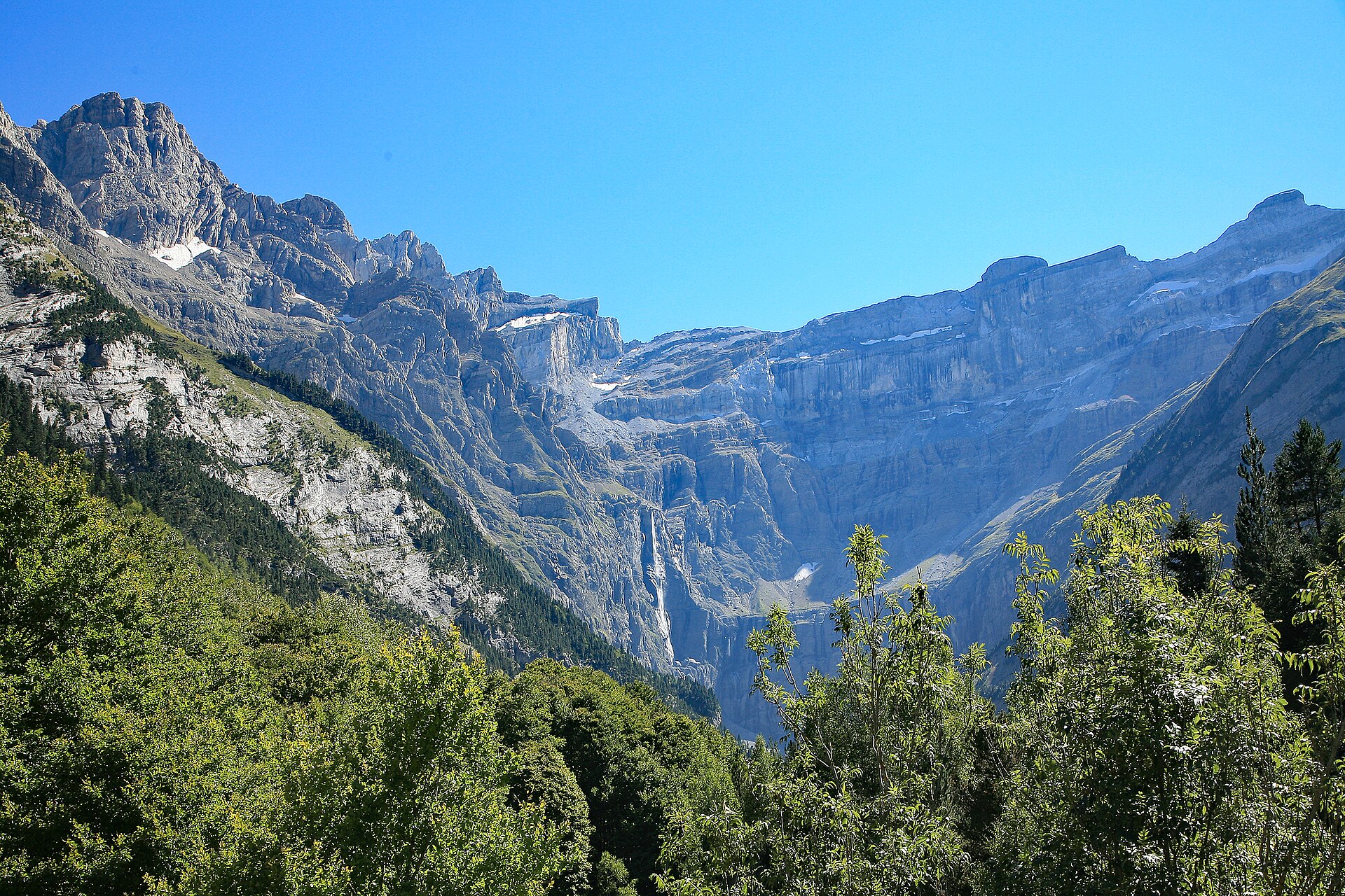
© Adbar · CC BY-SA 3.0
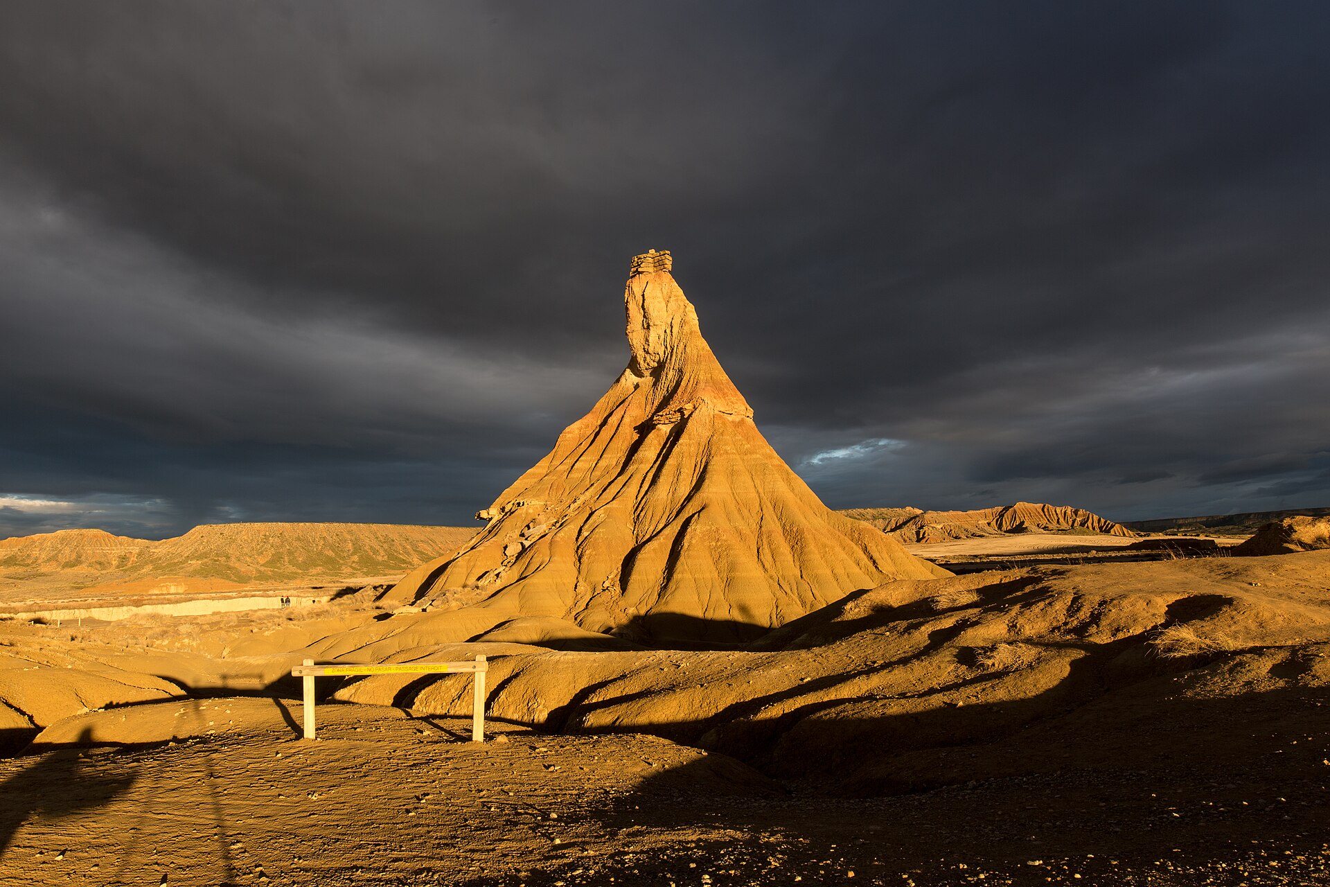
© Txo · Public domain
© Txo Mi discusión en castellano · Public domain
© Txo Mi discusión en castellano · Public domain
Sources and licences
- Wikidata: Q521527
- OpenStreetMap: relation 342322
- Official website: http://www.bardenasreales.es/
- Wikipedia: en.wikipedia.org/wiki/Bardenas_Reales
- WDPA: 151237
References
- land.copernicus.eu: land cover, land cover change, sea share · COPERNICUS
- doi.org: population around the site · CC-BY-4.0
- wikidata.org: official area, highest point, establishment date, protected heritage, official name, nearby cities and airport, access and peaks, lake depths, places to see, official website · CC0-1.0
- eea.europa.eu: bathing water quality, ecological status of waters · CC-BY-4.0
- en.eurovelo.com: EuroVelo cycle routes · ODbL-1.0
- cycling.waymarkedtrails.org: cycle routes · ODbL-1.0
- opentopodata.org: elevations · PD
- forest-fire.emergency.copernicus.eu: wildfires · COPERNICUS
- globalforestwatch.org: tree cover loss · CC-BY-4.0
- gbif.org: seasonality of sightings, invasive alien species, observed species · CC-BY-4.0
- europe-geology.eu: geology · CC-BY-4.0
- hydrosheds.org: lakes · CC-BY-4.0
- natura2000.eea.europa.eu: Natura 2000 habitats and species · CC-BY-4.0
- earthobservatory.nasa.gov: night light · PD
- openstreetmap.org: access and peaks, trail difficulty · ODbL-1.0
- registry.opendata.aws: detailed relief · PD
- nsidc.org: snow cover · PD
- wikidata.org: Wikipedia article · CC-BY-SA-4.0
Data © OpenStreetMap contributors (ODbL), Wikidata (CC0) and the sources cited.