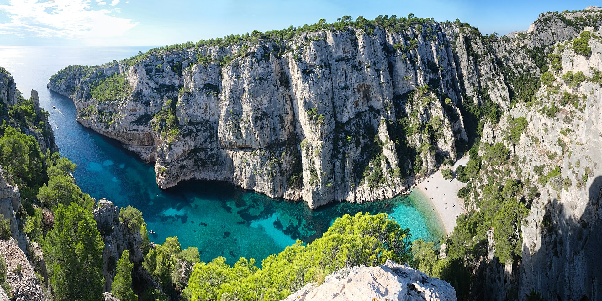

France · Mixed
Calanques National Park
National park of 52,000 hectares in France, established in 2012.
Overview
National park of 52,000 hectares in France, established in 2012.
Calanques National Park is located in France (Europe). It covers both land and sea. Established in 2012, it covers about 52,000 hectares.
Protections and designations
Natura 2000 · habitats (SAC)
Natura 2000 · birds (SPA) · 2 sites
- Falaises de Vaufrèges FR9312018
- Iles Marseillaises - Cassidaigne FR9312007
Protected as a national park. International labels and designations: Natura 2000 network (3 sites). Key dates: first Natura 2000 site under the Birds Directive in 2002, established in 2012 and first Natura 2000 site under the Habitats Directive in 2014.
In our collections
Timeline
-
2002
First Natura 2000 site under the Birds Directive 2 such sites designated up to 2006
-
2012
Established
-
2014
First Natura 2000 site under the Habitats Directive
Sources: Wikidata (CC0) for establishment and international labels; EEA Natura 2000 database (CC-BY 4.0) for site designation dates.
Frequently asked questions
Where is Calanques National Park?
In France (Europe). Representative point: 43.1534° N, 5.4103° E.
How large is Calanques National Park?
About 52,000 hectares (520 km²). It is the 10th largest of the 13 national parks in France covered by Parkavela. About 43,400 ha are at sea.
When was Calanques National Park established?
In 2012.
What habitats and landscapes does Calanques National Park include?
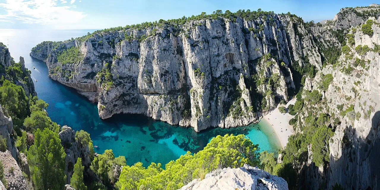
An area spanning land and sea, with coasts.
What rocks lie beneath Calanques National Park?
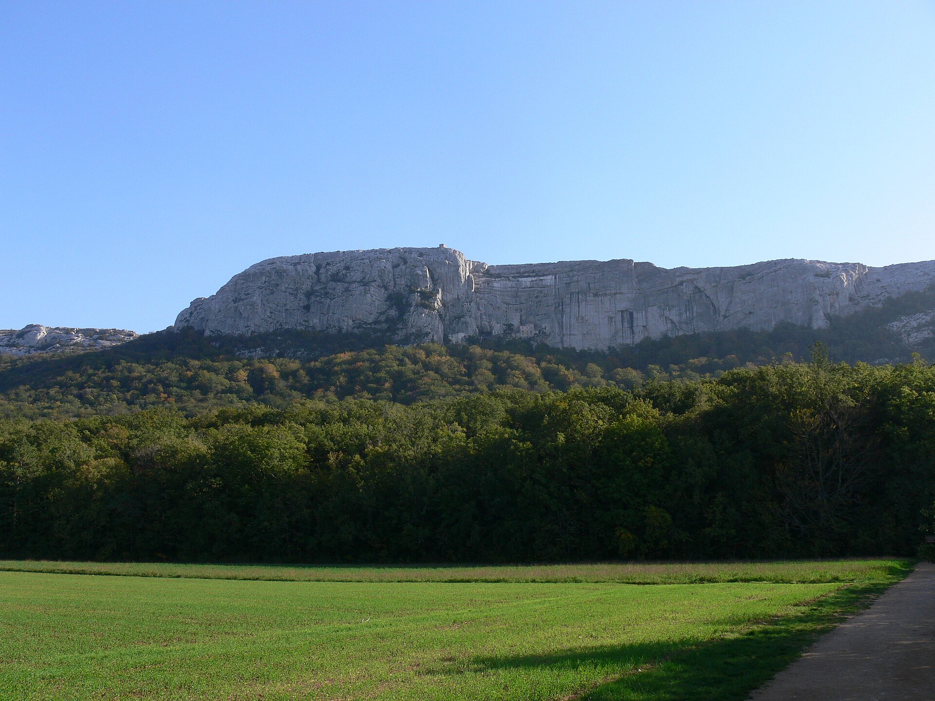
According to the BRGM's simplified lithological map, the bedrock consists mainly of limestones, marls and gypsum (100% of sampled points). These are mostly sedimentary rocks.
What is the highest point of Calanques National Park?
Mont Carpiagne, at 645 m (OpenStreetMap).
What are the main summits of Calanques National Park?
Mont Carpiagne (645 m), Mont Saint-Cyr (610 m), Mont Puget (563 m), Aiguille Guillermin (495 m) and Grande Candelle (465 m) (OpenStreetMap).
Which international labels apply to Calanques National Park?
Natura 2000 network (3 sites).
When is the best time to visit Calanques National Park?
Best time to visit: from April to September, with average temperatures of 14 to 25 °C and moderate rainfall.
What is there to see in Calanques National Park?
119 viewpoints, 1 lake or pond and 125 caves, including Cap Gros (510 m), Grand bassin, Basse grotte du plan des Cailles and Col de la Candelle (430 m) (OpenStreetMap).
Where can I stay in Calanques National Park?
2 campsites, including Camps de protection de la forêt and Parking des Gorguettes (OpenStreetMap).
Are there historic monuments in Calanques National Park?
Yes. According to the French Ministry of Culture's Mérimée database, 5 historic monuments stand within the boundary, 3 of them with the highest level of protection (classé). For example: “Château d'If” in Marseille, “Grottes Cosquer” in Marseille and “Phare du Planier” in Marseille.
Can you swim in Calanques National Park?
16 monitored bathing sites lie in or within 1 km of the site; official 2025 classification: 13 excellent, 2 good and 1 sufficient (European Environment Agency). Swimming is only permitted at the sites and times authorised locally.
What is the nearest large city to Calanques National Park?
Nearest towns of over 50,000 people, as the crow flies: Marseille (4 km) and La Seyne-sur-Mer (21 km). Nearest airport: Marseille Provence (MRS), about 18 km away.
How can I reach Calanques National Park by train?
The nearest railway station is La Barasse, less than 1 km from the site boundary.
Where can I get visitor information on site?
Maison forestière de la Gardiole, Office de Tourisme et des Congrès Cassis and Office municipal de tourisme.
Are there waymarked hiking trails in Calanques National Park?
Yes. Waymarked hiking routes listed in OpenStreetMap: 62, including GR 51 and GR 98 (62 km). The GR 51 route runs for about 28 km through the site, with some 1,260 m of ascent on its longest section.
Which species can be seen in Calanques National Park?
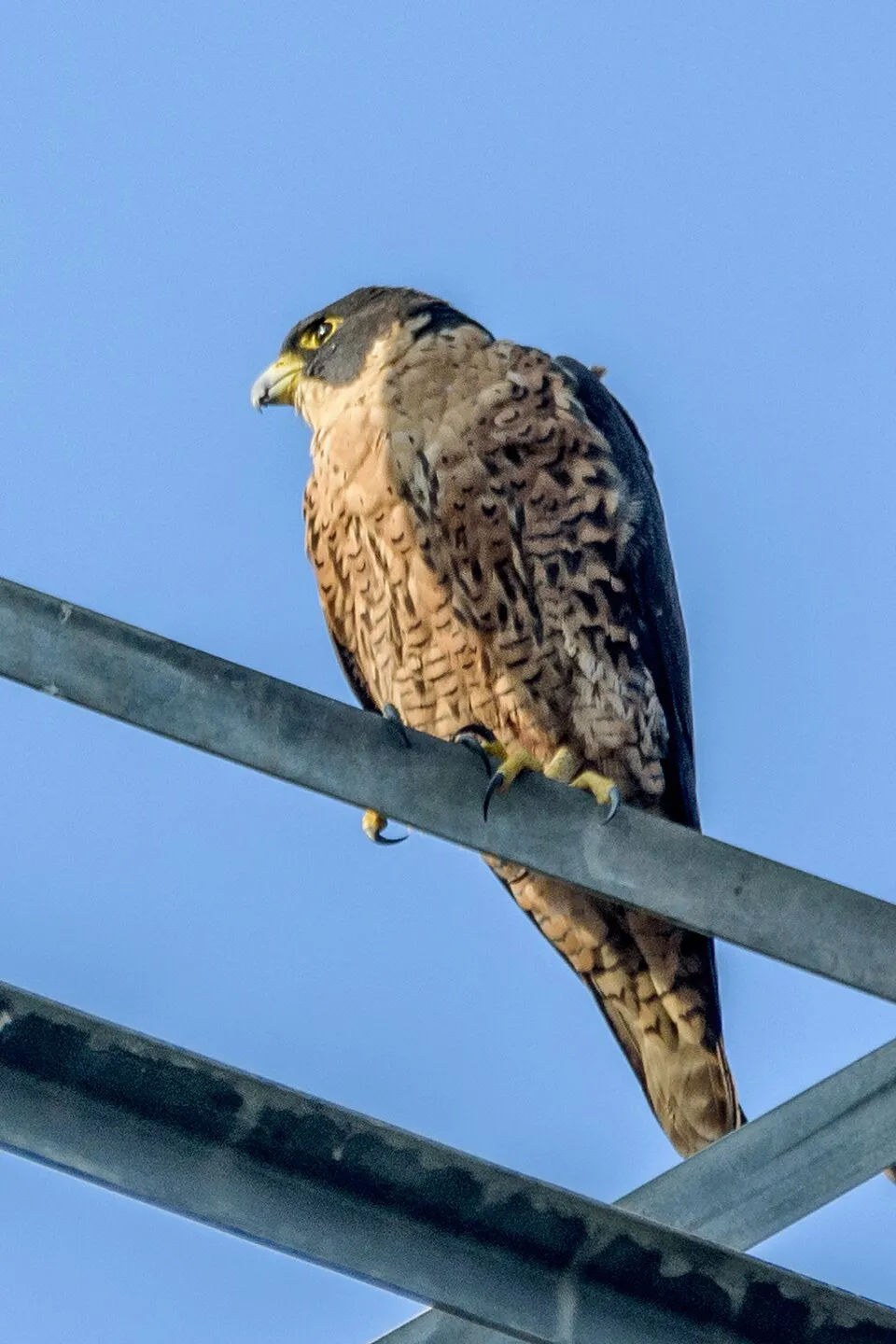
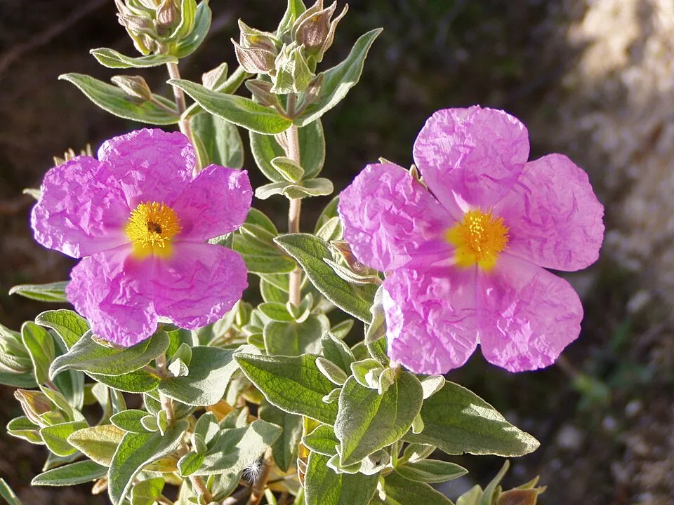
Among the species most often recorded on GBIF are Astragalus tragacantha, Sylvia melanocephala (Sardinian warbler), Falco peregrinus (Peregrine Falcon) and Cistus albidus (Grey-leaved Cistus).
What is the official website of Calanques National Park?
© OpenStreetMap
Download the boundary: GeoJSON · GPX Boundary © OpenStreetMap contributors (ODbL).
Geography
Over the 1996–2025 period, the mean annual temperature is about 15.9 °C and total precipitation reaches roughly 629 mm per year. The warmest month is usually July, the coolest January, and the wettest November. According to the BRGM's simplified lithological map, the bedrock consists mainly of limestones, marls and gypsum (100% of sampled points). These are mostly sedimentary rocks.
Area
- Area
- 52,000 ha
- Coordinates
- 43.1534, 5.4103
Bedrock
- Limestones, marls and gypsum 100 %
Sedimentary rocks 100 %
Source: BRGM, simplified lithological map at 1:1,000,000 (Licence Ouverte), 3 points sampled within the boundary.
Main summits
- Mont Carpiagne645 m
- Mont Saint-Cyr610 m
- Mont Puget563 m
- Aiguille Guillermin495 m
- Grande Candelle465 m
- Le Candélon446 m
- Marseilleveyre433 m
- Pain de Sucre414 m
- Signal Sud de l'Homme Mort396 m
- Signal Est de l'Homme Mort396 m
Data © OpenStreetMap contributors (ODbL)
Climate
● Mean temperature (°C) · ▮ Precipitation (mm)
Source: Copernicus ERA5-Land (C3S, doi:10.24381/cds.68d2bb30), monthly averages 1996–2025 interpolated to the representative point, temperatures adjusted for elevation.
Contains modified Copernicus Climate Change Service information 2026. Neither the European Commission nor ECMWF is responsible for any use that may be made of the Copernicus information or data it contains.
Natural habitats
According to CORINE Land Cover (2018), the land area is mainly made up of Mediterranean scrub (65%), sparsely vegetated land (11%) and forests (11%). The sea covers about 83% of the site. The seabed reaches about 1,153 m deep (median depth 98 m; GEBCO bathymetry). Elevation ranges from sea level to 645 m (highest point: Mont Carpiagne). The 3 Natura 2000 sites overlapping the area list 21 habitats of European interest (3 priority), the most extensive being calcareous rocky slopes with chasmophytic vegetation, Posidonia beds (Posidonion oceanicae) and western Mediterranean and thermophilous scree.
Biodiversity
Based on occurrences aggregated by GBIF, several species are regularly recorded within the site. Among the most frequent are Astragalus tragacantha, Sylvia melanocephala (Sardinian warbler), Falco peregrinus (Peregrine Falcon) and Cistus albidus (Grey-leaved Cistus). The full list of documented taxa is shown below. The overlapping Natura 2000 sites list 38 species of European interest: 26 birds, 5 mammals, 2 reptiles, 4 invertebrates and 1 plant.
Habitats of European interest
From the official forms of the 3 Natura 2000 sites overlapping the area (areas reported for each whole site).
- Calcareous rocky slopes with chasmophytic vegetation 818 ha
- Posidonia beds (Posidonion oceanicae) priority 656 ha
- Western Mediterranean and thermophilous scree 479 ha
- Quercus ilex and Quercus rotundifolia forests 376 ha
- Reefs 311 ha
- Sandbanks which are slightly covered by sea water all the time 269 ha
- Mediterranean pine forests with endemic Mesogean pines 234 ha
- Vegetated sea cliffs of the Mediterranean coasts with endemic Limonium spp. 231 ha
and 13 more
Species of European interest
Birds · 26
Razorbill (Alca torda) wintering passage, Tawny Pipit (Anthus campestris) breeding, Bonelli's Eagle (Aquila fasciata) resident, Eurasian Eagle-owl (Bubo bubo) resident, Scopoli's Shearwater (Calonectris diomedea) passage breeding, European Nightjar (Caprimulgus europaeus) breeding, Short-toed Snake Eagle (Circaetus gallicus) passage, Hen Harrier (Circus cyaneus) passage, European Roller (Coracias garrulus) breeding, Ortolan Bunting (Emberiza hortulana) breeding, Eleonora's Falcon (Falco eleonorae) passage, Peregrine Falcon (Falco peregrinus) resident passage and 14 more
Mammals · 5
Common bent-wing bat (Miniopterus schreibersii), Bechstein's bat (Myotis bechsteinii), Lesser mouse-eared myotis (Myotis blythii), Greater Horseshoe Bat (Rhinolophus ferrumequinum), Common bottlenose dolphin (Tursiops truncatus)
Invertebrates · 4
Greater Capricorn Beetle (Cerambyx cerdo), Marsh fritillary (Euphydryas aurinia), Jersey Tiger (Euplagia quadripunctaria), Stag beetle (Lucanus cervus)
Plants · 1
Arenaria provincialis
Source: Natura 2000 standard data forms (EEA, CC-BY 4.0). Not exhaustive: sensitive species are not published.
Species to look out for


Observed species
Occurrences documented via GBIF; they are neither an exhaustive inventory nor proof of current presence.
- Astragalus tragacantha · 3667
- Sardinian warbler · Sylvia melanocephala · 3304
- Peregrine Falcon · Falco peregrinus · 2966
- Grey-leaved Cistus · Cistus albidus · 2101
- European robin · Erithacus rubecula · 2017
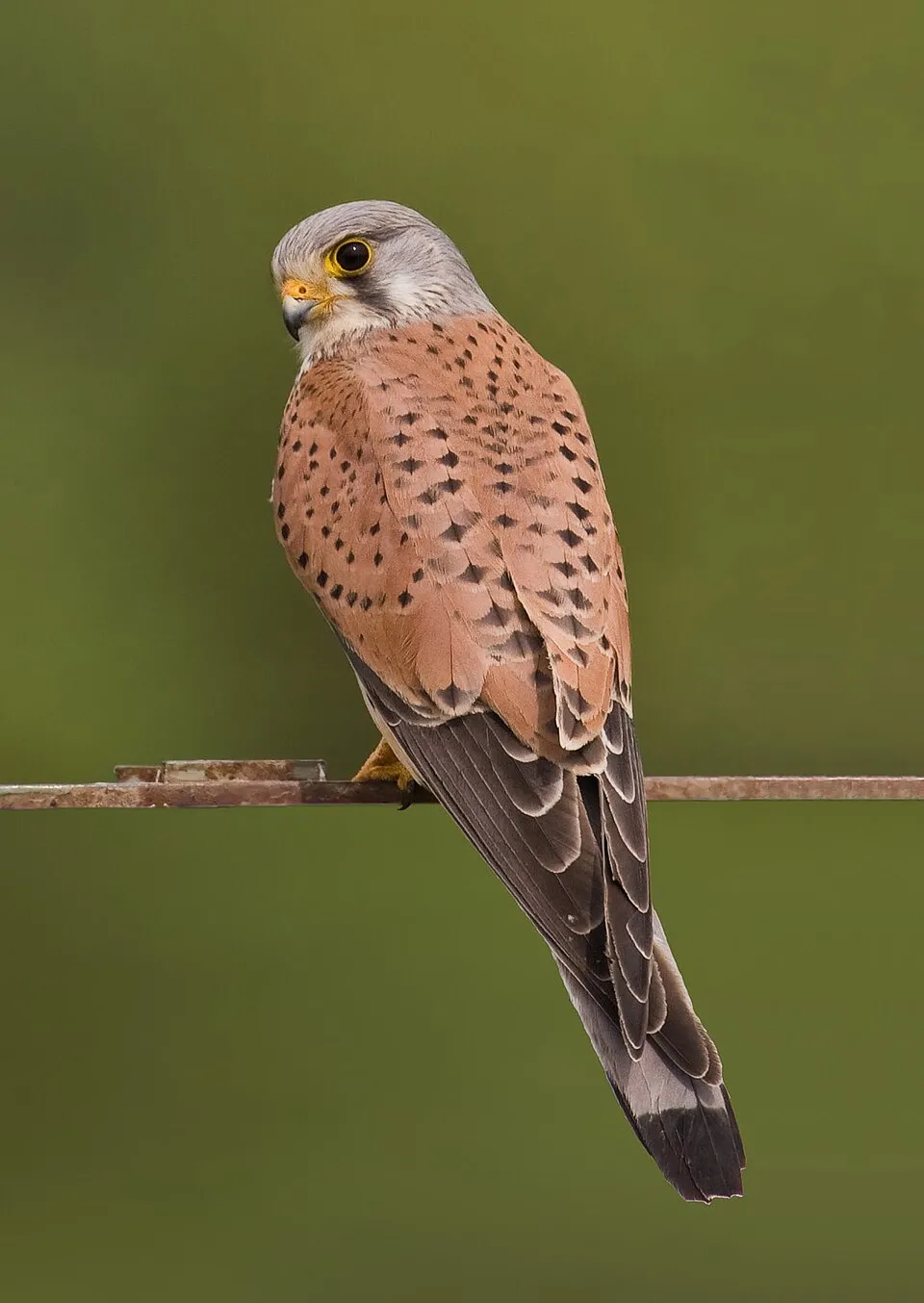
- Common Kestrel · Falco tinnunculus · 1903
- Eurasian Chaffinch · Fringilla coelebs · 1826
- Mastic Tree · Pistacia lentiscus · 1798
- Arenaria provincialis · 1753
- Black Redstart · Phoenicurus ochruros · 1743
- Savi's Pipistrelle · Hypsugo savii · 1696
- Yellow-legged Gull · Larus michahellis · 1590
+18 more species
- European shag · Phalacrocorax aristotelis · 1580
- Eurasian Magpie · Pica pica · 1573
- Blue Rock Thrush · Monticola solitarius · 1293
- Great Cormorant · Phalacrocorax carbo · 1219
- Common smilax · Smilax aspera · 1190
- Narrow-leaved Scorpion-vetch · Coronilla juncea · 1166
- Coastal Stonecrop · Sedum litoreum · 1142
- Mediterranean False-brome · Brachypodium retusum · 1133
- Common Wood Pigeon · Columba palumbus · 1118
- Rosemary · Salvia rosmarinus · 1096
- Limonium pseudominutum · 1070
- Silvery Spurge Flax · Thymelaea tartonraira · 1060
- Dartford Warbler · Sylvia undata · 1054
- Mediterranean Buckthorn · Rhamnus alaternus · 1036
- Neptune Grass · Posidonia oceanica · 1019
- Common Chiffchaff · Phylloscopus collybita · 1009
- Wild boar · Sus scrofa · 986
- Blue Aphyllanthes · Aphyllanthes monspeliensis · 981
Records: GBIF.org (CC-BY). Names: Wikidata (CC0), GBIF. Photos: Wikimedia Commons.
Conservation challenges
The primary purpose of the site is to preserve its natural habitats and the biodiversity they support. The species recorded (Biodiversity tab) reflect its ecological value. The designations it holds frame its management and the control of land use.
According to Global Forest Change data (University of Maryland, Global Forest Watch), about 246 ha of tree cover were lost within the boundary between 2001 and 2023 (under 1% of its area), peaking in 2009 and 2016. These losses include logging, storms and fires, and do not account for regrowth. According to CORINE Land Cover, land cover here remained almost unchanged between 1990 and 2018 (less than 0.5% of the area affected); only some 11 ha were built over. Since 2016, the European EFFIS system (Copernicus) has mapped 3 fires here, burning about 215 ha within the boundary; the largest, in September 2016 (near Marseille), covered 204 ha. At night, 18% of the area gives off artificial light detectable from space (NASA VIIRS Black Marble composite, 2016). According to the Natura 2000 forms, of 20 assessed habitats of European interest, 2 are in excellent condition and 7 in average or reduced condition. According to the Water Framework Directive assessment (2022 river basin management plans, data 2012–2017), water bodies assessed within the site: coastal waters, 2 of 4 in good ecological status or better. Since 2000, 41 invasive alien species have been recorded within the site (GBIF observations), 6 of them listed as of Union concern under EU Regulation 1143/2014. Among them: Ailanthus altissima (Tree-of-heaven), Rugulopteryx okamurae (Northwest Pacific brown alga) and Vespa velutina (Asian hornet).
Pressure indicators
Tree cover lost
246 ha
2001–2023 · < 1% of the area
20012023
Fires since 2016
215 ha
burned within the boundary (3 mapped fires)
- 2016 · Marseille · 204 ha
- 2026 · Marseille · 6 ha
- 2021 · Marseille · 5 ha
Light at night
18%
of the area gives off artificial light visible from space
DarkLit
Built-up land
< 1%
buildings, business areas, roads, quarries
Land cover change
< 0.5%
of the area changed, 1990–2018 · CORINE
Rivers and lakes
Coastal waters: 2 of 4 good or better
assessments 2012–2017
Invasive alien species
41
incl. 6 of EU concern · since 2000
 Tree-of-heavenEU
 Northwest Pacific brown algaEU
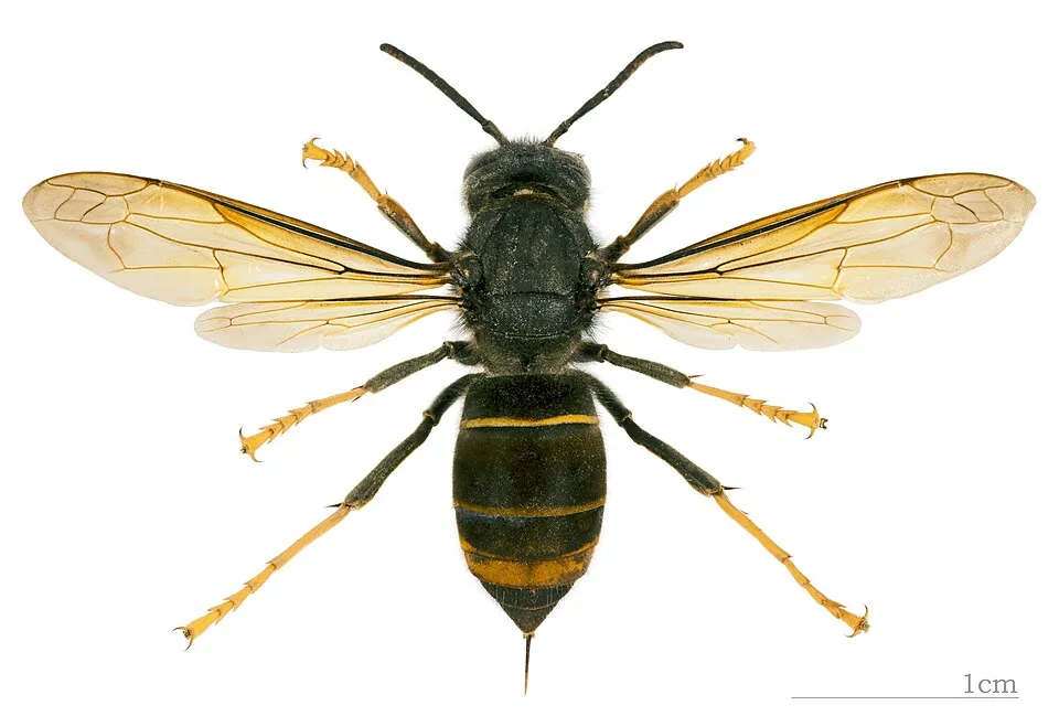 Asian hornetEU
 Paper mulberryEU
 CoypuEU
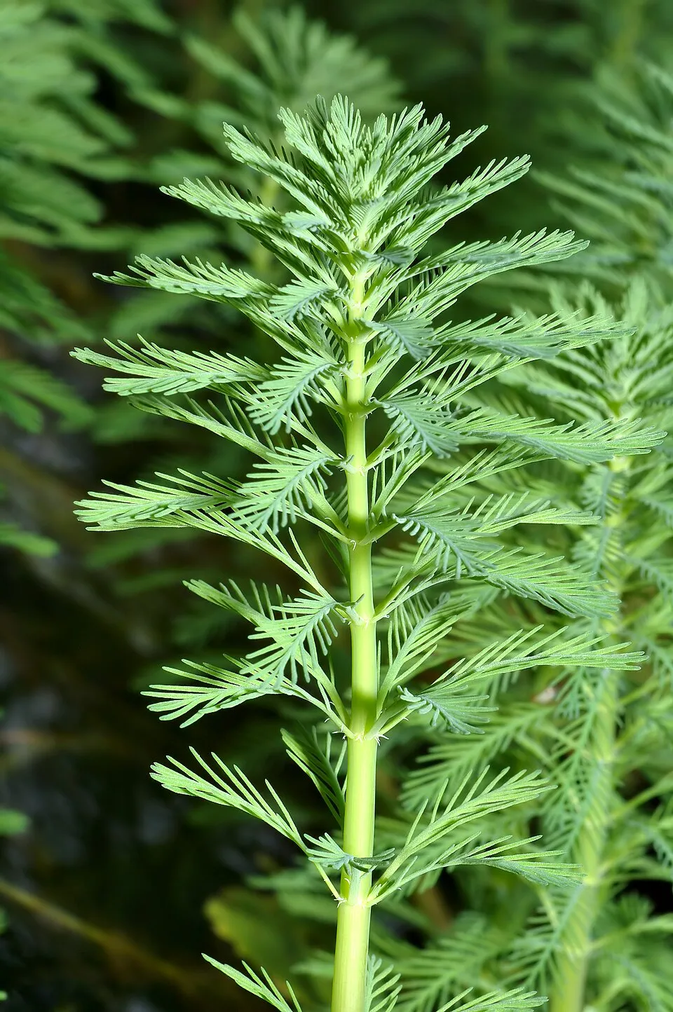 Parrot feather watermilfoilEU
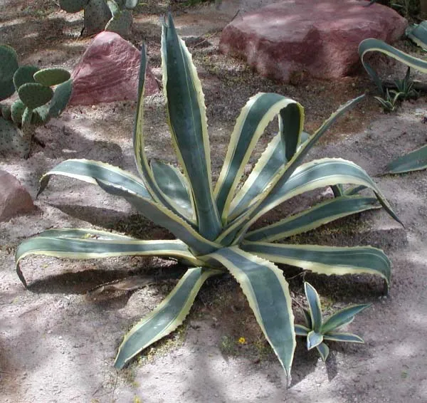 American century plant
 Harpoon Weed
Photos: Tree-of-heaven © Darkone · CC BY-SA 2.5; Northwest Pacific brown alga © Okamura, Kintaro · Public domain; Asian hornet © Didier Descouens · CC BY-SA 4.0; Paper mulberry © Didier Descouens · CC BY-SA 4.0; Coypu © Philippe Amelant · CC BY-SA 3.0; Parrot feather watermilfoil © André Karwath aka Aka · CC BY-SA 2.5; American century plant © Stan Shebs · CC BY-SA 3.0; Harpoon Weed © Neto AIA et al. · CC BY 4.0
Sources: Global Forest Change (Hansen et al., University of Maryland, via Global Forest Watch, CC-BY 4.0); EFFIS, European Commission / Copernicus; NASA Black Marble 2016 (public domain); CORINE Land Cover 2018 (Copernicus) or MODIS.
CORINE Land Cover Change 1990–2018: generated using European Union's Copernicus Land Monitoring Service information (EEA), aggregated by Parkavela; DOI 10.2909/f30f1000-7cf8-43bb-872c-5eb093911b24.
Ecological status of water bodies: European Environment Agency, WISE – Water Framework Directive, 3rd river basin management plans (2022), CC BY 4.0. Official national classification, not comparable between countries.
Invasive alien species: Global Register of Introduced and Invasive Species (ISSG, CC BY 4.0); Union list, Regulation (EU) 1143/2014 (INBO, CC0); GBIF.org records (CC0 / CC BY 4.0), at least 2 per species.
Practical information
Cities and airport
- Marseille
4 km as the crow flies - La Seyne-sur-Mer
21 km as the crow flies - Airport: Marseille Provence (MRS)
18 km as the crow flies
Visitor information
- Maison forestière de la Gardiole
within the site - Office de Tourisme et des Congrès Cassis
< 1 km from the site boundary - Office municipal de tourisme
< 1 km from the site boundary - À Nous la Mer
2 km from the site boundary
Parking
66 public car parks listed within the site
Col de SormiouParking NapoléonL'ÉtangParking Cap Canaille
Things to see
119 viewpoints · 1 lake or pond · 125 caves
- Cap Gros
viewpoint · 510 m - Grand bassin
lake or pond - Basse grotte du plan des Cailles
cave - Col de la Candelle
viewpoint · 430 m - Baume du Pas de la Mounine
cave
Hiking
62 waymarked routes listed, including:
GR 51GR 98 (62 km)
Data © OpenStreetMap contributors (ODbL) · Wikidata (CC0)
Waymarked hiking routes
GR 51 Unnamed route
28 km within the site ↗ 1,257 m↘ 1,235 m 4–449 m
up to T2 · mountain hiking
GR 98 Sentier de Grande Randonnée 98
28 km within the site ↗ 1,220 m↘ 1,201 m 4–449 m
up to T2 · mountain hiking
GR Pays 2013 Sentier de grande randonnée 2013
4.7 km within the site ↗ 243 m↘ 158 m 93–335 m
Bleu 1 Unnamed route
11.7 km within the site ↗ 625 m↘ 654 m 1–411 m
up to T3 · demanding mountain hiking
Rouge 1 Unnamed route
7.3 km within the site ↗ 452 m↘ 388 m 10–415 m
up to T2 · mountain hiking
Jaune 6 Unnamed route
14.3 km within the site ↗ 581 m↘ 723 m 35–522 m
up to T2 · mountain hiking
Noir 2 Unnamed route
7.8 km within the site ↗ 446 m↘ 334 m 4–246 m
up to T2 · mountain hiking
Tracks © OpenStreetMap contributors (ODbL), clipped to the boundary; elevation gain and profiles computed on the longest section from Mapzen Terrain Tiles (≈ 30 m), indicative only. Indicative difficulty (SAC scale, OpenStreetMap, via Waymarked Trails): check with the park.
Bathing
16 monitored bathing sites in or within 1 km of the site · 2025 classification
Excellent · 13
Good · 2
Sufficient · 1
- Anse de l'Arene · sea · Excellent
- Anse des Phoceens · sea · Excellent
- Bains des Dames · sea · Excellent
- Bestouan · sea · Excellent
- Bonne Brise · sea · Excellent
- Corton · sea · Excellent
- EN VAU · sea · Excellent
- Figuerolles · sea · Excellent
- Grande Mer · sea · Excellent
- Morgiou · sea · Excellent
and 6 more
Source: European Environment Agency, official bathing water classification (Directive 2006/7/EC, CC-BY 4.0). Swimming is only permitted at the sites and times authorised locally.
Access and visiting
The nearest railway station is La Barasse, less than 1 km from the site boundary. Nearest towns of over 50,000 people, as the crow flies: Marseille (4 km) and La Seyne-sur-Mer (21 km). Nearest airport: Marseille Provence (MRS), about 18 km away. About 1.4 million people live within 20 km of the site boundary, 990,000 of them within 10 km; some 18,000 people are estimated to live inside (GHSL estimate, 2020). This population has grown by about 6% since 2000. Visitor information on site: Maison forestière de la Gardiole, Office de Tourisme et des Congrès Cassis and Office municipal de tourisme. Public car parks listed within the site: 66, including Col de Sormiou, Parking Napoléon and L'Étang. Waymarked hiking routes listed in OpenStreetMap: 62, including GR 51 and GR 98 (62 km). To see: 119 viewpoints, 1 lake or pond and 125 caves, including Cap Gros (510 m), Grand bassin, Basse grotte du plan des Cailles and Col de la Candelle (430 m). Where to stay: 2 campsites, including Camps de protection de la forêt and Parking des Gorguettes. To plan a visit (access, opening periods, visitor rules), it is best to consult the official information from the managing body and the official website listed in this page's sources.
Source: OpenStreetMap (ODbL), Wikidata (CC0), October 2026.
Built heritage
According to the French Ministry of Culture's Mérimée database, 5 historic monuments stand within the boundary, 3 of them with the highest level of protection (classé). Among them are 2 bridges, lighthouses, mills and working buildings, 1 castle or fortification and 1 prehistoric or archaeological site. Notable classé monuments include “Château d'If” in Marseille, “Grottes Cosquer” in Marseille and “Phare du Planier” in Marseille.
2 bridges, lighthouses, mills and working buildings1 castle or fortification1 prehistoric or archaeological site1 house or civic building
-
Château d'If
Classé
Marseille · 16th c. -
Grottes Cosquer
Classé
Marseille · Prehistory -
Phare du Planier
Classé
Marseille · 20th c. -
Carrière Gambi ou du Picouveau
Cassis -
Hôpital Caroline
Marseille · 19th c.
Source: Mérimée database, French Ministry of Culture (Licence Ouverte 2.0). Each record links to the Plateforme ouverte du patrimoine (POP).
When to visit
Best time to visit: from April to September, with average temperatures of 14 to 25 °C and moderate rainfall. Precipitation peaks in November (up to 100 mm per month). Day length ranges from about 9 h 00 min in December to 15 h 21 min in June. Wildlife records published on GBIF peak for birds (from March to May), plants (April and May), butterflies and moths (June), dragonflies (September) and mammals (July). These peaks also reflect when observers are most active.
Source: Copernicus ERA5-Land (C3S), monthly averages 1996–2025 at the representative point, temperatures adjusted for elevation.
Contains modified Copernicus Climate Change Service information 2026. Neither the European Commission nor ECMWF is responsible for any use that may be made of the Copernicus information or data it contains.
Wildlife records calendar
JFMAMJJASOND
Birds
Plants
Butterflies & moths
Dragonflies
Mammals
Monthly records published on GBIF (CC-BY), relative to the busiest month; also reflects observer activity.
Gallery
© kallerna · CC BY-SA 4.0
© Grafikm fr · CC BY-SA 3.0
© Indigo&fushia · CC BY-SA 4.0
© Bastien Guigue · CC BY-SA 4.0
© Karim saari · CC BY 4.0
© Karim saari · CC BY 4.0
Sources and licences
- Wikidata: Q2600427
- OpenStreetMap: relation 3080199
- Official website: http://www.calanques-parcnational.fr/
- Wikipedia: en.wikipedia.org/wiki/Calanques_National_Park
- WDPA: 555559618
References
- cds.climate.copernicus.eu: climate · CC-BY-4.0
- registry.opendata.aws: elevation of the reference point, detailed relief · PD
- land.copernicus.eu: land cover, land cover change, sea share · COPERNICUS
- doi.org: population around the site · CC-BY-4.0
- wikidata.org: official area, establishment date, official name, nearby cities and airport, access and peaks, lake depths, places to see, official website · CC0-1.0
- eea.europa.eu: bathing water quality, ecological status of waters · CC-BY-4.0
- en.eurovelo.com: EuroVelo cycle routes · ODbL-1.0
- cycling.waymarkedtrails.org: cycle routes · ODbL-1.0
- gebco.net: depths · PD
- opentopodata.org: elevations · PD
- forest-fire.emergency.copernicus.eu: wildfires · COPERNICUS
- globalforestwatch.org: tree cover loss · CC-BY-4.0
- gbif.org: seasonality of sightings, invasive alien species, observed species · CC-BY-4.0
- infoterre.brgm.fr: geology · LO-2.0
- pop.culture.gouv.fr: protected heritage · LO-2.0
- hydrosheds.org: lakes · CC-BY-4.0
- natura2000.eea.europa.eu: Natura 2000 habitats and species · CC-BY-4.0
- earthobservatory.nasa.gov: night light · PD
- openstreetmap.org: access and peaks, places to see, wheelchair access · ODbL-1.0
- hiking.waymarkedtrails.org: route difficulty · ODbL-1.0
- nsidc.org: snow cover · PD
- wikidata.org: Wikipedia article · CC-BY-SA-4.0
Data © OpenStreetMap contributors (ODbL), Wikidata (CC0) and the sources cited.