
France · Mixed
Camargue Regional Natural Park
Regional nature park of 99,931 hectares in France, established in 1970.
Overview
Regional nature park of 99,931 hectares in France, established in 1970.
Camargue Regional Natural Park is a regional nature park in France (Europe). It covers both land and sea. Established on 25 September 1970, it covers about 99,931 hectares.
Protections and designations
Ramsar site
Natura 2000 · habitats (SAC) · 6 sites
- Camargue FR9301592
- Crau centrale - Crau sèche FR9301595
- Le Petit Rhône FR9101405
- Le Rhône aval FR9301590
- Marais de la vallée des Baux et marais d'Arles FR9301596
- Petite Camargue FR9101406
Natura 2000 · birds (SPA) · 3 sites
- Camargue FR9310019
- Marais entre Crau et Grand Rhône FR9312001
- Petite Camargue laguno-marine FR9112013
Protected as a regional nature park. International labels and designations: Ramsar site (“Camargue”, “La Petite Camargue”) and Natura 2000 network (9 sites). Key dates: established in 1970, Ramsar Site in 1986, first Natura 2000 site under the Birds Directive in 2003 and first Natura 2000 site under the Habitats Directive in 2006.
In our collections
Timeline
-
1970
Established
-
1986
Ramsar Site (wetland of international importance) Camargue
-
1996
Ramsar Site (wetland of international importance) La Petite Camargue
-
2003
First Natura 2000 site under the Birds Directive 3 such sites designated up to 2006
-
2006
First Natura 2000 site under the Habitats Directive 6 such sites designated up to 2014
Sources: Wikidata (CC0) for establishment and international labels; EEA Natura 2000 database (CC-BY 4.0) for site designation dates.
Frequently asked questions
Where is Camargue Regional Natural Park?
In France (Europe). Representative point: 43.5176° N, 4.5740° E.
How large is Camargue Regional Natural Park?
About 99,931 hectares (999 km²). It is the 38th largest of the 59 regional parks in France covered by Parkavela. About 26,700 ha are at sea.
When was Camargue Regional Natural Park established?
On 25 September 1970.
What habitats and landscapes does Camargue Regional Natural Park include?
An area spanning land and sea, with wetlands and coasts.
What rocks lie beneath Camargue Regional Natural Park?
According to the BRGM's simplified lithological map, the bedrock consists mainly of sands (100% of sampled points). These are mostly sedimentary rocks.
Which international labels apply to Camargue Regional Natural Park?
Ramsar site (“Camargue”, “La Petite Camargue”) and Natura 2000 network (9 sites).
When is the best time to visit Camargue Regional Natural Park?
Best time to visit: from April to August, with average temperatures of 14 to 25 °C and moderate rainfall.
What is there to see in Camargue Regional Natural Park?
26 viewpoints, 104 lakes and ponds and 52 bird hides, including Ancienne abbaye d'Ulmet, Clos de Mansoulène, Marais du Verdier and Espace Alan R. Johnson (OpenStreetMap).
Where can I stay in Camargue Regional Natural Park?
9 campsites, including Aire Municipale Saintes-Maries-de-la-Mer (Centre), Aire de camping-car de Salin-de-Giraud and Camperpark Plage Ouest (OpenStreetMap).
Are there historic monuments in Camargue Regional Natural Park?
Yes. According to the French Ministry of Culture's Mérimée database, 12 historic monuments stand within the boundary, 4 of them with the highest level of protection (classé). For example: “Croix de Méjanes” in Saintes-Maries-de-la-Mer, “Domaine de l'Armeillère ou l'Armeillière” in Arles and “Église” in Saintes-Maries-de-la-Mer.
Can you swim in Camargue Regional Natural Park?
6 monitored bathing sites lie in or within 1 km of the site; official 2025 classification: 6 excellent (European Environment Agency). Swimming is only permitted at the sites and times authorised locally.
What is the nearest large city to Camargue Regional Natural Park?
Nearest towns of over 50,000 people, as the crow flies: Arles (4 km) and Nîmes (18 km). Nearest airport: Nîmes-Alès-Camargue-Cévennes (FNI), about 9 km away.
How can I reach Camargue Regional Natural Park by train?
The nearest railway station is Arles, about 5 km from the site boundary.
Where can I get visitor information on site?
Maison de la Réserve et du Vaccarès, Domaine de la Palissade and Accueil de la Manade.
Are there waymarked hiking trails in Camargue Regional Natural Park?
Yes. Waymarked hiking routes listed in OpenStreetMap: 9, including GR 42 (452 km). The “Boucle entre les deux bras du Rhône” route runs for about 43 km through the site.
Which species can be seen in Camargue Regional Natural Park?
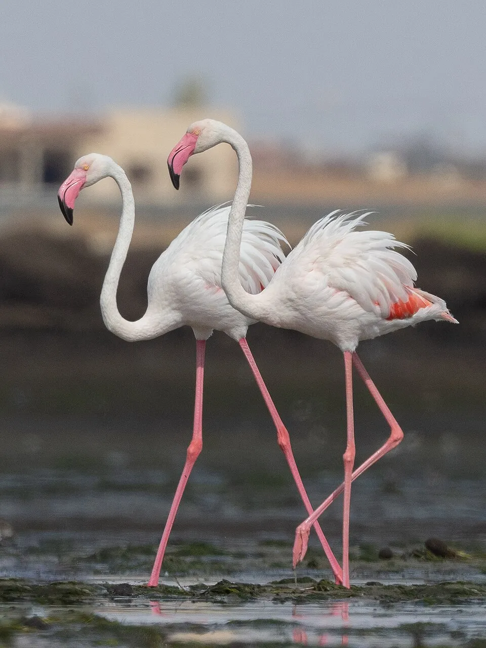
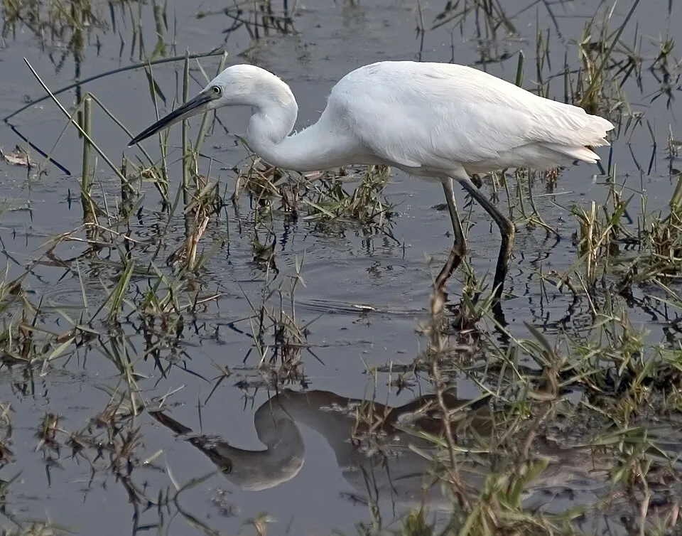
Among the species most often recorded on GBIF are Anas platyrhynchos (Mallard), Phoenicopterus roseus (Greater Flamingo), Egretta garzetta (Little Egret) and Larus michahellis (Yellow-legged Gull).
What is the official website of Camargue Regional Natural Park?
© OpenStreetMap
Download the boundary: GeoJSON · GPX Boundary © OpenStreetMap contributors (ODbL).
Geography
Over the 1996–2025 period, the mean annual temperature is about 15.9 °C and total precipitation reaches roughly 643 mm per year. The warmest month is usually July, the coolest January, and the wettest November. According to the BRGM's simplified lithological map, the bedrock consists mainly of sands (100% of sampled points). These are mostly sedimentary rocks. The site contains 119 lakes larger than 10 ha, totalling 226 km² of water; the largest, Vaccares, covers 95.3 km² (HydroLAKES).
Area
- Area
- 99,931 ha
- Lakes over 10 ha
- 119 (226 km²)
- Coordinates
- 43.5176, 4.574
Lakes: HydroLAKES (Messager et al. 2016, hydrosheds.org, CC BY 4.0) · depths: Wikidata (CC0)
Bedrock
- Sands 100 %
Sedimentary rocks 100 %
Source: BRGM, simplified lithological map at 1:1,000,000 (Licence Ouverte), 16 points sampled within the boundary.
Climate
● Mean temperature (°C) · ▮ Precipitation (mm)
Source: Copernicus ERA5-Land (C3S, doi:10.24381/cds.68d2bb30), monthly averages 1996–2025 interpolated to the representative point, temperatures adjusted for elevation.
Contains modified Copernicus Climate Change Service information 2026. Neither the European Commission nor ECMWF is responsible for any use that may be made of the Copernicus information or data it contains.
Natural habitats
According to CORINE Land Cover (2018), the land area is mainly made up of farmland (45%) and salt marshes and salt pans (40%). The sea covers about 27% of the site. The seabed reaches about 34 m deep (median depth 2 m; GEBCO bathymetry). The land is almost flat (mean slope under 2°). The 9 Natura 2000 sites overlapping the area list 36 habitats of European interest (7 priority), the most extensive being sandbanks which are slightly covered by sea water all the time, coastal lagoons and lowland hay meadows (Alopecurus pratensis, Sanguisorba officinalis).
Biodiversity
Based on occurrences aggregated by GBIF, several species are regularly recorded within the site. Among the most frequent are Anas platyrhynchos (Mallard), Phoenicopterus roseus (Greater Flamingo), Egretta garzetta (Little Egret) and Larus michahellis (Yellow-legged Gull). The full list of documented taxa is shown below. The overlapping Natura 2000 sites list 202 species of European interest: 163 birds, 12 mammals, 6 reptiles, 5 amphibians, 7 fish, 8 invertebrates and 1 plant.
Habitats of European interest
From the official forms of the 9 Natura 2000 sites overlapping the area (areas reported for each whole site).
- Sandbanks which are slightly covered by sea water all the time 34,248 ha
- Coastal lagoons priority 28,802 ha
- Lowland hay meadows (Alopecurus pratensis, Sanguisorba officinalis) 13,484 ha
- Mediterranean and thermo-Atlantic halophilous scrubs (Sarcocornetea fruticosi) 10,928 ha
- Pseudo-steppe with grasses and annuals of the Thero-Brachypodietea priority 8,698 ha
- Natural eutrophic lakes with Magnopotamion or Hydrocharition-type vegetation 7,321 ha
- Mediterranean salt meadows (Juncetalia maritimi) 5,019 ha
- Salix alba and Populus alba galleries 2,282 ha
and 28 more
Species of European interest
Birds · 163
Moustached Warbler (Acrocephalus melanopogon) passage wintering resident breeding, Aquatic warbler (Acrocephalus paludicola) passage, Common Sandpiper (Actitis hypoleucos) passage wintering, Razorbill (Alca torda) passage, Common Kingfisher (Alcedo atthis) wintering breeding passage resident, Northern Pintail (Anas acuta) wintering passage, Eurasian Teal (Anas crecca) wintering passage, Mallard (Anas platyrhynchos) breeding passage wintering, Greater white-fronted goose (Anser albifrons) passage wintering, Greylag Goose (Anser anser) passage wintering breeding, Taiga bean goose (Anser fabalis) passage wintering, Tawny Pipit (Anthus campestris) breeding passage and 151 more
Mammals · 12
Barbastelle (Barbastella barbastellus), Eurasian Beaver (Castor fiber), Eurasian otter (Lutra lutra), Common bent-wing bat (Miniopterus schreibersii), Lesser mouse-eared myotis (Myotis blythii), Long-fingered bat (Myotis capaccinii), Geoffroy's bat (Myotis emarginatus), Greater mouse-eared bat (Myotis myotis), Mediterranean Horseshoe Bat (Rhinolophus euryale), Greater Horseshoe Bat (Rhinolophus ferrumequinum), Lesser horseshoe bat (Rhinolophus hipposideros), Common bottlenose dolphin (Tursiops truncatus)
Reptiles · 6
Loggerhead sea turtle (Caretta caretta), Aesculapian snake (Elaphe longissima), European Pond Turtle (Emys orbicularis), Green lizard (Lacerta viridis), Iberian pond turtle (Mauremys leprosa), Common wall lizard (Podarcis muralis)
Amphibians · 5
Midwife toad (Alytes obstetricans), Natterjack (Bufo calamita), Stripeless tree frog (Hyla meridionalis), Western Spadefoot (Pelobates cultripes), Great crested newt (Triturus cristatus)
Fish · 7
Twait shad (Alosa fallax), European bullhead (Cottus gobio), European river lamprey (Lampetra fluviatilis), South-West European Nase (Parachondrostoma toxostoma), Sea lamprey (Petromyzon marinus), European bitterling (Rhodeus amarus), Souffia (Telestes souffia)
Invertebrates · 8
Lesser Ramshorn Snail (Anisus vorticulus), Greater Capricorn Beetle (Cerambyx cerdo), Southern damselfly (Coenagrion mercuriale), Jersey Tiger (Euplagia quadripunctaria), Pronged clubtail (Gomphus graslinii), Stag beetle (Lucanus cervus), Orange-spotted Emerald (Oxygastra curtisii), Common Predatory Bush-cricket (Saga pedo)
Plants · 1
Riella helicophylla
Source: Natura 2000 standard data forms (EEA, CC-BY 4.0). Not exhaustive: sensitive species are not published.
Species to look out for


Observed species
Occurrences documented via GBIF; they are neither an exhaustive inventory nor proof of current presence.
- Mallard · Anas platyrhynchos · 39814
- Greater Flamingo · Phoenicopterus roseus · 39242
- Little Egret · Egretta garzetta · 37127
- Yellow-legged Gull · Larus michahellis · 31942
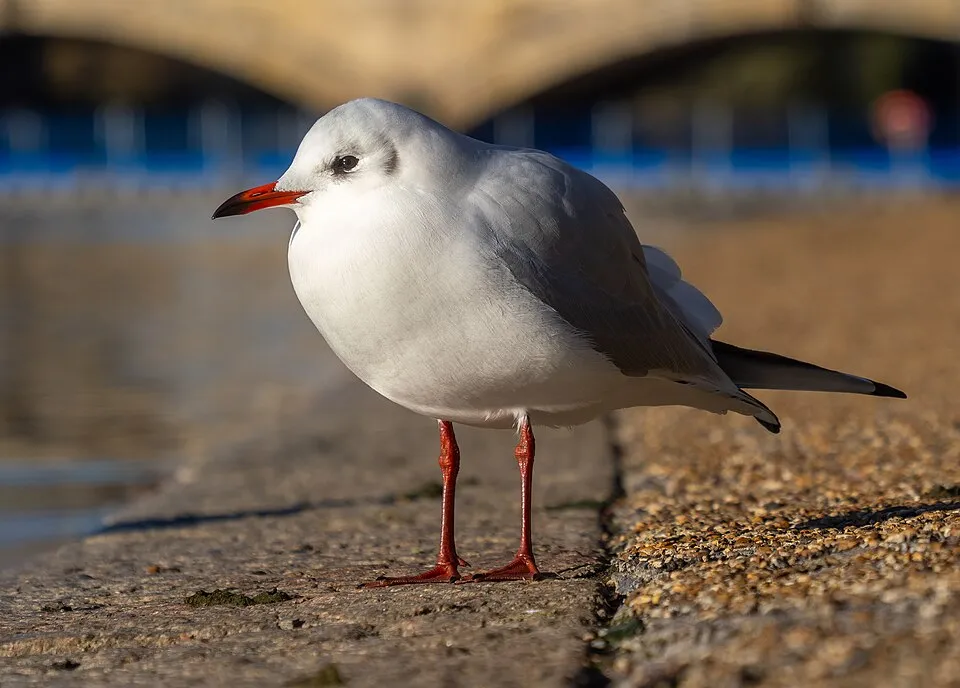
- Black-headed Gull · Chroicocephalus ridibundus · 29922
- Grey Heron · Ardea cinerea · 28753
- Great Egret · Ardea alba · 24700
- Great Cormorant · Phalacrocorax carbo · 22726
- Common Coot · Fulica atra · 21730
- Cetti's Warbler · Cettia cetti · 21273
- Common Shelduck · Tadorna tadorna · 20567
- Eurasian Teal · Anas crecca · 18736
+18 more species
- Great Crested Grebe · Podiceps cristatus · 17800
- Mute Swan · Cygnus olor · 17328
- Western Marsh Harrier · Circus aeruginosus · 16931
- House Sparrow · Passer domesticus · 16178
- Pied Avocet · Recurvirostra avosetta · 14702
- Black-winged Stilt · Himantopus himantopus · 13918
- Eurasian Curlew · Numenius arquata · 12941
- Zitting Cisticola · Cisticola juncidis · 12719
- Northern Shoveler · Spatula clypeata · 12567
- Barn Swallow · Hirundo rustica · 12499
- Glossy Ibis · Plegadis falcinellus · 12071
- White stork · Ciconia ciconia · 11968
- Reed Bunting · Emberiza schoeniclus · 11774
- Common Buzzard · Buteo buteo · 11077
- Common Redshank · Tringa totanus · 10686
- Common Starling · Sturnus vulgaris · 10456
- Common Chiffchaff · Phylloscopus collybita · 10306
- Western Yellow Wagtail · Motacilla flava · 10191
Records: GBIF.org (CC-BY). Names: Wikidata (CC0), GBIF. Photos: Wikimedia Commons.
Conservation challenges
The primary purpose of the site is to preserve its natural habitats and the biodiversity they support. The species recorded (Biodiversity tab) reflect its ecological value. The designations it holds frame its management and the control of land use.
According to Global Forest Change data (University of Maryland, Global Forest Watch), about 100 ha of tree cover were lost within the boundary between 2001 and 2023 (under 1% of its area), peaking in 2008 and 2012. These losses include logging, storms and fires, and do not account for regrowth. According to the European CORINE Land Cover inventory (Copernicus), land cover changed on about 732 ha of the site between 1990 and 2018 (under 1% of its area). Since 2016, the European EFFIS system (Copernicus) has mapped 17 fires here, burning about 839 ha within the boundary; the largest, in March 2023 (near Arles), covered 189 ha. At night, 8% of the area gives off artificial light detectable from space (NASA VIIRS Black Marble composite, 2016). According to the Natura 2000 forms, of 36 assessed habitats of European interest, 12 are in excellent condition and 2 in average or reduced condition. According to the Water Framework Directive assessment (2022 river basin management plans, data 2012–2017), the only river assessed within the site has moderate ecological potential. Other assessed water bodies: lagoons and estuaries, 1 of 5 in good ecological status or better; coastal waters, 0 of 1 in good ecological status or better. Since 2000, 87 invasive alien species have been recorded within the site (GBIF observations), 23 of them listed as of Union concern under EU Regulation 1143/2014. Among them: Myocastor coypus (Coypu), Threskiornis aethiopicus (African Sacred Ibis) and Baccharis halimifolia (Eastern baccharis).
Pressure indicators
Tree cover lost
100 ha
2001–2023 · < 1% of the area
20012023
Fires since 2016
839 ha
burned within the boundary (17 mapped fires)
- 2023 · Arles · 189 ha
- 2024 · Arles · 164 ha
- 2025 · Arles · 92 ha
Light at night
8%
of the area gives off artificial light visible from space
DarkLit
Built-up land
< 1%
buildings, business areas, roads, quarries · farmland 33%
Land cover change
732 ha
changed cover, 1990–2018 · CORINE · < 1% of the area
Rivers and lakes
0%
of the 18 km of assessed rivers at good or high ecological potential (mostly heavily modified water bodies) · WFD 2022
Lagoons and estuaries: 1 of 5 good or better
Coastal waters: 0 of 1 good or better
assessments 2012–2017
Invasive alien species
87
incl. 23 of EU concern · since 2000
 CoypuEU
 African Sacred IbisEU
 Eastern baccharisEU
 Red swamp crayfishEU
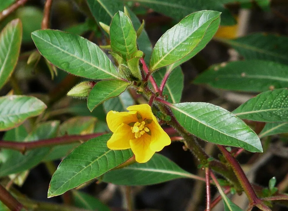 Floating primrose-willowEU
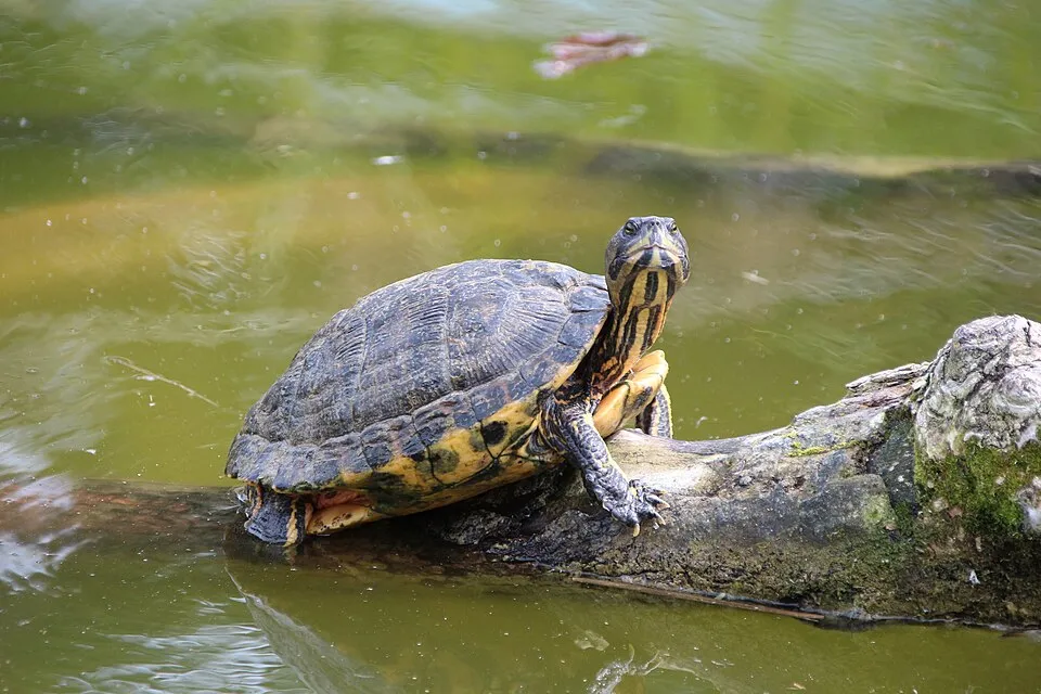 Pond sliderEU
 Egyptian GooseEU
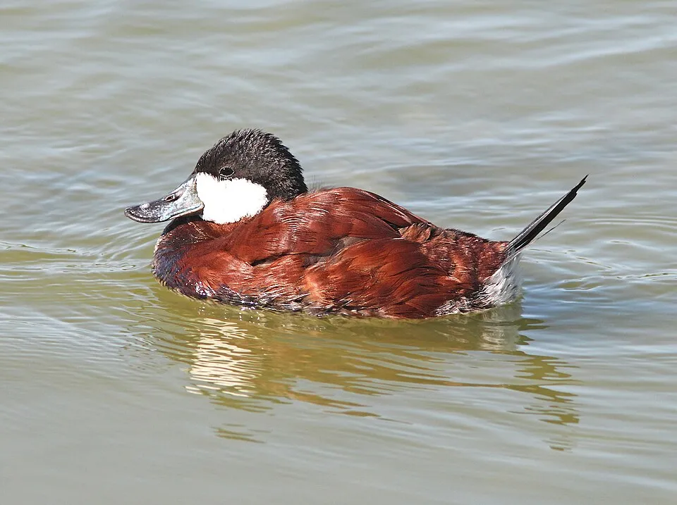 Ruddy DuckEU
Photos: Coypu © Philippe Amelant · CC BY-SA 3.0; African Sacred Ibis © Steve Garvie from Dunfermline, Fife, Scotland · CC BY-SA 2.0; Eastern baccharis © Jean-Jacques MILAN · CC BY-SA 3.0; Red swamp crayfish © MikeMurphy · Public domain; Floating primrose-willow © Père Igor · CC BY-SA 3.0; Pond slider © Viva.Chelonia · CC BY 2.0; Egyptian Goose © Rhododendrites · CC BY-SA 4.0; Ruddy Duck © ALAN SCHMIERER · CC0-1.0
Sources: Global Forest Change (Hansen et al., University of Maryland, via Global Forest Watch, CC-BY 4.0); EFFIS, European Commission / Copernicus; NASA Black Marble 2016 (public domain); CORINE Land Cover 2018 (Copernicus) or MODIS.
CORINE Land Cover Change 1990–2018: generated using European Union's Copernicus Land Monitoring Service information (EEA), aggregated by Parkavela; DOI 10.2909/f30f1000-7cf8-43bb-872c-5eb093911b24.
Ecological status of water bodies: European Environment Agency, WISE – Water Framework Directive, 3rd river basin management plans (2022), CC BY 4.0. Official national classification, not comparable between countries.
Invasive alien species: Global Register of Introduced and Invasive Species (ISSG, CC BY 4.0); Union list, Regulation (EU) 1143/2014 (INBO, CC0); GBIF.org records (CC0 / CC BY 4.0), at least 2 per species.
Practical information
Cities and airport
- Arles
4 km as the crow flies - Nîmes
18 km as the crow flies - Airport: Nîmes-Alès-Camargue-Cévennes (FNI)
9 km as the crow flies
Visitor information
- Maison de la Réserve et du Vaccarès
within the site - Domaine de la Palissade
within the site - Accueil de la Manade
within the site - Accueil Musée et Hébergements
within the site
Things to see
26 viewpoints · 104 lakes and ponds · 52 bird hides
- Ancienne abbaye d'Ulmet
viewpoint - Clos de Mansoulène
lake or pond - Marais du Verdier
bird hide - Espace Alan R. Johnson
viewpoint - Clos de Vovo
lake or pond
Where to stay
9 campsites
- Aire Municipale Saintes-Maries-de-la-Mer (Centre)
campsite - Aire de camping-car de Salin-de-Giraud
campsite - Camperpark Plage Ouest
campsite - Camping du Clos-Peyron
campsite - La Brise de Camargue
campsite
Hiking
9 waymarked routes listed, including:
GR 42 (452 km)
By bike
EV17 · 40 km V65 Saint-Laurent-d'Aigouze - Nice · 5 km
+ 5 local loops
Signed cycle routes: this does not mean that cycling is allowed on footpaths.
Wheelchair access
- Accueil
visitor information - Maison de la Réserve et du Vaccarès
visitor information · partial access - Le Point de Vue des Salins
viewpoint - Observatoire des Blongios
bird hide
Reported by OpenStreetMap contributors (ODbL); check with the park before visiting.
Data © OpenStreetMap contributors (ODbL) · Wikidata (CC0)
Contains information from EuroVelo GPX tracks downloaded from www.EuroVelo.com on 2026-10-22, which is made available here under the Open Database License (ODbL). EuroVelo® is a registered trademark of the ECF. Routes © OpenStreetMap contributors (ODbL), via Waymarked Trails
Waymarked hiking routes
GR 42 De Saint-Étienne au Grau-du-Roi
4.2 km within the site ↗ 5 m↘ 0 m 2–12 m
Boucle entre les deux bras du Rhône
42.6 km within the site ↗ 0 m↘ 0 m -2–4 m
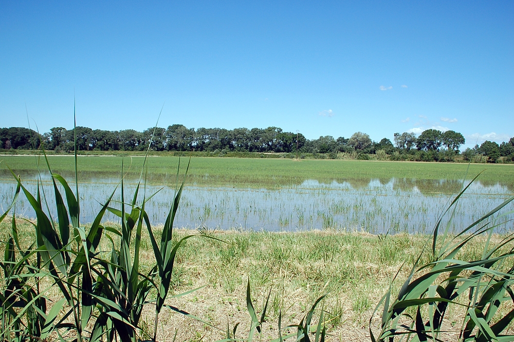
Entre rizières et roselières sur le sentier du Pont de Rousty
5.3 km within the site ↗ 0 m↘ 0 m -1–5 m
Tracks © OpenStreetMap contributors (ODbL), clipped to the boundary; elevation gain and profiles computed on the longest section from Mapzen Terrain Tiles (≈ 30 m), indicative only.
Bathing
6 monitored bathing sites in or within 1 km of the site · 2025 classification
Excellent · 6
- Beauduc · sea · Excellent
- Brise de Mer · sea · Excellent
- Crin Blanc · sea · Excellent
- Les Arenes · sea · Excellent
- Napoleon · sea · Excellent
- Piemanson · sea · Excellent
Source: European Environment Agency, official bathing water classification (Directive 2006/7/EC, CC-BY 4.0). Swimming is only permitted at the sites and times authorised locally.
Access and visiting
The nearest railway station is Arles, about 5 km from the site boundary. Nearest towns of over 50,000 people, as the crow flies: Arles (4 km) and Nîmes (18 km). Nearest airport: Nîmes-Alès-Camargue-Cévennes (FNI), about 9 km away. About 600,000 people live within 20 km of the site boundary, 180,000 of them within 10 km; some 12,000 people are estimated to live inside (GHSL estimate, 2020). This population has grown by about 14% since 2000. Visitor information on site: Maison de la Réserve et du Vaccarès, Domaine de la Palissade and Accueil de la Manade. Waymarked hiking routes listed in OpenStreetMap: 9, including GR 42 (452 km). The EuroVelo 17 cycle route (Rhone Cycle Route) crosses the site for about 40 km, mostly developed and signed; another signed cycle route also passes through: “V65 Saint-Laurent-d'Aigouze - Nice” (EuroVelo, OpenStreetMap). OpenStreetMap contributors list 5 wheelchair-accessible places, including Accueil and Le Point de Vue des Salins; check with the park before visiting. To see: 26 viewpoints, 104 lakes and ponds and 52 bird hides, including Ancienne abbaye d'Ulmet, Clos de Mansoulène, Marais du Verdier and Espace Alan R. Johnson. Where to stay: 9 campsites, including Aire Municipale Saintes-Maries-de-la-Mer (Centre), Aire de camping-car de Salin-de-Giraud and Camperpark Plage Ouest. To plan a visit (access, opening periods, visitor rules), it is best to consult the official information from the managing body and the official website listed in this page's sources.
Source: OpenStreetMap (ODbL), Wikidata (CC0), October 2026.
Built heritage
According to the French Ministry of Culture's Mérimée database, 12 historic monuments stand within the boundary, 4 of them with the highest level of protection (classé). Among them are 6 castles and fortifications, 2 religious buildings and 1 house or civic building. Notable classé monuments include “Croix de Méjanes” in Saintes-Maries-de-la-Mer, “Domaine de l'Armeillère ou l'Armeillière” in Arles and “Église” in Saintes-Maries-de-la-Mer.
6 castles and fortifications2 religious buildings1 house or civic building1 bridge, lighthouse, mill or working building
-
Croix de Méjanes
Classé
Saintes-Maries-de-la-Mer -
Domaine de l'Armeillère ou l'Armeillière
Classé
Arles · 17th c. -
Église
Classé
Saintes-Maries-de-la-Mer -
Domaine du château d'Avignon
Classé
Saintes-Maries-de-la-Mer · 19th c. -
Bergerie de La Favouillane
Port-Saint-Louis-du-Rhône · 19th c. -
La Tourvieille (ou château de la Tourvieille ou Tour du Tanpan)
Arles · 17th c., 19th c. -
Mas de Méjanes
Saintes-Maries-de-la-Mer -
Phare de Faraman
Arles · 19th c.
and 4 more
Source: Mérimée database, French Ministry of Culture (Licence Ouverte 2.0). Each record links to the Plateforme ouverte du patrimoine (POP).
When to visit
Best time to visit: from April to August, with average temperatures of 14 to 25 °C and moderate rainfall. Precipitation peaks in November (up to 100 mm per month). Day length ranges from about 8 h 58 min in December to 15 h 24 min in June. Wildlife records published on GBIF peak for birds (April and May), plants (May), butterflies and moths (May and June), dragonflies (May and June) and mammals (from March to July). These peaks also reflect when observers are most active.
Source: Copernicus ERA5-Land (C3S), monthly averages 1996–2025 at the representative point, temperatures adjusted for elevation.
Contains modified Copernicus Climate Change Service information 2026. Neither the European Commission nor ECMWF is responsible for any use that may be made of the Copernicus information or data it contains.
Wildlife records calendar
JFMAMJJASOND
Birds
Plants
Butterflies & moths
Dragonflies
Mammals
Monthly records published on GBIF (CC-BY), relative to the busiest month; also reflects observer activity.
Gallery
© Fritz Geller-Grimm · CC BY-SA 2.5
© Pascal Bois · CC BY-SA 4.0
© DimiTalen · CC0-1.0
© Florine Vanorlé · CC BY-SA 4.0
© Cayambe · CC BY-SA 4.0
© Florine Vanorlé · CC BY-SA 4.0
Sources and licences
- Wikidata: Q1570460
- OpenStreetMap: relation 5393067
- Official website: http://www.parc-camargue.fr/
- Wikipedia: en.wikipedia.org/wiki/Parc_naturel_régional_de_Camargue
- Natura 2000: FR9310019
- WDPA: 6325
References
- cds.climate.copernicus.eu: climate · CC-BY-4.0
- registry.opendata.aws: elevation of the reference point, detailed relief · PD
- land.copernicus.eu: land cover, land cover change, sea share · COPERNICUS
- doi.org: population around the site · CC-BY-4.0
- wikidata.org: official area, establishment date, nearby cities and airport, access and peaks, lake depths, places to see, official website · CC0-1.0
- eea.europa.eu: bathing water quality, ecological status of waters · CC-BY-4.0
- en.eurovelo.com: EuroVelo cycle routes · ODbL-1.0
- cycling.waymarkedtrails.org: cycle routes · ODbL-1.0
- gebco.net: depths · PD
- opentopodata.org: elevations · PD
- forest-fire.emergency.copernicus.eu: wildfires · COPERNICUS
- globalforestwatch.org: tree cover loss · CC-BY-4.0
- gbif.org: seasonality of sightings, invasive alien species, observed species · CC-BY-4.0
- infoterre.brgm.fr: geology · LO-2.0
- pop.culture.gouv.fr: protected heritage · LO-2.0
- hydrosheds.org: lakes · CC-BY-4.0
- natura2000.eea.europa.eu: Natura 2000 habitats and species · CC-BY-4.0
- openstreetmap.org: official name, access and peaks, places to see, wheelchair access · ODbL-1.0
- earthobservatory.nasa.gov: night light · PD
- hiking.waymarkedtrails.org: route difficulty · ODbL-1.0
- nsidc.org: snow cover · PD
- wikidata.org: Wikipedia article · CC-BY-SA-4.0
Data © OpenStreetMap contributors (ODbL), Wikidata (CC0) and the sources cited.