Spain · Terrestrial
Tablas de Daimiel National Park
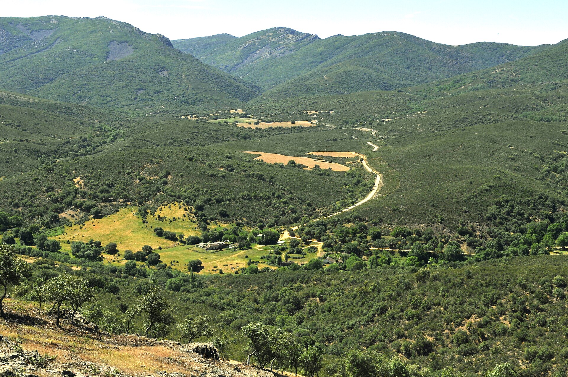
National park of 3,030 hectares in Spain, established in 1973.
Overview
National park of 3,030 hectares in Spain, established in 1973.
Tablas de Daimiel National Park is located in Spain (Europe). It is a predominantly terrestrial area. Established on 28 June 1973, it covers about 3,030 hectares.
Protections and designations
UNESCO Biosphere Reserve
Ramsar site
Natura 2000 · habitats (SAC)
- Tablas de Daimiel ES0000013
Natura 2000 · birds (SPA)
- Tablas de Daimiel ES0000013
Protected as a national park. International labels and designations: UNESCO Biosphere Reserve (“Mancha Húmeda Biosphere Reserve”), Ramsar site and Natura 2000 network (1 site: “Tablas de Daimiel”). Key dates: established in 1973, Biosphere Reserve in 1980, Ramsar Site in 1982 and first Natura 2000 site under the Birds Directive in 1987.
In our collections
Timeline
-
1973
Established
-
1980
UNESCO Biosphere Reserve Mancha Húmeda Biosphere Reserve
-
1982
Ramsar Site (wetland of international importance) Tablas de Daimiel National Park
-
1987
First Natura 2000 site under the Birds Directive
Sources: Wikidata (CC0) for establishment and international labels; EEA Natura 2000 database (CC-BY 4.0) for site designation dates.
Frequently asked questions
Where is Tablas de Daimiel National Park?
In Spain (Europe). Representative point: 39.1449° N, 3.7020° W.
How large is Tablas de Daimiel National Park?
About 3,030 hectares (30 km²). It is the 16th largest of the 16 national parks in Spain covered by Parkavela.
When was Tablas de Daimiel National Park established?
On 28 June 1973.
What habitats and landscapes does Tablas de Daimiel National Park include?
A terrestrial area, with wetlands.
What rocks lie beneath Tablas de Daimiel National Park?
According to the European 1:1 million geological map (EGDI), recent unconsolidated deposits – sands and gravels (69% of sampled points) – cover most of the site; among the consolidated rocks: carbonate rocks (23%). These are mostly sedimentary rocks. The geological units date mainly from the Quaternary (69% of sampled points).
Which international labels apply to Tablas de Daimiel National Park?
UNESCO Biosphere Reserve (“Mancha Húmeda Biosphere Reserve”), Ramsar site and Natura 2000 network (1 site: “Tablas de Daimiel”).
When is the best time to visit Tablas de Daimiel National Park?
Best time to visit: May and June, with average temperatures of 17 to 24 °C and moderate rainfall.
What is the nearest large city to Tablas de Daimiel National Park?
Nearest towns of over 50,000 people, as the crow flies: Ciudad Real (20 km) and Toledo (80 km). Nearest airport: Madrid-Barajas (MAD), about 142 km away.
How can I reach Tablas de Daimiel National Park by train?
The nearest railway station is Daimiel, about 10 km from the site boundary.
Are there waymarked hiking trails in Tablas de Daimiel National Park?
Yes. Waymarked hiking routes listed in OpenStreetMap: 1, including GR 114 (28 km).
Which species can be seen in Tablas de Daimiel National Park?
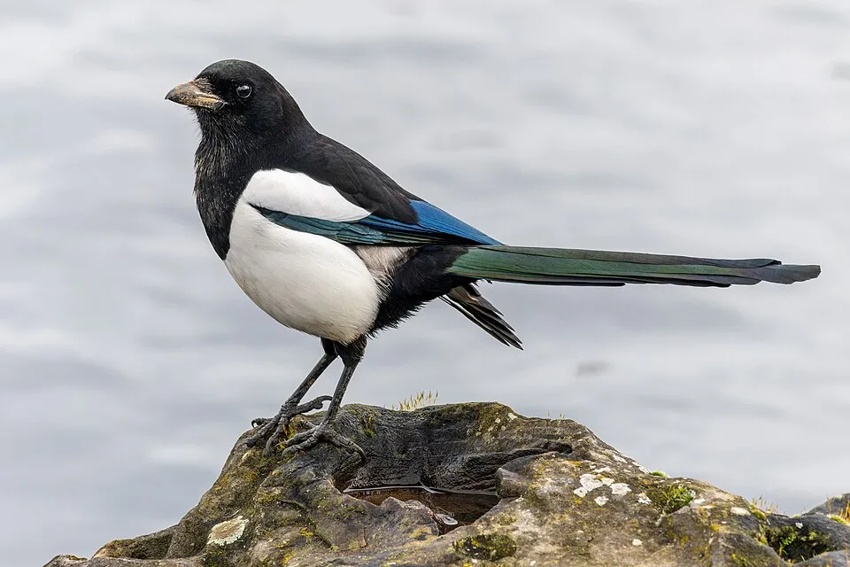
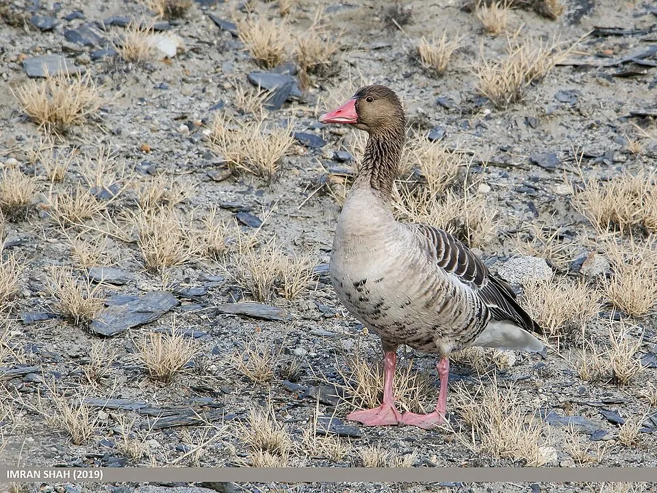
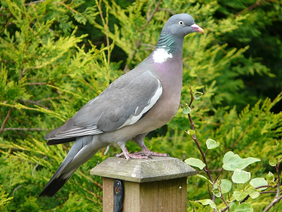
Among the species most often recorded on GBIF are Pica pica (Eurasian Magpie), Anas platyrhynchos (Mallard), Anser anser (Greylag Goose) and Columba palumbus (Common Wood Pigeon).
What is the official website of Tablas de Daimiel National Park?
© OpenStreetMap
Download the boundary: GeoJSON · GPX Boundary © OpenStreetMap contributors (ODbL).
Geography
The representative point of the site lies at around 605 m above sea level. Over the 1996–2025 period, the mean annual temperature is about 15.8 °C and total precipitation reaches roughly 421 mm per year. The warmest month is usually July, the coolest January, and the wettest March. According to the European 1:1 million geological map (EGDI), recent unconsolidated deposits – sands and gravels (69% of sampled points) – cover most of the site; among the consolidated rocks: carbonate rocks (23%). These are mostly sedimentary rocks. The geological units date mainly from the Quaternary (69% of sampled points).
Area
- Area
- 3,030 ha
- Elevation
- 605 m
- Median elevation
- 607 m
- Coordinates
- 39.1449, -3.702
Terrain: Mapzen Terrain Tiles (SRTM, USGS)
Bedrock
- Sands and gravels 69 %
- Carbonate rocks 23 %
- Conglomerates and breccias 8 %
Sedimentary rocks 100 % · Main age: Quaternary (69%)
Source: EGDI 1:1M geological map (EuroGeoSurveys and national geological surveys), CC BY 4.0 · 13 sampled points within the site.
Climate
● Mean temperature (°C) · ▮ Precipitation (mm)
Source: Copernicus ERA5-Land (C3S, doi:10.24381/cds.68d2bb30), monthly averages 1996–2025 interpolated to the representative point, temperatures adjusted for elevation.
Contains modified Copernicus Climate Change Service information 2026. Neither the European Commission nor ECMWF is responsible for any use that may be made of the Copernicus information or data it contains.
Natural habitats
According to CORINE Land Cover (2018), the site is mainly made up of marshes and bogs (64%), farmland (19%) and grassland and meadows (14%). The land is almost flat (mean slope under 2°). The Natura 2000 site overlapping the area lists 10 habitats of European interest (2 priority), the most extensive being southern riparian galleries and thickets (Nerio-Tamaricetea and Securinegion tinctoriae), Mediterranean salt meadows (Juncetalia maritimi) and hard oligo-mesotrophic waters with benthic vegetation of Chara spp.
Biodiversity
Based on occurrences aggregated by GBIF, several species are regularly recorded within the site. Among the most frequent are Pica pica (Eurasian Magpie), Anas platyrhynchos (Mallard), Anser anser (Greylag Goose) and Columba palumbus (Common Wood Pigeon). The full list of documented taxa is shown below. The overlapping Natura 2000 site lists 95 species of European interest: 75 birds, 5 mammals, 4 reptiles, 6 amphibians, 4 fish and 1 plant.
Habitats of European interest
From the official form of the Natura 2000 site overlapping the area (areas reported for the whole site).
- Southern riparian galleries and thickets (Nerio-Tamaricetea and Securinegion tinctoriae) 132 ha
- Mediterranean salt meadows (Juncetalia maritimi) 128 ha
- Hard oligo-mesotrophic waters with benthic vegetation of Chara spp. 44 ha
- Quercus ilex and Quercus rotundifolia forests 30 ha
- Halo-nitrophilous scrubs (Pegano-Salsoletea) 20 ha
- Calcareous fens with Cladium mariscus and species of the Caricion davallianae priority 12 ha
- Mediterranean tall humid grasslands of the Molinio-Holoschoenion 7 ha
- Mediterranean salt steppes (Limonietalia) priority 5 ha
and 2 more
Species of European interest
Birds · 75
Moustached Warbler (Acrocephalus melanopogon) resident, Common Sandpiper (Actitis hypoleucos) breeding, Northern Pintail (Anas acuta) passage wintering, Eurasian Teal (Anas crecca) passage wintering, Mallard (Anas platyrhynchos) passage breeding wintering, Greylag Goose (Anser anser) wintering breeding passage, Great Egret (Ardea alba) wintering breeding passage, Grey Heron (Ardea cinerea) wintering breeding passage, Purple Heron (Ardea purpurea) breeding passage, Squacco Heron (Ardeola ralloides) passage breeding, Common Pochard (Aythya ferina) passage wintering breeding, Ferruginous Duck (Aythya nyroca) wintering passage breeding and 63 more
Mammals · 5
European wildcat (Felis silvestris), Common genet (Genetta genetta), Eurasian otter (Lutra lutra), Western Polecat (Mustela putorius), Common pipistrelle (Pipistrellus pipistrellus)
Reptiles · 4
Bedriaga's skink (Chalcides bedriagai), European Pond Turtle (Emys orbicularis), Horseshoe Whip Snake (Hemorrhois hippocrepis), Iberian pond turtle (Mauremys leprosa)
Amphibians · 6
Iberian painted frog (Discoglossus galganoi), Natterjack toad (Epidalea calamita), Stripeless tree frog (Hyla meridionalis), European Treefrog (Hyla molleri), Western Spadefoot (Pelobates cultripes), Southern marbled newt (Triturus pygmaeus)
Fish · 4
Lamprehuela (Cobitis paludica), Iberian Barbel (Luciobarbus comizo), Iberian small-head barbel (Luciobarbus microcephalus), Squalius alburnoides
Plants · 1
Lythrum flexuosum
Source: Natura 2000 standard data forms (EEA, CC-BY 4.0). Not exhaustive: sensitive species are not published.
Species to look out for


Observed species
Occurrences documented via GBIF; they are neither an exhaustive inventory nor proof of current presence.
- Eurasian Magpie · Pica pica · 1198
- Mallard · Anas platyrhynchos · 1192
- Greylag Goose · Anser anser · 1170
- Common Wood Pigeon · Columba palumbus · 1149
- Western Marsh Harrier · Circus aeruginosus · 1083
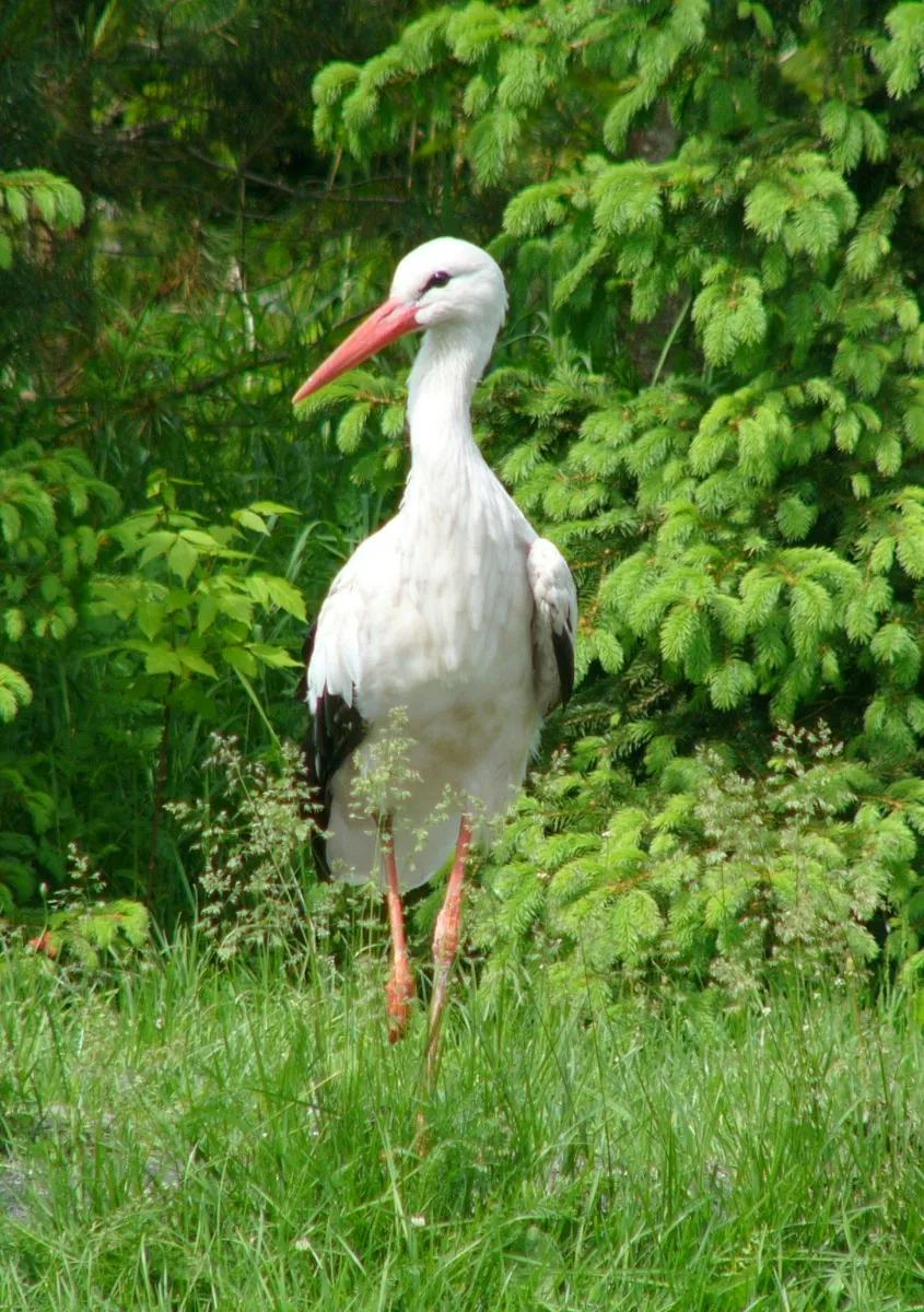
- White stork · Ciconia ciconia · 1078
- Common Coot · Fulica atra · 1070
- Cetti's Warbler · Cettia cetti · 1037
- European Goldfinch · Carduelis carduelis · 969
- Corn Bunting · Emberiza calandra · 956
- Barn Swallow · Hirundo rustica · 915
- Red-crested Pochard · Netta rufina · 900
+18 more species
- Common Moorhen · Gallinula chloropus · 890
- Black-winged Stilt · Himantopus himantopus · 868
- Spotless Starling · Sturnus unicolor · 848
- European Stonechat · Saxicola rubicola · 838
- Great Cormorant · Phalacrocorax carbo · 837
- Great tit · Parus major · 811
- Gadwall · Mareca strepera · 745
- Zitting Cisticola · Cisticola juncidis · 726
- House Sparrow · Passer domesticus · 712
- Eurasian Collared Dove · Streptopelia decaocto · 687
- Grey Heron · Ardea cinerea · 665
- Eurasian Hoopoe · Upupa epops · 648
- Eurasian Reed Warbler · Acrocephalus scirpaceus · 645
- Greater Flamingo · Phoenicopterus roseus · 644
- Common Blackbird · Turdus merula · 640
- Black-headed Gull · Chroicocephalus ridibundus · 625
- Eurasian blue tit · Cyanistes caeruleus · 624
- Northern Shoveler · Spatula clypeata · 623
Records: GBIF.org (CC-BY). Names: Wikidata (CC0), GBIF. Photos: Wikimedia Commons.
Conservation challenges
The primary purpose of the site is to preserve its natural habitats and the biodiversity they support. The species recorded (Biodiversity tab) reflect its ecological value. The designations it holds frame its management and the control of land use.
According to Global Forest Change data (University of Maryland, Global Forest Watch), about 26 ha of tree cover were lost within the boundary between 2001 and 2023 (under 1% of its area), peaking in 2003 and 2009. These losses include logging, storms and fires, and do not account for regrowth. According to the European CORINE Land Cover inventory (Copernicus), land cover changed on about 19 ha of the site between 1990 and 2018 (under 1% of its area). At night, the area gives off virtually no artificial light detectable from space (NASA VIIRS Black Marble composite, 2016). According to the Natura 2000 forms, of 10 assessed habitats of European interest, 3 are in average or reduced condition and the rest in good condition. According to the Water Framework Directive assessment (2022 river basin management plans, data 2018–2019), water bodies assessed within the site: lakes, 0 of 1 in good ecological status or better. Invasive alien species have been recorded within the site since 2000 (GBIF observations), several of them listed as of Union concern. Among them: Alopochen aegyptiaca (Egyptian Goose) and Gambusia holbrooki (Eastern mosquitofish).
Pressure indicators
Tree cover lost
26 ha
2001–2023 · < 1% of the area
20012023
Fires since 2016
0
No large fire mapped (fires over about 30 ha)
Light at night
0%
of the area gives off artificial light visible from space
DarkLit
Land cover change
19 ha
changed cover, 1990–2018 · CORINE · < 1% of the area
Rivers and lakes
Lakes: 0 of 1 good or better
assessments 2018–2019
Invasive alien species
2
incl. 2 of EU concern · since 2000
 Egyptian GooseEU
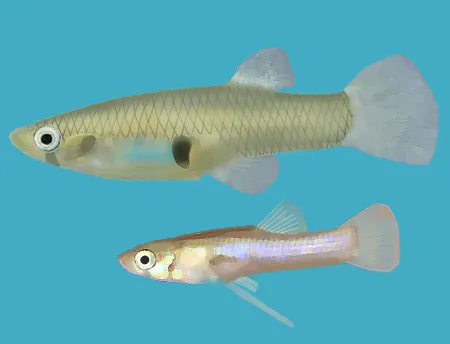 Eastern mosquitofishEU
Photos: Egyptian Goose © Rhododendrites · CC BY-SA 4.0; Eastern mosquitofish © Osado · CC BY-SA 3.0
Sources: Global Forest Change (Hansen et al., University of Maryland, via Global Forest Watch, CC-BY 4.0); EFFIS, European Commission / Copernicus; NASA Black Marble 2016 (public domain); CORINE Land Cover 2018 (Copernicus) or MODIS.
CORINE Land Cover Change 1990–2018: generated using European Union's Copernicus Land Monitoring Service information (EEA), aggregated by Parkavela; DOI 10.2909/f30f1000-7cf8-43bb-872c-5eb093911b24.
Ecological status of water bodies: European Environment Agency, WISE – Water Framework Directive, 3rd river basin management plans (2022), CC BY 4.0. Official national classification, not comparable between countries.
Invasive alien species: Global Register of Introduced and Invasive Species (ISSG, CC BY 4.0); Union list, Regulation (EU) 1143/2014 (INBO, CC0); GBIF.org records (CC0 / CC BY 4.0), at least 2 per species.
Practical information
Cities and airport
- Ciudad Real
20 km as the crow flies - Toledo
80 km as the crow flies - Airport: Madrid-Barajas (MAD)
142 km as the crow flies
Parking
2 public car parks listed within the site
Hiking
1 waymarked routes listed, including:
GR 114 (28 km)
Data © OpenStreetMap contributors (ODbL) · Wikidata (CC0)
Waymarked hiking routes
Tracks © OpenStreetMap contributors (ODbL), clipped to the boundary; elevation gain and profiles computed on the longest section from Mapzen Terrain Tiles (≈ 30 m), indicative only.
Access and visiting
The nearest railway station is Daimiel, about 10 km from the site boundary. Nearest towns of over 50,000 people, as the crow flies: Ciudad Real (20 km) and Toledo (80 km). Nearest airport: Madrid-Barajas (MAD), about 142 km away. About 95,000 people live within 20 km of the site boundary, 32,000 of them within 10 km; some 50 people are estimated to live inside (GHSL estimate, 2020). Public car parks listed within the site: 2. Waymarked hiking routes listed in OpenStreetMap: 1, including GR 114 (28 km). To plan a visit (access, opening periods, visitor rules), it is best to consult the official information from the managing body and the official website listed in this page's sources.
Source: OpenStreetMap (ODbL), Wikidata (CC0), October 2026.
When to visit
Best time to visit: May and June, with average temperatures of 17 to 24 °C and moderate rainfall. Day length ranges from about 9 h 26 min in December to 14 h 54 min in June. Wildlife records published on GBIF peak for birds (April and May), plants (April and May), butterflies and moths (from April to June), dragonflies (April) and mammals (April). These peaks also reflect when observers are most active.
Source: Copernicus ERA5-Land (C3S), monthly averages 1996–2025 at the representative point, temperatures adjusted for elevation.
Contains modified Copernicus Climate Change Service information 2026. Neither the European Commission nor ECMWF is responsible for any use that may be made of the Copernicus information or data it contains.
Wildlife records calendar
JFMAMJJASOND
Birds
Plants
Butterflies & moths
Dragonflies
Mammals
Monthly records published on GBIF (CC-BY), relative to the busiest month; also reflects observer activity.
Gallery
© Jgg1992 · CC BY-SA 4.0
© untipografico · CC BY 2.0
© Pablo García Armentano · CC BY-SA 3.0
© Wikipedio · CC BY-SA 4.0
© Gemma Gómez Rubio · CC BY-SA 3.0
© Xemenendura · CC BY-SA 4.0
Sources and licences
- Wikidata: Q1520216
- OpenStreetMap: relation 10036262
- Official website: http://reddeparquesnacionales.mma.es/parques/daimiel/index.htm
- Wikipedia: en.wikipedia.org/wiki/Tablas_de_Daimiel_National_Park
- WDPA: 4750
References
- cds.climate.copernicus.eu: climate · CC-BY-4.0
- registry.opendata.aws: elevation of the reference point, detailed relief · PD
- land.copernicus.eu: land cover, land cover change, sea share · COPERNICUS
- doi.org: population around the site · CC-BY-4.0
- wikidata.org: official area, establishment date, protected heritage, nearby cities and airport, access and peaks, lake depths, places to see, official website · CC0-1.0
- eea.europa.eu: bathing water quality, ecological status of waters · CC-BY-4.0
- en.eurovelo.com: EuroVelo cycle routes · ODbL-1.0
- cycling.waymarkedtrails.org: cycle routes · ODbL-1.0
- opentopodata.org: elevations · PD
- forest-fire.emergency.copernicus.eu: wildfires · COPERNICUS
- globalforestwatch.org: tree cover loss · CC-BY-4.0
- gbif.org: seasonality of sightings, invasive alien species, observed species · CC-BY-4.0
- europe-geology.eu: geology · CC-BY-4.0
- hydrosheds.org: lakes · CC-BY-4.0
- natura2000.eea.europa.eu: Natura 2000 habitats and species · CC-BY-4.0
- openstreetmap.org: official name, access and peaks · ODbL-1.0
- earthobservatory.nasa.gov: night light · PD
- hiking.waymarkedtrails.org: route difficulty · ODbL-1.0
- nsidc.org: snow cover · PD
- wikidata.org: Wikipedia article · CC-BY-SA-4.0
Data © OpenStreetMap contributors (ODbL), Wikidata (CC0) and the sources cited.