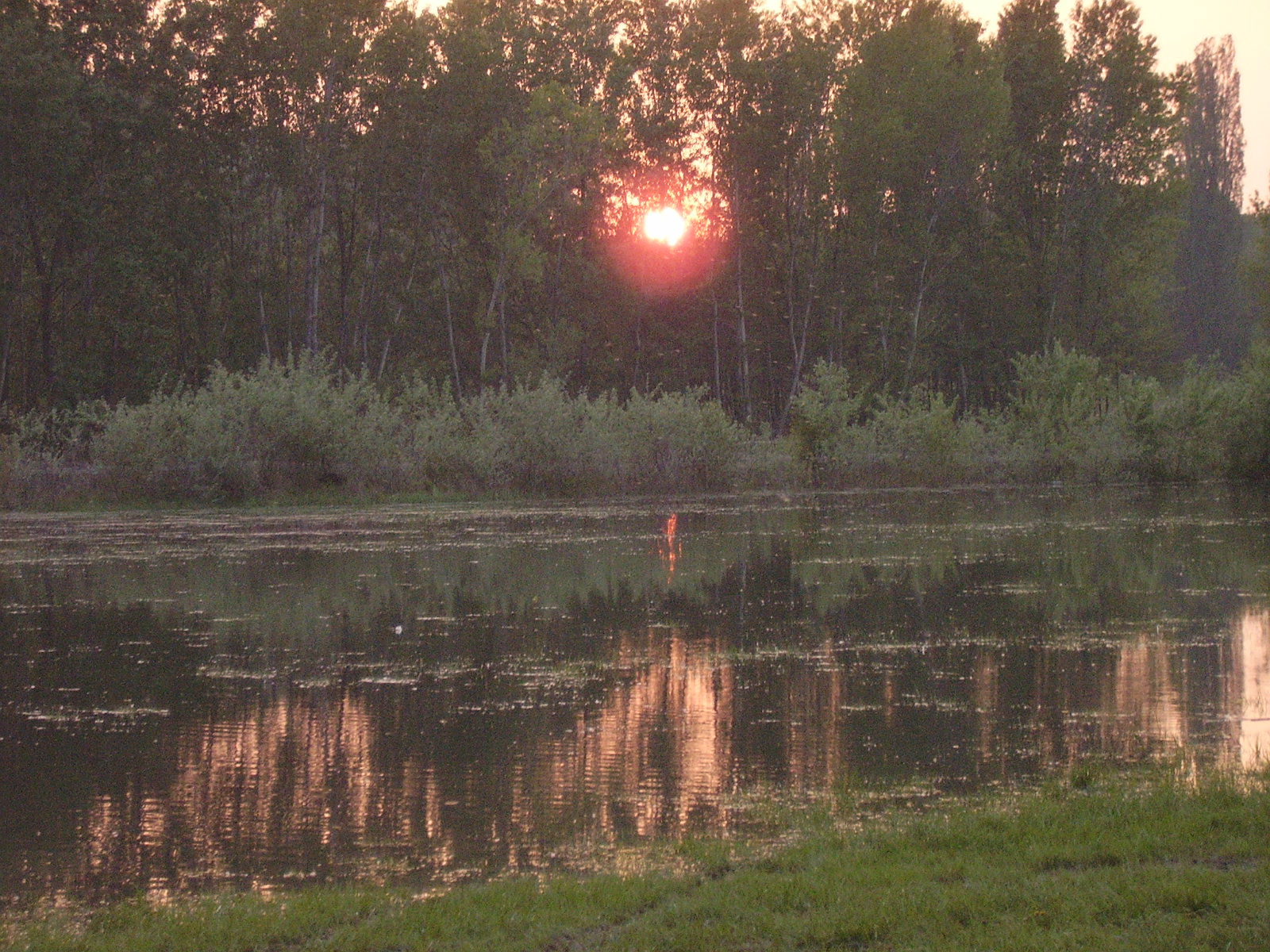
Slovakia · Terrestrial
Záhorie Protected Landscape Area
Protected landscape area of 27,522 hectares in Slovakia, established in 1988.
Overview
Protected landscape area of 27,522 hectares in Slovakia, established in 1988.
Záhorie Protected Landscape Area is located in Slovakia (Europe). It is a predominantly terrestrial area. Established in 1988, it covers about 27,522 hectares.
Protections and designations
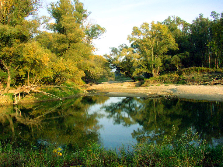
Ramsar site
Natura 2000 · habitats (SAC) · 29 sites
- Abrod SKUEV0117
- Bahno SKUEV0115
- Bencov mlyn SKUEV0513
- Bogdalický vrch SKUEV0124
- Borské piesky SKUEV0899
- Červený rybník SKUEV0179
- and 23 more
Natura 2000 · birds (SPA)
- Záhorské Pomoravie SKCHVU016
Designated as a protected landscape area. International labels and designations: Ramsar site (“Moravské luhy”) and Natura 2000 network (30 sites). Key dates: established in 1988, Ramsar Site in 1993, first Natura 2000 site under the Birds Directive in 2004 and first Natura 2000 site under the Habitats Directive in 2004.
In our collections
Timeline
-
1988
Established
-
1993
Ramsar Site (wetland of international importance) Moravské luhy
-
2004
First Natura 2000 site under the Birds Directive
-
2004
First Natura 2000 site under the Habitats Directive 20 such sites designated up to 2012
Sources: Wikidata (CC0) for establishment and international labels; EEA Natura 2000 database (CC-BY 4.0) for site designation dates.
Frequently asked questions
Where is Záhorie Protected Landscape Area?
In Slovakia (Europe). Representative point: 48.4333° N, 16.8667° E.
How large is Záhorie Protected Landscape Area?
About 27,522 hectares (275 km²). It is the 8th largest of the 14 protected landscape areas in Slovakia covered by Parkavela.
When was Záhorie Protected Landscape Area established?
In 1988.
What habitats and landscapes does Záhorie Protected Landscape Area include?
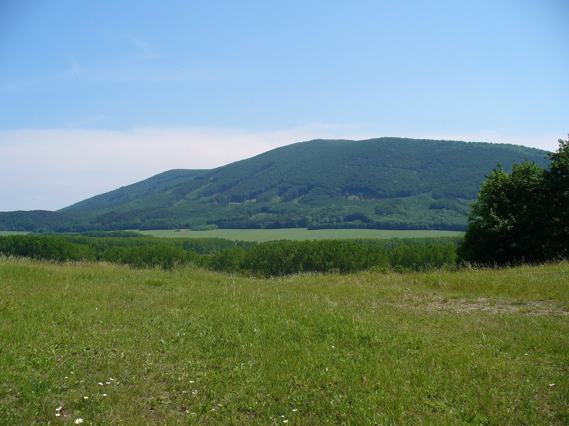
A terrestrial area, with forests.
What rocks lie beneath Záhorie Protected Landscape Area?
According to the European 1:1 million geological map (EGDI), the bedrock consists mainly of clays and silts (77% of sampled points) and sands and gravels (23%). These are mostly sedimentary rocks. The geological units date mainly from the Neogene (85% of sampled points).
What is the highest point of Záhorie Protected Landscape Area?
Kopec Márie Magdalény, at 297 m (OpenStreetMap).
What are the main summits of Záhorie Protected Landscape Area?
Kopec Márie Magdalény (297 m), Dubník (289 m), Ruženica (281 m), Kamenec (281 m) and Vinohrádky (260 m) (OpenStreetMap).
Which international labels apply to Záhorie Protected Landscape Area?
Ramsar site (“Moravské luhy”) and Natura 2000 network (30 sites).
When is the best time to visit Záhorie Protected Landscape Area?
Mildest period: from June to August, with average temperatures of 20 to 22 °C.
What is there to see in Záhorie Protected Landscape Area?
2 lakes and ponds, including Devínske jazero and Čierny Feld (142 m) (Wikidata).
Are there historic monuments in Záhorie Protected Landscape Area?
Yes. According to Wikidata, 4 monuments listed in the Slovak register of national cultural monuments stand within the boundary. For example: “Kaplnka sv. Márie Magdalény” in Borský Mikuláš, “Sumorovec, so slamenou strechou” in Borský Mikuláš and “Kostol sv. Ondreja” in Vysoká pri Morave.
What is the nearest large city to Záhorie Protected Landscape Area?
Nearest towns of over 50,000 people, as the crow flies: Bratislava (17 km) and Trnava (35 km). Nearest airport: M. R. Štefánik (BTS), about 22 km away.
How can I reach Záhorie Protected Landscape Area by train?
Vysoká pri Morave railway station lies within the site.
Where can I get visitor information on site?
March Thaya Zentrum.
Are there waymarked hiking trails in Záhorie Protected Landscape Area?
Yes. Waymarked hiking routes listed in OpenStreetMap: 9, including Via Slovakia (Skalica and Záhorácka magistrála. The “Via Slovakia (Skalica - Bratislava)” route runs for about 52 km through the site.
Which species can be seen in Záhorie Protected Landscape Area?
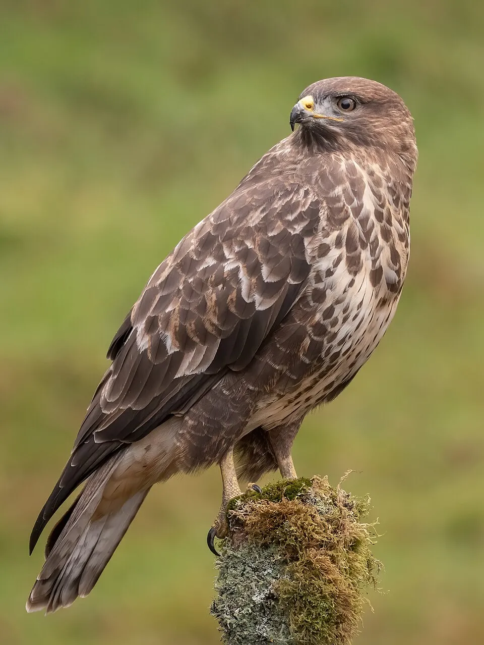
Among the species most often recorded on GBIF are Anas platyrhynchos (Mallard), Corvus cornix (Hooded Crow), Ardea cinerea (Grey Heron) and Buteo buteo (Common Buzzard).
What is the official website of Záhorie Protected Landscape Area?
© OpenStreetMap
Download the boundary: GeoJSON · GPX Boundary © OpenStreetMap contributors (ODbL).
Geography
The representative point of the site lies at around 151 m above sea level. Over the 1996–2025 period, the mean annual temperature is about 11.1 °C and total precipitation reaches roughly 677 mm per year. The warmest month is usually July, the coolest January, and the wettest July. According to the European 1:1 million geological map (EGDI), the bedrock consists mainly of clays and silts (77% of sampled points) and sands and gravels (23%). These are mostly sedimentary rocks. The geological units date mainly from the Neogene (85% of sampled points). The site contains 4 lakes larger than 10 ha, totalling 1.1 km² of water (HydroLAKES).
Area
- Area
- 27,522 ha
- Elevation
- 151 m
- Lakes over 10 ha
- 4 (1.1 km²)
- Coordinates
- 48.4333, 16.8667
Lakes: HydroLAKES (Messager et al. 2016, hydrosheds.org, CC BY 4.0) · depths: Wikidata (CC0)
Bedrock
- Clays and silts 77 %
- Sands and gravels 23 %
Sedimentary rocks 100 % · Main age: Neogene (85%)
Source: EGDI 1:1M geological map (EuroGeoSurveys and national geological surveys), CC BY 4.0 · 13 sampled points within the site.
Main summits
- Kopec Márie Magdalény297 m
- Dubník289 m
- Ruženica281 m
- Kamenec281 m
- Vinohrádky260 m
- Lipovec257 m
- Kravia hora253 m
- Dudovie vrch248 m
- Batašov vrch242 m
- Kobyliarka232 m
Data © OpenStreetMap contributors (ODbL)
Climate
● Mean temperature (°C) · ▮ Precipitation (mm)
Source: Copernicus ERA5-Land (C3S, doi:10.24381/cds.68d2bb30), monthly averages 1996–2025 interpolated to the representative point, temperatures adjusted for elevation.
Contains modified Copernicus Climate Change Service information 2026. Neither the European Commission nor ECMWF is responsible for any use that may be made of the Copernicus information or data it contains.
Snow cover measured by satellite
J
F
M
A
M
J
J
A
S
O
N
D
average share of the site under snow · snowiest parts · ≈ 15 days a year
Snow cover: MODIS/Terra MOD10CM v61 (Hall & Riggs, 2021, NASA NSIDC DAAC, doi:10.5067/MODIS/MOD10CM.061), imagery from NASA GIBS (ESDIS); 2015–2025 average, grid of about 5 km.
Natural habitats
According to CORINE Land Cover (2018), the site is mainly made up of farmland (44%), forests (41%) and grassland and meadows (9%). Woodland mixes broadleaved and coniferous trees. Elevation ranges from about 140 m to 297 m (highest point: Kopec Márie Magdalény). The 30 Natura 2000 sites overlapping the area list 20 habitats of European interest (6 priority), the most extensive being riparian mixed forests of Quercus robur, Ulmus laevis and Ulmus minor, Fraxinus excelsior or Fraxinus angustifolia, along the great rivers (Ulmenion minoris), alluvial meadows of river valleys of the Cnidion dubii and central European lichen Scots pine forests.
Biodiversity
Based on occurrences aggregated by GBIF, several species are regularly recorded within the site. Among the most frequent are Anas platyrhynchos (Mallard), Corvus cornix (Hooded Crow), Ardea cinerea (Grey Heron) and Buteo buteo (Common Buzzard). The full list of documented taxa is shown below. The overlapping Natura 2000 sites list 172 species of European interest: 130 birds, 5 mammals, 1 reptile, 2 amphibians, 14 fish, 17 invertebrates and 3 plants.
Habitats of European interest
From the official forms of the 30 Natura 2000 sites overlapping the area (areas reported for each whole site).
- Riparian mixed forests of Quercus robur, Ulmus laevis and Ulmus minor, Fraxinus excelsior or Fraxinus angustifolia, along the great rivers (Ulmenion minoris) 1,522 ha
- Alluvial meadows of river valleys of the Cnidion dubii 997 ha
- Central European lichen Scots pine forests 318 ha
- Alluvial forests with Alnus glutinosa and Fraxinus excelsior (Alno-Padion, Alnion incanae, Salicion albae) priority 272 ha
- Lowland hay meadows (Alopecurus pratensis, Sanguisorba officinalis) 254 ha
- Natural eutrophic lakes with Magnopotamion or Hydrocharition-type vegetation 138 ha
- Old acidophilous oak woods with Quercus robur on sandy plains 130 ha
- Euro-Siberian steppic woods with Quercus spp. priority 105 ha
and 12 more
Species of European interest
Birds · 130
Great Reed Warbler (Acrocephalus arundinaceus), Moustached Warbler (Acrocephalus melanopogon), Aquatic warbler (Acrocephalus paludicola), Sedge warbler (Acrocephalus schoenobaenus), Eurasian Reed Warbler (Acrocephalus scirpaceus), Common Kingfisher (Alcedo atthis) resident breeding, Northern Pintail (Anas acuta), Northern Shoveler (Anas clypeata), Eurasian Teal (Anas crecca), Eurasian Wigeon (Anas penelope), Gadwall (Anas strepera), Anas strepera strepera breeding and 118 more
Mammals · 5
Barbastelle (Barbastella barbastellus), Eurasian Beaver (Castor fiber), Eurasian otter (Lutra lutra), Pond bat (Myotis dasycneme), Greater mouse-eared bat (Myotis myotis)
Reptiles · 1
Amphibians · 2
European fire-bellied toad (Bombina bombina), Danube Crested Newt (Triturus dobrogicus)
Fish · 14
Asp (Aspius aspius), Spined loach (Cobitis taenia), European bullhead (Cottus gobio), White-finned gudgeon (Gobio albipinnatus), Balon's ruffe (Gymnocephalus baloni), Striped Ruffe (Gymnocephalus schraetzer), Weatherfish (Misgurnus fossilis), Ziege (Pelecus cultratus), Rhodeus sericeus amarus, Kessler's Gudgeon (Romanogobio kesslerii), Danube Whitefin Gudgeon (Romanogobio vladykovi), European mudminnow (Umbra krameri) and 2 more
Invertebrates · 17
Lesser Ramshorn Snail (Anisus vorticulus), Carabus variolosus, Greater Capricorn Beetle (Cerambyx cerdo), Balkan goldenring (Cordulegaster heros), Cucujus cinnaberinus, Water beetle (Graphoderus bilineatus), Keeled Plump Bush-cricket (Isophya costata), Yellow-spotted Whiteface (Leucorrhinia pectoralis), Violet click beetle (Limoniscus violaceus), Stag beetle (Lucanus cervus), Large copper (Lycaena dispar), Dusky Large Blue (Maculinea nausithous) and 5 more
Plants · 3
Angelica palustris, Cirsium brachycephalum, Marsh gladiolus (Gladiolus palustris)
Source: Natura 2000 standard data forms (EEA, CC-BY 4.0). Not exhaustive: sensitive species are not published.
Species to look out for

Bird
Hooded Crow
Corvus cornix1,936 records © Ricardo Tulio Gandelman from Rio de Janeiro, Brazil · CC BY 2.0


Observed species
Occurrences documented via GBIF; they are neither an exhaustive inventory nor proof of current presence.
- Mallard · Anas platyrhynchos · 1976
- Hooded Crow · Corvus cornix · 1936
- Grey Heron · Ardea cinerea · 1894
- Common Buzzard · Buteo buteo · 1869
- Great tit · Parus major · 1698
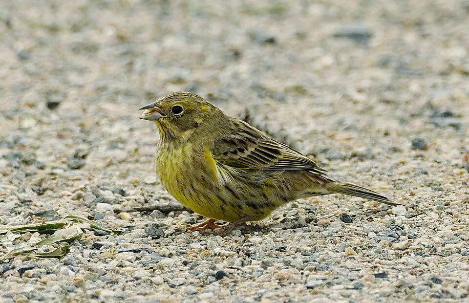
- Yellowhammer · Emberiza citrinella · 1640
- Red Kite · Milvus milvus · 1628
- Mute Swan · Cygnus olor · 1570
- Greylag Goose · Anser anser · 1546
- Common Blackbird · Turdus merula · 1491
- Eurasian Chaffinch · Fringilla coelebs · 1477
- Common Starling · Sturnus vulgaris · 1461
+18 more species
- Great Spotted Woodpecker · Dendrocopos major · 1337
- European Goldfinch · Carduelis carduelis · 1327
- Great Egret · Ardea alba · 1288
- Great Cormorant · Phalacrocorax carbo · 1257
- Common Wood Pigeon · Columba palumbus · 1206
- Eurasian blue tit · Cyanistes caeruleus · 1184
- Common Chiffchaff · Phylloscopus collybita · 1173
- European robin · Erithacus rubecula · 1123
- Yellow Iris · Iris pseudacorus · 1098
- White Wagtail · Motacilla alba · 1097
- Common comfrey · Symphytum officinale · 1080
- Common Pheasant · Phasianus colchicus · 1079
- Eurasian Tree Sparrow · Passer montanus · 1056
- Reed Canary-grass · Phalaris arundinacea · 1050
- Creeping buttercup · Ranunculus repens · 1036
- Eurasian Blackcap · Sylvia atricapilla · 1033
- White-tailed Eagle · Haliaeetus albicilla · 1016
- Reed Bunting · Emberiza schoeniclus · 958
Records: GBIF.org (CC-BY). Names: Wikidata (CC0), GBIF. Photos: Wikimedia Commons.
Conservation challenges
The primary purpose of the site is to preserve its natural habitats and the biodiversity they support. The species recorded (Biodiversity tab) reflect its ecological value. The designations it holds frame its management and the control of land use.
According to Global Forest Change data (University of Maryland, Global Forest Watch), about 1,840 ha of tree cover were lost within the boundary between 2001 and 2023 (7% of its area), peaking in 2010 and 2011. These losses include logging, storms and fires, and do not account for regrowth. According to the European CORINE Land Cover inventory (Copernicus), land cover changed on about 296 ha of the site between 1990 and 2018 (1% of its area): farmland shrank by 205 ha, mostly giving way to forest, while built-up land grew by 158 ha, mostly at the expense of forest. Forest felling and regrowth add about 2,810 ha in total over the period. At night, 1% of the area gives off artificial light detectable from space (NASA VIIRS Black Marble composite, 2016). Built-up and developed land (buildings, business areas, roads, quarries) covers 2% of the area, and farmland 44% (CORINE Land Cover). According to the Natura 2000 forms, of 19 assessed habitats of European interest, 11 are in excellent condition and the rest in good condition. According to the Water Framework Directive assessment (2022 river basin management plans, data 2021), only 16% of the 105 km of rivers assessed within the site are in good or high ecological status; the others mostly have moderate ecological status. Since 2000, 39 invasive alien species have been recorded within the site (GBIF observations), 6 of them listed as of Union concern under EU Regulation 1143/2014. Among them: Alopochen aegyptiaca (Egyptian Goose), Impatiens glandulifera (Himalayan Balsam) and Ailanthus altissima (Tree-of-heaven).
Pressure indicators
Tree cover lost
1,842 ha
2001–2023 · 7% of the area
20012023
Fires since 2016
0
No large fire mapped (fires over about 30 ha)
Light at night
1%
of the area gives off artificial light visible from space
DarkLit
Built-up land
2%
buildings, business areas, roads, quarries · farmland 44%
Land cover change
296 ha
changed cover, 1990–2018 · CORINE · 1% of the area
- −205 ha · farmland
- +158 ha · built-up land
forest felling and regrowth: 2,810 ha in total
Rivers and lakes
16%
of the 105 km of assessed rivers in good or high ecological status · WFD 2022
assessments 2021
Invasive alien species
39
incl. 6 of EU concern · since 2000
 Egyptian GooseEU
 Himalayan BalsamEU
 Tree-of-heavenEU
Bohemian knotweedEU
Common milkweedEU
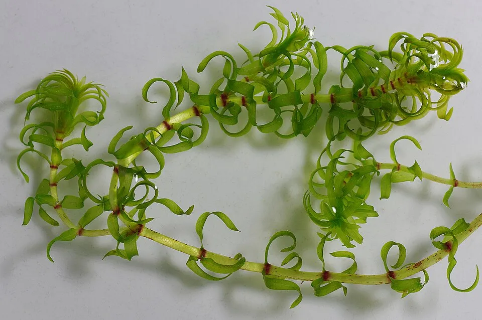 Western waterweedEU
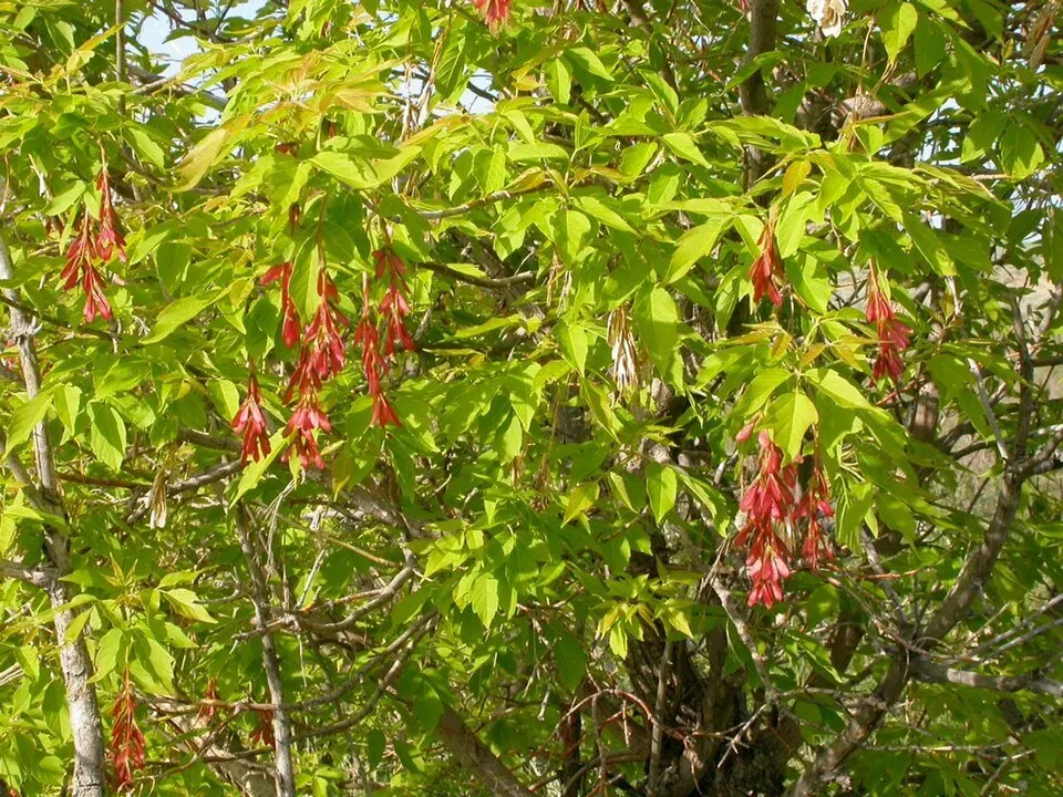 Ashleaf maple
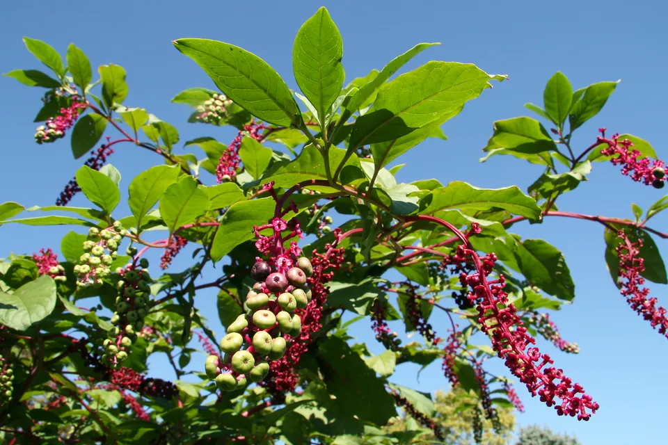 American pokeweed
Photos: Egyptian Goose © Rhododendrites · CC BY-SA 4.0; Himalayan Balsam © Guptaele · CC BY-SA 4.0; Tree-of-heaven © Darkone · CC BY-SA 2.5; Western waterweed © Christian Fischer · CC BY-SA 3.0; Ashleaf maple © Matt Lavin from Bozeman, Montana, USA · CC BY-SA 2.0; American pokeweed © Huw Williams (Huwmanbeing) · Public domain
Sources: Global Forest Change (Hansen et al., University of Maryland, via Global Forest Watch, CC-BY 4.0); EFFIS, European Commission / Copernicus; NASA Black Marble 2016 (public domain); CORINE Land Cover 2018 (Copernicus) or MODIS.
CORINE Land Cover Change 1990–2018: generated using European Union's Copernicus Land Monitoring Service information (EEA), aggregated by Parkavela; DOI 10.2909/f30f1000-7cf8-43bb-872c-5eb093911b24.
Ecological status of water bodies: European Environment Agency, WISE – Water Framework Directive, 3rd river basin management plans (2022), CC BY 4.0. Official national classification, not comparable between countries.
Invasive alien species: Global Register of Introduced and Invasive Species (ISSG, CC BY 4.0); Union list, Regulation (EU) 1143/2014 (INBO, CC0); GBIF.org records (CC0 / CC BY 4.0), at least 2 per species.
Practical information
Cities and airport
- Bratislava
17 km as the crow flies - Trnava
35 km as the crow flies - Airport: M. R. Štefánik (BTS)
22 km as the crow flies
Visitor information
- March Thaya Zentrum
2 km from the site boundary
Hiking
9 waymarked routes listed, including:
Via Slovakia (SkalicaZáhorácka magistrála
By bike
EV13 · 45 km 024 Záhorská cyklomagistrála · 8 km004 Moravská cyklotrasa · 5 km003 Malokarpatská cyklomagistrála · 3 km2003 · 15 km
+ 4 local loops
Signed cycle routes: this does not mean that cycling is allowed on footpaths.
Data © OpenStreetMap contributors (ODbL) · Wikidata (CC0)
Contains information from EuroVelo GPX tracks downloaded from www.EuroVelo.com on 2026-10-22, which is made available here under the Open Database License (ODbL). EuroVelo® is a registered trademark of the ECF. Routes © OpenStreetMap contributors (ODbL), via Waymarked Trails
Waymarked hiking routes
Tracks © OpenStreetMap contributors (ODbL), clipped to the boundary; elevation gain and profiles computed on the longest section from Mapzen Terrain Tiles (≈ 30 m), indicative only.
Access and visiting
Vysoká pri Morave railway station lies within the site. Nearest towns of over 50,000 people, as the crow flies: Bratislava (17 km) and Trnava (35 km). Nearest airport: M. R. Štefánik (BTS), about 22 km away. About 650,000 people live within 20 km of the site boundary, 200,000 of them within 10 km; some 8,100 people are estimated to live inside (GHSL estimate, 2020). Visitor information on site: March Thaya Zentrum. Waymarked hiking routes listed in OpenStreetMap: 9, including Via Slovakia (Skalica and Záhorácka magistrála. The EuroVelo 13 cycle route (Iron Curtain Trail) crosses the site for about 45 km, mostly developed and signed; 8 other signed cycle routes also pass through, including “024 Záhorská cyklomagistrála” and “004 Moravská cyklotrasa” (EuroVelo, OpenStreetMap). To see: 2 lakes and ponds, including Devínske jazero and Čierny Feld (142 m). To plan a visit (access, opening periods, visitor rules), it is best to consult the official information from the managing body and the official website listed in this page's sources.
Source: OpenStreetMap (ODbL), Wikidata (CC0), October 2026.
Built heritage
According to Wikidata, 4 monuments listed in the Slovak register of national cultural monuments stand within the boundary. Examples include “Kaplnka sv. Márie Magdalény” in Borský Mikuláš, “Sumorovec, so slamenou strechou” in Borský Mikuláš and “Kostol sv. Ondreja” in Vysoká pri Morave.
3 religious buildings1 house or civic building
-
Kaplnka sv. Márie Magdalény
Borský Mikuláš · 18th c. -
Sumorovec, so slamenou strechou
Borský Mikuláš · 19th c. -
Kostol sv. Ondreja
Vysoká pri Morave · 17th c. -
Church of Saint Lawrence
Lakšárska Nová Ves · 18th c.
Source: Wikidata (CC0), monuments in each country’s official heritage protection registers, at national or regional level. Each item links to its Wikidata entry.
When to visit
Mildest period: from June to August, with average temperatures of 20 to 22 °C. Snow only makes brief appearances in winter (about 15 days a year on average, MODIS satellites 2015–2025). Day length ranges from about 8 h 20 min in December to 16 h 05 min in June. Wildlife records published on GBIF peak for birds (from March to May), plants (May and June), butterflies and moths (from June to August), dragonflies (July) and mammals (September). These peaks also reflect when observers are most active.
Source: Copernicus ERA5-Land (C3S), monthly averages 1996–2025 at the representative point, temperatures adjusted for elevation.
Contains modified Copernicus Climate Change Service information 2026. Neither the European Commission nor ECMWF is responsible for any use that may be made of the Copernicus information or data it contains.
Wildlife records calendar
JFMAMJJASOND
Birds
Plants
Butterflies & moths
Dragonflies
Mammals
Monthly records published on GBIF (CC-BY), relative to the busiest month; also reflects observer activity.
Gallery
© Stanislav Doronenko · CC BY 2.5
© Vlendert · CC BY-SA 4.0
© Marek Jakubov · CC BY-SA 4.0
© Martingazak · CC BY-SA 4.0
© Annak02 · CC BY-SA 4.0
© Annak02 · CC BY-SA 4.0
Sources and licences
- Wikidata: Q1327209
- OpenStreetMap: relation 7017139
- Official website: https://chkozahorie.sopsr.sk
- Wikipedia: en.wikipedia.org/wiki/Záhorie_Protected_Landscape_Area
- WDPA: 19034
References
- cds.climate.copernicus.eu: climate · CC-BY-4.0
- registry.opendata.aws: elevation of the reference point, detailed relief · PD
- land.copernicus.eu: land cover, land cover change, sea share · COPERNICUS
- doi.org: population around the site · CC-BY-4.0
- wikidata.org: official area, establishment date, protected heritage, official name, nearby cities and airport, access and peaks, lake depths, places to see, official website · CC0-1.0
- eea.europa.eu: bathing water quality, ecological status of waters · CC-BY-4.0
- en.eurovelo.com: EuroVelo cycle routes · ODbL-1.0
- cycling.waymarkedtrails.org: cycle routes · ODbL-1.0
- opentopodata.org: elevations · PD
- forest-fire.emergency.copernicus.eu: wildfires · COPERNICUS
- globalforestwatch.org: tree cover loss · CC-BY-4.0
- gbif.org: seasonality of sightings, invasive alien species, observed species · CC-BY-4.0
- europe-geology.eu: geology · CC-BY-4.0
- hydrosheds.org: lakes · CC-BY-4.0
- natura2000.eea.europa.eu: Natura 2000 habitats and species · CC-BY-4.0
- earthobservatory.nasa.gov: night light · PD
- openstreetmap.org: access and peaks · ODbL-1.0
- hiking.waymarkedtrails.org: route difficulty · ODbL-1.0
- nsidc.org: snow cover · PD
- wikidata.org: Wikipedia article · CC-BY-SA-4.0
Data © OpenStreetMap contributors (ODbL), Wikidata (CC0) and the sources cited.