France · Terrestrial
Réserve naturelle nationale des gorges de l'Ardèche
Nature reserve of 1,950 hectares in France, established in 1980.
Overview
Nature reserve of 1,950 hectares in France, established in 1980.
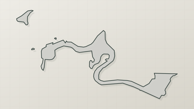
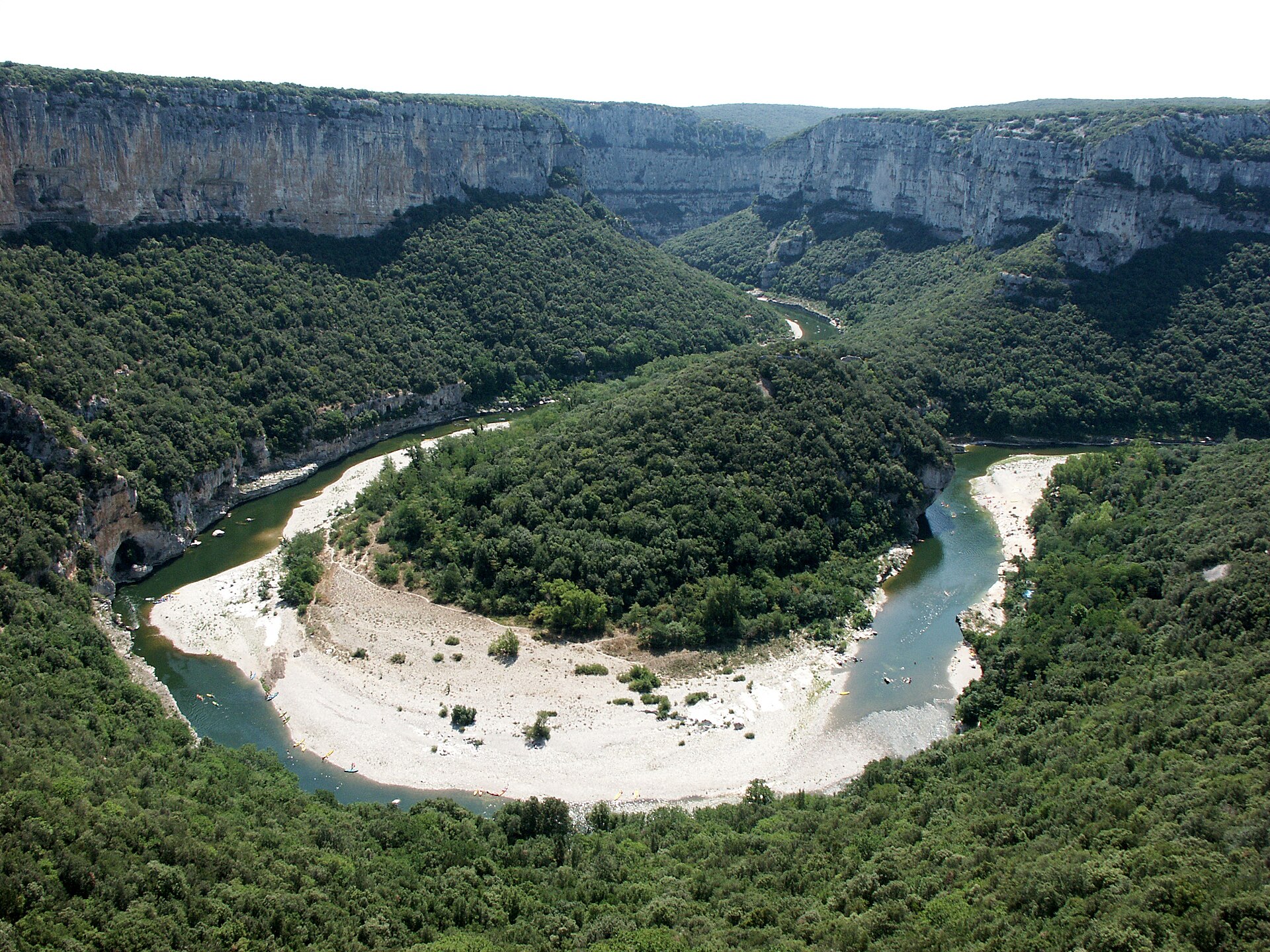
Réserve naturelle nationale des gorges de l'Ardèche is a nature reserve in France (Europe). It is a predominantly terrestrial area. Established in 1980, it covers about 1,950 hectares.
Protections and designations
Natura 2000 · habitats (SAC)
- Basse Ardèche urgonienne FR8201654
Natura 2000 · birds (SPA)
- Basse Ardèche FR8210114
Protected as a nature reserve. International labels and designations: Natura 2000 network (2 sites). Key dates: established in 1980, first Natura 2000 site under the Birds Directive in 2003 and first Natura 2000 site under the Habitats Directive in 2010.
In our collections
Timeline
-
1980
Established
-
2003
First Natura 2000 site under the Birds Directive
-
2010
First Natura 2000 site under the Habitats Directive
Sources: Wikidata (CC0) for establishment and international labels; EEA Natura 2000 database (CC-BY 4.0) for site designation dates.
Frequently asked questions
Where is Réserve naturelle nationale des gorges de l'Ardèche?
In France (Europe). Representative point: 44.3459° N, 4.4839° E.
How large is Réserve naturelle nationale des gorges de l'Ardèche?
About 1,950 hectares (20 km²). It is the 28th largest of the 121 nature reserves in France covered by Parkavela.
When was Réserve naturelle nationale des gorges de l'Ardèche established?
In 1980.
What habitats and landscapes does Réserve naturelle nationale des gorges de l'Ardèche include?
A terrestrial area, with forests.
What rocks lie beneath Réserve naturelle nationale des gorges de l'Ardèche?
According to the BRGM's simplified lithological map, the bedrock consists mainly of limestones, marls and gypsum (100% of sampled points). These are mostly sedimentary rocks.
Which international labels apply to Réserve naturelle nationale des gorges de l'Ardèche?
Natura 2000 network (2 sites).
When is the best time to visit Réserve naturelle nationale des gorges de l'Ardèche?
Best time to visit: from April to September, with average temperatures of 11 to 24 °C and moderate rainfall.
What is there to see in Réserve naturelle nationale des gorges de l'Ardèche?
39 viewpoints and 24 caves, including Balcon d'Autridge, Aven de Noël (262 m), Balcon des Gorges (la Cathédrale) and Aven des Neuf Gorges (OpenStreetMap).
Where can I stay in Réserve naturelle nationale des gorges de l'Ardèche?
5 campsites, including Bivouac de Gaud, Bivouac de Gournier and Camping Mille Étoiles (OpenStreetMap).
Are there historic monuments in Réserve naturelle nationale des gorges de l'Ardèche?
Yes. According to the French Ministry of Culture's Mérimée database, 9 historic monuments stand within the boundary, 4 of them with the highest level of protection (classé). For example: “Dolmen dit Pié de Mounié” in Aiguèze, “Grotte d'Ebbou dite de Chamas” in Vallon-Pont-d'Arc and “Grotte à gravures préhistoriques d'Oullins” in Le Garn.
Can you swim in Réserve naturelle nationale des gorges de l'Ardèche?
2 monitored bathing sites lie in or within 1 km of the site; official 2025 classification: 2 poor (European Environment Agency). Swimming is only permitted at the sites and times authorised locally.
What is the nearest large city to Réserve naturelle nationale des gorges de l'Ardèche?
Nearest towns of over 50,000 people, as the crow flies: Avignon (46 km) and Nîmes (56 km). Nearest airport: Nîmes-Alès-Camargue-Cévennes (FNI), about 63 km away.
How can I reach Réserve naturelle nationale des gorges de l'Ardèche by train?
The nearest railway station is Pont-Saint-Esprit, about 10 km from the site boundary.
Where can I get visitor information on site?
Maison de la Réserve Naturelle des Gorges de l'Ardèche and Bureau d'Information Touristique de Saint-Martin-d'Ardèche.
Are there waymarked hiking trails in Réserve naturelle nationale des gorges de l'Ardèche?
Yes. Waymarked hiking routes listed in OpenStreetMap: 12. The “Sentier amont des Gorges de l'Ardèche” route runs for about 19 km through the site, with some 400 m of ascent on its longest section.
Which species can be seen in Réserve naturelle nationale des gorges de l'Ardèche?
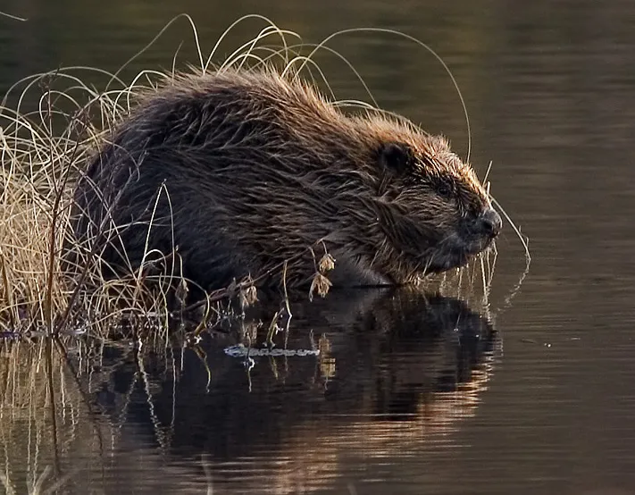
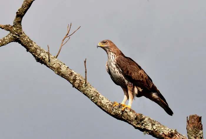
Among the species most often recorded on GBIF are Castor fiber (Eurasian Beaver), Aquila fasciata (Bonelli's Eagle), Lutra lutra (Eurasian otter) and Alburnoides bipunctatus (Spirlin).
What is the official website of Réserve naturelle nationale des gorges de l'Ardèche?
© OpenStreetMap
Download the boundary: GeoJSON · GPX Boundary © OpenStreetMap contributors (ODbL).
Geography
The representative point of the site lies at around 282 m above sea level. Over the 1996–2025 period, the mean annual temperature is about 13.3 °C and total precipitation reaches roughly 1,006 mm per year. The warmest month is usually July, the coolest January, and the wettest October. According to the BRGM's simplified lithological map, the bedrock consists mainly of limestones, marls and gypsum (100% of sampled points). These are mostly sedimentary rocks.
Area
- Area
- 1,950 ha
- Elevation
- 282 m
- Mean slope
- 21°
- Coordinates
- 44.3459, 4.4839
Terrain: Mapzen Terrain Tiles (SRTM, USGS)
Bedrock
- Limestones, marls and gypsum 100 %
Sedimentary rocks 100 %
Source: BRGM, simplified lithological map at 1:1,000,000 (Licence Ouverte), 12 points sampled within the boundary.
Climate
● Mean temperature (°C) · ▮ Precipitation (mm)
Source: Copernicus ERA5-Land (C3S, doi:10.24381/cds.68d2bb30), monthly averages 1996–2025 interpolated to the representative point, temperatures adjusted for elevation.
Contains modified Copernicus Climate Change Service information 2026. Neither the European Commission nor ECMWF is responsible for any use that may be made of the Copernicus information or data it contains.
Natural habitats
According to CORINE Land Cover (2018), the site is mainly made up of forests (100%). Woodland is mostly broadleaved. Elevation ranges from about 70 to 400 m (sampled elevations, SRTM). The terrain is steep: 24% of slopes exceed 30° (mean slope 21°). The 2 Natura 2000 sites overlapping the area list 17 habitats of European interest (3 priority), the most extensive being Quercus ilex and Quercus rotundifolia forests, arborescent matorral with Juniperus spp. and calcareous rocky slopes with chasmophytic vegetation.
Biodiversity
Based on occurrences aggregated by GBIF, several species are regularly recorded within the site. Among the most frequent are Castor fiber (Eurasian Beaver), Aquila fasciata (Bonelli's Eagle), Lutra lutra (Eurasian otter) and Alburnoides bipunctatus (Spirlin). The full list of documented taxa is shown below. The overlapping Natura 2000 sites list 78 species of European interest: 23 birds, 25 mammals, 4 reptiles, 5 amphibians, 8 fish, 12 invertebrates and 1 plant.
Habitats of European interest
From the official forms of the 2 Natura 2000 sites overlapping the area (areas reported for each whole site).
- Quercus ilex and Quercus rotundifolia forests 3,193 ha
- Arborescent matorral with Juniperus spp. 446 ha
- Calcareous rocky slopes with chasmophytic vegetation 135 ha
- Salix alba and Populus alba galleries 108 ha
- Western Mediterranean and thermophilous scree 84 ha
- Caves not open to the public 69 ha
- Water courses of plain to montane levels with the Ranunculion fluitantis and Callitricho-Batrachion vegetation 53 ha
- Constantly flowing Mediterranean rivers with Glaucium flavum 49 ha
and 9 more
Species of European interest
Birds · 23
Cinereous Vulture (Aegypius monachus) passage, Common Kingfisher (Alcedo atthis) resident, Tawny Pipit (Anthus campestris) breeding, Bonelli's Eagle (Aquila fasciata) resident, Eurasian Eagle-owl (Bubo bubo) resident, European Nightjar (Caprimulgus europaeus) breeding, Short-toed Snake Eagle (Circaetus gallicus) breeding passage, Western Marsh Harrier (Circus aeruginosus) passage, Hen Harrier (Circus cyaneus) passage, Montagu's Harrier (Circus pygargus) passage, Little Egret (Egretta garzetta) passage, Ortolan Bunting (Emberiza hortulana) breeding and 11 more
Mammals · 25
Barbastelle (Barbastella barbastellus), Eurasian Beaver (Castor fiber), Serotine bat (Eptesicus serotinus), Common genet (Genetta genetta), Savi's Pipistrelle (Hypsugo savii), Eurasian otter (Lutra lutra), Common bent-wing bat (Miniopterus schreibersii), Bechstein's bat (Myotis bechsteinii), Lesser mouse-eared myotis (Myotis blythii), Long-fingered bat (Myotis capaccinii), Daubenton's Bat (Myotis daubentoni), Geoffroy's bat (Myotis emarginatus) and 13 more
Reptiles · 4
Dark green snake (Coluber viridiflavus), Aesculapian snake (Elaphe longissima), Green lizard (Lacerta viridis), Common wall lizard (Podarcis muralis)
Amphibians · 5
Midwife toad (Alytes obstetricans), Natterjack (Bufo calamita), Stripeless tree frog (Hyla meridionalis), Agile frog (Rana dalmatina), Pool frog (Rana lessonae)
Fish · 8
Twait shad (Alosa fallax), Mediterranean Barbel (Barbus meridionalis), European bullhead (Cottus gobio), European brook lamprey (Lampetra planeri), South-West European Nase (Parachondrostoma toxostoma), European bitterling (Rhodeus amarus), Souffia (Telestes souffia), Apron (Zingel asper)
Invertebrates · 12
Greater Capricorn Beetle (Cerambyx cerdo), Southern damselfly (Coenagrion mercuriale), Eastern Eggar (Eriogaster catax), Marsh fritillary (Euphydryas aurinia), Pronged clubtail (Gomphus graslinii), Stag beetle (Lucanus cervus), Splendid Cruiser (Macromia splendens), Orange-spotted Emerald (Oxygastra curtisii), Willowherb Hawkmoth (Proserpinus proserpina), Common Predatory Bush-cricket (Saga pedo), Thick shelled river mussel (Unio crassus), Narrow-mouthed whorl snail (Vertigo angustior)
Plants · 1
Source: Natura 2000 standard data forms (EEA, CC-BY 4.0). Not exhaustive: sensitive species are not published.
Species to look out for

Observed species
Occurrences documented via GBIF; they are neither an exhaustive inventory nor proof of current presence.
- Eurasian Beaver · Castor fiber · 300
- Bonelli's Eagle · Aquila fasciata · 235
- Eurasian otter · Lutra lutra · 176
- Spirlin · Alburnoides bipunctatus · 161
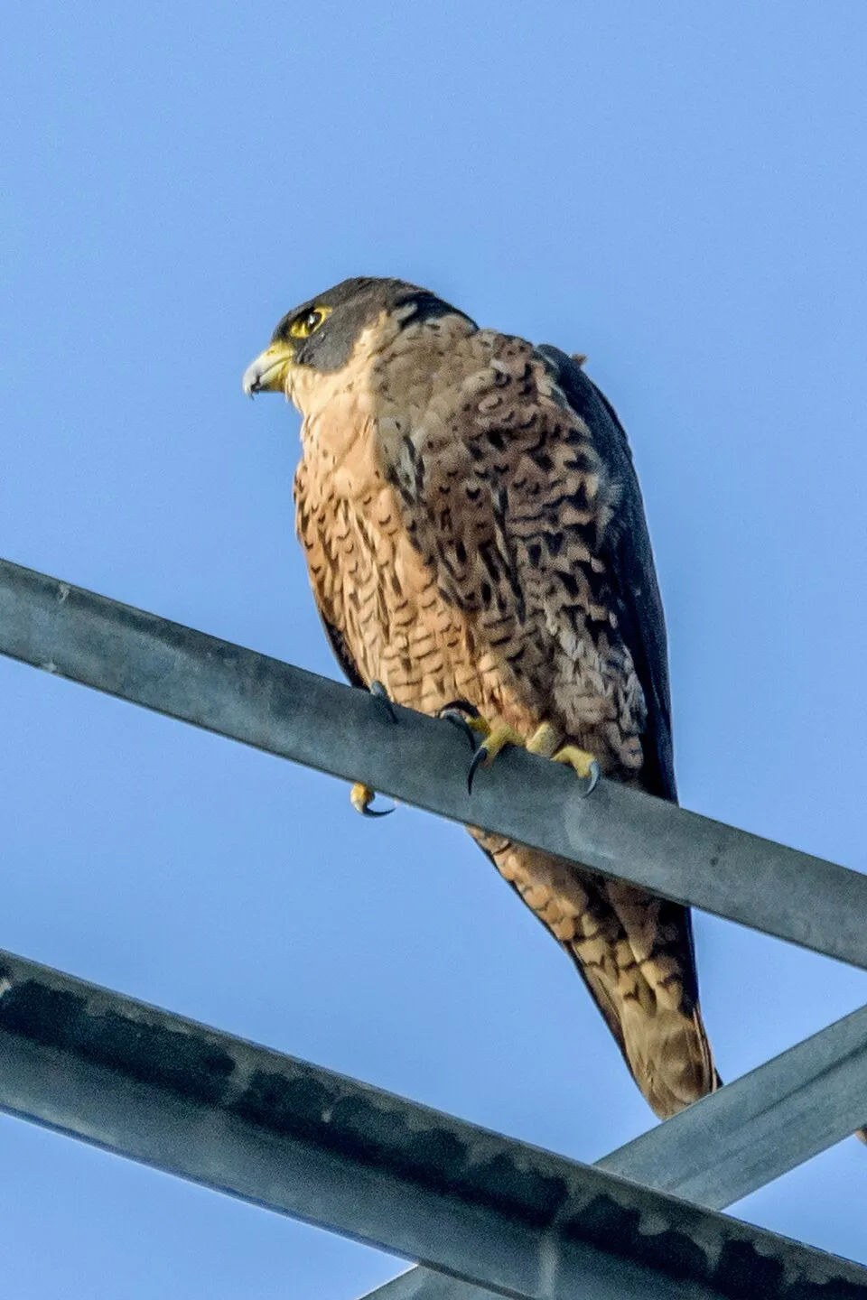
- Peregrine Falcon · Falco peregrinus · 151
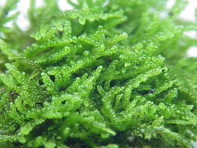
- Hypnum moss · Hypnum cupressiforme · 130
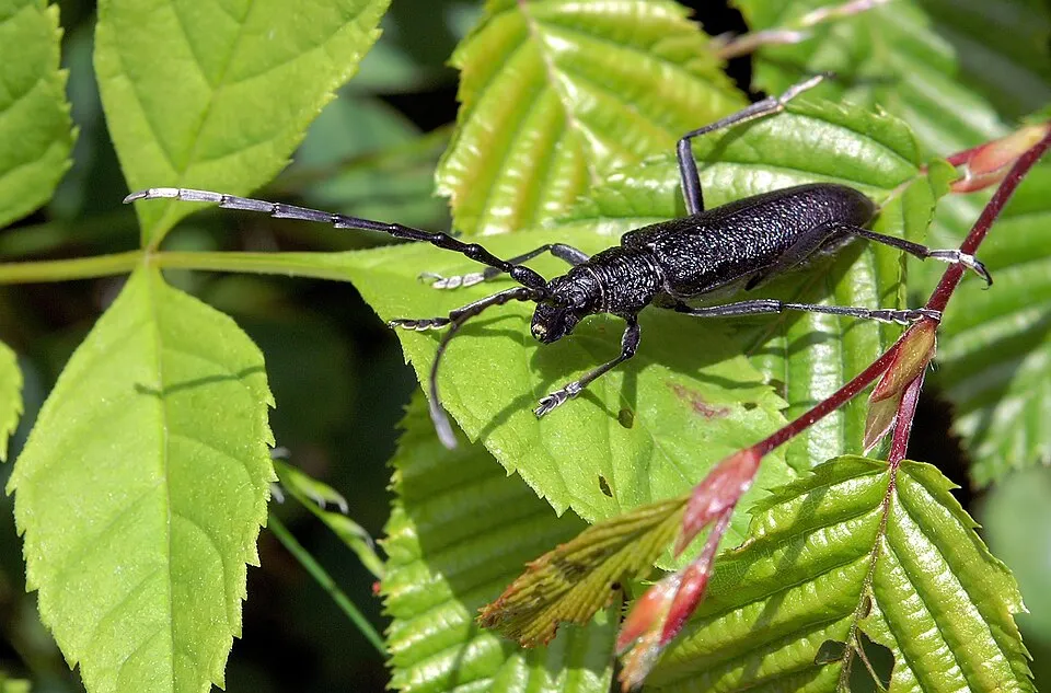
- Greater Capricorn Beetle · Cerambyx cerdo · 126
- Flat Neckera · Alleniella complanata · 125
- Egyptian Vulture · Neophron percnopterus · 115
- Holm Oak · Quercus ilex · 111
- Smith's leptodon moss · Leptodon smithii · 109
- Small pincertail · Onychogomphus forcipatus · 107
+18 more species
- Flat-leaved scalewort · Radula complanata · 100
- Purpuricenus kaehleri · 97
- Asian clam · Corbicula fluminea · 90
- Crisped Neckera · Exsertotheca crispa · 89
- Lesser Striated Feather-moss · Plasteurhynchium striatulum · 88
- Eurasian Crag Martin · Ptyonoprogne rupestris · 83
- Alpine Swift · Tachymarptis melba · 82
- Cerambyx welensii · 80
- Barbel · Barbus barbus · 79
- Eurasian Chaffinch · Fringilla coelebs · 76
- Park Yoke-moss · Zygodon rupestris · 73
- Least pouncewort · Lejeunea cavifolia · 73
- Common Blackbird · Turdus merula · 72
- Butcher's-broom · Ruscus aculeatus · 70
- Albanian spurge · Euphorbia characias · 68
- European robin · Erithacus rubecula · 67
- Curving Feather-moss · Scorpiurium circinatum · 67
- Pronged clubtail · Gomphus graslinii · 67
Records: GBIF.org (CC-BY). Names: Wikidata (CC0), GBIF. Photos: Wikimedia Commons.
Conservation challenges
The primary purpose of the site is to preserve its natural habitats and the biodiversity they support. The species recorded (Biodiversity tab) reflect its ecological value. The designations it holds frame its management and the control of land use.
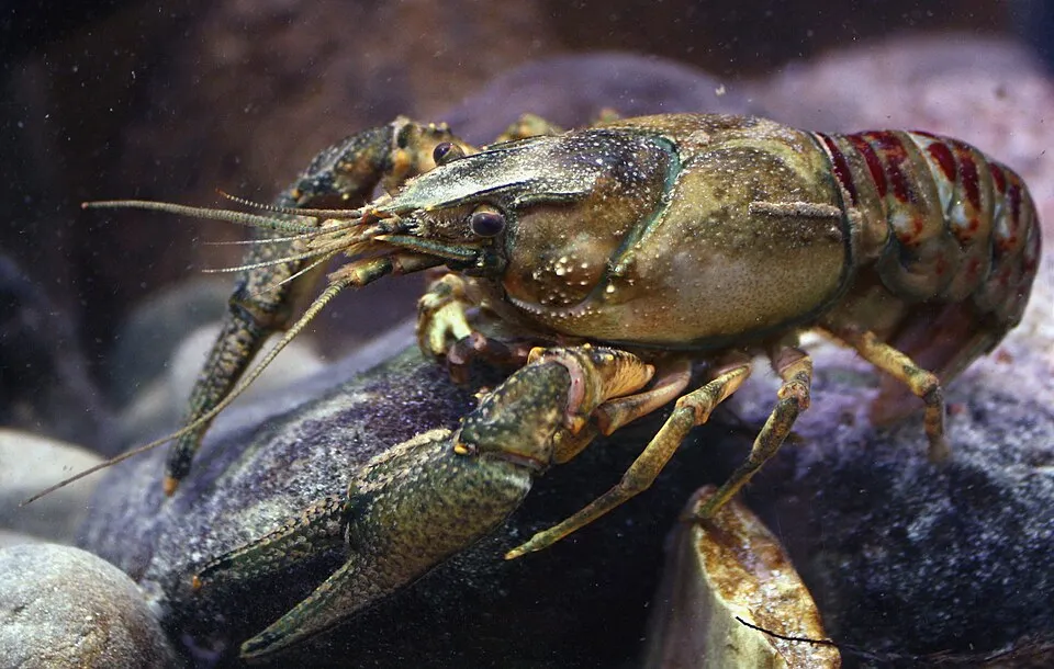
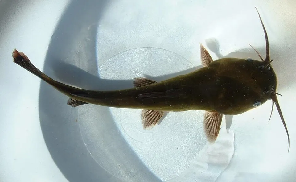
According to Global Forest Change data (University of Maryland, Global Forest Watch), about 68 ha of tree cover were lost within the boundary between 2001 and 2023 (3% of its area), peaking in 2018 and 2019. These losses include logging, storms and fires, and do not account for regrowth. According to CORINE Land Cover, land cover here remained almost unchanged between 1990 and 2018 (less than 0.5% of the area affected). At night, the area gives off virtually no artificial light detectable from space (NASA VIIRS Black Marble composite, 2016). According to the Natura 2000 forms, of 16 assessed habitats of European interest, 6 are in average or reduced condition and the rest in good condition. According to the Water Framework Directive assessment (2022 river basin management plans, data 2015–2017), the only river assessed within the site has moderate ecological status. Since 2000, 25 invasive alien species have been recorded within the site (GBIF observations), 7 of them listed as of Union concern under EU Regulation 1143/2014. Among them: Lepomis gibbosus (Pumpkinseed), Faxonius limosus (Spinycheek crayfish) and Ameiurus melas (Black bullhead).
Pressure indicators
Tree cover lost
68 ha
2001–2023 · 3% of the area
20012023
Fires since 2016
0
No large fire mapped (fires over about 30 ha)
Light at night
0%
of the area gives off artificial light visible from space
DarkLit
Land cover change
< 0.5%
of the area changed, 1990–2018 · CORINE
Rivers and lakes
0%
of the 20 km of assessed rivers in good or high ecological status · WFD 2022
assessments 2015–2017
Invasive alien species
25
incl. 7 of EU concern · since 2000
 PumpkinseedEU
 Spinycheek crayfishEU
 Black bullheadEU
 Himalayan BalsamEU
 Tree-of-heavenEU
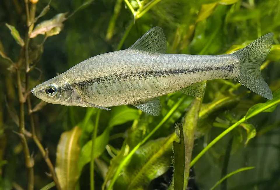 Topmouth gudgeonEU
 Japanese KnotweedEU
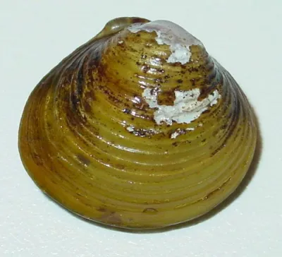 Asian clam
Photos: Pumpkinseed © Cephas · CC BY-SA 3.0; Spinycheek crayfish © Astacoides · CC BY-SA 3.0; Black bullhead © Jeffdelonge · CC BY-SA 3.0; Himalayan Balsam © Guptaele · CC BY-SA 4.0; Tree-of-heaven © Darkone · CC BY-SA 2.5; Topmouth gudgeon © Seotaro, edited by Lycaon · CC BY-SA 3.0; Japanese Knotweed © W.carter · CC0-1.0; Asian clam © USGS · Public domain
Sources: Global Forest Change (Hansen et al., University of Maryland, via Global Forest Watch, CC-BY 4.0); EFFIS, European Commission / Copernicus; NASA Black Marble 2016 (public domain); CORINE Land Cover 2018 (Copernicus) or MODIS.
CORINE Land Cover Change 1990–2018: generated using European Union's Copernicus Land Monitoring Service information (EEA), aggregated by Parkavela; DOI 10.2909/f30f1000-7cf8-43bb-872c-5eb093911b24.
Ecological status of water bodies: European Environment Agency, WISE – Water Framework Directive, 3rd river basin management plans (2022), CC BY 4.0. Official national classification, not comparable between countries.
Invasive alien species: Global Register of Introduced and Invasive Species (ISSG, CC BY 4.0); Union list, Regulation (EU) 1143/2014 (INBO, CC0); GBIF.org records (CC0 / CC BY 4.0), at least 2 per species.
Practical information
Cities and airport
- Avignon
46 km as the crow flies - Nîmes
56 km as the crow flies - Airport: Nîmes-Alès-Camargue-Cévennes (FNI)
63 km as the crow flies
Visitor information
- Maison de la Réserve Naturelle des Gorges de l'Ardèche
within the site - Bureau d'Information Touristique de Saint-Martin-d'Ardèche
2 km from the site boundary
Parking
4 public car parks listed within the site
Things to see
39 viewpoints · 24 caves
- Balcon d'Autridge
viewpoint - Aven de Noël
cave · 262 m - Balcon des Gorges (la Cathédrale)
viewpoint - Aven des Neuf Gorges
cave - Balcon des Templiers
viewpoint
Where to stay
5 campsites
- Bivouac de Gaud
campsite - Bivouac de Gournier
campsite - Camping Mille Étoiles
campsite - Camping la Plage des Templiers
campsite - Camping la Rouvière
campsite
Hiking
12 waymarked routes listed
Wheelchair access
- Belvédère des Templiers
viewpoint
Reported by OpenStreetMap contributors (ODbL); check with the park before visiting.
Data © OpenStreetMap contributors (ODbL) · Wikidata (CC0)
Waymarked hiking routes
Circuit de la Maladrerie des templiers
5.4 km within the site ↗ 226 m↘ 62 m 62–253 m
up to T2 · mountain hiking
Tracks © OpenStreetMap contributors (ODbL), clipped to the boundary; elevation gain and profiles computed on the longest section from Mapzen Terrain Tiles (≈ 30 m), indicative only. Indicative difficulty (SAC scale, OpenStreetMap, via Waymarked Trails): check with the park.
Bathing
2 monitored bathing sites in or within 1 km of the site · 2025 classification
Poor · 2
- L'Ardeche Amont Pont d'Arc · river · Poor
- L'Ardeche Aval Pont d'Arc · river · Poor
Source: European Environment Agency, official bathing water classification (Directive 2006/7/EC, CC-BY 4.0). Swimming is only permitted at the sites and times authorised locally.
Access and visiting
The nearest railway station is Pont-Saint-Esprit, about 10 km from the site boundary. Nearest towns of over 50,000 people, as the crow flies: Avignon (46 km) and Nîmes (56 km). Nearest airport: Nîmes-Alès-Camargue-Cévennes (FNI), about 63 km away. About 150,000 people live within 20 km of the site boundary, 35,000 of them within 10 km; the site itself is virtually uninhabited (GHSL estimate, 2020). This population has grown by about 15% since 2000. Visitor information on site: Maison de la Réserve Naturelle des Gorges de l'Ardèche and Bureau d'Information Touristique de Saint-Martin-d'Ardèche. Public car parks listed within the site: 4. Waymarked hiking routes listed in OpenStreetMap: 12. OpenStreetMap contributors list one wheelchair-accessible place: Belvédère des Templiers; check with the park before visiting. To see: 39 viewpoints and 24 caves, including Balcon d'Autridge, Aven de Noël (262 m), Balcon des Gorges (la Cathédrale) and Aven des Neuf Gorges. Where to stay: 5 campsites, including Bivouac de Gaud, Bivouac de Gournier and Camping Mille Étoiles. To plan a visit (access, opening periods, visitor rules), it is best to consult the official information from the managing body and the official website listed in this page's sources.
Source: OpenStreetMap (ODbL), Wikidata (CC0), October 2026.
Built heritage
According to the French Ministry of Culture's Mérimée database, 9 historic monuments stand within the boundary, 4 of them with the highest level of protection (classé). Among them are 9 prehistoric and archaeological sites. Notable classé monuments include “Dolmen dit Pié de Mounié” in Aiguèze, “Grotte d'Ebbou dite de Chamas” in Vallon-Pont-d'Arc and “Grotte à gravures préhistoriques d'Oullins” in Le Garn.
-
Dolmen dit Pié de Mounié
Classé
Aiguèze · Prehistory -
Grotte d'Ebbou dite de Chamas
Classé
Vallon-Pont-d'Arc · Prehistory -
Grotte à gravures préhistoriques d'Oullins
Classé
Le Garn · Prehistory -
Grotte aux points
Classé
Aiguèze · Prehistory -
Grotte dite de la Combe d'Oulen
Labastide-de-Virac · Prehistory -
Grotte du Colombier
Vallon-Pont-d'Arc · Prehistory -
Grotte de la Cabre
Vallon-Pont-d'Arc · Prehistory -
Grotte des Potiers de Gaud
Saint-Remèze · Prehistory
and 1 more
Source: Mérimée database, French Ministry of Culture (Licence Ouverte 2.0). Each record links to the Plateforme ouverte du patrimoine (POP).
When to visit
Best time to visit: from April to September, with average temperatures of 11 to 24 °C and moderate rainfall. Precipitation peaks in October and November (up to 150 mm per month). Day length ranges from about 8 h 52 min in December to 15 h 30 min in June. Wildlife records published on GBIF peak for birds (from April to June), plants (April and May), butterflies and moths (July), dragonflies (June) and mammals (March). These peaks also reflect when observers are most active.
Source: Copernicus ERA5-Land (C3S), monthly averages 1996–2025 at the representative point, temperatures adjusted for elevation.
Contains modified Copernicus Climate Change Service information 2026. Neither the European Commission nor ECMWF is responsible for any use that may be made of the Copernicus information or data it contains.
Wildlife records calendar
JFMAMJJASOND
Birds
Plants
Butterflies & moths
Dragonflies
Mammals
Monthly records published on GBIF (CC-BY), relative to the busiest month; also reflects observer activity.
Gallery
© Jean-Christophe BENOIST · CC BY 2.5
© Emil Pollnow (Kontakt: Marcus Augustine [1]) · CC BY 2.0
© Getfunky Paris · CC BY 2.0
© W. Bulach · CC BY-SA 4.0
© Modano~commonswiki · CC BY-SA 2.5
© Sébastien Crego · CC BY-SA 4.0
Sources and licences
- Wikidata: Q3457506
- OpenStreetMap: relation 1023754
- Official website: http://www.gorgesdelardeche.fr/reserve-naturelle.php
- Wikipedia: fr.wikipedia.org/wiki/Réserve_naturelle_nationale_des_gorges_de_l'Ardèche
- WDPA: 18993
References
- cds.climate.copernicus.eu: climate · CC-BY-4.0
- registry.opendata.aws: elevation of the reference point, detailed relief · PD
- land.copernicus.eu: land cover, land cover change, sea share · COPERNICUS
- doi.org: population around the site · CC-BY-4.0
- wikidata.org: official area, establishment date, nearby cities and airport, access and peaks, lake depths, places to see, official website · CC0-1.0
- eea.europa.eu: bathing water quality, ecological status of waters · CC-BY-4.0
- en.eurovelo.com: EuroVelo cycle routes · ODbL-1.0
- cycling.waymarkedtrails.org: cycle routes · ODbL-1.0
- opentopodata.org: elevations · PD
- forest-fire.emergency.copernicus.eu: wildfires · COPERNICUS
- globalforestwatch.org: tree cover loss · CC-BY-4.0
- gbif.org: seasonality of sightings, invasive alien species, observed species · CC-BY-4.0
- infoterre.brgm.fr: geology · LO-2.0
- pop.culture.gouv.fr: protected heritage · LO-2.0
- hydrosheds.org: lakes · CC-BY-4.0
- natura2000.eea.europa.eu: Natura 2000 habitats and species · CC-BY-4.0
- openstreetmap.org: official name, access and peaks, places to see, wheelchair access · ODbL-1.0
- earthobservatory.nasa.gov: night light · PD
- hiking.waymarkedtrails.org: route difficulty · ODbL-1.0
- nsidc.org: snow cover · PD
- wikidata.org: Wikipedia article · CC-BY-SA-4.0
Data © OpenStreetMap contributors (ODbL), Wikidata (CC0) and the sources cited.