
Greece · Terrestrial
Samaria National Park
National park of 24,560 hectares in Greece, established in 1962.
Overview
National park of 24,560 hectares in Greece, established in 1962.
Samaria National Park is located in Greece (Europe). It is a predominantly terrestrial area. Established in 1962, it covers about 24,560 hectares.
Protections and designations
UNESCO Biosphere Reserve
Natura 2000 · habitats (SAC)
- Lefka Ori kai Paraktia Zoni GR4340008
Natura 2000 · birds (SPA)
Protected as a national park. International labels and designations: UNESCO Biosphere Reserve and Natura 2000 network (2 sites). Key dates: established in 1962, first Natura 2000 site under the Birds Directive in 1987 and first Natura 2000 site under the Habitats Directive in 2011.
In our collections
Timeline
-
1962
Established
-
1987
First Natura 2000 site under the Birds Directive
-
2011
First Natura 2000 site under the Habitats Directive
Sources: Wikidata (CC0) for establishment and international labels; EEA Natura 2000 database (CC-BY 4.0) for site designation dates.
Frequently asked questions
Where is Samaria National Park?
In Greece (Europe). Representative point: 35.2711° N, 23.9614° E.
How large is Samaria National Park?
About 24,560 hectares (246 km²). It is the 9th largest of the 14 national parks in Greece covered by Parkavela.
When was Samaria National Park established?
In 1962.
What habitats and landscapes does Samaria National Park include?
A terrestrial area, with forests, mountains and coasts.
What rocks lie beneath Samaria National Park?
According to the European 1:1 million geological map (EGDI), the bedrock consists mainly of marbles (56% of sampled points) and limestones (44%). The geological units date mainly from the Jurassic (56% of sampled points).
What is the highest point of Samaria National Park?
Pachnes, at 2,453 m (OpenStreetMap).
What are the main summits of Samaria National Park?
Pachnes (2,453 m), Mávri Gourgoútha (2,435 m), Trocharis (2,401 m), Svourikti (2,356 m) and Thodori Korfi (2,354 m) (OpenStreetMap).
Which international labels apply to Samaria National Park?
UNESCO Biosphere Reserve and Natura 2000 network (2 sites).
When is the best time to visit Samaria National Park?
Best time to visit: from April to June, with average temperatures of 15 to 24 °C and moderate rainfall.
What is there to see in Samaria National Park?
Cave Sternes (Wikidata).
Are there historic monuments in Samaria National Park?
Yes. According to Wikidata, 3 monuments protected as Greek cultural heritage stand within the boundary. For example: “Church of Michail Archangelou Aradenas” in Sfakia, “Fortress of Agia Roumeli” in Sfakia and “Tarra” in Sfakia.
What is the nearest large city to Samaria National Park?
Nearest towns of over 50,000 people, as the crow flies: Chania (19 km) and Heraklion (92 km). Nearest airport: Chania (CHQ), about 23 km away.
Are there waymarked hiking trails in Samaria National Park?
Yes. Waymarked hiking routes listed in OpenStreetMap: 22, including E 4. The “Chemin de randonnée Européen E4, Grèce, Crète” route runs for about 71 km through the site, with some 830 m of ascent on its longest section.
Which species can be seen in Samaria National Park?
Among the species most often recorded on GBIF are Gyps fulvus (Griffon Vulture), Fringilla coelebs (Eurasian Chaffinch), Corvus corax (Northern Raven) and Ptyonoprogne rupestris (Eurasian Crag Martin).
What is the official website of Samaria National Park?
© OpenStreetMap
Download the boundary: GeoJSON · GPX Boundary © OpenStreetMap contributors (ODbL).
Geography
The representative point of the site lies at around 456 m above sea level. Over the 1996–2025 period, the mean annual temperature is about 18.1 °C and total precipitation reaches roughly 727 mm per year. The warmest month is usually July, the coolest January, and the wettest December. According to the European 1:1 million geological map (EGDI), the bedrock consists mainly of marbles (56% of sampled points) and limestones (44%). The geological units date mainly from the Jurassic (56% of sampled points).
Area
- Area of the boundary
- 24,560 ha
- Elevation
- 456 m
- Median elevation
- 1,391 m
- Mean slope
- 25°
- Coordinates
- 35.2711, 23.9614
Terrain: Mapzen Terrain Tiles (SRTM, USGS)
Elevation bands
- below 500 m 11%
- 500–1,000 m 21%
- 1,000–1,500 m 23%
- 1,500–2,000 m 31%
- 2,000–2,500 m 14%
share of the site in each elevation band (smoothed terrain model: summits are rounded off) · Terrain: Mapzen Terrain Tiles (SRTM, USGS)
Bedrock
- Marbles 56 %
- Limestones 44 %
Metamorphic rocks 56 % · Sedimentary rocks 44 % · Main age: Jurassic (56%)
Source: EGDI 1:1M geological map (EuroGeoSurveys and national geological surveys), CC BY 4.0 · 16 sampled points within the site.
Main summits
- Pachnes2,453 m
- Mávri Gourgoútha2,435 m
- Trocharis2,401 m
- Svourikti2,356 m
- Thodori Korfi2,354 m
- Gavala2,350 m
- Mesa Soros2,347 m
- Gremnaras2,344 m
- Bournelos2,342 m
- Korifi Sternes2,335 m
Data © OpenStreetMap contributors (ODbL)
Climate
● Mean temperature (°C) · ▮ Precipitation (mm)
Source: Copernicus ERA5-Land (C3S, doi:10.24381/cds.68d2bb30), monthly averages 1996–2025 interpolated to the representative point, temperatures adjusted for elevation.
Contains modified Copernicus Climate Change Service information 2026. Neither the European Commission nor ECMWF is responsible for any use that may be made of the Copernicus information or data it contains.
Natural habitats
According to CORINE Land Cover (2018), the site is mainly made up of forests (29%), heath and scrub (19%) and sparsely vegetated land (17%). Woodland is mostly coniferous. The site borders the coast. Elevation ranges from sea level to 2,453 m (highest point: Pachnes). Median elevation is 1,391 m, and 14% of the site lies above 2,000 m (SRTM elevation model). The terrain is steep: 34% of slopes exceed 30° (mean slope 25°). The 2 Natura 2000 sites overlapping the area list 20 habitats of European interest (4 priority), the most extensive being endemic oro-Mediterranean heaths with gorse, Cupressus forests (Acero-Cupression) and Mediterranean pine forests with endemic Mesogean pines.
Biodiversity
Based on occurrences aggregated by GBIF, several species are regularly recorded within the site. Among the most frequent are Gyps fulvus (Griffon Vulture), Fringilla coelebs (Eurasian Chaffinch), Corvus corax (Northern Raven) and Ptyonoprogne rupestris (Eurasian Crag Martin). The full list of documented taxa is shown below. The overlapping Natura 2000 sites list 52 species of European interest: 28 birds, 10 mammals, 5 reptiles, 2 amphibians, 1 invertebrate and 6 plants.
Habitats of European interest
From the official forms of the 2 Natura 2000 sites overlapping the area (areas reported for each whole site).
- Endemic oro-Mediterranean heaths with gorse 17,794 ha
- Cupressus forests (Acero-Cupression) 14,303 ha
- Mediterranean pine forests with endemic Mesogean pines 8,973 ha
- Sarcopoterium spinosum phryganas 5,996 ha
- Endemic phryganas of the Euphorbio-Verbascion 2,302 ha
- Eastern Mediterranean screes 189 ha
- Platanus orientalis and Liquidambar orientalis woods (Platanion orientalis) 43 ha
- Olea and Ceratonia forests 30 ha
and 12 more
Species of European interest
Birds · 28
Levant Sparrowhawk (Accipiter brevipes) passage, Common Kingfisher (Alcedo atthis) breeding, Tawny Pipit (Anthus campestris) breeding, Greater Short-toed Lark (Calandrella brachydactyla) passage, Ruff (Calidris pugnax) passage, European Nightjar (Caprimulgus europaeus) breeding, Short-toed Snake Eagle (Circaetus gallicus) passage, Hen Harrier (Circus cyaneus) wintering, Pallid Harrier (Circus macrourus) passage, Little Egret (Egretta garzetta) passage, Cretzschmar's Bunting (Emberiza caesia) passage, Ortolan Bunting (Emberiza hortulana) passage and 16 more
Mammals · 10
Wild Goat (Capra aegagrus), Serotine bat (Eptesicus serotinus), Savi's Pipistrelle (Hypsugo savii), Steppe Whiskered Bat (Myotis aurascens), Lesser noctule (Nyctalus leisleri), Hanaki's Dwarf Bat (Pipistrellus hanaki), Kuhl's pipistrelle (Pipistrellus kuhlii), Kolombatovic's Long-eared Bat (Plecotus kolombatovici), Mountain Long-eared Bat (Plecotus macrobullaris), European free-tailed bat (Tadarida teniotis)
Reptiles · 5
Ocellated skink (Chalcides ocellatus), Balkan green lizard (Lacerta trilineata), Kotschys Gecko (Mediodactylus kotschyi), Cat Snake (Telescopus fallax), European ratsnake (Zamenis situla)
Amphibians · 2
Green Toad (Bufotes viridis), Common tree frog (Hyla arborea)
Invertebrates · 1
Fan Mussel (Pinna nobilis)
Plants · 6
Hare's-ear (Bupleurum kakiskalae), The Hood-Shaped Cephalanthera (Cephalanthera cucullata), Hypericum aciferum, Nepeta sphaciotica, Dittany of Crete (Origanum dictamnus), Cretan zelkova (Zelkova abelicea)
Source: Natura 2000 standard data forms (EEA, CC-BY 4.0). Not exhaustive: sensitive species are not published.
Species to look out for

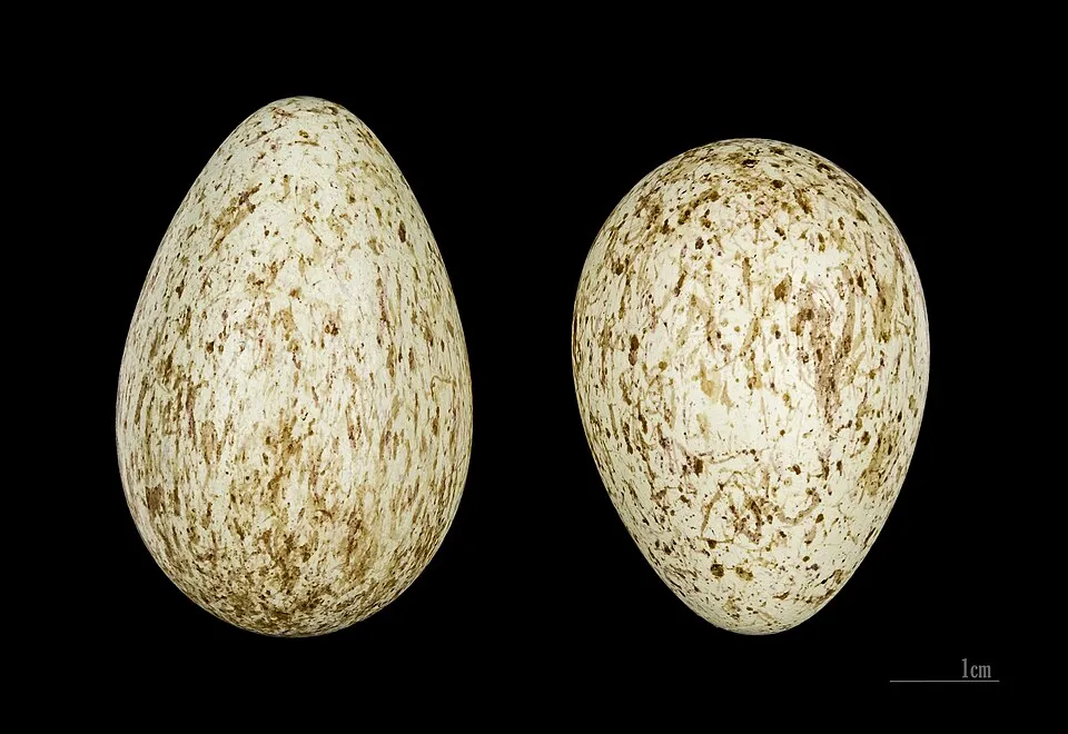
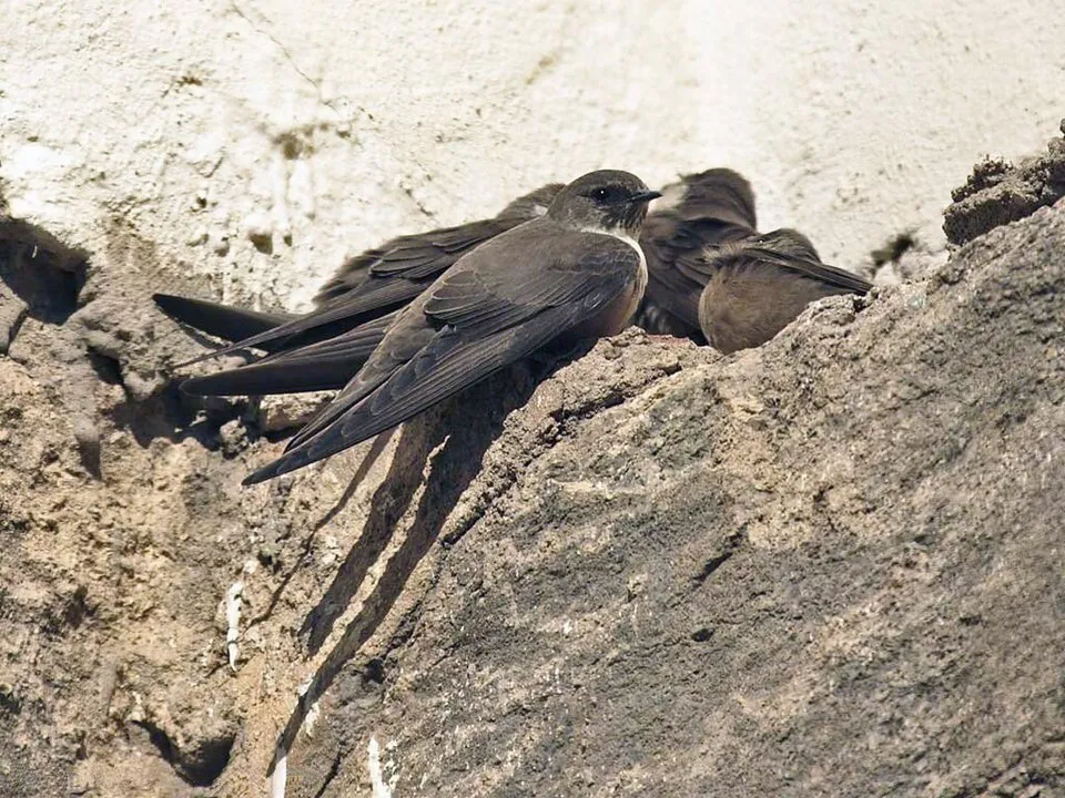

Bird
Hooded Crow
Corvus cornix153 records © Ricardo Tulio Gandelman from Rio de Janeiro, Brazil · CC BY 2.0

Observed species
Occurrences documented via GBIF; they are neither an exhaustive inventory nor proof of current presence.
- Griffon Vulture · Gyps fulvus · 250
- Eurasian Chaffinch · Fringilla coelebs · 184
- Northern Raven · Corvus corax · 169
- Eurasian Crag Martin · Ptyonoprogne rupestris · 162
- Hooded Crow · Corvus cornix · 153
- Great tit · Parus major · 147
- Eurasian blue tit · Cyanistes caeruleus · 144
- European Goldfinch · Carduelis carduelis · 132
- Eurasian Wren · Troglodytes troglodytes · 129
- Eurasian Jay · Garrulus glandarius · 121
- Common Blackbird · Turdus merula · 112
- Sardinian Warbler · Curruca melanocephala · 99
+18 more species
- Common Buzzard · Buteo buteo · 96
- Blue Rock Thrush · Monticola solitarius · 95
- European Greenfinch · Chloris chloris · 90
- Italian Sparrow · Passer italiae · 90
- European Stonechat · Saxicola rubicola · 89
- Red-billed Chough · Pyrrhocorax pyrrhocorax · 85
- Northern Wheatear · Oenanthe oenanthe · 85
- Rock Dove · Columba livia · 84
- Western Black-eared Wheatear · Oenanthe hispanica · 83
- Eurasian Collared Dove · Streptopelia decaocto · 82
- Common Linnet · Linaria cannabina · 71
- Woodlark · Lullula arborea · 68
- Common Wood Pigeon · Columba palumbus · 62
- Barn Swallow · Hirundo rustica · 61
- Yellow-legged Gull · Larus michahellis · 57
- Alpine Swift · Tachymarptis melba · 56
- Cirl Bunting · Emberiza cirlus · 53
- Common Kestrel · Falco tinnunculus · 53
Records: GBIF.org (CC-BY). Names: Wikidata (CC0), GBIF. Photos: Wikimedia Commons.
Conservation challenges
The primary purpose of the site is to preserve its natural habitats and the biodiversity they support. The species recorded (Biodiversity tab) reflect its ecological value. The designations it holds frame its management and the control of land use.
According to Global Forest Change data (University of Maryland, Global Forest Watch), about 39 ha of tree cover were lost within the boundary between 2001 and 2023 (under 1% of its area), peaking in 2005 and 2012. These losses include logging, storms and fires, and do not account for regrowth. According to CORINE Land Cover, land cover here remained almost unchanged between 1990 and 2018 (less than 0.5% of the area affected). Since 2016, the European EFFIS system (Copernicus) has mapped one fire here, in November 2023 (near Τοπική Κοινότητα Λάκκων), which burned about 43 ha of the site. At night, 8% of the area gives off artificial light detectable from space (NASA VIIRS Black Marble composite, 2016). According to the Natura 2000 forms, of 19 assessed habitats of European interest, 12 are in excellent condition and the rest in good condition. According to the Water Framework Directive assessment (2022 river basin management plans, data 2016–2021), both rivers assessed within the site have good ecological status. Other assessed water bodies: coastal waters, 1 of 1 in good ecological status or better.
Pressure indicators
Tree cover lost
39 ha
2001–2023
20012023
Fires since 2016
43 ha
burned within the boundary (1 mapped fire)
- 2023 · Τοπική Κοινότητα Λάκκων · 43 ha
Light at night
8%
of the area gives off artificial light visible from space
DarkLit
Land cover change
< 0.5%
of the area changed, 1990–2018 · CORINE
Rivers and lakes
100%
of the 16 km of assessed rivers in good or high ecological status · WFD 2022
Coastal waters: 1 of 1 good or better
assessments 2016–2021
Invasive alien species
1
recorded since 2000
Sources: Global Forest Change (Hansen et al., University of Maryland, via Global Forest Watch, CC-BY 4.0); EFFIS, European Commission / Copernicus; NASA Black Marble 2016 (public domain); CORINE Land Cover 2018 (Copernicus) or MODIS.
CORINE Land Cover Change 1990–2018: generated using European Union's Copernicus Land Monitoring Service information (EEA), aggregated by Parkavela; DOI 10.2909/f30f1000-7cf8-43bb-872c-5eb093911b24.
Ecological status of water bodies: European Environment Agency, WISE – Water Framework Directive, 3rd river basin management plans (2022), CC BY 4.0. Official national classification, not comparable between countries.
Invasive alien species: Global Register of Introduced and Invasive Species (ISSG, CC BY 4.0); Union list, Regulation (EU) 1143/2014 (INBO, CC0); GBIF.org records (CC0 / CC BY 4.0), at least 2 per species.
Practical information
Cities and airport
- Chania
19 km as the crow flies - Heraklion
92 km as the crow flies - Airport: Chania (CHQ)
23 km as the crow flies
Parking
7 public car parks listed within the site · 1 trailheads
End of Pachnes Track
Hiking
22 waymarked routes listed, including:
E 4
Data © OpenStreetMap contributors (ODbL) · Wikidata (CC0)
Waymarked hiking routes
E4 Chemin de randonnée Européen E4, Grèce, Crète
70.5 km within the site ↗ 826 m↘ 1,629 m 1,131–2,079 m
OK Omalos-Kallergi via Koukoule
1.4 km within the site ↗ 34 m↘ 38 m 1,575–1,614 m
Ag. Ioannis - Kakos Poros
1.2 km within the site ↗ 203 m↘ 0 m 570–776 m
up to T2 · mountain hiking
Agios Ioannis-Kormokopos Cave
3.1 km within the site ↗ 59 m↘ 302 m 760–1,038 m
up to T2 · mountain hiking
Agios Ioannis-Koules
1.1 km within the site ↗ 216 m↘ 0 m 844–1,067 m
up to T2 · mountain hiking
Tracks © OpenStreetMap contributors (ODbL), clipped to the boundary; elevation gain and profiles computed on the longest section from Mapzen Terrain Tiles (≈ 30 m), indicative only. Indicative difficulty (SAC scale, OpenStreetMap, via Waymarked Trails): check with the park.
Access and visiting
Nearest towns of over 50,000 people, as the crow flies: Chania (19 km) and Heraklion (92 km). Nearest airport: Chania (CHQ), about 23 km away. About 130,000 people live within 20 km of the site boundary, 5,700 of them within 10 km; some 150 people are estimated to live inside (GHSL estimate, 2020). This population has grown by about 7% since 2000. Public car parks listed within the site: 7, including End of Pachnes Track. Waymarked hiking routes listed in OpenStreetMap: 22, including E 4. To see: cave Sternes. To plan a visit (access, opening periods, visitor rules), it is best to consult the official information from the managing body and the official website listed in this page's sources.
Source: OpenStreetMap (ODbL), Wikidata (CC0), October 2026.
Built heritage
According to Wikidata, 3 monuments protected as Greek cultural heritage stand within the boundary. Examples include “Church of Michail Archangelou Aradenas” in Sfakia, “Fortress of Agia Roumeli” in Sfakia and “Tarra” in Sfakia.
1 religious building1 castle or fortification
-
Church of Michail Archangelou Aradenas
Sfakia -
Fortress of Agia Roumeli
Sfakia · 19th c. -
Tarra
Sfakia
Source: Wikidata (CC0), monuments in each country’s official heritage protection registers, at national or regional level. Each item links to its Wikidata entry.
When to visit
Best time to visit: from April to June, with average temperatures of 15 to 24 °C and moderate rainfall. Precipitation peaks from December to February (up to 130 mm per month). These averages apply to the site's representative point (456 m); higher up it is markedly cooler and snow lasts longer. Day length ranges from about 9 h 47 min in December to 14 h 31 min in June. Wildlife records published on GBIF peak for birds (April and May), plants (April and May) and butterflies and moths (May and June). These peaks also reflect when observers are most active.
Source: Copernicus ERA5-Land (C3S), monthly averages 1996–2025 at the representative point, temperatures adjusted for elevation.
Contains modified Copernicus Climate Change Service information 2026. Neither the European Commission nor ECMWF is responsible for any use that may be made of the Copernicus information or data it contains.
Wildlife records calendar
JFMAMJJASOND
Birds
Plants
Butterflies & moths
Monthly records published on GBIF (CC-BY), relative to the busiest month; also reflects observer activity.
Gallery
© Lapplaender · CC BY-SA 3.0
© Lapplaender · CC BY-SA 3.0
© Luu · Public domain
© Dkoukoul · CC BY-SA 3.0
© Jimzoun · CC BY-SA 4.0
© Alefbetac · CC BY-SA 2.5
Sources and licences
- Wikidata: Q112032100
- OpenStreetMap: relation 6522689
- Official website: https://www.samaria.gr
- Wikipedia: es.wikipedia.org/wiki/Parque_nacional_de_Samaria
- WDPA: 3026
References
- cds.climate.copernicus.eu: climate · CC-BY-4.0
- registry.opendata.aws: elevation of the reference point, detailed relief · PD
- land.copernicus.eu: land cover, land cover change, sea share · COPERNICUS
- doi.org: population around the site · CC-BY-4.0
- openstreetmap.org: official name, access and peaks · ODbL-1.0
- wikidata.org: establishment date, protected heritage, nearby cities and airport, access and peaks, lake depths, places to see, official website · CC0-1.0
- eea.europa.eu: bathing water quality, ecological status of waters · CC-BY-4.0
- en.eurovelo.com: EuroVelo cycle routes · ODbL-1.0
- cycling.waymarkedtrails.org: cycle routes · ODbL-1.0
- opentopodata.org: elevations · PD
- forest-fire.emergency.copernicus.eu: wildfires · COPERNICUS
- globalforestwatch.org: tree cover loss · CC-BY-4.0
- gbif.org: seasonality of sightings, invasive alien species, observed species · CC-BY-4.0
- europe-geology.eu: geology · CC-BY-4.0
- hydrosheds.org: lakes · CC-BY-4.0
- natura2000.eea.europa.eu: Natura 2000 habitats and species · CC-BY-4.0
- earthobservatory.nasa.gov: night light · PD
- hiking.waymarkedtrails.org: route difficulty · ODbL-1.0
- nsidc.org: snow cover · PD
- wikidata.org: Wikipedia article · CC-BY-SA-4.0
Data © OpenStreetMap contributors (ODbL), Wikidata (CC0) and the sources cited.