Sweden · Terrestrial
Sarek National Park
National park of 198,466 hectares in Sweden, established in 1909.
Overview
National park of 198,466 hectares in Sweden, established in 1909.
Sarek National Park is located in Sweden (Europe). It is a predominantly terrestrial area. Established on 21 June 1909, it covers about 198,466 hectares. The site is managed by Norrbotten County Administrative Board.
Protections and designations
UNESCO World Heritage
Natura 2000 · habitats (SAC)
- Sarek SE0820185
Protected as a national park. International labels and designations: UNESCO World Heritage (“Laponian National Park”) and Natura 2000 network (1 site: “Sarek”). Key dates: established in 1909, World Heritage listing in 1996 and first Natura 2000 site under the Habitats Directive in 2009.
In our collections
Timeline
-
1909
Established
-
1996
Inscribed as a UNESCO World Heritage Site Laponian National Park
-
2009
First Natura 2000 site under the Habitats Directive
Sources: Wikidata (CC0) for establishment and international labels; EEA Natura 2000 database (CC-BY 4.0) for site designation dates.
Frequently asked questions
Where is Sarek National Park?
In Sweden (Europe). Representative point: 67.2883° N, 17.6691° E.
How large is Sarek National Park?
About 198,466 hectares (1,985 km²). It is the 2nd largest of the 31 national parks in Sweden covered by Parkavela.
When was Sarek National Park established?
On 21 June 1909.
What habitats and landscapes does Sarek National Park include?
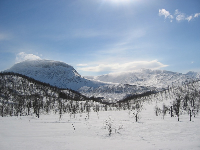
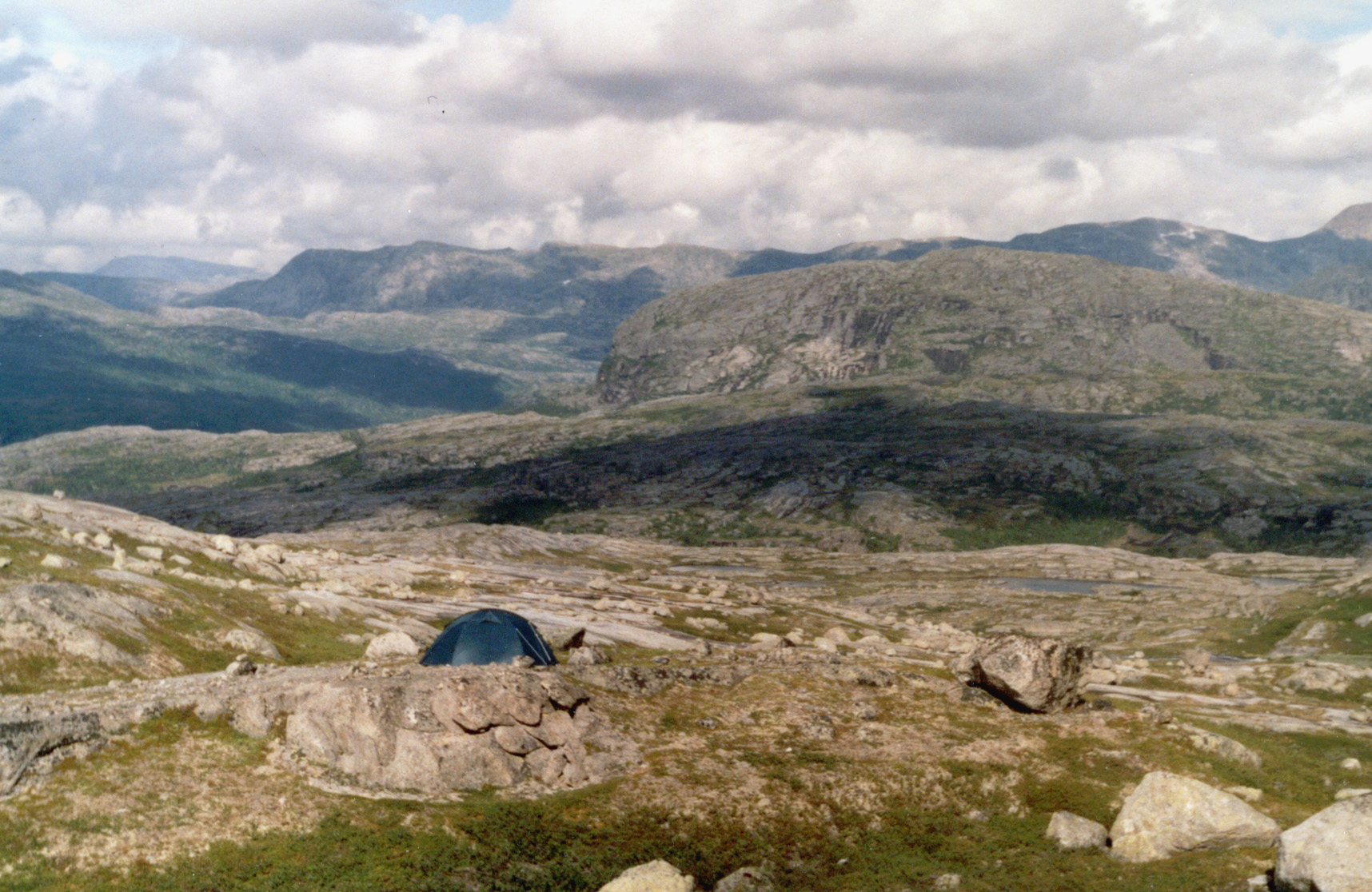
A terrestrial area, with mountains.
What rocks lie beneath Sarek National Park?
According to the European 1:1 million geological map (EGDI), the bedrock consists mainly of granites (46% of sampled points) and amphibolites (31%). These are mostly igneous rocks. The geological units date mainly from the Precambrian (100% of sampled points).
What is the highest point of Sarek National Park?
Sarektjåhkkå, at 2,089 m (OpenStreetMap).
What are the main summits of Sarek National Park?
Sarektjåhkkå (2,089 m), Nordtoppen (2,060 m), Sydtoppen (2,023 m), Buchttoppen (2,010 m) and Bårddetjåhkkå (2,005 m) (OpenStreetMap).
Which international labels apply to Sarek National Park?
UNESCO World Heritage (“Laponian National Park”) and Natura 2000 network (1 site: “Sarek”).
When is the best time to visit Sarek National Park?
Mildest period: July and August, with average temperatures of 6 to 9 °C.
Is there snow in Sarek National Park?
Yes. According to NASA's MODIS satellites (2015–2025 average), snow covers most of the site from October to June, with about 265 snow-covered days a year on average. Permanent snow remains on the summits even in midsummer. In midwinter, too dark for satellite measurements, snow cover is estimated from the neighbouring months.
What is there to see in Sarek National Park?
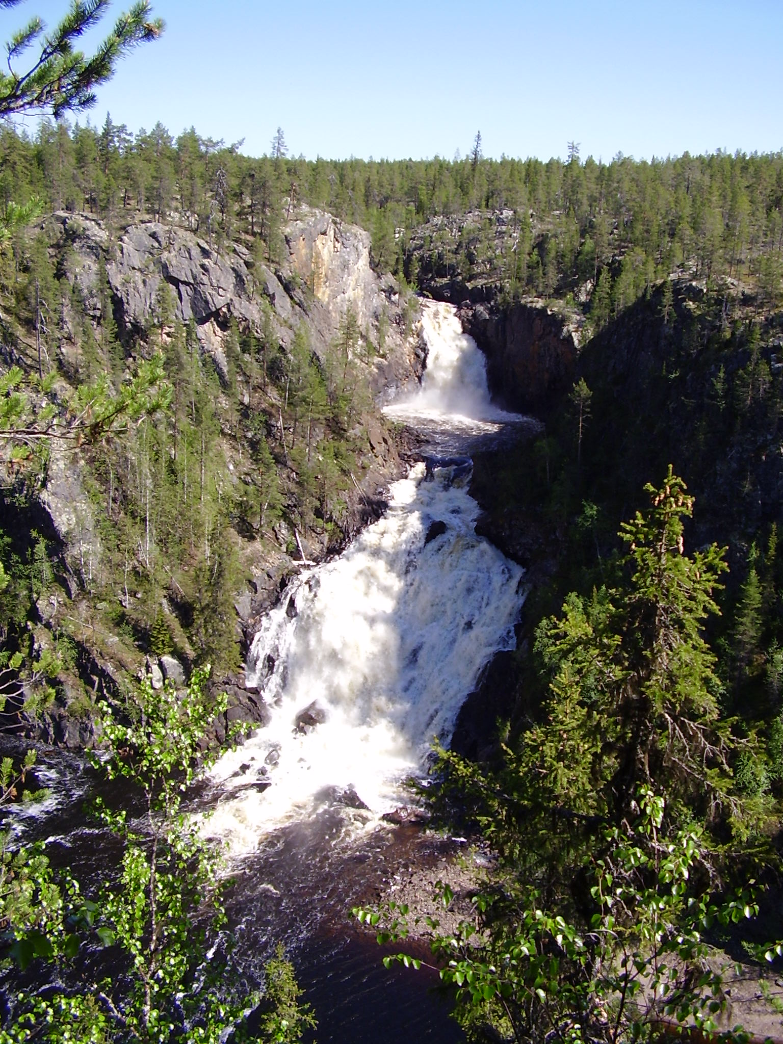
52 lakes and ponds and 59 glaciers, including Vássjájávrátja (851 m), Várdasjiegŋa, Vuojnesluobbala (792 m) and Oarjep Ruohtesjiegŋa (Wikidata).
Where can I stay in Sarek National Park?
Mountain hut Mikkastugan (Wikidata).
Are there historic monuments in Sarek National Park?
Yes. According to Wikidata, one monument protected under the Swedish Historic Environment Act (byggnadsminne, kyrkligt kulturminne) stands within the boundary. For example: “Alkavare kapell”.
What is the nearest airport to Sarek National Park?
Nearest airport: Kiruna (KRN), about 105 km away.
Are there waymarked hiking trails in Sarek National Park?
Yes. Waymarked hiking routes listed in OpenStreetMap: 4, including Padjelantaleden and Kungsleden Etapp. The “Kungsleden Etapp 16: Aktse - Pårte” route runs for about 17 km through the site, with some 490 m of ascent on its longest section.
Which species can be seen in Sarek National Park?
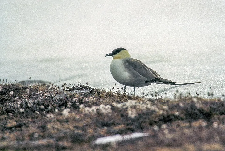
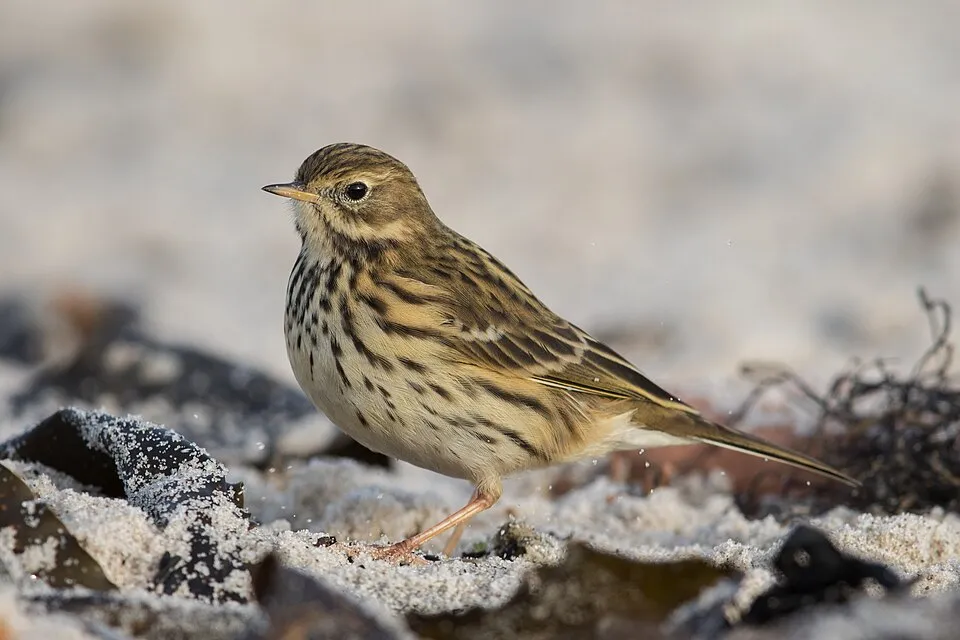
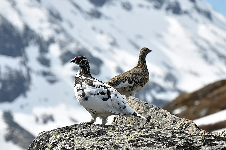
Among the species most often recorded on GBIF are Stercorarius longicaudus (Long-tailed Jaeger), Anthus pratensis (Meadow Pipit), Luscinia svecica (Bluethroat) and Lagopus lagopus (Willow Grouse).
Who manages Sarek National Park?
Norrbotten County Administrative Board.
© OpenStreetMap
Download the boundary: GeoJSON · GPX Boundary © OpenStreetMap contributors (ODbL).
Geography
The representative point of the site lies at around 1,283 m above sea level. Over the 1996–2025 period, the mean annual temperature is about -4.6 °C and total precipitation reaches roughly 1,083 mm per year. The warmest month is usually July, the coolest February, and the wettest July. According to the European 1:1 million geological map (EGDI), the bedrock consists mainly of granites (46% of sampled points) and amphibolites (31%). These are mostly igneous rocks. The geological units date mainly from the Precambrian (100% of sampled points). The site contains 54 lakes larger than 10 ha as well as part of another lake (Låptåvákkjávrre), totalling 35.9 km² of water; the largest, Álggajávrre, covers 3.1 km² (HydroLAKES). Boarekjávrre (21 ha) is 6.7 m deep (Wikidata).
Area
- Area
- 198,466 ha
- Elevation
- 1,283 m
- Median elevation
- 1,053 m
- Mean slope
- 13°
- Snow cover
- ≈ 265 days a year
- Lakes over 10 ha
- 54 (35.9 km²)
- Coordinates
- 67.2883, 17.6691
Terrain: Mapzen Terrain Tiles (SRTM, USGS) · Lakes: HydroLAKES (Messager et al. 2016, hydrosheds.org, CC BY 4.0) · depths: Wikidata (CC0)
Elevation bands
- below 500 m 1%
- 500–1,000 m 43%
- 1,000–1,500 m 45%
- 1,500–2,000 m 11%
share of the site in each elevation band (smoothed terrain model: summits are rounded off) · Terrain: Mapzen Terrain Tiles (SRTM, USGS)
Bedrock
- Granites 46 %
- Amphibolites 31 %
- Plutonic rocks 8 %
- Sandstones 8 %
- Rhyolites 8 %
Igneous rocks 62 % · Metamorphic rocks 31 % · Sedimentary rocks 8 % · Main age: Precambrian (100%)
Source: EGDI 1:1M geological map (EuroGeoSurveys and national geological surveys), CC BY 4.0 · 13 sampled points within the site.
Main summits
- Sarektjåhkkå2,089 m
- Nordtoppen2,060 m
- Sydtoppen2,023 m
- Buchttoppen2,010 m
- Bårddetjåhkkå2,005 m
- Spijkka1,976 m
- Áhkátjåhkkå1,974 m
- Vuojnestjåhkkå1,968 m
- Kanalberget1,946 m
- Såltatjåhkka1,928 m
Data © OpenStreetMap contributors (ODbL)
Climate
● Mean temperature (°C) · ▮ Precipitation (mm)
Source: Copernicus ERA5-Land (C3S, doi:10.24381/cds.68d2bb30), monthly averages 1996–2025 interpolated to the representative point, temperatures adjusted for elevation.
Contains modified Copernicus Climate Change Service information 2026. Neither the European Commission nor ECMWF is responsible for any use that may be made of the Copernicus information or data it contains.
Snow cover measured by satellite
J
F
M
A
M
J
J
A
S
O
N
D
average share of the site under snow · snowiest parts · ≈ 265 days a year
Snow cover: MODIS/Terra MOD10CM v61 (Hall & Riggs, 2021, NASA NSIDC DAAC, doi:10.5067/MODIS/MOD10CM.061), imagery from NASA GIBS (ESDIS); 2015–2025 average, grid of about 5 km.
Natural habitats
According to CORINE Land Cover (2018), the site is mainly made up of sparsely vegetated land (31%), bare rock and scree (25%) and heath and scrub (24%). Elevation ranges from about 460 m to 2,089 m (highest point: Sarektjåhkkå). Median elevation is 1,053 m, and 11% of the site lies above 1,500 m (SRTM elevation model). The Natura 2000 site overlapping the area lists 23 habitats of European interest (4 priority), the most extensive being Alpine and Boreal heaths, siliceous alpine and boreal grasslands and Nordic subalpine/subarctic forests with Betula pubescens ssp. czerepanovii.
Biodiversity
Based on occurrences aggregated by GBIF, several species are regularly recorded within the site. Among the most frequent are Stercorarius longicaudus (Long-tailed Jaeger), Anthus pratensis (Meadow Pipit), Luscinia svecica (Bluethroat) and Lagopus lagopus (Willow Grouse). The full list of documented taxa is shown below. The overlapping Natura 2000 site lists 10 species of European interest: 4 mammals, 3 invertebrates and 3 plants.
Habitats of European interest
From the official form of the Natura 2000 site overlapping the area (areas reported for the whole site).
- Alpine and Boreal heaths 85,395 ha
- Siliceous alpine and boreal grasslands 29,789 ha
- Nordic subalpine/subarctic forests with Betula pubescens ssp. czerepanovii 17,873 ha
- Permanent glaciers 13,902 ha
- Sub-Arctic Salix spp. Scrub 11,916 ha
- Siliceous scree of the montane to snow levels (Androsacetalia alpinae and Galeopsietalia ladani) 7,944 ha
- Siliceous rocky slopes with chasmophytic vegetation 5,958 ha
- Hydrophilous tall herb fringe communities of plains and of the montane to alpine levels 1,986 ha
and 15 more
Species of European interest
Mammals · 4
Arctic fox (Alopex lagopus), Wolverine (Gulo gulo), Eurasian otter (Lutra lutra), Eurasian Lynx (Lynx lynx)
Invertebrates · 3
Agriades glandon aquilo, Geyer's whorl snail (Vertigo geyeri), Xestia borealis
Plants · 3
Cynodontium suecicum, Orthothecium lapponicum, Rooted poppy (Papaver radicatum subsp. radicatum)
Source: Natura 2000 standard data forms (EEA, CC-BY 4.0). Not exhaustive: sensitive species are not published.
Species to look out for


Bird
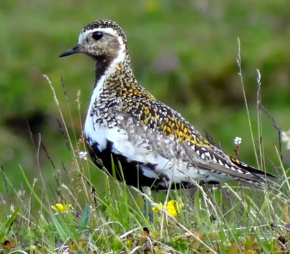
European Golden Plover
Pluvialis apricaria424 records © Bjørn Christian Tørrissen · CC BY-SA 3.0
Observed species
Occurrences documented via GBIF; they are neither an exhaustive inventory nor proof of current presence.
- Long-tailed Jaeger · Stercorarius longicaudus · 535
- Meadow Pipit · Anthus pratensis · 501
- Bluethroat · Luscinia svecica · 452
- Willow Grouse · Lagopus lagopus · 431
- Rock Ptarmigan · Lagopus muta · 429
- European Golden Plover · Pluvialis apricaria · 424
- Northern Wheatear · Oenanthe oenanthe · 374
- Snow Bunting · Plectrophenax nivalis · 331
- Redpoll · Acanthis flammea · 320
- Common Gull · Larus canus · 316
- Lapland Longspur · Calcarius lapponicus · 314
- Northern Raven · Corvus corax · 304
+18 more species
- Common Redshank · Tringa totanus · 261
- Willow Warbler · Phylloscopus trochilus · 254
- Ring Ouzel · Turdus torquatus · 253
- Long-tailed Duck · Clangula hyemalis · 232
- Serpent-grass · Bistorta vivipara · 222
- Common Ringed Plover · Charadrius hiaticula · 217
- Rough-legged Buzzard · Buteo lagopus · 212
- Temminck's Stint · Calidris temminckii · 199
- Eurasian Dotterel · Charadrius morinellus · 195
- Brambling · Fringilla montifringilla · 195
- Common Kestrel · Falco tinnunculus · 187
- Common Sandpiper · Actitis hypoleucos · 183
- Western Yellow Wagtail · Motacilla flava · 178
- Golden Eagle · Aquila chrysaetos · 159
- Redwing · Turdus iliacus · 157
- White-tailed Eagle · Haliaeetus albicilla · 154
- Reed Bunting · Emberiza schoeniclus · 154
- Red-necked Phalarope · Phalaropus lobatus · 147
Records: GBIF.org (CC-BY). Names: Wikidata (CC0), GBIF. Photos: Wikimedia Commons.
Conservation challenges
The primary purpose of the site is to preserve its natural habitats and the biodiversity they support. The species recorded (Biodiversity tab) reflect its ecological value. The designations it holds frame its management and the control of land use.
According to Global Forest Change data (University of Maryland, Global Forest Watch), about 30 ha of tree cover were lost within the boundary between 2001 and 2023, peaking in 2001 and 2008. These losses include logging, storms and fires, and do not account for regrowth. According to CORINE Land Cover, land cover here remained almost unchanged between 2000 and 2018 (less than 0.5% of the area affected). At night, the area gives off virtually no artificial light detectable from space (NASA VIIRS Black Marble composite, 2016). According to the Natura 2000 forms, of 22 assessed habitats of European interest, 13 are in excellent condition and the rest in good condition. According to the Water Framework Directive assessment (2022 river basin management plans, data 2013–2018), 99% of the 236 km of rivers assessed within the site are in good or high ecological status. Other assessed water bodies: lakes, 21 of 22 in good ecological status or better.
Pressure indicators
Tree cover lost
30 ha
2001–2023 · < 1% of the area
20012023
Fires since 2016
0
No large fire mapped (fires over about 30 ha)
Light at night
0%
of the area gives off artificial light visible from space
DarkLit
Land cover change
< 0.5%
of the area changed, 2000–2018 · CORINE
Rivers and lakes
99%
of the 236 km of assessed rivers in good or high ecological status · WFD 2022
Lakes: 21 of 22 good or better
assessments 2013–2018
Sources: Global Forest Change (Hansen et al., University of Maryland, via Global Forest Watch, CC-BY 4.0); EFFIS, European Commission / Copernicus; NASA Black Marble 2016 (public domain); CORINE Land Cover 2018 (Copernicus) or MODIS.
CORINE Land Cover Change 2000–2018: generated using European Union's Copernicus Land Monitoring Service information (EEA), aggregated by Parkavela; DOI 10.2909/f30f1000-7cf8-43bb-872c-5eb093911b24.
Ecological status of water bodies: European Environment Agency, WISE – Water Framework Directive, 3rd river basin management plans (2022), CC BY 4.0. Official national classification, not comparable between countries.
Practical information
Cities and airport
- Airport: Kiruna (KRN)
105 km as the crow flies
Things to see
52 lakes and ponds · 59 glaciers
- Vássjájávrátja
lake or pond · 851 m - Várdasjiegŋa
glacier - Vuojnesluobbala
lake or pond · 792 m - Oarjep Ruohtesjiegŋa
glacier - Oarjep Tjievrajávrre
lake or pond · 879 m
Hiking
4 waymarked routes listed, including:
PadjelantaledenKungsleden Etapp
Data © OpenStreetMap contributors (ODbL) · Wikidata (CC0)
Waymarked hiking routes
Tracks © OpenStreetMap contributors (ODbL), clipped to the boundary; elevation gain and profiles computed on the longest section from Mapzen Terrain Tiles (≈ 30 m), indicative only. Indicative difficulty (SAC scale, OpenStreetMap, via Waymarked Trails): check with the park.
Access and visiting
Nearest airport: Kiruna (KRN), about 105 km away. Fewer than 5,000 people live within 20 km of the site boundary, a very sparsely populated area; the site itself is virtually uninhabited (GHSL estimate, 2020). Waymarked hiking routes listed in OpenStreetMap: 4, including Padjelantaleden and Kungsleden Etapp. To see: 52 lakes and ponds and 59 glaciers, including Vássjájávrátja (851 m), Várdasjiegŋa, Vuojnesluobbala (792 m) and Oarjep Ruohtesjiegŋa. Where to stay: mountain hut Mikkastugan. To plan a visit (access, opening periods, visitor rules), it is best to consult the official information from the managing body (Norrbotten County Administrative Board) and the official website listed in this page's sources.
Source: OpenStreetMap (ODbL), Wikidata (CC0), October 2026.
Built heritage
According to Wikidata, one monument protected under the Swedish Historic Environment Act (byggnadsminne, kyrkligt kulturminne) stands within the boundary. It is “Alkavare kapell”.
-
Alkavare kapell
18th c.
Source: Wikidata (CC0), monuments in each country’s official heritage protection registers, at national or regional level. Each item links to its Wikidata entry.
When to visit
Mildest period: July and August, with average temperatures of 6 to 9 °C. Average temperatures drop below 0 °C from October to May: frost is common. Precipitation peaks in July (up to 140 mm per month). These averages apply to the site's representative point (1,283 m); higher up it is markedly cooler and snow lasts longer. According to NASA's MODIS satellites (2015–2025 average), snow covers most of the site from October to June, with about 265 snow-covered days a year on average. Permanent snow remains on the summits even in midsummer. In midwinter, too dark for satellite measurements, snow cover is estimated from the neighbouring months. Day length ranges from about 1 h 07 min in December to 24 h 00 min in June. Wildlife records published on GBIF peak for birds (July), plants (July), butterflies and moths (July) and mammals (July). These peaks also reflect when observers are most active.
Source: Copernicus ERA5-Land (C3S), monthly averages 1996–2025 at the representative point, temperatures adjusted for elevation.
Contains modified Copernicus Climate Change Service information 2026. Neither the European Commission nor ECMWF is responsible for any use that may be made of the Copernicus information or data it contains.
Wildlife records calendar
JFMAMJJASOND
Birds
Plants
Butterflies & moths
Mammals
Monthly records published on GBIF (CC-BY), relative to the busiest month; also reflects observer activity.
Gallery
© Svjo · Public domain
© SiriusA · Public domain
© Ökologix · CC BY-SA 3.0
© Trougnouf (Benoit Brummer) · CC BY 4.0
© Trougnouf (Benoit Brummer) · CC BY 4.0
© SiriusA · Public domain
Sources and licences
- Wikidata: Q945780
- OpenStreetMap: relation 62327
- Wikipedia: en.wikipedia.org/wiki/Sarek_National_Park
- WDPA: 906
References
- cds.climate.copernicus.eu: climate · CC-BY-4.0
- registry.opendata.aws: elevation of the reference point · PD
- land.copernicus.eu: land cover, land cover change, sea share · COPERNICUS
- doi.org: population around the site · CC-BY-4.0
- wikidata.org: official area, establishment date, protected heritage, managing body, nearby cities and airport, access and peaks, lake depths, places to see · CC0-1.0
- eea.europa.eu: bathing water quality, ecological status of waters · CC-BY-4.0
- en.eurovelo.com: EuroVelo cycle routes · ODbL-1.0
- cycling.waymarkedtrails.org: cycle routes · ODbL-1.0
- opentopodata.org: elevations · CC-BY-4.0
- forest-fire.emergency.copernicus.eu: wildfires · COPERNICUS
- globalforestwatch.org: tree cover loss · CC-BY-4.0
- gbif.org: seasonality of sightings, invasive alien species, observed species · CC-BY-4.0
- europe-geology.eu: geology · CC-BY-4.0
- hydrosheds.org: lakes · CC-BY-4.0
- natura2000.eea.europa.eu: Natura 2000 habitats and species · CC-BY-4.0
- openstreetmap.org: official name, access and peaks, trail difficulty · ODbL-1.0
- earthobservatory.nasa.gov: night light · PD
- registry.opendata.aws: detailed relief · CC-BY-4.0
- hiking.waymarkedtrails.org: route difficulty · ODbL-1.0
- nsidc.org: snow cover · PD
- wikidata.org: Wikipedia article · CC-BY-SA-4.0
Data © OpenStreetMap contributors (ODbL), Wikidata (CC0) and the sources cited.