Spain · Terrestrial
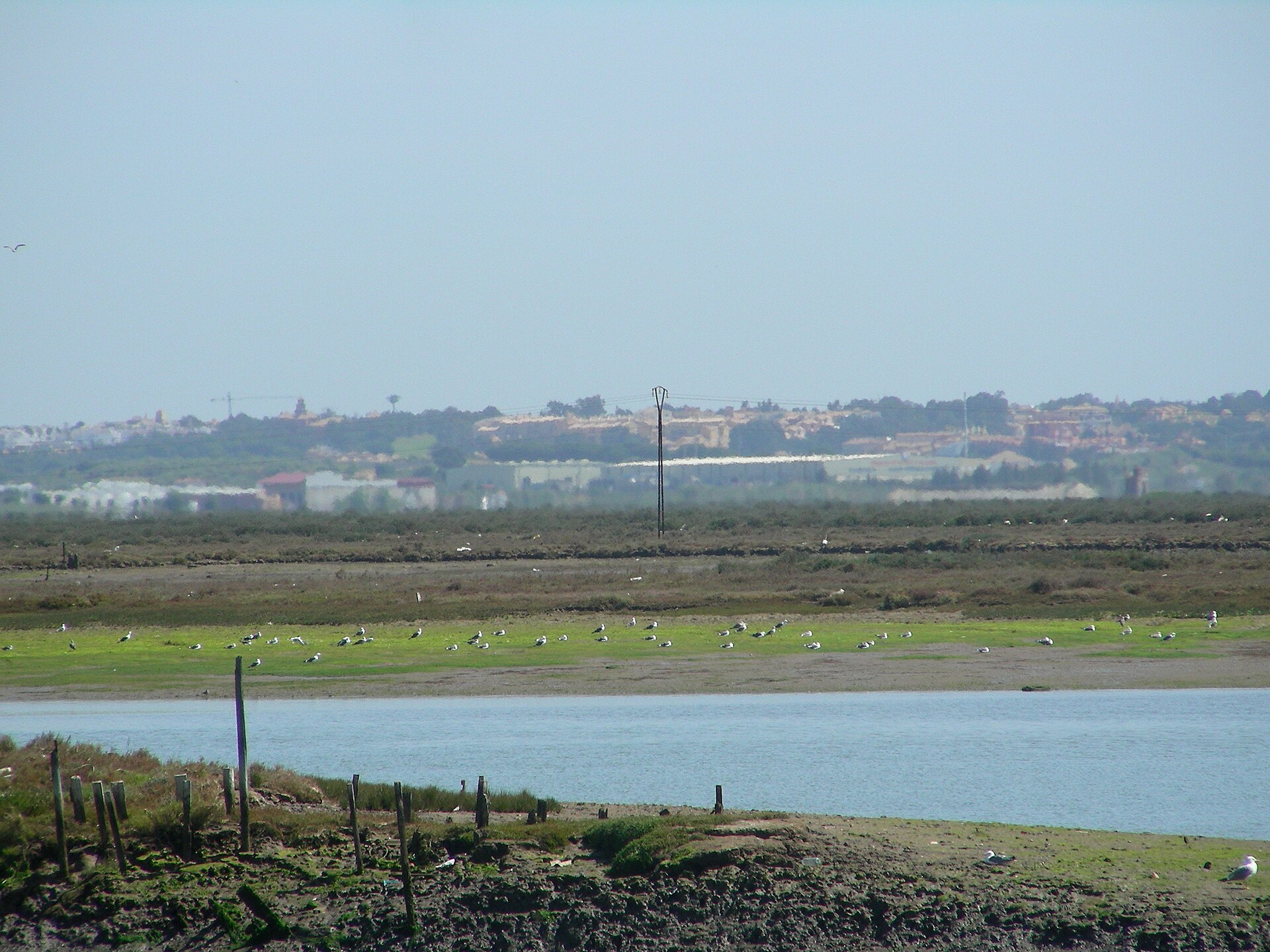
Marismas de Isla Cristina
Nature park of 2,498 hectares in Spain, established in 1992.
Overview
Nature park of 2,498 hectares in Spain, established in 1992.
Marismas de Isla Cristina is a nature park in Spain (Europe). It is a predominantly terrestrial area. Established in 1992, it covers about 2,498 hectares.
Protections and designations
Natura 2000 · habitats (SAC)
- Marismas de Isla Cristina ES6150005
Natura 2000 · birds (SPA)
- Marismas de Isla Cristina ES6150005
Protected as a nature park. International labels and designations: Natura 2000 network (1 site: “Marismas de Isla Cristina”). Key dates: established in 1992 and first Natura 2000 site under the Birds Directive in 2002.
In our collections
Timeline
-
1992
Established
-
2002
First Natura 2000 site under the Birds Directive
Sources: Wikidata (CC0) for establishment and international labels; EEA Natura 2000 database (CC-BY 4.0) for site designation dates.
Frequently asked questions
Where is Marismas de Isla Cristina?
In Spain (Europe). Representative point: 37.2071° N, 7.3433° W.
How large is Marismas de Isla Cristina?
About 2,498 hectares (25 km²). It is the 66th largest of the 73 nature parks in Spain covered by Parkavela.
When was Marismas de Isla Cristina established?
In 1992.
What habitats and landscapes does Marismas de Isla Cristina include?
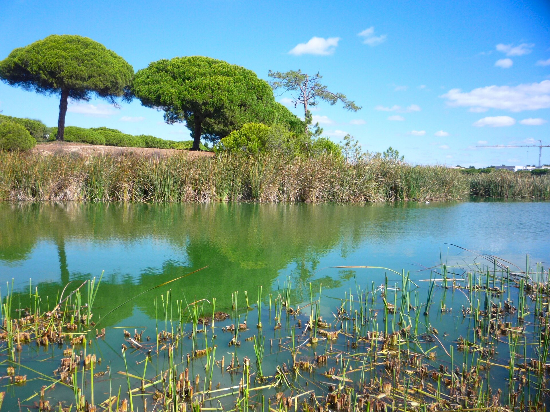
A terrestrial area, with wetlands and coasts.
What rocks lie beneath Marismas de Isla Cristina?
According to the European 1:1 million geological map (EGDI), the bedrock consists mainly of sands and gravels (88% of sampled points) and conglomerates and breccias (13%). These are mostly sedimentary rocks. The geological units date mainly from the Quaternary (88% of sampled points).
Which international labels apply to Marismas de Isla Cristina?
Natura 2000 network (1 site: “Marismas de Isla Cristina”).
When is the best time to visit Marismas de Isla Cristina?
Best time to visit: from April to June and from September to November, with average temperatures of 15 to 25 °C and moderate rainfall.
Can you swim in Marismas de Isla Cristina?
3 monitored bathing sites lie in or within 1 km of the site; official 2025 classification: 3 excellent (European Environment Agency). Swimming is only permitted at the sites and times authorised locally.
What is the nearest airport to Marismas de Isla Cristina?
Nearest airport: Faro (FAO), about 54 km away.
How can I reach Marismas de Isla Cristina by train?
The nearest railway station is Vila Real de Santo António, about 2 km from the site boundary.
Where can I get visitor information on site?
Oficina de Turismo.
Are there waymarked hiking trails in Marismas de Isla Cristina?
Yes. Waymarked hiking routes listed in OpenStreetMap: 3, including Vía Verde del Litoral and Camino de Valdecerros y Vera Abajo. The “Sendero Salinas del Duque” route runs for about 5 km through the site.
Which species can be seen in Marismas de Isla Cristina?
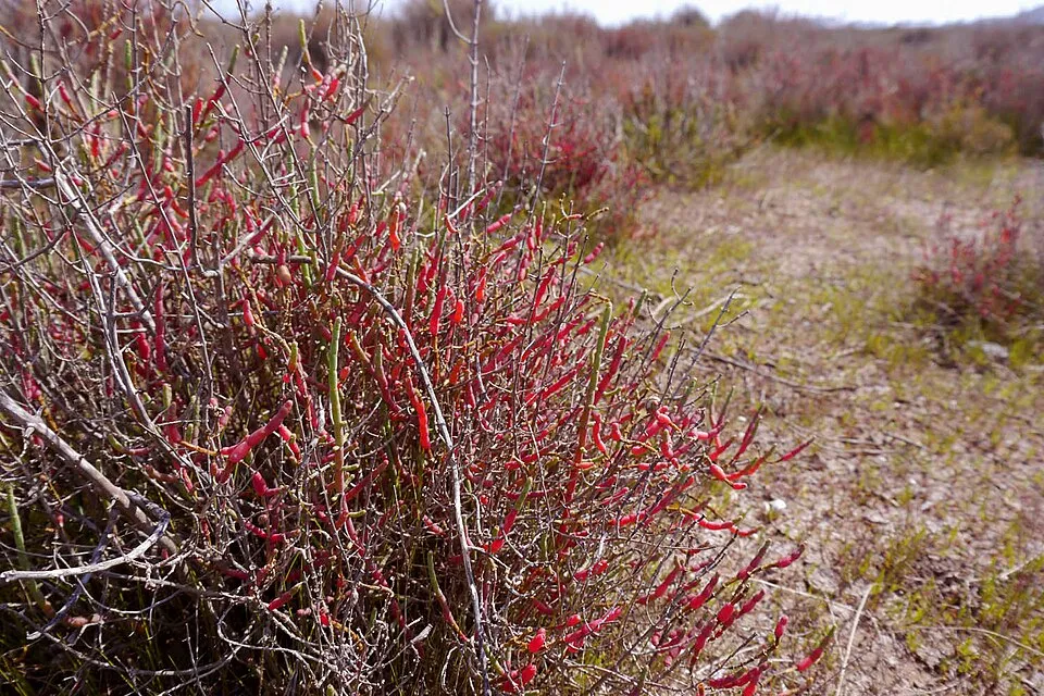
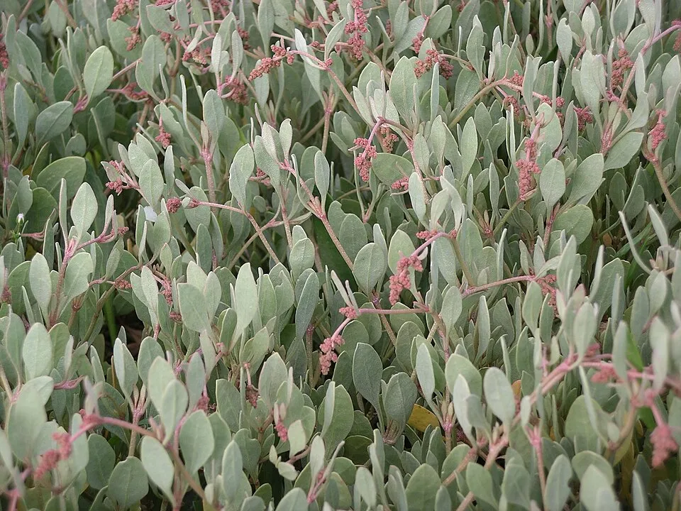
Among the species most often recorded on GBIF are Salicornia fruticosa (Shrubby Glasswort), Halimione portulacoides (Sea Purslane), Larus fuscus (Lesser Black-backed Gull) and Salicornia perennis (Perennial glasswort).
What is the official website of Marismas de Isla Cristina?
juntadeandalucia.es/medioambiente/servtc5/ventana/mostrarFicha.do?idEspacio=7392
© OpenStreetMap
Download the boundary: GeoJSON · GPX Boundary © OpenStreetMap contributors (ODbL).
Geography
The representative point of the site lies at around 2 m above sea level. Over the 1996–2025 period, the mean annual temperature is about 18.8 °C and total precipitation reaches roughly 406 mm per year. The warmest month is usually August, the coolest January, and the wettest December. According to the European 1:1 million geological map (EGDI), the bedrock consists mainly of sands and gravels (88% of sampled points) and conglomerates and breccias (13%). These are mostly sedimentary rocks. The geological units date mainly from the Quaternary (88% of sampled points).
Area
- Area
- 2,498 ha
- Elevation
- 2 m
- Coordinates
- 37.2071, -7.3433
Bedrock
- Sands and gravels 88 %
- Conglomerates and breccias 13 %
Sedimentary rocks 100 % · Main age: Quaternary (88%)
Source: EGDI 1:1M geological map (EuroGeoSurveys and national geological surveys), CC BY 4.0 · 16 sampled points within the site.
Climate
● Mean temperature (°C) · ▮ Precipitation (mm)
Source: Copernicus ERA5-Land (C3S, doi:10.24381/cds.68d2bb30), monthly averages 1996–2025 interpolated to the representative point, temperatures adjusted for elevation.
Contains modified Copernicus Climate Change Service information 2026. Neither the European Commission nor ECMWF is responsible for any use that may be made of the Copernicus information or data it contains.
Natural habitats
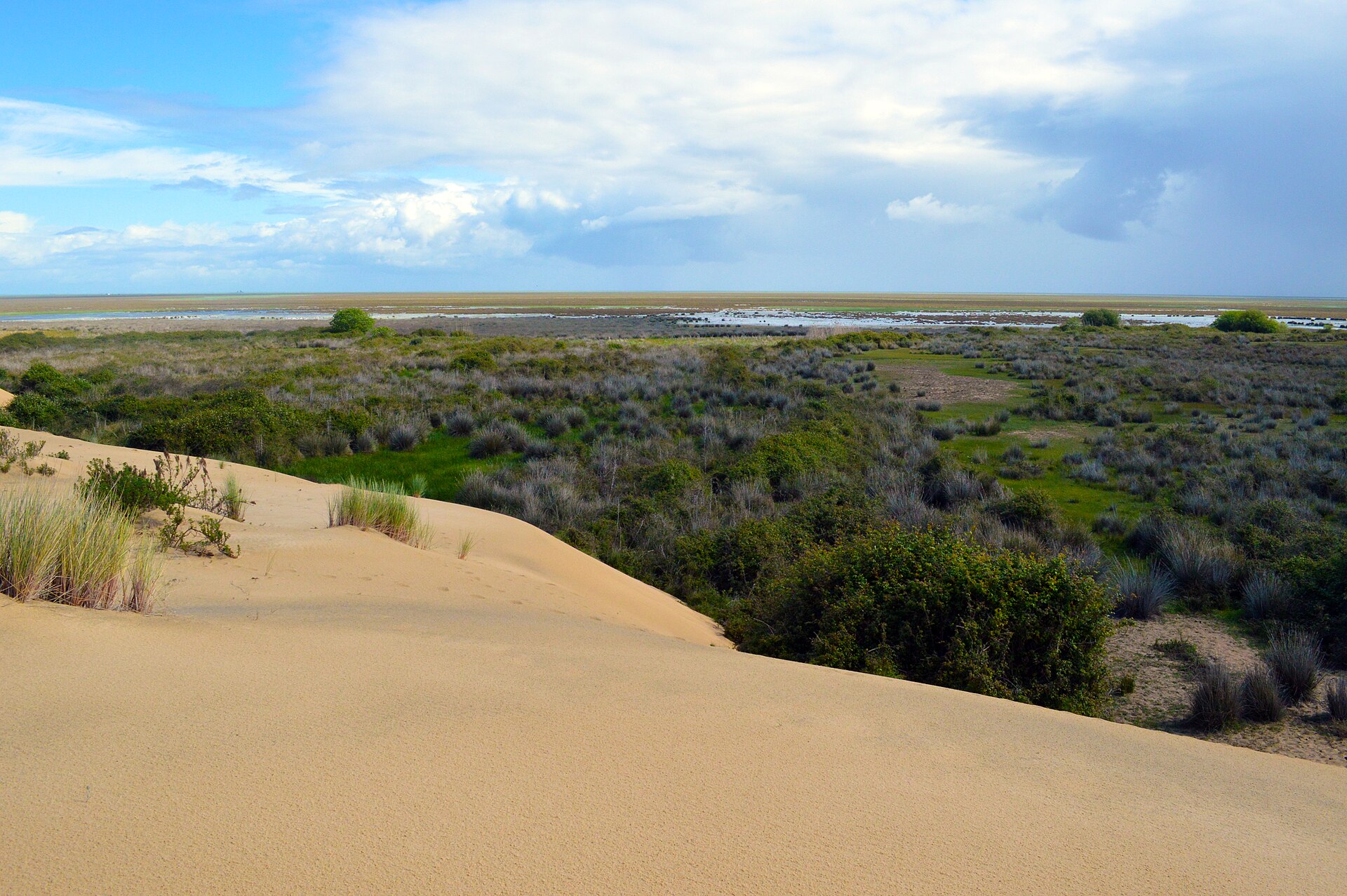
According to CORINE Land Cover (2018), the site is mainly made up of salt marshes and tidal flats (88%) and farmland (9%). The site borders the coast. The land is almost flat (mean slope under 2°). The Natura 2000 site overlapping the area lists 10 habitats of European interest, the most extensive being Mediterranean and thermo-Atlantic halophilous scrubs (Sarcocornetea fruticosi), estuaries and mudflats and sandflats not covered by seawater at low tide.
Biodiversity
Based on occurrences aggregated by GBIF, several species are regularly recorded within the site. Among the most frequent are Salicornia fruticosa (Shrubby Glasswort), Halimione portulacoides (Sea Purslane), Larus fuscus (Lesser Black-backed Gull) and Salicornia perennis (Perennial glasswort). The full list of documented taxa is shown below. The overlapping Natura 2000 site lists 96 species of European interest: 92 birds, 1 mammal, 1 invertebrate and 2 plants.
Habitats of European interest
From the official form of the Natura 2000 site overlapping the area (areas reported for the whole site).
- Mediterranean and thermo-Atlantic halophilous scrubs (Sarcocornetea fruticosi) 879 ha
- Estuaries 426 ha
- Mudflats and sandflats not covered by seawater at low tide 275 ha
- Mediterranean tall humid grasslands of the Molinio-Holoschoenion 25 ha
- Spartina swards (Spartinion maritimae) 14 ha
- Salicornia and other annuals colonizing mud and sand 4 ha
- Thermo-Mediterranean and pre-desert scrub 1 ha
- Humid dune slacks 1 ha
and 2 more
Species of European interest
Birds · 92
Great Reed Warbler (Acrocephalus arundinaceus) passage breeding, Common Sandpiper (Actitis hypoleucos) wintering, Razorbill (Alca torda) wintering, Common Kingfisher (Alcedo atthis) wintering, Eurasian Teal (Anas crecca) wintering, Mallard (Anas platyrhynchos) breeding wintering, Tawny Pipit (Anthus campestris) passage, Water Pipit (Anthus spinoletta) wintering passage, Great Egret (Ardea alba) wintering, Grey Heron (Ardea cinerea) wintering, Ruddy Turnstone (Arenaria interpres) wintering, Short-eared Owl (Asio flammeus) passage and 80 more
Mammals · 1
Invertebrates · 1
Plants · 2
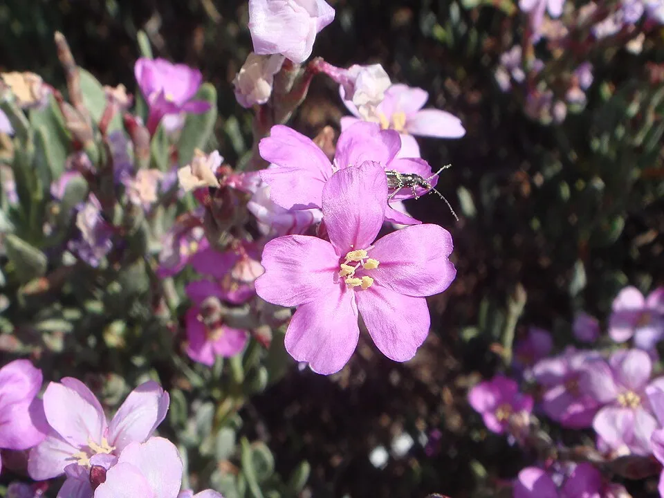
Limonium lanceolatum, Picris willkommii
Source: Natura 2000 standard data forms (EEA, CC-BY 4.0). Not exhaustive: sensitive species are not published.
Species to look out for

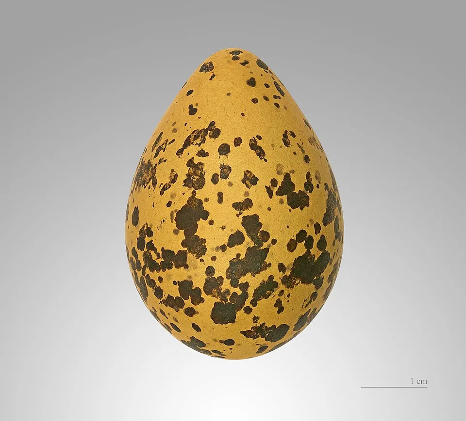
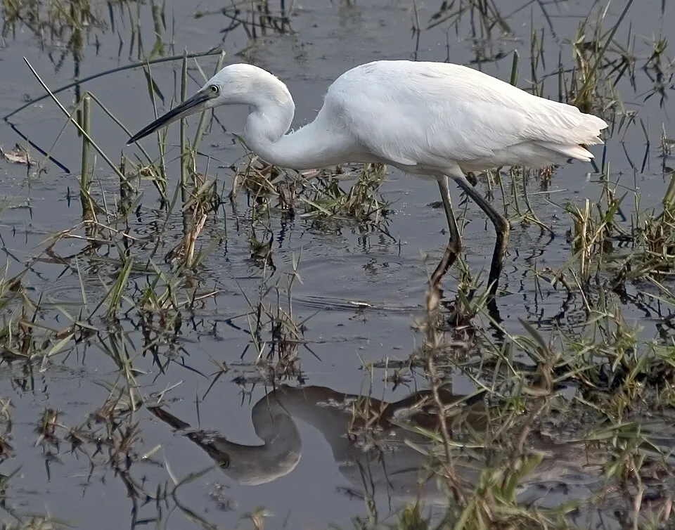
Observed species
Occurrences documented via GBIF; they are neither an exhaustive inventory nor proof of current presence.
- Shrubby Glasswort · Salicornia fruticosa · 55
- Sea Purslane · Halimione portulacoides · 41
- Lesser Black-backed Gull · Larus fuscus · 36
- Perennial glasswort · Salicornia perennis · 27
- Limoniastrum monopetalum · 26
- Black-winged Stilt · Himantopus himantopus · 23
- Little Egret · Egretta garzetta · 22
- Common Redshank · Tringa totanus · 22
- Dunlin · Calidris alpina · 22
- Common Ringed Plover · Charadrius hiaticula · 22
- Yellow-legged Gull · Larus michahellis · 21
- Grey Heron · Ardea cinerea · 21
+18 more species
- Eurasian Spoonbill · Platalea leucorodia · 20
- Black-headed Gull · Chroicocephalus ridibundus · 19
- Kentish Plover · Charadrius alexandrinus · 18
- White stork · Ciconia ciconia · 18
- Crested Lark · Galerida cristata · 17
- House Sparrow · Passer domesticus · 16
- Alkali seepweed · Suaeda vera · 16
- Common Sandpiper · Actitis hypoleucos · 15
- Herbaceous seepweed · Suaeda maritima · 15
- Pied Avocet · Recurvirostra avosetta · 14
- Swamp sea-lavender · Limonium narbonense · 14
- Greater Flamingo · Phoenicopterus roseus · 14
- Sardinian Warbler · Curruca melanocephala · 14
- Myriolimon diffusum · 12
- White Wagtail · Motacilla alba · 12
- Western Yellow Wagtail · Motacilla flava · 12
- Mallard · Anas platyrhynchos · 12
- Common Greenshank · Tringa nebularia · 11
Records: GBIF.org (CC-BY). Names: Wikidata (CC0), GBIF. Photos: Wikimedia Commons.
Conservation challenges
The primary purpose of the site is to preserve its natural habitats and the biodiversity they support. The species recorded (Biodiversity tab) reflect its ecological value. The designations it holds frame its management and the control of land use.
According to CORINE Land Cover, land cover here remained almost unchanged between 1990 and 2018 (less than 0.5% of the area affected). At night, 94% of the area gives off artificial light detectable from space (NASA VIIRS Black Marble composite, 2016). According to the Natura 2000 forms, all 5 assessed habitats of European interest are in excellent condition. According to the Water Framework Directive assessment (2022 river basin management plans, data 2015–2019), water bodies assessed within the site: lagoons and estuaries, 0 of 1 in good ecological status or better.
Pressure indicators
Tree cover lost
3 ha
2001–2023 · < 1% of the area
20012023
Fires since 2016
0
No large fire mapped (fires over about 30 ha)
Light at night
94%
of the area gives off artificial light visible from space
DarkLit
Built-up land
< 1%
buildings, business areas, roads, quarries · farmland 9%
Land cover change
< 0.5%
of the area changed, 1990–2018 · CORINE
Rivers and lakes
Lagoons and estuaries: 0 of 1 good or better
assessments 2015–2019
Sources: Global Forest Change (Hansen et al., University of Maryland, via Global Forest Watch, CC-BY 4.0); EFFIS, European Commission / Copernicus; NASA Black Marble 2016 (public domain); CORINE Land Cover 2018 (Copernicus) or MODIS.
CORINE Land Cover Change 1990–2018: generated using European Union's Copernicus Land Monitoring Service information (EEA), aggregated by Parkavela; DOI 10.2909/f30f1000-7cf8-43bb-872c-5eb093911b24.
Ecological status of water bodies: European Environment Agency, WISE – Water Framework Directive, 3rd river basin management plans (2022), CC BY 4.0. Official national classification, not comparable between countries.
Practical information
Cities and airport
- Airport: Faro (FAO)
54 km as the crow flies
Visitor information
- Oficina de Turismo
< 1 km from the site boundary
Hiking
3 waymarked routes listed, including:
Vía Verde del LitoralCamino de Valdecerros y Vera Abajo
By bike
Vía Verde del Litoral · 4 km
Signed cycle routes: this does not mean that cycling is allowed on footpaths.
Data © OpenStreetMap contributors (ODbL) · Wikidata (CC0)
Routes © OpenStreetMap contributors (ODbL), via Waymarked Trails
Waymarked hiking routes
PR-A 467 Camino de Valdecerros y Vera Abajo
1.1 km within the site ↗ 0 m↘ 0 m 1–3 m
Tracks © OpenStreetMap contributors (ODbL), clipped to the boundary; elevation gain and profiles computed on the longest section from Mapzen Terrain Tiles (≈ 30 m), indicative only.
Bathing
3 monitored bathing sites in or within 1 km of the site · 2025 classification
Excellent · 3
- Playa Central Pm1 · sea · Excellent
- Playa El Hoyo Pm1 · sea · Excellent
- Playa Isla Cristina Pm1 · sea · Excellent
Source: European Environment Agency, official bathing water classification (Directive 2006/7/EC, CC-BY 4.0). Swimming is only permitted at the sites and times authorised locally.
Access and visiting
The nearest railway station is Vila Real de Santo António, about 2 km from the site boundary. Nearest airport: Faro (FAO), about 54 km away. About 110,000 people live within 20 km of the site boundary, 83,000 of them within 10 km; some 1,900 people are estimated to live inside (GHSL estimate, 2020). Visitor information on site: Oficina de Turismo. Waymarked hiking routes listed in OpenStreetMap: 3, including Vía Verde del Litoral and Camino de Valdecerros y Vera Abajo. A signed cycle route crosses the site: “Vía Verde del Litoral” (OpenStreetMap). To plan a visit (access, opening periods, visitor rules), it is best to consult the official information from the managing body and the official website listed in this page's sources.
Source: OpenStreetMap (ODbL), Wikidata (CC0), October 2026.
When to visit
Best time to visit: from April to June and from September to November, with average temperatures of 15 to 25 °C and moderate rainfall. Day length ranges from about 9 h 37 min in December to 14 h 42 min in June. Wildlife records published on GBIF peak for birds (from August to October), plants (August) and butterflies and moths (January). These peaks also reflect when observers are most active.
Source: Copernicus ERA5-Land (C3S), monthly averages 1996–2025 at the representative point, temperatures adjusted for elevation.
Contains modified Copernicus Climate Change Service information 2026. Neither the European Commission nor ECMWF is responsible for any use that may be made of the Copernicus information or data it contains.
Wildlife records calendar
JFMAMJJASOND
Birds
Plants
Butterflies & moths
Monthly records published on GBIF (CC-BY), relative to the busiest month; also reflects observer activity.
Gallery
© Fanattiq · CC BY-SA 3.0
© Fanattiq · CC BY-SA 3.0
© Fernández Salinas, Víctor · CC BY 4.0
© MichaelR · CC BY-SA 3.0
© Frdadiga · CC BY-SA 4.0
© Deepcom · CC BY-SA 4.0
Sources and licences
- Wikidata: Q3364572
- OpenStreetMap: relation 3009056
- Official website: http://www.juntadeandalucia.es/medioambiente/servtc5/ventana/mostrarFicha.do?idEspacio=7392
- Wikipedia: en.wikipedia.org/wiki/Marismas_de_Isla_Cristina
- Natura 2000: ES6150005
- WDPA: 555588888
References
- cds.climate.copernicus.eu: climate · CC-BY-4.0
- registry.opendata.aws: elevation of the reference point, detailed relief · PD
- land.copernicus.eu: land cover, land cover change, sea share · COPERNICUS
- doi.org: population around the site · CC-BY-4.0
- wikidata.org: official area, establishment date, protected heritage, official name, nearby cities and airport, access and peaks, lake depths, places to see, official website · CC0-1.0
- eea.europa.eu: bathing water quality, ecological status of waters · CC-BY-4.0
- en.eurovelo.com: EuroVelo cycle routes · ODbL-1.0
- cycling.waymarkedtrails.org: cycle routes · ODbL-1.0
- opentopodata.org: elevations · PD
- forest-fire.emergency.copernicus.eu: wildfires · COPERNICUS
- globalforestwatch.org: tree cover loss · CC-BY-4.0
- gbif.org: seasonality of sightings, invasive alien species, observed species · CC-BY-4.0
- europe-geology.eu: geology · CC-BY-4.0
- hydrosheds.org: lakes · CC-BY-4.0
- natura2000.eea.europa.eu: Natura 2000 habitats and species · CC-BY-4.0
- earthobservatory.nasa.gov: night light · PD
- openstreetmap.org: access and peaks · ODbL-1.0
- hiking.waymarkedtrails.org: route difficulty · ODbL-1.0
- nsidc.org: snow cover · PD
- wikidata.org: Wikipedia article · CC-BY-SA-4.0
Data © OpenStreetMap contributors (ODbL), Wikidata (CC0) and the sources cited.