Spain · Marine
Cabrera National Park
National park of 90,794 hectares in Spain, established in 1991.
Overview
National park of 90,794 hectares in Spain, established in 1991.
Cabrera National Park is located in Spain (Europe). It is a predominantly marine area. Established on 29 April 1991, it covers about 90,794 hectares.
Protections and designations
Natura 2000 · habitats (SAC)
- Arxipèlag de Cabrera ES0000083
Natura 2000 · birds (SPA) · 2 sites
- Arxipèlag de Cabrera ES0000083
- Espacio marino del sur de Mallorca y Cabrera ES0000518
Protected as a national park. International labels and designations: Natura 2000 network (2 sites). Key dates: established in 1991, first Natura 2000 site under the Birds Directive in 2006 and first Natura 2000 site under the Habitats Directive in 2015.
In our collections
Timeline
-
1991
Established
-
2006
First Natura 2000 site under the Birds Directive 2 such sites designated up to 2014
-
2015
First Natura 2000 site under the Habitats Directive
Sources: Wikidata (CC0) for establishment and international labels; EEA Natura 2000 database (CC-BY 4.0) for site designation dates.
Frequently asked questions
Where is Cabrera National Park?
In Spain (Europe). Representative point: 39.1583° N, 2.9667° E.
How large is Cabrera National Park?
About 90,794 hectares (908 km²). It is the largest of the 16 national parks in Spain covered by Parkavela.
When was Cabrera National Park established?
On 29 April 1991.
What habitats and landscapes does Cabrera National Park include?
A marine area.
Which international labels apply to Cabrera National Park?
Natura 2000 network (2 sites).
When is the best time to visit Cabrera National Park?
Best time to visit: from April to June, with average temperatures of 15 to 23 °C and moderate rainfall.
Are there historic monuments in Cabrera National Park?
Yes. According to Wikidata, 3 monuments listed as Bien de Interés Cultural stand within the boundary. For example: “Castell de Cabrera” in Palma de Mallorca, “Clot des Guix / sa Bassa” in Palma de Mallorca and “Resta prehistòrica des Puig de Santa Maria” in Palma de Mallorca.
What is the nearest large city to Cabrera National Park?
Nearest towns of over 50,000 people, as the crow flies: Palma (47 km). Nearest airport: Palma de Mallorca (PMI), about 41 km away.
Which species can be seen in Cabrera National Park?
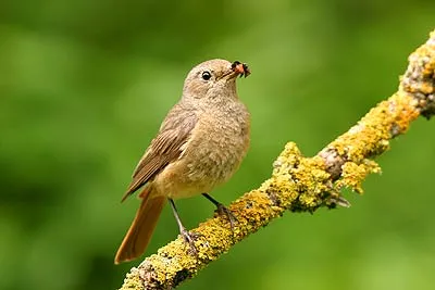
Among the species most often recorded on GBIF are Phoenicurus phoenicurus (Common Redstart), Curruca melanocephala (Sardinian Warbler), Chloris chloris (European Greenfinch) and Larus michahellis (Yellow-legged Gull).
© OpenStreetMap
Download the boundary: GeoJSON · GPX Boundary © OpenStreetMap contributors (ODbL).
Geography
The representative point of the site lies at around 65 m above sea level. Over the 1996–2025 period, the mean annual temperature is about 18.0 °C and total precipitation reaches roughly 394 mm per year. The warmest month is usually August, the coolest February, and the wettest November.
Area
- Area
- 90,794 ha
- Elevation
- 65 m
- Coordinates
- 39.1583, 2.9667
Climate
● Mean temperature (°C) · ▮ Precipitation (mm)
Source: Copernicus ERA5-Land (C3S, doi:10.24381/cds.68d2bb30), monthly averages 1996–2025 interpolated to the representative point, temperatures adjusted for elevation.
Contains modified Copernicus Climate Change Service information 2026. Neither the European Commission nor ECMWF is responsible for any use that may be made of the Copernicus information or data it contains.
Natural habitats
The site is almost entirely marine. The seabed reaches about 2,069 m deep (median depth 920 m; GEBCO bathymetry). The 2 Natura 2000 sites overlapping the area list 23 habitats of European interest (3 priority), the most extensive being Posidonia beds (Posidonion oceanicae), reefs and arborescent matorral with Juniperus spp.
Biodiversity
Based on occurrences aggregated by GBIF, several species are regularly recorded within the site. Among the most frequent are Phoenicurus phoenicurus (Common Redstart), Curruca melanocephala (Sardinian Warbler), Chloris chloris (European Greenfinch) and Larus michahellis (Yellow-legged Gull). The full list of documented taxa is shown below. The overlapping Natura 2000 sites list 33 species of European interest: 25 birds, 4 mammals, 2 reptiles and 2 plants.
Habitats of European interest
From the official forms of the 2 Natura 2000 sites overlapping the area (areas reported for each whole site).
- Posidonia beds (Posidonion oceanicae) priority 5,375 ha
- Reefs 1,609 ha
- Arborescent matorral with Juniperus spp. 623 ha
- Thermo-Mediterranean and pre-desert scrub 290 ha
- Petrifying springs with tufa formation (Cratoneurion) priority 205 ha
- Salicornia and other annuals colonizing mud and sand 205 ha
- Mediterranean and thermo-Atlantic halophilous scrubs (Sarcocornetea fruticosi) 205 ha
- Annual vegetation of drift lines 205 ha
and 15 more
Species of European interest
Birds · 25
Eurasian Stone-curlew (Burhinus oedicnemus) wintering passage resident, Scopoli's Shearwater (Calonectris diomedea) breeding, Great Skua (Catharacta skua) passage, Black Tern (Chlidonias niger) passage, Little Egret (Egretta garzetta) passage, Eleonora's Falcon (Falco eleonorae) breeding, Peregrine Falcon (Falco peregrinus) resident, European Storm Petrel (Hydrobates pelagicus) resident breeding, Audouin's Gull (Larus audouinii) breeding, Lesser Black-backed Gull (Larus fuscus) wintering, Mediterranean gull (Larus melanocephalus) wintering, Yellow-legged Gull (Larus michahellis) breeding resident and 13 more
Mammals · 4
Common bent-wing bat (Miniopterus schreibersii), Long-fingered bat (Myotis capaccinii), Greater mouse-eared bat (Myotis myotis), Common bottlenose dolphin (Tursiops truncatus)
Reptiles · 2
Loggerhead sea turtle (Caretta caretta), Lilford's Wall Lizard (Podarcis lilfordi)
Plants · 2
Diplotaxis ibicensis, Paeonia cambessedesii
Source: Natura 2000 standard data forms (EEA, CC-BY 4.0). Not exhaustive: sensitive species are not published.
Species to look out for

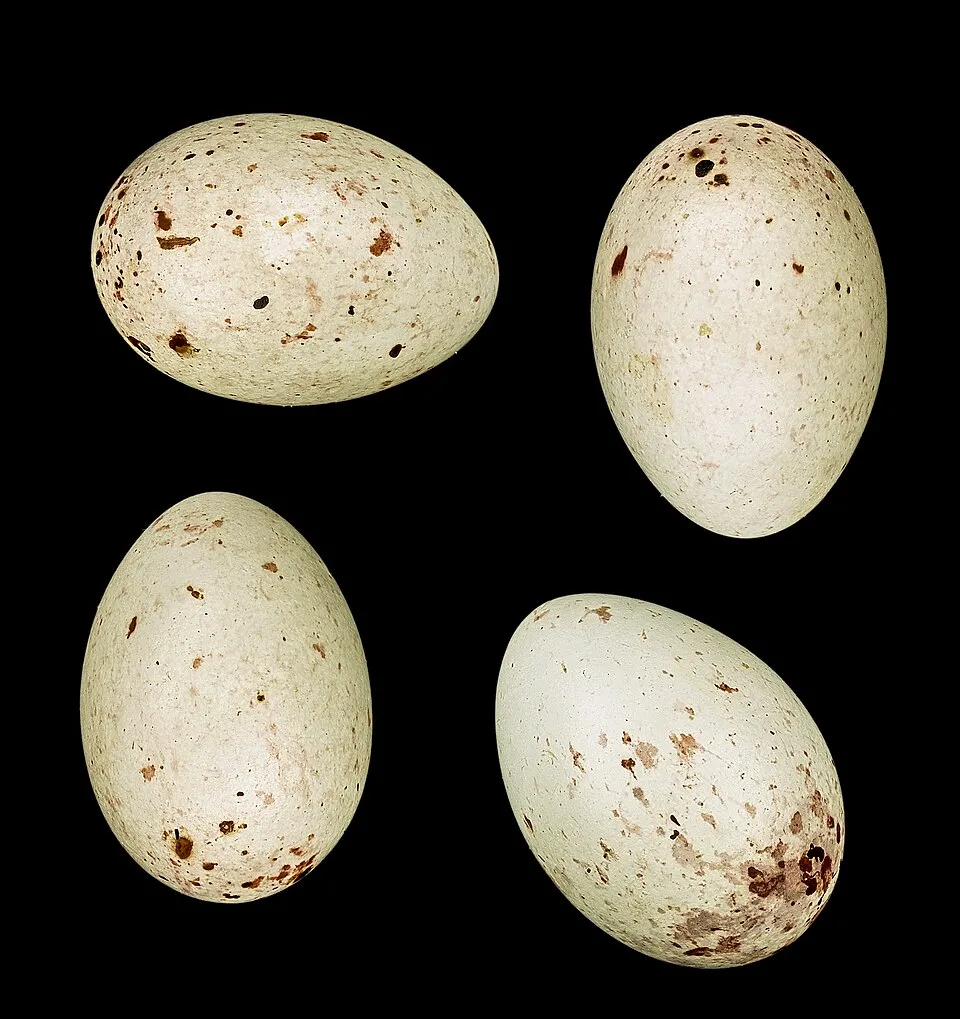

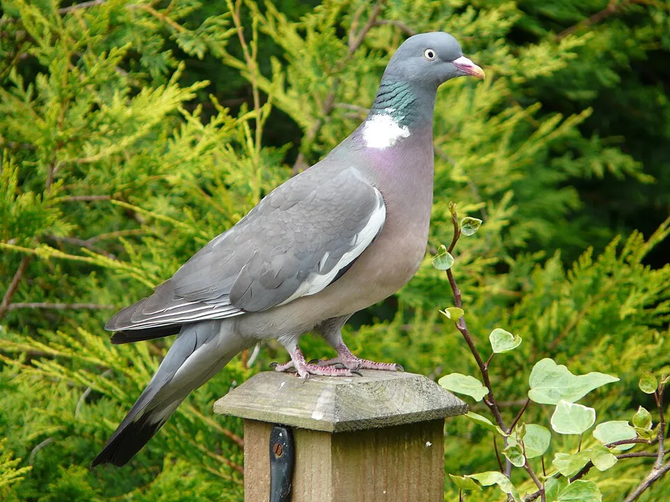
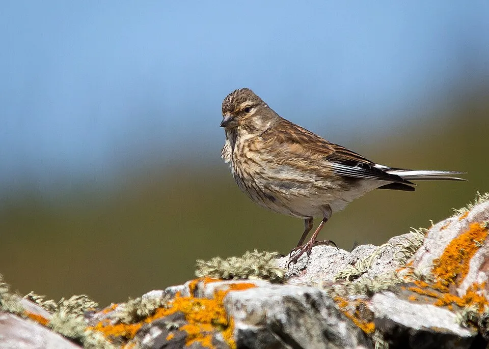
Observed species
Occurrences documented via GBIF; they are neither an exhaustive inventory nor proof of current presence.
- Common Redstart · Phoenicurus phoenicurus · 559
- Sardinian Warbler · Curruca melanocephala · 527
- European Greenfinch · Chloris chloris · 493
- Yellow-legged Gull · Larus michahellis · 492
- Common Wood Pigeon · Columba palumbus · 491
- Common Linnet · Linaria cannabina · 443
- European shag · Phalacrocorax aristotelis · 429
- European robin · Erithacus rubecula · 412
- Eurasian Blackcap · Sylvia atricapilla · 412
- Booted Eagle · Hieraaetus pennatus · 410
- Barn Swallow · Hirundo rustica · 406
- Willow Warbler · Phylloscopus trochilus · 405
+18 more species
- Common Kestrel · Falco tinnunculus · 395
- Eurasian Hoopoe · Upupa epops · 371
- Peregrine Falcon · Falco peregrinus · 363
- Curruca balearica · 354
- Spotted Flycatcher · Muscicapa striata · 354
- Western Yellow Wagtail · Motacilla flava · 333
- Song Thrush · Turdus philomelos · 330
- Garden Warbler · Sylvia borin · 329
- Eleonora's Falcon · Falco eleonorae · 321
- Northern Wheatear · Oenanthe oenanthe · 316
- European Goldfinch · Carduelis carduelis · 313
- Common Blackbird · Turdus merula · 309
- Common Whitethroat · Sylvia communis · 305
- Black Redstart · Phoenicurus ochruros · 303
- Common Chiffchaff · Phylloscopus collybita · 298
- European Pied Flycatcher · Ficedula hypoleuca · 290
- Whinchat · Saxicola rubetra · 285
- Eurasian Chaffinch · Fringilla coelebs · 285
Records: GBIF.org (CC-BY). Names: Wikidata (CC0), GBIF. Photos: Wikimedia Commons.
Conservation challenges
The primary purpose of the site is to preserve its natural habitats and the biodiversity they support. The species recorded (Biodiversity tab) reflect its ecological value. The designations it holds frame its management and the control of land use.
According to CORINE Land Cover, land cover here remained almost unchanged between 1990 and 2018 (less than 0.5% of the area affected). According to the Natura 2000 forms, of 19 assessed habitats of European interest, 14 are in excellent condition and the rest in good condition. According to the Water Framework Directive assessment (2022 river basin management plans, data 2019), water bodies assessed within the site: coastal waters, 2 of 2 in good ecological status or better.
Pressure indicators
Land cover change
< 0.5%
of the area changed, 1990–2018 · CORINE
Rivers and lakes
Coastal waters: 2 of 2 good or better
assessments 2019
Invasive alien species
1
recorded since 2000
Sources: Global Forest Change (Hansen et al., University of Maryland, via Global Forest Watch, CC-BY 4.0); EFFIS, European Commission / Copernicus; NASA Black Marble 2016 (public domain); CORINE Land Cover 2018 (Copernicus) or MODIS.
CORINE Land Cover Change 1990–2018: generated using European Union's Copernicus Land Monitoring Service information (EEA), aggregated by Parkavela; DOI 10.2909/f30f1000-7cf8-43bb-872c-5eb093911b24.
Ecological status of water bodies: European Environment Agency, WISE – Water Framework Directive, 3rd river basin management plans (2022), CC BY 4.0. Official national classification, not comparable between countries.
Invasive alien species: Global Register of Introduced and Invasive Species (ISSG, CC BY 4.0); Union list, Regulation (EU) 1143/2014 (INBO, CC0); GBIF.org records (CC0 / CC BY 4.0), at least 2 per species.
Practical information
Cities and airport
- Palma
47 km as the crow flies - Airport: Palma de Mallorca (PMI)
41 km as the crow flies
Data © OpenStreetMap contributors (ODbL) · Wikidata (CC0)
Access and visiting
Nearest towns of over 50,000 people, as the crow flies: Palma (47 km). Nearest airport: Palma de Mallorca (PMI), about 41 km away. About 35,000 people live within 20 km of the site boundary, 3,600 of them within 10 km (GHSL estimate, 2020). This population has grown by about 49% since 2000. To plan a visit (access, opening periods, visitor rules), it is best to consult the official information from the managing body and the official website listed in this page's sources.
Source: OpenStreetMap (ODbL), Wikidata (CC0), October 2026.
Built heritage
According to Wikidata, 3 monuments listed as Bien de Interés Cultural stand within the boundary. Examples include “Castell de Cabrera” in Palma de Mallorca, “Clot des Guix / sa Bassa” in Palma de Mallorca and “Resta prehistòrica des Puig de Santa Maria” in Palma de Mallorca.
2 prehistoric and archaeological sites1 castle or fortification
-
Castell de Cabrera
Palma de Mallorca -
Clot des Guix / sa Bassa
Palma de Mallorca -
Resta prehistòrica des Puig de Santa Maria
Palma de Mallorca
Source: Wikidata (CC0), monuments in each country’s official heritage protection registers, at national or regional level. Each item links to its Wikidata entry.
When to visit
Best time to visit: from April to June, with average temperatures of 15 to 23 °C and moderate rainfall. Day length ranges from about 9 h 25 min in December to 14 h 54 min in June. Wildlife records published on GBIF peak for birds (October), plants (April and May), butterflies and moths (November) and mammals (July). These peaks also reflect when observers are most active.
Source: Copernicus ERA5-Land (C3S), monthly averages 1996–2025 at the representative point, temperatures adjusted for elevation.
Contains modified Copernicus Climate Change Service information 2026. Neither the European Commission nor ECMWF is responsible for any use that may be made of the Copernicus information or data it contains.
Wildlife records calendar
JFMAMJJASOND
Birds
Plants
Butterflies & moths
Mammals
Monthly records published on GBIF (CC-BY), relative to the busiest month; also reflects observer activity.
Gallery
© NASA World Wind · Public domain
© Antoni Salvà · CC BY-SA 3.0
© Olaf Tausch · CC BY 3.0
© Maximovich Nikolay · CC BY 3.0
© Rafel Jaume · CC BY-SA 4.0
© Friedrich Haag · CC BY-SA 4.0
Sources and licences
- Wikidata: Q1968721
- OpenStreetMap: relation 10036151
- Wikipedia: en.wikipedia.org/wiki/Cabrera_Archipelago_Maritime-Terrestrial_National_Park
- WDPA: 196045
References
- cds.climate.copernicus.eu: climate · CC-BY-4.0
- registry.opendata.aws: elevation of the reference point · PD
- land.copernicus.eu: land cover, land cover change, sea share · COPERNICUS
- doi.org: population around the site · CC-BY-4.0
- wikidata.org: official area, highest point, establishment date, protected heritage, nearby cities and airport, access and peaks, places to see · CC0-1.0
- eea.europa.eu: bathing water quality, ecological status of waters · CC-BY-4.0
- gebco.net: depths · PD
- opentopodata.org: elevations · PD
- gbif.org: seasonality of sightings, invasive alien species, observed species · CC-BY-4.0
- natura2000.eea.europa.eu: Natura 2000 habitats and species · CC-BY-4.0
- openstreetmap.org: official name, access and peaks, trail difficulty · ODbL-1.0
- wikidata.org: Wikipedia article · CC-BY-SA-4.0
Data © OpenStreetMap contributors (ODbL), Wikidata (CC0) and the sources cited.