
Spain · Mixed
Ebro Delta Natural Park
Nature park of 7,625 hectares in Spain, established in 1983.
Overview
Nature park of 7,625 hectares in Spain, established in 1983.
Ebro Delta Natural Park is a nature park in Spain (Europe). It covers both land and sea. Established in 1983, it covers about 7,625 hectares. The site is managed by Generalitat of Catalonia.
Protections and designations
Ramsar site
Natura 2000 · habitats (SAC)
- Delta de l'Ebre ES0000020
Natura 2000 · birds (SPA)
- Delta de l'Ebre ES0000020
Protected as a nature park. International labels and designations: Ramsar site and Natura 2000 network (1 site: “Delta de l'Ebre”). Key dates: established in 1983, first Natura 2000 site under the Birds Directive in 1988 and first Natura 2000 site under the Habitats Directive in 2014.
In our collections
Timeline
-
1983
Established
-
1988
First Natura 2000 site under the Birds Directive
-
2014
First Natura 2000 site under the Habitats Directive
Sources: Wikidata (CC0) for establishment and international labels; EEA Natura 2000 database (CC-BY 4.0) for site designation dates.
Frequently asked questions
Where is Ebro Delta Natural Park?
In Spain (Europe). Representative point: 40.7025° N, 0.8089° E.
How large is Ebro Delta Natural Park?
About 7,625 hectares (76 km²). It is the 46th largest of the 73 nature parks in Spain covered by Parkavela. About 2,100 ha are at sea.
When was Ebro Delta Natural Park established?
In 1983.
What habitats and landscapes does Ebro Delta Natural Park include?
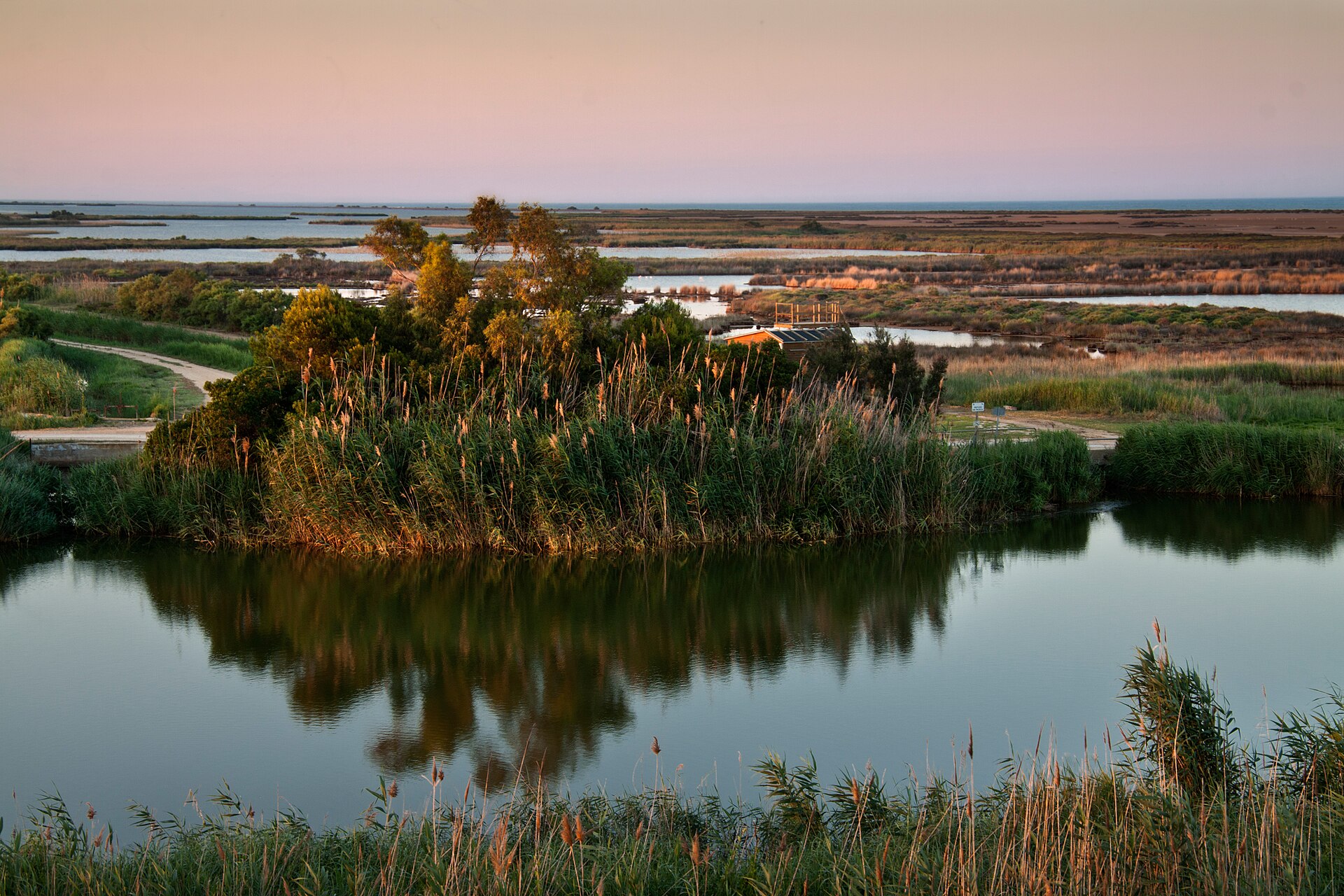
An area spanning land and sea, with wetlands and coasts.
What rocks lie beneath Ebro Delta Natural Park?
According to the European 1:1 million geological map (EGDI), the bedrock consists mainly of sands and gravels (100% of sampled points). These are mostly sedimentary rocks. The geological units date mainly from the Quaternary (100% of sampled points).
Which international labels apply to Ebro Delta Natural Park?
Ramsar site and Natura 2000 network (1 site: “Delta de l'Ebre”).
When is the best time to visit Ebro Delta Natural Park?
Best time to visit: from April to July, with average temperatures of 14 to 25 °C and moderate rainfall.
What is there to see in Ebro Delta Natural Park?
2 lakes and ponds, including La Platjola (1 m) and Bassa de les Olles (Wikidata).
Are there historic monuments in Ebro Delta Natural Park?
Yes. According to Wikidata, one monument listed as Bien de Interés Cultural stands within the boundary. For example: “Coeteres del Delta de l'Ebre” in Camarles.
Can you swim in Ebro Delta Natural Park?
7 monitored bathing sites lie in or within 1 km of the site; official 2025 classification: 7 excellent (European Environment Agency). Swimming is only permitted at the sites and times authorised locally.
What is the nearest large city to Ebro Delta Natural Park?
Nearest towns of over 50,000 people, as the crow flies: Castellón de la Plana (84 km) and Vilanova i la Geltrú (90 km). Nearest airport: Reus (REU), about 52 km away.
How can I reach Ebro Delta Natural Park by train?
The nearest railway station is Camarles - Deltebre, about 2 km from the site boundary.
Where can I get visitor information on site?
Centre d'Informaciò, Oficina de Turismo and Oficina de Turisme.
Are there waymarked hiking trails in Ebro Delta Natural Park?
Yes. Waymarked hiking routes listed in OpenStreetMap: 4, including GR 92 (18 km), GR 99 (28 km) and Camí de Sant Jaume.
Which species can be seen in Ebro Delta Natural Park?
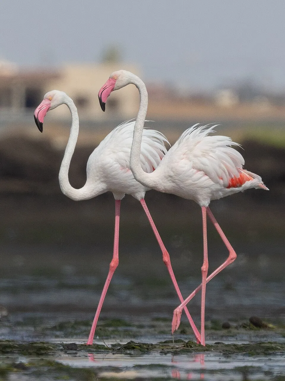
Among the species most often recorded on GBIF are Larus fuscus (Lesser Black-backed Gull), Larus michahellis (Yellow-legged Gull), Phoenicopterus roseus (Greater Flamingo) and Anas platyrhynchos (Mallard).
Who manages Ebro Delta Natural Park?
Generalitat of Catalonia.
What is the official website of Ebro Delta Natural Park?
mediambient.gencat.net/esp//el_medi/parcs_de_catalunya/delta_ebre/inici.jsp
© OpenStreetMap
Download the boundary: GeoJSON · GPX Boundary © OpenStreetMap contributors (ODbL).
Geography
Over the 1996–2025 period, the mean annual temperature is about 17.2 °C and total precipitation reaches roughly 519 mm per year. The warmest month is usually August, the coolest January, and the wettest October. According to the European 1:1 million geological map (EGDI), the bedrock consists mainly of sands and gravels (100% of sampled points). These are mostly sedimentary rocks. The geological units date mainly from the Quaternary (100% of sampled points). The site contains 9 lakes larger than 10 ha, totalling 12.3 km² of water (HydroLAKES).
Area
- Area
- 7,625 ha
- Lakes over 10 ha
- 9 (12.3 km²)
- Coordinates
- 40.7025, 0.8089
Lakes: HydroLAKES (Messager et al. 2016, hydrosheds.org, CC BY 4.0) · depths: Wikidata (CC0)
Bedrock
- Sands and gravels 100 %
Sedimentary rocks 100 % · Main age: Quaternary (100%)
Source: EGDI 1:1M geological map (EuroGeoSurveys and national geological surveys), CC BY 4.0 · 5 sampled points within the site.
Climate
● Mean temperature (°C) · ▮ Precipitation (mm)
Source: Copernicus ERA5-Land (C3S, doi:10.24381/cds.68d2bb30), monthly averages 1996–2025 interpolated to the representative point, temperatures adjusted for elevation.
Contains modified Copernicus Climate Change Service information 2026. Neither the European Commission nor ECMWF is responsible for any use that may be made of the Copernicus information or data it contains.
Natural habitats
According to CORINE Land Cover (2018), the land area is mainly made up of salt marshes and salt pans (35%), farmland (26%) and beaches and dunes (25%). The sea covers about 28% of the site. The Natura 2000 site overlapping the area lists 22 habitats of European interest (3 priority), the most extensive being mudflats and sandflats not covered by seawater at low tide, coastal lagoons and Mediterranean and thermo-Atlantic halophilous scrubs (Sarcocornetea fruticosi).
Biodiversity
Based on occurrences aggregated by GBIF, several species are regularly recorded within the site. Among the most frequent are Larus fuscus (Lesser Black-backed Gull), Larus michahellis (Yellow-legged Gull), Phoenicopterus roseus (Greater Flamingo) and Anas platyrhynchos (Mallard). The full list of documented taxa is shown below. The overlapping Natura 2000 site lists 146 species of European interest: 120 birds, 8 mammals, 6 reptiles, 3 amphibians, 7 fish, 1 invertebrate and 1 plant.
Habitats of European interest
From the official form of the Natura 2000 site overlapping the area (areas reported for the whole site).
- Mudflats and sandflats not covered by seawater at low tide 2,451 ha
- Coastal lagoons priority 1,681 ha
- Mediterranean and thermo-Atlantic halophilous scrubs (Sarcocornetea fruticosi) 647 ha
- Mediterranean salt meadows (Juncetalia maritimi) 303 ha
- Water courses of plain to montane levels with the Ranunculion fluitantis and Callitricho-Batrachion vegetation 294 ha
- Salicornia and other annuals colonizing mud and sand 172 ha
- Embryonic shifting dunes 129 ha
- Calcareous fens with Cladium mariscus and species of the Caricion davallianae priority 106 ha
and 14 more
Species of European interest
Birds · 120
Great Reed Warbler (Acrocephalus arundinaceus) breeding, Moustached Warbler (Acrocephalus melanopogon) wintering breeding, Aquatic warbler (Acrocephalus paludicola) passage, Common Sandpiper (Actitis hypoleucos) wintering, Razorbill (Alca torda) wintering, Common Kingfisher (Alcedo atthis) wintering breeding, Northern Pintail (Anas acuta) wintering, Eurasian Teal (Anas crecca) wintering, Mallard (Anas platyrhynchos) breeding wintering, Greylag Goose (Anser anser) wintering, Tawny Pipit (Anthus campestris) breeding, Bonelli's Eagle (Aquila fasciata) passage and 108 more
Mammals · 8
Erinaceus algirus, Eurasian otter (Lutra lutra), Greater mouse-eared bat (Myotis myotis), Common pipistrelle (Pipistrellus pipistrellus), Soprano Pipistrelle (Pipistrellus pygmaeus), Greater Horseshoe Bat (Rhinolophus ferrumequinum), European free-tailed bat (Tadarida teniotis), Common bottlenose dolphin (Tursiops truncatus)
Reptiles · 6
Loggerhead sea turtle (Caretta caretta), Green Turtle (Chelonia mydas), Leatherback sea turtle (Dermochelys coriacea), European Pond Turtle (Emys orbicularis), Iberian pond turtle (Mauremys leprosa), Hermann's tortoise (Testudo hermanni)
Amphibians · 3
Natterjack toad (Epidalea calamita), Western Spadefoot (Pelobates cultripes), Perez's Frog (Pelophylax perezi)
Fish · 7
Twait shad (Alosa fallax), Spanish toothcarp (Aphanius iberus), Lamprehuela (Cobitis paludica), Ebro Barbel (Luciobarbus graellsii), Ebro Nase (Parachondrostoma miegii), Sea lamprey (Petromyzon marinus), Valencia toothcarp (Valencia hispanica)
Invertebrates · 1
Plants · 1
Source: Natura 2000 standard data forms (EEA, CC-BY 4.0). Not exhaustive: sensitive species are not published.
Species to look out for



Observed species
Occurrences documented via GBIF; they are neither an exhaustive inventory nor proof of current presence.
- Lesser Black-backed Gull · Larus fuscus · 10370
- Yellow-legged Gull · Larus michahellis · 6886
- Greater Flamingo · Phoenicopterus roseus · 6826
- Mallard · Anas platyrhynchos · 6718
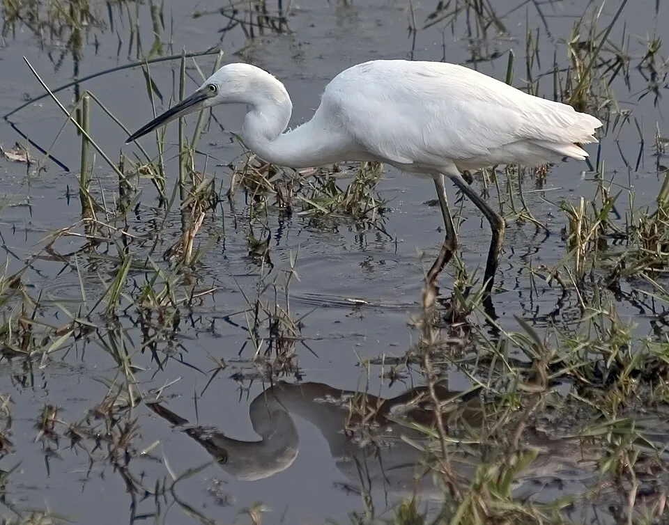
- Little Egret · Egretta garzetta · 6313
- Grey Heron · Ardea cinerea · 6122
- Black-headed Gull · Chroicocephalus ridibundus · 5552
- Great Egret · Ardea alba · 5154
- Great Cormorant · Phalacrocorax carbo · 4859
- Glossy Ibis · Plegadis falcinellus · 4457
- Common Coot · Fulica atra · 4273
- Common Greenshank · Tringa nebularia · 4226
+18 more species
- Western Marsh Harrier · Circus aeruginosus · 3994
- Barn Swallow · Hirundo rustica · 3916
- Common Redshank · Tringa totanus · 3839
- Zitting Cisticola · Cisticola juncidis · 3745
- Common Sandpiper · Actitis hypoleucos · 3294
- House Sparrow · Passer domesticus · 3226
- Great Crested Grebe · Podiceps cristatus · 3190
- Whiskered Tern · Chlidonias hybrida · 3176
- Black-winged Stilt · Himantopus himantopus · 3160
- Grey Plover · Pluvialis squatarola · 2997
- Common Moorhen · Gallinula chloropus · 2990
- Slender-billed Gull · Chroicocephalus genei · 2978
- Crested Lark · Galerida cristata · 2904
- Sandwich Tern · Thalasseus sandvicensis · 2851
- Dunlin · Calidris alpina · 2818
- Audouin's Gull · Ichthyaetus audouinii · 2751
- Common Kingfisher · Alcedo atthis · 2748
- Caspian Tern · Hydroprogne caspia · 2701
Records: GBIF.org (CC-BY). Names: Wikidata (CC0), GBIF. Photos: Wikimedia Commons.
Conservation challenges
The primary purpose of the site is to preserve its natural habitats and the biodiversity they support. The species recorded (Biodiversity tab) reflect its ecological value. The designations it holds frame its management and the control of land use.
According to the European CORINE Land Cover inventory (Copernicus), land cover changed on about 105 ha of the site between 1990 and 2018 (2% of its area): open natural land grew by 80 ha, mostly at the expense of open water, while open water shrank by 66 ha, mostly giving way to open natural land. Since 2016, the European EFFIS system (Copernicus) has mapped one fire here, in February 2025 (near Sant Carles de la Ràpita), which burned about 18 ha of the site. At night, 4% of the area gives off artificial light detectable from space (NASA VIIRS Black Marble composite, 2016). According to the Natura 2000 forms, of 14 assessed habitats of European interest, 10 are in excellent condition and 2 in average or reduced condition. According to the Water Framework Directive assessment (2022 river basin management plans, data 2018), water bodies assessed within the site: lagoons and estuaries, 5 of 13 in good ecological status or better; coastal waters, 1 of 1 in good ecological status or better. Since 2000, 7 invasive alien species have been recorded within the site (GBIF observations), 3 of them listed as of Union concern under EU Regulation 1143/2014. Among them: Alopochen aegyptiaca (Egyptian Goose), Procambarus clarkii (Red swamp crayfish) and Trachemys scripta (Pond slider).
Pressure indicators
Tree cover lost
7 ha
2001–2023 · < 1% of the area
20012023
Fires since 2016
18 ha
burned within the boundary (1 mapped fire)
- 2025 · Sant Carles de la Ràpita · 18 ha
Light at night
4%
of the area gives off artificial light visible from space
DarkLit
Built-up land
< 1%
buildings, business areas, roads, quarries · farmland 19%
Land cover change
105 ha
changed cover, 1990–2018 · CORINE · 2% of the area
- +80 ha · open natural land
- −66 ha · water bodies
Rivers and lakes
Lagoons and estuaries: 5 of 13 good or better
Coastal waters: 1 of 1 good or better
assessments 2018
Invasive alien species
7
incl. 3 of EU concern · since 2000
 Egyptian GooseEU
 Red swamp crayfishEU
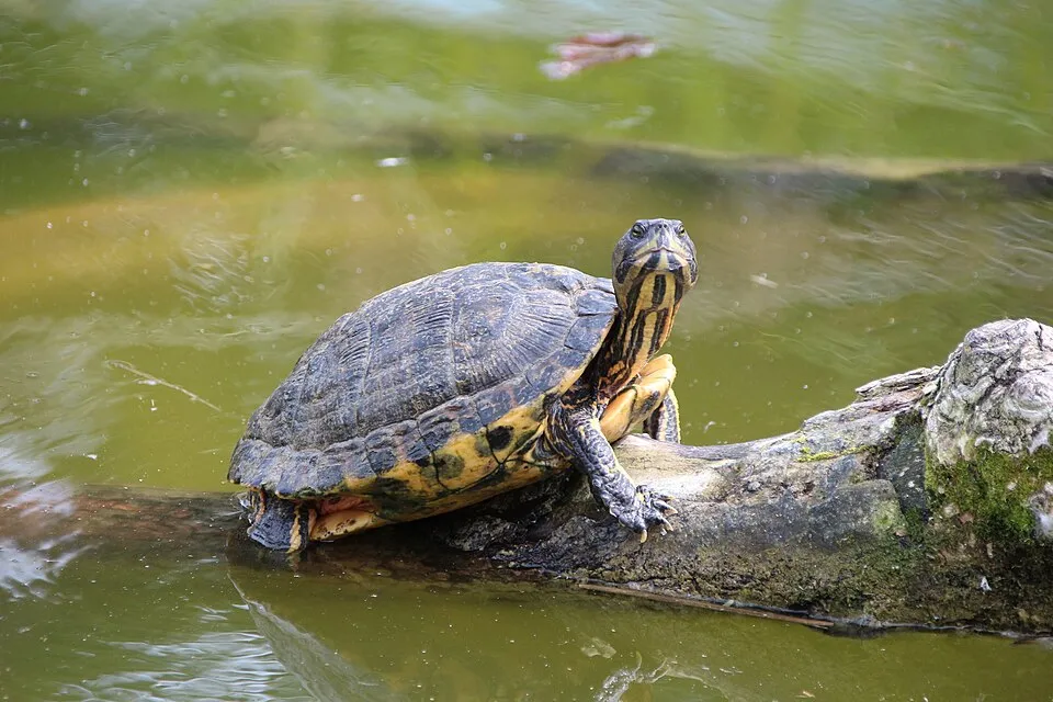 Pond sliderEU
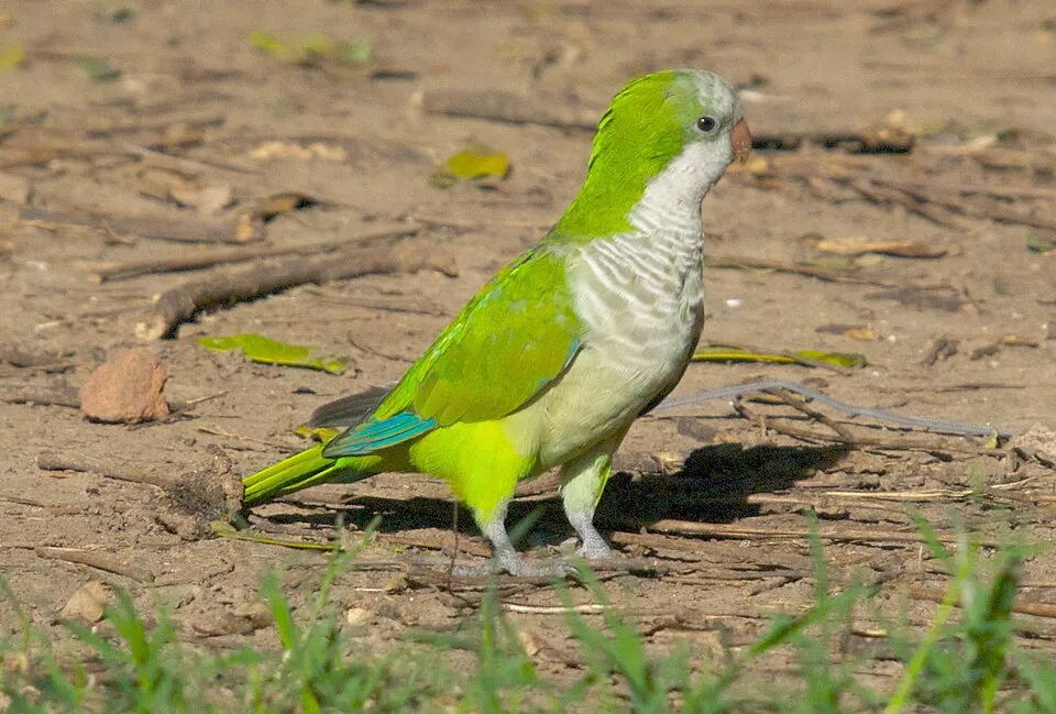 Monk Parakeet
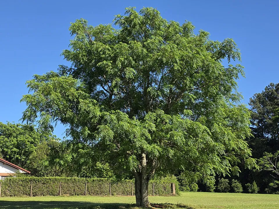 Russian olive
 Bermuda buttercup
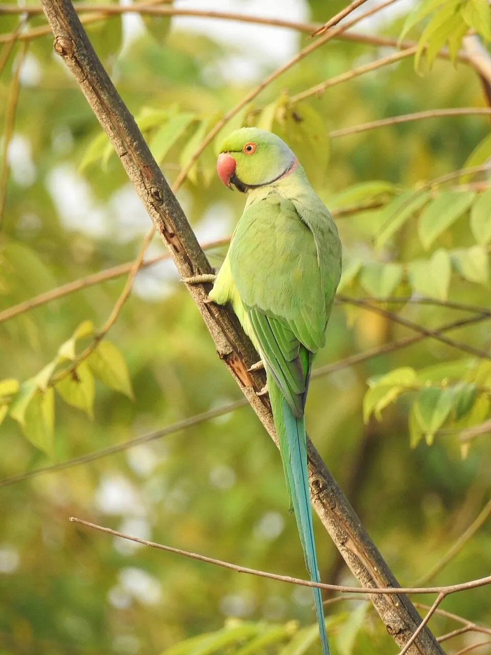 Rose-ringed Parakeet
Photos: Egyptian Goose © Rhododendrites · CC BY-SA 4.0; Red swamp crayfish © MikeMurphy · Public domain; Pond slider © Viva.Chelonia · CC BY 2.0; Monk Parakeet © Kevin Jones · CC BY 2.0; Russian olive © Horacio Cambeiro · CC BY-SA 4.0; Bermuda buttercup © MathKnight and Zachi Evenor אביר המתמטיקה וצחי אבנור · CC BY-SA 4.0; Rose-ringed Parakeet © Afsarnayakkan · CC BY 3.0
Sources: Global Forest Change (Hansen et al., University of Maryland, via Global Forest Watch, CC-BY 4.0); EFFIS, European Commission / Copernicus; NASA Black Marble 2016 (public domain); CORINE Land Cover 2018 (Copernicus) or MODIS.
CORINE Land Cover Change 1990–2018: generated using European Union's Copernicus Land Monitoring Service information (EEA), aggregated by Parkavela; DOI 10.2909/f30f1000-7cf8-43bb-872c-5eb093911b24.
Ecological status of water bodies: European Environment Agency, WISE – Water Framework Directive, 3rd river basin management plans (2022), CC BY 4.0. Official national classification, not comparable between countries.
Invasive alien species: Global Register of Introduced and Invasive Species (ISSG, CC BY 4.0); Union list, Regulation (EU) 1143/2014 (INBO, CC0); GBIF.org records (CC0 / CC BY 4.0), at least 2 per species.
Practical information
Cities and airport
- Castellón de la Plana
84 km as the crow flies - Vilanova i la Geltrú
90 km as the crow flies - Airport: Reus (REU)
52 km as the crow flies
Visitor information
- Centre d'Informaciò
< 1 km from the site boundary - Oficina de Turismo
< 1 km from the site boundary - Oficina de Turisme
1 km from the site boundary
Hiking
4 waymarked routes listed, including:
GR 92 (18 km)GR 99 (28 km)Camí de Sant Jaume
By bike
4 L'Aldea-Camarles-l'Ampolla · 5 km1 Ruta de les llacunes · 3 km7 la Ràpita - Casa de Fusta · 2 km
Signed cycle routes: this does not mean that cycling is allowed on footpaths.
Wheelchair access
- Mirador del Través
viewpoint - Mirador de Fusta
bird hide - Mirador del Carreter
bird hide
accessible toilets: 1
Reported by OpenStreetMap contributors (ODbL); check with the park before visiting.
Data © OpenStreetMap contributors (ODbL) · Wikidata (CC0)
Routes © OpenStreetMap contributors (ODbL), via Waymarked Trails
Waymarked hiking routes
Tracks © OpenStreetMap contributors (ODbL), clipped to the boundary; elevation gain and profiles computed on the longest section from Mapzen Terrain Tiles (≈ 30 m), indicative only.
Bathing
7 monitored bathing sites in or within 1 km of the site · 2025 classification
Excellent · 7
- Playa de l'Arenal Pm1 · estuary or lagoon · Excellent
- Playa de l'Eucaliptus Pm1 · sea · Excellent
- Playa de la Bassa d'Arena Pm1 · sea · Excellent
- Playa de la Marquesa Pm1 · sea · Excellent
- Playa de Riumar Pm1 · sea · Excellent
- Playa del Migjorn Pm1 · sea · Excellent
- Playa del Serrallo Pm1 · sea · Excellent
Source: European Environment Agency, official bathing water classification (Directive 2006/7/EC, CC-BY 4.0). Swimming is only permitted at the sites and times authorised locally.
Access and visiting
The nearest railway station is Camarles - Deltebre, about 2 km from the site boundary. Nearest towns of over 50,000 people, as the crow flies: Castellón de la Plana (84 km) and Vilanova i la Geltrú (90 km). Nearest airport: Reus (REU), about 52 km away. About 170,000 people live within 20 km of the site boundary, 73,000 of them within 10 km; some 880 people are estimated to live inside (GHSL estimate, 2020). This population has grown by about 33% since 2000. Visitor information on site: Centre d'Informaciò, Oficina de Turismo and Oficina de Turisme. Waymarked hiking routes listed in OpenStreetMap: 4, including GR 92 (18 km), GR 99 (28 km) and Camí de Sant Jaume. The site is crossed by 3 signed cycle routes, including “4 L'Aldea-Camarles-l'Ampolla” and “1 Ruta de les llacunes” (OpenStreetMap). OpenStreetMap contributors list 3 wheelchair-accessible places, including Mirador del Través and Mirador de Fusta; check with the park before visiting. To see: 2 lakes and ponds, including La Platjola (1 m) and Bassa de les Olles. To plan a visit (access, opening periods, visitor rules), it is best to consult the official information from the managing body (Generalitat of Catalonia) and the official website listed in this page's sources.
Source: OpenStreetMap (ODbL), Wikidata (CC0), October 2026.
Built heritage
According to Wikidata, one monument listed as Bien de Interés Cultural stands within the boundary. It is “Coeteres del Delta de l'Ebre” in Camarles.
-
Coeteres del Delta de l'Ebre
Camarles · 20th c.
Source: Wikidata (CC0), monuments in each country’s official heritage protection registers, at national or regional level. Each item links to its Wikidata entry.
When to visit
Best time to visit: from April to July, with average temperatures of 14 to 25 °C and moderate rainfall. Day length ranges from about 9 h 16 min in December to 15 h 04 min in June. Wildlife records published on GBIF peak for birds (September), plants (from April to August), butterflies and moths (September and October), dragonflies (September) and mammals (November). These peaks also reflect when observers are most active.
Source: Copernicus ERA5-Land (C3S), monthly averages 1996–2025 at the representative point, temperatures adjusted for elevation.
Contains modified Copernicus Climate Change Service information 2026. Neither the European Commission nor ECMWF is responsible for any use that may be made of the Copernicus information or data it contains.
Wildlife records calendar
JFMAMJJASOND
Birds
Plants
Butterflies & moths
Dragonflies
Mammals
Monthly records published on GBIF (CC-BY), relative to the busiest month; also reflects observer activity.
Gallery
© Mikipons · CC BY-SA 3.0
© (Hans Hillewaert) · CC BY-SA 3.0
© Juan Emilio Prades Bel · CC BY 4.0
© L. Vadillo - MaLéPhotoSpain · CC BY-SA 4.0
© Agustí Descarrega · CC BY-SA 4.0
© Salomé Mulet · CC BY 4.0
Sources and licences
- Wikidata: Q549557
- OpenStreetMap: relation 2622191
- Official website: http://mediambient.gencat.net/esp//el_medi/parcs_de_catalunya/delta_ebre/inici.jsp
- Wikipedia: fr.wikipedia.org/wiki/Parc_naturel_du_delta_de_l'Èbre
- WDPA: 196213
References
- cds.climate.copernicus.eu: climate · CC-BY-4.0
- registry.opendata.aws: elevation of the reference point, detailed relief · PD
- land.copernicus.eu: land cover, land cover change, sea share · COPERNICUS
- doi.org: population around the site · CC-BY-4.0
- wikidata.org: official area, establishment date, protected heritage, managing body, nearby cities and airport, access and peaks, lake depths, places to see, official website · CC0-1.0
- eea.europa.eu: bathing water quality, ecological status of waters · CC-BY-4.0
- en.eurovelo.com: EuroVelo cycle routes · ODbL-1.0
- cycling.waymarkedtrails.org: cycle routes · ODbL-1.0
- gebco.net: depths · PD
- opentopodata.org: elevations · PD
- forest-fire.emergency.copernicus.eu: wildfires · COPERNICUS
- globalforestwatch.org: tree cover loss · CC-BY-4.0
- gbif.org: seasonality of sightings, invasive alien species, observed species · CC-BY-4.0
- europe-geology.eu: geology · CC-BY-4.0
- hydrosheds.org: lakes · CC-BY-4.0
- natura2000.eea.europa.eu: Natura 2000 habitats and species · CC-BY-4.0
- openstreetmap.org: official name, access and peaks, trail difficulty, wheelchair access · ODbL-1.0
- earthobservatory.nasa.gov: night light · PD
- hiking.waymarkedtrails.org: route difficulty · ODbL-1.0
- nsidc.org: snow cover · PD
- wikidata.org: Wikipedia article · CC-BY-SA-4.0
Data © OpenStreetMap contributors (ODbL), Wikidata (CC0) and the sources cited.